Monday, March 31, 2014

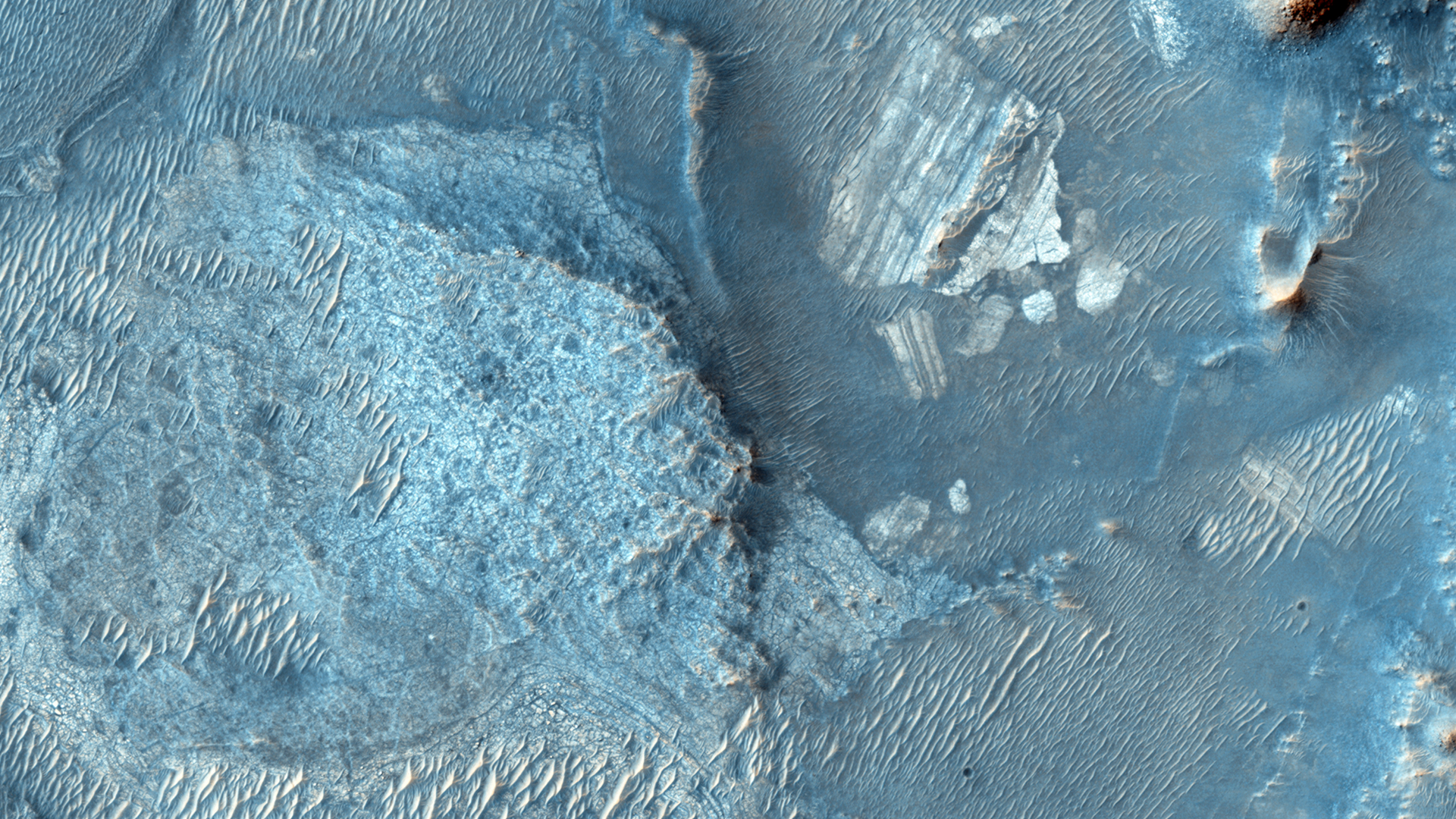
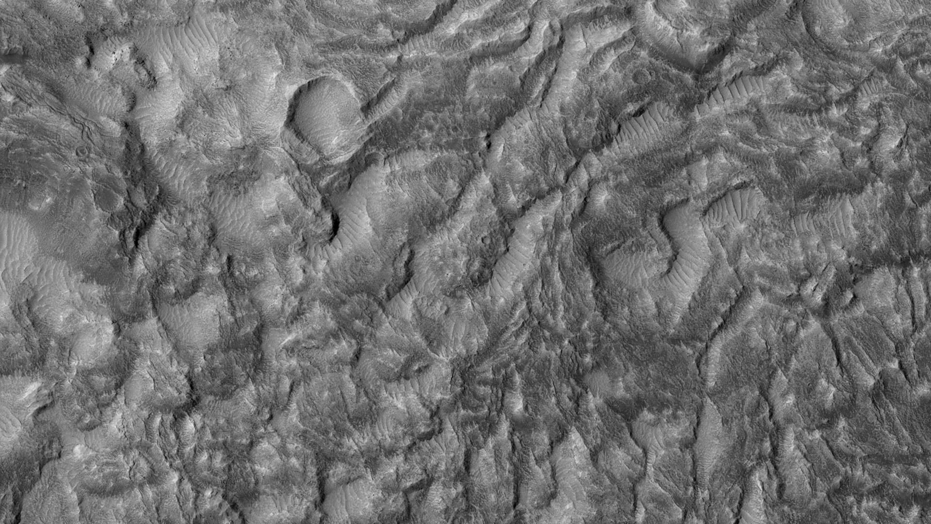
Large, Banded Angular Fragment in Nili Fossae


In a Context Camera (CTX) image, there is a large angular fragment that appears to have light and dark-toned bands. HiRISE images of similar fragments nearby also show this banding, and the resolution of our camera may help determine what these layers are.

Nili Fossae was once considered a potential landing spot for the Mars Science Laboratory, and has one of the largest, most diverse exposures of clay minerals. Clay minerals contain water in their mineral structure and may preserve organic materials.

Photo credit: NASA/JPL/University of Arizona

Sunday, March 30, 2014

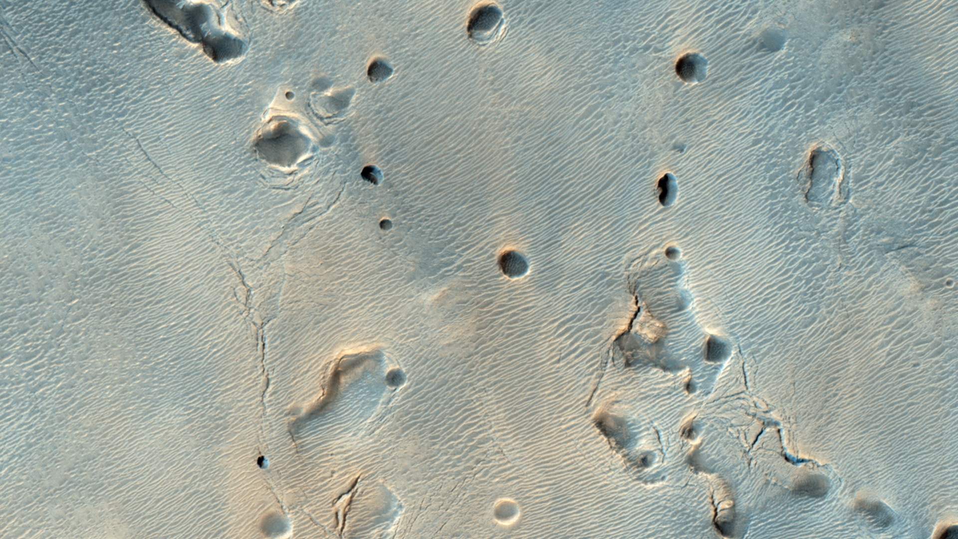
Pitted Mound in Northeast Arabia Terra


This fascinating observation shows us a dark-toned mound with pits inside an impact crater. Are these pits the result of sublimation?

The crater itself is an ancient one, as evidenced by the eroded rim. For the mound inside, HiRISE resolution can give us a closer look at textural features that might help explain what we're looking at: layers in pit walls, or perhaps cracks from expansion?

This is a stereo pair with ESP_034324_2040.

Photo credit: NASA/JPL/University of Arizona

Saturday, March 29, 2014

Windstreaks in Tartarus Montes


A long, narrow windstreak has formed in the lee of this hill in the Tartarus Montes. Several small dark craters also have windstreaks.

Orbit Number: 53874 Latitude: 13.993 Longitude: 168.415 Instrument: VIS Captured: 2014-02-04 20:57

Photo credit: NASA/JPL-Caltech/Arizona State University

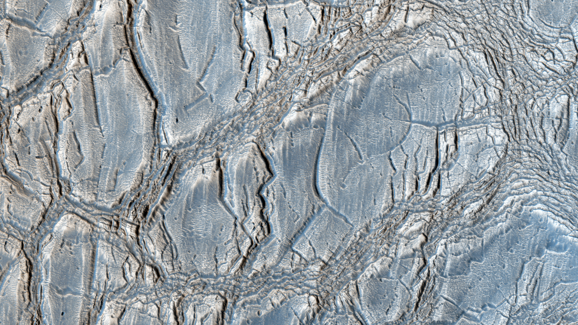
Unusual Mound in Arabia Terra


With its cracked, blistery appearance, this mound near the center of a very large, over 5-kilometer diameter mid-latitude crater poses an interesting question: how did this form?

More importantly, what is the relationship between the mound and the surrounding, viscous features? Did those flow features play a role in forming the mound? Can that material help explain the cracked surface of the mound?

This is a stereo pair with ESP_034287_2185.

Photo credit: NASA/JPL/University of Arizona

Friday, March 28, 2014

Slope Streaks in Lycus Sulci


Dark slope streaks are a common feature on the cliff faces of Lycus Sulci.

Orbit Number: 53872 Latitude: 26.4392 Longitude: 227.913 Instrument: VIS Captured: 2014-02-04 16:56

Photo credit: NASA/JPL-Caltech/Arizona State University

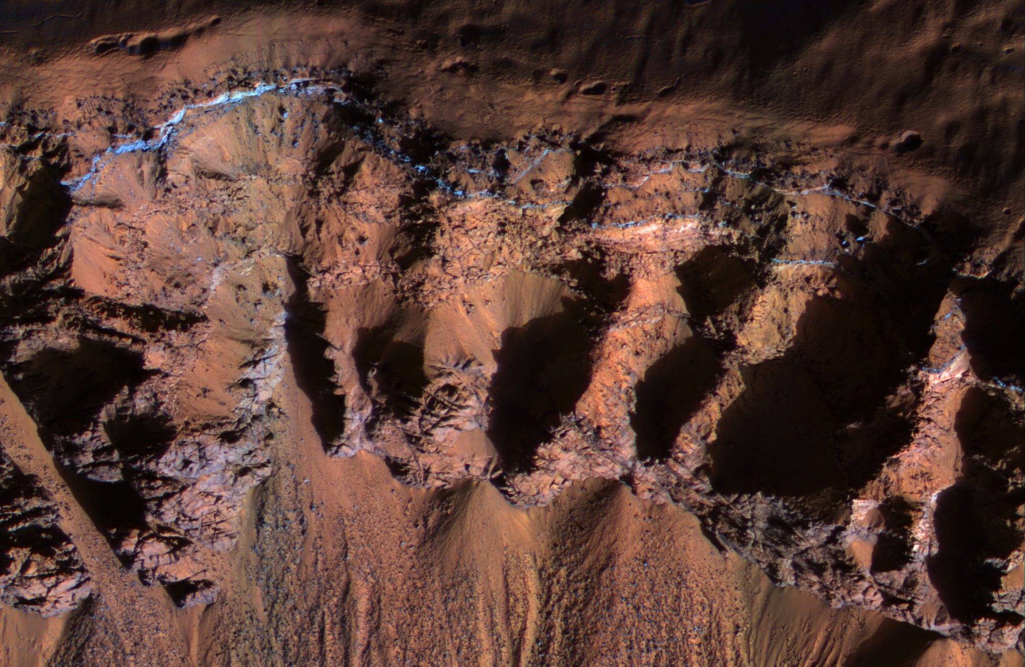
Bedrock in a Trough in Asimov Crater


This image was acquired in southern winter over part of Asimov Crater (latitude 47.5 S), showing the equator-facing slope of a deep trough inside the crater. The crater appears to have been completely filled by a thick sequence of materials, perhaps including sediments and lava flows.

Later, deep troughs formed around the outer edge of the fill material<, probably by collapse over void spaces at depth. What made the void space is not known, but one idea is that there were lenses of ice that slowly sublimated into the atmosphere. Another idea is that this is part of a sequence of crater fill and "exhumation", that includes Gale Crater (home of the Curiosity rover). In other words, continued collapse and erosion of Asimov crater could eventually lead to a central mound like Eolis Mons (popular known as "Mt. Sharp") in Gale Crater. However, at Asimov crater, the southern trough has destroyed the southern rim of the original crater, which didn't happen at Gale Crater.

Many of these steep trough slopes in Asimov crater, where facing the equator, have recurring slope lineae (RSL) activity in the summer when the sun-facing slopes get warm. The RSL fade in the winter, so none are seen in this image even if they were present last summer. There are no previous HiRISE images acquired in the summer over this location.

Asimov Crater was named after Isaac Asimov, professor of biochemistry and prolific writer of science fiction and popular science books.


Photo credit: NASA/JPL/University of Arizona

Thursday, March 27, 2014

Acheron Catena


This VIS image shows several of the graben (fault bounded depression) that are part of Acheron Catena. Most of the lava flows in the image originated at Alba Mons and predate the graben.

Orbit Number: 53871 Latitude: 35.0865 Longitude: 258.1 Instrument: VIS Captured: 2014-02-04 14:55

Photo credit: NASA/JPL-Caltech/Arizona State University

Wednesday, March 26, 2014

Lava Flows From Alba Mons


Today's VIS image shows lava flows from Alba Mons.

Orbit Number: 53834 Latitude: 35.6081 Longitude: 244.876 Instrument: VIS Captured: 2014-02-01 13:50

Photo credit: NASA/JPL-Caltech/Arizona State University

Outcrop Near The Kimberley


This 360-degree panorama from NASA's Curiosity Mars rover is centered southward toward a planned science waypoint at "the Kimberley," with an outcrop of eroded sandstone in the foreground. It combines several frames taken by the Navigation Camera (Navcam) high on the rover's mast, during the 574th Martian day, or sol, of Curiosity's work on Mars (March 18, 2014).

The mission's prime science destinations are on the lower slope of Mount Sharp, which is on the horizon of this scene. North is at both ends of the panorama, which is presented as a cylindrical projection.

Image credit: NASA/JPL-Caltech

Note: For more information, see PIA18070: Panorama With Sandstone Outcrop Near 'The Kimberley' Waypoint (Stereo) and NASA Mars Rover's Next Stop Has Sandstone Variations.

Tuesday, March 25, 2014

Lava Flows and Channel Northeast of Olympus Mons


The small channel and lava flows in this VIS image are located northeast of Olympus Mons.

Orbit Number: 53822 Latitude: 29.858 Longitude: 229.899 Instrument: VIS Captured: 2014-01-31 14:10

Photo credit: NASA/JPL-Caltech/Arizona State University

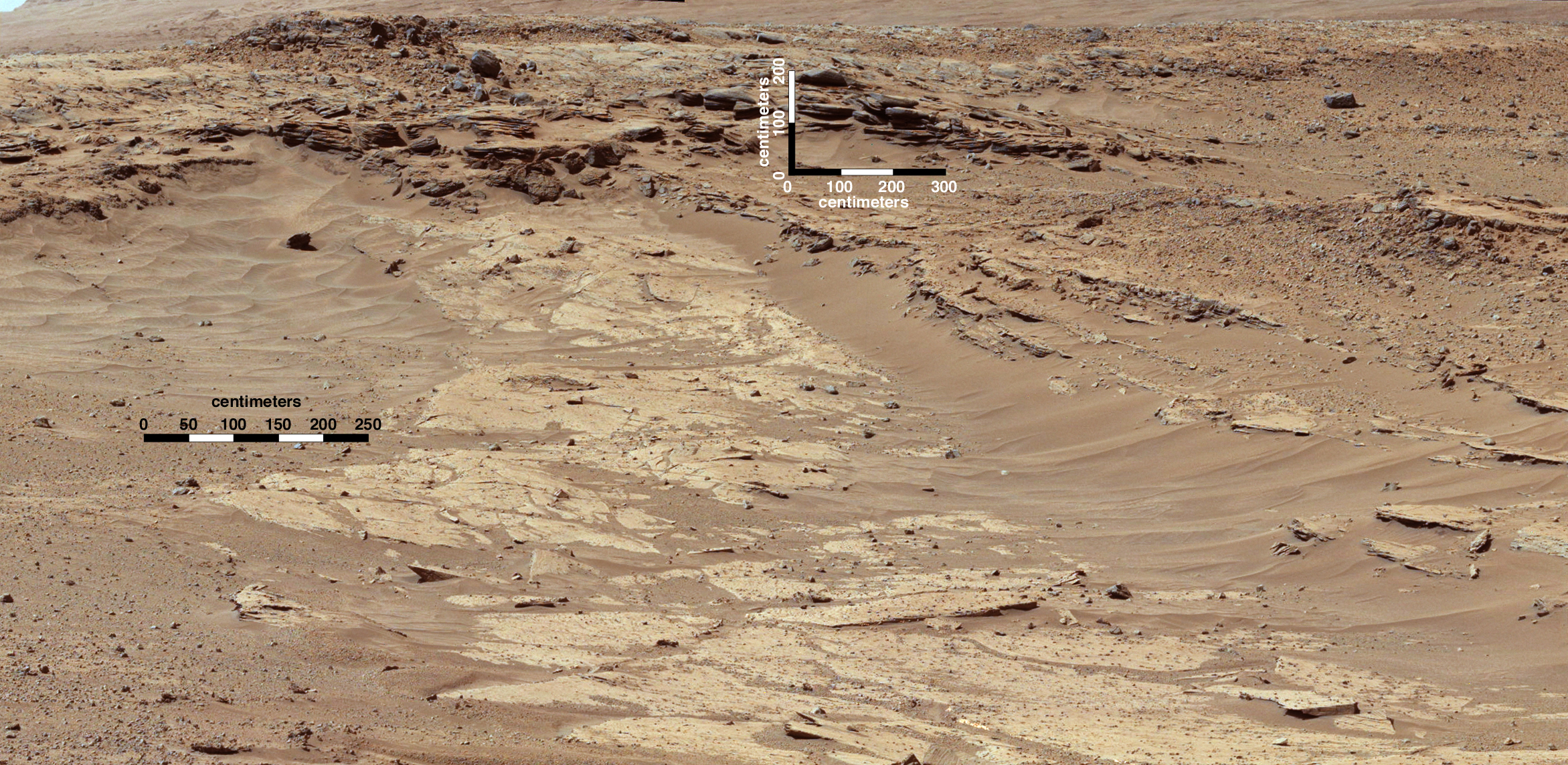
Differential Erosion in Sandstone Layering Within Gale Crater


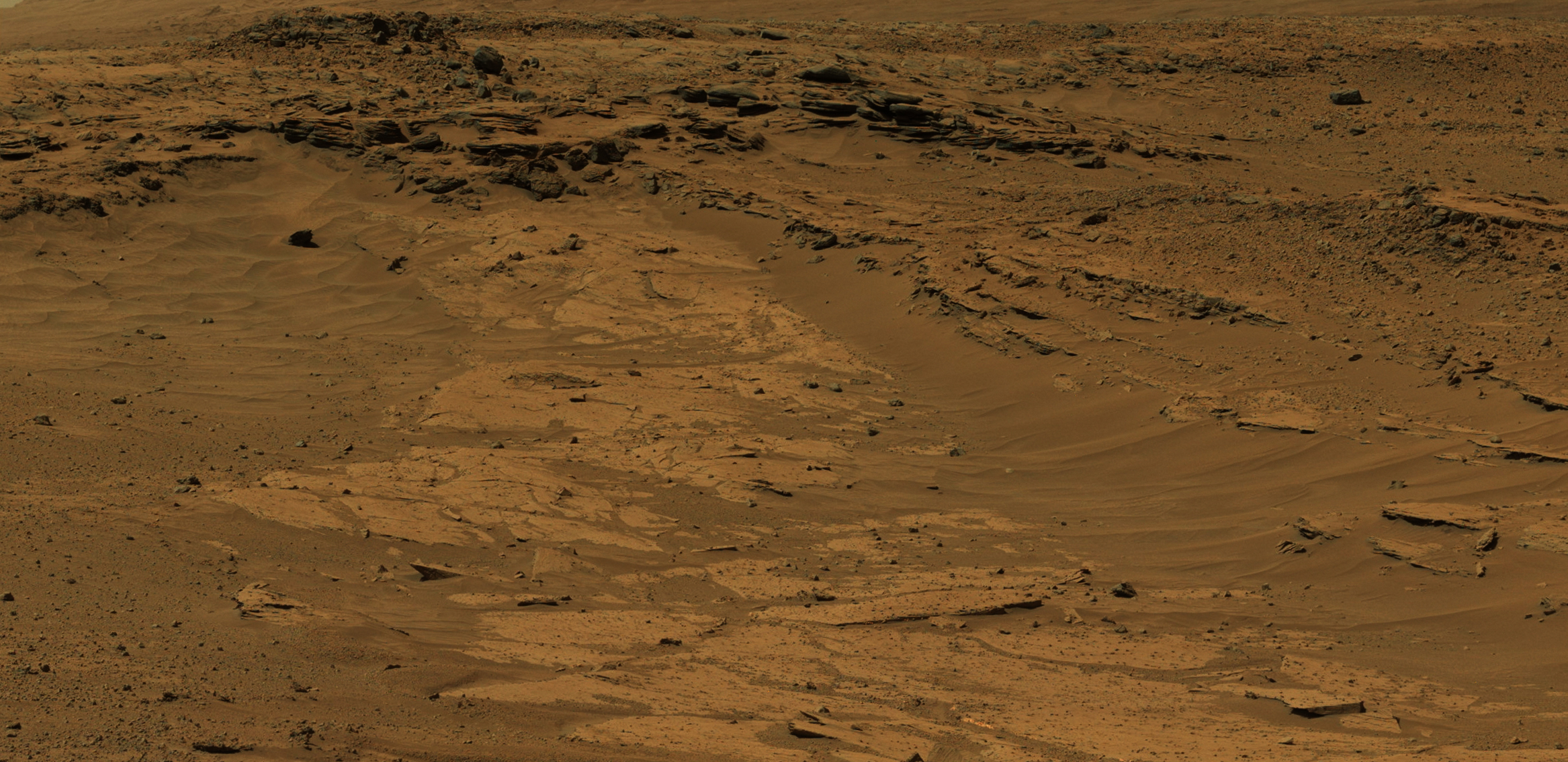
Sandstone layers with varying resistance to erosion are evident in this Martian scene recorded by the Mast Camera (Mastcam) on NASA's Curiosity Mars rover. The component images were taken by the Mastcam's left-eye camera shortly before midday of the 553rd Martian day, or sol, of the rover's work on Mars (February 25, 2014). The location is about one-quarter mile (about 400 meters) north-northwest of a planned waypoint called "the Kimberley," by straight-line distance, longer by driving distance.

Differing degrees of resistance to erosion result in a stair-stepped pattern visible here. Steeper steps result from more resistant rock, so the flat, tan surface is a weakly resistant sandstone. The small steps to the right center are a bit more resistant, and the steeper steps near the top of the scene are even more resistant.

The image has been white-balanced to show what the rocks would look like if they were on Earth. A version with superimposed scale bars is available as Figure A; the bars at different locations and orientations in the scene are labeled for lengths of 200 to 300 centimeters (79 to 118 inches). A version with raw color, as recorded by the camera under Martian lighting conditions, is available as Figure B.

Image credit: NASA/JPL-Caltech/MSSS

Note: For more information, see NASA Mars Rover's Next Stop Has Sandstone Variations.

Saturday, March 22, 2014

Channel in Hebrus Valles


This VIS image shows a portion of Hebrus Valles. The flow of liquid (water or lava) is from the bottom of the image into the circular feature, which was likely filled by the material from the channel. The channel continues, exiting out of the circular feature to the northwest (just outside the image boundary).

Orbit Number: 53813 Latitude: 19.277 Longitude: 127.727 Instrument: VIS Captured: 2014-01-30 20:27

Photo credit: NASA/JPL-Caltech/Arizona State University

Friday, March 21, 2014

Tartarus Colles


The hills in this VIS image are part of Tartarus Colles. Several of the hills have dark slope streaks, believed to be formed by downslope removal of dust revealing the darker rock beneath.

Orbit Number: 53811 Latitude: 26.2606 Longitude: 186.421 Instrument: VIS Captured: 2014-01-30 16:28

Photo credit: NASA/JPL-Caltech/Arizona State University

Thursday, March 20, 2014

Alba Mons Lava Flows


Today's VIS image shows a small portion of the lava flows from Alba Mons. The depression and collapse features within it are part of the large system of tectonic features created by the apparent collapse of the volcano.

Orbit Number: 53809 Latitude: 32.2307 Longitude: 245.056 Instrument: VIS Captured: 2014-01-30 12:29

Photo credit: NASA/JPL-Caltech/Arizona State University

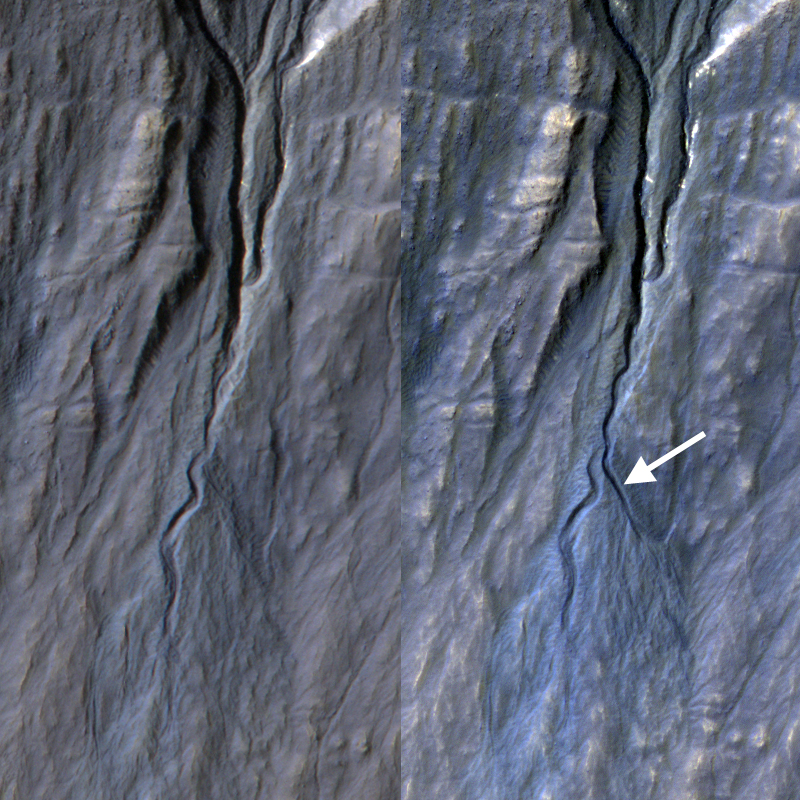
New Gully Channel in Terra Sirenum


Gully, or ravine, landforms are commonly found in the mid-latitudes on Mars, particularly in the Southern highlands. These features typically have a broad upslope alcove, feeding into a channel and apron of debris that has been carried from above.

HiRISE has discovered many examples of activity in these gullies, likely driven by seasonal carbon dioxide (dry ice) frost. Images to look for such changes have been key targets for HiRISE in recent years, as we seek to understand the full range of surface processes that are active today.

This area was targeted to look for changes in gullies previously covered by ESP_020051_1420 and ESP_013115_1420. Comparing the newer and older images, we see that a substantial new channel formed sometime between November 2010 and May 2013. Material flowing down from the alcove broke out of the old route, eroded a new channel, and formed a deposit on the apron.

Observations like this show that gullies are forming today. Although we cannot pin down the season of this event, locations where HiRISE has been able to image more often demonstrate that this sort of event generally occurs in the winter, when liquid water is very unlikely. Despite their resemblance to water-formed ravines on Earth, carbon dioxide may play a key role in the formation of many Martian gullies.


Photo credit (top): NASA/JPL/University of Arizona; (bottom) NASA/JPL-Caltech/University of Arizona

Note: For more information, see NASA Orbiter Finds New Gully Channel on Mars and PIA17958: A New Gully Channel in Terra Sirenum, Mars.

Wednesday, March 19, 2014

Windstreaks Between Alba Mons and Acheron Fossae


Today's VIS image shows windstreaks on the volcanic surface between Alba Mons and Acheron Fossae.

Orbit Number: 53722 Latitude: 31.5024 Longitude: 233.118 Instrument: VIS Captured: 2014-01-23 08:04

Photo credit: NASA/JPL-Caltech/Arizona State University

Tuesday, March 18, 2014

Delta Deposit Near Ismenius Cavus


A delta deposit is located where a channel enters Ismenius Cavus.

Orbit Number: 53717 Latitude: 33.7284 Longitude: 17.5608 Instrument: VIS Captured: 2014-01-22 22:04

Photo credit: NASA/JPL-Caltech/Arizona State University

Monday, March 17, 2014

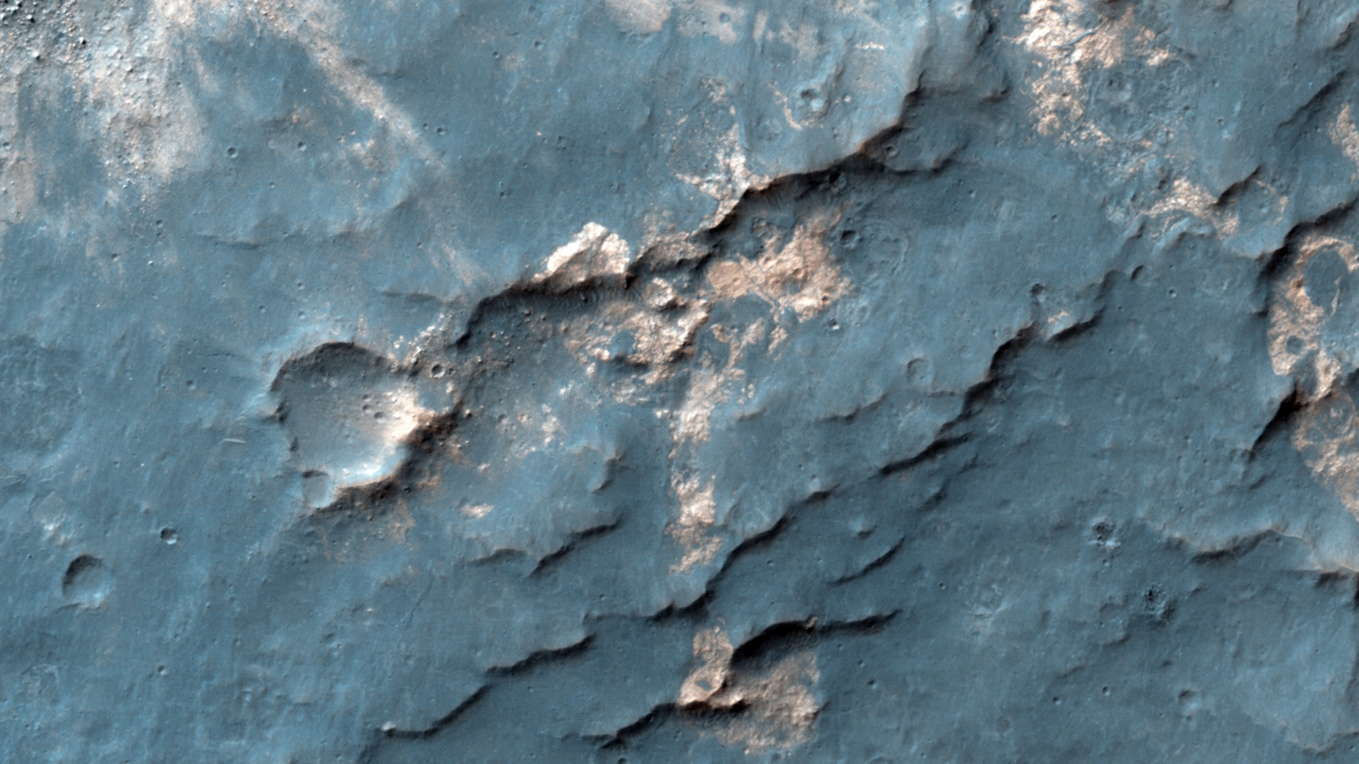
Impact Crater in Hesperia Planum


Sandwiched between a crater nearly 4 kilometer across and a much larger and older crater over 15-kilometers in diameter is this small impact crater with light-toned material exposed in its ejecta.

Because the material is still brighter than the surrounding surface, darker dust settling out of the atmosphere has not had time to cover it up, so the crater is fairly recent. Of course, “recent” could mean on the order of thousands of years or older. This small crater is also fairly shallow and smooth in its interior.

This light-toned rock deposit is also visible along neighboring scarps and even in the rock strata exposed along the rim of the larger 15-kilometer crater, indicating that the formation of this rocky strata predates all of these craters. The brightness and color of these deposits are the result of different minerals within the rock relative to the nearby darker rocks and soils, and perhaps indicate extensive chemical interaction between water and the native rocks.

Photo credit: NASA/JPL/University of Arizona

Note: This impact crater is located in Hesperia Planum, northeast of Tyrrhena Patera.

Sunday, March 16, 2014

Impact Crater Ejecta Blanket in Utopia Planitia


When impact craters are formed, the material that once resided in the subsurface is blown upward and outward. This material falls back and settles around the newly formed crater into what is called an “ejecta blanket.” It often appears as a layer on top of the original surface extending radially outward from the crater.

In some cases the volume of the ejecta material—mainly rocky debris—appears to exceed the volume of the original crater, presenting something of a puzzle. One hypothesis is that the original surface may have been inflated with an ice-rich layer at the time of the impact. After the impact, the newly formed blanket of ejecta then protected this ice from evaporation loss, while the rest of the surrounding terrain was unprotected and deflated as ice was lost due to more recent climate changes.

Examining these craters up close with HiRISE may reveal clues to the presence of buried ice deposits today beneath the ejecta, and about the subsurface stratigraphy exposed along the crater walls.

Photo credit: NASA/JPL/University of Arizona

Note: This impact crater is located near the southeastern "beach" of Utopia Planitia, northwest of Elysium Mons.

Saturday, March 15, 2014

Gordii Fossae


The channels and depressions in this VIS image are part of Gordii Fossae, located on the volcanic plains between Olympus Mons and Gigas Sulci.

Orbit Number: 53697 Latitude: 13.0526 Longitude: 231.156 Instrument: VIS Captured: 2014-01-21 07:23

Photo credit: NASA/JPL-Caltech/Arizona State University