Showing posts with label Mie Crater. Show all posts

Thursday, August 9, 2012

Martian Dust Storm Over Utopia Planitia


This close-up image of a dust storm on Mars was acquired by the Mars Color Imager instrument on NASA's Mars Reconnaissance Orbiter on November 7, 2007, around 3 p.m. local time on Mars. Scientists working with NASA's Curiosity rover, which is set to land on Mars on Aug. 5 PDT (August 6 EDT), are monitoring Mars each day for similar small storms that could either drift over the landing site or stir up dust that moves as haze over the site.

This image is centered on Utopia Planitia (53.6 degrees north latitude, 147.9 degrees east longitude), along the north seasonal polar cap edge in late northern winter. When NASA's Curiosity rover lands on Mars, it will be late southern winter. Scientists are looking at similar small storms that form near the south seasonal polar cap edge. The dust storm pictured here was short-lived, lasting less than 24 hours. The image also shows the seasonal north polar cap (at top of figure) and gravity-wave water ice clouds coming off of Mie crater, just south of the storm. Gravity-wave clouds, also called lee-wave clouds, are clouds that result from changes in atmospheric pressure, temperature and height because of vertical displacement, such as when wind blows over a mountain or crater wall.

The projection of the image is polar stereographic and the image has a resolution of about 0.6 miles (1 kilometer) per pixel. North is indicated with an arrow in this image. The white scale bar is 93 miles (150 kilometers).

Photo credit: NASA/JPL-Caltech/MSSS

Note: Obviously the text for this photo was written prior to Curiosity's landing; however, due to the deluge of new photos coming in, I decided to push this blog post back to give priority to some of the other, more important stories.

Saturday, August 7, 2010

Exposed Ice in Fresh Crater


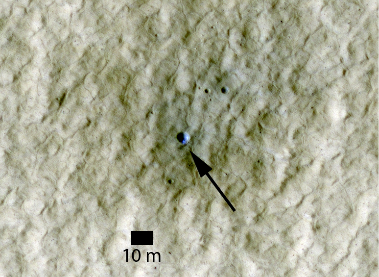
Previous HiRISE images of fresh craters in the middle to high Northern latitudes show exposed water ice on the poleward-facing slopes (see here). Here is another example. The enlarged image shows an approximately 6 meter (20 feet) diameter crater. Based on "before" and "after" images acquired by the Odyssey THEMIS and MRO CTX cameras, respectively, this crater formed some time between April 2004 and January 2010.

The crater is at a latitude of 44 degrees North and is itself located on the ejecta of a larger crater. The image was acquired in early summer, when frost at this latitude is not expected. It is therefore believed that the bright blue material in this false-color color image is sub-surface ice that was exposed by the impact.

This ice is probably at the same depth and has a similar origin to that excavated by the Phoenix lander back in 2008. The area of exposed ice based on the HiRISE images is about 1-2 square meters (10-20 square feet).

Photo credit: NASA/JPL/University of Arizona

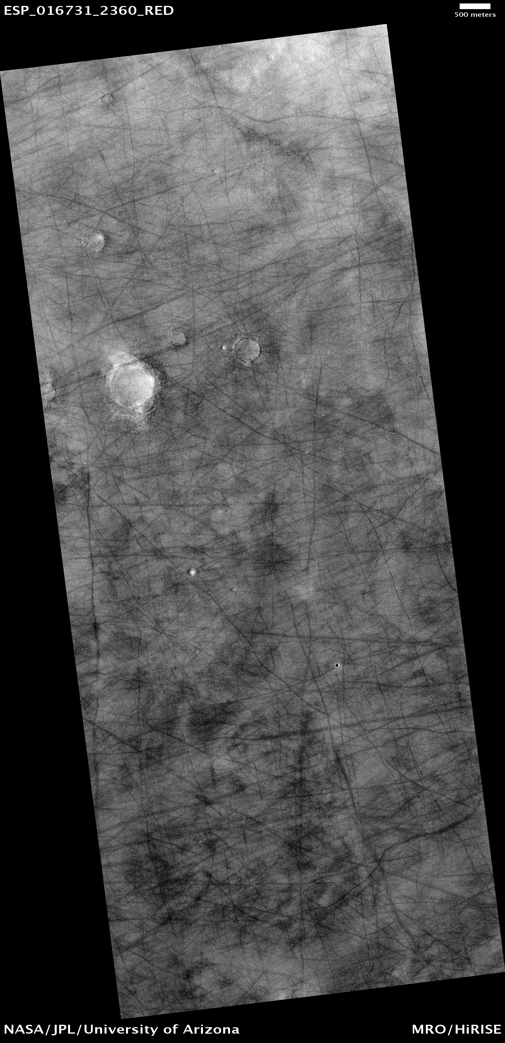
Note: This crater is located roughly halfway between Mie Crater and Phlegra Montes in the far eastern region of Utopia Planitia.

Friday, April 9, 2010

Boulder Strewn Plain in Northern Utopia Planitia


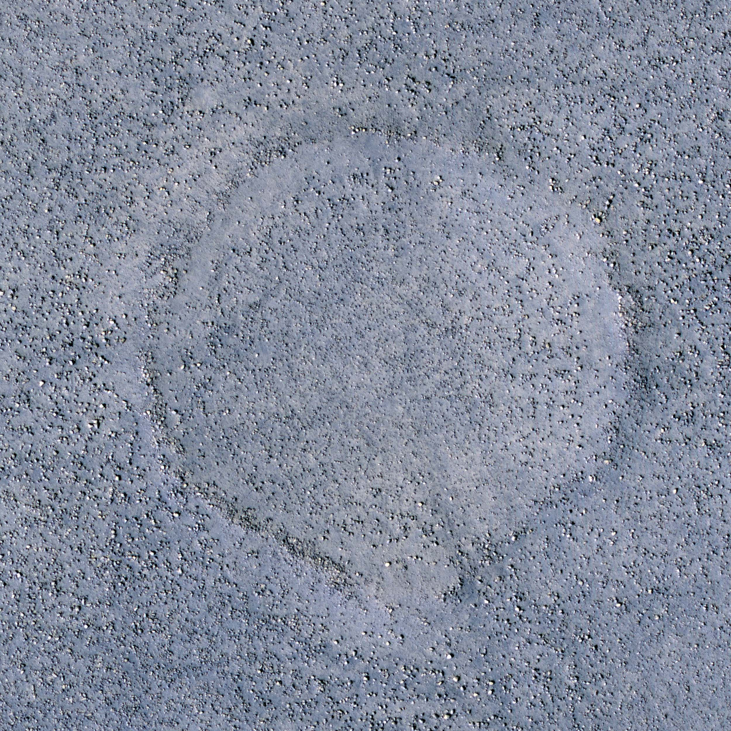
Common to the northern plains of Mars are rock and boulder strewn landscapes otherwise devoid of major features, short of a few impact craters. This image in the Cydnus Rupes region of northern Utopia Planitia is an excellent example of this sort of terrain.

Boulders up to several meters in size densely coat the landscape. The concentration of these boulders varies at several scales. In some areas only smaller rocks less than a meter across dominate the surface, while a couple hundred meters away may be a somewhat circular "blotch" of larger boulders. Often these blotches of boulders coincide with a faint circular ridge, the remnant of an impact crater now reduced by erosion and infilling to a a mere hint of a crater rim. The abundant boulders excavated by the impact, however, remain scattered over the surface to mark the past event.

Close examination of excavated large rocks and boulders may yield clues to the geologic processes that have shaped the regional landscape over Martian history. However, as a future landing site, these terrains are perilous. Large boulders can damage landing gear and puncture the underside of spacecraft. Rovers would find it extremely difficult to traverse through dense populations of large rocks and boulders.

Photo credit: NASA/JPL/University of Arizona

Notes: For a similar landscape, see Signs of Aeolian and Periglacial Activity at Vastitas Borealis. The Cydnus Rupes region is located in the northern half of Utopia Planitia. This particular location (55.5° North, 131.0° East) is northwest of Mie Crater.