Showing posts with label Secondary Craters. Show all posts

Wednesday, November 20, 2013

Ismeniae Fossae Perspective


Branches in the 2 km-wide trough of Ismeniae Fossae are seen in close-up detail in this scene. Material in the channels likely derived from the walls subsequently transported by glaciers or water flowing through the region. Smaller dendritic valley systems formed by water – possibly from melting ice – are seen at the bottom left and in the upper right portion of the image. The clusters of circular to elliptical depressions in the bottom left may be either secondary impact craters from debris flung out by larger impact craters, or collapse pits caused by the sublimation of subsurface ice.

This region was imaged by the High Resolution Stereo Camera on ESA’s Mars Express on 16 June 2013 (orbit 11709), with a ground resolution of about 20 m per pixel. The scene is located at approximately 40°N / 42°E.

Photo credit: ESA/DLR/FU Berlin (G. Neukum)

Tuesday, November 19, 2013

Ismeniae Fossae


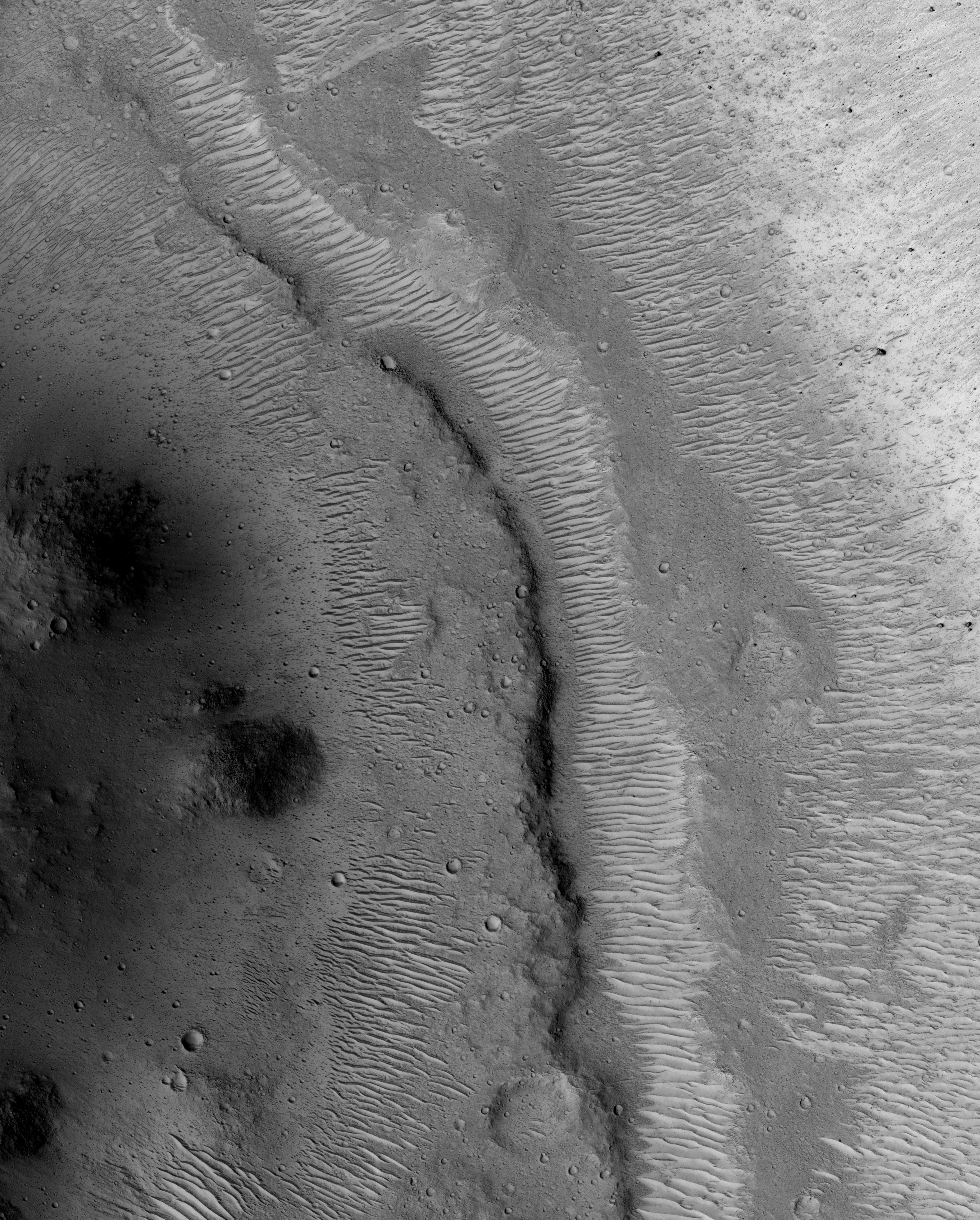
This scene shows a section of Ismeniae Fossae that straddles the southern highlands–northern lowlands of Mars. The 2 km-wide curvilinear trough that runs through this image contains numerous parallel grooves and ridges comprising material from the trough walls and material that has been dragged along the floor by ancient glaciers and ice-rich flows.

In the left portion of the scene the channel truncates a roughly 25 km-wide crater. Material in the crater walls has slumped down into the channel, smoothing over the grooved floor.

Around this crater, and elsewhere in Ismeniae Fossae, clusters of circular to elliptical, partially interconnected depressions are observed. These may be either secondary impact craters from debris flung out by larger impact craters, or collapse pits caused by the sublimation of subsurface ice.

The western portion of the 138 km-wide Moreux Crater is seen in the bottom right of the image. Numerous small dendritic valley systems west of the crater provide further evidence of water flowing in this region at some point in the Red Planet’s past, perhaps as water melting from the ice thought to have once covered this region.

The image was taken by the High Resolution Stereo Camera on ESA’s Mars Express on 16 June 2013 (orbit 11709), with a ground resolution of about 20 m per pixel. The image centre is at approximately 40°N / 42°E.

Photo credit: ESA/DLR/FU Berlin (G. Neukum)

Saturday, May 26, 2012

Expanded Craters on Icy Terrain in Tantalus Fossae


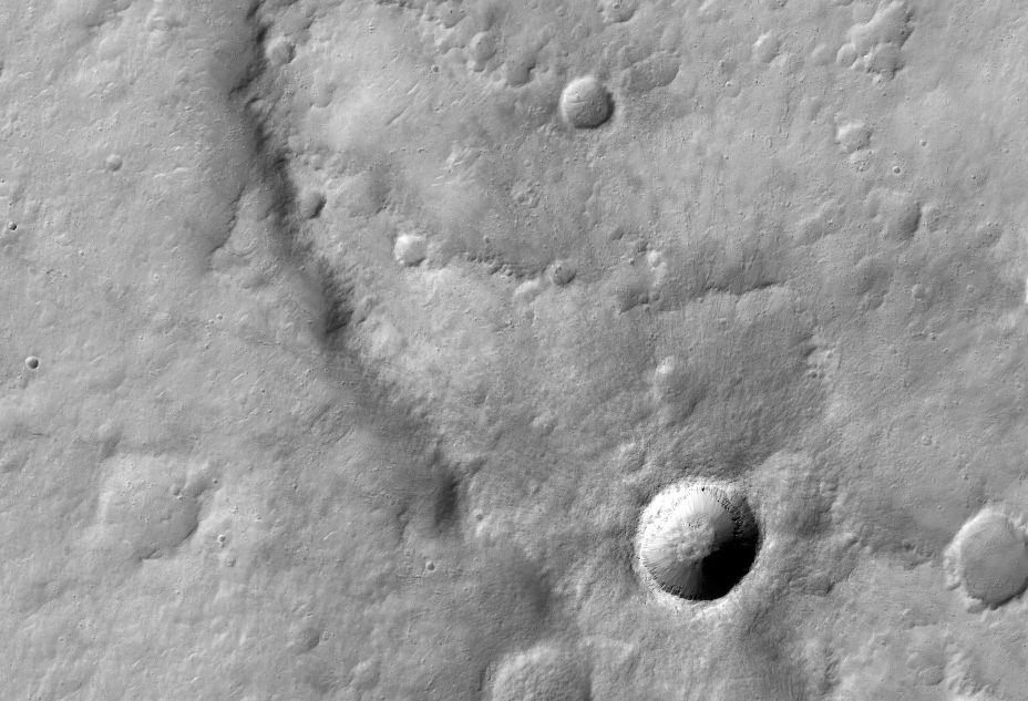
The middle of this image contains a cluster of depressions (craters) with two levels: a small inner crater, surrounded by a shallow depression extending outward from the inner crater.

This image is located at 50 degrees north latitude, where shallow ice has been mapped by the Mars Odyssey spacecraft. MRO has detected newly-formed impact craters in this broad region that exposed shallow ice, and also revealed that it is nearly pure ice.

One interpretation of the expanded craters visible here is that a group of small impacts, probably secondary craters from a much larger primary crater, exposed the clean, shallow ice in this region. Once exposed, the ice is unstable and sublimates (passes directly from ice to gas), and the shallow depressions could gradually expand.

Photo credit: NASA/JPL/University of Arizona

Note: This crater is located in eastern Tantalus Fossae to the northwest of Tempe Terra.

Wednesday, February 1, 2012

Very Fresh Impact Crater Superposing a Wrinkle Ridge in Hesperia Planum


The ridge captured in this HiRISE image is called a wrinkle ridge. This wrinkle ridge is located in Hesperia Planum, a region of over two million square kilometers (over 770,000 square miles) in the southern highlands of Mars. It is located northwest of the Hellas basin and adjacent to Tyrrhena Patera and contains abundant orthogonal and intersecting wrinkle ridges.

Wrinkle ridges are long, winding topographic highs and are often characterized by a broad arch with superposed narrow asymmetric ridges. These features have also been identified on the Moon, Mercury, and Venus. Their origin is attributed to horizontal compression or shortening of the crust due to faulting and folding. They commonly have asymmetrical cross sectional profiles and an offset in elevation on either side of the ridge.

Superposing or located on top of the wrinkle ridge, is a very fresh impact crater. We can tell that this crater is fresh because of its relatively sharp or crisp rim and unmodified shape. If you look closely, you can see faint rays of relatively fine material, boulders, and smaller secondary craters radiating from the crater and superposing the wrinkle ridge and older surrounding craters.

Photo credit: NASA/JPL/University of Arizona

Note: For an mp4 video clip of this area, including additional photographs, click here.

Saturday, January 22, 2011

Chain Gang


This chain of secondary craters just happened to be well-aligned with HiRISE's groundtrack (the path across the surface that a spot directly below the MRO spacecraft would trace out). Because of this favorable alignment, HiRISE was able to capture most of the chain in one 25 kilometer-long (15.6 mile) image.

Secondary craters occur during the formation of an impact crater. Impacts are very high-energy events, and while some rock gets melted or vaporized, other rock gets broken into large chunks and flung outward from the crater. Some of these pieces have enough energy to form small craters themselves when they reimpact the surface of Mars.

These craters can be of the same diameter as primary craters (those created directly from bodies entering the Martian atmosphere from space). In addition, primary crater clusters also exist (see examples like PSP_010200_1805, PSP_010292_1785, and ESP_017270_2265), leading to difficulties in determining the process responsible for creating a particular group of craters. One distinguishing feature of secondary craters is that they tend to be irregularly shaped, due to the lower velocity of crater ejecta.

Photo credit: NASA/JPL/University of Arizona

Note: This image is located inside the northwestern edge of Isidis Planitia.

Thursday, January 20, 2011

Distinctive Rayed Impact Crater in Meridiani Planum


This "fresh" (very well-preserved) impact crater has created a radial pattern of dark rays. The image was suggested to address the question of why the rays are dark.

Is the crater so fresh and recent that there hasn't been time for bright dust to settle on the rays? That doesn't seem likely, as we can see windblown deposits inside the crater, which requires at least thousands of years to form after the impact event. Also, fresh craters with dark ejecta are common in Meridiani, and they can't all be extremely recent.

Did the crater eject a subsurface layer of dark material? Maybe, but all of the bedrock exposures in the surrounding region are relatively bright. The surface layer is darker than the bedrock because dark materials like hematite concretions ("blueberries" found by Opportunity rover) are resistant to wind erosion and get left as a lag deposit. At HiRISE scale the rays are seen to be a thin deposit, perhaps less than 1 meter thick.

The more distant ray segments contain many small secondary craters created by impact of rocks ejected from the primary crater. Maybe these are lag deposits from the original rays. In other words, a mix of broken-up target material was deposited, but the relatively bright materials have blown away since the crater formed. The darker sand or granule-sized materials might eventually be moved by the wind and trapped inside craters, as commonly seen over Meridiani Planum, but there hasn't been sufficient time since crater formation for this process to remove the rays.

The coarser particles might not be movable by wind in the current climate regime of Mars, but that changes over thousands and millions of years as Mars experiences periodic changes in orbital parameters such as tilt of the rotational axis. There has been some sand movement since the crater formed, since we see deposits inside the crater, but not enough to remove the rays.

Photo credit: NASA/JPL/University of Arizona

Sunday, September 26, 2010

Evros Vallis and Nearby Craters


This image shows part of Evros Vallis, one of the Martian valley networks.

These more ancient valley networks may have been eroded by flowing water during a warmer, wetter period of Martian history. Many dunes are visible along the valley floor, as well as throughout the scene and in a partially exhumed crater on the valley wall. There are multiple generations and orientations of dunes. Dune orientation reflects the dominant or prevailing wind direction. Multiple dune orientations indicate that this region has experienced different wind regimes.

An exhumed crater is one that likely formed a long time ago, was buried, and is now being re-exposed because the materials that originally covered it are being eroded away. The prominent crater on the valley wall as well as several other craters in this scene are thought to be partially exhumed.

The subimage shows a couple groups of secondary craters. Secondary craters are craters that form when ejecta from the primary crater hits the surface with enough energy to form another smaller crater. As seen in the subimage, secondary craters often form in clusters spatially, because ejecta thrown out of the primary crater impacts the surface near each other at approximately the same time.

Many potential secondary craters have have similar morphologies and have distinct, bright ejecta. This implies that these craters are relatively young and that their ejecta have yet to be covered by dust.

Photo credit: NASA/JPL/University of Arizona

Note: Evros Vallis is located in the northern region of Noachis Terra, and is south of Schiaparelli Crater.

Monday, August 16, 2010

Rough Terrain


This HiRISE image shows a close-up view of the terrain northeast of Zilair Crater.

In lower-resolution images, from the Context Camera (also on board the Mars Reconnaissance Orbiter), this area looks quite rough. The reasons for this rough texture are difficult to determine; however, clues from the surrounding area help solve this mystery. Many large impact craters surround this image, but there are no volcanoes nearby making it unlikely that the rough surface is from fresh, blocky lava flows.

The high-resolution image shown here reveals a few fresh, irregularly-shaped craters on top of this rough terrain. An irregular crater, approximately 600 meters (2,000 feet) in diameter, is visible just right of center, about a third of the way up from the bottom of the image. Its shape suggests that it formed from a body that impacted the surface at a relatively low angle and slow speed. This makes it likely that it is a secondary crater (a crater that forms from debris blasted out of a nearby crater).

The rough terrain here is therefore likely to be a mix of impact material and secondary craters from nearby impacts, such as the one that formed the nearby large crater Zilair.

Photo credit: NASA/JPL/University of Arizona

Note: Zilair Crater lies in Noachis Terra, between Argyre Planitia to the south and Margaritifer Terra to the north; the closest named features to Zilair are Bond and Hale Craters to the west.

Sunday, August 8, 2010

Rayed Crater in Elysium Planitia


This image shows a prominent "rayed" crater in the Elysium Planitia region, the second largest volcanic province on Mars.

Rayed craters have distinct lines of ejecta emanating in all directions from their centers, creating a star-like pattern. Originally it was thought that these craters were only present on the Moon, Mercury, and some of the moons of Jupiter and Saturn, and therefore were only created on surfaces that lacked an atmosphere.

This view changed when the THEMIS camera began to image the surface of Mars and rayed craters started to become apparent in the infrared spectrum. The rays themselves are usually made up of both impact ejecta and, in the case of the larger craters, the clustering of secondary craters.

The patterns in the ground in which the crater was emplaced are composed of slightly raised sinuous ridges. These may be pressure ridges and could be the result of the expansion of cooling flood lavas prevalent in the area. Although the surface is presently covered with a light-toned dusty material, the underlying, dark presumably basaltic material is exposed in the larger craters.

This particular crater is close enough to another even larger rayed crater known as Zunil to actually be one of its secondary craters. Secondary craters generally have a shallower bottom and are often non-circular due to their lower impact velocity and angle of impact. This crater appears nearly circular with ejecta and large boulders that are visible near the crater rim and within the crater itself.

A slightly darker rayed ejecta pattern surrounds the crater and is probably composed of finer-grained material transported farther away during impact formation. The center of the crater appears to be shallower than would be expected from a higher energy primary impact event, but an elevation model would be needed to accurately measure the crater's depth to width ratio and use scaling laws to decide whether or not its a primary or secondary crater.

Photo credit: NASA/JPL/University of Arizona

Wednesday, July 21, 2010

Meanders in Nanedi Valles


This observation shows a portion of Nanedi Valles, an equatorial Martian valley network.

Valley networks are thought to have formed by groundwater sapping either in conjunction with an ice layer to cover the running water or during a past warmer, wetter climate regime on Mars. Glacial activity has also been proposed to form the valley networks.

Groundwater sapping is the leading theory because of the morphology of the valleys. They commonly have approximately constant width along their reaches, as seen here, as well as theater shaped heads, as seen in the tributary valley in the bottom right of the scene. The meandering nature of valleys suggests persistent or repeated flow as required to form meanders in streams on Earth.

The subimage shows a potential remnant channel seen on the floor of Nanedi Valles just below the center of the image. If this is a remnant channel, it suggests that there was either repeated or waning flows in this valley. Winding dunes and abundant impact craters are found throughout the valley, as well as within this putative channel.

Dunes are thought to be transient features on Mars, although no movement has been detected to date. It is interesting to note that some of the dunes are superposed by craters indicating that the dunes were stable long enough for craters to form and not be erased.

It is possible that the craters on top of the dunes are secondary craters that formed as a product of a larger impact. Secondary craters from a single impact are clustered in space and form almost simultaneously, implying that the dunes were stable for a time period — long enough for a single crater, rather than multiple craters, to form.

Photo credit: NASA/JPL/University of Arizona

Thursday, June 10, 2010

Distal Rampart of Crater in Chryse Planitia


Impact craters on Mars are kind of neat: many of them look very different than impact craters seen on the Moon or Mercury.

Fresh lunar and Mercurian craters have ejecta blankets that look a bit rough near the crater rims; around larger craters, long rays or chains of secondary craters radiate away from the crater rims. Some Martian craters are similar to these craters, but Mars also has a high proportion of craters with forms not found on the Moon or Mercury: rampart craters.

Rampart craters, also called fluidized-ejecta craters, have ejecta blankets that appear lobate, or rounded, and end in low ridges or ramparts, such as the ridge in this HiRISE image. Here you see the rampart at the edge of the ejecta blanket that comes from an approximately 16 kilometer (10 mile)-diameter crater, about 16 km (10 mi) to the east.

For years there has been a debate about whether these lobes and ramparts were formed by ejecta interacting with the thin Martian atmosphere, or whether they formed because volatiles (such as water or ice) in the subsurface were incorporated into the ejecta material excavated by the impact. The common consensus is now in favor of the volatile hypothesis. Because of this, rampart craters can be used to indicate the past presence of water or ice in the Martian crust.

Photo credit: NASA/JPL/University of Arizona

Notes: This image is located in the southwestern uplands of Chryse Planitia. The Viking 1 Lander is due north from this location.

Saturday, April 24, 2010

Cluster of Secondary Impact Craters


This observation was taken to see if the cluster of pits were formed by the interaction of hot lava with water. Such pits and cones have been found in this region, most likely because there was significant ice in the ground when a large lava flow inundated the area.

However, in this case, HiRISE reveals that the circular features are a mass of impact craters (note that the word "crater" is used by geologists for holes formed by volcanic, impact, and other geologic processes). The tight clustering of these craters is unusual. The most likely explanation is that they were formed by a clump of material thrown out from a larger impact crater nearby. As such, they are called "secondary" craters with the larger source crater called a "primary". This HiRISE image covers too small an area to identify the primary.

Photo credit: NASA/JPL/University of Arizona

Note: This photo was taken in the Tartarus Montes/Phlegra Dorsa region of Elysium Planitia.

Friday, February 26, 2010

A Field of Secondary Craters

This observation shows a secondary crater field, which form when material ejected from a larger impact event impacts the Martian surface. One impact event, depending on the size of the impactor, can form hundreds of millions of secondary craters at essentially the same time.

Primary craters (those created directly from an impactor from space) can be the same size as secondary craters, which makes dating surfaces based on the number of accumulated craters difficult to near-impossible. Secondary craters are distinguished from primaries based on their morphologies. They are sometimes irregularly shaped, as seen in this image, because they form at relatively low velocities. The velocity of the impactor determines a crater’s size, shape, and depth, with lower energy impacts forming shallow, less-developed craters and higher energy impacts forming deeper, more regular craters.

Secondary craters often occur in clusters, as seen here, as a piece of ejecta breaks up before hitting the surface. Primary craters form at random locations globally. Secondary clusters are more likely to be found in groups because of their formation mechanism.
Note: The craters in this photo are located in the southwestern rim of Utopia Planitia (31.1° North, 89.7° East), in the Casius Quadrangle.

Photo Credit: NASA/JPL/University of Arizona