Showing posts with label CRISM. Show all posts

Monday, August 4, 2014

Water-Bearing Rocks in Noctis Labyrinthus


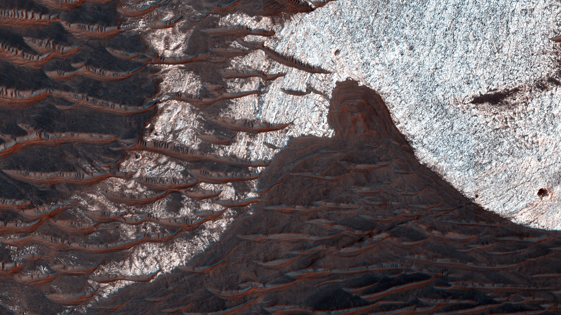
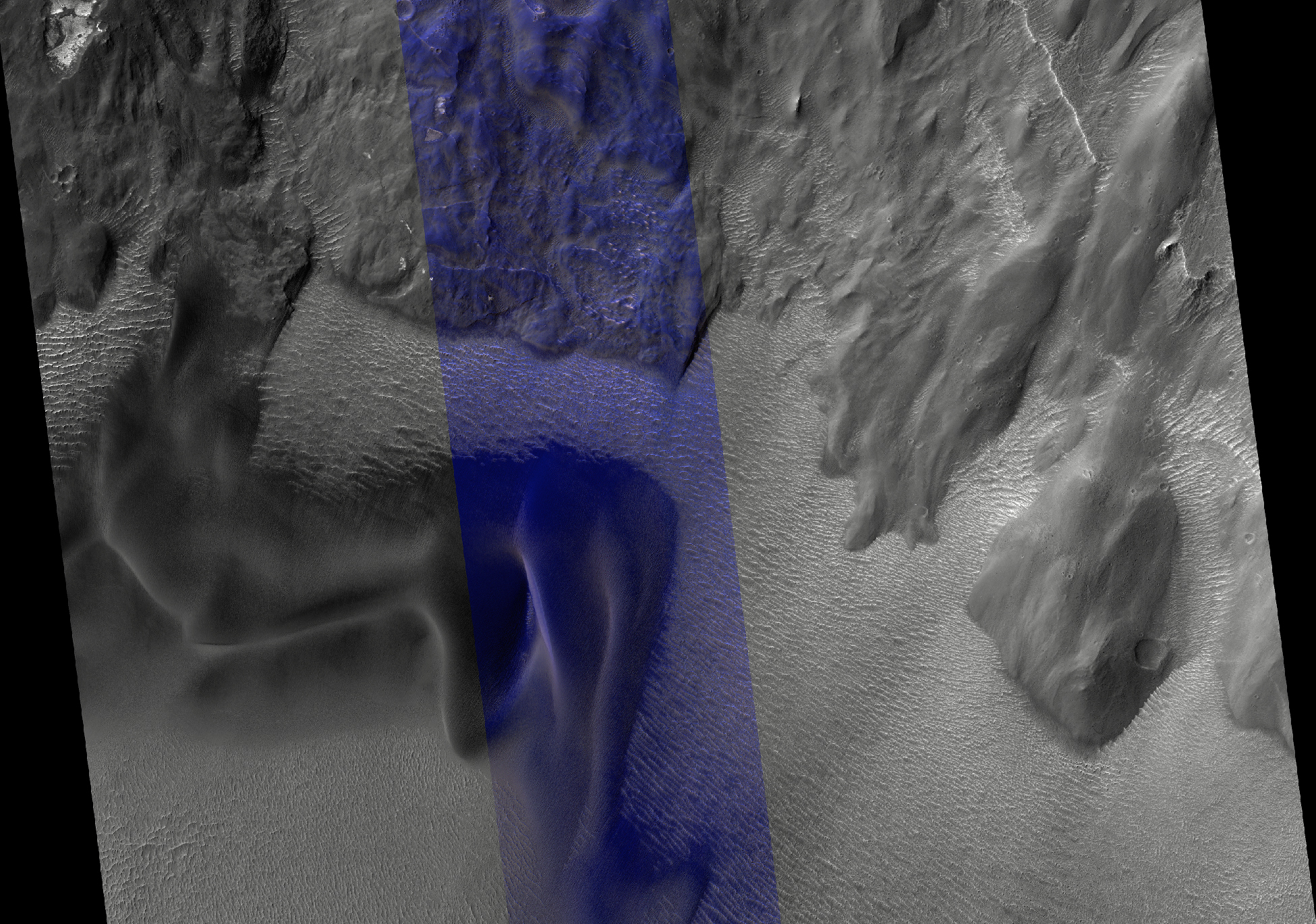
The bright rocks in this image have minerals that contain water. These water-bearing minerals are found using the companion instrument on the MRO spacecraft called CRISM.

By combining the spectral data from the CRISM instrument with the high resolution visible images taken by HiRISE, scientists are able to speculate how water deposited and/or altered these rocks.

Many of the depressions in Noctis Labyrinthus contain water-bearing minerals, suggesting that water was available and persistent in this region during the Late Hesperian to Amazonian epochs on Mars, a time when the climate is believed to have been dry and cold like we see today.

This is a stereo pair with ESP_036743_1735.

Image credit: NASA/JPL/University of Arizona

Note: For more information, see PIA18632: Water-Bearing Rocks in Noctis Labyrinthus.

Friday, April 11, 2014

Opportunity at Murray Ridge


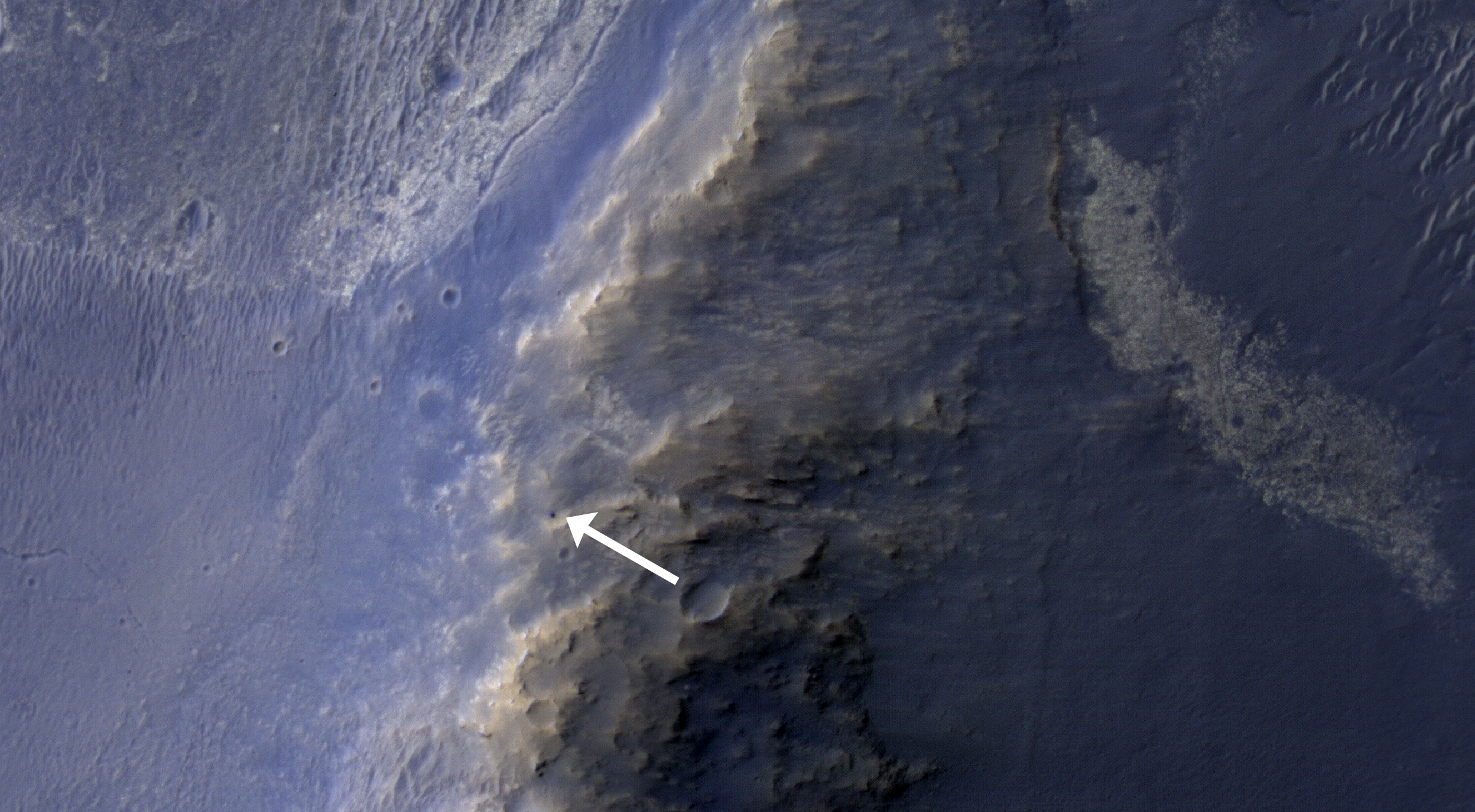
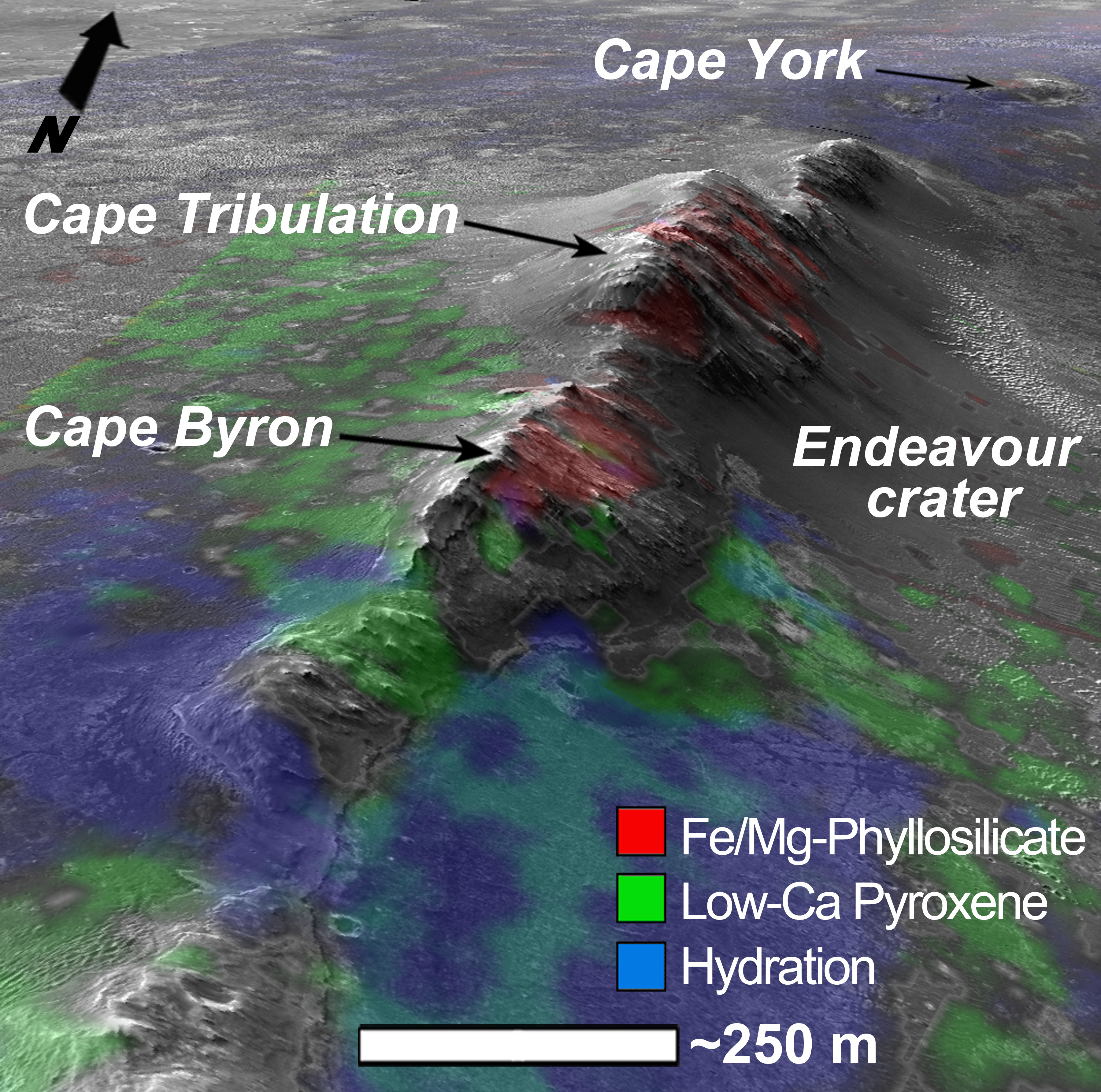
This HiRISE image of the Opportunity rover was acquired as a coordinated “ride-along” observation with the CRISM instrument, also onboard the Mars Reconnaissance Orbiter. The CRISM instrument is a spectrometer that views the surface in many wavelengths beyond what the human eye can detect, allowing for mineral identification of the Martian surface.

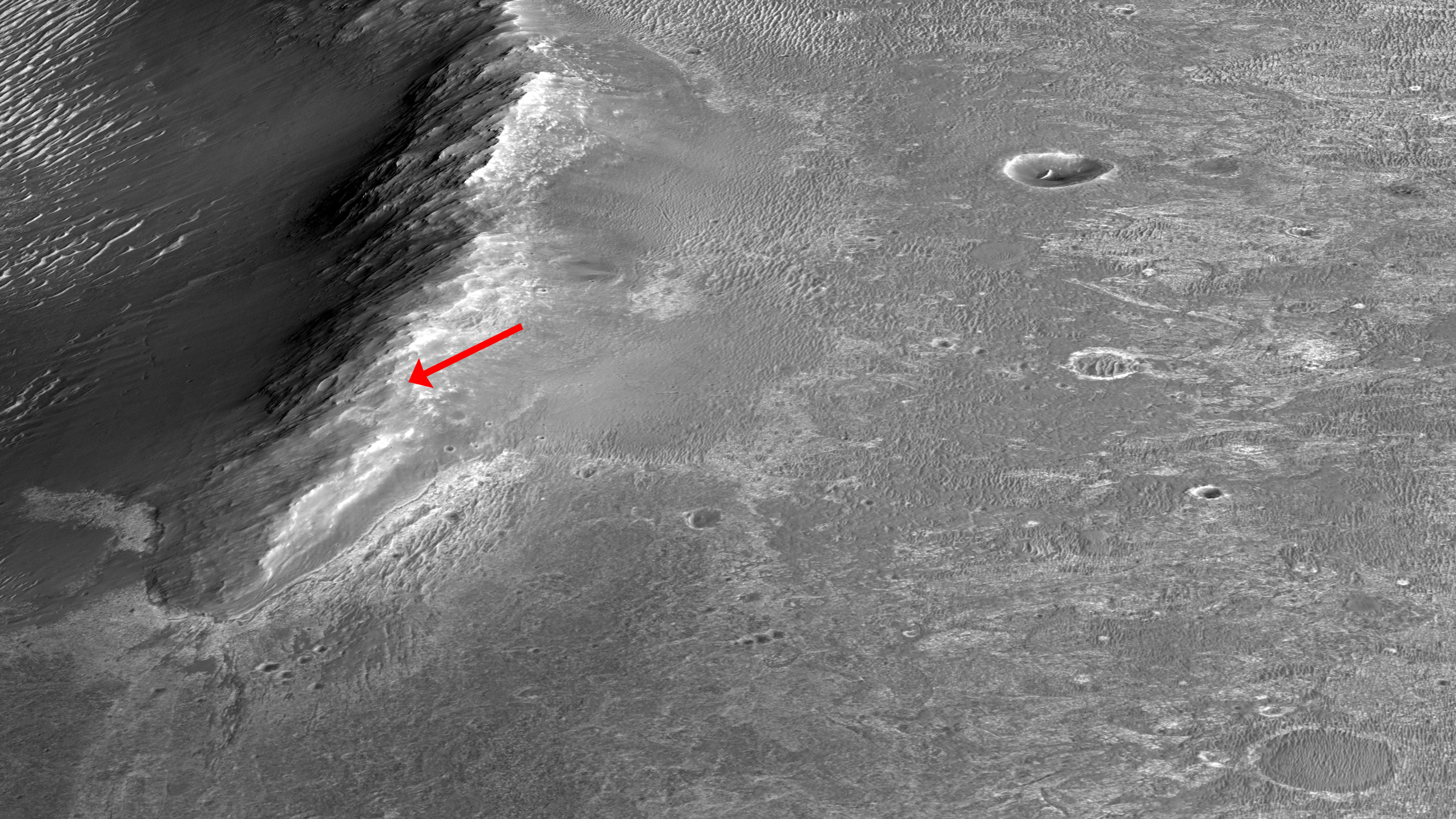
HiRISE images can be used to construct digital terrain models (or DTM), like the one of Endeavour Crater’s western rim, which provides high-resolution topography for landing site support. This southward prospective view was built using that DTM.

The use of CRISM mineralogy, along with topography and fine-scale images from HiRISE will aid in Opportunity's investigation into the geologic history of the Murray Ridge of Endeavour Crater.

Photo credit: NASA/JPL/University of Arizona

Tuesday, February 11, 2014

Recurring Slope Lineae at Palikir Crater


This image combines a photograph of seasonal dark flows on a Martian slope with a grid of colors based on data collected by a mineral-mapping spectrometer observing the same area. The area is at Palikir Crater in the southern hemisphere of Mars.

The photograph is from the High Resolution Imaging Science Experiment (HiRISE) camera. The composition information, as an image with pixels appearing as a grid of squares, is from the Compact Reconnaissance Imaging Spectrometer for Mars (CRISM). Both of these instruments are on NASA's Mars Reconnaissance Orbiter. The view is oriented with north toward the bottom. The scale bar at lower left indicates 90 meters (295 feet).

These dark, warm-season flows are called "recurring slope lineae" or RSL. Researchers are using observations from Mars orbiters to study the possibility that RSL result from action of salty liquid water. This image was included in a paper by Lujendra Ojha of Georgia Institute of Technology, Atlanta, and co-authors in Geophysical Research Letters.

The purple and pink colors of the CRISM image represent spectra with absorption of light at wavelengths of 920 nanometers and 530 nanometers. The strength of these absorption bands at this site varies seasonally -- weaker when the RSL are inactive and stronger when the RSL are active. Absorption at 530 nanometers can indicate a concentration of ferric iron, so this could be a clue that the fluctuations observed in the absorption bands of iron minerals may be related to the RSL activity. Other image products from the same Nov. 2, 2007, HiRISE observation are available at http://www.uahirise.org/PSP_005943_1380.

Image credit: NASA/JPL-Caltech/UA/JHU-APL

Note: For more information, see NASA Mars Orbiters See Clues to Possible Water Flows.

Thursday, January 30, 2014

Opportunity Traverse Map for Cape York


A region known as "Cape York" on the western rim of Endeavour Crater, where NASA's Mars Exploration Rover Opportunity worked for 20 months, is highlighted in these images.

The inset at upper left is a portion of a false-color image taken by the High Resolution Imaging Science Experiment (HiRISE) camera on NASA's Mars Reconnaissance Orbiter. The black outline shows the "Matijevic Hill" region, enlarged in the central image. Initial traverses accomplished by Opportunity to evaluate the geologic setting of the region are noted. The Opportunity team was interested in this region because the Compact Reconnaissance Spectrometer for Mars (CRISM) on NASA's Mars Reconnaissance Orbiter showed a specific type of clay mineral called a ferric smectite. This type of clay mineral originally formed in groundwater along fractures in which the water was only mildly acidic.

The lower left inset shows a portion of CRISM data centered on Cape York. The red region delineates where CRISM spectra show features diagnostic of the smectite clay mineral.

This image is from a portion of a HiRISE observation cataloged as ESP_032573_1775 . Other products from the same observation are available at http://hirise.lpl.arizona.edu/ESP_032573_1775.

Image credit: NASA/JPL-Caltech/University of Arizona

Monday, January 27, 2014

Light-Toned Deposits in Coprates Chasma


Valles Marineris contains kilometers-thick light-toned layered sedimentary deposits along many of its floors. In this image, similar light-toned layered deposits are observed, except these are found along steeper wallrock slopes in Coprates Chasma.

Compositional data from CRISM and also stereo images—which we use to create 3D images—can help scientists determine how these sediments were deposited and if they are the same as the thicker deposits seen along the chasma floors.

Photo credit: NASA/JPL/University of Arizona

Friday, July 19, 2013

Layered Deposits North of Hellas Planitia


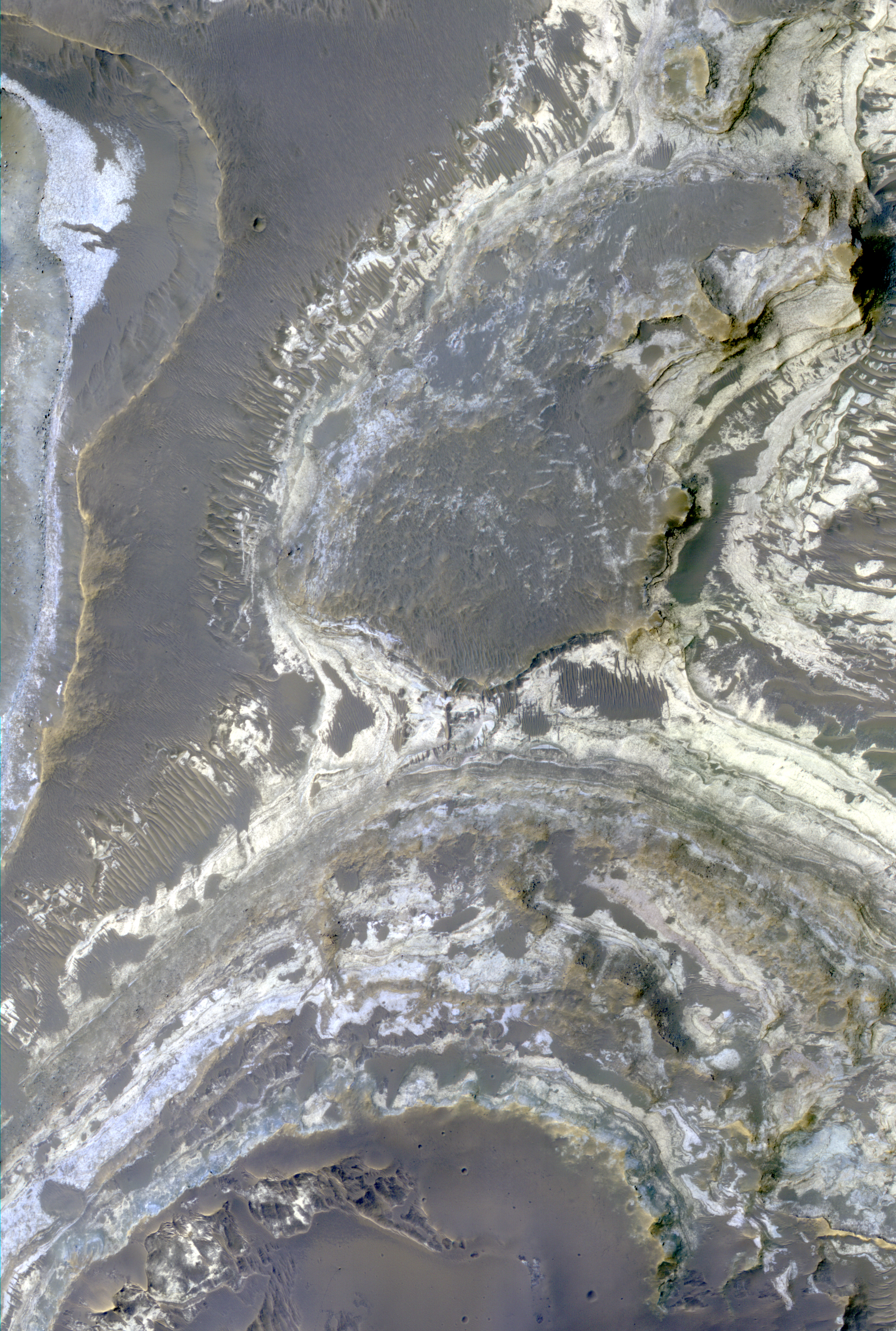
Excellent exposures of light-toned layered deposits occur along the northern edge of Hellas Basin, like those visible in this enhanced color image.

Some of these layered sediments have hydration features in CRISM data, and the various colors visible in this image suggests several different compositions may be present throughout the strata. The sediments may have been emplaced by hydrothermal activity associated with the impact event that created Hellas Basin.

Alternatively, they could be younger deposits that formed within this region when a lake existed here. Studies of the deposits using several data sets could distinguish between these two origins and may result in additional hypotheses for their formation.

This is a stereo pair with ESP_032425_1525.

Photo credit: NASA/JPL/University of Arizona

Wednesday, July 17, 2013

Ius Chasma Landslide and Dune Field


Landslides in Valles Marineris are truly enormous, sometimes stretching from one wall to the base of another. This 45-kilometer-long HiRISE image alone drops nearly 2 kilometers in elevation into Ius Chasma. This landslide, known as Ius Labes, would occupy the surface area of Delaware.

Here, we can see dark-toned material emanating from the landslide scarp and forming dunes and dark streaks that were carried downslope by the wind. Geologic context and compositional information from CRISM suggest this dune field was locally derived from landslide material. Other locations in this image show smaller ripples and smooth, rounded textures of the landslide, both attesting to long-lived wind transport and erosion.

This site records a long and complex geologic history of landscape evolution. This history likely includes: (1) ancient lava flows and ash fall deposits which were deposited horizontally and would eventually make what now is canyon wall material; (2) extensional forces rifted or faulted Valles Marineris; (3) mass wasting ensued where gravity forced weak and dislodged rock down into the canyon as massive landslides or smaller fans of boulders; (4) wind driven aeolian forces took small sand-sized particles to form dunes and ripples observable in this image, while also slowly eroding the landscape and modifying its shape.

Photo credit: NASA/JPL/University of Arizona

Thursday, June 27, 2013

Endeavour Crater's Western Rim (DTM)


This digital terrain model covers the western rim of Endeavour Crater where the Mars Exploration Rover Opportunity has been investigating since 2011. It provides valuable topographic data that have been very useful in Opportunity mission planning.

For example, this subimage shows a northward perspective view of HiRISE and compositional data from the Compact Reconnaissance Imaging Spectrometer for Mars (CRISM) overlaid over the DTM of Endeavour Crater. This image shows where orbital data indicate possible clay (red), sulfate (green), and volcanic (blue) minerals are located, where the former two attest to the regions aqueous ancient past.

Ongoing surface operations by Opportunity are attempting to reveal the geologic history at Endeavour crater.

Opportunity is currently (2013) at Cape York heading south.

Image credit: NASA/JPL/University of Arizona/USGS

Monday, May 6, 2013

Olivine-Bearing Dune Fields and Wall Rock in Coprates Chasma


In this image, lower wall rock spurs are found that spread dark materials onto a dune field, suggesting local wall materials are a nearby sediment source for dunes. This subimage shows the interface between wall materials and dunes in the northwest portion of the main image

Dune sand, wall spurs, and boulders are all partially composed of olivine (according to CRISM data), a common mineral formed in volcanic processes, supporting the notion for local sourcing of dunes.

Olivine is highly susceptible to weathering by aqueous processes indicating these dunes and the wall debris formed after any such activity. Interestingly, clay minerals (known as phyllosilicates) are detected farther up the wall suggesting that aqueous alteration of wall materials has occurred in the ancient past.

Photo credit: NASA/JPL/University of Arizona

Saturday, April 27, 2013

Ancient Rocks of the Isidis Basin and Libya Montes Exposed and Preserved by Hashir Crater


The focus of this HiRISE observation is the inner portion of the approximately 9-kilometer diameter Hashir Crater.

Hashir is located at 84.56 degrees east, 3.63 degrees north within the transition from the vast Isidis Basin plains (Isidis Planitia) to the great circumferential mountains of Libya Montes (i.e., the ancient and dissected mountains raised-up from the Isidis-forming event).

Hashir is of particular interest to scientists because there are several spectral units that are characteristic of the Isidis Basin/Libya Montes region that are exposed or preserved within it. Hashir and its surroundings have been spectrally characterized by multiple orbiting spectrometers spanning almost 25 years, including: Phobos 2-ISM, MGS-TES, MO-THEMIS, MEx-OMEGA and most recently by MRO-CRISM. The results from the analysis of these data indicate the presence of surface materials rich in olivine, pyroxene, clays (Fe/Mg-smectites) and carbonate. The latter two are of particular interest as they were likely formed by alteration of the ancient basaltic rocks through interactions with water. The Fe/Mg-phyllosilicates and carbonate are often associated with olivine in CRISM and HiRISE images because these alteration minerals are observed where the olivine-rich lavas have been eroded away.

This 3D perspective image of Hashir Crater was generated by combining color from CRISM with the high-resolution of a gray-scale HiRISE RED image draped over a HiRISE stereo derived digital terrain model (DTM) with a 3x vertical enhancement. This close-up view from the south (looking north) illustrates the occurrence of the pyroxene-bearing caprock in blue on top of olivine-bearing layered bedrock in green, which in turn overlies a Fe/Mg-smectite-bearing unit in red. The hilly red unit is interpreted to be the central uplift of Hashir Crater, which are rocks uplifted and exposed by the crater-forming event. The blue and green units are more recent lava flows or impact melt deposits from Isidis that filled in Hashir after it formed and have been since eroded back by the high winds in the Libya Montes region.

Image credit: NASA/JPL/University of Arizona/USGS

Monday, April 15, 2013

Megabreccia in a Terra Cimmeria Impact Crater


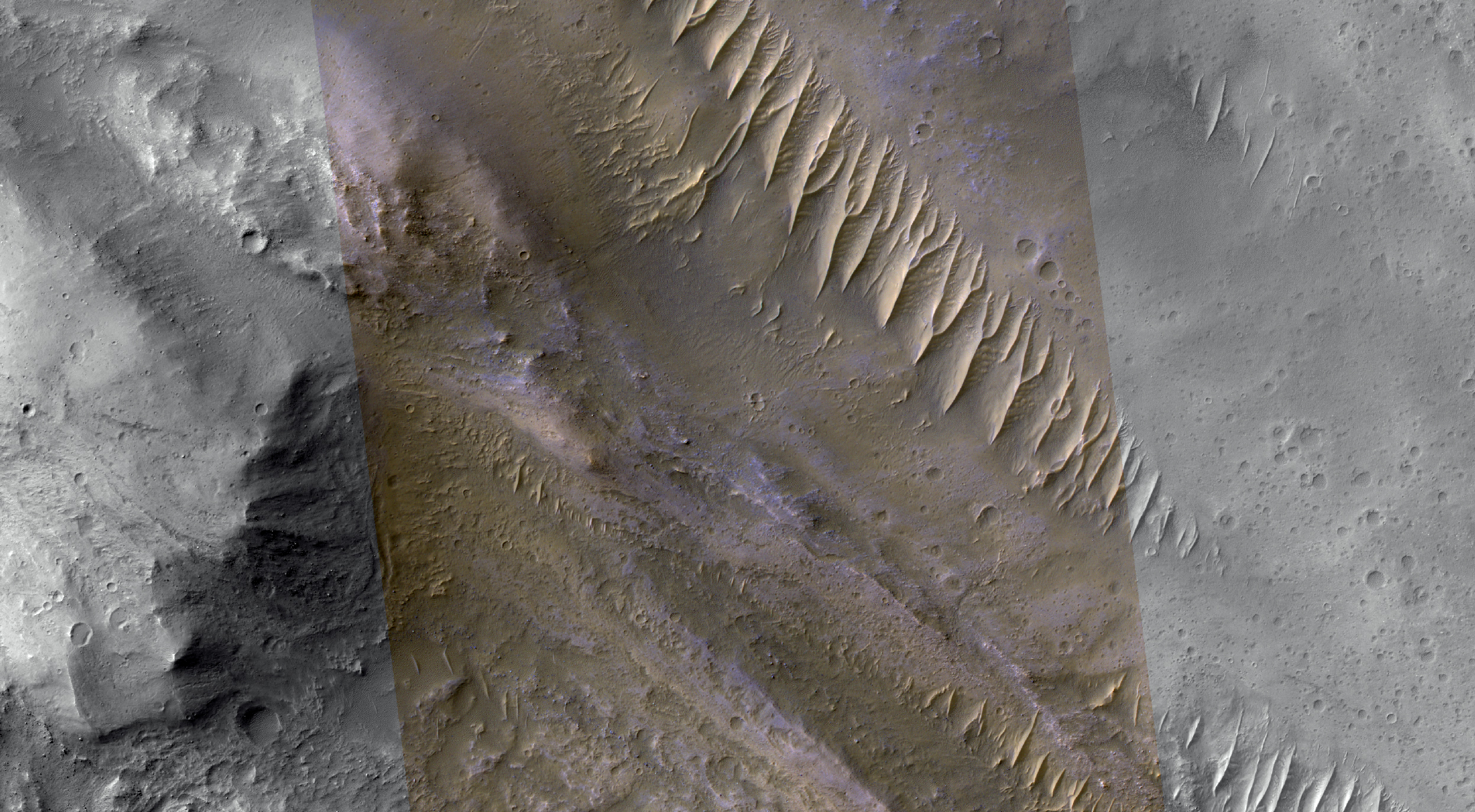
"Megabreccia" is a term we use to describe jumbled, fragmented blocks of rock larger than 1 meter across, in a matrix of finer-grained materials. It's the result of energetic processes, typically from an impact event.

This image was acquired by HiRISE only in the narrow color strip, as a ride-along with a CRISM target, since HiRISE had previously imaged this location.

Photo credit: NASA/JPL/University of Arizona

Note: This image is located in northern Terra Cimmeria, near the "shore" of Elysium Planitia. The closest named feature is Al-Qahira Vallis, to the northwest.

Friday, April 12, 2013

Raindrop Dunes in Copernicus Crater


The dark features here look like raindrops, but are actually sand dunes. This spot was targeted by CRISM because the dunes are rich in the mineral olivine.

Olivine-rich dunes are very rare on Earth, as olivine rapidly weathers to clays in a wet environment. There is also olivine-rich bedrock in the central peaks of Copernicus Crater on the Moon.

There is only a handful of very important scientists, like Nicolaus Copernicus (1473-1543) who have craters named after them on both Mars and the Moon.

Photo credit: NASA/JPL/University of Arizona

Monday, April 1, 2013

Possible Hydrated Minerals in Terra Sirenum


This image shows a small light-toned exposure of rock on the plains of Terra Sirenum, in a heavily cratered region of the Southern hemisphere of Mars.

What's of interest here is the potential hydrated mineral signature that appears in CRISM multispectral data. Hydrated minerals on Mars are indicators of past environmental conditions. Comparing high-resolution images from HiRISE and the high spectral resolution of CRISM helps understand these minerals.

Prior to HiRISE, there were no existing high-resolution images of this exposure.

Photo credit: NASA/JPL/University of Arizona

Thursday, January 31, 2013

Curiosity on Sol 157


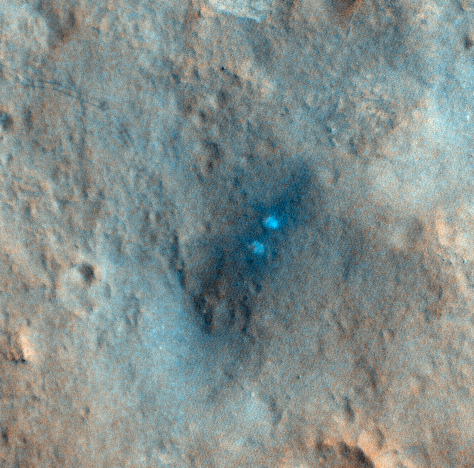
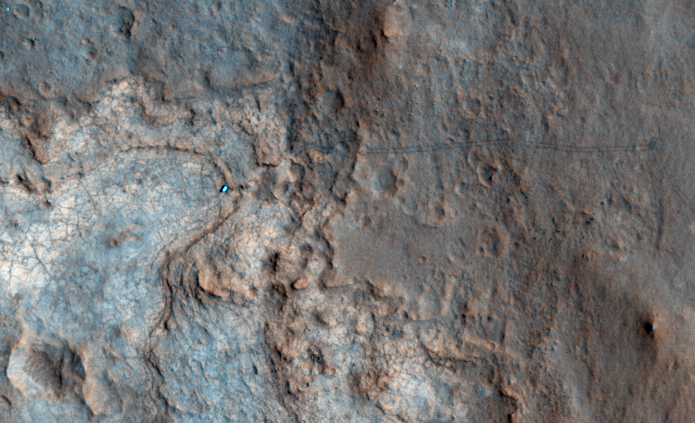
This HiRISE observation was performed in conjunction with a CRISM observation so that they could get good spectral data on the scour zone created by the MSL descent rockets.

Our higher resolution HiRISE image will allow the CRISM team to compare their data with ours. The scour zone is where MSL touched down. The pair of bright white spots in the HiRISE image show the area immediately below where sky crane's rockets were pointed. Those areas were "blasted clean" and therefore show brightest. The larger dark scour zone is dark because the fine dust has been blown away from the area leaving darker materials.

However, we also captured Curiosity on its 157th Sol as it was exploring Yellowknife Bay and about to drill its first rock.

This is the first time that we've captured the rover tracks in color, and they show up as a pair of dark lines moving across the landscape.

Note: the above image is non map-projected, so approximate north is down.

Photo credit: NASA/JPL/University of Arizona

Monday, January 21, 2013

Carbonate Layering in McLaughlin Crater


This view of layered rocks on the floor of McLaughlin Crater shows sedimentary rocks that contain spectroscopic evidence for minerals formed through interaction with water. The High Resolution Imaging Science Experiment (HiRISE) camera on NASA's Mars Reconnaissance Orbiter recorded the image.

A combination of clues suggests this 1.4-mile-deep (2.2-kilometer-deep) crater once held a lake fed by groundwater. Part of the evidence is identification of clay and carbonate minerals within layers visible near the center of this image. The mineral identifications come from the Compact Reconnaissance Imaging Spectrometer for Mars (CRISM), also on the Mars Reconnaissance Orbiter.

The scene covers an area about one-third of a mile (about 550 meters) across, at 337.6 degrees east longitude, 21.9 degrees north latitude. North is up. Figure 1 [the second, annotated image above] indicates the location of layers bearing clay and carbonate minerals and includes a scale bar of 100 meters (328 feet).

Photo credit: NASA/JPL-Caltech/University of Arizona

Notes: For more information, see Layers with Carbonate Content Inside McLaughlin Crater on Mars. Unfortunately, these images are very low resolution, especially when compared to the very high resolution, very beautiful images the HiRISE team normally provides; however, this is the highest resolution NASA is releasing at this time.

Tuesday, July 10, 2012

Colorful Layers in Nili Fossae


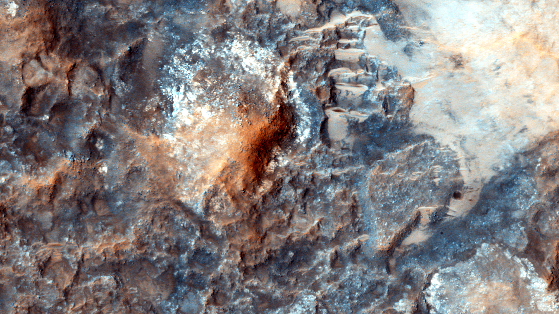
This enhanced-color version of the central part of the HiRISE image shows colorful layers that may contain carbonate minerals.

Carbonates are commonly formed on Earth by marine organisms; the origin of these carbonates on Mars is unknown, but probably involved liquid water.

This image was taken along with the CRISM instrument, also onboard MRO, in what is called "ridealong" mode.

Photo credit: NASA/JPL/University of Arizona

Notes: This picture was taken in the Nili Fossae area to the northeast of Hargraves Crater. For the Spanish translation of this page, see Estratos de Colores en Nili Fossae.

Thursday, June 28, 2012

Excavating Water-Rich Rocks


The large 25 km-diameter crater in the foreground of this High Resolution Stereo Camera (HRSC) perspective view has excavated rocks which have been altered by groundwater in the crust before the impact occurred. Using OMEGA (Visible and Infrared Mineralogical Mapping Spectrometer) on ESA's Mars Express and CRISM (Compact Reconnaissance Imaging Spectrometer for Mars) on NASA's Mars Reconnaissance Orbiter (MRO), scientists have identified hydrated minerals in the central mound of the crater, on the crater walls and on the large ejecta blanket around the crater. Hydrated minerals were found in 175 locations associated with other nearby craters in the Tyrrhena Terra region of Mars.

Photo credit: Mars Express HRSC, ESA/DLR/FU Berlin (G. Neukum); NASA/MOLA Science Team; D. Loizeau et al.

Note: For more information, see Craters Expose Action of Groundwater Beneath Martian Highlands.

Monday, June 18, 2012

Bright Material along the Floor of a Trough in Noctis Labyrinthus


Many of the troughs (or, rounded depressions) of Noctis Labyrinthus contain bright, sometimes layered, materials. Noctis Labyrinthus is located on the far western end of the large canyon system Valles Marineris. To the west lie the volcanoes of Tharsis.

This HiRISE image shows an example of the bright material commonly found along the floors of some of the Noctis troughs. Spectral data from the CRISM instrument, also onboard the MRO spacecraft, indicate the bright material is hydrated (i.e., contains water). The hydrated material may have formed when water upwelled into the low-lying depression or when ice within the trough melted due to heating from volcanic activity.

An earlier image taken of this same location will now be combined with this new image to produce a stereo anaglyph. The stereo should allow scientists to understand the relationship between the bright material and the darker rocks that make up the trough floor.

This is a stereo pair with ESP_017399_1680.

Photo credit: NASA/JPL/University of Arizona

Monday, May 7, 2012

Colorful Uplifted Rocks in Acidalia Planitia


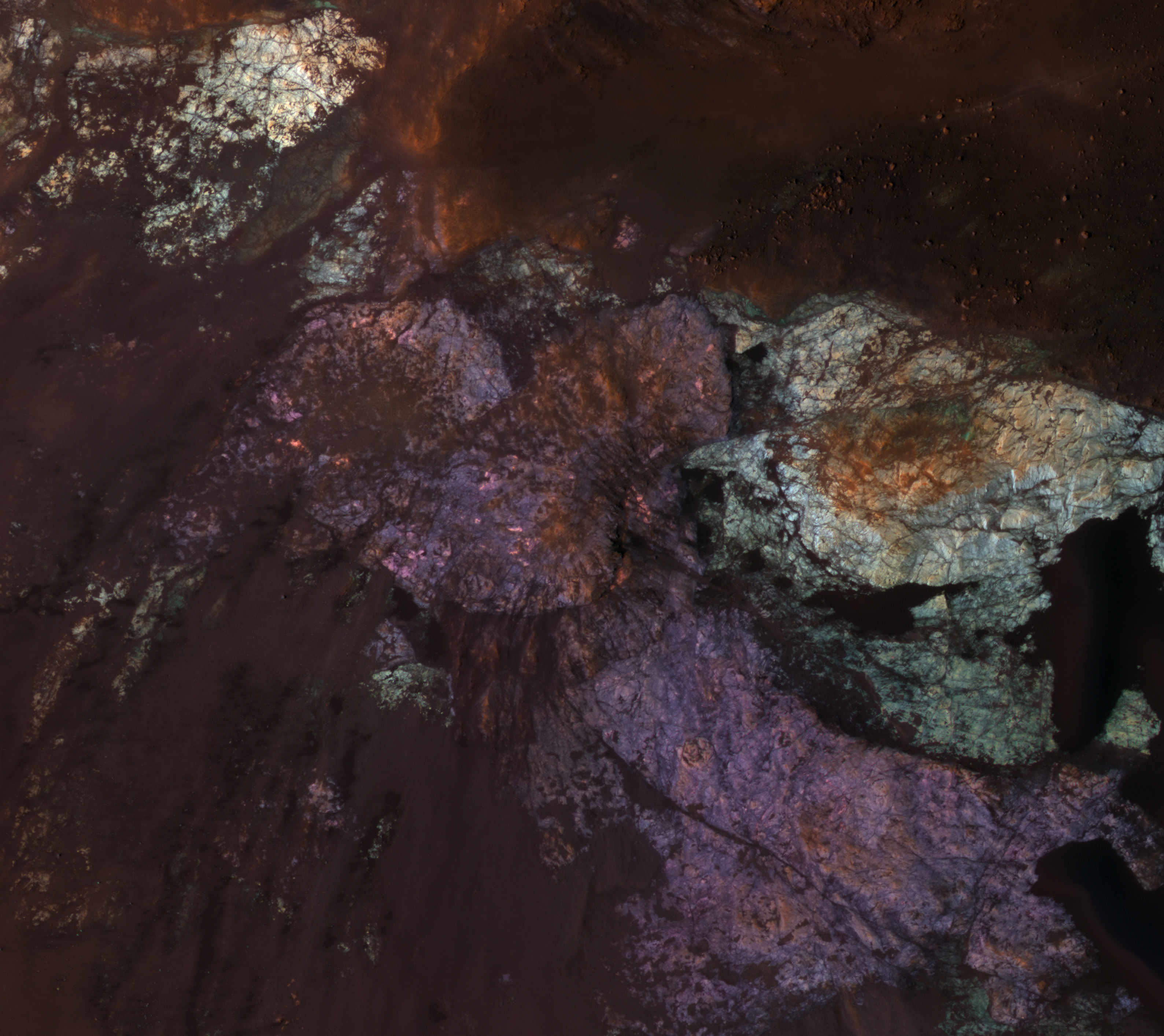
Large impact craters have central regions of uplifted bedrock, a rebound effect following the tremendous energy of a hypervelocity impact. This produces windows into the deep and more ancient geologic history.

Central peaks on Mars have some of the most diverse and distinctive rock types. In this enhanced-color subimage we see two distinctive bedrock colors--light blue and purple--plus reddish to black fine-grained materials covering some of the rock. These rocks are generally massive or jumbled, and do not show regular layers like lava flows or water-lain sediments. One possibility is that these are plutonic rocks, where molten rock solidified at depth rather than erupted onto the surface as lava flows or particles.

Analysis of the CRISM spectra here should provide further clues. This spot is in the vast northern plains, where some workers believe there was an ancient ocean. So far, the mineralogic signature of ocean-deposited sediments has not been reported.

Photo credit: NASA/JPL/University of Arizona

Note: This crater is located in Acidalia Planitia; the closest named feature is Davies Crater, which lies some distance to the southwest.

Friday, February 17, 2012

Polar Layers in Gemini Scopuli


This is an especially pretty image due to the color variations and lighting geometry.

The color variations are due to mixtures of reddish dust with white frost and ice. The image was acquired as a "rider" with either a Context Camera or CRISM target.

One of these other MRO experiments chose this location to point at with the spacecraft, then the HiRISE science lead for this 2-week planning cycle decided to add a HiRISE image here for a high-resolution sample.

Photo credit: NASA/JPL/University of Arizona

Note: This image is located along one of the canyons in the Gemini Scopuli region of Planum Boreum.