Showing posts with label Complex Impact Craters. Show all posts

Monday, May 7, 2012

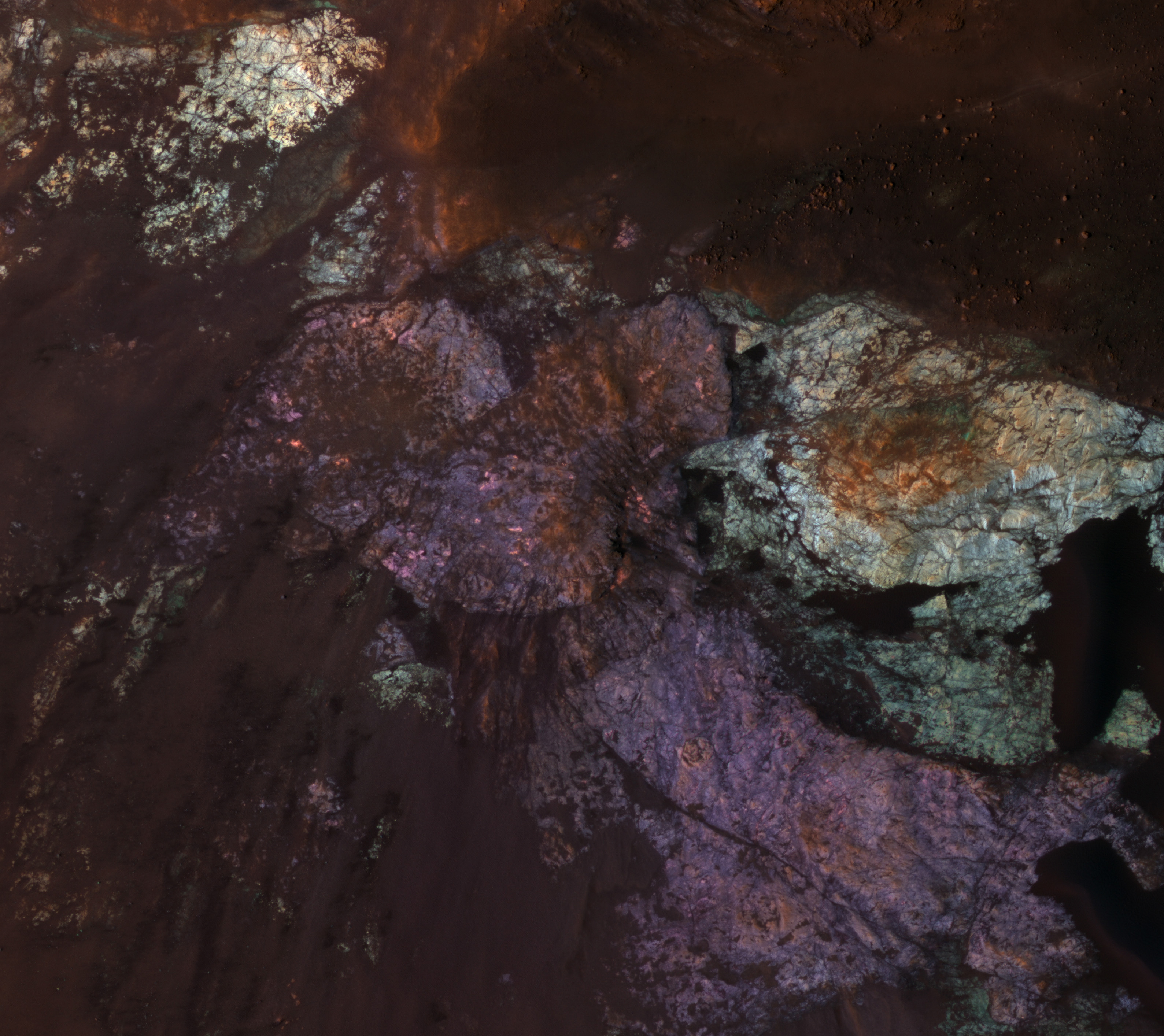
Colorful Uplifted Rocks in Acidalia Planitia


Large impact craters have central regions of uplifted bedrock, a rebound effect following the tremendous energy of a hypervelocity impact. This produces windows into the deep and more ancient geologic history.

Central peaks on Mars have some of the most diverse and distinctive rock types. In this enhanced-color subimage we see two distinctive bedrock colors--light blue and purple--plus reddish to black fine-grained materials covering some of the rock. These rocks are generally massive or jumbled, and do not show regular layers like lava flows or water-lain sediments. One possibility is that these are plutonic rocks, where molten rock solidified at depth rather than erupted onto the surface as lava flows or particles.

Analysis of the CRISM spectra here should provide further clues. This spot is in the vast northern plains, where some workers believe there was an ancient ocean. So far, the mineralogic signature of ocean-deposited sediments has not been reported.

Photo credit: NASA/JPL/University of Arizona

Note: This crater is located in Acidalia Planitia; the closest named feature is Davies Crater, which lies some distance to the southwest.

Sunday, February 19, 2012

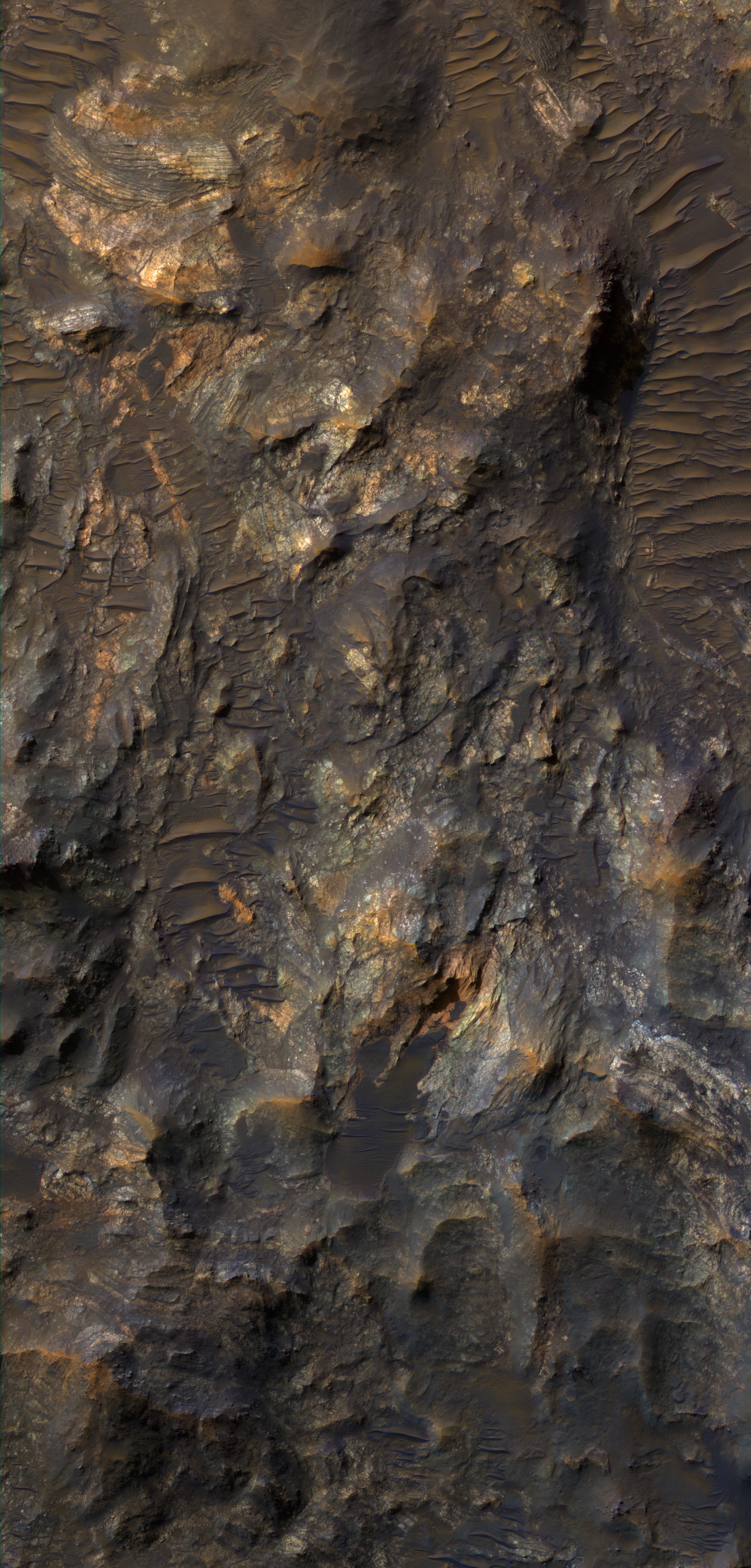
Uplifted Jumble of Ancient Bedrock


Impact craters larger than a certain size have complex forms, including central peaks or other structures that result from structural uplift of the target material. This provides a mechanism for exposing deep, ancient bedrock.

The enhanced-color subimage shows a great variety of colors and textures in the bedrock, where it is exposed from beneath a dark fine-grained mantle. The mantle is sometimes modified by the wind into dunes.

The bedrock here includes massive, layered, and broken-up (brecciated) areas. This crater is located in the volcanic plains between Argyre Planitia and Valles Marineris.

Photo credit: NASA/JPL/University of Arizona

Note: This crater is located in northwestern Noachis Terra, to the east of Nectaris Fossae. It is also located northwest of Ritchey Crater.

Saturday, October 8, 2011

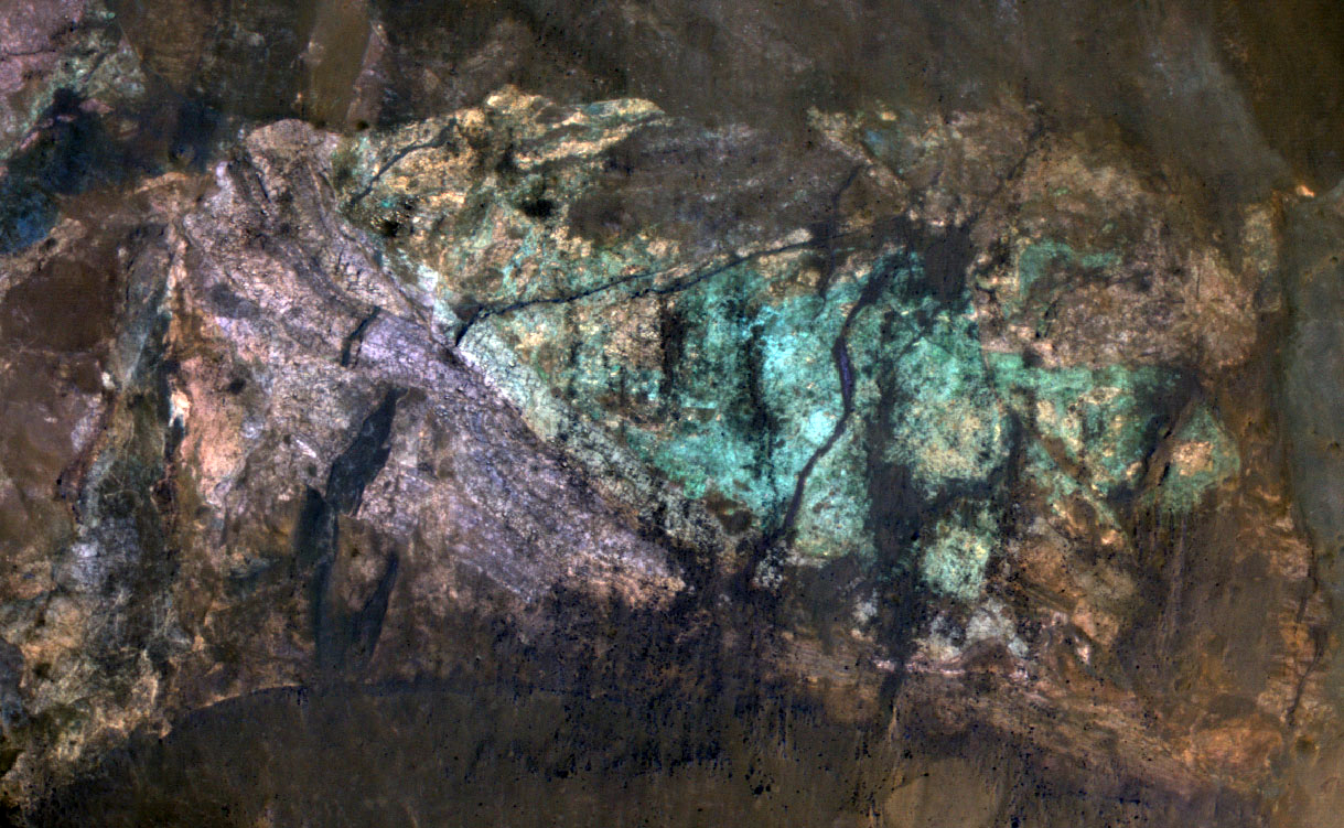
Colorful Central Peak in Noachis Terra


Small impact craters retain their original bowl shape, but once a crater is large enough that the force of gravity on the slopes of the crater wall is greater than the strength of the target material, the wall collapses inward to form a central peak.

On Mars, the transition between simple (bowl-shaped) and complex craters is observed to occur at about 7-kilometer diameter. The formation of central peaks in complex craters brings up material from deep beneath the Martian surface. Therefore, central peaks of complex craters are good places to look for ancient rocks.

The colorful rocks exposed in the central peak visible in this image probably reflect variations in mineral content that were caused by water activity early in Mars' history. The CRISM hyperspectral image that was taken at the same time as this HiRISE image may show evidence for the various types of minerals that presumably are responsible for the colors visible here.

Photo credit: NASA/JPL/University of Arizona

Note: This crater is located in northwestern Noachis Terra, east of Nectaris Fossae and south of Saravan Crater.

Sunday, November 14, 2010

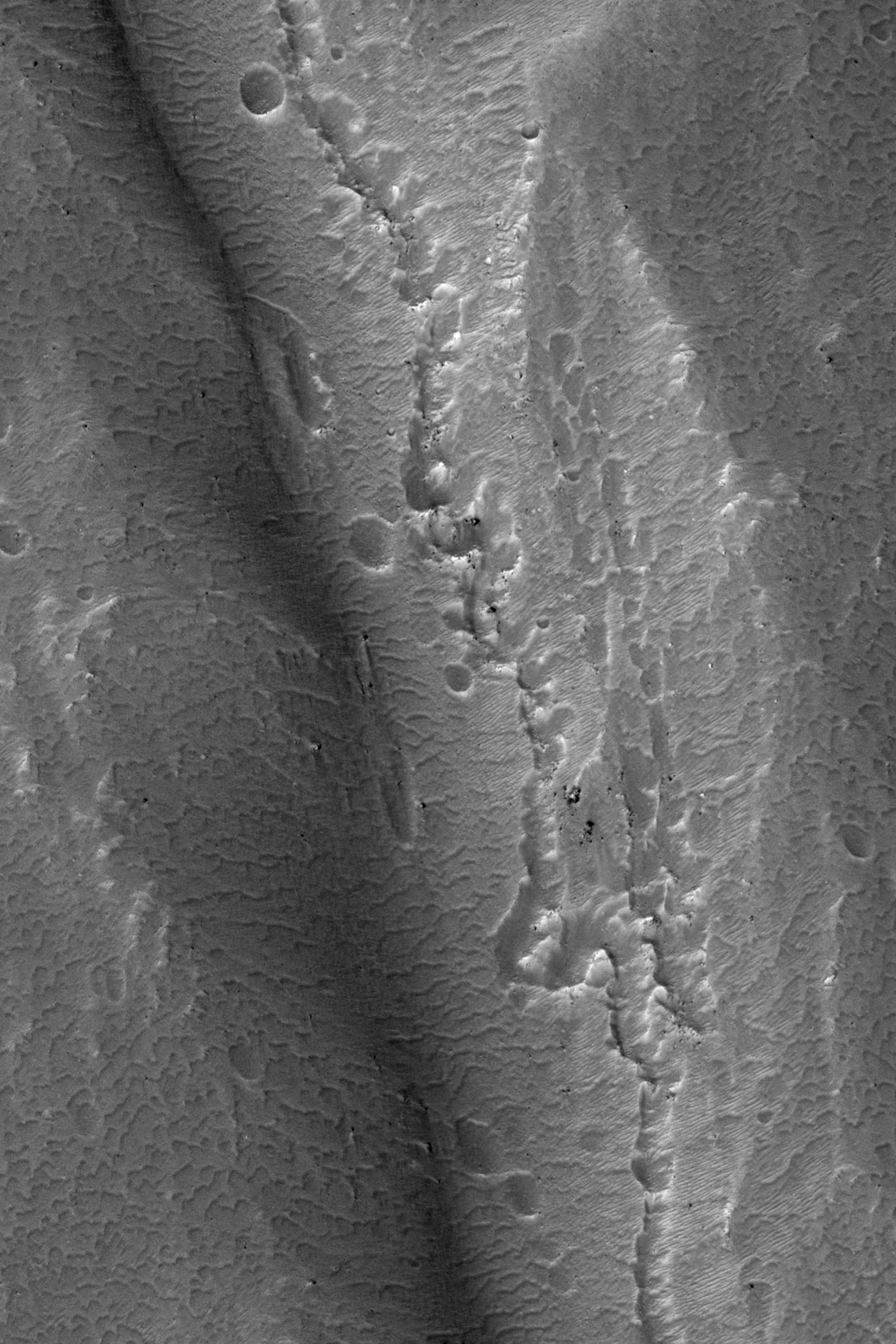
Crater Central Peak


This observation shows a central peak of a large, degraded impact crater in the Terra Sirenum region of the southern hemisphere. Central peaks form during crater formation when a particularly large impactor hits the surface.

The central peak visible here (about 2/3 of the way down the full image) is interesting because it has some fluvial-like features on its south side. At lower resolution, these features appear to be channels with some connecting pits. At higher resolution (see subimage), the features appear to be troughs that are filled with dunes.

What is most interesting is the chain of pits that extends down the center of some of the troughs as seen in the subimage. It is possible that these pits are evidence of subsurface piping or hydrothermal activity. Piping occurs when subsurface water flows through soil, takes some soil with it, and causes the overlying ground to collapse. These fluvial-like features and the connected pits may have formed during a late stage of crater formation when temperatures were suitable for liquid water.

Photo credit: NASA/JPL/University of Arizona

Thursday, October 14, 2010

Moreux Crater Dunes and Central Peaks


Today's VIS image shows some of the dunes of the floor of Moreux Crater.

Photo credit: NASA/JPL/Arizona State University

Note: The "hills" in the upper left corner of the image are actually the central peaks that were formed by the impact that created this complex crater.

Friday, October 8, 2010

Central Peak Crater


As crater size increases, craters become more complex. This moderate size crater contains a central peak, created by rebound of molten material just following the impact.


Photo credit: NASA/JPL/Arizona State University

Note: This crater is located on the northeastern "cape" between Isidis Planitia and Utopia Planitia; it is directly north of the Amenthes Fossae region.

Wednesday, August 11, 2010

Santa Fe Crater Impact Processes


This image covers the eastern half of the 20.5-kilometer diameter Santa Fe impact crater. This moderately sized crater possesses a fluid-like ejecta blanket, which is typically referred to as “layered ejecta.”

The term layered ejecta is used because it is less suggestive then “fluidized,” which suggests that water is involved. There is an ongoing debate as to whether this type of ejecta is formed from ices or fluids in the target, may be a consequence of interactions between the ejecta and the atmosphere,or both.

Sante Fe Crater is located about 150 km south of the Viking Lander 1 site in Chryse Planitia. Because this is a well-preserved impact crater, the high-resolution image here captures several important aspects of larger impact craters in general and large layered ejecta type craters in particular.

The crater is covered in this image from its central peak on the west edge of the image to almost the crater rim on the east side, and north and south onto the ejecta surface beyond the crater rim. The margins of the ejecta that are characteristic of this type of crater are not visible in this observation, but have been imaged by HiRISE (ESP_012795_1995). Parallel ridges of outcrop on the inner slopes of the north and south crater wall are “terraces” of faulted wall rock common to large complex impact craters.

In the north and south quarter of the image, the surface of the ejecta beyond the crater is visible as a rolling and hilly terrain. Throughout the image, and particularly along the base of slopes and scarps there are numerous small ridges. These are dunes, much younger than and unrelated to the formation of the crater.

Santa Fe Crater takes its name from Santa Fe, New Mexico. (The convention for naming craters on Mars states that some craters may be named after towns with populations smaller than 100,000.) During the Viking Landing site selection in 1976, early Viking Orbiter images were acquired of southern Chrsye Planitia near the outflow point of Kasei Valles onto the Chryse plains. In honor of the 200th anniversary of the nation at that time, local craters near the landing site were named after towns important in the Nation’s founding. Santa Fe, was one of the first towns on the continent, so one of the craters was named after the town.

Interestingly, the town of Santa Fe, New Mexico lies just 40 km east of another young 20 km-diameter crater, except this one is not an impact crater, but rather a giant volcanic caldera, the Valles Caldera.

Photo credit: NASA/JPL/University of Arizona