Showing posts with label Chasma/Chasmata. Show all posts

Sunday, December 7, 2014

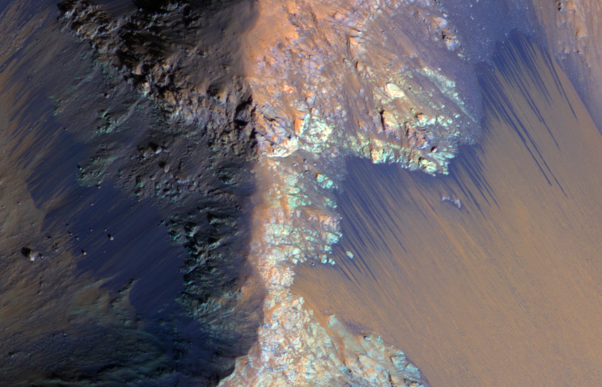
Clays Along the Coprates Chasma Plateau


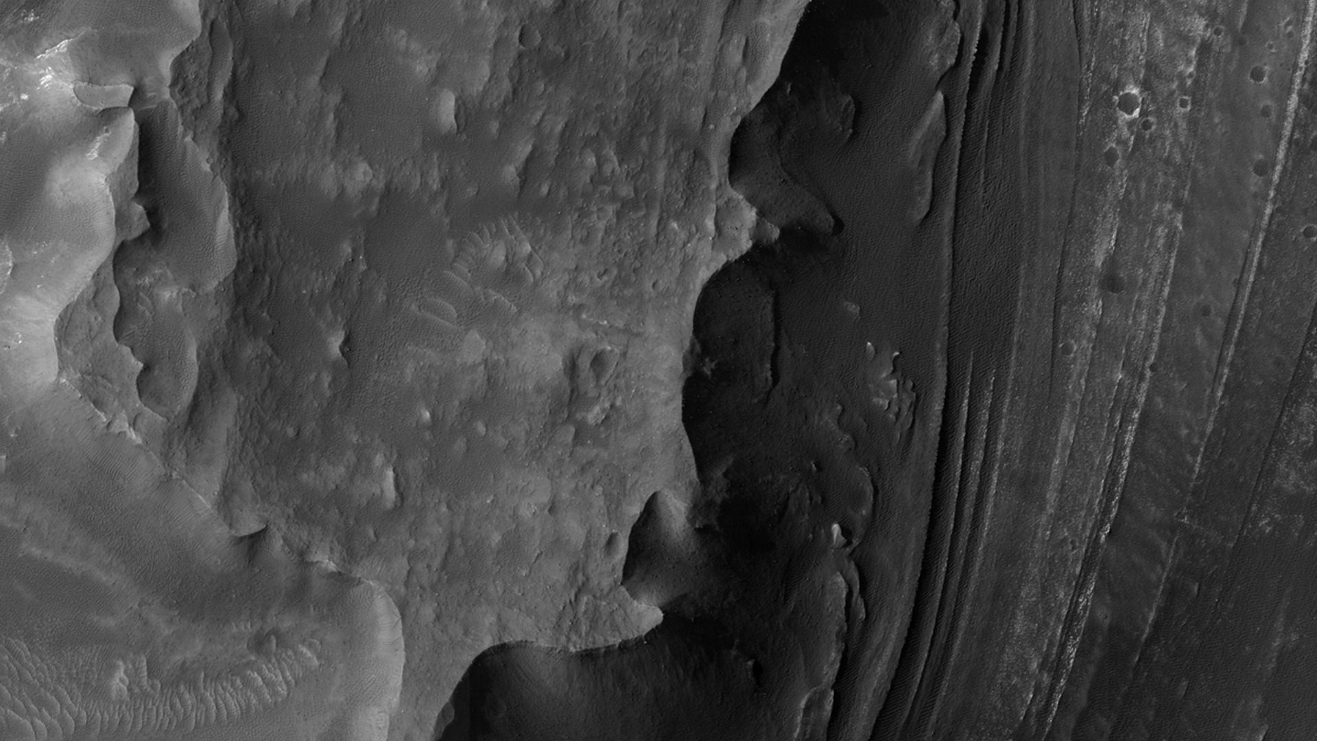
This image shows exposures of deposits along the plateau just to the south of Coprates Chasma.

Whereas Coprates Chasma and many of the other chasmata of Valles Marineris contain kilometer-thick light-toned mounds made up of sulfates, several of the deposits along the plateau have signatures of clays. This indicates that water was here for extensive periods of time to cause the plains to weather and alter into clays.

Image credit: NASA/JPL/University of Arizona

Note: For more information, see PIA18933: Clays along the Coprates Chasma Plateau.

Saturday, November 29, 2014

False Color Tithonium and Ius Chasmata


This false color image of the region including both Tithonium and Ius Chasmata includes a bluish region in both canyons. This may indicate an atmospheric haze. The potential haze appears to be more widespread in Ius Chasma.

Orbit Number: 56524 Latitude: -5.5587 Longitude: 273.654 Instrument: VIS Captured: 2014-09-10 22:30

Image credit: NASA/JPL-Caltech/Arizona State University

Friday, October 17, 2014

Candor Chasma


Today's VIS image shows part of the floor of Candor Chasma.

Orbit Number: 56461 Latitude: -6.12623 Longitude: 290.797 Instrument: VIS Captured: 2014-09-05 18:01

Image credit: NASA/JPL-Caltech/Arizona State University

Thursday, October 16, 2014

Mounds of Layered Material on the West Edge of Melas Chasma


Melas Chasma is the widest segment of the Valles Marineris canyon, and is an area where MRO has detected the presence of sulfates.

This image offers a view of an excellent contact between layered deposits that postdate the formation of Valles Marineris and possible deposits that predate the canyon's formation. The materials are near interior layered deposits that contain sulfates and likely have hydrated minerals. At high resolution, we can have more accurate mapping of the stratigraphic relationships and contacts. Enhanced color can help to differentiate between geologic units and for mapping of sulfates.

Image credit: NASA/JPL/University of Arizona

Note: For more information, see PIA18830: Mounds of Layered Material on the West Edge of Melas Chasma.

Friday, October 3, 2014

Hebes Chasma


This VIS image shows a portion of Hebes Chasma.

Orbit Number: 56299 Latitude: -1.25997 Longitude: 282.713 Instrument: VIS Captured: 2014-08-23 09:56

Photo credit: NASA/JPL-Caltech/Arizona State University

Thursday, October 2, 2014

Tithonium Chasma and Ius Chasma


This VIS image spans from Tithonium Chasma (top of image) to Ius Chasma (bottom of image).

Orbit Number: 56187 Latitude: -6.18316 Longitude: 273.792 Instrument: VIS Captured: 2014-08-14 04:36

Photo credit: NASA/JPL-Caltech/Arizona State University

Saturday, September 27, 2014

Candor Chasma


This VIS image spans Candor Chasma.

Orbit Number: 56411 Latitude: -7.43707 Longitude: 293.113 Instrument: VIS Captured: 2014-09-01 15:12

Photo credit: NASA/JPL-Caltech/Arizona State University

Tuesday, September 16, 2014

Northern Slope of Melas Chasma


Today's VIS image shows part of Melas Chasma.

Orbit Number: 56149 Latitude: -10.2791 Longitude: 290.34 Instrument: VIS Captured: 2014-08-11 01:30

Photo credit: NASA/JPL-Caltech/Arizona State University

Saturday, July 5, 2014

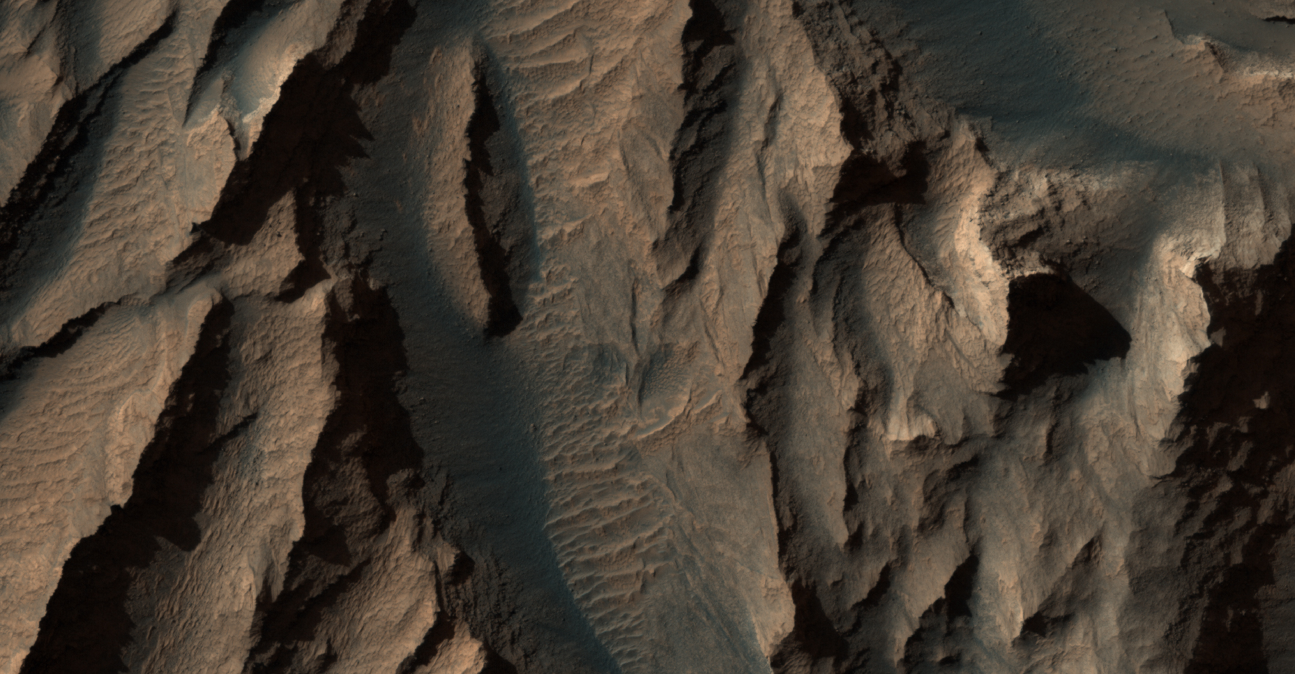
Landslide in Hebes Chasma


This image shows a prominently stratified transect through the rock of a mountain of material in the middle of Hebes Chasma.

The knobby material showing several lineations in the center of the scene may be remnants of landslides that exposed these tall, steep slopes in this image and just off-scene to the west. Mid-way up the slope (and to a lesser extent all the way up to the top) a series of alternating lighter and darker bands can be traced running east-west across the ridges and troughs of the outcrop. Just below this, dark material is eroding off of the slope, moving downhill, and collecting in fans at the base of the cliff.

Exposures of layered rock like these are helpful in determining the types of geologic processes that have occurred at an area over time, and the landslide and fan deposits tell of how the region is being eroded more recently, including today.

Image credit: NASA/JPL/University of Arizona

Friday, June 6, 2014

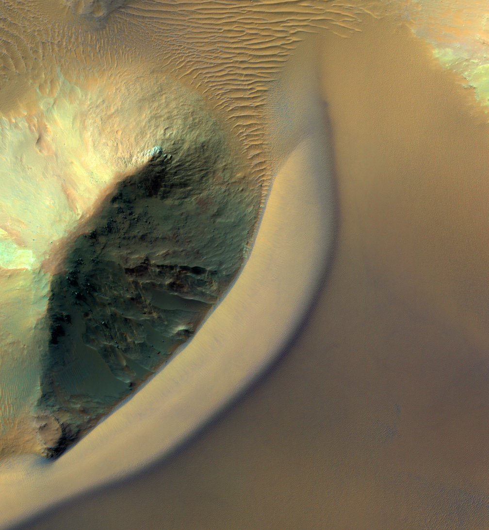
Draa in Juventae Chasma


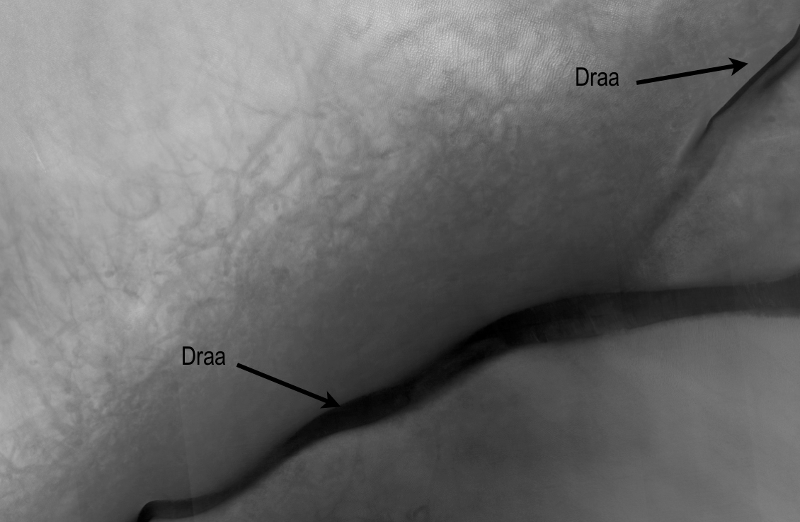
Sandy landforms formed by the wind or aeolian bedforms are classified by the wavelength--or length--between crests. On Mars we can observe four classes of bedforms (in order of increasing wavelengths): ripples, transverse aeolian ridges (known as TARs), dunes, and what are called “draa.” All of these are visible in this Juventae Chasma image.

Ripples are the smallest bed forms (less than 20 meters) and can only be observed in high-resolution images acquired by HiRISE commonly superposed on many surfaces. TARs are slightly larger bedforms (wavelengths approximately 20 to 70 meters), which are often light in tone relative to their surroundings. Dark-toned dunes (wavelengths 100 meters to 1 kilometer) are a common landform and many are active today. What geologists call “draa” is the highest-order bedform with largest wavelengths ( greater than 1 kilometer), and is relatively uncommon on Mars.

Here, this giant draa possess steep faces or slip faces several hundreds of meters tall and has lower-order superposed bedforms, such as ripples and dunes. A bedform this size likely formed over thousands of Mars years, probably longer.

Image credit: NASA/JPL/University of Arizona

Monday, April 21, 2014

Slope Streak in Melas Chasma


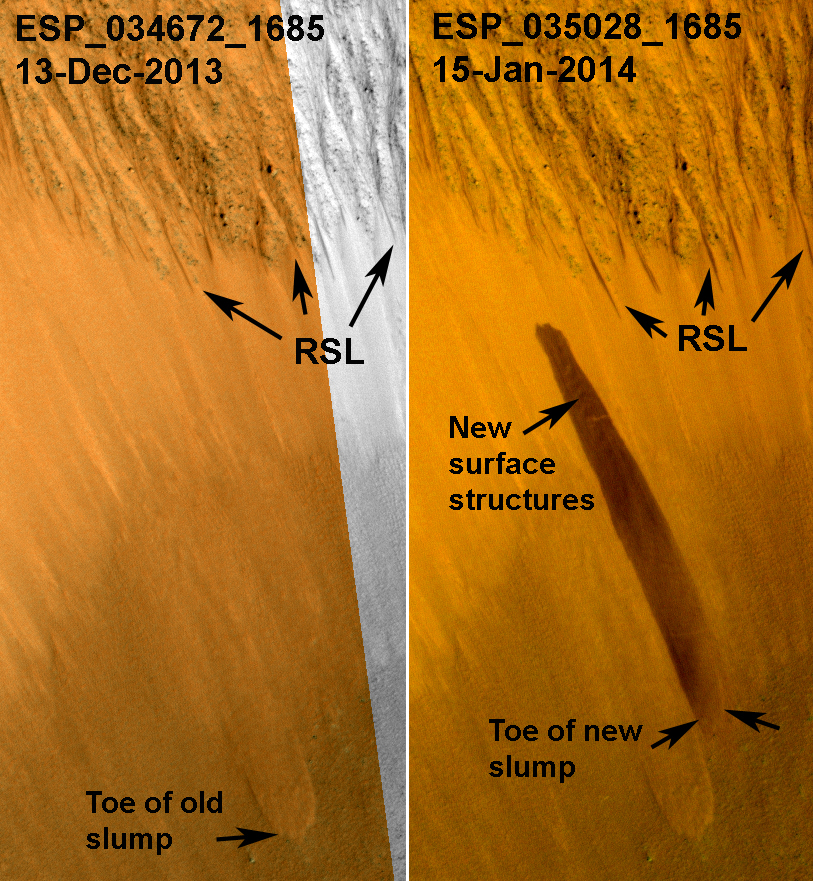
HiRISE has been monitoring the recurring slope lineae (RSL) over the mid-latitude and equatorial regions of Mars. One of these sites is a crater on the floor of Melas Chasma; and an animation shows how the RSL follow the sun, changing slope aspect with the seasons.

In one of our most recent images of this site, there was a surprise: a new dark streak just down slope from the RSL. This new streak is about 18 meters wide, whereas most RSL flows (see closer to the crater rim) are less than 5 meters wide. Closer inspection shows that the dark streak corresponds to a topographic slump, similar to several others visible on this slope.

This is one of the largest topographic changes we've seen in equatorial regions of Mars. We are continuing to monitor this location to see if this streak fades in the same manner as RSL, and to understand its relationship, if any, to the RSL activity. If the RSL are due to seeping water, then saturation of a layer downslope could destabilize the slope and lead to such slumps. We continue to be surprised by new discoveries from the Mars Reconnaissance Orbiter after 8 years in orbit.

Photo credit: NASA/JPL/University of Arizona

Note: For more information, see PIA18224: A Surprise Landslump in Melas Chasma.

Saturday, March 1, 2014

Dunes Streaming Through Hills in Ganges Chasma


This dramatic image show dark rippled bodies of sand, sometimes in the form of dunes, streaming through Ganges Chasma. The floor of the canyon is covered by hills and mesas, perhaps remnants of chaotic terrain that formed from sudden collapse as water was withdrawn to form outflow channels.

The sand moving through (generally from east to west, or upstream) interacts with the topography to make streamlined shapes. A closeup image in enhanced-color shows one hill with a dune piling up to the east.

This is a stereo pair with ESP_033748_1720.

Photo credit: NASA/JPL/University of Arizona

Monday, February 24, 2014

Recurring Slope Lineae in Coprates Chasma


Recurring slope lineae (RSL) may be due to active seeps of water. These dark flows are abundant along the steep slopes of ancient bedrock in Coprates Chasma.

The enhanced-color cutout shows a full-resolution sample. The RSL are most prominent on the bright fans at the base of the bedrock, but actually extend back into the bedrock following small channels. MRO is continuing to monitor key sites to better understand this and other geologic activity on Mars.

This is a stereo pair with ESP_034619_1670.

Photo credit: NASA/JPL/University of Arizona

Saturday, February 22, 2014

Three Faults in Melas Chasma


Melas Chasma is part of the Valles Marineris canyon system, the largest canyon in the Solar System. It has been recently suggested that Melas Chasma may have been produced by an impact crater. To test this idea, HiRISE has been imaging surrounding small faults such as the ones seen in this image.

There are actually three faults in this image. The two trench-like features are called “graben” and are caused when the surface stretches apart and blocks of rock drop downwards. The third fault is the wavy ridge the cuts across both of the graben. This type of fault is sometimes called a “wrinkle ridge” and occurs when surface rocks are compressed causing one block of rock to be thrust up on top of another. So this area has been both stretched in the north-south direction and squeezed in the east-west direction.

With enough HiRISE images scientists hope to reconstruct the full history of this area and uncover the origin of one of Mars’ most spectacular features.

This is a stereo pair with ESP_034817_1645.

Photo credit: NASA/JPL/University of Arizona

Monday, January 27, 2014

Light-Toned Deposits in Coprates Chasma


Valles Marineris contains kilometers-thick light-toned layered sedimentary deposits along many of its floors. In this image, similar light-toned layered deposits are observed, except these are found along steeper wallrock slopes in Coprates Chasma.

Compositional data from CRISM and also stereo images—which we use to create 3D images—can help scientists determine how these sediments were deposited and if they are the same as the thicker deposits seen along the chasma floors.

Photo credit: NASA/JPL/University of Arizona

Sunday, January 12, 2014

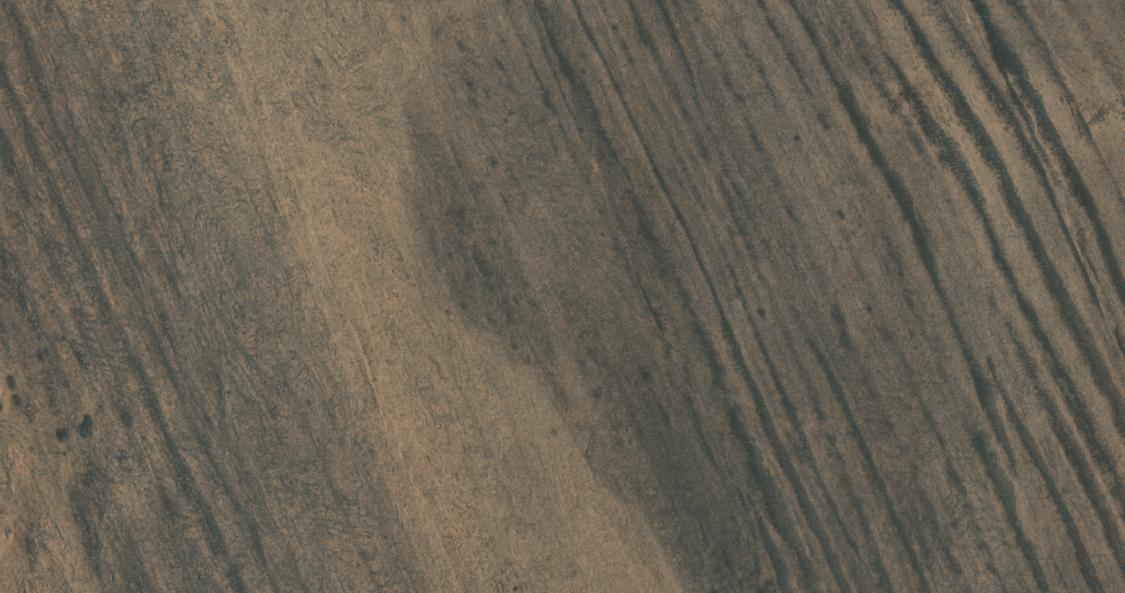
Periodic Bedding in Tithonium Chasma


Earth's seasons are caused by the tilt of our planet's rotational axis to the orbital plane or obliquity. Mars' obliquity is currently about 25 degrees, which is not much different from Earth's 23 degrees. However, numerical calculations by scientists at the Paris Observatory and Massachusetts Institute of Technology suggest that this near-agreement is a coincidence.

Under the influence of gravitational torques from other planets, Mars' obliquity varies chaotically, probably reaching values greater than 60 degrees and lower than 10 degrees. By contrast, Earth's obliquity appears to have been limited to small variations from its current value because of the stabilizing gravitational influence of the Moon. If the calculations are correct, then for most of the Solar System's history, the obliquity of Mars was greater than 25 degrees. This would produce warmer summers and colder winters than on present-day Mars. On Earth, a recent 1 degree rise in obliquity is believed to have triggered ice sheet retreat from the current location of New York City to Greenland. The climatic consequences of 50 degree changes in obliquity on Mars remain unknown.

It is possible, though unproven, that higher obliquity triggered partial melting of some of Mars' water ice. Our best chance at understanding this is to find piles of ice, dust, silt or sand that accumulated over many cycles of obliquity change. Chemical, mineralogical and isotopic variations within those piles could then offer clues to about past climate changes. On Mars, sediment layers of near-uniform thickness visible from orbit are a fingerprint of deposits that record many cycles of obliquity change.

This HiRISE image of an east-facing slope in Tithonium Chasma was taken to follow up an earlier Context Camera image that seemed to show sediment layers of near-uniform thickness. These sediment layers are the dark and light stripes that run diagonally across the center of the observation. In this top-down view, afternoon sunlight picks out subtle east-west trending ridges in the east-facing slope. The dark and light stripes appear to deflect to the east (downslope) across the ridges. To a geologist, this outcrop pattern shows that the dip of the ancient sediment layers is gentler than the slope of the modern hillside. Further analysis of the image may determine whether these layers do record ancient obliquity-driven climate change on Mars.

Photo credit: NASA/JPL/University of Arizona

Sunday, December 15, 2013

Juventae Chasma Topography


Color-coded topography map of Juventae Chasma. White and red show the highest terrains, while blue and purple show the deepest.

The floor of Juventae Chasma sits some 5.8 km below the surrounding plateau. It is filled with sand in the southern part (left), which takes on a smooth appearance, in contrast to the northern (right) part of this image where many blocky rock fragments have slumped down from the chasma walls. Two large mounds of layered material sit inside Juventae Chasma and comprise minerals altered by water.

This region was imaged by the high-resolution stereo camera on ESA’s Mars Express on 4 November 2013 (orbit 12,508), with a ground resolution of 16 ms per pixel. The image center is at about 4°S / 298°E.

Image credit: ESA/DLR/FU Berlin (G. Neukum)

Note: For more information, see Juventae Chasma 3D.

Saturday, December 14, 2013

Tithonium Chasma


The steep northern wall of Tithonium Chasma crosses this VIS image. Landslide deposits from slope failure can be seen at the lower left corner of the image.

Orbit Number: 52610 Latitude: -4.11268 Longitude: 274.623 Instrument: VIS Captured: 2013-10-23 18:45

Photo credit: NASA/JPL-Caltech/Arizona State University

Juventae Chasma Perspective


The largest layered mound in Juventae Chasma is seen here in close-up perspective view. It is about 53 km long, up to 20 km wide and rises some 3.3 km above the surrounding area, comparable to a small mountain range on Earth.

Its surface is etched with grooves carved by strong prevailing winds blowing through the chasma. Layers in the mound consist of sulphate-rich materials, an indication that the rocks have been altered by water.

The mound is a relic of at least 3 billion years of martian history and its layers were most likely built up as lake deposits over time. But ice-laden dust raining out from the atmosphere – a phenomenon observed at the poles of Mars – may also have contributed to the formation of the layers.

This region was imaged by the high-resolution stereo camera on ESA’s Mars Express on 4 November 2013 (orbit 12,508), with a ground resolution of 16 m per pixel. The image center is at about 4°S / 298°E.

Image credit: ESA/DLR/FU Berlin (G. Neukum)

Friday, December 13, 2013

Juventae Chasma


Intriguing mounds of light-toned layered deposits sit inside Juventae Chasma, surrounded by a bed of soft sand and dust.

The origin of the chasma is linked to faulting associated with volcanic activity more than 3 billion years ago, causing the chasma walls to collapse and slump inwards, as seen in the blocky terrain in the right-hand side of this image.

At the same time, fracturing and faulting allowed subsurface water to spill out and pool in the newly formed chasm. Observations by ESA’s Mars Express and NASA’s Mars Reconnaissance Orbiter show that the large mounds inside the chasma consist of sulphate-rich materials, an indication that the rocks were indeed altered by water.

The mounds contain numerous layers that were most likely built up as lake-deposits during the Chasma’s wet epoch. But ice-laden dust raining out from the atmosphere – a phenomenon observed at the poles of Mars – may also have contributed to the formation of the layers.

While the water has long gone, wind erosion prevails, etching grooves into the exposed surfaces of the mounds and whipping up the surrounding dust into ripples.

The image was taken by the high-resolution stereo camera on ESA’s Mars Express on 4 November 2013 (orbit 12 508), with a ground resolution of 16 m per pixel. The image center is at about 4°S / 298°E.

Image credit: ESA/DLR/FU Berlin (G. Neukum)

Note: For more information, see Juventae Chasma Context.