The lava flows in today's image are located east of Olympus Mons.
Orbit Number: 54134 Latitude: 21.153 Longitude: 233.622 Instrument: VIS Captured: 2014-02-26 06:26
Photo credit: NASA/JPL-Caltech/Arizona State University
The lava flows in today's image are located east of Olympus Mons.
Orbit Number: 54134 Latitude: 21.153 Longitude: 233.622 Instrument: VIS Captured: 2014-02-26 06:26

Given their location in the Tharsis volcanic complex, these channels were likely formed by the flow of lava rather than water.
Orbit Number: 54084 Latitude: 20.4294 Longitude: 235.074 Instrument: VIS Captured: 2014-02-22 03:41

The graben in this VIS image is Cyane Fossae. The lava flows are part of the extensive Tharsis volcanic flows.
Orbit Number: 54084 Latitude: 23.9838 Longitude: 235.597 Instrument: VIS Captured: 2014-02-22 03:39

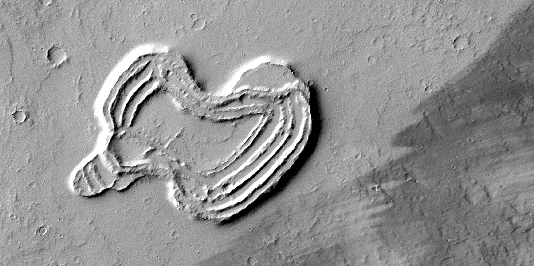
What is this strange-looking feature? HiRISE scientists first noticed it in images from the Context Camera and acquired this picture to investigate more closely.
The feature indeed does look like a heart. It is located south of Ascraeus Mons, which is a large volcano within the Tharsis volcanic plateau, so it is extremely likely that this feature was formed by a volcanic process. The feature rises above the surrounding terrain and we can see concentric ridges on its top. Perhaps this feature is an ancient vent structure (an opening in the ground from which volcanic lava emerges) that has been more resistant to erosion than the surrounding area, so that it resembles “inverted” terrains.
Topographic inversion or inverted terrain often occurs when low areas of a landscape become filled with lava or sediments that harden into materials which are more resistant to erosion than the materials that surround them. Differential erosion then removes the less resistant surrounding material, leaving behind the younger resistant material which may then appear as a ridge where previously there was a valley, or in our case, a butte, where there was once a pit or depression.
Additional imaging of the feature to create a stereo and a digital terrain model may help in further assessing the structure by making accurate measurement of its height and the steepness of its slopes.

The windstreak in this VIS image is located on Tharsis volcanic lava flows east of Olympus Mons.
Orbit Number: 54009 Latitude: 20.7725 Longitude: 237.425 Instrument: VIS Captured: 2014-02-15 23:33

This VIS image shows a small portion of the extensive lava flows created by the large Tharsis volcanoes. These flows are located north east of Ascraeus Mons.
Orbit Number: 53296 Latitude: 16.4472 Longitude: 272.098 Instrument: VIS Captured: 2013-12-19 07:25

Winds have scoured this region south of Olympus Mons.
Orbit Number: 52848 Latitude: 8.2951 Longitude: 226.333 Instrument: VIS Captured: 2013-11-12 10:41

The lava flows in this VIS image are located of the eastern margin of the Tharsis Volcanic complex.
Orbit Number: 52709 Latitude: 3.26702 Longitude: 272.733 Instrument: VIS Captured: 2013-11-01 00:12

The channel in the bottom part of this VIS image was created by lava flow rather than water flow. This feature is located in the Tharsis plains east of Olympus Mons.
Orbit Number: 52423 Latitude: 20.9613 Longitude: 240.14 Instrument: VIS Captured: 2013-10-08 11:01

Significant wind erosion has sculpted these materials located south of Olympus Mons.
Orbit Number: 51824 Latitude: 8.18554 Longitude: 225.7 Instrument: VIS Captured: 2013-08-20 04:26

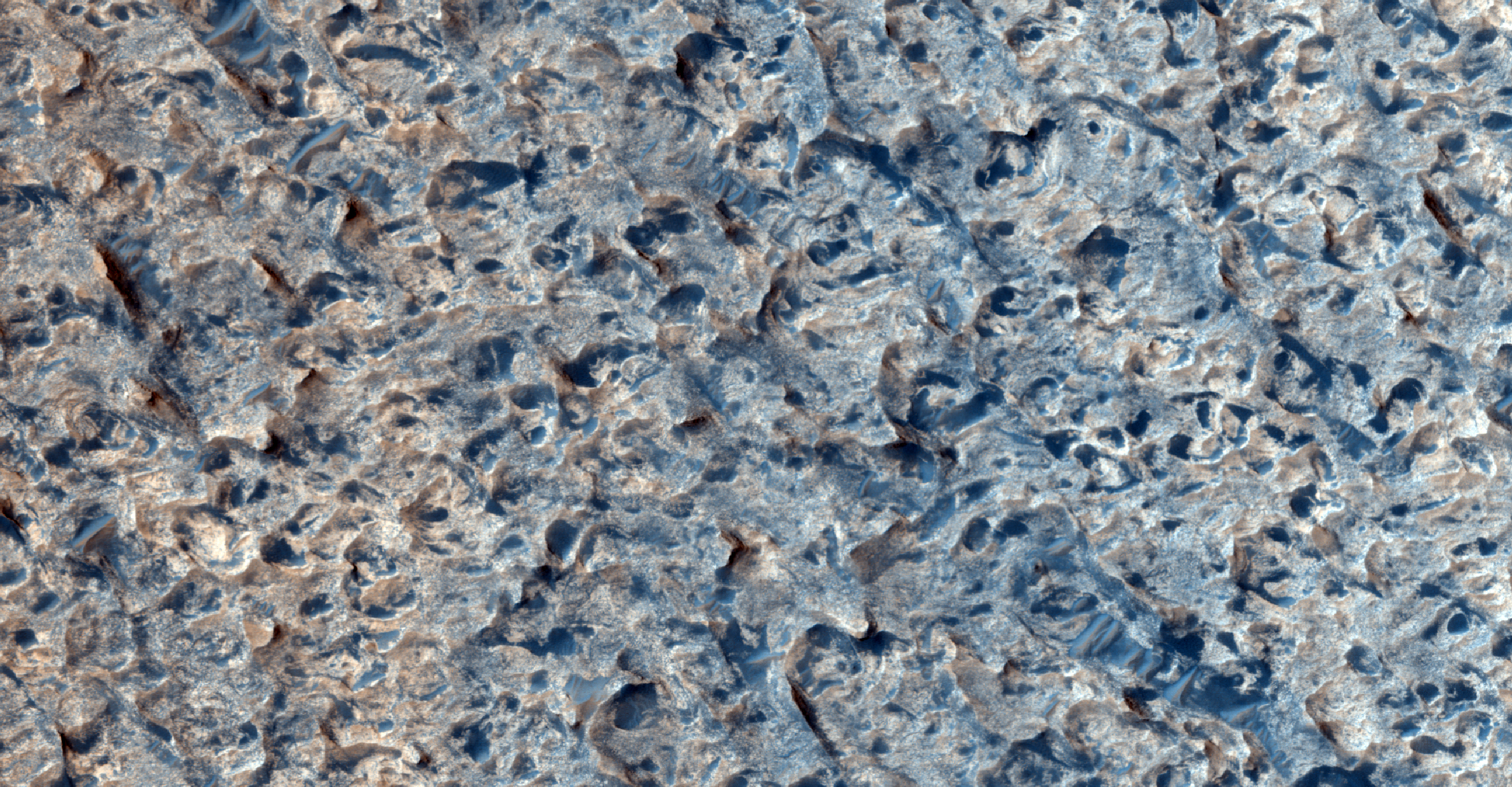
The southern cap rock in Aram Chaos is situated in the Martian equatorial region, to the east of the Tharsis region.
In Ancient Greek, "chaos" meant an emptiness or void, the gap that existed between the heavens and the earth; here, we use the word to describe terrain that is jumbled and "confused." As the image shows us, Aram Chaos is actually a heavily eroded impact crater, with material on the floor that is blocky in contrast to some of the surrounding terrain.
This would be an interesting area to explore and to send a rover, because we think that water might have existed in the underground as ice.

This impact crater is approximately one kilometer in diameter. The ejecta blanket (remnants of the material from the original impact) is still visible indicating that the crater may be very fresh.
But what do we mean by the word "fresh," or even "recent," as some craters are described? When talking about craters on Mars, both terms are relative: the impact that created the crater in this observation could have occurred millions of years ago! We can often differentiate between older and younger craters by looking at their rims. A crater rim that appears more defined or sharp, versus one that is clearly eroded, indicates the former is more recent, or "fresh."
The Tharsis region on Mars is home to some of the largest shield volcanoes on the Red Planet, including the largest, Olympus Mons.
This is a stereo pair with ESP_019140_2310.

The Tharsis region, where this observation is located, contains numerous volcanoes, including the largest one in the Solar System, Olympus Mons. It also contains many tectonic faults such as those visible here in Ulysses Fossae.
The flat-floored troughs seen here are called "graben." They are formed when the terrain gets pulled apart and two parallel fractures form in the bedrock. As the terrain gets stretched apart the block of rock between the two fractures drops downwards.
Graben of different orientations criss-cross each other here, indicating that the terrain was stretched in different directions at different times.
There are also several dark slope streaks throughout this observation.

This channel is located within the Tharsis volcanic flows. It was most likely carved by the flow of molten lava.

This image is of an approximately 5 kilometer (approx. 3.1 mile) diameter crater that is one of the rare examples of a fresh "lunar-like" crater on Mars. The impact crater formed in the Tharsis region, which is the volcanic region on Mars that harbors the great Olympus Mons volcano -- in fact, this crater lies just 150 kilometer (94 miles) from the flanks of Olympus.
Now most really fresh craters on Mars typically have floors with a frothy, pitted deposit on them (see Zumba Crater caption), which possibly suggesting that water/ice was present in the subsurface prior to impact.
This 5 kilometer crater completely lacks such materials. Instead, the crater possess a deposit is generally smooth with some rocks peppered throughout the deposit. This is more similar to observations of fresh craters on the Moon. This distinction from the more typical pitted crater floor deposit may support that the lavas sampled by this crater were low in water/ice or dry at the time of impact. There are some smaller craters superimposed on the floor, which is a sign that the crater is reasonably fresh, but not as recent as other craters on Mars.
There's also a lot of Martian dust in this crater, which often gives geologic forms a somewhat muted appearance, some of that dust and fine-grained material may be the source of the materials that comprise the "sand" ripples in the bottom-half of the subimage.
Note: By "fresh," we are speaking in geologic terms, not something that just occurred.

Arsia Chasmata is the name given to the complex collapsed region at the northeastern flank of Arsia Mons. The collapsed region aligns with the Pavonis and Ascraeus Mons volcanoes, indicating that all three volcanoes are located on a major fracture in the Tharsis region.

This image shows a graben (a trough formed when the ground drops between two parallel faults) and a lava flow in the Tharsis volcanic province of Mars.
Relations like this can be used to establish the relative ages of features on the surface. In this case, the trough cuts the lava flow, indicating that it is younger. If the trough existed when the flow occurred, lava would have spilled into and flooded it before the flow was able to proceed to the north.
Another interesting feature in this lava flow is the trace of a central channel, indicated by two roughly parallel linear features within the flow. After the first lava flowed across this area, the rest of the flow was probably concentrated in this inner channel (most easily seen in the browse image). The channel was still full of lava when the flow stopped, and so the surface is still at the same height as the rest of the flow.

Ulysses Fossae is located in the Tharsis volcanic region. Cross cutting tectonic fractures indicate that this region underwent stresses in multiple directions.

This image covers a pit in the lower west flank of Arsia Mons, one of the four giant volcanoes of the Tharsis region.
Many layers are exposed in the pit, probably marking individual lava flows, and provide information about the nature of the volcanic eruptions. This image was acquired in the middle of large regional dust storms on Mars, but the atmosphere over this image is only moderately dusty because the altitude is 6.5 kilometers higher than the planetary mean, so the air is quite thin and cannot hold as much dust.
Although the atmosphere is not too dusty, the surface is buried by a dust layer meters thick. These high-altitude locations on Mars have thick dust deposits because the thin air cannot blow away the dust, or at least not as fast as it accumulates. On Earth the oceans serve as dust traps, but on Mars, it is the high volcanoes.

This image shows detail of a small volcanic complex in the region of Mars called Tharsis.
Tharsis, a high volcanic region thousands of kilometers wide, hosts some of the largest known volcanoes in the Solar System. The volcanic crater seen here, however, is only about 1 kilometer (0.6 miles) across. This means that Tharsis was covered with volcanic activity at a wide range of scales. The wavy ridges of material seen here are solidified lava flows.
On some flows, a set of narrow parallel ridges, or levees, illustrate how the flowing lava created its own path as it flowed along. Measuring the height and width of these levees and the flows themselves can yield information on the lava's rheology, or how it flowed and moved. In turn, rheology depends on the composition of the lava, among other factors. Knowing how lava moved across the surface of Mars and what it was made of can help scientists determine how similar Mars' volcanic processes were to those on Earth.
In order to facilitate vertical measurements from images, such as the height of these levees, the MRO spacecraft has the ability to roll to its side, allowing the HiRISE camera to take images of a spot on the surface, like these lava flows, from two different angles (on two different orbits). From these two images a stereo image and digital terrain model of topography can be created, much as the separation between your two eyes allows you to view objects in three dimensions. (The stereo pair for this image consists of this image and ESP_018468_1950.)
One factor that will complicate the study of these lava flows is that they are quite old, and thus have been damaged and covered by impact cratering and deposition and removal of material by the wind.