Showing posts with label Ius Chasma. Show all posts

Saturday, November 29, 2014

False Color Tithonium and Ius Chasmata


This false color image of the region including both Tithonium and Ius Chasmata includes a bluish region in both canyons. This may indicate an atmospheric haze. The potential haze appears to be more widespread in Ius Chasma.

Orbit Number: 56524 Latitude: -5.5587 Longitude: 273.654 Instrument: VIS Captured: 2014-09-10 22:30

Image credit: NASA/JPL-Caltech/Arizona State University

Thursday, October 2, 2014

Tithonium Chasma and Ius Chasma


This VIS image spans from Tithonium Chasma (top of image) to Ius Chasma (bottom of image).

Orbit Number: 56187 Latitude: -6.18316 Longitude: 273.792 Instrument: VIS Captured: 2014-08-14 04:36

Photo credit: NASA/JPL-Caltech/Arizona State University

Wednesday, July 17, 2013

Ius Chasma Landslide and Dune Field


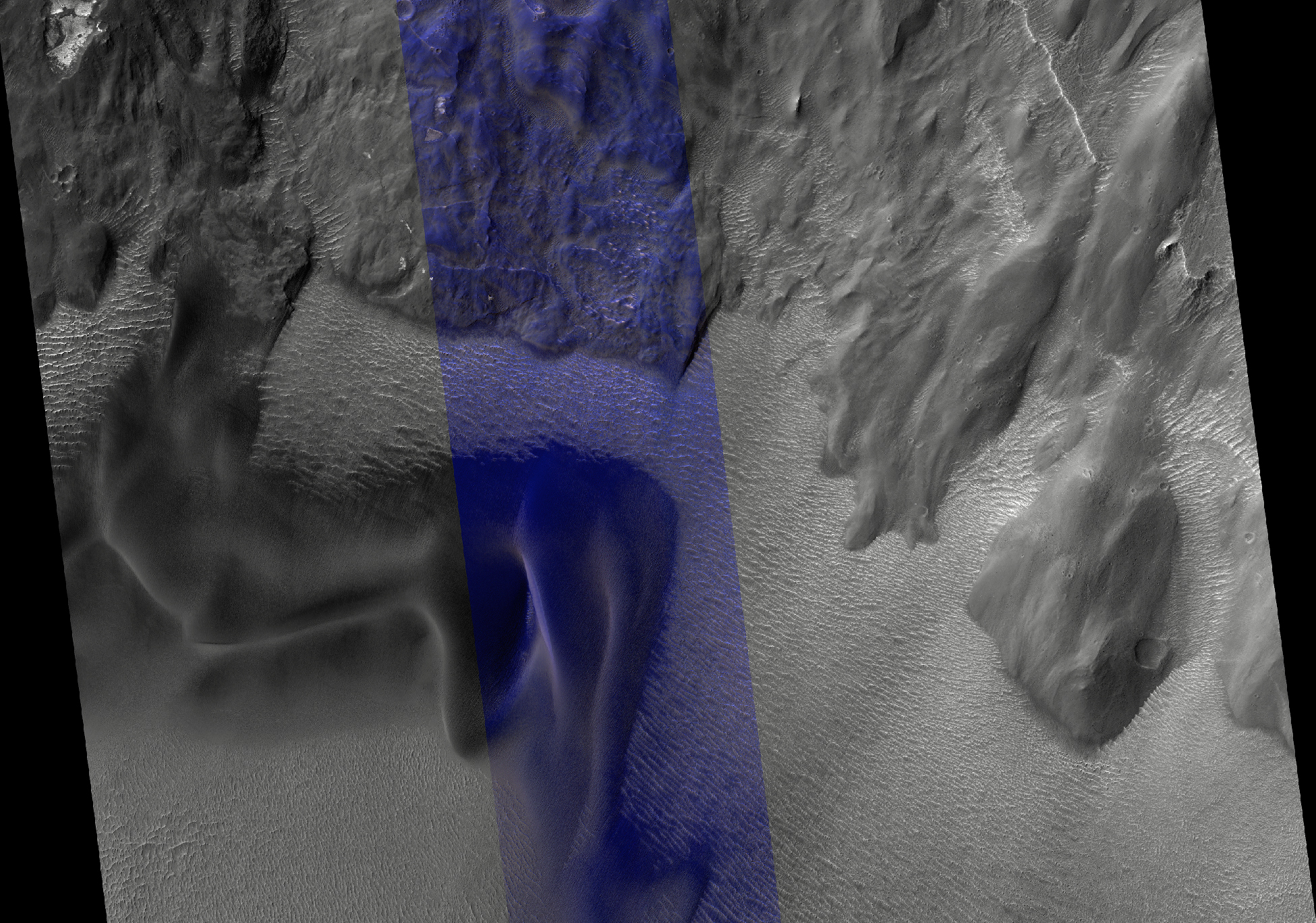
Landslides in Valles Marineris are truly enormous, sometimes stretching from one wall to the base of another. This 45-kilometer-long HiRISE image alone drops nearly 2 kilometers in elevation into Ius Chasma. This landslide, known as Ius Labes, would occupy the surface area of Delaware.

Here, we can see dark-toned material emanating from the landslide scarp and forming dunes and dark streaks that were carried downslope by the wind. Geologic context and compositional information from CRISM suggest this dune field was locally derived from landslide material. Other locations in this image show smaller ripples and smooth, rounded textures of the landslide, both attesting to long-lived wind transport and erosion.

This site records a long and complex geologic history of landscape evolution. This history likely includes: (1) ancient lava flows and ash fall deposits which were deposited horizontally and would eventually make what now is canyon wall material; (2) extensional forces rifted or faulted Valles Marineris; (3) mass wasting ensued where gravity forced weak and dislodged rock down into the canyon as massive landslides or smaller fans of boulders; (4) wind driven aeolian forces took small sand-sized particles to form dunes and ripples observable in this image, while also slowly eroding the landscape and modifying its shape.

Photo credit: NASA/JPL/University of Arizona

Sunday, March 3, 2013

Fault in Ius Chasma


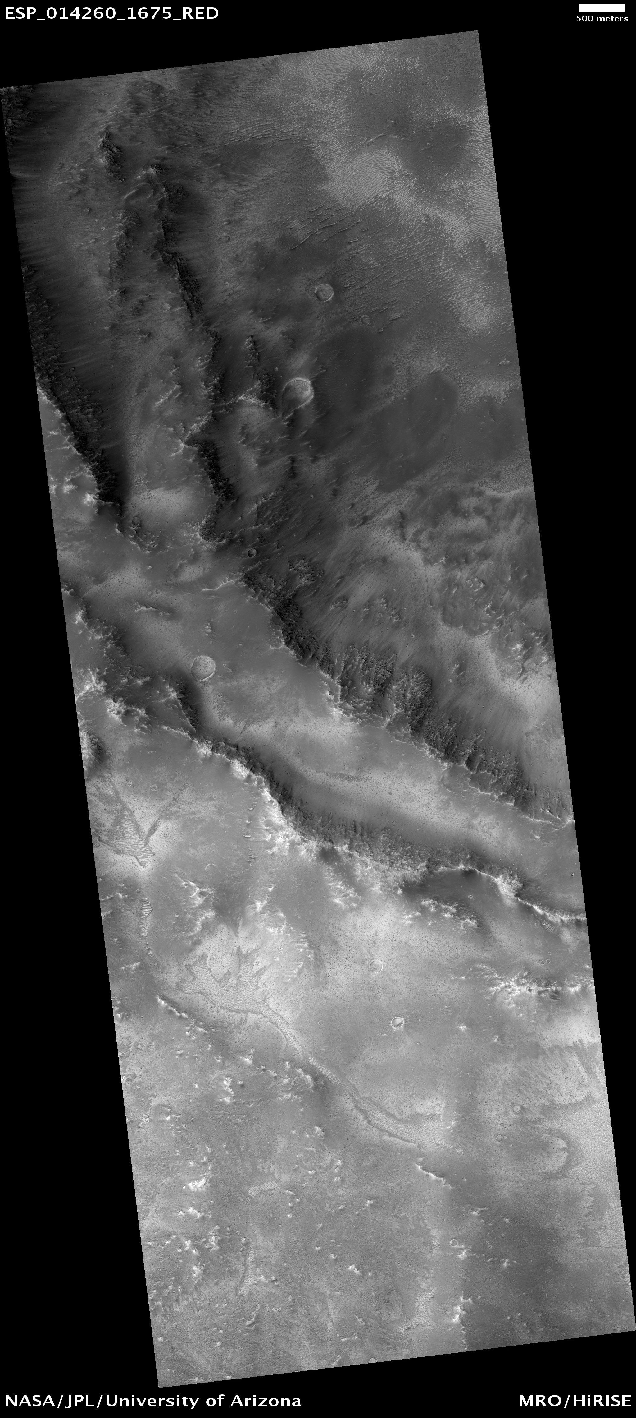
This image in Ius Chasma, a portion of the massive canyon system Vallis Marineris, draws our attention because a fault previously imaged by the Mars Orbiter Camera.

A valley cuts also cuts across the ridge. Is this the result of some tectonic process? A study in 2012 suggested that Mars possesses tectonic plates, but if so, how these processes work is still an area of study.

This is a stereo pair with ESP_017939_1720.

Photo credit: NASA/JPL/University of Arizona

Monday, February 13, 2012

Dunes and Ripples in Valles Marineris


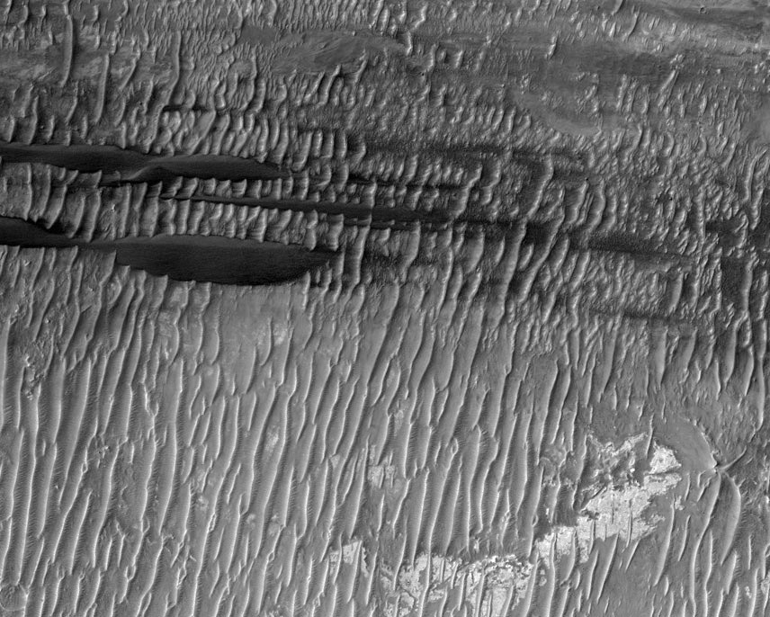
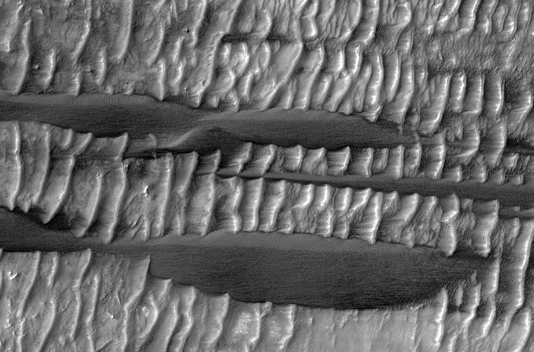
Two types of wind-blown sedimentary deposits are pictured in this scene of the floor of Ius Chasma in the Valles Marineris.

Smaller light toned ridge-like ripples draped over the bright bedrock are visible in this subimage. Long dark sand dunes superpose the small ridges, indicating that the sand dunes formed more recently than the ridges. Earlier observations have shown that the small ridges, known as "transverse aeolian ridges" or TARs, appear to be fixed in place. They are typically found near the equator of Mars, in places where the winds alternate in direction over daily or seasonal cycles.

Detailed investigations by the MER rovers revealed that the TARs were armored by a surface layer of coarse granules left behind after the smaller particles were winnowed away by the wind. These granules are too large to be lifted by the wind and preserve the TARs from further erosion. In contrast, recent HiRISE observations show that many of the dark sand dunes on Mars are actively on the move.

From these facts, we can hypothesize the recent history of the aeolian deposits here in Ius Chasma. Unconsolidated sediments were formed in the canyon by impact fragmentation and erosion of the steep canyon walls. These sediments were eroded and shaped into dunes by the winds that blow up and down the canyon, alternating direction between day and night. Eventually the tireless winds won the battle over sediment supply, and the remaining sediments were sifted into the TARs visible in the image, oriented perpendicular to the length of the canyon (transverse to the winds).

More recently, a fresh supply of sand was introduced into the canyon that the winds have not yet had time to tame. Instead of forming simple crescent dunes, the bidirectional winds have shaped the sand into long linear dunes punctuated by short slip faces. At high resolution, we see that the linear sand dunes are ruffled along their lengths by ripples transverse to the wind directions. Ultimately, most of this sand will be swept away, leaving the TARs trapped behind.

Photo credit: NASA/JPL/University of Arizona

Sunday, January 15, 2012

Banded Wall Outcrop in Ius Chasma


This area was covered in a well-known MOC image of October 1997 (AB1-01303) that shows what appears to be layered rock, deep below the Martian surface.

At the time, this was considered to be revolutionary and seemed to contradict the general view of the upper crust of Mars as being a lunar-like "megaregolith." Later coverage of this outcrop area by MOC is not particularly good and the CTX (Context Camera) coverage doesn't improve on spatial resolution much.

However, experience with other HiRISE images suggests the "layering" will be less obvious at sub-meter-per-pixel scales, but nonetheless we'll see some interesting things. This was thought to be an important area for the development of some post-Viking views of Mars. This underscores how much technology has changed since the 1970s.

Photo credit: NASA/JPL/University of Arizona

Monday, December 19, 2011

Faults in Ius Chasma


Ius Chasma is one of many steep-sided interconnected depressions (chasmata) that comprise Valles Marineris, the largest canyon system in the Solar System.

The chasma is approximately 900 kilometers long and is located in western Valles Marineris. The floor of Ius Chasma is between 8 to 10 kilometers deep and is divided by a prominent east-west trending ridge known as Geryon Montes.

The region in this image is located (approximately 7.8 degrees South, 279.5 degrees East) on the floor of Ius Chasma. A variety of light and medium-toned terrains and layered units of different rock types comprise the chasma floor. Prominent faults of various sizes have displaced and deformed these layered units and outcrops, some in a spectacular fashion.

The ejecta of small fresh-appearing impact craters formed in the light-toned units reveal the existence of a darker (likely basaltic) underlying substrate. Linear dunes are located on top of the lighter-tone outcropping units and are ubiquitous on the chasma floor. These dunes are oriented in a north-south direction and indicate prevailing westerly winds through the canyon.

Photo credit: NASA/JPL/University of Arizona

Saturday, September 24, 2011

Jumbled Terrain in Ius Chasma


This HiRISE image shows a mixture of bright and dark units. The bright units have a mineral called sulfate (salty sulfuric acid) that on Earth typically forms in the presence of water as an evaporite.

The brighter sulfates appear jumbled and folded, sometimes with sharp edges, inside a darker matrix of material. Either the sulfates were deposited this way, such as from a landslide that mixed and messed them up inside the darker material, or the sulfate was disrupted after it was deposited, perhaps from tectonic activity that broke it apart and folded it.

This is a stereo pair with PSP_006652_1725.

Photo credit: NASA/JPL/University of Arizona

Note: This image was taken in Ius Chasma, located roughly half-way between Melas Chasma to the east and Noctis Labyrinthus to the west.

Saturday, August 20, 2011

Los Campos de Dunas en Marte


Las dunas de arena son las características eólicas más extendidas en Marte. Su distribución espacial y morfología, sensible a los cambios de condiciones de circulación del viento, corresponde a las pautas de erosión y deposición y puede determinar la historia de sedimentos del terreno circundante.

De hecho, las dunas están muy adecuadas para los estudios planetarios porque son abundantes en varias elevaciones y terrenos diversos. Por eso, un estudio a escala global de las dunas marcianas puede calificar a nuestra comprensión de dos procesos: clima y sedimento.

Photo credit: NASA/JPL/La Universidad de Arizona

Note: The HiRise team writes captions to their photos in languages other than English. The above caption, for example, is in Spanish. Below is the English translation, a la Google Translate. The dunes themselves are located in Ius Chasma, about halfway between Noctis Labyrinthus to the west and Melas Chasma to the east.

The Dune Fields on Mars

Sand dunes are the most prevalent wind features on Mars. Their spatial distribution and morphology, sensitive to changes in wind flow conditions, corresponds to the pattern of erosion and deposition and can determine the history of sediment from the surrounding terrain.

In fact, the dunes are well suited for planetary studies because they are abundant at various elevations and diverse terrain. Therefore, a global-scale study of Martian dunes can qualify our understanding of two processes: climate and sediment.

Thursday, July 8, 2010

Crater Intersecting Wrinkle Ridge


“Wrinkle ridges” are topographic structures produced by subsurface faulting; they are commonly found on both the Moon and Mars.

This image shows a site where a wrinkle ridge intersects a crater; the ridge is a large feature and extends well outside this observation. The spur just inside the crater rim is roughly in line with the wrinkle ridge structure, and probably represents enhanced crater collapse along the fault line.

An alternative possibility is that this spur was created by movement of the wrinkle ridge fault after the crater formed, but this is unlikely because the outer rim of the crater is not cut. Observations like this help constrain the relative timing of events on Mars.

Photo credit: NASA/JPL/University of Arizona

Note: This crater is located in Sinai Planum to the south of Ius Chasma.

Saturday, May 29, 2010

Ius Chasma


Large landslide deposits dominate this VIS image of Ius Chasma. Dunes are visible at the bottom of the frame.

Photo credit: NASA/JPL/Arizona State University

Saturday, May 1, 2010

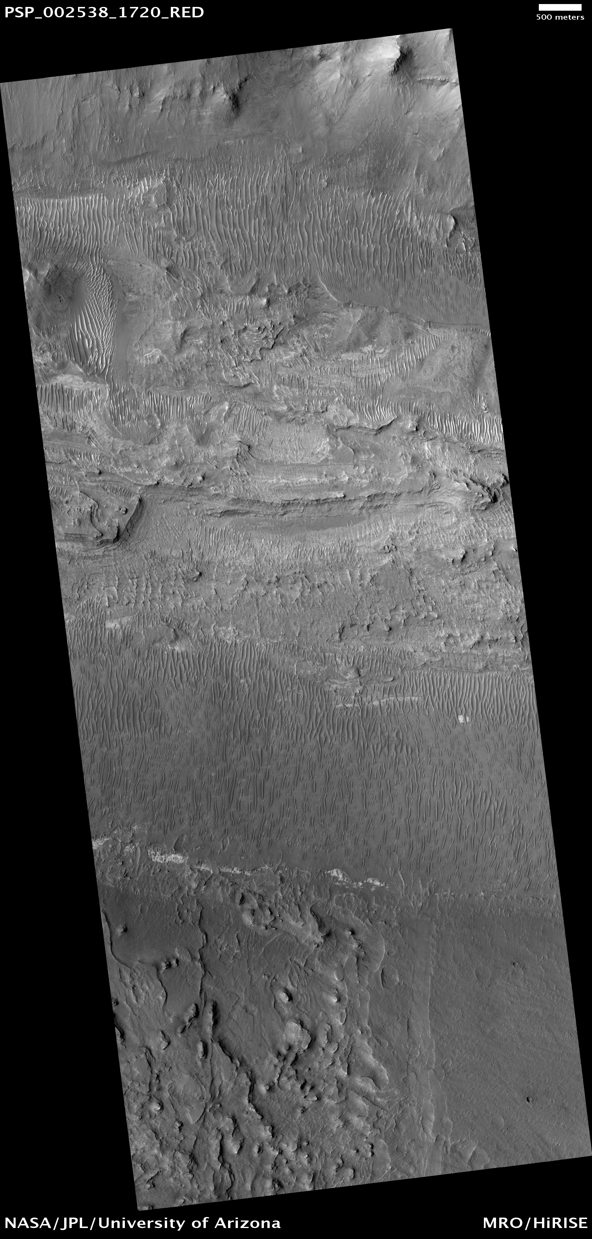
Floor of Ius Chasma


Ius Chasma is one of several canyons that make up Valles Marineris, the largest canyon system in the Solar System.

The canyons likely formed by extension in association with the development of the Tharsis plateau and volcanoes to the west. Wind and possibly water have modified the canyons after they formed.

This observation shows the floor of Ius Chasma. The floor is bounded to the north and south by higher standing wallrock, with a few exposures of wallrock seen in the north (top) of the picture. Much of the floor is covered by ripples that are oriented approximately north-south, indicating an east to west wind flow, parallel to the orientation of Ius Chasma.

Layered deposits and bright patches of material are also seen along portions of the Ius Chasma floor. The layered deposits appear distinct in morphology from the nearby wallrock. These layered deposits could be lava flows, sediments deposited in a former lake, or fines that settled out from the atmosphere over time, such as dust or volcanic ash.

The bright outcrops visible further south in the image have been seen elsewhere in Valles Marineris as well as other locations on Mars and tend to have mineral signatures consistent with sulfates. Data from the CRISM instrument (also on Mars Reconnaissance Orbiter) of the composition of these bright patches in Ius Chasma could shed insight into their origin.

Photo credit: NASA/JPL/University of Arizona