
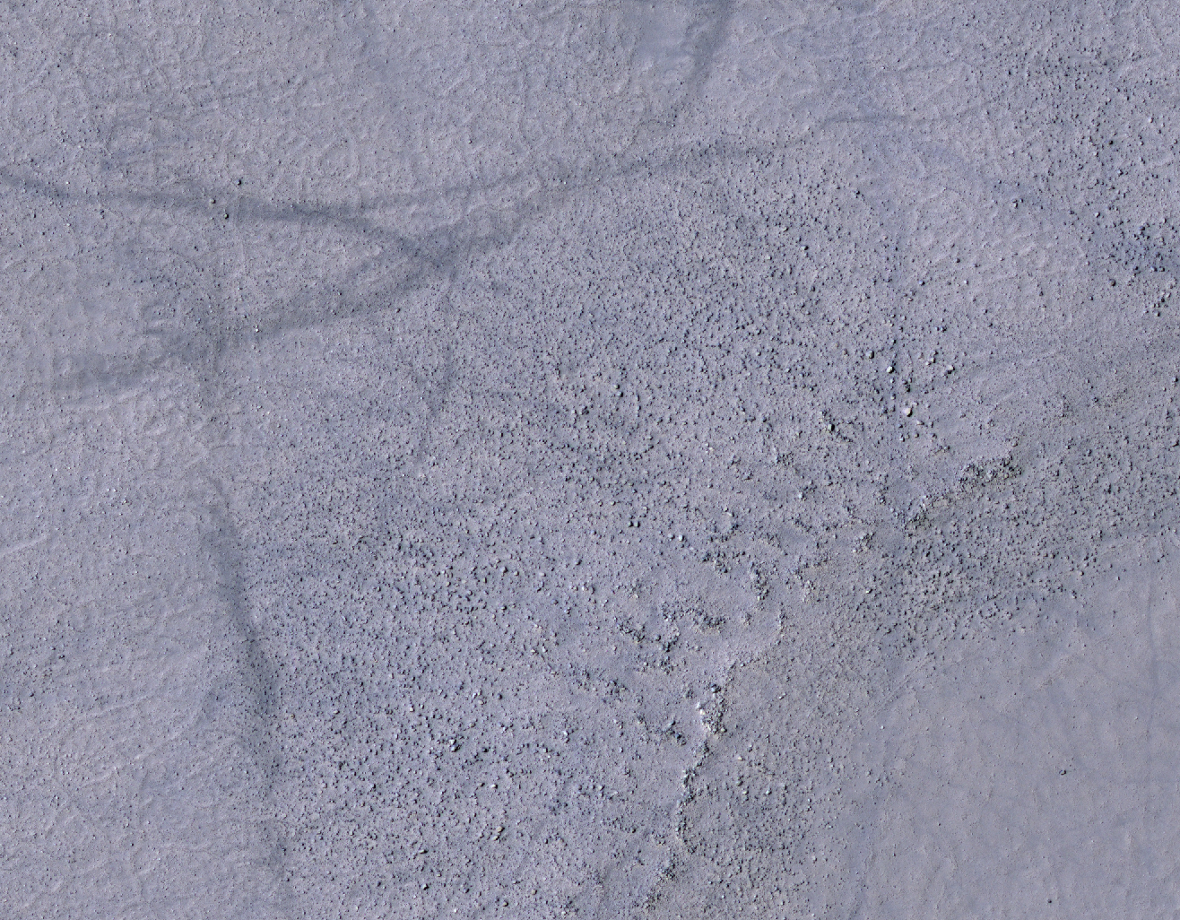
A small channel enters this unnamed crater in Arabia Terra. There appears to be a small fan or delta formed where the channel meets the crater floor.
Photo credit: NASA/JPL/Arizona State University
A small channel enters this unnamed crater in Arabia Terra. There appears to be a small fan or delta formed where the channel meets the crater floor.

During the long dark night of Martian winter at the South Pole, carbon dioxide in its solid form (also known as "dry ice") accumulates and forms a seasonal polar cap.
As the Sun comes up in the spring, the ice evaporates in a complex way. This observation shows dark dust being blown across the seasonal south polar cap. The dust comes from the surface beneath the ice: it either starts at spots bare of ice, or it's possible that it's lofted from below the ice in geyser-like plumes.
Local winds blow the dust from its source, forming a long fan. When the wind changes direction, a new fan is formed pointing in the new direction In this single image we can see that the wind has blown in a number of directions. This data will be used to study weather patterns near the South Pole.

This VIS image shows are region of lava covered plains east of Olympus Mons. Winds are common in the area and have created windstreaks downwind of craters in the region and on the lava flows.

HiRISE captured this image (in 2007) of an eroded mesa made famous by its similarity to a human face in a Viking Orbiter image with much lower spatial resolution and a different lighting geometry.
Compared to the original Viking image, HiRISE shows incredible detail, even from 300 kilometers above the surface.

In this image of dunes near the north pole of Mars it appears that small individual dunes are coalescing into larger dune forms.

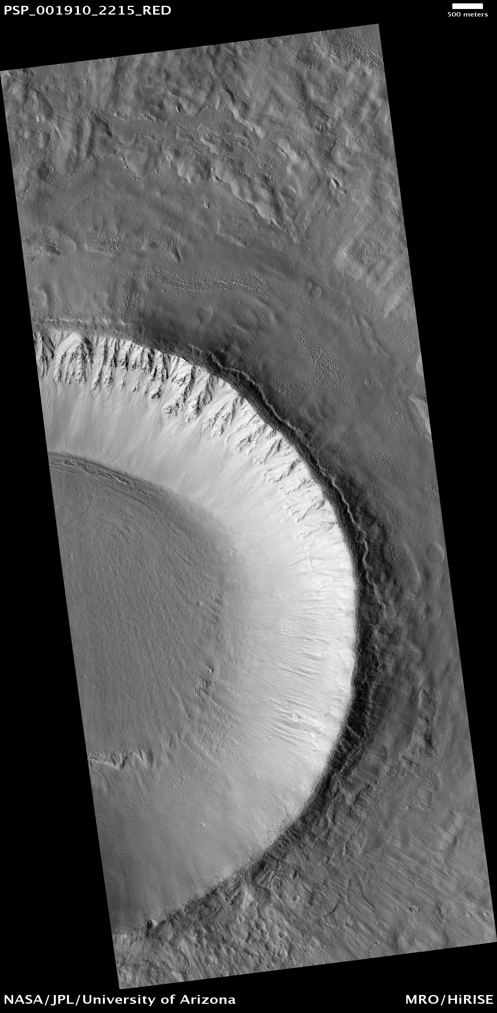
This image shows part of the southern wall region of Asimov Crater (centered at -47S, 5E) in Noachis Terra, located west of Hellas Planitia. This ancient crater displays an intriguing large trough-shaped feature (a.k.a. Noachis ring trough) that encircles the entire inner crater wall.
In this image, the northern slope exhibits crisp-appearing gullies that appear to have sourced from jumbled, gravelly indistinct regions. Some tributaries seem to originate in fractured bedrock. The tributaries coalesce forming sinuous gullies that dissipate into the trough floor deposits. Frost or ice covers much of this south facing slope. In contrast, the south wall of Asimov Crater seems to lack the pristine gully morphology evident on the trough slope to the north, but contains more distinct rock layers near the rim. Gullies on the upper crater wall exhibit more of a debris chute morphology likely formed by the persistent erosion of the southern rim. These gullies coalesce into more channelized forms across the lower reaches, creating fans of sediment and debris before terminating on the crater floor below.

Sand dunes cover the floor of this unnamed crater in Terra Cimmeria.

Candidate landing site in Acidalia Mensa for future Mars missions.

Dark slope streaks mark the rim of this unnamed crater in Terra Sabaea.

This observation shows an unnamed impact crater located in Utopia Planitia; this crater is more than 10 kilometers (6.25 miles) in diameter and 700 meters (765 yards) deep. Different features in and around this crater may indicate fluid beneath the surface.
Linear features radiating outward from the crater's rim are evident in the upper right and lower right parts of the full image. Closer examination shows these features are formed by rocks and finer soils that are located along a straight line; they are "spokes" produced immediately after the impact by very fast outward-moving materials ejected from the impact.
Because these ejecta came from deep under the crater, their composition will tell us what type of rocks are under the surface.
An MOC context image of this crater shows its ejecta materials form an elevated "pedestal," shaped like a pancake. The pedestal is approximately 20 km (12.5 miles) in diameter. "Pedestal craters" such as this may have formed because ice beneath the surface melted when the impact occurred.
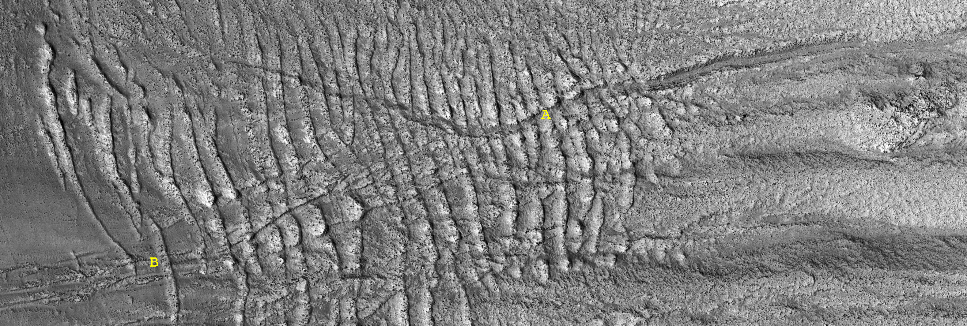
This subimage shows a portion of the west-facing slope inside the crater; upslope is to the right (East). In this subimage, East-West channels, some of them 6 meters (6.5 yards) wide, cut into the slope's soils.
It is not clear if these channels were carved by dry landslides or by a fluid. The channels cut across relatively older, rock-rich, elongated ridges (e.g., location labeled "A" in the subimage) that are approximately perpendicular to the slope. By contrast, in location "B" relatively younger ridges are on top of channels, some of which have dunes in their floors.
Elsewhere in this crater, ridges transition laterally to ripples and fissures of similar orientation. One possible explanation for these ridges, ripples, and fissures could be creep. Creep is slow downhill movement of slope soils that are held together somehow, maybe cemented by ice or some other agent. From the cross-cutting relationships seen in this subset, we infer there may have been several alternating episodes of creep and channel formation.

The small, dark features in this VIS image are sand dunes. The majority of the dunes appear to be located within eroded deposits on the floor of Pasteur Crater.

This image spans the floor and two walls of a pit in Noctis Labyrinthus, a system of deep, steep-walled valleys on the western edge of Valles Marineris.
The valleys themselves are tectonic features known as graben - trench-like features that form in response to extension (or stretching) of the crust. In the case of Noctis Labyrinthus, volcanic activity in the Tharsis region may have formed a bulge, which then stretched and fractured the crust above it.
HiRISE has taken many images (ESP_016845_1715, ESP_015922_1720, PSP_009474_1705 to name a few) in Noctis Labyrinthus to examine the light-colored layers on the valley floors, which may contain hydrated minerals (minerals with water bound in their molecular structure). This image was intended to look for any changes in the light-toned layers present in PSP_005400_1685, which was taken one Mars year (about two Earth years) earlier.
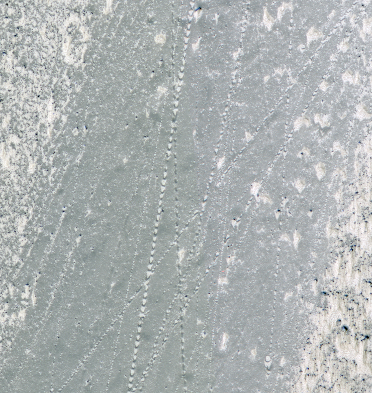
The subimage focuses on one of the pit walls, where numerous boulder tracks criss-cross each other in a large patch of smooth, dust-covered terrain. Boulders leave linear patterns in the dust as they tumble down the steep slopes.

This unnamed crater in the far northern lowlands contains a sand sheet with dune forms on its floor. Many craters this close to the pole contain similar dune fields.

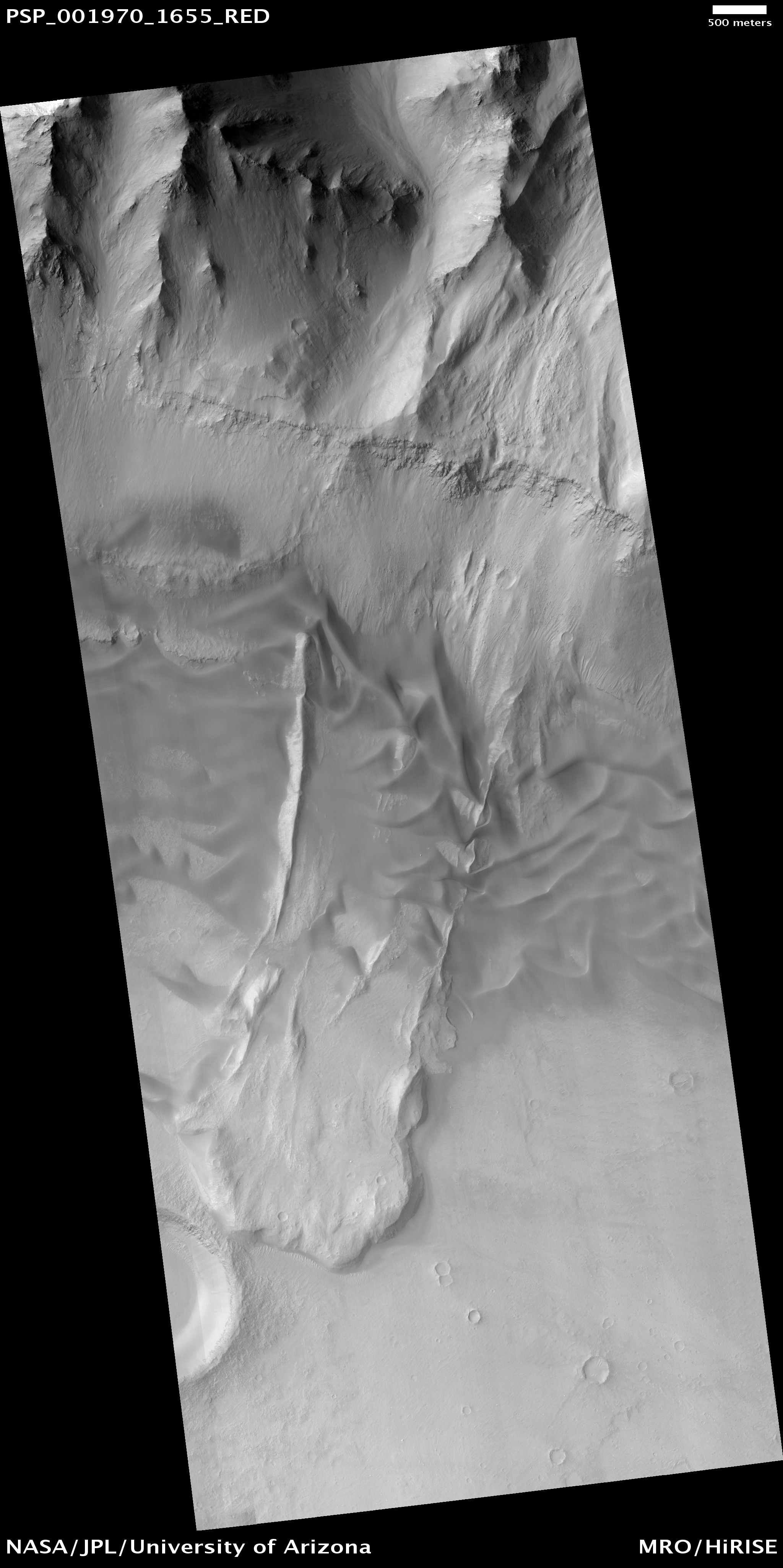
This observation shows a landslide in the Coprates Chasma region of Valles Marineris that occurred when a large unstable area of rock broke away from the cliffs along the top of the image.
This mass of falling rock broke into many small pieces as it slid downhill and came to rest at the base of the cliff, forming the lobate (curved) mound in the lower part of the image.
The smooth textured ripples that are in the central part of the image are sand dunes. Sand dunes form as wind-blown particles roll across the surface and accumulate. Since the air on Mars is very thin, sand dunes take much longer to form on Mars than they do on Earth. The presence of large sand dunes, along with many small impact craters, on top of this landslide indicates that movement of the slide occurred a very long time ago, perhaps hundreds of millions of years.
This landslide was probably caused by a strong earthquake. A nearby meteorite impact may have generated an earthquake that was sufficiently strong to cause this landslide. Alternatively, movement along nearby faults may have triggered the landslide.
The Valles Marineris region is cut by many faults and in fact contains many more landslides such as this one. Some scientists believe that these landslides represent a record of earthquake activity in this area. Understanding the history of earthquake activity in the region may help scientists to predict the likelihood that such earthquakes occur on Mars today.

Sand dunes form large fields, called ergs, around the north polar cap of Mars. This image shows a region of dunes at the cap margin.

This observation shows a mesa within Coprates Chasma, a large trough in the Valles Marineris canyon system. Multiple layers, some only a few meters in thickness, are visible on the slopes descending from the edges of the flat-topped mesa.
The layered rocks could have formed from volcanic, lacustrine, or aeolian sediments that were deposited in portions of the Valles Marineris trough. Variations in the brightness of the layers may represent compositional differences. In particular, the slopes contain a prominent layer of dark material that is seemingly composed of materials more resistant to erosion than the overlying brighter layers.
Dunes and ripples are also visible on the top of the mesa.

Both polar caps on Mars are composed of many layers of ice and dust. This VIS image clearly shows the layering of the North polar cap.

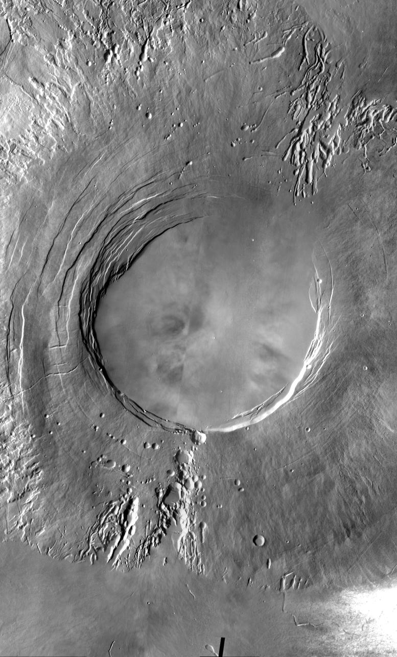
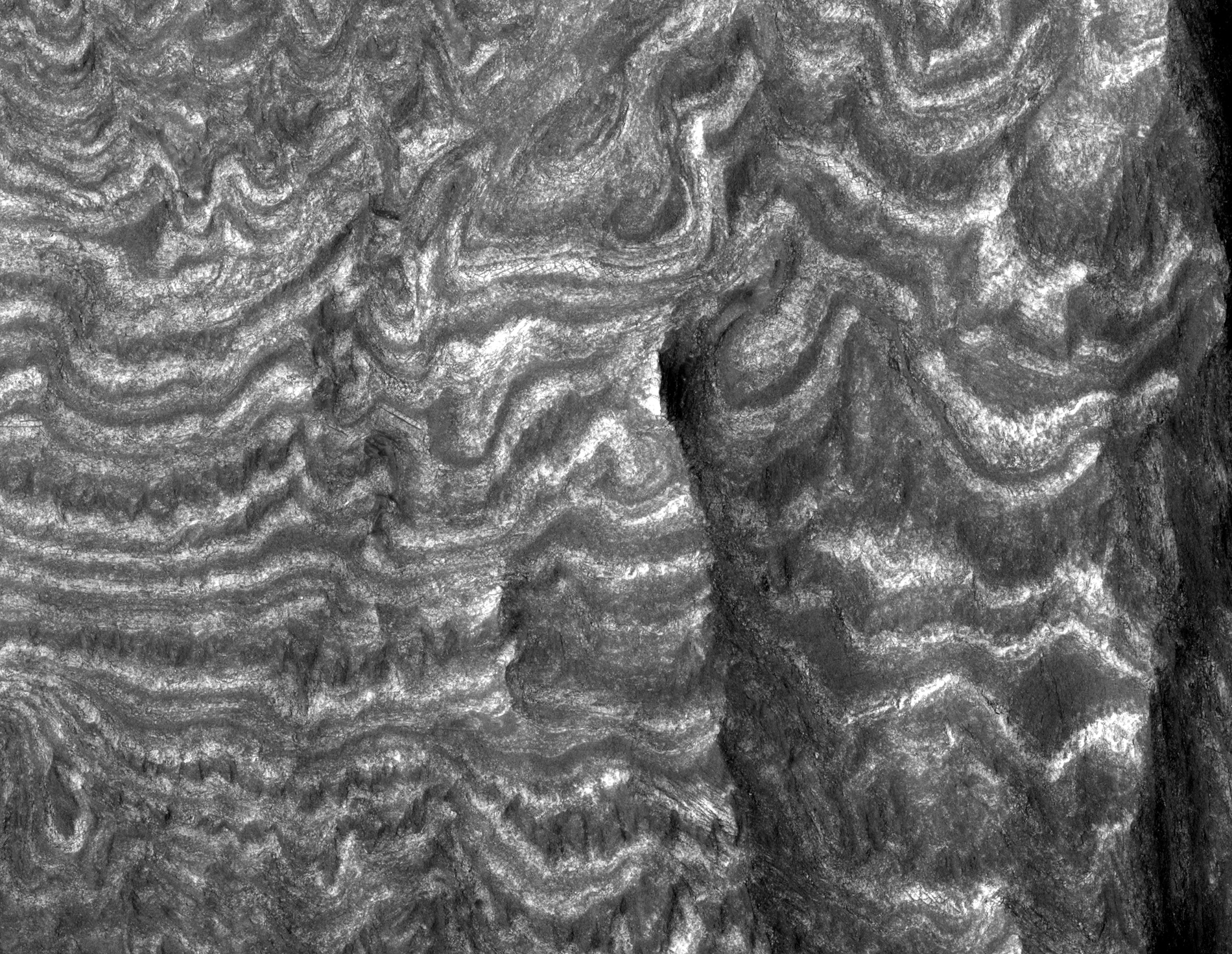
This HiRISE image shows part of the central uplift of Moreux Crater, at about 42 degrees North of the equator.
In several parts of the image, the underlying topography appears mantled by a later deposit. This appears mostly in topographic lows and has lineations which suggest that it has flowed downslope, indicating that this mantle may have been ice-rich.
In one point near the center of the image, some of this material appears detached in a local topographic minimum; however, this patch is still lineated. North of the image center there are several patches of dark material which appear smooth at low resolution (zoomed out). A closer look reveals that these areas are broken into polygonal patterns, which may be due to stresses created by temperature variations. Such polygons often indicate the presence of ground ice near the surface.
Sites like this provide a wealth of information about processes affecting the the surface of Mars.

A sand dune field is located on the floor of this unnamed crater in Terra Cimmeria.

This image shows a portion of a relatively bright landform named "White Rock" on the floor of Pollack Crater in the Sinus Sabaeus region of Mars.
Data from the Mars Global Surveyor Thermal Emission Spectrometer (TES) indicates that this landform is not anomalously bright, relative to other bright Martian regions. Further, the apparent brightness seen here is due to contrast with other materials on the crater floor.
Dunes and ripples are visible in the dark material between the bright ridges. Their orientations appear to be influenced by wind directionally channeled by the ridges. Material appears to have been shed from the white landform and deposited on the darker bedforms indicating that the light-toned outcrops break down into fine materials.
Its high albedo and location in a topographic basin have led to suggestions that White Rock is an erosional remnant of an ancient lacustrine evaporite deposit. Other interpretations include an eroded accumulation of compacted or weakly cemented aeolian sediment.

Nili Fossae, a series of tectonic fractures, is the low region on the right side of this image. A small channel is visible draining into the large tectonic depression.

This observation shows a portion of Nanedi Valles, an equatorial Martian valley network.
Valley networks are thought to have formed by groundwater sapping either in conjunction with an ice layer to cover the running water or during a past warmer, wetter climate regime on Mars. Glacial activity has also been proposed to form the valley networks.
Groundwater sapping is the leading theory because of the morphology of the valleys. They commonly have approximately constant width along their reaches, as seen here, as well as theater shaped heads, as seen in the tributary valley in the bottom right of the scene. The meandering nature of valleys suggests persistent or repeated flow as required to form meanders in streams on Earth.
The subimage shows a potential remnant channel seen on the floor of Nanedi Valles just below the center of the image. If this is a remnant channel, it suggests that there was either repeated or waning flows in this valley. Winding dunes and abundant impact craters are found throughout the valley, as well as within this putative channel.
Dunes are thought to be transient features on Mars, although no movement has been detected to date. It is interesting to note that some of the dunes are superposed by craters indicating that the dunes were stable long enough for craters to form and not be erased.
It is possible that the craters on top of the dunes are secondary craters that formed as a product of a larger impact. Secondary craters from a single impact are clustered in space and form almost simultaneously, implying that the dunes were stable for a time period — long enough for a single crater, rather than multiple craters, to form.

The region southwest of Olympus Mons is covered with materials that have been eroded by the wind. Surface materials in this area indicate wind action in many different directions.

A northern mid-latitude scene consisting of craters, intercrater plains, and mantled material is visible in this HiRISE image.
The mantled material seen here covers much of the middle latitudes in both hemispheres of Mars; it has been visibly removed in some locations. It's called "mantled" because it looks as if it's just draped over, or mantling, the topography underneath.
The mantled material is what causes the craters to have a muted, softened appearance. It's thought to be ice-rich material deposited in a climate different from that of today.
The mantled unit is dissected here, meaning that is not pristine and has likely undergone modification since it was originally laid down. The intercrater plains have a pitted texture full resolution thought to be caused by water ice sublimating and leaving depressions behind.
Unlike that of Earth, the obliquity (tilt of the planet's rotation axis) of Mars changes wildly. Earth has the Moon to keep its axis stable, but Mars' satellites, Phobos and Deimos, are not massive enough to do the same.
Today Mars' obliquity (25.19 degrees) is similar to that of Earth's (23.45 degrees), but this has not always been the case. As the obliquity changes, the portions of Mars that receive the most sunlight shift. During periods of high obliquity, polar regions receive the most sunlight. This causes polar ices, including water ice and carbon dioxide ice, to sublimate (evaporate) into the atmosphere. They would then potentially be re-deposited in the mid-latitudes, similar to where this image is located. It is believed that this process is responsible for the mid-latitude mantled unit.

This VIS image of Daedalia Planum shows various lava flows from Arsia Mons.

Candidate landing site in Antoniadi Crater for future Mars missions.

This observation shows a glacier-like flow in a depression in the flanks of Arsia Mons.
Arsia Mons is one of the large Martian volcanoes that sits near the equator on the Tharsis Rise. Downslope is towards the top left of the full image, and flow is in this direction.
It is interesting to note that the depression being viewed is not directly radial from the volcano's peak, but rather oriented approximately 45 degrees away from radial, along the flanks of the volcano.
The pitted texture of the material suggests that sublimation is occurring or has occurred. (Sublimation is when a substance, such as water ice, goes directly from a solid state to a gaseous state without going through an intermediate liquid phase.) The surface temperature and pressure on Mars are such that water in ice-rich material can easily sublimate leaving behind a depression where the volatiles were removed.
It is possible that the flow features in this image are relict glaciers. The flow lobes and surface lineations are similar to those found on glaciers on Earth. The merging of the lobes seen in the bottom of the image and the subimage implies that multiple walls are shedding material.
It's possible that the flanks of Arsia Mons contain ice-rich material possibly deposited during a different obliquity (tilt of Mars' spin axis) or climate regime.

This VIS image shows part of the floor of Ganges Chasma. Deposits of fine surface materials and bright layered deposits are visible in this image.

This observation shows a portion of interior layered deposits (ILD) in Juventae Chasma.
Juventae Chasma is a large depression near the equatorial canyon system Valles Marineris. The scene is along the top of a mound of layered deposits on the floor of Juventae Chasma. Dunes are seen in the low-lying, darker regions. Very fine layers are also visible. Understanding what kinds of materials formed the layers, how they were set in place, and how they have evolved will provide insight into Martian geologic history.
Many of the Martian chasmata (plural of chasma) contain ILD like these. The ILD were deposited a long time ago, but the actual method is unknown. It has been suggested that sedimentary layers in standing bodies of water or volcanic ash deposits comprise the ILD. The alternating layers could indicate regular, repeating cycles of deposition. It is possible that these layers once covered the entire chasma floor.
The IDL shown here have been modified by wind erosion. The yardangs visible near the top right of the full image are evidence for wind sculpting of the deposits. It is interesting to note that there are very few craters in this scene, especially in the areas with visible layers. One crater can be found about half-way down the left side of the image amidst layers, and several craters are seen in the dark material on the right side of the image. This suggests that the ILD are eroding here fast enough to erase small craters before large numbers of them can accumulate.

Layering is visible in these deposits on the floor of Juventae Chasma.

In this picture, engineers are preparing Curiosity's wheels for installation. Six new wheels were installed onto the rover on June 28 and 29, in the Spacecraft Assembly Facility at NASA's Jet Propulsion Laboratory, Pasadena, California, where the rover is being assembled.
These wheels are 50 centimeters (20 inches) in diameter, making them larger than the wheels of a car. Each wheel has its own motor, giving the rover independent six-wheel drive. The rover can swerve and turn in place a full 360 degrees. The suspension system is based on the "rocker-bogie" system, which was used on the Spirit and Opportunity rovers and the earlier Pathfinder missions. This system allows the rover to roll over large rocks and dips without tipping over. The rover can also climb steep hills, up to 45 degrees. Curiosity's wheels have "cleats," similar to those soccer players have on their shoes, which provide grip and prevent the rover from slipping while going over rocks or climbing up hills of soft sand.
Curiosity is the centerpiece of NASA's Mars Science Laboratory mission, which is expected to launch in late 2011, and touch down wheels-first in summer 2012.

The dunes in this VIS image are located in an unnamed crater in Terra Cimmeria.
+Silent+Rolling+Stones+in+Kasei+Valles+01+by+HiRise.jpg)
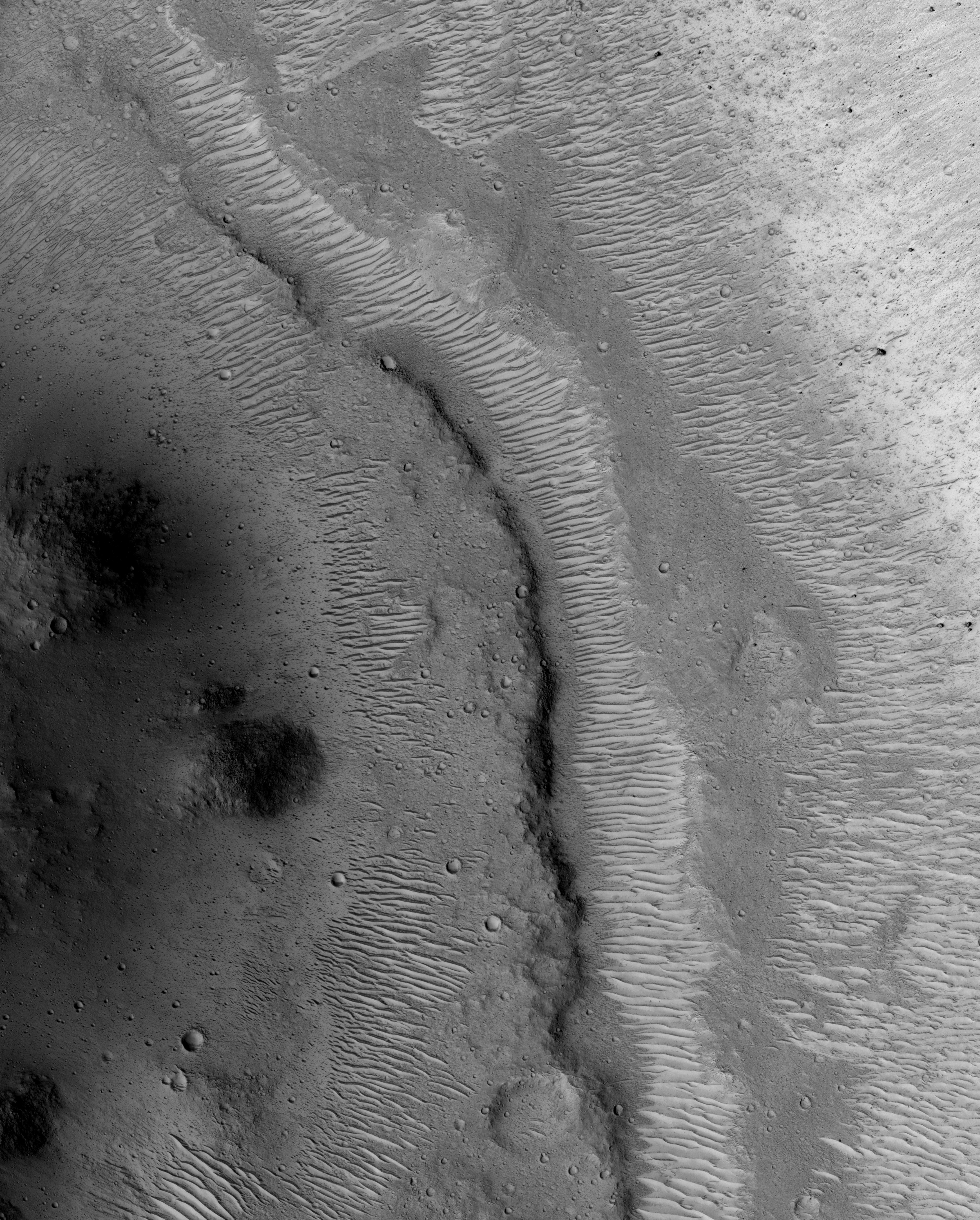
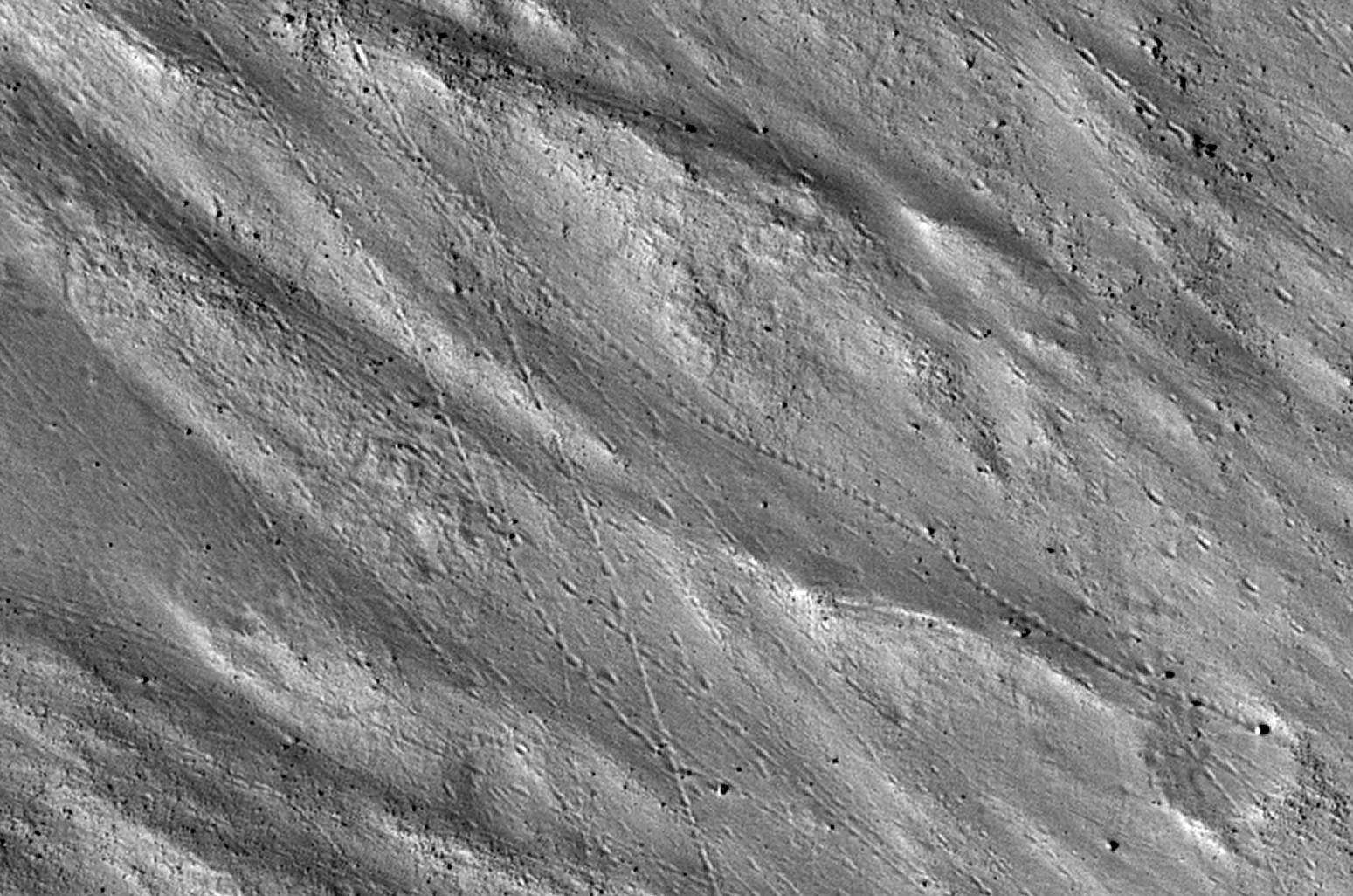
This observation shows the very steep side of a plateau, part of the northern limit of the Kasei Valles system, which is one of the largest outflow channel systems on Mars.
The difference in elevation here between the mostly flat channel's floor (bottom right) and the top of the plateau (top left) is over 1,300 meters (0.8 miles), comparable in height to the Grand Canyon walls.
The Kasei Valles system is much wider than the Grand Canyon, though, getting to be in places 500 kilometers (300 miles) wide. (The Grand Canyon's maximum width is 30 kilometers, or 18 miles).
This subimage shows numerous paths with the appearance of dotted lines, criss-crossing the steep side of the plateau. The carving agents can be found at the end of some of these paths: rocky blocks such as the ones in this subset, up to 2 meters (2.2 yards) across (4 meters or 4.4 yards across elsewhere in the image).
Some of these blocks traveled downhill several hundred meters (yards) as they rolled and bounced leaving behind a trail of indentations or poke marks in the surface's fine-grained, light-toned soils. The raised borders in some of these poke marks indicate they are relatively recent features, unaffected by wind erosion, or that this soil has cohesive properties, such as if it was cemented [i.e., cohesive soil].
The sound of these blocks falling did not travel very far, though. According to computer simulations sound in Mars travels only 1.5 percent the distance it would travel on Earth. (No Martian sound has ever been recorded.) Hence, the same sound which would travel one kilometer (0.6 miles) on Earth would travel only 15 meters (16 yards) on Mars. This is due to the lower Martian atmospheric pressure, which is approximately one percent of that of Earth.

This VIS image of Utopia Planitia is covered with the tracks of dust devils.

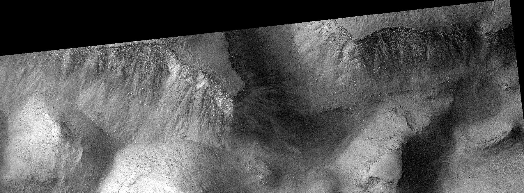
This observation shows part of Gorgonum Chaos, a large cluster of chaotic terrain found in the southern hemisphere.
Many regions of chaotic terrain are found at the head of large outflow channels that were scoured by ancient floods. Gorgonum Chaos is one region that is not associated with an outflow channel.
Chaotic terrain can form when subsurface volatiles (such as water) are catastrophically released and the overlying surface collapses. It is not known whether isolated chaotic terrain — such as that shown in this image — formed in the same way that the chaotic terrain near the outflow channels did. Wind erosion might play a role in their formation.
Gorgonum Chaos is an especially interesting area because gullies thought to have been eroded by liquid water are located on its mesas (see subimage). The gullies have a wide range of orientations and many appear to emanate from a distinct layer in the mesas (see subimage).
It is not known why gullies form on one slope rather than another, but insolation (amount of sunlight received), availability of water, and regional slope are possible contributing factors.

This VIS image of Zephyria Planum shows wind eroded yardangs.

This observation is a view of the sand dune field in Richardson Crater covered with seasonal frost.
The subimage is a close-up view of defrosting patterns on the dunes. The frost is a combination of frozen carbon dioxide and some water ice that covers the dunes in the winter and spring. As the seasonal frost sublimes away, odd features such as spots, fans, and streaks form.
Small dark streaks on the dune slip face slopes may be where recent avalanches of sand, or perhaps wind, has moved the dark sand underlying the frost, or where frost has been removed to expose the sand. Alternatively, the dark streaks may be patches of coarse-grained ice that are clear enough so that the dark material below the ice is visible. The slip faces indicate that the general direction of sand transport is from the right to the left across the full image.
It has been hypothesized that the dark spots and fans may be "geysers" or "cold gas jets" that form when sublimation processes trap gas at the bottom of the ice. The gas is released through cracks in the ice, entraining dust from below the ice and scattering it onto the surface to form the dark spots and fans.
The high resolution, stereo, and low light imaging capabilities of HiRISE has provided new insight into the processes that form these features. Repeated imaging in a variety of locations will provide a record of their development and evolution.

This VIS image of the floor of Proctor Crater shows part of the sand sheet and dune forms that are located there.

This image shows a degraded impact crater in the southern highlands. Part of the crater rim is visible at the top and bottom of the image, with the boulder-covered crater floor in the center.
The subdued appearance of the crater indicates that it has been highly modified since it formed. In the southern part of the crater floor a smaller impact crater overlies the larger crater. However, it too has been heavily eroded, such that it can only be identified by the circular pattern of boulders near the rim and the relatively boulder-free ejecta farther from the rim, which covers the boulder-rich floor of the large crater. The boulders in this image range in size from approximately 1 meter (3 feet) to approximately 6 meters (20 feet).
Other craters in the region around this HiRISE image have a similar appearance (heavily modified with boulder-rich floors) as seen in this CTX image which covers this crater imaged by HiRISE, as well as a crater directly to the north. This indicates that the processes that have modified this crater are regional in nature.
The dark lines crisscrossing the whole image are dust devil tracks that are formed when dust devils move across the surface and pick up bright dust, leaving darker coarse material behind. The subimage shows dust devil tracks along with part of the boulder-rich rim of the smaller crater.

This VIS image shows just one of many lava channels located on the Elysium Mons volcanic complex.

This observation shows part of the floor of a large impact crater in the southern highlands, north of the giant Hellas impact basin. Most of the crater floor is dark, with abundant small ripples of wind-blown material. However, a pit in the floor of the crater has exposed light-toned, fractured rock.
The light-toned material appears fractured at several different scales. These fractures are called joints, and result from stresses on the rock after its formation.
Joints are similar to faults, but have undergone virtually no displacement. With careful analysis, joints can provide insight into the forces that have affected a unit of rock, and thus into its geologic history. The fractures appear dark; this may be due to trapping of dark, wind-blown sand in the crack, to precipitation of different minerals along the fracture, or both.

The floor of Melas Chasma contains a variety of landforms. This VIS image shows deposits of fine materials as well as layered deposits.

