Showing posts with label Deimos. Show all posts

Saturday, August 17, 2013

Phobos Occulting Deimos


This movie clip shows the larger of Mars' two moons, Phobos, passing in front of the smaller Martian moon, Deimos, as observed by NASA's Mars rover Curiosity. The series of 41 images is shown at increased speed. The actual elapsed time is 55 seconds.

The images were taken by the telephoto-lens camera of the Mast Camera pair (right Mastcam) on Curiosity on August 1, 2013, during the 351st Martian day, or sol, of Curiosity's work on Mars. These observations of Phobos and Deimos help researchers make knowledge of the moons' orbits even more precise.

On Phobos, Stickney Crater is visible on the bottom. It is on the leading hemisphere of Phobos. Hall Crater, in the south, is the prominent feature on the right hand side.

Video credit: NASA/JPL-Caltech/Malin Space Science Systems/Texas A&M University

Note: For more information, see PIA17350: Two Moons of Mars in One Enhanced View, PIA17351: Illustration Comparing Apparent Sizes of Moons, PIA17352: Smoothed Movie of Phobos Passing Deimos in Martian Sky, PIA17353: Before and After Occultation of Deimos by Phobos, and NASA Rover Gets Movie as a Mars Moon Passes Another.

Tuesday, June 4, 2013

Celebrating Ten Years of Mars Express


The journey of Mars Express, from drawing board through launch, to its key science highlights during ten years of operations.

With its suite of seven instruments, Mars Express has studied the subsurface of the Red Planet to the upper atmosphere and beyond to the two tiny moons Phobos and Deimos, providing an in depth analysis of the planet's history and returning stunning 3D images.

Video credit: ESA; text credit: ESA

Note: For more information, see Ten Years at Mars: New Global Views Plot the Red Planet’s History; also, Mars Express: Ten Years in Orbit.


Monday, January 3, 2011

Deimos


These color-enhanced views of Deimos, the smaller of the two moons of Mars, result from imaging on February 21, 2009, by the High Resolution Imaging Science Experiment (HiRISE) camera on NASA's Mars Reconnaissance Orbiter.

Deimos has a smooth surface due to a blanket of fragmental rock or regolith, except for the most recent impact craters. It is a dark, reddish object, very similar to Mars' other moon, Phobos. For a comparison, see HiRISE images of Phobos taken March 23, 2008.

These Deimos images combine HiRISE exposures in near-infrared, red and blue-green wavelengths. In the enhanced color, subtle color variations are visible — redder in the smoothest areas and less red near the fresh impact craters and over ridges of topographic highs (relative to Deimos' center of gravity). The color variations are probably caused by exposure of surface material to the space environment, which leads to darkening and reddening. Brighter and less-red surface materials have seen less exposure to space due to recent impacts or downslope movement of regolith.

Deimos is about 12 kilometers (7.5 miles) in diameter. Its orbital period is 1 day, 6 hours, 17.9 minutes.

These two images were acquired 5 hours and 35 minutes apart. The Sun was to the upper left in the first (left) image, and to the right in the second image. The viewing geometry is similar in the two images, but surface features appear very different due to the change in illumination.

With an image scale of about 20 meters (66 feet) per pixel, features 60 meters (197 feet) or larger can be discerned.

Photo credit: NASA/JPL-Caltech/University of Arizona

Tuesday, December 28, 2010

Phobos Transits the Sun, 9 November 2010


The larger of the two moons of Mars, Phobos, transits (passes in front of) the Sun in this approximately true-speed movie simulation using images from the panoramic camera (Pancam) on NASA's Mars Exploration Rover Opportunity taken on the rover's 2,415th Martian day, or sol (November 9, 2010). The movie includes images that have been calibrated and enhanced, plus simulated frames used to smooth the action.

Images of solar transits of Phobos and the other Mars moon, Deimos, taken over many years by Mars rovers aid in studies of slight changes in the moons' orbits.

This movie is based on 10 individual photos taken through the Pancam's special solar filter every four seconds during the transit, which lasted about 32 seconds. The images were gradually blended together to create a simulated near-real-speed animation of the event. The moviemakers supplemented those images with sky color information from a pair of images taken right after the transit through two regular imaging filters: one centered on a wavelength of 440 nanometers (blue) and the other on 750 nanometers (near infrared).

The silhouette of Phobos looks smaller than in some other Mars rover transit images (for example, PIA05554) because when Phobos is near the horizon it is more than 30 percent farther from the camera's location than when it is straight overhead.

Video credit: NASA/JPL-Caltech/Cornell/Texas A&M

Tuesday, July 20, 2010

Dissected Mantled Terrain


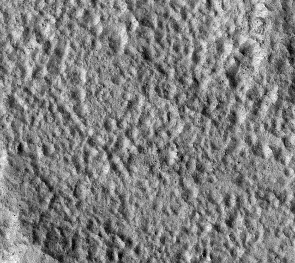
A northern mid-latitude scene consisting of craters, intercrater plains, and mantled material is visible in this HiRISE image.

The mantled material seen here covers much of the middle latitudes in both hemispheres of Mars; it has been visibly removed in some locations. It's called "mantled" because it looks as if it's just draped over, or mantling, the topography underneath.

The mantled material is what causes the craters to have a muted, softened appearance. It's thought to be ice-rich material deposited in a climate different from that of today.

The mantled unit is dissected here, meaning that is not pristine and has likely undergone modification since it was originally laid down. The intercrater plains have a pitted texture full resolution thought to be caused by water ice sublimating and leaving depressions behind.

Unlike that of Earth, the obliquity (tilt of the planet's rotation axis) of Mars changes wildly. Earth has the Moon to keep its axis stable, but Mars' satellites, Phobos and Deimos, are not massive enough to do the same.

Today Mars' obliquity (25.19 degrees) is similar to that of Earth's (23.45 degrees), but this has not always been the case. As the obliquity changes, the portions of Mars that receive the most sunlight shift. During periods of high obliquity, polar regions receive the most sunlight. This causes polar ices, including water ice and carbon dioxide ice, to sublimate (evaporate) into the atmosphere. They would then potentially be re-deposited in the mid-latitudes, similar to where this image is located. It is believed that this process is responsible for the mid-latitude mantled unit.

Photo credit: NASA/JPL/University of Arizona

Sunday, February 28, 2010

Mars Express to make closest ever approach to Phobos

On 3 March 2010 Mars Express will make its closest ever approach to Phobos, the larger of the two Martian moons. During a series of flybys, spanning six weeks, all seven instruments onboard Mars Express will be utilised to study Phobos. The close approach provides a first opportunity to perform a unique gravity experiment that may reveal the distribution of mass within this intriguing moon.


ESA's Mars Express spacecraft orbits the Red Planet in a highly elliptical, polar orbit that brings it close to Phobos every five months. It is the only spacecraft, currently in orbit around Mars, whose orbit reaches far enough away from the planet to provide a close-up view of Phobos. Over the course of twelve flybys, taking place between 16 February and 26 March 2010, Mars Express will pass within 1400 km of the surface of Phobos. The Mars orbiter will make its closest ever approach to Phobos- just 50 km above the surface - on 3 March 2010.

The suite of seven experiments onboard Mars Express are primarily used to study the atmosphere, surface and subsurface of the Red Planet. These science instruments can also be used to investigate Phobos. During this current series of flybys all Mars Express instruments will be used to study Phobos, taking advantage of not only the close approach to the moon but also, for the gravity experiment during the closest flyby, the proximity of Mars to the Earth.

Phobos – a moon of unknown origin
Phobos, the larger of the two Martian moons, remains one of the few objects in the Solar System whose location cannot be easily explained. By studying Phobos with the Mars Express instruments scientists are hoping to contribute to the understanding of the moon's nature and origin. Phobos (and Deimos) could be captured asteroids – early measurements of the composition of both moons were compatible with this idea – or they could have formed from material that was ejected following a large collision with Mars. Additional theories are that the moons could be survival planetisimals, or formed from the break-up of a moon that was created early in the formation of the Solar System. Knowing how the mass is distributed within Phobos is an important step in understanding the interior of the moon and this in turn will provide crucial insight into the moon’s origin.

Studying Phobos close-up – unique science
At a distance of just 50 km above the surface of Phobos Mars Express will make the most precise measurements to date of the moon's gravity field using the X-band (8.4 GigaHertz) channel of the Mars Radio Science (MaRS) instrument. This instrument relies on the observation of the phase, amplitude, polarisation and propagation times of radio signals transmitted from the spacecraft and received at ground station antennas on Earth. The radio signals are affected by the medium through which the signals propagate, by the gravitational influence of Mars on the spacecraft and finally by the performance of the various systems involved both on the spacecraft and on ground. In addition, during this series of close flybys, the gravitational attraction of Phobos will slightly disturb the trajectory of the spacecraft. The difference between predicted trajectory (without Phobos) and the actually observed trajectory will lead to the determination of the forces acting on the spacecraft and from them the gravity field of the moon. To make these measurements, the spacecraft operates in two-way link mode with an X-band uplink and downlink.

This current series of flybys happen to occur when the orbits of Earth and Mars bring them close together which means that Mars Express will be ideally positioned to maximize the signal-to-noise ratio of the two-way X-band radio-link. NASA’s Deep Space Network (DSN) 70 metre radio station at Robledo, Spain, will track the radio signal from Mars Express and will pick up the subtle changes in the signal due to the doppler effect as the gravity of Phobos affects the spacecraft's velocity. In addition, the ESA Cebreros station will also be listening to the signal.

Mapping the mass distribution of Phobos
Analysis of Mars Express data will provide key coefficients of the gravity field. The most important coefficient, the mass of Phobos, has been determined from previous flybys at higher altitudes, but it does not provide any information about how the mass is distributed. Calculation of the density of Phobos, using the mass and volume, gives a value too low to be consistent with a solid, non-porous body, which has led to speculation about the composition of the moon and about how its mass is distributed.

Measurement of the gravity field coefficients from a lower altitude, as will be achieved during this series of flybys, will provide increased accuracy of the mass and allow the subsequent, smaller coefficients, such as the J2 coefficient, to be determined for the first time. To determine the mass distribution of Phobos these coefficients are required along with the libration, a measure of how Phobos rotates – this has already been determined from Mars Express HRSC images. Knowledge of these various parameters allows the three principle moments of inertia to be derived - these in turn describe the mass distribution of Phobos. Models of Phobos' interior are being developed and will be tested against the findings of the current and future close flybys.

Studying Phobos close-up – continuing investigation
In addition to the new science performed during the gravity experiment, this series of flybys will see Mars Express build on knowledge gained from previous flybys. HRSC data obtained during previous flybys has led to the development of a new topographical atlas of Phobos (see M. Wählisch et al. (2009) for further details and the Phobos atlas website). On-going investigations include: improving the accuracy of the location of Phobos (see J. Oberst et al. (2006), V. Lainey et al. (2007), K. Willner et al. (2008), P. Rosenblatt et al. (2008)) and therefore knowledge of its constantly changing orbit as it spirals slowly towards Mars; measurements of the surface to determine its composition (see B. Gondet et al. (2008), S. Perrier et al. (2004)), study of the origin of grooves [pdf] (see J. Murray et al. (2006)), shape (see K. Willner et al. (2010)) and sub-surface properties; as well as studying how the surface interacts with the solar wind.

Mars Express data will provide an important contribution to understanding the nature and origin of Phobos but this alone will not provide a definitive answer. Further exploration is required, and in 2011 the Russian Phobos-Grunt (Phobos-Soil) mission is scheduled to launch to retrieve a sample from Phobos to return for study on Earth. Images taken by the Mars Express HRSC instrument during this series of flybys will be used to support the final selection of the Phobos-Grunt landing site.

Credits:
Digital terrain model of Phobos derived from HRSC data (top), M. Wählisch et al. (2009)
Orbits of Phobos and Mars Express (bottom), ESA

For a very nice animation of Phobos (that, unfortunately, I'm not able to upload for this blog post), see A Complete View of Phobos.

Sunday, August 19, 2007

Viking 2

Credit: NASA

Viking 2 was launched on September 9, 1975 using a Titan/Centaur rocket. After a 333 day cruise to Mars, the Viking 2 Orbiter entered Mars orbit on August 7, 1976. The Lander detached from the Orbiter on September 3rd. While normal operations called for the structure connecting the Orbiter and Lander (the bioshield) to be ejected after separation, the bioshield was left attached to the Orbiter because of problems with the separation.

The Viking 2 Lander touched down about 200 km west of the crater Mie in Utopia Planitia at 48.269º North, 225.990º West at 22:58:20 UT (9:49:05 a.m. local Mars time). Due to radar misidentification of a rock or highly reflective surface, the thrusters fired an extra time 0.4 seconds before landing, cracking the surface and raising dust. The lander settled down with one leg on a rock, tilted at 8.2 degrees. The cameras began taking images immediately after landing.

The Orbiter's primary mission ended at the beginning of solar conjunction on November 8, 1976. The extended mission commenced on December 14, 1976 after the solar conjunction. On December 20th, 1976 the periapsis was lowered to 778 km. Operations included close approaches to Deimos in October 1977, and the periapsis was lowered to 300 km and the period changed to 24 hours on 23 October 1977. The Orbiter developed a leak in its propulsion system that vented its attitude control gas. It was turned off on July 25, 1978 after returning almost 16,000 images in 706 orbits around Mars.

As for the Viking 2 Lander, it operated on the surface for 1,281 Mars days, and was turned off on April 11, 1980 when its batteries failed.

The above picture is the second image of the Martian surface taken by the Viking Lander 2, shortly after touchdown on September 3, 1976. The picture sweeps around 330°, starting from northwest at the left through north (above the sampler arm housing) past east, where the sky is bright at the center, and southeast toward the right above the radioisotope thermoelectric generator cover. The surface is strewn with rocks out to the horizon, ranging in size up to several meters across. Some pitted rocks resemble fragments of porous volcanic lava. Other rocks have grooves that may have been eroded by windblown sand and dust. Although fine-grained material is seen between the boulders, no sand dunes are evident. The dip in the eastern horizon at the center is an illusion caused by an 8° tilt of the Lander toward the west. Actually, the terrain is more level than that at the Viking 1 site. The horizon toward the left of the panorama (northwest) appears featureless, indicating that it may be several kilometers distant. The sky at the center (east) is bright because the sun was above but out of the picture at 10 a.m. Mars time. Toward the right (southeast), the rocks that are silhouetted against the skyline indicate that the horizon is much nearer, probably because of a slight rise in that area of the terrain. The circular high-gain antenna at the right has clots of fine-grained material adhering to the lower half, some of which appeared to have been sliding downward while the camera was scanning the area. At the extreme right, the banded appearance resulted because the camera continued to scan while it was no longer moving in azimuth. Any motion or other variation in the scene would show up as a change in successive lines.

Wednesday, August 1, 2007

Deimos

Credit: NASA

Yesterday, we presented the Martian satellite Phobos (“Fear”); today, it’s Deimos’s (“Panic”) turn. Both satellites were discovered together by the American astronomer Asalph Hall; however, the names were suggested by Henry Madan (1838–1901), then Science Master of Eton, who got the idea from Book XV of the Iliad, where Ares (the Roman god Mars) summons Dread (Deimos) and Fear (Phobos).

Deimos (pronounced DEE-mos) is much smaller than Phobos, having dimensions of 15 x 12 x 10.4 kilometers, and being too small to have formed into a spherical shape. (Phobos, in contrast, is 26.8 × 21 × 18.4 kilometers in size.) Deimos is also much further away from Mars. Whereas Phobos only takes 7 hours, 39 minutes to orbit Mars, Deimos takes a little over 30 hours to complete one orbit.

The Viking 2 Orbiter took the above photo on October 5, 1977 from a distance of 1,400 kilometers.