Showing posts with label Hellas Planitia. Show all posts

Friday, August 22, 2014

Impact Craters in Hellas Planitia


Scarring the southern highlands of Mars is one of the Solar System’s largest impact basins: Hellas, with a diameter of 2300 km and a depth of over 7 km.

Hellas is thought to have formed between 3.8 and 4.1 billion years ago, when a large asteroid hit the surface of Mars. Since its formation, Hellas has been subject to modification by the action of wind, ice, water and volcanic activity.

Impact craters have also since pock-marked this vast basin floor, two of which are the focus of this image, taken by the High Resolution Stereo Camera on ESA’s Mars Express on 17 December 2013. The ground resolution is about 15 meters per pixel.

These craters lie in the deepest, western portion of Hellas, and such a clear view is unusual because dust clouds typically obscure the basin floor. Indeed, this region seems to be covered by a thick blanket of dust.

The larger of the two craters is about 25 km across. A flow of material appears to have been transported from the top left of the scene and into the crater. Zooming in to the smooth mound and the area immediately around it reveals interesting textures that likely resulted from this flow.

Flow features are also seen outside of the craters, and in particular, at the center left of the image near the top of the frame. Material also seems to have cascaded from the larger crater’s rim and into a neighboring smaller crater, at the far left of the image.

The morphology of many features in the Hellas Basin and its surroundings strongly suggests the presence of ice and glaciers.

For example, in the foreground and around the crater rim, polygons of patterned ground are visible which indicates the presence of water – this pattern occurs when fine grained and porous wet soil freezes.

Indeed, in the deepest parts of the basin, the atmospheric pressure is about 89% higher than at the surface, which may even offer conditions suitable for water. Radar images from NASA’s Mars Reconnaissance Orbiter suggest that some craters in Hellas might contain water-ice glaciers several hundred meters thick, buried under layers of dust.

See more images from this region at the DLR website and in this previous ESA release.

Image credit: ESA/DLR/FU Berlin

Sunday, August 17, 2014

Glacial Ridges and Channels in Eastern Hellas Planitia


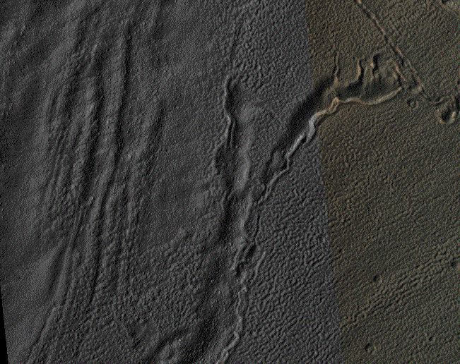
Hellas Crater in the ancient highlands contains some of the clearest evidence on Mars for glacial processes. This image, on the eastern margin of the giant impact crater, shows a number of features consistent with glaciation.

There are roughly north-south running ridges and troughs which mark the deposition of sediment called moraine underneath or beside a glacier. There are also sinuous channels which may formed from meltwater underneath a glacier. A small (3.5 x 3.5 kilometer) cutout shows an example of the moraine and meltwater channel.

Image credit: NASA/JPL/University of Arizona

Note: For more information, see PIA18647: Glaciation at the Eastern Hellas Margin.

Saturday, July 12, 2014

Perspective View of Hellespontus Montes


Perspective view of Hellespontus Montes, a rocky ridge on the western rim of the vast Hellas basin in the southern hemisphere of Mars.

The foreground shows a close-up of a crater with a particularly interesting feature: wrinkles that form a roughly concentric pattern, with ever-smaller arcs towards the structure’s center. This type of feature is known as ‘concentric crater fill’, and is thought to be associated with snowfall and freezing cycles in an earlier and wetter period of martian history.

Once inside the crater, the snow was trapped and soon covered by surface dust, before compacting to form ice. The number of concentric lines indicate many cycles of this process and it is possible that ice may be hidden beneath just tens of meters of surface debris in these craters.

The image was taken by the High Resolution Stereo Camera on ESA’s Mars Express on 13 January 2014 (orbit 12,750). The center of the associated main color image is located at approximately 41°S/45°E.

Image credit: ESA/DLR/FU Berlin

Thursday, July 10, 2014

Hellespontus Montes


This view shows a portion of the western rim of the vast Hellas basin in the southern hemisphere of Mars. The crater shown in the upper left is on the periphery of the Hellas basin. The edge of the Hellas basin is traced by a string of rocky peaks known as the Hellespontus Montes, which runs roughly half way through the image from the edge of the large crater towards the right hand side of the scene. Many other interesting features can be seen: intricate valleys, dune fields and unusual deposits of dust-covered ice inside smaller craters.

The image was taken by the High Resolution Stereo Camera on ESA’s Mars Express on 13 January 2014 (orbit 12,750). The center of the image is located at approximately 41°S/45°E, in the southern highlands of Mars. The image resolution is roughly 17 m per pixel. North is to the right, east is up.

Image credit: ESA/DLR/FU Berlin

Note: For more information, see Hellespontus Montes in Context, Hellespontus Montes in 3D, and Hellespontus Montes Topography.

Sunday, June 8, 2014

Inverted Alluvial Fan in a Tyrrhena Terra Impact Crater


On Earth, alluvial fans form in desert regions when heavy but sporadic rainfall washes debris from upslope and deposits it in a wedge-shaped fan on the lower slopes below.

On Mars, alluvial fans are sometimes visible in impact crater basins, as material from the steep rims is transported radially inward to the relatively flat floor. Because this is a water-driven process on Earth, and therefore might work the same way on Mars, scientists study Martian alluvial fans order to try to better understand the climate history and possible warmer, wetter past of Mars.

This image, along with its stereo companion, displays an alluvial fan on the floor of a large, 60-kilometer (38 mile) diameter equatorial crater. It is one of several present in the crater (see ESP_017340_1565). This one looks particularly nice in the anaglyph, as there are well-delineated ridges in the fan that stand above the crater floor. These ridges are inverted channels, which form when the floor of a channel is more resistant to erosion than the surrounding surface. This can happen if the floor of the channel is cemented by minerals deposited from water, filled by lava, or simply covered by larger rocks which are hard for the wind to sweep away.

This is a stereo pair with ESP_029221_1565.

Image credit: NASA/JPL/University of Arizona

Note: This crater is located in Tyrrhena Terra to the north of Hellas Planitia.

Sunday, April 20, 2014

Red Bedrock in an Impact Crater Northeast of Hellas Planitia


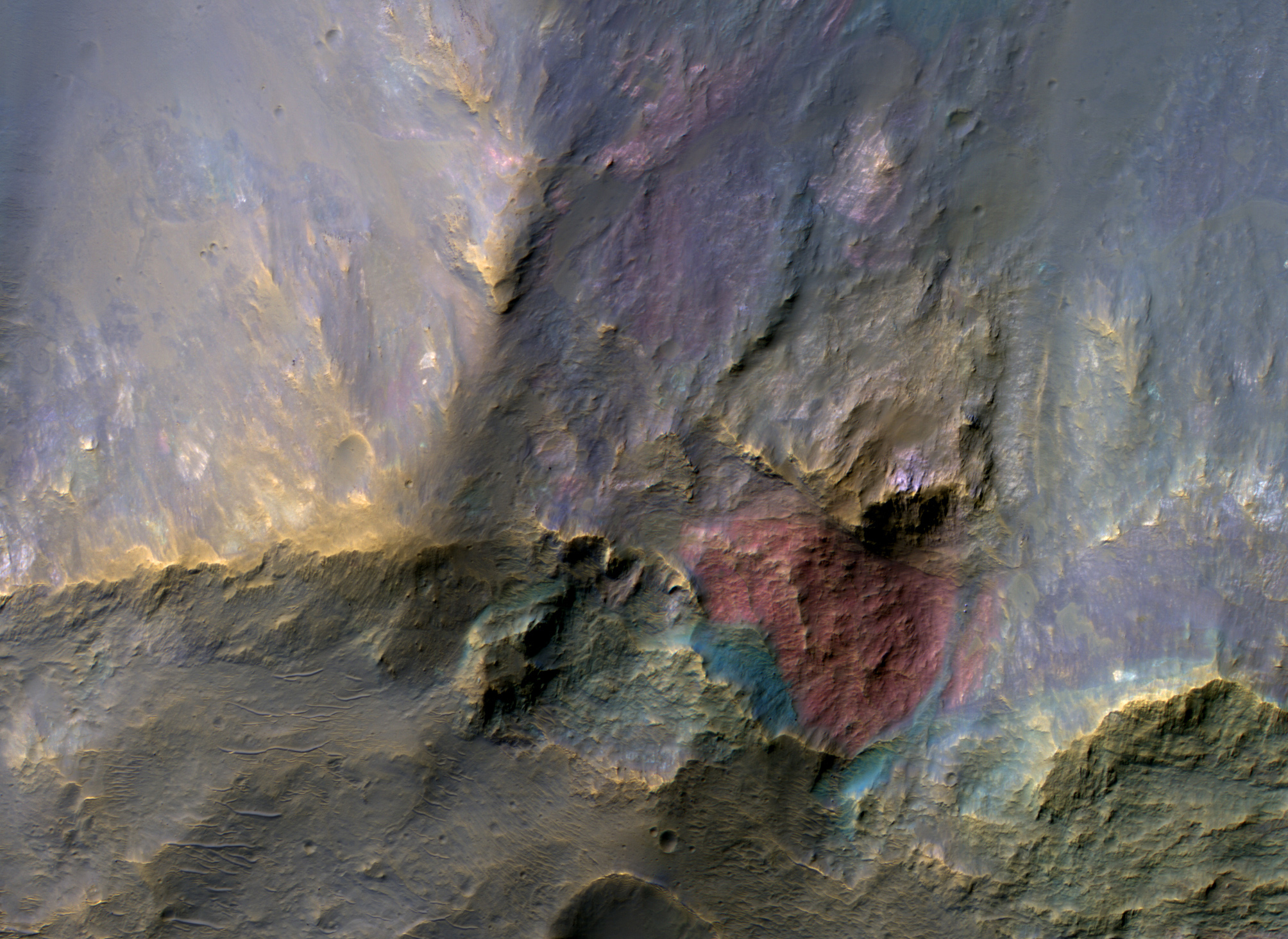
This image covers a 26-kilometer-wide impact crater northeast of the Hellas impact basin. The crater exposes large blocks of bedrock (called "megabreccia") in both the central uplift and in the walls of the crater.

The enhanced-color subimage from the wall shows a large, approximately 250-meter-wide reddish block, although actually "red" in the infrared-shifted color of HiRISE. These blocks could be ejecta from the ancient Hellas impact or other large impacts from billions of years ago.

Image credit: NASA/JPL/University of Arizona

Note: For more information, see PIA18226: A Big Block of Red Bedrock.

Sunday, January 19, 2014

Dunes on the Western Rim of the Hellas Planitia


Sand dunes like these seen in this image have been observed to creep slowly across the surface of Mars through the action of the wind. These are a particular type of dune called a “barchan”, which forms when the wind blows in one direction (here, east to west) for long periods of time. Barchan dunes are common on Mars and in the desert regions of the Earth.

These barchan dunes are located on the western rim of the Hellas impact basin, in the Southern Hemisphere of Mars. This area is covered by extensive deposits of layered rocks that were initially deposited as loose sediments and over time formed these rock layers. Portions of these layered rocks were subsequently eroded away and the remaining layers now form numerous flat-topped hills called “mesas”. The barchan dunes are forming in the lee (or downwind) of the mesas.

This area was previously image by HiRISE in 2008 and was retargeted here through a public request via HiWish. Careful comparison of repeat images such as these can reveal the speed and manner by which dunes move across the Martian surface. This information can be used to study the current atmosphere of Mars, the age and mobility of sand deposits on the planet’s surface, and the hazards that sand dunes may pose to landed vehicles such as rovers.

Over the course of its mission, the science instruments on board the Mars Reconnaissance Orbiter (MRO) have returned over 200 terabits of data back to Earth. This image was taken on November 4, 2013, the same day that MRO’s 200-terabit mark was surpassed.

Photo credit: NASA/JPL/University of Arizona

Note: For more information, see PIA17873: Dunes on the Rim of the Hellas Impact Basin.

Saturday, January 11, 2014

Banded Ridges in Hellas Planitia


Low lying areas in the Hellas region -- which is the largest impact basin on Mars -- often show complex groups of banded ridges, furrows, and pits. These sorts of bands suggest that the surface material has flowed and twisted viscously like taffy. The orientation of the ridges and groups of ridges would then point in the direction of the flow, called stream lines.

Making this landscape even more complex is when we see that the ridges are sometimes disconnected. They stop abruptly, break up into blocky segments that sometimes appear offset. Such mixed up fragments give an initial sense that parts of the flow have been rafted apart from one another. Alternatively, the entire region may be substantially eroded since the time when the taffy-like ridges actually formed. In that case, the flow may have been far more complex and three dimensional, such that the disconnected portions are actually areas where the flow transitioned up and down relative to the current plane of the eroded surface. In this way we only see a slice through a far more complex series of twists and bends, some of which is still buried beneath the ground.

What this taffy-like material is made of is currently unknown. Hard and soft rocks, as well as ice and ice-rich rocky debris, can deform and flow given time under the force of gravity and the pressures found deep beneath the surface. Afterwards, differential erosion of hard and soft rock or icy materials mixed in bands and layers might give rise to the ridges, furrows and pits which we observe today.

Photo credit: NASA/JPL-Caltech/University of Arizona

Tuesday, November 12, 2013

Barchan Dunes on the Western Rim of Hellas Planitia


Sand dunes such as those seen in this image have been observed to creep slowly across the surface of Mars through the action of the wind. These are a particular type of dune called a "barchan," which forms when the wind blows in one direction (here, east to west) for long periods of time. Barchan dunes are common on Mars and in the desert regions of the Earth.

These barchan dunes are located on the western rim of the Hellas impact basin, in the Southern hemisphere of Mars. This area is covered by extensive deposits of layered rocks that were initially deposited as loose sediments and over time formed these rock layers. Portions of these layered rocks were subsequently eroded away and the remaining layers now form numerous flat-topped hills called "mesas." The barchan dunes are forming in the lee (downwind) of the mesas.

This area was previously image by HiRISE in 2008 (PSP_007676_1385) and was retargeted here through a public request (http://www.uahirise.org/hiwish). Careful comparison of repeat images such as these can reveal the speed and manner by which dunes move across the Martian surface. This information can be used to study the current atmosphere of Mars, the age and mobility of sand deposits on the planet's surface, and the hazards that sand dunes may pose to landed vehicles such as rovers.

Over the course of its mission, the science instruments on board the Mars Reconnaissance Orbiter (MRO) have returned over 200 terabits of data back to Earth. This image was taken on November 4, 2013, the same day that MRO's 200-terabit mark was surpassed.

Photo credit: NASA/JPL-Caltech/University of Arizona

Friday, September 20, 2013

Dunes in Bogia Crater


This VIS image shows the dunes on the floor of Bogia Crater, a crater in Hellas Planitia.

Orbit Number: 51480 Latitude: -44.3424 Longitude: 83.1185 Instrument: VIS Captured: 2013-07-22 19:25

Photo credit: NASA/JPL-Caltech/Arizona State University

Tuesday, August 13, 2013

Hellas Planitia and the South Polar Ice Cap by MARSIS


A radar view of the southern highlands of Mars, captured by the Mars Advanced Radar for Subsurface and Ionospheric Sounding (MARSIS) instrument on ESA’s Mars Express. The radar track covers 5580 km and features the Hellas Basin at the far right, and the south polar ice cap with its associated layered deposits just left of center.

The gap to the left of the south pole is an artificial effect due to a distortion in the measurements; it does not correspond to any geological feature.

Image credit: ESA/NASA/JPL/ASI/Univ. Rome

Friday, July 19, 2013

Layered Deposits North of Hellas Planitia


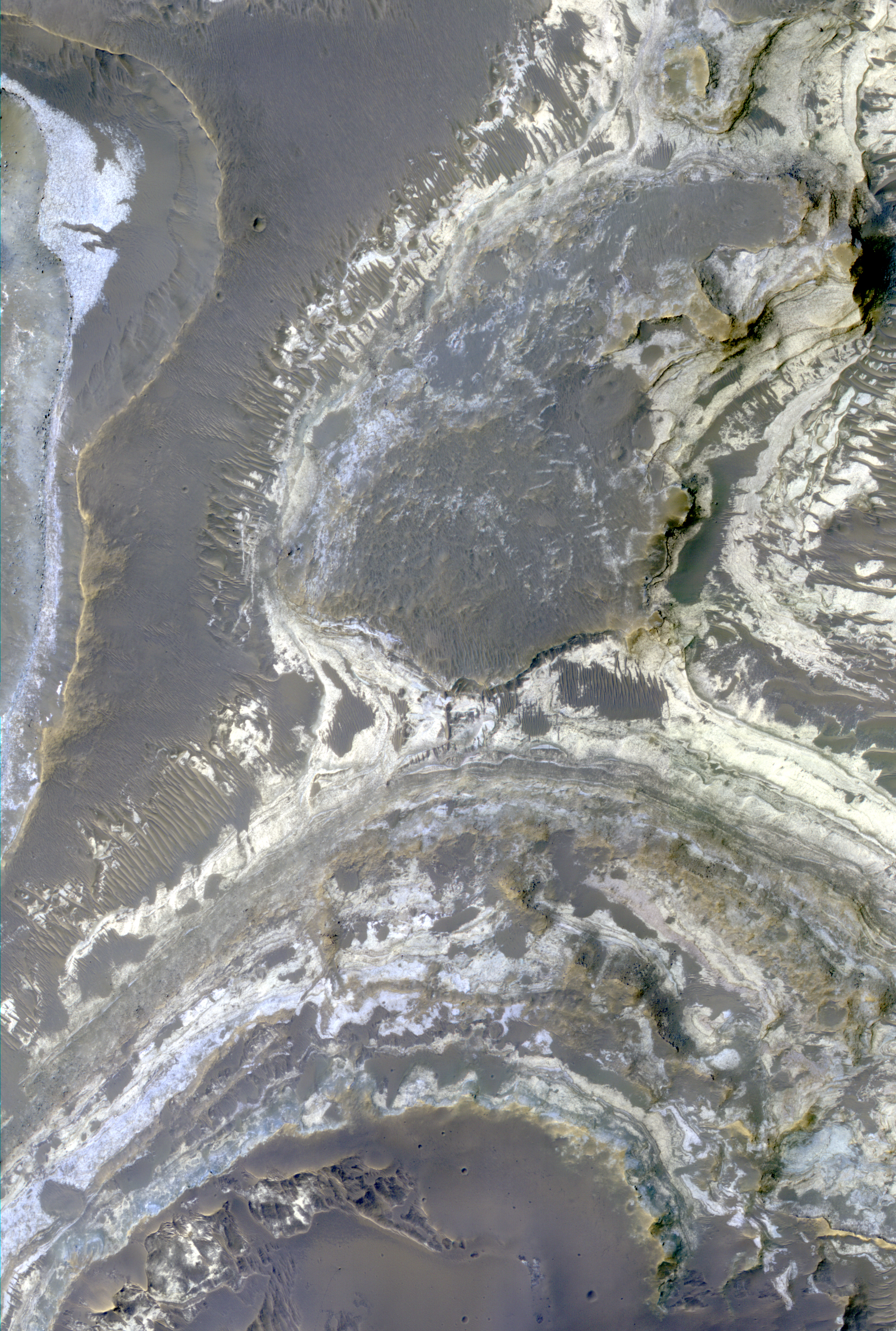
Excellent exposures of light-toned layered deposits occur along the northern edge of Hellas Basin, like those visible in this enhanced color image.

Some of these layered sediments have hydration features in CRISM data, and the various colors visible in this image suggests several different compositions may be present throughout the strata. The sediments may have been emplaced by hydrothermal activity associated with the impact event that created Hellas Basin.

Alternatively, they could be younger deposits that formed within this region when a lake existed here. Studies of the deposits using several data sets could distinguish between these two origins and may result in additional hypotheses for their formation.

This is a stereo pair with ESP_032425_1525.

Photo credit: NASA/JPL/University of Arizona

Sunday, May 5, 2013

Sedimentary Bedrock Diversity in Terby Crater


Terby Crater, sitting on the northern rim of Hellas Basin, has been filled by sedimentary deposits, perhaps deposited by or in water.

The northeast portion of these layers have been eroded by the wind, exposing the layers. The enhanced-color subimage is a sample of these materials, in which the different colors and textures represent different rock types.

Be sure to take a look at the stereo anaglyph for a 3D view of the landscape.

This is a stereo pair with ESP_031278_1525.

Photo credit: NASA/JPL/University of Arizona

Friday, February 1, 2013

Diverse Mineral Compositions within Schaeberle Crater


This image covers a well-preserved (relatively young) impact crater about 5 kilometers (3 miles) wide. The enhanced-color sample shows that the north-facing slope (on the south side of the crater) has a blue-green color but the south-facing slope has a yellowish color.

The blue-green (infrared-shifted) colors indicate minerals like olivine and pyroxene, common in lava or subsurface intrusions of magma. The yellowish color is typical of hydrous alteration or dust. This crater likely exposed diverse lithologies (rock types) that were present before the crater formed.

This is a stereo pair with ESP_030290_1550.

Photo credit: NASA/JPL/University of Arizona

Note: The location of this photo is within Schaeberle Crater, which lies to the northwest of Hellas Planitia in Terra Sabaea.

Monday, January 28, 2013

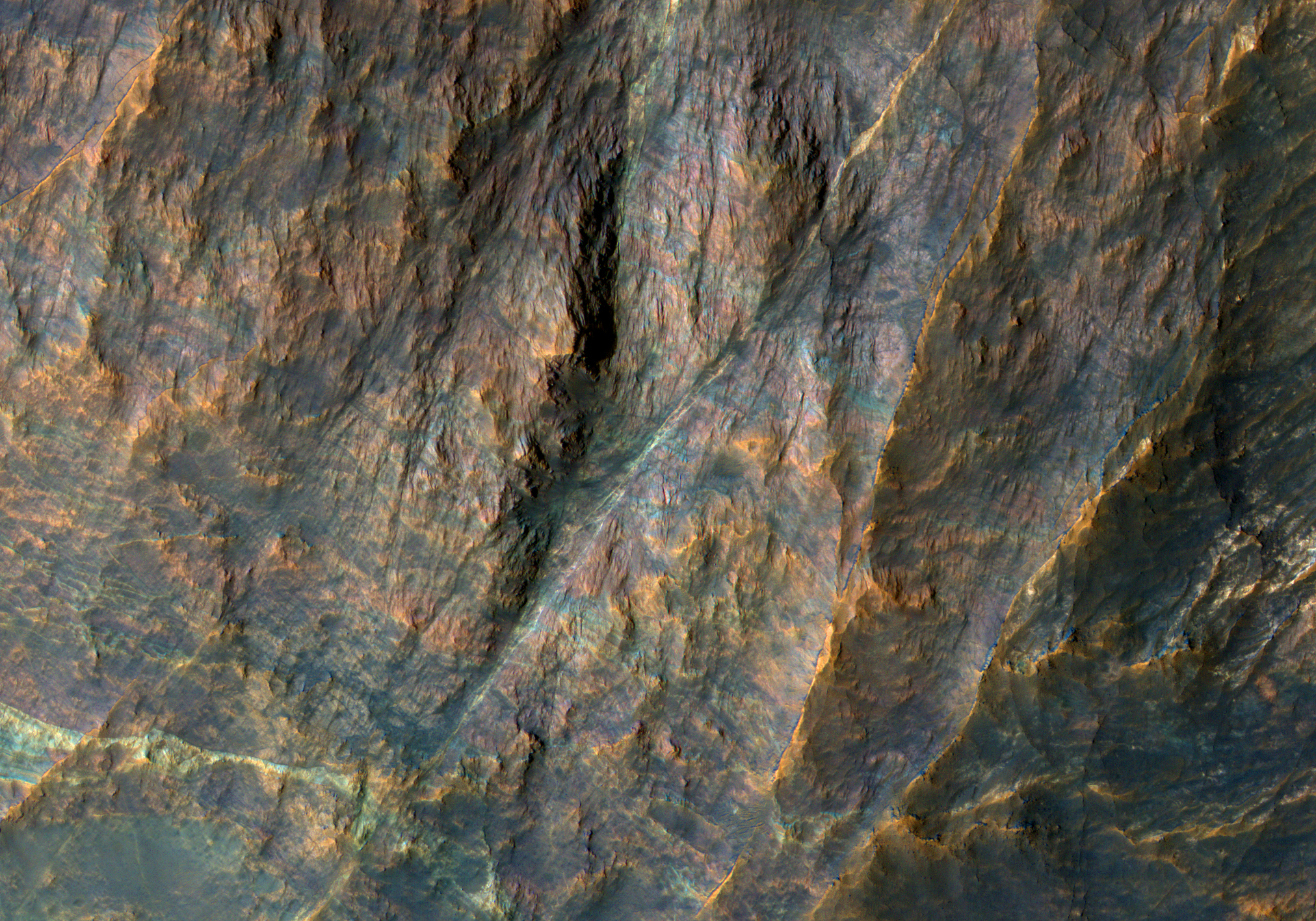
Banded Bedrock in Terra Sabaea


Terra Sabaea is the region of ancient highlands north of the Hellas impact basin.

The enhanced color image shows bands of bedrock with different colors. Such colorful bedrock is typical of ancient Mars, when water played a more active role in altering minerals, and multiple geologic processes were very active (impact, volcanism, fluvial, tectonic).

The ridges or bright or dark lines that cut across the layers mark faults, places where the crust fractured and accommodated motions. A field geologist could spend years mapping the geology of the terrain covered by this image.

Photo credit: NASA/JPL/University of Arizona

Saturday, January 26, 2013

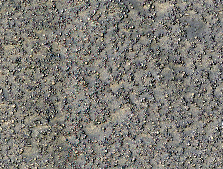
Stone Circles in Promethei Terra


This image covers a region southeast of the giant Hellas impact basin, which has distinctive properties in THEMIS temperature images.

The daytime temperatures are relatively cold while nighttime temperatures are relatively warm. This tells us that the surface material conducts heat efficiently, like rocks rather than fine-grained materials.

This image shows lots of boulders, and in places they form crude circular patterns. This could be due to the effects of many small impact craters (which we can no longer see, except perhaps for the boulder patterns). An alternative idea is that active processes on Mars can move large boulders (up to several meters in diameter) little by little over time.

There is almost certainly ice in the ground at this latitude (58 degrees south latitude), which expands and contracts with temperature changes. Those temperature stresses combined with the removal of fine-grained materials by the wind might be able to organize the boulders. Another idea is that in a recent past, climate the ice could seasonally melt, then re-freeze, which leads to stone circles in terrestrial permafrost (ground that is largely frozen throughout the year).

Photo credit: NASA/JPL/University of Arizona

Note: This image is located to the east of Secchi Crater in Promethei Terra.

Wednesday, July 25, 2012

Tyrrhena Terra


The 1000 × 2000 km area region of Tyrrhena Terra (outlined by the white box in the inset) sits between two regions of low altitude – Hellas Planitia and Isidis Planitia – in Mars' southern hemisphere, as shown in this global topography map. Hydrated minerals were found in 175 locations associated with impact craters in Tyrrhena Terra, such as inside the walls of craters, along crater rims, or in material excavated by the impact. Analysis suggests that these minerals were formed in the presence of water that persisted at depth for an extended period of time.

Map credit: NASA/MOLA Science Team/D. Loizeau et al.

Wednesday, July 18, 2012

Flows in Hellas Planitia


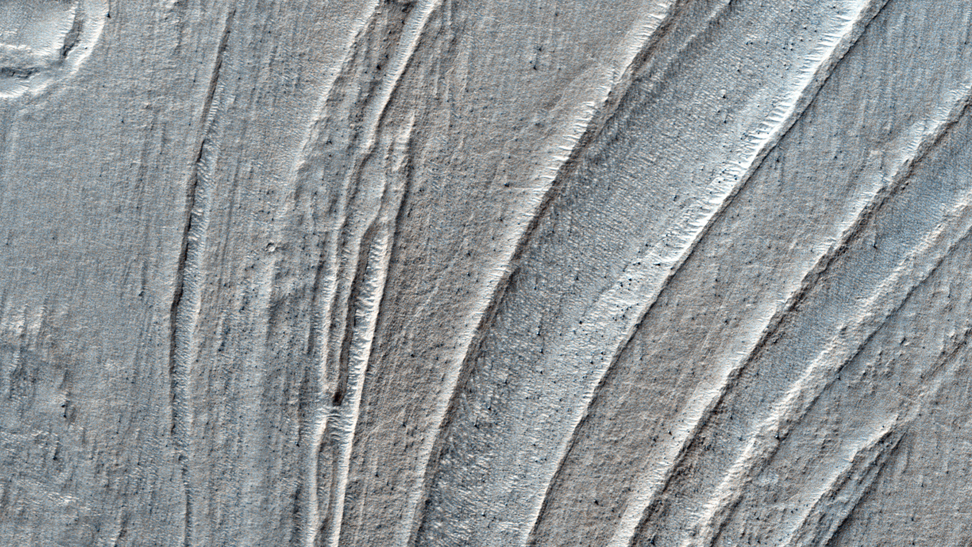
Hellas Planitia is the interior of the Hellas impact basin, is one of the largest visible impact craters in the Solar System. Hellas is located in the Southern highlands and formed very early in the planet's history. The floor of Hellas includes the lowest elevations on Mars and some of the strangest landscapes.

The most striking feature of this observation are the incredible banded features, probably due to the flow of surface material. Although Martian flow features may have Earth analogs such as rock glaciers, it's uncertain as to what types of fluvial, glacial and mass-wasting processes are involved in their formation.

This is a stereo pair with ESP_017644_1420.

Photo credit: NASA/JPL/University of Arizona

Friday, May 18, 2012

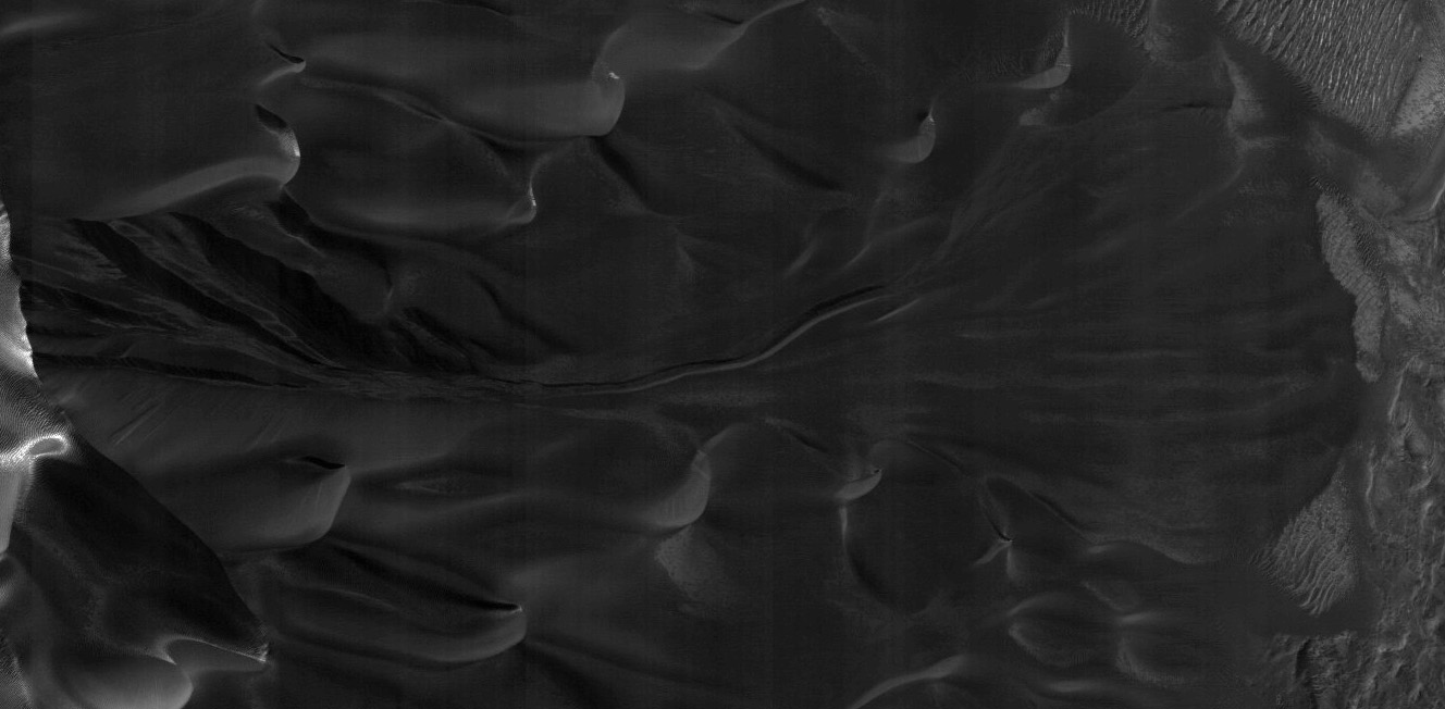
Monitoring Dune Gullies in Matara Crater


There are landforms called "gullies," consisting of an alcove, channel, and apron, on many large sand dunes on Mars.

Remarkably, we have learned that the gullies form primarily or entirely during seasons when there is carbon dioxide frost on the ground. To understand this better we image key locations multiple times throughout the Martian year.

This image, at 49.5 S latitude, was acquired very near the winter solstice, when shadows are very long in the middle afternoon when MRO passes overhead. Dark sand inside shadows is a challenging scene to image while flying overhead at 3.4 km/sec, but the HiRISE camera has the sensitivity needed to acquire useful images even at the most challenging time of the year.

The subimage shows one of these gullies, hidden in the shadow. Vertical stripes in the image are from electronic noise that is usually hidden by the image signal, but in this case the signal is extremely low.

Photo credit: NASA/JPL/University of Arizona

Note: This image is located in Matara Crater, which is to the southwest of Hellas Planitia in Noachis Terra.

Friday, May 11, 2012

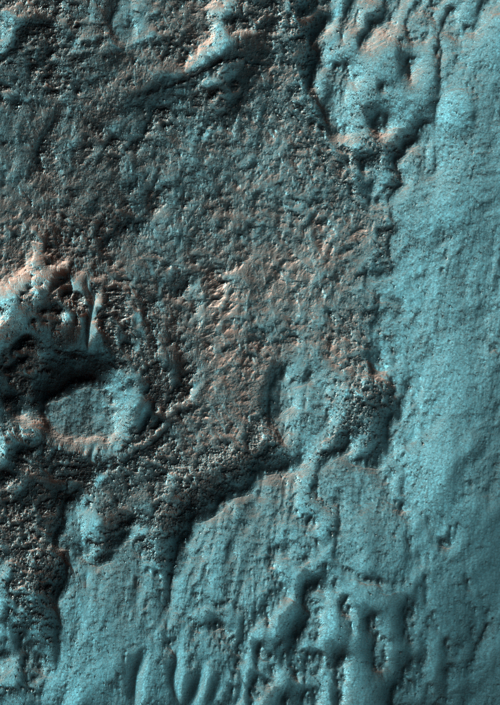
Frosted Ground in Noachis Terra in Late Autumn


This image was acquired within two weeks of the winter solstice, when the subsolar latitude is at its northernmost position.

At this location (latitude 52 S) and time the Sun barely peeks over the horizon in the mid-afternoon when MRO passes overhead, and carbon dioxide frost is building up on most of the surface.

In enhanced color, the frost appears blue. Slopes that face north receive more heat from the Sun and appear reddish, indicating less frost is present. There may also be a small amount of water frost on the surface.

Mars is very different from Earth in that its main atmospheric component can condense onto the surface. The nitrogen that dominates Earth's atmosphere never condenses onto the surface, although nitrogen in the atmospheres of frigid Triton and Pluto do form surface frost and ice.

Photo credit: NASA/JPL/University of Arizona

Note: This image is located in Noachis Terra, roughly halfway between Hellas Planitia and Argyre Planitia; the closest named feature is Russell Crater, which lies to the southwest.