Showing posts with label Ridges. Show all posts

Friday, December 5, 2014

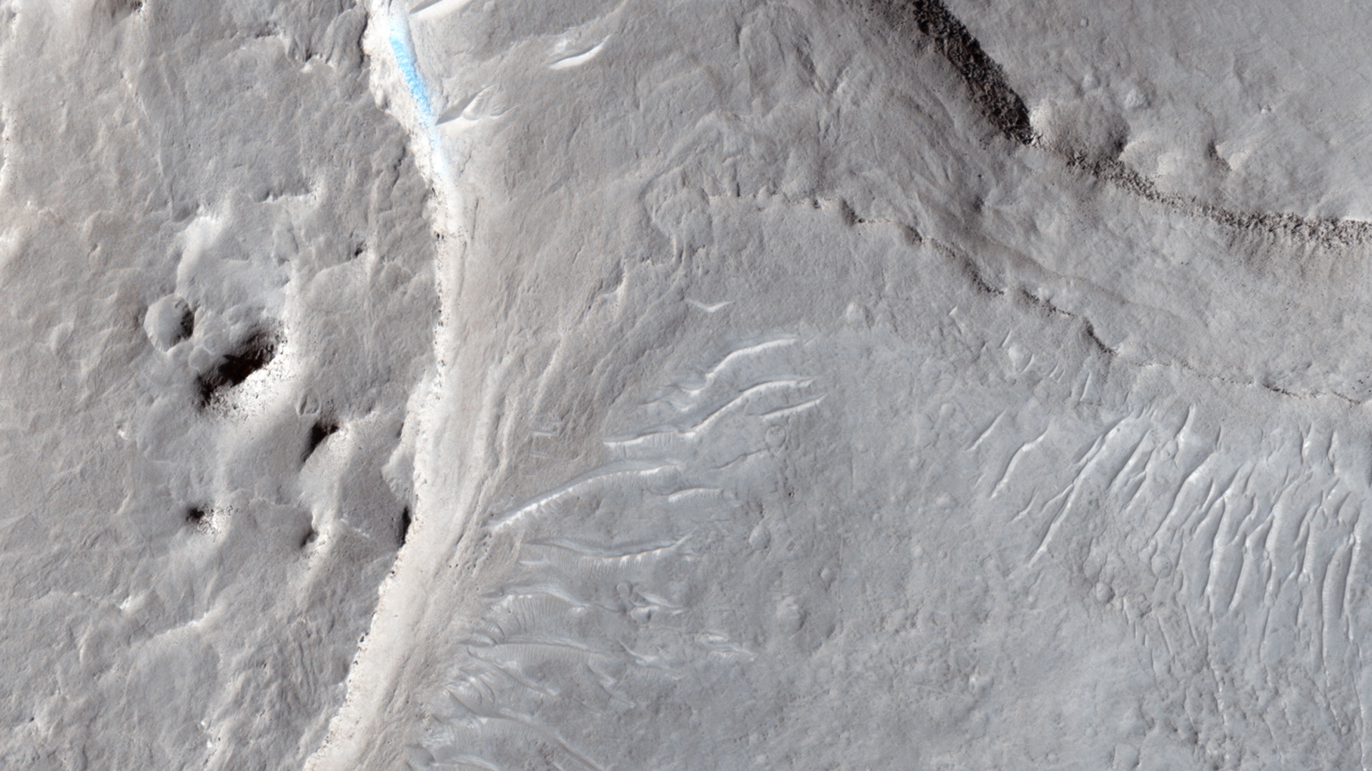
Braided TARs in Syrtis Major


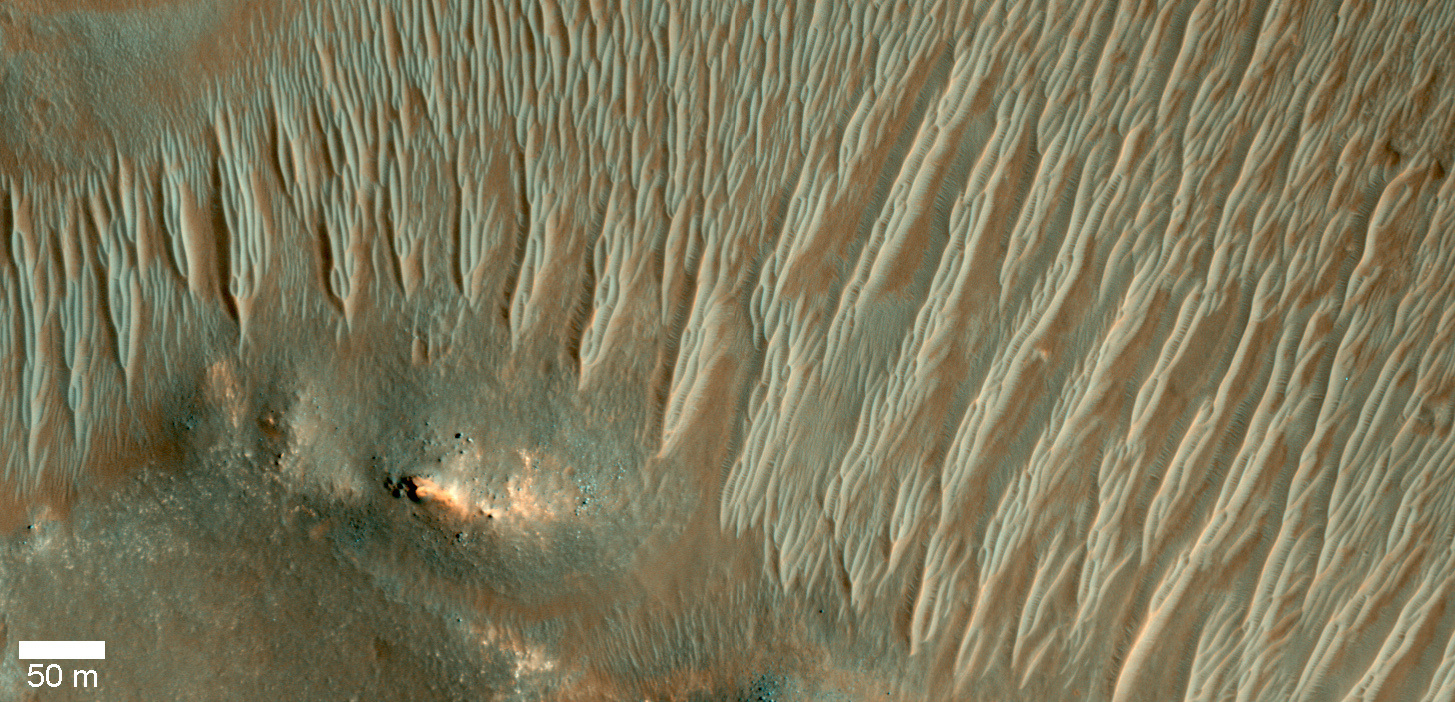
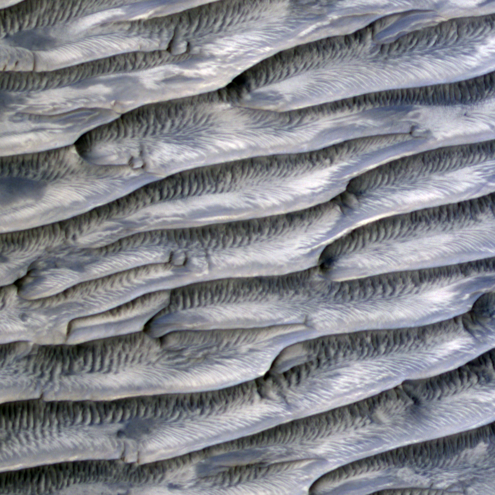
Transverse aeolian ridges (TARs) are commonly found throughout the Martian tropics, including rocky regions such as Syrtis Major that are largely devoid of dust.

These bright wind-blown ripples most often occur in simple sets of ridges with regular size and spacing. Typical TARs stand a few meters tall and have a wavelength (that is to say, separation) of 30 to 60 meters. HiRISE has not detected any changes among the TARs today, suggesting that they are inactive.

In this scene, we see TARs with a highly unusual morphology. Instead of single ridges, we see sets of small ridges that are separated by about 50 meters. The smaller ripples are spaced only 5 to 8 meters apart. Between the smaller ripples are even smaller striations that are perpendicular to the ridge crests with regular spacings of less than 2 meters.

This image raises a number of puzzling questions. Why are the ripples organized into two distinct wavelengths? Did the different wavelengths result from different processes or from different conditions? When did these wavelength-specific conditions or processes take place? Did they occur together, or did they alternate, or did one take place after the other? Were the processes depositional or erosional, or both?

The complexity of Martian TARs makes us think twice about any single explanation for their origin.

Image credit: NASA/JPL/University of Arizona

Note: For more information, see PIA18930: Braided TARs in Syrtis Major.

Thursday, November 20, 2014

Pink Cliffs


This small ridge, about 3 feet (1 meter) long, appears to resist wind erosion more than the flatter plates around it. Such differences are among the rock characteristics that NASA's Curiosity Mars rover is examining at selected targets at the base of Mount Sharp.

The ridge pictured here, called "Pink Cliffs," is within the "Pahrump Hills" outcrop forming part of the basal layer of the mountain. This view is a mosaic of exposures acquired by Curiosity's Mast Camera (Mastcam) shortly before a two-week walkabout up the outcrop, scouting to select which targets to examine in greater detail during a second pass.

Pink Cliffs is one of the targets chosen for closer inspection. This image combines several frames taken with the Mastcam on October 7, 2014, the 771st Martian day, or sol of Curiosity's work on Mars. The color has been approximately white-balanced to resemble how the scene would appear under daytime lighting conditions on Earth.

Figure 1 is a version with a scale bar overlaid on the image.

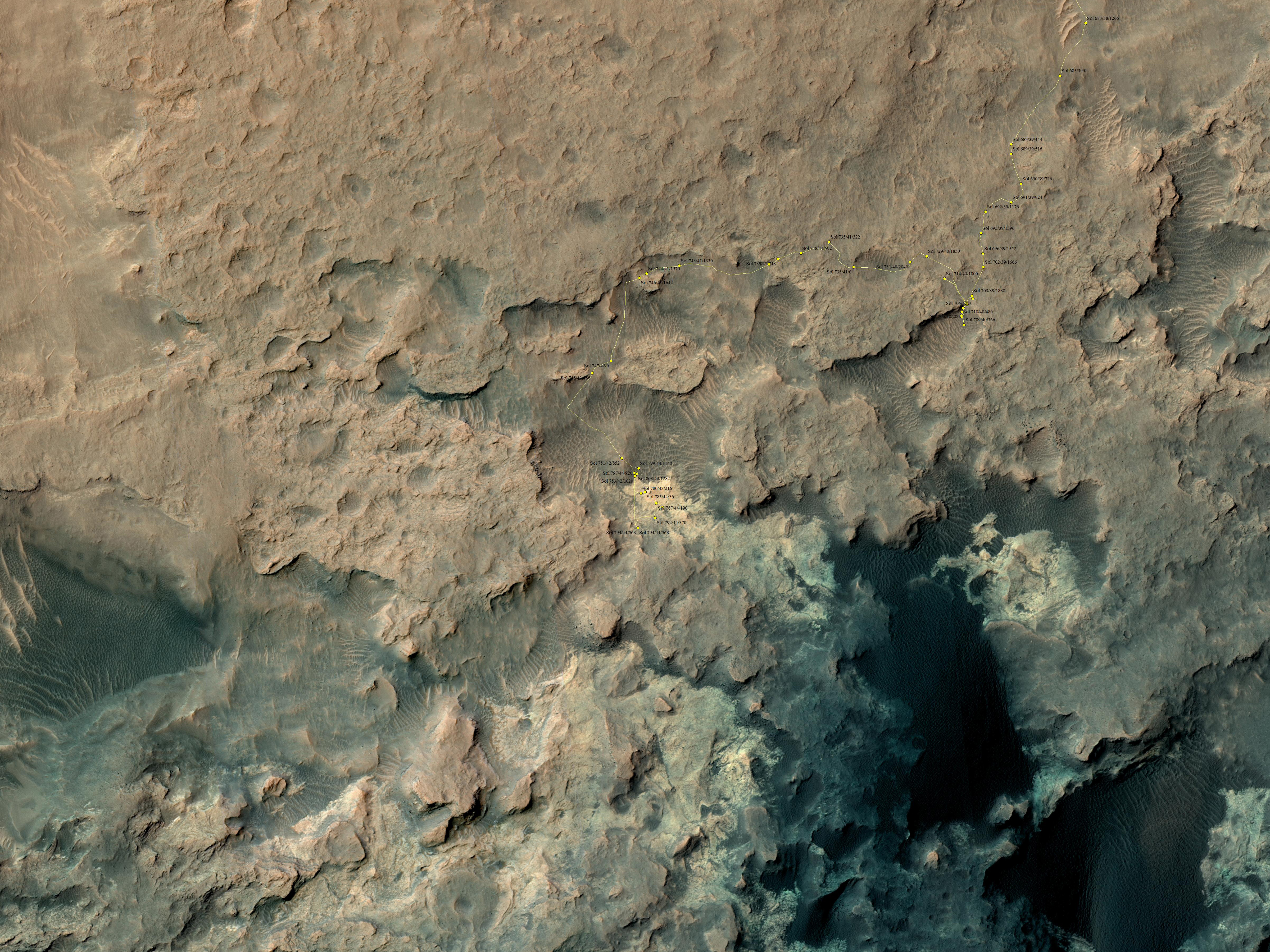
An image showing the Pahrump Hills walkabout route is at PIA19039. An overhead map showing the walkabout drives, from Sol 780 (Oct. 16) to Sol 794 (Oct. 30) is at http://mars.jpl.nasa.gov/msl/images/Curiosity_Location_Sol803-full.jpg.

Image credit: NASA/JPL-Caltech/MSSS

Wednesday, November 19, 2014

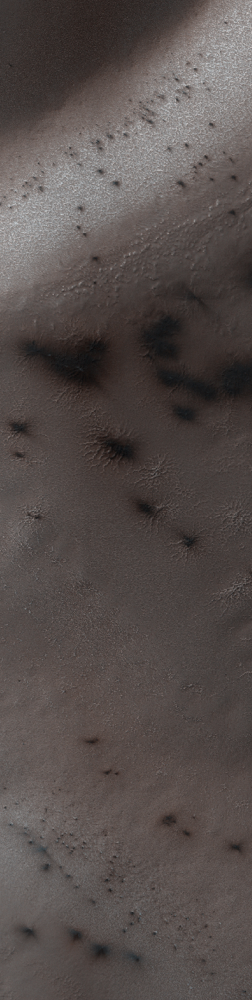
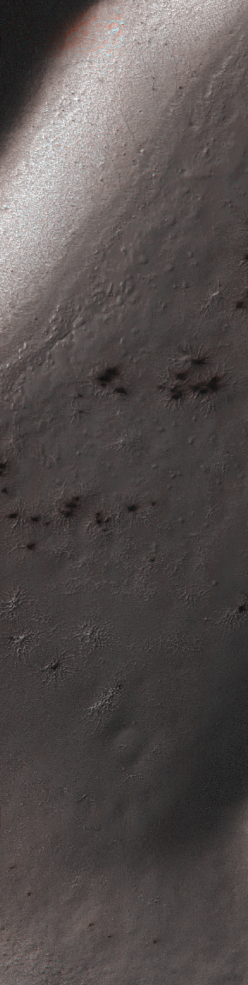
Spring in Inca City V


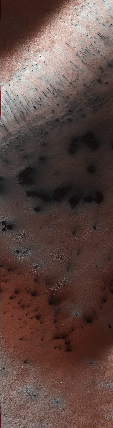
A significant event has occurred in Inca City. The layer of seasonal ice has started to develop long cracks. This is visible in the orange-colored band adjacent to the araneiforms. Fans of dust are emerging from long linear cracks. The cracks form when large plates of ice have no easily ruptured weak spots to release the pressure from gas building up underneath, so the ice simply cracks.

There are also more fans on the ridge at the top of the image, and more have appeared in between the araneiforms. We do not have any analogous processes occurring naturally on Earth: this is truly Martian.

Image credit: NASA/JPL/University of Arizona

Note: For more information, see PIA18896: Spring in Inca City V.

Monday, November 17, 2014

Spring in Inca City III


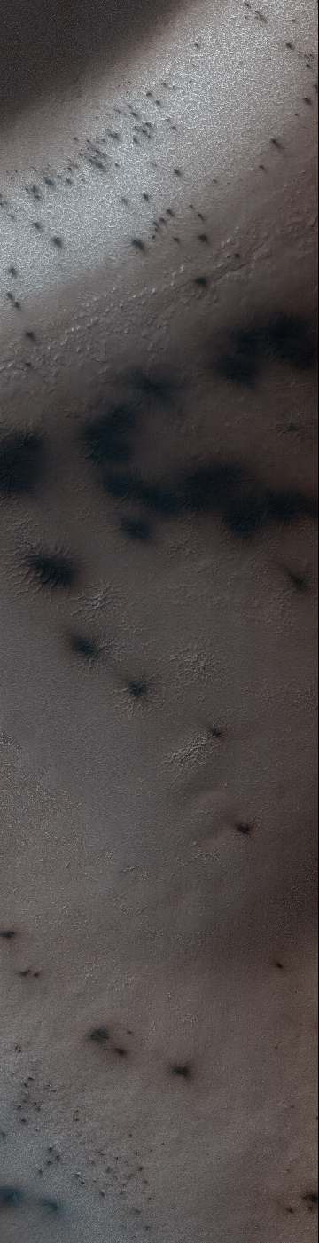
In Inca City another week has passed, and there are a few more fans on the ridge. We are studying the sequence of spring activity with the help of citizen scientists at the Planetfour website, sponsored by Zooniverse.

Citizens of planet Earth log on and identify and measure fans and blotches in the South polar region of Mars imaged by HiRISE. With their help we can study the polar weather by looking at how the fan directions change through the spring.

We see how the number of fans and blotches depends on the thickness of the ice layer and how high the sun is in the sky. If you would like to be a part of this endeavor join us at www.planetfour.org.

Image credit: NASA/JPL/University of Arizona

Note: For more information, see PIA18894: Spring in Inca City III.

Sunday, November 16, 2014

Spring in Inca City II


It is about two weeks later in Inca City and the season is officially spring. Numerous changes have occurred. Large blotches of dust cover the araneiforms. Dark spots on the ridge show places where the seasonal polar ice cap has ruptured, releasing gas and fine material from the surface below.

At the bottom of the image fans point in more than one direction from a single source, showing that the wind has changed direction while gas and dust were flowing out. Was the flow continuous or has the vent opened and closed?

Image credit: NASA/JPL/University of Arizona

Note: For more information, see PIA18893: Spring in Inca City II.

Saturday, November 15, 2014

Spring in Inca City I


Every winter a layer of carbon dioxide ice — or, dry ice — condenses in the Southern polar region, forming a seasonal polar cap less than 1 meter deep. Early in the spring the ice layer begins to sublimate (going directly from a solid to gas) from the top and bottom of the ice layer. Under the ice gas pressure builds up until a weak spot in the ice layer ruptures. The gas rushes out and as it escapes it erodes a bit of the surface.

Fine particles are carried by the gas to the top of the ice and then fall out in fan-shaped deposits. The direction of the fan shows the direction either of the wind or down the slope. If the wind is not blowing a dark blotch settles around the spot the gas escaped.

This region is known informally as Inca City, and it has a series of distinctive ridges. On the floor between the ridges are radially organized channels, known colloquially as spiders, more formally called "araneiforms." The channels have been carved in the surface over many years by the escaping pressurized gas. Every spring they widen just a bit.

This was the first image to be acquired after the sun rose on Inca City, marking the end to polar night. A few fans are visible emerging from the araneiforms.

Image credit: NASA/JPL/University of Arizona

Note: For more information, see PIA18892: Spring in Inca City I.

Friday, October 17, 2014

Wdowiak Ridge


This vista from NASA's Mars Exploration Rover Opportunity shows "Wdowiak Ridge," from left foreground to center, as part of a northward look with the rover's tracks visible at right.

Opportunity's panoramic camera (Pancam) recorded the component images for this mosaic on September 17, 2014, during the 3,786th Martian day, or sol, of Opportunity's work on Mars.

The ridge stands prominently on the western rim of Endeavour crater, about 200 yards or meters west of the rim's main crest line. Its informal name is a tribute to Opportunity science team member Thomas J. Wdowiak (1939-2013).

This panorama spans about 70 compass degrees from north-northwest on the left to east-northeast on the right. Wdowiak Ridge rises steeply about 40 feet from base to top. It extends about 500 feet (150 meters) in length. For scale, the distance between Opportunity's parallel wheel tracks is about 3.3 feet (1 meter).

Wdowiak Ridge is visible from overhead in the map at http://mars.nasa.gov/mer/mission/tm-opportunity/images/MERB_Sol3798_1.jpg, from the northeastern end near the rover's Sol 3751 location to Odyssey Crater near the rover's Sol 3789 location.

This version of the image is presented in approximate true color by combing exposures taken through three of the Pancam's color filters, centered on wavelengths of 753 nanometers (near-infrared), 535 nanometers (green) and 432 nanometers (violet).

Image credit: NASA/JPL-Caltech/Cornell University/Arizona State University

Note: For more information, see PIA18615: Opportunity's Northward View of 'Wdowiak Ridge' (False Color), PIA18616: Opportunity's Northward View of 'Wdowiak Ridge' (Stereo), and NASA's Opportunity Rover Gets Panorama Image at 'Wdowiak Ridge'.

Tuesday, October 14, 2014

Yardangs Near Memnonia Sulci


This region near Memnonia Sulci has been eroded by the wind to form linear ridges called yardangs. The two prominent directions of wind are recorded by the two directions of the ridges.

Orbit Number: 56315 Latitude: -10.4443 Longitude: 182.475 Instrument: VIS Captured: 2014-08-24 17:30

Image credit: NASA/JPL-Caltech/Arizona State University

Friday, October 10, 2014

Angustus Labyrinthus


This region of linear, intersecting ridges near the south pole is called Angustus Labyrinthus.

Orbit Number: 56312 Latitude: -81.7259 Longitude: 297.097 Instrument: VIS Captured: 2014-08-24 11:11

Image credit: NASA/JPL-Caltech/Arizona State University

Wednesday, October 8, 2014

Thumbprint Ridges at Planum Australe


While yesterday's VIS image showed a texture of oval depressions (swiss cheese), today's VIS image shows a linear surface texture of the south polar cap. This texture is described as looking like a thumbprint.

Orbit Number: 56378 Latitude: -77.7252 Longitude: 184.825 Instrument: VIS Captured: 2014-08-29 21:37

Photo credit: NASA/JPL-Caltech/Arizona State University

Friday, September 26, 2014

Impact Crater in Southern Terra Sirenum


The ridge in today's VIS image is the rim of a crater near the south polar cap.

Orbit Number: 56402 Latitude: -78.815 Longitude: 214.37 Instrument: VIS Captured: 2014-08-31 21:02

Photo credit: NASA/JPL-Caltech/Arizona State University

Note: This impact crater is located in southern Terra Sirenum; the closest named feature is Reynolds Crater, which is some distance to the north.

Pahrump Hills Outcrop


This southeastward-looking vista from the Mast Camera (Mastcam) on NASA's Curiosity Mars rover shows the "Pahrump Hills" outcrop and surrounding terrain seen from a position about 70 feet (20 meters) northwest of the outcrop.

The component images were acquired on September 17, 2014, during the 751st Martian day, or sol, of Curiosity's work on Mars. The rover team used these images to select a first drilling site on Pahrump Hills, which is part of the base layer of Mount Sharp. The selected drilling location is in the near portion of the pale outcrop to the right of the sand ripples.

The scene includes four distinct features:
1. Sand ripples in foreground, typical of those along the floors of valleys in this area within Gale Crater
2. The Pahrump Hills section of the Murray formation, where approximately 60 vertical feet (18 meters) of rock layers are exposed
3. A darker ridge off in the distance toward the left
4. Northwestern slopes of Mount Sharp in the background, where an abrupt transition is apparent between the buttes and valleys in the lower part and the tilted and carved beds of the upper part

This view combines several exposures taken by the Mastcam's left-eye camera. The color has been approximately white-balanced to resemble how the scene would appear under daytime lighting conditions on Earth.

Image credit: NASA/JPL-Caltech/MSSS

Note: For more information, see PIA18607: Curiosity Mars Rover's Route from Landing to 'Pahrump Hills', PIA18609: First Sampling Hole in Mount Sharp, PIA18610: Resistant Features in 'Pahrump Hills' Outcrop, and NASA Rover Drill Pulls First Taste From Mars Mountain.

Friday, September 5, 2014

Nilus Mensae


The hills and ridges at the top of this VIS image are part of Nilus Mensae, which is part of the complex Kasei Valles channels.

Orbit Number: 56124 Latitude: 21.5934 Longitude: 286.954 Instrument: VIS Captured: 2014-08-09 00:17

Photo credit: NASA/JPL-Caltech/Arizona State University

Tuesday, September 2, 2014

Possible Landing Site in Aram Dorsum for the ExoMars Rover


One of the important roles of HiRISE is to take high resolution images of potential landing sites for future landing missions.

This image is of an area called Aram Dorsum (also known by its old name, Oxia Palus) that has been suggested for the 2018/2020 ExoMars Rover, because it contains an ancient, exhumed alluvial system.

Imaging is needed both to check for boulder fields and other obstacles, as well as checking the scientific justification for choosing a site. This image is one part of what we call a stereo observation, where taking a view at a different angle from another orbit of the same areas will allow a 3D model (a digital terrain model) to be prepared. With this model, accurate measurements of slopes can then be made. Although it won't show the exhumed alluvial system, images of the area are needed to characterize the landing site.

The main image of the Aram Dorsum site contains a relatively fresh, 150-meter diameter impact crater with associated boulders. This small (1 kilometer square) part also shows signs of erosion into an overlying plateau, plus recent formation of some transverse aeolian ridges (called TARs) within the resulting valley. Overall, however, the site has relatively few obstacles for a lander.

This is a stereo pair with ESP_036740_1880.

Image credit: NASA/JPL/University of Arizona

Note: For more information, see PIA18773: A Possible Landing Site in Aram Dorsum for the ExoMars Rover.

Sunday, August 17, 2014

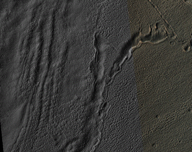
Glacial Ridges and Channels in Eastern Hellas Planitia


Hellas Crater in the ancient highlands contains some of the clearest evidence on Mars for glacial processes. This image, on the eastern margin of the giant impact crater, shows a number of features consistent with glaciation.

There are roughly north-south running ridges and troughs which mark the deposition of sediment called moraine underneath or beside a glacier. There are also sinuous channels which may formed from meltwater underneath a glacier. A small (3.5 x 3.5 kilometer) cutout shows an example of the moraine and meltwater channel.

Image credit: NASA/JPL/University of Arizona

Note: For more information, see PIA18647: Glaciation at the Eastern Hellas Margin.

Saturday, August 2, 2014

Frosty Gullies in Argyre Planitia


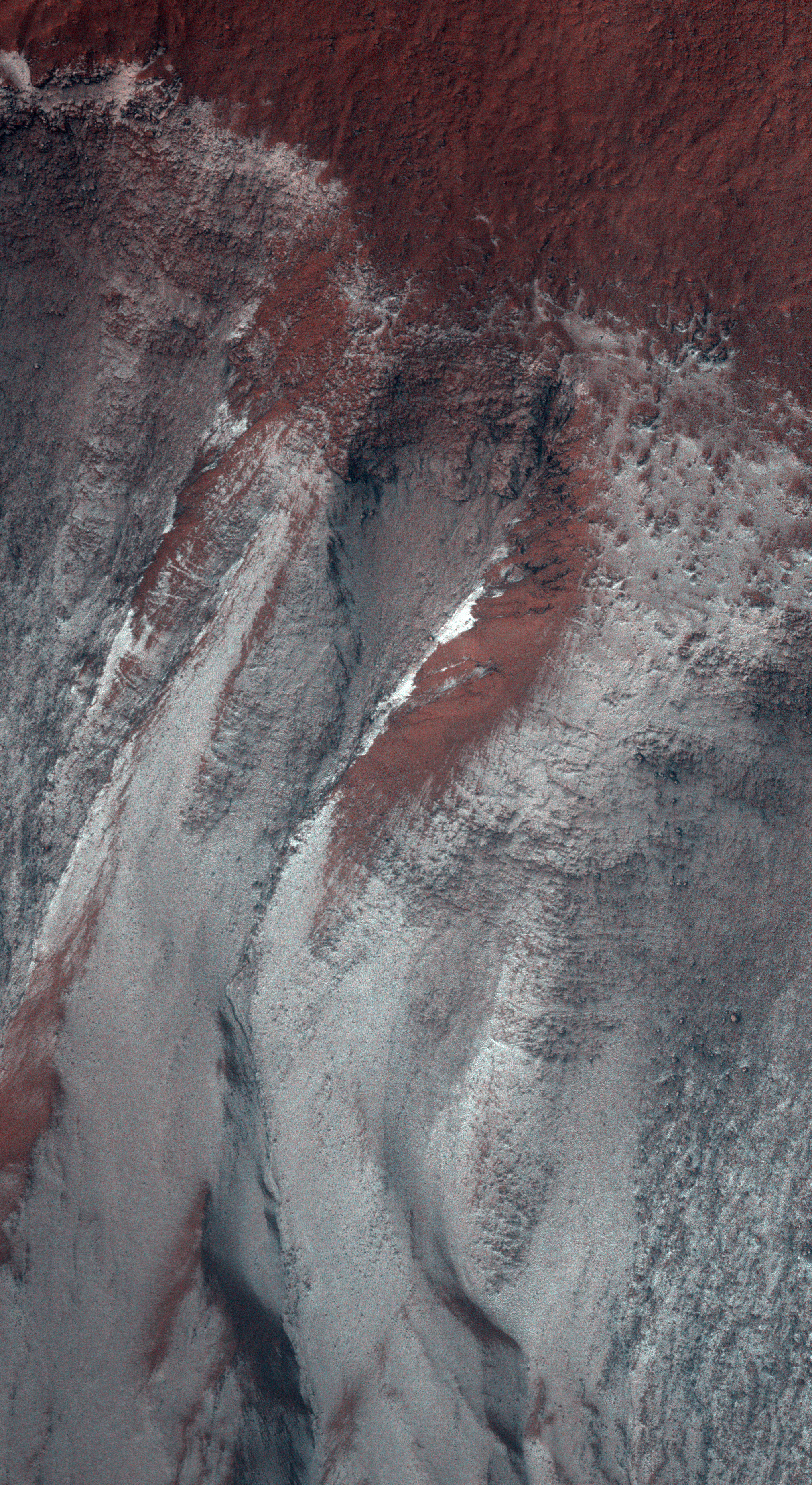
HiRISE monitoring has shown that gully formation on Mars occurs in winter and early spring in times and places with frost on the ground.

This image was acquired in late winter, and the frost or ice (visible as white areas) persists only on the south-facing slopes that have received little direct sunlight to this date.

Ridges between gully alcoves that get more light are reddish and largely free of frost. New gully activity isn't obvious in this image. There may be a delicate balance: in some years the frost (up to approximately 1 meter thick) will trigger avalanches, but not in most years. This frost consist of mostly carbon dioxide (dry ice), but includes small amounts of water ice as well.

Image credit: NASA/JPL/University of Arizona

Note: This image is located in the northern part of Argyre Planitia, just north of Hooke Crater. For more information, see PIA18634: Frosty Gullies.

Sunday, July 20, 2014

Surface of Planum Boreum


At Mars’ North Pole is a dome of icy layers ranging up to 2 kilometers thick, roughly analogous to the Earth’s ice caps in Greenland or Antarctica.

Although not visible here, the dome is characterized by incised spiraling troughs that reveal sequences of layers thought to reflect varying climate conditions over the time they were originally deposited. This image is of an area on the top surface of the polar dome between the troughs — vast, generally smooth, flat plains composed of a thin layer of very pure water ice. This image also shows that this thin ice layer has a rough texture, composed of knobs, ridges, and depressions on the scale of 1 - 10 meters.

This texture is only beginning to be studied with the high-resolution capabilities of HiRISE — the details of the texture varies around the polar cap, but the causes of the variation are not yet clear. This image has two particularly interesting features. One is that the surface dips into a depression towards the southwest, where the texture of the ice surface appears to change. The other is that there is a fracture or chain of pits in the southeast, which is a rare feature.

The brightness, composition, texture, and small-scale features of this ice layer that covers most of the polar dome are important as they influence the local energy balance (such the amount of sunlight reflected and absorbed), which in turn influences polar-wide climate and the stability of ice.

Image credit: NASA/JPL/University of Arizona

Note: For more information, see PIA18624: The Icy Surface of the North Polar Cap.

Friday, July 18, 2014

Ridges in Eridania Basin


Eridania Basin, located at the head of Maadim Vallis, has mounting geomorphic and spectral evidence that it may have been the site of an ancient inland sea.

This site presents interesting mineralogical and geological evidence for the past existence of a large aqueous system on Mars that could have been long lived, and may have been well suited for ancient life, and almost certainly contains important clues about the ancient climate.

In this HiRISE image, there are numerous dark ridges against a brighter substrate. These ridges could be cemented and topographically inverted fractures, although other origins (such as eskers, channels, or volcanic dikes) cannot be ruled out. One way to produce these ridges would be when fluids moved through the fractures, causing cementation and hardening. Later, erosion removed the softer rocks surrounding the fractures, while the more resistant cemented materials within the fractures were left standing higher, thus appearing inverted.

Image credit: NASA/JPL/University of Arizona

Note: For more information, see PIA18623: Ridges in Eridania Basin.

Saturday, July 12, 2014

Perspective View of Hellespontus Montes


Perspective view of Hellespontus Montes, a rocky ridge on the western rim of the vast Hellas basin in the southern hemisphere of Mars.

The foreground shows a close-up of a crater with a particularly interesting feature: wrinkles that form a roughly concentric pattern, with ever-smaller arcs towards the structure’s center. This type of feature is known as ‘concentric crater fill’, and is thought to be associated with snowfall and freezing cycles in an earlier and wetter period of martian history.

Once inside the crater, the snow was trapped and soon covered by surface dust, before compacting to form ice. The number of concentric lines indicate many cycles of this process and it is possible that ice may be hidden beneath just tens of meters of surface debris in these craters.

The image was taken by the High Resolution Stereo Camera on ESA’s Mars Express on 13 January 2014 (orbit 12,750). The center of the associated main color image is located at approximately 41°S/45°E.

Image credit: ESA/DLR/FU Berlin

Sunday, July 6, 2014

Feathery Transverse Ridges in Terra Cimmeria


This HiRISE image shows a valley filled with an assortment of linear ridges. These ridges are often referred to as transverse aeolian ridges, or TAR, and they take a variety of forms. Here they sit at right angles to the direction of the valley, because the topography funnels the wind along the trough.

At this location, some of the TAR have secondary structures, likely small ripples. It is common for sand dunes to be covered in small ripples, often with different orientations that may be shaped by winds redirected by the larger dunes. Here the secondary structures have an unusual radiating/converging pattern, giving the TAR here a feathery appearance.

Image credit: NASA/JPL/University of Arizona

Note: These ridges are located in far northwestern Terra Cimmeria. They lie to the northeast of Hesperia Planum.