Showing posts with label Kaiser Crater. Show all posts

Friday, August 2, 2013

Kaiser Crater Dunes


This daytime IR image shows part of the dune field on the floor of Kaiser Crater. The dune sand is warmer than the surrounding materials, so it appears bright in the IR image.

Orbit Number: 50658 Latitude: -46.8214 Longitude: 19.182 Instrument: IR Captured: 2013-05-16 04:05

Image credit: NASA/JPL-Caltech/Arizona State University

Monday, April 23, 2012

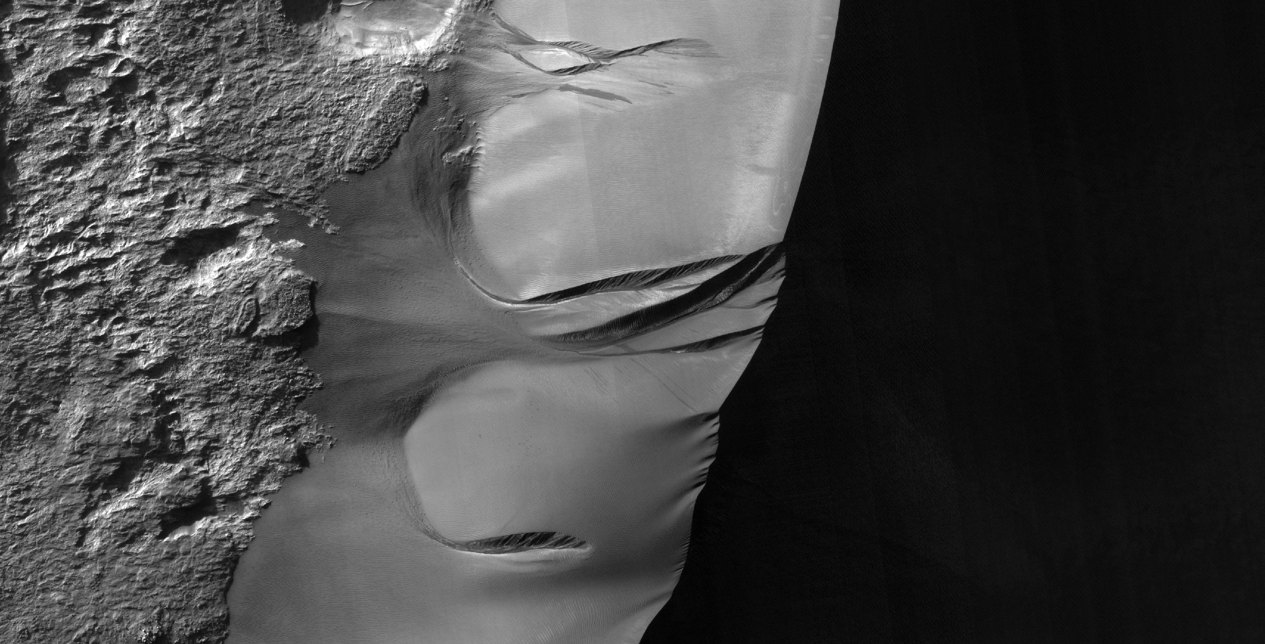
Active Dune Gullies in Kaiser Crater


Gullies remain an interesting feature to study on Mars, especially because we are still learning about their formation and what processes still act on them.

In this observation, we see large gullies on a huge, barchan dune. We've observed these gullies before, seeing that they appear to be active at different times. When we say "active," we mean that we can see changes in their appearance between different HiRISE images of the same area.

The major objective of this and similar images is to better understand the mechanism for these changes. A specific hypothesis the HiRISE team is investigating is that the changes we see are associated with frost deposits. The frost may be thick and heavy enough to cause parts of the sand dune to collapse, especially if it is "lubricated" by a layer of gas at the base of the frost layer. The gas would form at the bottom of the frost if sunlight passes through the frost and heats the underlying dark sand, working like a greenhouse.

Photo credit: NASA/JPL/University of Arizona

Wednesday, August 10, 2011

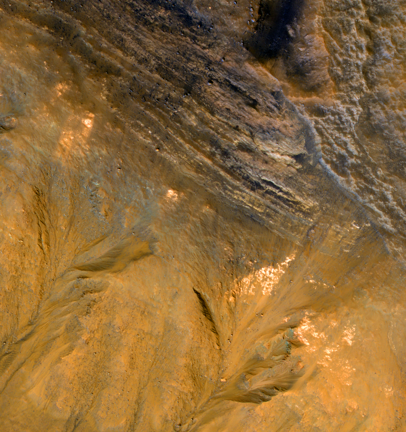
Crater Rim with Bedrock Layers and Gullies


This enhanced-color image shows a stack of bedrock layers exposed in the upper slope of an impact crater inside Kaiser Crater.

This observation reveals some of the materials that have largely filled the crater. There are also gullies on the lower slopes, extending up to the resistant bedrock layers. The gully-forming process erodes the loose materials much more readily than intact bedrock.

Photo credit: NASA/JPL/University of Arizona

Saturday, January 29, 2011

Monday, January 10, 2011

Active Gullies on Martian Sand Dunes


The dark sand dunes here are eroded in many places, forming gullies. Some of these gullies were not present in prior images of this spot, or have grown in size.

Monitoring of dune gullies by HiRISE has shown us when the gullies are active: in the winter or early spring! This was a surprise, because the gullies look like ones on Earth that are formed by flowing water or wet debris.

It is far too cold for water to be liquid in the Martian winter, but there is carbon dioxide frost (dry ice) on the ground, lasting through the spring at high latitudes. This frost may serve to reduce grain-to-grain friction, allowing the sand to flow on the steep slopes.

Photo credit: NASA/JPL/University of Arizona

Note: These dune gullies are located in an impact crater in Noachis Terra, roughly halfway between Russell Crater and Kaiser Crater.

Monday, October 4, 2010

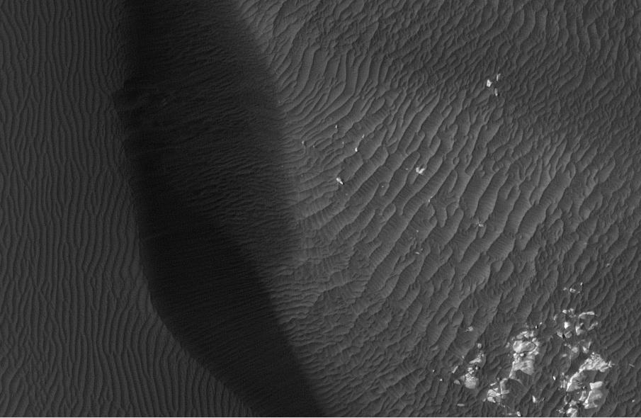
Kaiser Crater Dune Field


This observation shows a sand dune field in Kaiser Crater, a 210 kilometer (130 mile) wide impact basin in the Hellespontus region of Mars.

Winds have trapped massive quantities of sand on the floors of broad craters in this region. The steepest slopes on each dune, the slip faces, point to the East indicating that the dominant wind direction in this part of the dune field is from West to East. Patches of seasonal frost can be seen in the low areas between the dunes.

The subimage reveals smaller secondary dunes superimposed on the surface of the large dunes and even smaller ripples that appear between and perpendicular to the secondary dunes. Avalanching or mass movement of sand has left deep scars on the slip face of the large dune in the upper left portion of the subimage. This may indicate that the sand is not loose but is weakly cemented.

Photo credit: NASA/JPL/University of Arizona

Monday, July 5, 2010

Kaiser Crater Dunes (Once More)


Today's VIS image of the dunes on the floor of Kaiser Crater was collected simultaneously with yesterday's IR [infrared] image.

Photo credit: NASA/JPL/Arizona State University

Sunday, July 4, 2010

Kaiser Crater Dunes


This daytime IR [infrared] image of Kaiser Crater shows the majority of the dune field located on the floor of the crater.

Photo credit: NASA/JPL/Arizona State University