Today's VIS image shows part of the floor of Candor Chasma.
Orbit Number: 56461 Latitude: -6.12623 Longitude: 290.797 Instrument: VIS Captured: 2014-09-05 18:01
Image credit: NASA/JPL-Caltech/Arizona State University
Today's VIS image shows part of the floor of Candor Chasma.
Orbit Number: 56461 Latitude: -6.12623 Longitude: 290.797 Instrument: VIS Captured: 2014-09-05 18:01

This VIS image spans Candor Chasma.
Orbit Number: 56411 Latitude: -7.43707 Longitude: 293.113 Instrument: VIS Captured: 2014-09-01 15:12

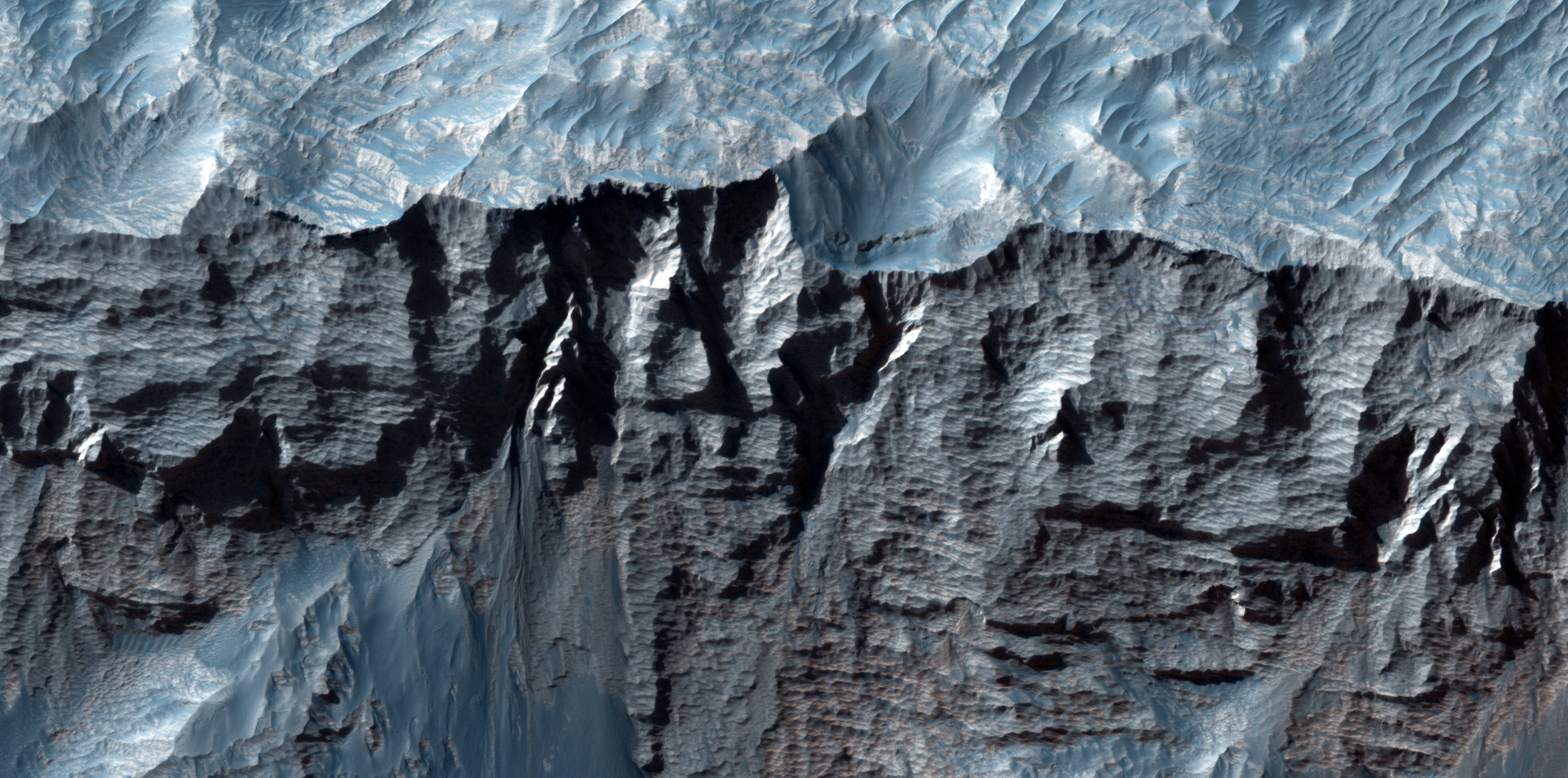
Shadows cast by the high walls and high hills within Candor Chasma are visible in this image. The Odyssey spacecraft and THEMIS camera are passing over the surface of Mars at a local time near 5 in the afternoon. The sun is close to the western horizon and shadows are being created by tall topographic features.
Orbit Number: 52547 Latitude: -6.7789 Longitude: 290.464 Instrument: VIS Captured: 2013-10-18 14:20

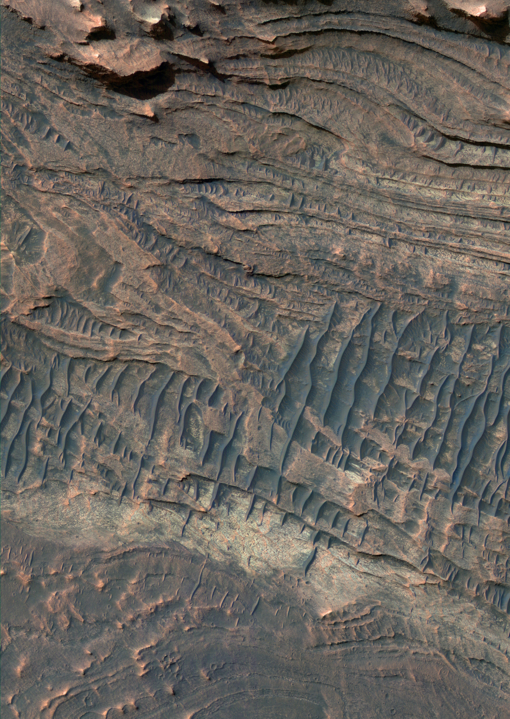
This beautiful image shows terrific layers and exposed bedrock along a cliff in west Candor Chasma, which is part of the extensive Valles Marineris canyon system.
A Context Camera (CTX) image of this area showed that the strata is not entirely horizontal, and that there may be crossed beds, or lenses pinching out, or some other texture/structure that might give a clue as to the depositional setting of the sediment that makes up these layers.
This image shows the area in greater detail and resolution, so we can compare what we have gleaned from CTX and MOC images to develop a better understanding of what we're looking at and how to interpret the past history of the region.

This VIS image shows a portion of Candor Chasma.
Orbit Number: 51473 Latitude: -6.36614 Longitude: 290.738 Instrument: VIS Captured: 2013-07-22 05:23

In this beautiful image there appears to be a breccia layer, or a layer composed of rock fragments embedded in a finer material. This particular breccia is made up of fragments (or "clasts" as they are known to geologists) so large they can be seen by HiRISE.
The breccia layer, seen most easily near the center of this image, seems to be more resistant to erosion than the surrounding material, serving as a caprock to protect the layers beneath it.
The HiRISE team is planning on acquiring another image over this area in order to create a stereo (3-D) pair. This will help scientists better understand the topography and stratigraphy of the area.
This is a stereo pair with ESP_026523_1735.

West Candor Chasma in central Valles Marineris contains some of the thickest of the fine-grained layered deposits on Mars.
We can't see the grain sizes with HiRISE, but as the material erodes in the wind it disappears--apparently carried away by the wind--so the grains must be small. The layers may have been deposited from windblown materials, fall of volcanic sediments, or carried in by water, or all of the above.
Subsequently the layers may have been altered by groundwater, producing hydrated minerals such as sulfates. The enhanced colors in the sub image are related to the minerals or to overlying dust or sand. The dark blue sharp-crested ridges are sand dunes.

This HiRISE image shows faulted layered deposits in a part of Valles Marineris called Candor Chasma.
Often faults cut through the layered material in this area, indicating that the rocks underwent stress causing them to crack and shift in position after they were deposited.
This area also has a high abundance of hematite. Hematite is a mineral that can precipitate out of water, so its presence on Mars is of special interest for understanding the distant past.

Today's VIS image shows the region between Candor Chasma and Melas Chasma.

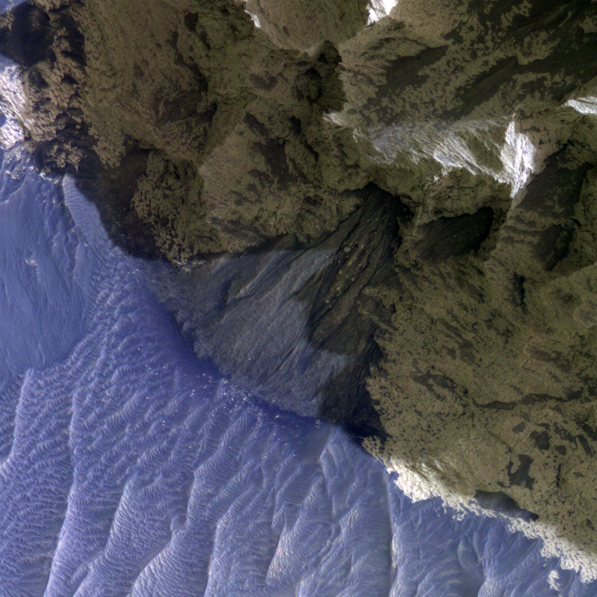
Today's VIS image shows a small landslide chute and deposit. This feature is located on the easternmost end of Candor Chasma.

This image shows an area of layered deposits in Candor Chasma. Here, sheets and dunes of dark-toned sand cover the light-toned, layered bedrock. Accumulations of dark sand accentuate bedding within the light-toned bedrock, giving some areas a zebra-striped pattern.
In the northern part of the scene, the bedrock has been eroded into steep, craggy cliffs. Some sections of these cliffs are covered by triangular-shaped debris fans that are intermediate in color between the dark-toned sand and light-toned bedrock.These fans may contain a mix of light-toned bedrock that has crumbled away from the surrounding cliffs and wind-blown sand and dust.
The surfaces of some fans are dissected by gullies, which most likely formed through dry avalanching. The bottoms of the gully channels are often darker in tone than the surrounding fan surface. This may be due to accumulations of wind-blown sand in the gully floor. The subimage shows a clear example of a gullied fan from the northern portion of the scene.

This VIS image of Candor Chasma shows a complex region of eroded layered deposits.

The ridge features at the top of this VIS image are called spurs. Spurs and gullies form the cliff sides of the Vallis Marineris chasmata. Sand dunes can be seen at the bottom of the image. Dunes are a common feature on the floors of the chasmata.

This VIS image of Candor Chasma contains eroded deposits of material and a large landslide deposit. Gravity, wind, and water all played a role in shaping the landforms we see in this image.