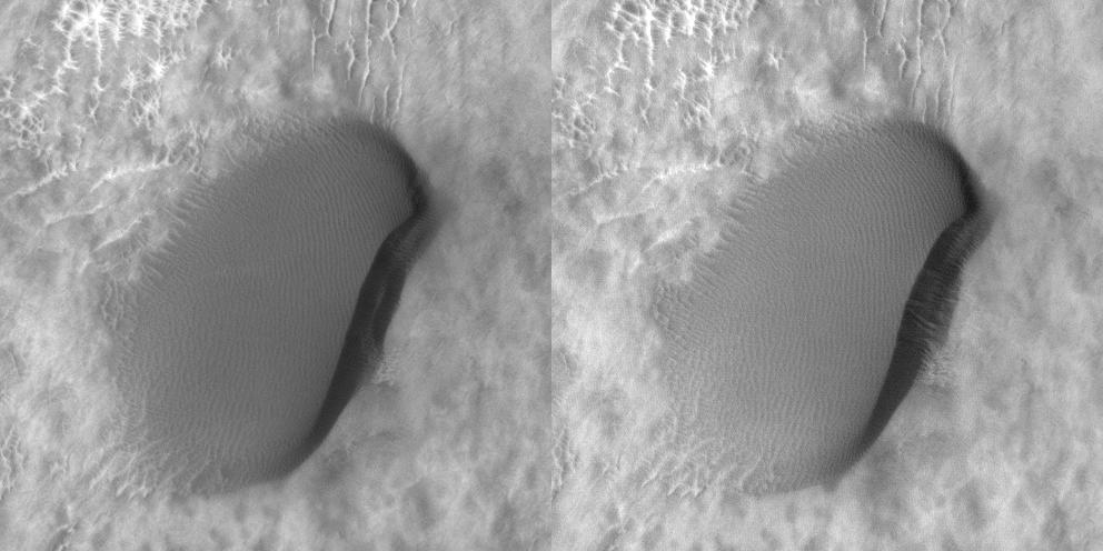
The dunes in this VIS image are located on the floor of Lyot Crater.
Orbit Number: 54853 Latitude: 50.2638 Longitude: 29.1544 Instrument: VIS Captured: 2014-04-26 10:23
Photo credit: NASA/JPL-Caltech/Arizona State University
The dunes in this VIS image are located on the floor of Lyot Crater.
Orbit Number: 54853 Latitude: 50.2638 Longitude: 29.1544 Instrument: VIS Captured: 2014-04-26 10:23

The dunes in this VIS image are located on the floor of Lyot Crater.
Orbit Number: 52955 Latitude: 50.411 Longitude: 28.5003 Instrument: VIS Captured: 2013-11-21 05:45

HiRISE has been carrying out a dedicated survey of sand dunes on Mars, determining whether and how fast the dunes move by observing repeatedly at intervals of Martian years. More than 60 sites have been monitored so far, showing that sand dunes from the equator to the poles are advancing at rates of up to 1 meter per Martian year.
These observations are still spotty, however, and tend to be concentrated in the tropics and the North Polar erg (the sand sea that surrounds the North Pole). One latitude band that had not been sampled at all lies between 30 and 65 degrees north. This observation is among a set of images acquired to fill that gap.
This image shows a variety of different dune types in southern Lyot Crater in the northern lowlands at 48.9 degrees North. Transverse dunes to the west grade into longitudinal dunes downwind to the east and barchans to the south, possibly because of local winds channeled by topography in the impact basin. This image was intended to match the approximate illumination and viewing conditions of an earlier HiRISE observation that was made two Martian years earlier, in August 2008.
Detailed comparison of the two images shows movement on many of the dunes during this interval of nearly four Earth years. The subimage is an animation showing changes on one of the small barchans in the south of the dune field. The area pictured in the subimage is about 100 meters across. Winds from the west (left) have shifted the small ripples up the back of the dune towards the east. Sand has blown over the crest of the dune, cascaded down the steep slip face, and accumulated along the base of the slip face in the lee of the dune. In this way, the small dune advances slowly downwind.
Other images also show dune activity in this latitude band, adding to a growing suspicion that dunes are on the move everywhere on Mars, faster in some places than others.

Nestled between mesas, this image shows the valley floor where eroded rocky and/or soil debris appears to have flowed viscously from the mesa walls across the valley to merge. A leading theory is that ice and snow became entrained with the soil debris as it shed from the mesa. This combined ice-rich debris then flowed slowly downhill. "Rock glaciers" on Earth are an analogous landform that flow viscously like a glacier, lubricated by ice trapped in the pore spaces.
The image shows light-toned viscous debris that overlays a darker toned surface. Both surfaces sport irregular fracture patterns and evidence that substantial erosion has since taken place. The upper viscous-flow surface also contains abundance small, regular polygonal patterns. Such patterns are commonplace in permafrost on Earth, and are typically considered strong evidence for shallow subsurface ice.
Erosion and the formation of small scarps reveal a multitude of layers within the subsurface. Such structure is unusual for a single glacial flow and may indicate episodic glacial advance and retreat. Additionally, the sparse population of rocks on the surface and along the eroded scarps suggest that the debris eroding from the mesas consists largely of soil.

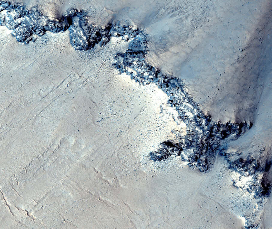
This mid-latitude (53 degrees North) crater appears well-preserved, with a clear ejecta blanket and well-defined rim. Bedrock exposures are visible near the top of the rim. Studying this site can yield information about the underlying terrain within this region.
Additionally, HiRISE images show small-scale features formed through modification and degradation processes; for example, few-meter-wide cracks that run perpendicular to the slope are likely formed through slumping and periglacial processes.
Gullies and flow features are also likely to be found along the crater wall -- possible shallow channels starting at the bedrock exposures are visible in along the rim in the upper/left portion of the image.

The 40-kilometer diameter unnamed crater (49 degrees North, 21 degrees East) in this image is located west of Lyot Crater and north of Deuteronilus Mensae in the Northern Plains of Mars.
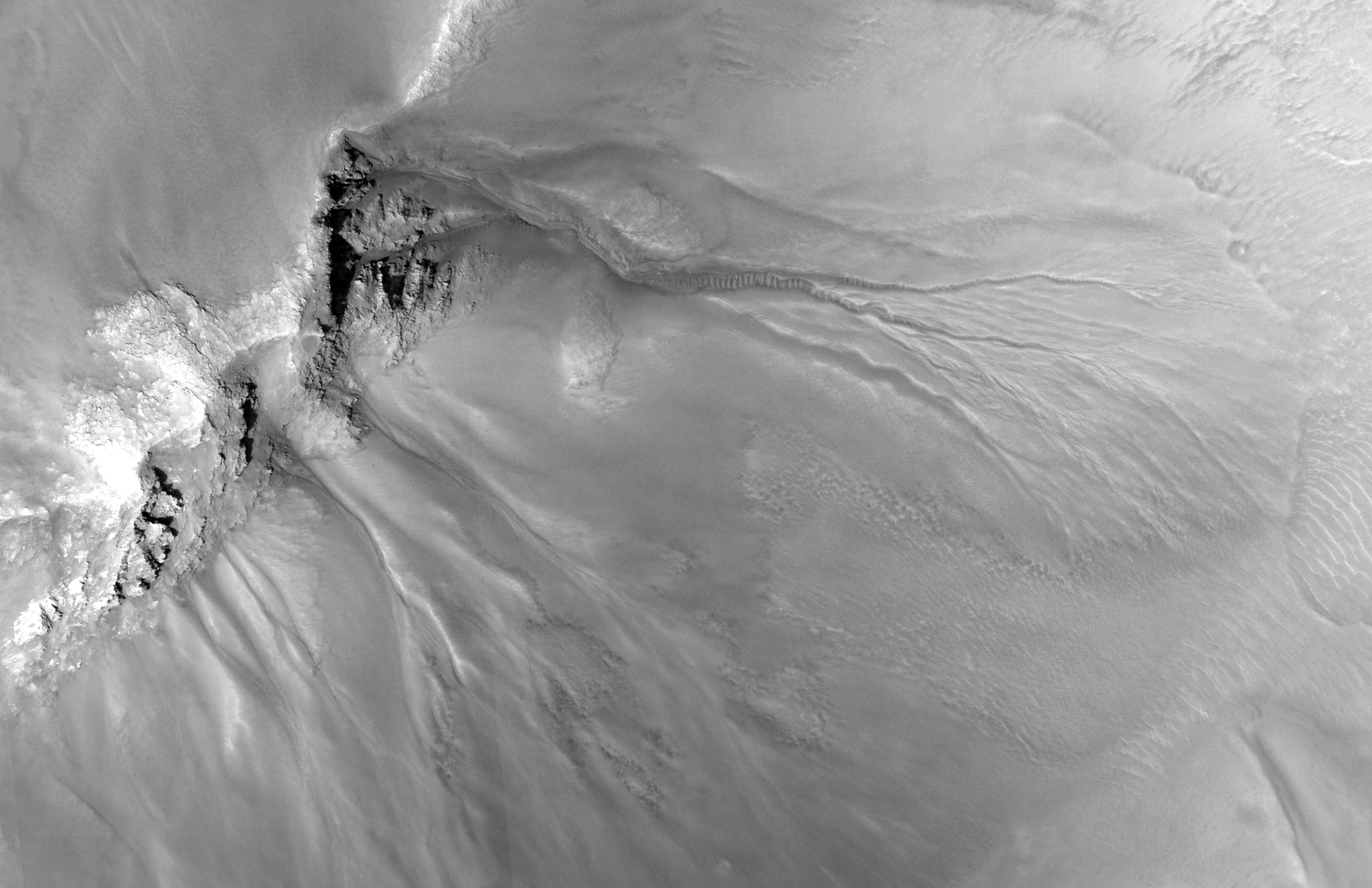
As seen in the subimage, gully systems in the central structure have eroded underlying layers (undercutting) that are less resistant to erosion than the surface rock of the central structure. Previous channelized water flows likely transported the eroded sediments toward the southeast and deposited them forming the expansive debris aprons.
The formation of channels on the debris aprons supports the hypothesis that these sediments were transported down the gullies and then deposited onto the aprons by flowing water. In the larger, northernmost system, sediments have partially filled in the channel segments and winds have remobilized these sediments forming the dunes that line the gullies.
This is a stereo pair with PSP_009298_2295.

This image shows what appears to be a degraded alluvial fan at upper left and a dust devil at lower right.
An alluvial fan is deposited by a river flowing out onto a plain; if this feature was formed by water, the activity ceased long ago, based on the density of craters on the fan surface.
The dust devil, on the other hand, is an example of the ongoing processes that continue to shape the surface of Mars.
Abanico y Remolino de Polvo en Deuteronilus Mensa
Esta imagen muestra lo que parece ser un abanico aluvial degradado en la parte superior izquierda y un remolino de polvo en la parte inferior derecha.
Un abanico aluvial se deposita a través de un rio que fluye hacia una llanura. Si el agua formó este abanico, la actividad cesó hace mucho tiempo si nos fijamos en la densidad de cráteres sobre su superficie.
El remolino de polvo, por otra parte, es un ejemplo de los procesos que hay actualmente en funcionamiento y que dan forma a la superficie de Marte.

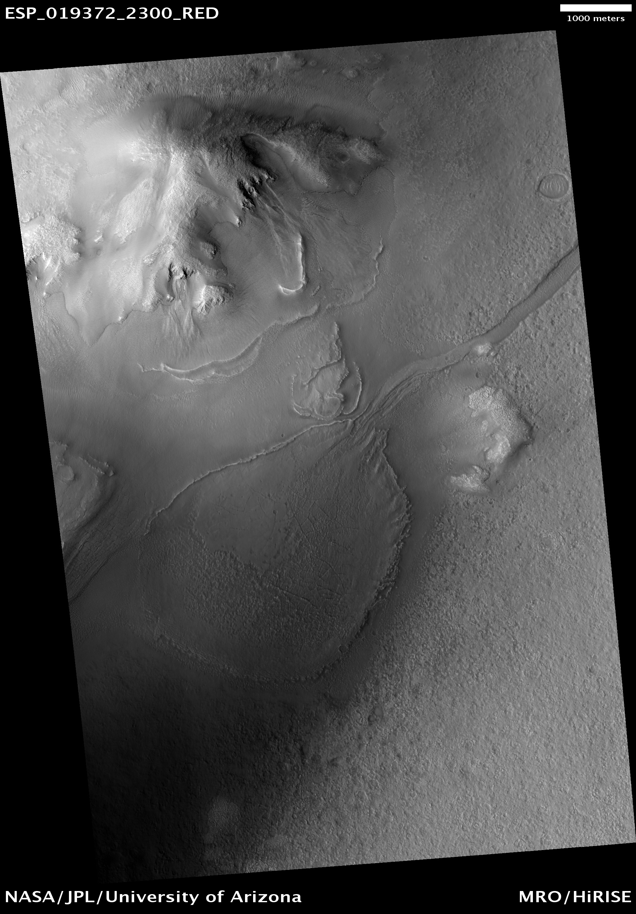
Extensive flow of liquid water across the surface of Mars is generally constrained to the first billion years of the planet's evolution. There are some specific places, however, where liquid water may have been stable later in the planet's history, when Mars is considered to have been cold and dry. Lyot Crater is one of those places.
Lyot Crater is a "peak-ring basin" that formed in the lowlands of the northern hemisphere of Mars, making it the lowest topographic point in the northern hemisphere. Additionally, we know that the Lyot impact event occurred after the most significant era of fluvial activity on Mars, so any features observed in Lyot were formed after that era as well.
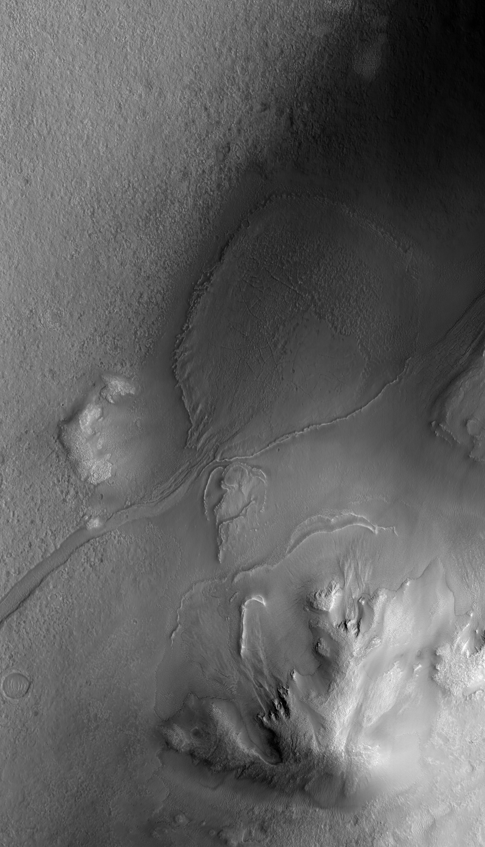
This observation shows what appears to be a very unusual fan of material that is sourced by a valley that extends upslope for almost 50 kilometers along the floor of Lyot Crater (top-right of the full image [see also here]). The fan is not fresh, so this activity pre-dates the Martian gullies (a few of which can be seen at the top of this image). The fan has been mantled by smooth material which has been removed in some areas and fractured in others. This makes it difficult to tell what the fan looked like when it was originally emplaced.
Lyot Crater is found in a region of Mars that is thought to host many debris-covered glaciers (some of which are found within Lyot itself) and ice-rich mantling units. These could provide potential sources of water that, under conditions slightly more favorable than those of today, could melt and create features like we see here.

This observation is located in the Deuteronilus Mensae region along the highland/lowland dichotomy boundary in the Northern hemisphere of Mars.
This region contains many mesas surrounded by lobate debris aprons that are thought to be ice-rich. These aprons have been interpreted as a variety of possible features including rock glaciers, ice-rich mass movements, or debris-covered glacial flows. Recent radar data from the MRO SHARAD instrument has shown them to be composed of nearly pure ice.
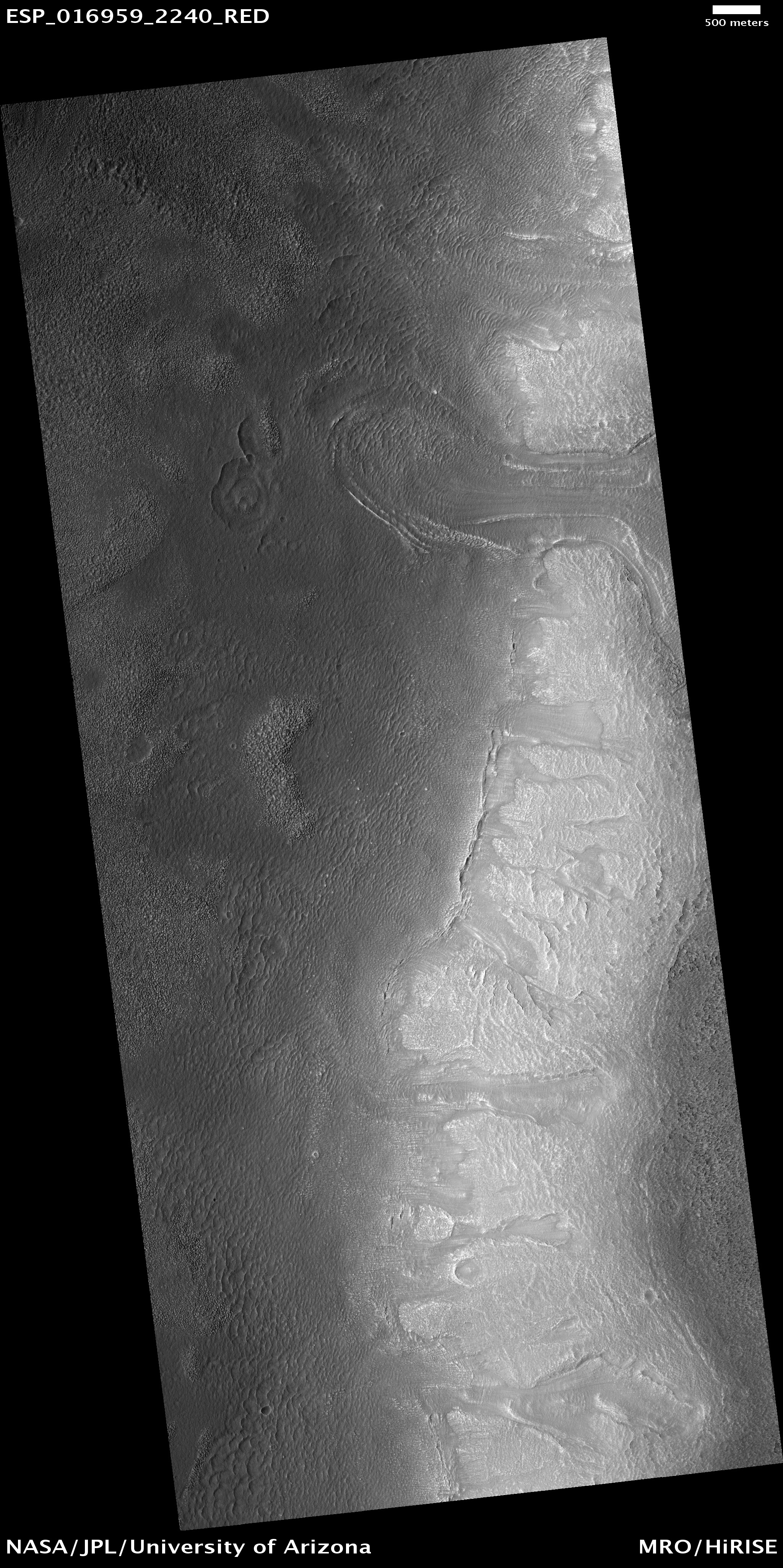
The full image shows the edge of one of these mesas with a lobate debris apron extending from its base. Both the mesa top and the surface of the debris apron appear covered with ice-rich mantling materials characteristic of the Martian mid-latitudes and thought to have been deposited around 10 million years ago during a period of high obliquity. Ice-rich flows also extend down the side of the mesa onto the surface of the apron, as evidenced by the lobate flow near the top of the image. Several alcoves can also be seen along the mesa wall that appear to be filled with "pasted-on" mantling deposits. Similar features have been observed along the walls of Dao Vallis east of the Hellas Basin, a mid-latitude region that also contains lobate debris aprons.