Showing posts with label Viking. Show all posts

Sunday, February 16, 2014

Morning Clouds Over Valles Marineris


No NASA Mars orbiter has been in a position to observe morning daylight on Mars since the twin Viking orbiters of the 1970s. This image, taken by Viking Orbiter 1 on August 17, 1976, shows water-ice clouds in the Valles Marineris area of equatorial Mars during local morning time. North is to the upper left, and the scene is about 600 miles (about 1,000 kilometers) across.

Although a few observations of Mars in morning daylight have come from the Viking orbiters and the European Space Agency's Mars Express orbiter, no mission has systematically studied how morning features such as clouds, fogs and surface frost develop in different Martian seasons in different parts of the planet. NASA's Mars Odyssey orbiter, in 2014, is in the process of changing its orbit to enable such systematic morning daylight observations.

Photo credit: NASA/JPL

Note: For more information, see NASA Moves Longest-Serving Mars Spacecraft for New Observations.

Friday, January 17, 2014

Cinder Cones in Valles Marineris


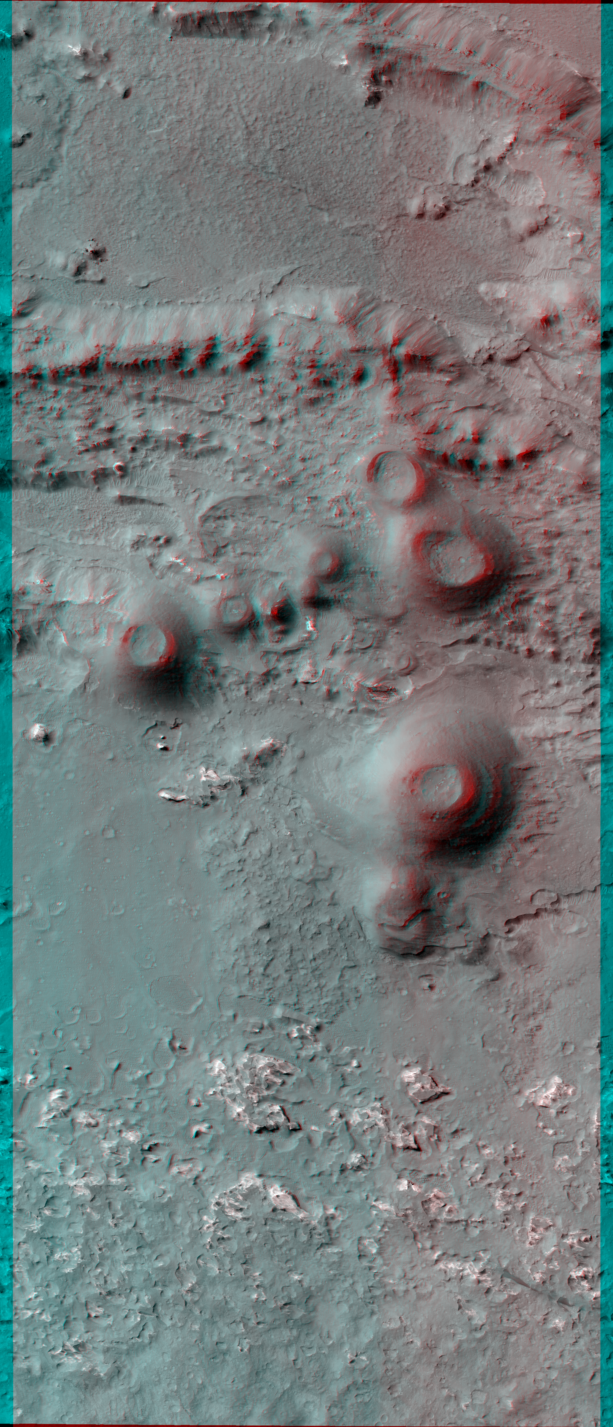
The possibility of recent volcanism inside Valles Marineris was first proposed decades ago based on Viking orbiter images, but the candidate volcanoes proved to be other features such as complex sand dunes when we studied them with higher-resolution images.

However, this image shows cones with summit pits that are very similar to cinder cones on Earth. They are also very well-preserved, peppered by only small impact craters, so they must be geologically young (perhaps less than a few hundred million years).

These features were first seen in Context Camera image D01_027538_1674_XN_12S062W and a HiRISE target was suggested by a member of that team using HiWish. The cones might look like craters in single images, but if you look at the stereo anaglyph, you’ll see the cones stick up and are clearly not the same shape as impact craters.

This is a stereo pair with ESP_033986_1670.

Photo credit: NASA/JPL/University of Arizona

Note: For more information, see PIA17874: Recent Volcanism in Valles Marineris.

Wednesday, December 18, 2013

Age Estimation of Mudstone in Gale Crater


A rock in the Sheepbed mudstone deposit in the Yellowknife Bay area inside Gale Crater is the first rock on Mars ever to be dated by laboratory analysis of its ingredients. The analysis using measurements of the rock's potassium and argon content by NASA's Curiosity Mars rover yielded an estimate that it is 3.86 billion to 4.56 billion years old.

The mudstone is a sedimentary rock formed by particles that had started in rocks at higher elevations -- labelled on this image as "sediment sources" -- and washed downslope before being deposited at Yellowknife Bay.

The age measured for the rock is not the depositional age of the mudstone. Researchers calculate that it is a mixture of the ages of the mineral components delivered to the mudstone via stream transport from the crater rim and the highlands beyond, as indicated by the yellow symbols. Estimates of age based on the density of impact craters on different areas of Mars put the Gale impact and surrounding highlands in the range 3.6 billion to 4.1 billion years old, a good match to the new age estimate from laboratory analysis.

An unannotated version of the underlying image is available at PIA16475. This image combines elevation data from the High Resolution Stereo Camera on the European Space Agency's Mars Express orbiter, image data from the Context Camera on NASA's Mars Reconnaissance Orbiter, and color information from Viking Orbiter imagery.

Image credit: NASA/JPL-Caltech

Wednesday, December 11, 2013

Possible Ancient Lake in Gale Crater


This illustration depicts a concept for the possible extent of an ancient lake inside Gale Crater. The existence of a lake there billions of years ago was confirmed from examination of mudstone in the crater's Yellowknife Bay area. For this illustration, the possible extent was estimated by mapping ancient lake and stream deposits and recognizing that water flowed from the crater rim into the basin (arrows). The water would have pooled in the linear depression created between the crater rim and Mt. Sharp. The area's history likely included the coming and going of multiple lakes of different sizes as climate conditions evolved.

The base map combines image data from the Context Camera on NASA's Mars Reconnaissance Orbiter and color information from Viking Orbiter imagery. The 25-kilometer scale bar at lower right is 15.5 miles long. North is up.

Image credit: NASA/JPL-Caltech/MSSS

Note: For more information, see PIA17594: View into 'John Klein' Drill Hole in Martian Mudstone, PIA17598: Clay Mineral Structure Similar to Clays Observed in Mudstone on Mars, PIA17599: Volatiles Released by Heating Sample Powder from Martian Rock 'Cumberland', and NASA Curiosity: First Mars Age Measurement and Human Exploration Help.

Friday, April 5, 2013

MSL's Parachute Flapping in the Wind


These seven HiRISE images were acquired between August 12, 2012 and January 13, 2013, and show distinct changes in the parachute (at bottom, attached to the backshell at top). In the first four images there are only subtle changes, perhaps explained by differences in viewing and illumination geometry.

Sometime between September 8, 2012 and November 30, 2012, there was a major change in which the parachute extension to the southeast (lower right) was moved inward, so the parachute covers a smaller area. In the same time interval some of the dark ejecta around the backshell brightened, perhaps from deposition of airborne dust.

Another change happened between December 16, 2012 and January 13, 2013, when the parachute shifted a bit to the southeast. This type of motion may kick off dust and keep parachutes on the surface bright, to help explain why the parachute from Viking 1 (landed in 1976) remains detectable.

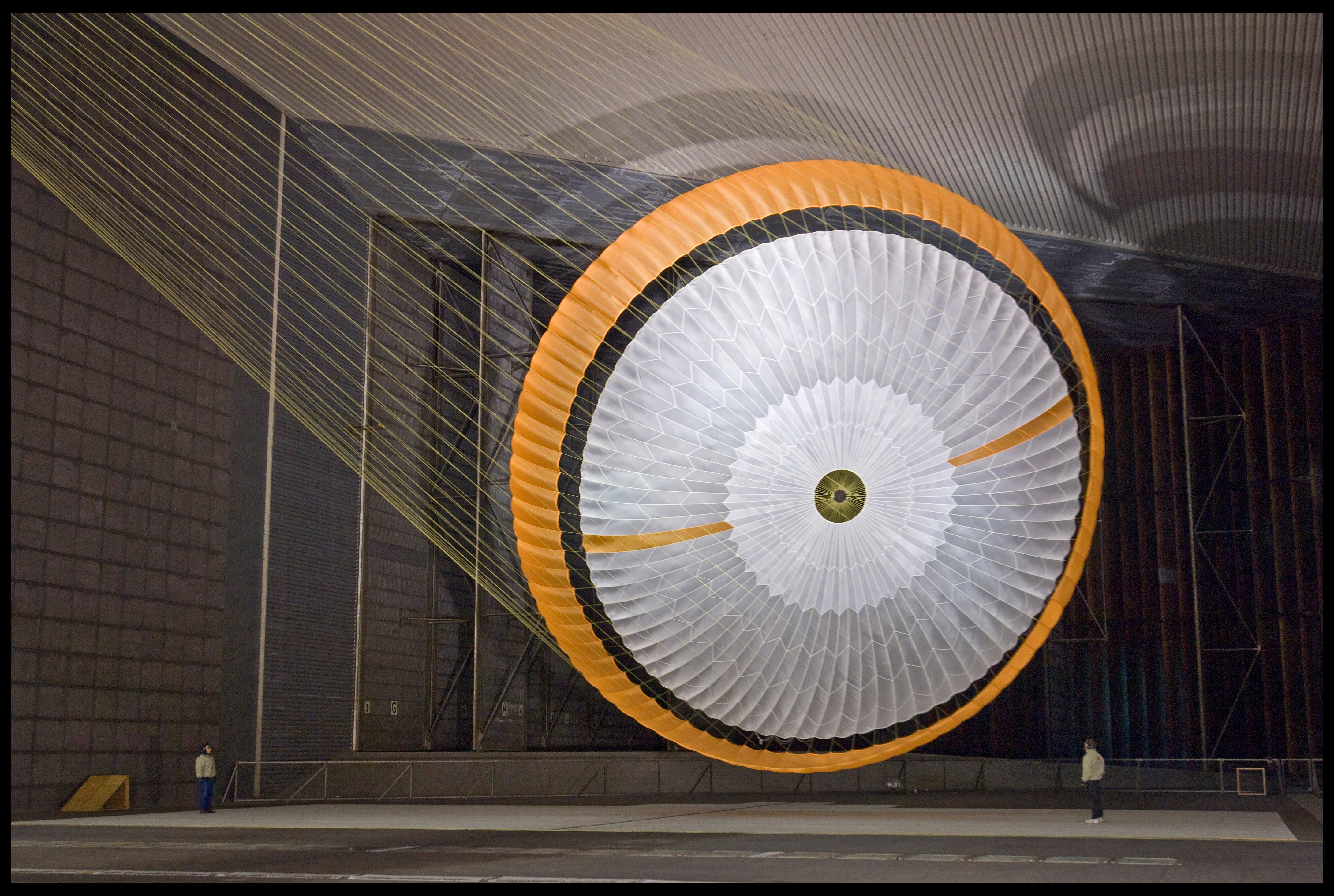
The parachute is the largest one of its kind ever constructed, coming in about 65 feet in diameter (you can see a scale here, courtesy JPL) The gap between the white and orange-hued sections prevented the chute from becoming torn during the descent phase.

You can also see a 3D view of the parachute on the ground here. The parachute’s suspension lines were made from Technora, with a fiber similar to Kevlar. The color is a creamy yellow, which is why they are not visible in the images such as those in the Phoenix lander descent image which were white.

Photo credit: NASA/JPL/University of Arizona

Note: This is a big story today. For more information, see PIA16813: MSL's Parachute Flapping in the Wind and Used Parachute on Mars Flaps in the Wind.

Monday, August 13, 2012

Gale Crater's Rim


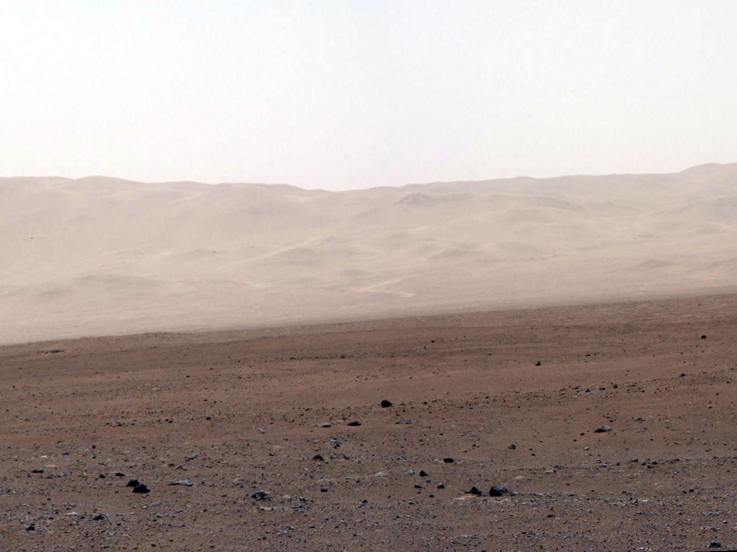
This color image from NASA's Curiosity rover shows part of the wall of Gale Crater, the location on Mars where the rover landed on August 5, 2012 PDT (August 6, 2012 EDT). This is part of a larger, high-resolution color mosaic made from images obtained by Curiosity's Mast Camera.

This image of the crater wall is north of the landing site, or behind the rover. Here, a network of valleys believed to have formed by water erosion enters Gale Crater from the outside. This is the first view scientists have had of a fluvial system -- one relating to a river or stream -- from the surface of Mars. Known and studied since the 1970s beginning with NASA's Viking missions, such networks date from a period in Martian history when water flowed freely across the surface. The main channel deposit seen here resembles a dirt road ascending into the mountains, which are actually the north wall and rim of Gale Crater. The colors in a second version (Figure 1) have been modified as if the scene were transported to Earth and illuminated by terrestrial sunlight. This processing, called "white balancing," is useful for scientists to be able to recognize and distinguish rocks by color in more familiar lighting.

Although Curiosity is about 11 miles (18 kilometers) away from this area and the view is obscured somewhat by dust and haze, the image provides new insights into the style of sediment transport within this system. Curiosity has no current plans to visit this valley system, since the primary objective of the rover is south of the landing site. But images taken later and with the 100-millimeter Mastcam are likely to allow scientists to study the area in significantly more detail.

The images in this mosaic were acquired by the 34-millimeter MastCam over about an hour of time on August 8, 2012 PDT (Aug. 9, 2012 EDT), each at 1,200 by 1,200 pixels in size.

Photo credit: NASA/JPL-Caltech/MSSS

Landing Accuracy on Mars: An Historical Perspective


This image illustrates how spacecraft landings on Mars have become more and more precise over the years. Since NASA's first Mars landing of Viking in 1976, the targeted landing regions, or ellipses, have shrunk. Improvements in interplanetary navigation tightened the ellipses between the 1997 and 2008 landings of NASA's Pathfinder and Phoenix.

NASA's Curiosity used those improvements, in addition to hypersonic guided entry similar to that used by astronauts returning to Earth during NASA's Apollo program, to further reduce the ellipse size and land just north of the slopes of Mount Sharp. The area of Curiosity's landing ellipse was just seven percent the size of the previous best landing ellipse for Phoenix. This guided entry technique also allowed a much heavier rover to land on Mars.

The background picture is from the European Space Agency's Mars Express overlaid with topographical data from NASA's Mars Global Surveyor.

Image credit: NASA/JPL-Caltech/ESA

Wednesday, May 2, 2012

How Did Valles Marineris Form?


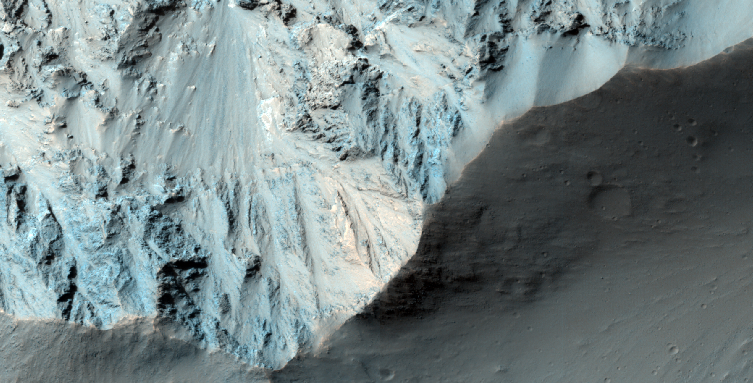
This image (and its companion for stereo) crosses an impact crater about 50 kilometers (30 miles) wide. The crater was visible in Mariner 9 and Viking Orbiter images acquired decades ago, and was interpreted as evidence that the floor of Coprates Chasma was an old surface like that of the surrounding plateaus north and south of the canyon, and had dropped more than 10 kilometers (6 miles) as a huge intact block of crust.

However, this image and others acquired by MRO reveal a geologically young crater, with far fewer superimposed craters than the high plateaus, and well-preserved primary impact morphologies. This crater must have formed after the opening of Valles Marineris, and is not evidence, by itself, that this portion of the canyon system formed from simple downdrop of a giant intact block.

The opening of Valles Marineris did involve crustal spreading and faulting, but may have had a more complex history. Many of the large landslides in Valles Marineris could have been triggered by this impact event.

Photo credit: NASA/JPL/University of Arizona

Monday, January 16, 2012

Search for Beagle 2 Lander


This is the twelfth image from HiRISE in the part of Isidis basin where the British Beagle 2 spacecraft was supposed to land around Christmas time of 2003.

All contact was lost after its separation from the Mars Express spacecraft six days before atmospheric entry. The lack of telemetry on its way to the surface means there is little information about where the spacecraft may have landed on the surface--we can only search in the region where it was expected to land if the entry, descent, and landing (EDL) sequence had been nominal. EDL was probably not nominal, but perhaps the spacecraft did land correctly and failure occurred for some other reason.

Nothing resembling the Beagle lander has been seen in any of the HiRISE images, although we aren't sure that they've been thoroughly searched. For an idea of what the Beagle 2 hardware might look like, see this web page.

The easiest thing to spot would be the bright parachute, if it actually deployed. The parachutes are still easy to spot at the MER and Pathfinder landing sites, so dust deposition over the past eight years probably would not disguise the bright feature over equatorial regions of Mars. At high latitudes the brightness patterns are reset each winter by the seasonal deposits of carbon-dioxide and dust, as seen at the Phoenix landing site. However, beware of bright cosmic-ray hits.

EDL on Mars is difficult! Only the United States has succeeded, with Viking 1, Viking 2, Mars Pathfinder, Spirit, Opportunity, and Phoenix. The 1999 Mars Polar Lander was a failure, as was Beagle 2 and six landing attempts by the former Soviet Union. One of the Soviet landers, Mars 3, made it to the surface and transmitted some data or noise for 20 seconds before failure. We haven't been able to locate any of the Soviet lander hardware from HiRISE images.

Searching for this hardware is like looking for a needle in a really big haystack, and we don't know what the needle looks like. In August 2012 NASA will attempt to land the biggest rover ever sent to Mars, MSL or Curiosity. HiRISE will attempt to image MSL during descent, as it did for Phoenix, and after what is hopefully a successful landing.

Photo credit: NASA/JPL/University of Arizona

Sunday, January 15, 2012

Banded Wall Outcrop in Ius Chasma


This area was covered in a well-known MOC image of October 1997 (AB1-01303) that shows what appears to be layered rock, deep below the Martian surface.

At the time, this was considered to be revolutionary and seemed to contradict the general view of the upper crust of Mars as being a lunar-like "megaregolith." Later coverage of this outcrop area by MOC is not particularly good and the CTX (Context Camera) coverage doesn't improve on spatial resolution much.

However, experience with other HiRISE images suggests the "layering" will be less obvious at sub-meter-per-pixel scales, but nonetheless we'll see some interesting things. This was thought to be an important area for the development of some post-Viking views of Mars. This underscores how much technology has changed since the 1970s.

Photo credit: NASA/JPL/University of Arizona

Thursday, December 1, 2011

Cross Section of Gale Crater


This artist's impression of Mars' Gale Crater depicts a cross section through the mountain in the middle of the crater, from a viewpoint looking toward the southeast. The rover Curiosity of NASA's Mars Science Laboratory mission will land in Gale Crater in August 2012. The landing area is on or near an alluvial fan indicated in blue. A key factor in selection of Gale as the mission's landing site is the existence of clay minerals in a layer near the base of the mountain, within driving range of the landing site. The location of the clay minerals is indicated as the green band through the cross section of the mountain. The image uses two-fold vertical exaggeration to emphasize the area's topography. The crater's diameter is 96 miles (154 kilometers).

The image combines elevation data from the High Resolution Stereo Camera on the European Space Agency's Mars Express orbiter, image data from the Context Camera on NASA's Mars Reconnaissance Orbiter, and color information from Viking Orbiter imagery.

Image Credit: NASA/JPL-Caltech/ESA/DLR/FU Berlin/MSSS

Saturday, December 18, 2010

Circular Feature in South Polar Residual Cap


This 4 kilometer diameter feature near the edge of the south polar residual cap was recognized in Mariner 9 and Viking Orbiter images taken in the 1970s, but its origin could not be inferred. It was therefore targeted for HiRISE stereo imaging.

The bright areas in this image are covered by carbon dioxide frost, and the "swiss cheese" terrain typical of the south polar residual cap covers much of the imaged area. The dark walls of the circular depression do not have as much frost on them, and are fractured in a polygonal pattern. Apparently the surface of the walls has been extensively modified by thermal expansion and contraction of water ice.

It also appears that the "swiss cheese" terrain of the residual cap has buried the floor of the circular depression, as well as the terrain surrounding the feature, making it difficult to infer the origin of this depression. Its circular symmetry is consistent with an impact origin, but there is no evidence of a crater rim or ejecta (perhaps because they have been buried). The depression may have formed by collapse, but there is little evidence of extensional fractures that would be expected around a collapse pit. Analysis of HiRISE stereo data may help the interpretation of this feature.

Photo credit: NASA/JPL/University of Arizona

Saturday, October 2, 2010

Balvicar Crater


A small channel enters the south side of Balvicar Crater.

Photo credit: NASA/JPL/Arizona State University

Note: Balvicar Crater is located along the Xanthe Montes mountain range near Chryse Planitia. The Viking 1 landing site is located some distance to the northeast of this crater.

Tuesday, August 31, 2010

Concentric Crater Fill in the Northern Plains


This observation shows part of an unnamed crater located in the Northern plains.

The intriguing landforms in the floor of this crater are known as "concentric crater fill." Such landforms are found at high latitudes (approximately above 30 degrees from the equator), where theoretical calculations indicate that ice may exist under the surface, mixed with rocks and soil. Examples of concentric crater fill were first observed in the 1970s, in images acquired by cameras on board the Viking orbiters.

The roughly concentric ridges and troughs in the crater's floor are believed to result from compression caused by viscous flow of a thick mixture of rocks, soils, and ice inward from the crater's walls.

Impact craters with concentric fill are usually shallower than other craters. The crater in this image is approximately 12 kilometers (7.5 miles) in diameter, and 200-400 meters (220-440 yards) deep; other Martian craters of similar diameter but without concentric fill may be as deep as 700 meters (765 yards). Unlike in "regular" craters, the slopes of the walls of craters with concentric fill tend to be convex, and the crater's rim is more rounded.

All these characteristics are consistent with deformation of an ice-rock mixture similar to what's observed in rock glaciers on Earth.

Photo credit: NASA/JPL/University of Arizona

Note: This crater is located in Colles Nili region, which lies between Arabia Terra and Utopia Planitia. The closest named crater is Renaudot, which is to the north of this site.

Wednesday, August 11, 2010

Santa Fe Crater Impact Processes


This image covers the eastern half of the 20.5-kilometer diameter Santa Fe impact crater. This moderately sized crater possesses a fluid-like ejecta blanket, which is typically referred to as “layered ejecta.”

The term layered ejecta is used because it is less suggestive then “fluidized,” which suggests that water is involved. There is an ongoing debate as to whether this type of ejecta is formed from ices or fluids in the target, may be a consequence of interactions between the ejecta and the atmosphere,or both.

Sante Fe Crater is located about 150 km south of the Viking Lander 1 site in Chryse Planitia. Because this is a well-preserved impact crater, the high-resolution image here captures several important aspects of larger impact craters in general and large layered ejecta type craters in particular.

The crater is covered in this image from its central peak on the west edge of the image to almost the crater rim on the east side, and north and south onto the ejecta surface beyond the crater rim. The margins of the ejecta that are characteristic of this type of crater are not visible in this observation, but have been imaged by HiRISE (ESP_012795_1995). Parallel ridges of outcrop on the inner slopes of the north and south crater wall are “terraces” of faulted wall rock common to large complex impact craters.

In the north and south quarter of the image, the surface of the ejecta beyond the crater is visible as a rolling and hilly terrain. Throughout the image, and particularly along the base of slopes and scarps there are numerous small ridges. These are dunes, much younger than and unrelated to the formation of the crater.

Santa Fe Crater takes its name from Santa Fe, New Mexico. (The convention for naming craters on Mars states that some craters may be named after towns with populations smaller than 100,000.) During the Viking Landing site selection in 1976, early Viking Orbiter images were acquired of southern Chrsye Planitia near the outflow point of Kasei Valles onto the Chryse plains. In honor of the 200th anniversary of the nation at that time, local craters near the landing site were named after towns important in the Nation’s founding. Santa Fe, was one of the first towns on the continent, so one of the craters was named after the town.

Interestingly, the town of Santa Fe, New Mexico lies just 40 km east of another young 20 km-diameter crater, except this one is not an impact crater, but rather a giant volcanic caldera, the Valles Caldera.

Photo credit: NASA/JPL/University of Arizona

Friday, July 30, 2010

The Face on Mars, by HiRise


HiRISE captured this image (in 2007) of an eroded mesa made famous by its similarity to a human face in a Viking Orbiter image with much lower spatial resolution and a different lighting geometry.

Compared to the original Viking image, HiRISE shows incredible detail, even from 300 kilometers above the surface.

Photo credit: NASA/JPL/University of Arizona

Note: The so-called "Face on Mars" is located in the Cydonia region.

Tuesday, March 16, 2010

A Very Recent Crater in Syria Planum


This image shows a very fresh-looking impact crater with extensive radial ejecta.

The crater was first seen in an image acquired with MRO's Context Camera (CTX). The best image of this region prior to CTX was from one of the Viking Orbiters, and the crater isn't apparent in that image. This could mean that the crater formed sometime between 1976 and 1999, or there may have been more dust on the surface in 1976 or the air may have been hazy, obscuring the crater.

Based on the HiRISE image, we suspect that the crater is more than several decades old, because at full resolution we see a textured surface that is common in dust-mantled regions of Mars, but absent in the youngest craters.

Photo credit: NASA/JPL/University of Arizona

Note: This crater is located in Syria Planum, which is south of Noctis Labyrinthus.

Wednesday, August 29, 2007

Results from Mars Pathfinder

Credit: NASA

Although Mars Pathfinder was expected to operate any time between a week to a month, it eventually lasted for almost three months. The final contact with Pathfinder was at 10:23 UTC on September 27, 1997, on sol 83. Although mission planners tried to restore contact during the following five months, the mission was terminated on March 10, 1998. The Lander's silver-zinc battery was only capable of being recharged about 40 times; as a consequence, after about sol 40, the battery was not able to keep the Lander warm at night. The exact reason for the final failure of the Lander is not certain, but it was probably due to an electronics failure due to the very cold night-time temperatures that were experienced in the final weeks of the mission. After sol 92, the automatic backup procedures should have instructed Sojourner to return to the Lander and circle it while attempting to re-establish communications. This behavior would have continued until hardware failure.

Mars Pathfinder returned 16,500 images from the lander and 550 images from the rover, as well as more than 15 chemical analyses of rocks and soil, plus extensive data on winds and other weather factors. Among the scientific findings were:
  • The APXS analysis of "Barnacle Bill" showed its origin to be consistent with the Martian meteorites. The rock is about 60% felsic, 40% mafic, roughly 1/3 quartz, 1/3 feldspar, and 1/3 orthopyroxene. This would classify it as an andesite (a type of rock found in the Andes mountain) if it is an igneous rock, a highly differentiated quartz-rich rock compared to the Martian meteorites, which are classified as basalts. This would indicate that Mars has been more thermally active in its past than was previously thought, producing at least some highly remelted and differentiated rocks. "Barnacle Bill" could also be a mixture of basalt or granite mixed in a sedimentary rock or impact melt. However, results from spot reflectance spectra compared with spectral results from fresh volcanic earth rocks strengthen the case that it is a volcanic andesite.
  • Preliminary analysis of the APXS data returned for "Yogi" suggested it was very different from Barnacle Bill. If Yogi is of volcanic origin, it appeared to be basalt, a primitive, unprocessed rock type. However, a thin covering of dust on the rock indicates there is probably a soil component mixed in these measurements. Rough estimates have been made of the contribution of the soil component. Subtracting this out gives a composition of Yogi similar to that of Barnacle Bill.
  • The rock "Scooby-Doo" appears to be a sedimentary rock composed primarily of compacted soil. The APXS analysis of Scooby-Doo shows only minor differences from the local soils analyzed.
  • Images from Pathfinder are consistent with the earlier results from Viking Orbiter images that Ares Vallis was the site of a massive flood about one to three billion years ago, and with measurements by the Viking Landers showing large quantities of iron oxides in the soil.
  • The analysis of soil samples by the APXS shows a very close match to soils examined by the Viking Landers. There are some differences, however. Soils at the Mars Pathfinder site generally have higher aluminum and magnesium, and lower iron, chlorine, and sulfur than those studied by Viking.
  • Preliminary analysis indicates the possibility that all Martian dust is at least slightly magnetic. The dust is believed to contain maghemite, a strongly magnetic mineral formed in environments of scarce oxygen.
  • Temperatures measured from the top of the 1 meter mast on Mars Pathfinder varied from daily highs of about 260 K (+8 F) to lows of 196 K (-107 F).
  • Imaging of the sky and the sun at different elevations above the horizon showed the atmosphere to be moderately dusty, consistent with what was seen by the Viking Landers. The optical depth indicates that about 35% of the direct sunlight at noon is scattered or absorbed by dust. Visibility tends to be about 30 km. The dust appears to be spread vertically high into the atmosphere and is globally distributed. The sky is hazy and salmon-colored, as it was for Viking.
  • Extensive water-ice clouds have been imaged in the pre-dawn hours by the Lander camera. The clouds moved from the NE at about 7 meters per second (15 mph) and disappeared right around sunrise. The clouds are thought to consist of frozen water condensed around dust particles.

    The above photo was taken by the left-side camera on the Mars Pathfinder Lander. The Lander carried a stereoscopic camera on an extendable pole that allowed "3-D" images to be taken. The photo shows the "Rock Garden" in the foreground and "Twin Peaks" in the background. The "Twin Peaks" are modest-sized hills to the southwest of the Mars Pathfinder landing site. The peaks were discovered on the first panoramic photos taken by Pathfinder's camera on July 4, 1997, and subsequently identified in Viking Orbiter images taken over 20 years ago. The peaks are approximately 30-35 meters (100 feet) tall. North Twin is approximately 860 meters (2,800 feet) from the lander, and South Twin is about a kilometer away (3,300 feet). The scene includes bouldery ridges and swales or "hummocks" of flood debris that range from a few tens of meters away from the lander to the distance of the South Twin Peak.
  • Tuesday, August 28, 2007

    Sojourner

    Credit: NASA

    On July 4, 1997, Mars Pathfinder landed on Mars using a combination of an entry capsule, a parachute, solid rockets, and large airbags. About 21.5 meters above the surface of the planet, the lander and rover, protected by a 5.2-meter "bubble" of airbags, detached from the parachute and bounced onto the surface of the planet. The lander and rover bounced a total of 15 times (the first bounce went up 12 meters into the air), rolling approximately a kilometer from the initial impact site. The lander deflated the airbags, then opened up three "petals" that surrounded the rover, the petals being covered with solar panels to generate electricity. Ninety-eight minutes after landing, Pathfinder began signaling Earth with the data it had accumulated during the descent and landing.

    The heart of the mission was the tiny rover, Sojourner, named after the American abolitionist and women's rights activist Sojourner Truth (1797-1883). Sojourner was very small, measuring 65 cm long, 48 cm wide, 30 cm tall, and weighing 10.6 kg. (In comparison, the Mars Exploration Rovers Spirit and Opportunity are both 1.6 meters long, 2.3 meters wide, 1.5 meters tall, and weigh 180 kg.)

    While the Mars Pathfinder mission was primarily concerned with engineering and budgetary hurdles (namely, proving the "faster, better and cheaper" program by sending a simple system to another planet at 20% of the cost of the Viking missions), the lander and Sojourner did carry a number of scientific instruments. The lander carried a stereoscopic camera on an extendable pole, plus a meteorological station that measured air pressures, temperatures, and wind speeds and directions. Sojourner carried an Alpha Proton X-ray Spectrometer (APXS) that was used to analyze the components of the rocks and soil. The rover also had three cameras, two black and white and one for color images, plus a number of other experiments.

    In the above image, Sojourner is taking Alpha Proton X-ray Spectrometer (APXS) measurements of the rock named "Yogi." The image clearly shows the "two-toned" surface of this large rock. The nature of this color difference is not known; however, it might consist of wind-blown dust accumulated on the surface (the rock is leaning into the prevailing wind) or it might be evidence of a break from a larger boulder as it was deposited in the ancient flood that scoured this area.

    Monday, August 27, 2007

    Pathfinder

    Credit: NASA

    [My apologies for the break over the past three days. While I've never promised that Areology would be a "Mars Picture of the Day"-type blog, I've tried to keep that type of schedule since the beginning. Unfortunately, this past weekend was rather busy, and I hadn't had time to prepare posts in advance. This type of break may happen from time to time in the future, but I'm hoping that the occurrences will be few and far between. Now, back to our continuing series of missions to Mars.]

    The third and final launch of the 1996 launch window (Mars Global Surveyor had been the first) was of the Mars Pathfinder mission. On December 4th, Pathfinder lifted off on a Delta II rocket, and arrived seven months later, on July 4, 1997, on Ares Vallis. Ares Vallis is a channel that flows out of Margaritifer Terra, through the Xanthe Terra highlands, and into a delta-like region of Chryse Planitia. Ares Vallis was chosen as the landing site because it is an ancient flood plain that was theorized to contain a wide variety of rocks deposited during a possible catastrophic flood. Upon the successful landing of Pathfinder's lander, the landing site was named "The Carl Sagan Memorial Station" in honor of the late astronomer; Sagan had died 16 days after the launch of Pathfinder. (Asteroid 2709 Sagan is also named after Carl Sagan.)

    The mission of Pathfinder was primarily one of testing new and cheaper technologies. Pathfinder was the second in a series of mission in the Discovery Program that NASA sponsored to launch low-cost spacecraft frequently under the motto, "cheaper, faster and better," which itself was a reaction to the loss of Mars Observer. Among the new technologies tested on this mission were large airbags used to cushion the impact of landing of the lander (as opposed to the much heavier and more expensive rocket-landing system used on the two Viking missions), an automated obstacle avoidance system (currently being used by the two Mars Exploration Rovers, Spirit and Opportunity) and, of course, Pathfinder's tiny rover, Sojourner.

    The above image is the first photo taken from the Pathfinder Lander.