Monday, December 13, 2010

Cerberus Fossae


Geological faulting has opened cracks in the Cerberus region that slice through flat plains and mesas alike. This view covers an area 57 kilometers (35 miles) wide. It combines images taken during the period from May 2002 to July 2004 by the Thermal Emission Imaging System instrument on NASA's Mars Odyssey orbiter. It is part of a special set of images marking the occasion of Odyssey becoming the longest-working Mars spacecraft in history. The pictured location on Mars is approximately 15 degrees north latitude, 170 degrees east longitude.

Photo credit: NASA/JPL-Caltech/ASU

Notes: For more information, see Odyssey Orbiter Nears Martian Longevity Record.

Sunday, December 12, 2010

Reptilian Dunes


Although this may look like a hostile alien life form, it's actually a complex line of sand dunes near the northern ice cap of Mars. The image covers an area about 10 kilometers (6 miles) wide. It was taken in April 2006 by the Thermal Emission Imaging System instrument on NASA's Mars Odyssey orbiter. It is part of a special set of images marking the occasion of Odyssey becoming the longest-working Mars spacecraft in history. The pictured location on Mars is 82.4 degrees north latitude, 314.5 degrees east longitude.

Photo credit: NASA/JPL-Caltech/ASU

Note: For more information, see Odyssey Orbiter Nears Martian Longevity Record. The location of these dunes is in Vastitas Borealis, just east of the entrance to Chasma Boreale.

Opportunity's Traverse Map Through Sol 2442


The white line on this map shows where NASA's Mars Rover Opportunity has driven from the place where it landed in January 2004 -- inside Eagle Crater, at the upper left end of the track -- to where it reached on the 2,442nd Martian day, or sol, of its work on Mars (December 6, 2010). The map covers an area about 14 kilometers (8.7 miles) wide. North is at the top.

An eastward drive of 124 meters (405 feet) on Sol 2442 brought Opportunity to within about 550 meters (1,800 feet) of Santa Maria Crater. Santa Maria, with a diameter about of about 90 meters (295 feet), is nearly as big as Endurance Crater, which Opportunity entered and explored from June to December 2004. Endurance is where the white line near the upper corner of the map bend from eastbound to southbound.

The Sol 2442 drive brought Opportunity's total odometry to 25.92 kilometers (16.11 miles). The long-term destination of the mission since mid-2008 has been Endeavour Crater, still more than 6 kilometers (3.7 miles) away. The western edge of Endeavour appears in the lower right, including ridges that are part of the crater's eroded rim. This crater is about 22 kilometer (14 miles) in diameter, dwarfing the largest crater that Opportunity has visited so far, Victoria, which is about 800 meters (half a mile) in diameter. Opportunity explored the rim and interior of Victoria from mid-2006 to mid-2008.

Photo credit: NASA/JPL-Caltech

Saturday, December 11, 2010

Dunes in Terra Cimmeria


These dunes are located on the floor of an unnamed crater in Terra Cimmeria.

Photo credit: NASA/JPL/Arizona State University

Note: The location of this image is just west of Herschel Crater.

Bacolor Crater


Bacolor Crater is a magnificent impact feature about 20 kilometers (12 miles) wide. The lines on the ejecta blanket surrounding the crater rim come from a surge of superheated gas and debris flying outward in the wake of the meteorite impact that made the crater.

This view combines images taken during the period from September 2002 to October 2005 by the Thermal Emission Imaging System instrument on NASA's Mars Odyssey orbiter. It is part of a special set of images marking the occasion of Odyssey becoming the longest-working Mars spacecraft in history. The pictured location on Mars is 33 degrees north latitude, 118.6 degrees east longitude.

Photo credit: NASA/JPL-Caltech/ASU

Notes: For more information, see Odyssey Orbiter Nears Martian Longevity Record. Bacolor Crater is located in Utopia Planitia southeast of Hephaestus Rupes. Bacolor Crater is a very good example of what is known as a pedestal crater.

Friday, December 10, 2010

Arsia Chasmata


Arsia Chasmata is the name given to the complex collapsed region at the northeastern flank of Arsia Mons. The collapsed region aligns with the Pavonis and Ascraeus Mons volcanoes, indicating that all three volcanoes are located on a major fracture in the Tharsis region.

Photo credit: NASA/JPL/Arizona State University

Dark Dust Devil Tracks in Bright Crater Floor in Southern Noachis Region


This image is located in a crater in the Hellespontus region that displays dunes and dust devil tracks.

The larger barchan-like dunes are surrounded by linear ripples and dark coarse material. The dunes are composed of basaltic sands that have accumulated in the troughs of the dunes. The dunes themselves run in a northeast to southwest direction. The steep west facing slip face indicates that the dune is controlled by a southeasterly direction and that the winds here tend to blow from left to right.

Both the sandy and rough textured surfaces are crisscrossed by the tracks of dust devils. These tracks form when dust devils abrade the surface exposing the underlying darker surface. The tracks appear to be clustered since dust devils frequently form in areas that have been previously scoured. The lighter tracks are older tracks that are fading or have been overprinted by other dust devils.

It is possible that the dunes are stable as many of the dust devils appear to be going to the southeast direction (based on scallop patterns - dust devils leave behind dark circular patterns and erase the frost as it moves forward by local winds). This is an indication of change of wind especially since the dune field is in a crater.

Photo credit: NASA/JPL/University of Arizona

Note: The location of this crater is in far southern Noachis Terra. The closest named feature is Chalcoporos Rupes, which is to the west.

Thursday, December 9, 2010

Tithonium Chasma


Today's VIS image shows a portion of Tithonium Chasma, part of western Valles Marineris.

Photo credit: NASA/JPL/Arizona State University

Pit Crater Chain South of Arsia Mons


This contains a series of craters called pit chains; however they are not formed by impact craters.

There are a few potential ways that these are formed. The pit craters are believed to form by the collapse of lava tubes or magma chambers. They could also form when the crust of Mars gets pulled apart by extensional forces from a growing volcano magma chamber. This leaves structurally weak areas that have a greater chance of collapsing when the area (lava tubes or magma chamber) no longer contains molten lava or is drained from the chamber.

There is evidence that Mars is not the only planet that has features like these. Earth also has similar pit chains that have formed in Iceland. This chain was formed on a known fault line and the pits formed when the region experienced an earthquake.

This process may be similar to the way the Martian pit chains were formed. If "Marsquakes" are the cause of the formation of pit chains, this will support the idea that there is still geologic (tectonic) activity occurring on Mars. The pit chains that have been found on Earth are considerably smaller than similar features that are found on Mars. Earth's are smaller due to higher gravity and weathering makes them smaller and at some point completely erasing them from sight. But Mars has no system to create erosion; therefore the chains on Mars are better preserved.

Photo credit: NASA/JPL/University of Arizona

Wednesday, December 8, 2010

Cyane Sulci


Located to the northeast of Olympus Mons, Cyane Sulci is a complexly fractured region of material inundated on its margins by volcanic flows.

Photo credit: NASA/JPL/Arizona State University

Note: A sulcus (singular) or sulci (plural) are subparallel furrows and ridges.

Layering in Exhumed Crater at Meridiani Planum


This observation features an exhumed crater in Meridiani Planum, an equatorial region where the MER Rover Opportunity has been exploring the Martian surface since January 2004.

An exhumed crater is one that formed a long time ago and was later infilled with materials and buried. Subsequent erosion has caused this crater to become exposed at the surface once again.

The crater interior contains a sequence of layers that are remnants of the material that originally filled the crater. The layers were deposited then became cemented as overlying layers pressed them down. The sequence of layers has not eroded evenly because different layer compositions and other factors, such as cementation and chemical alteration, can make certain locations more resistant to erosion.

Photo credit: NASA/JPL/University of Arizona

Tuesday, December 7, 2010

Channel in Elysium Planitia


This unnamed channel is located on the margin of Elysium Planitia and the Elysium volcanic complex.

Photo credit: NASA/JPL/Arizona State University

Blocks in the Olympus Mons


The aureole that surrounds the western and northern sectors of Olympus Mons has puzzled Mars geologists. The most common idea is that these deposits formed as giant landslides as the volcano partially collapsed under its own weight.

This HiRISE image is centered on a dark and relatively dust-free part of the aureole. Where the dust has been stripped off, swirling bands of darker and lighter rocks are visible. These suggest gently warped layers that have been exposed by erosion. In fact, many of the small pinnacles and mesas in this area are being eroded by the wind in the same way as layered deposits in other parts of Mars.

However, there are also blocks that shed dark material, that could be broken up lava rock. The many dunes in the area suggest that much of the debris is sand sized.

Photo credit: NASA/JPL/University of Arizona

Monday, December 6, 2010

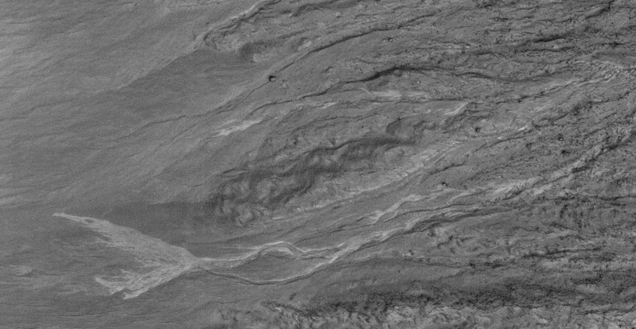
Gullies in Terra Sirenum


Several gullies are located on the rim of this unnamed crater in Terra Sirenum.

Photo credit: NASA/JPL/Arizona State University

Note: The crater in this image is located about halfway between craters Millman (to the southwest) and Nansen (to the northeast).

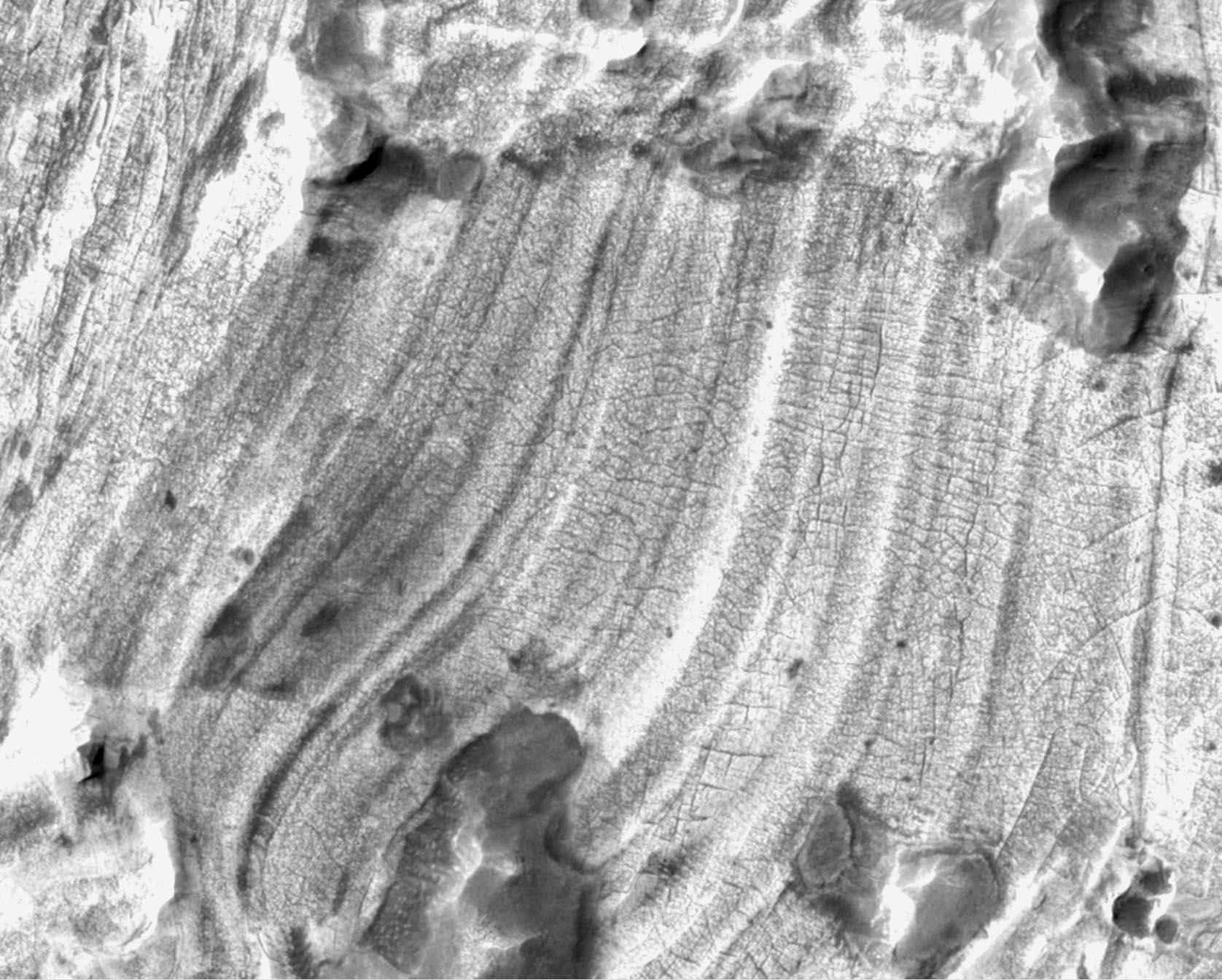
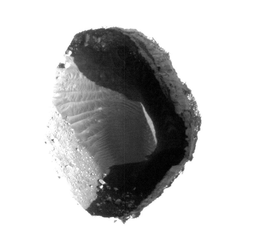
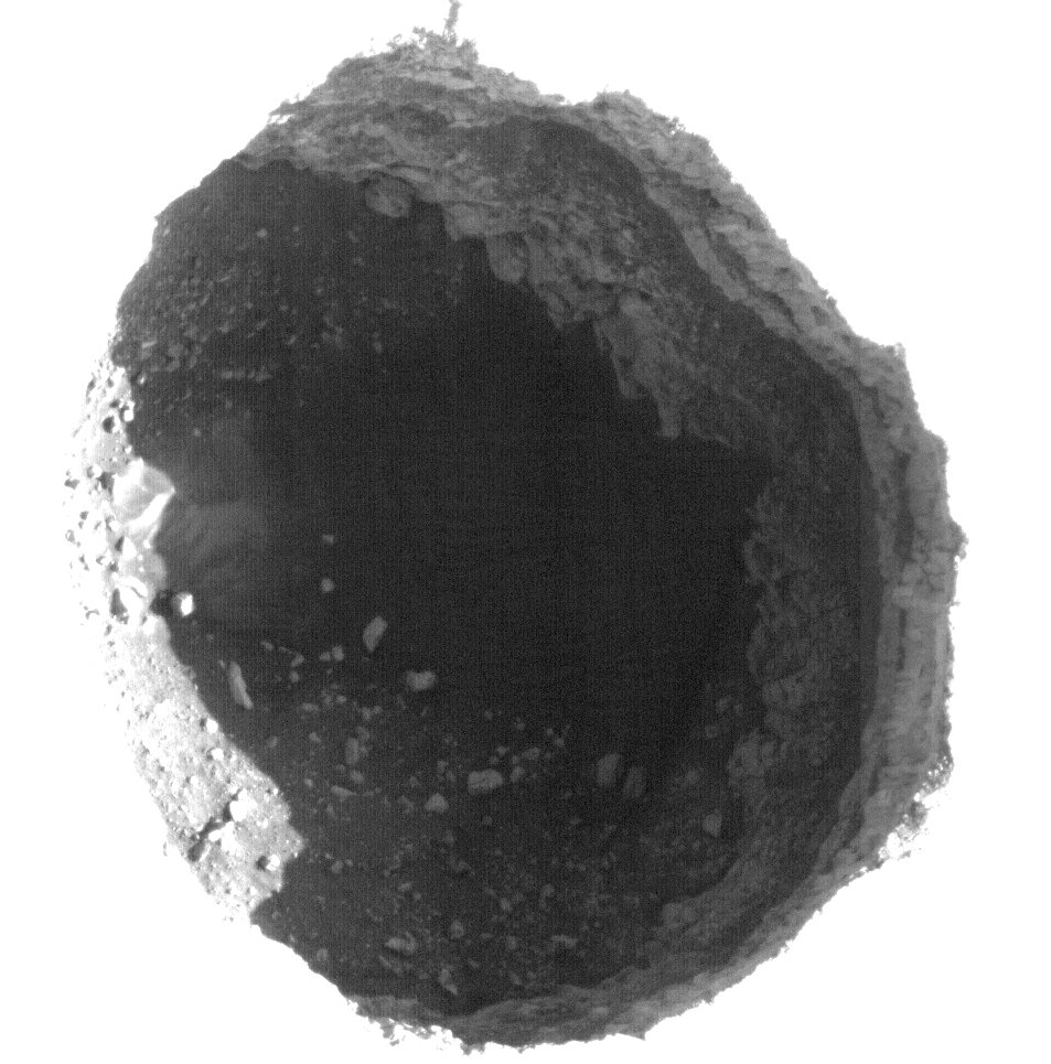
Dark Rimless Pits in the Tharsis Region


Two dark rimless pits are located to the northwest of Ascraeus Mons. These pits are approximately 180 meters and 310 meters in diameter, respectively, and are situated in the midst of a large, wispy dark boomerang-shaped deposit.

These pits are aligned with what appears to be larger, degraded depressions. The wispy deposit may consist of dark material that has been either blown out of the pits or from some other source and scattered about by the local winds.

Subimage (A) and (B) are close-ups of both pits. These images have been highly processed to reveal the surface details within each pit. The eastern most and smaller of the two pits (A) contains boulders and sediment along its walls and brighter aeolian dune sediments on its floor. The larger, western most pit (B) contains sediment and boulders with faint dune-like patterns visible on the deepest part of the floor. Both pits have steep eastern walls and more gently sloped western walls that transition gradually into the pit floor. Steep resistant ledges containing boulders that overhang and obscure the pit floors form the eastern walls.

Careful study of the walls and floors of the pits as well as of the surrounding terrains will help unravel the complicated series of processes that must have been responsible for their formation and subsequent modification.

Photo credit: NASA/JPL/University of Arizona

Sunday, December 5, 2010

Phobos


An image of Phobos by the High-Resolution Stereo Camera on board Mars Express on 22 January 2007.

The larger and inner of the two Martian moons is seen here floating just above the Martian limb. The image has been enhanced slightly to bring out the detail on the moon.

Photo credit: ESA/DLR/FU Berlin (G. Neukum)

Bright Crater Gully Deposits in Terra Cimmeria


Some of the most ancient terrains of the southern highlands of Mars comprise the Terra Cimmeria region, the location of this five-kilometer diameter impact crater.

Despite being part of an ancient landscape, the inner walls of this crater are dissected by apparently fresh gullies. Determining whether these gullies are indeed young (a few years or decades old) or are simply young from a geologic perspective (tens of thousands of years old) is one of the goals of the HiRISE team. HiRISE has been monitoring several locations to determine whether changes are seen in gullies such as these that exhibit associated bright (or dark) deposits. Changes in the extent or pattern of these deposits may indicate that gully forming processes are still occurring today.

Particularly notable bright deposits are located along the lower portions of some gully systems on the eastern slope of the crater wall. Bright deposits line the floors and walls of the downslope portions of the gully systems and extend out into the terminal debris fans. In the most prominent system, a second fainter bright terminal debris fan lobe can be seen further downslope which may record an earlier period of gully activity. As these gullies demonstrate, Mars records a rich history of landforms likely resulting from water repeatedly flowing, flooding and eroding its surface.

Photo credit: NASA/JPL/University of Arizona

Note: The crater in this image is Roseau, named after the town in Dominica. It lies to the northeast of Kepler Crater.

Saturday, December 4, 2010

Unusual Channel in Arabia Terra


This unusual channel is located in northern Arabia Terra.

Photo credit: NASA/JPL/Arizona State University

Note: The closest named feature to this channel is Quenisset Crater, which lies to the southeast.

Graben Cutting Lava Flow in Tharsis


This image shows a graben (a trough formed when the ground drops between two parallel faults) and a lava flow in the Tharsis volcanic province of Mars.

Relations like this can be used to establish the relative ages of features on the surface. In this case, the trough cuts the lava flow, indicating that it is younger. If the trough existed when the flow occurred, lava would have spilled into and flooded it before the flow was able to proceed to the north.

Another interesting feature in this lava flow is the trace of a central channel, indicated by two roughly parallel linear features within the flow. After the first lava flowed across this area, the rest of the flow was probably concentrated in this inner channel (most easily seen in the browse image). The channel was still full of lava when the flow stopped, and so the surface is still at the same height as the rest of the flow.

Photo credit: NASA/JPL/University of Arizona

Note: This graben is located east-southeast of Sulci Gordii, which is east of Olympus Mons.

Friday, December 3, 2010