Monday, April 9, 2012

20 Kilometer Tall Dust Devil in Amazonis Planitia


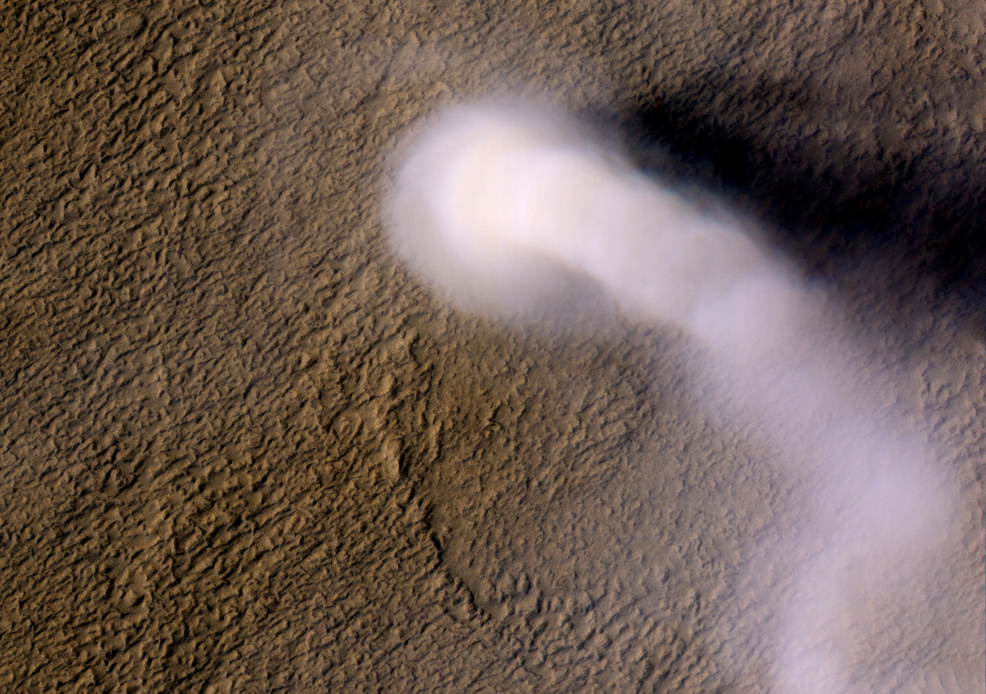
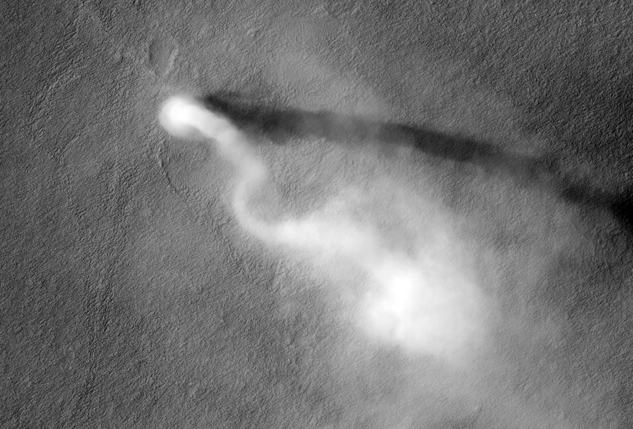
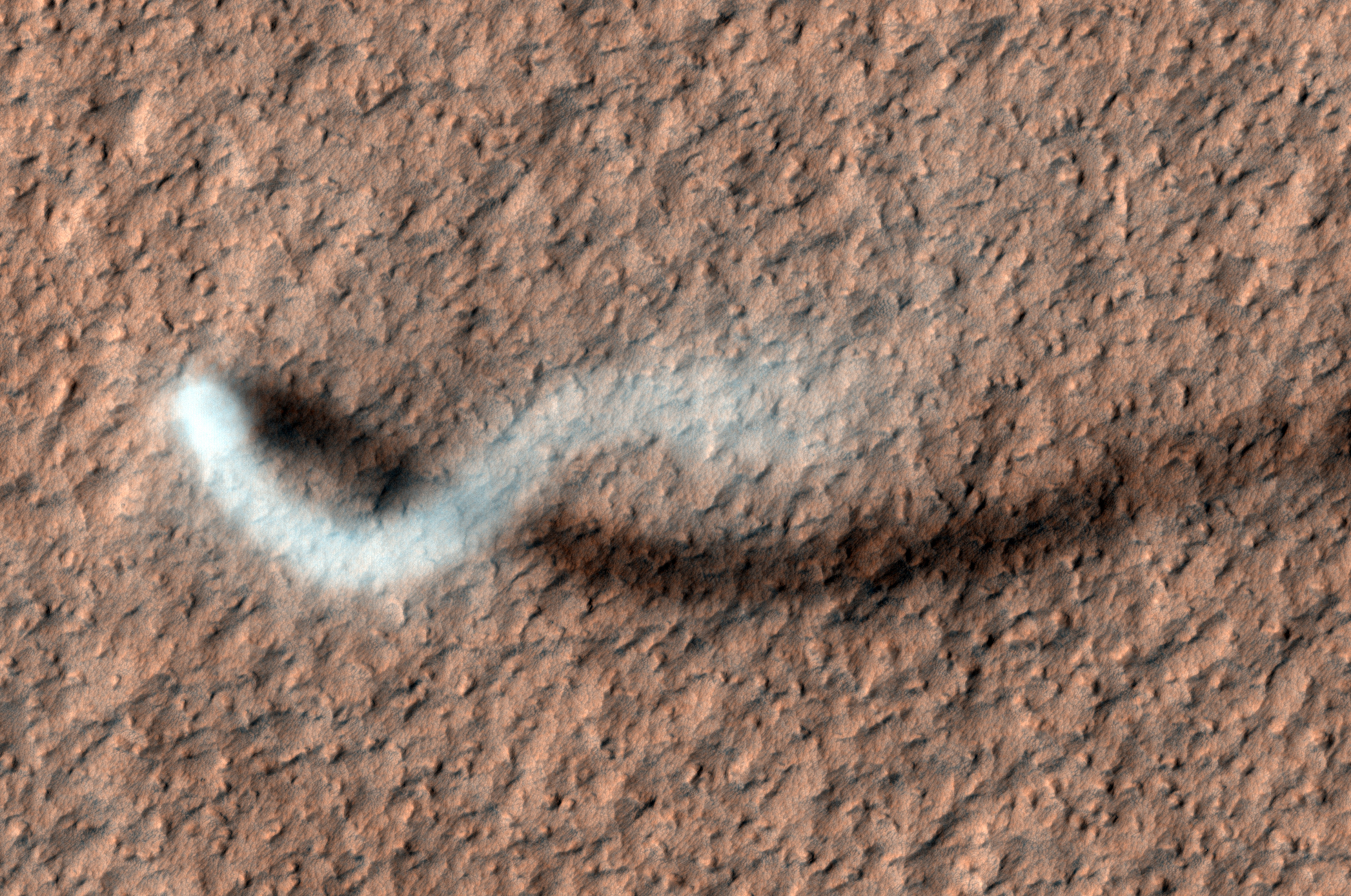
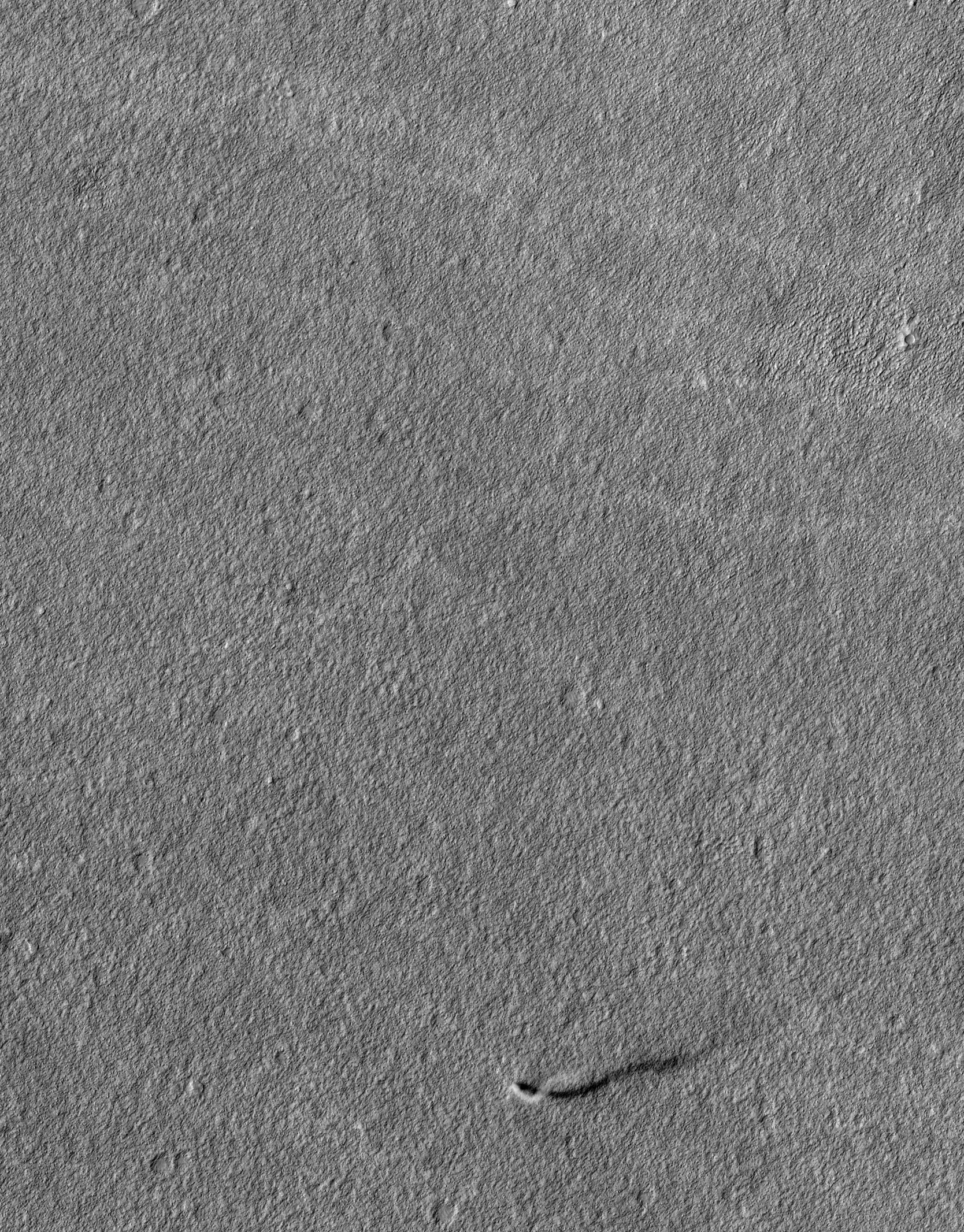
A dust devil the size of a terrestrial tornado towers above the Martian surface in this late springtime afternoon image of Amazonis Planitia.

Also captured by the Context Camera on MRO, the length of the shadow indicates that the dust plume reached a height of 20 kilometers (12 miles) above the surface! Despite its gargantuan height, the plume is only 70 meters (70 yards) in diameter, giving it a snake-like appearance that is twisted by high altitude winds, similar to another dust devil spotted recently in this region.

Typical tornadoes on Earth are less than 10 miles tall, while dust devils on our planet seldom reach more than a few hundred yards in height. So, why do we classify this plume as a monster dust devil and not a Martian tornado? Dust devils differ from tornadoes in their energy sources. Dust devils are driven by the heat of the surface, absorbed from sunlight and re-radiated to warm the atmosphere. The warm air rises and spins as it contracts, much as a figure skater spins faster as she draws her arms to her sides.

Tornadoes have an additional energy source: the heat given off as water vapor condenses into liquid rain. The condensing water vapor produces the visible part of a tornado, called the condensation funnel, which is made up of water droplets. On Mars, there is too little water vapor in the atmosphere to contribute significantly to atmospheric convection on local scales. The cloud that we see in this image is produced by dust particles, not raindrops. The astounding heights of Martian dust devils are made possible because mass of an atmospheric column on Mars is less than 1 percent than that of a column on Earth. Transfer of heat from the surface into this less dense atmosphere can produce more vigorous convection, which will penetrate higher into the Martian atmosphere than its counterparts do on Earth.

Now, what would happen if you were caught in its path? Because the density of Mars' atmosphere is so low, even a high velocity dust devil is unlikely to knock you over. However, you might be blasted by any sand or dust particles carried along by the dust devil, which might scratch the visor of your space suit quickly if you were caught outside by this monster!

This vortex left behind a bright track as its winds disturbed the dust-covered surface, tracing the path of the dust devil from the northwest towards the southeast. A dust "skirt" twice as wide as the plume itself is seen near the base of the dust devil, but the bright track is the size of the plume and not the skirt. Dozens of smaller dust devils were also spotted in the same Context Camera scene, steadily vacuuming the surface and pumping dust up into the Martian atmosphere.

VIDEO
JPL has produced two excellent animations of this dust devil in action.
Clip 1
Clip 2

Photo credit: NASA/JPL/University of Arizona

Note: For more information, see 12-Mile-High Martian Dust Devil Caught In Act.

Sunday, April 8, 2012

Layers in a Crater Wall in Noachis Terra


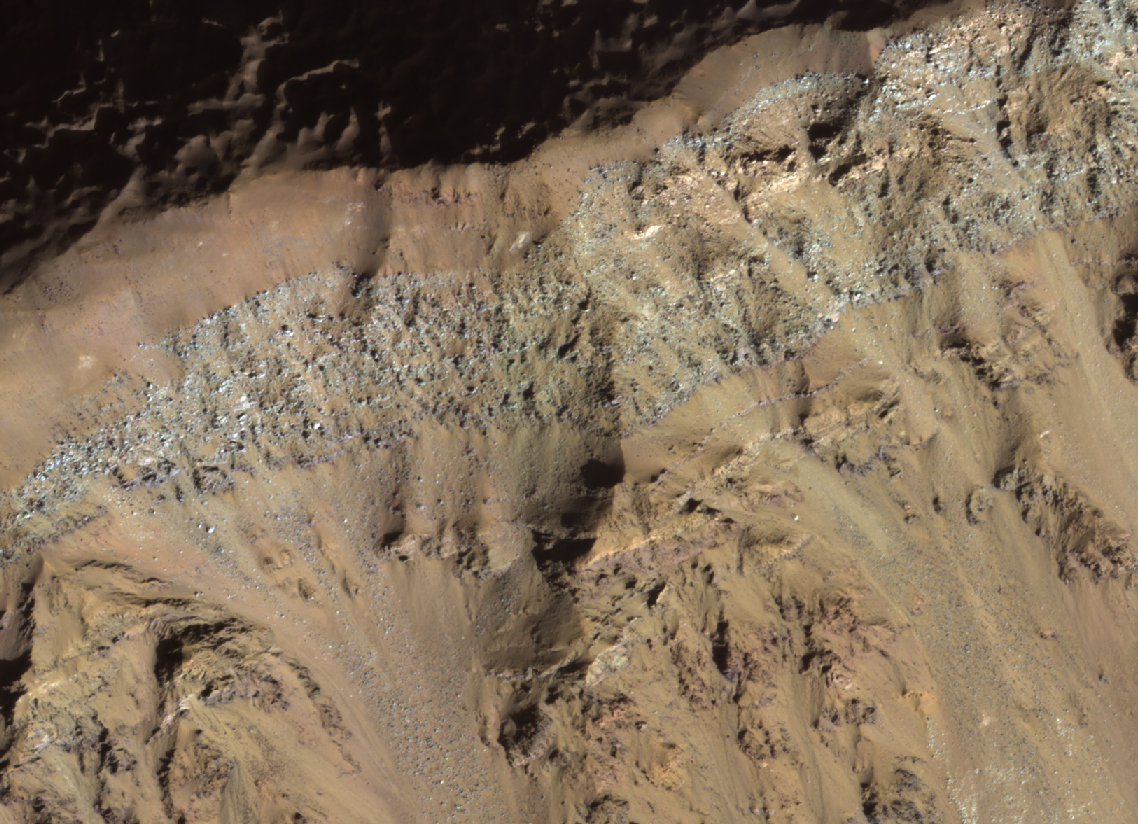
This image is of the rim of a crater. The Sun is low in the sky (only 15 degrees above the horizon) and shining full on this crater wall (you can see that the area beyond the rim has got long shadows).

The Sun is beautifully illuminating a series of layers exposed in the crater wall which have a variety of different colors.

Note: the subimage is non map-projected, so approximate North is down.

Photo credit: NASA/JPL/University of Arizona

Note: This crater is located in Noachis Terra to the northwest of Argyre Planitia. The closest named crater is Tábor, which is a very short distance to the northwest.

Saturday, April 7, 2012

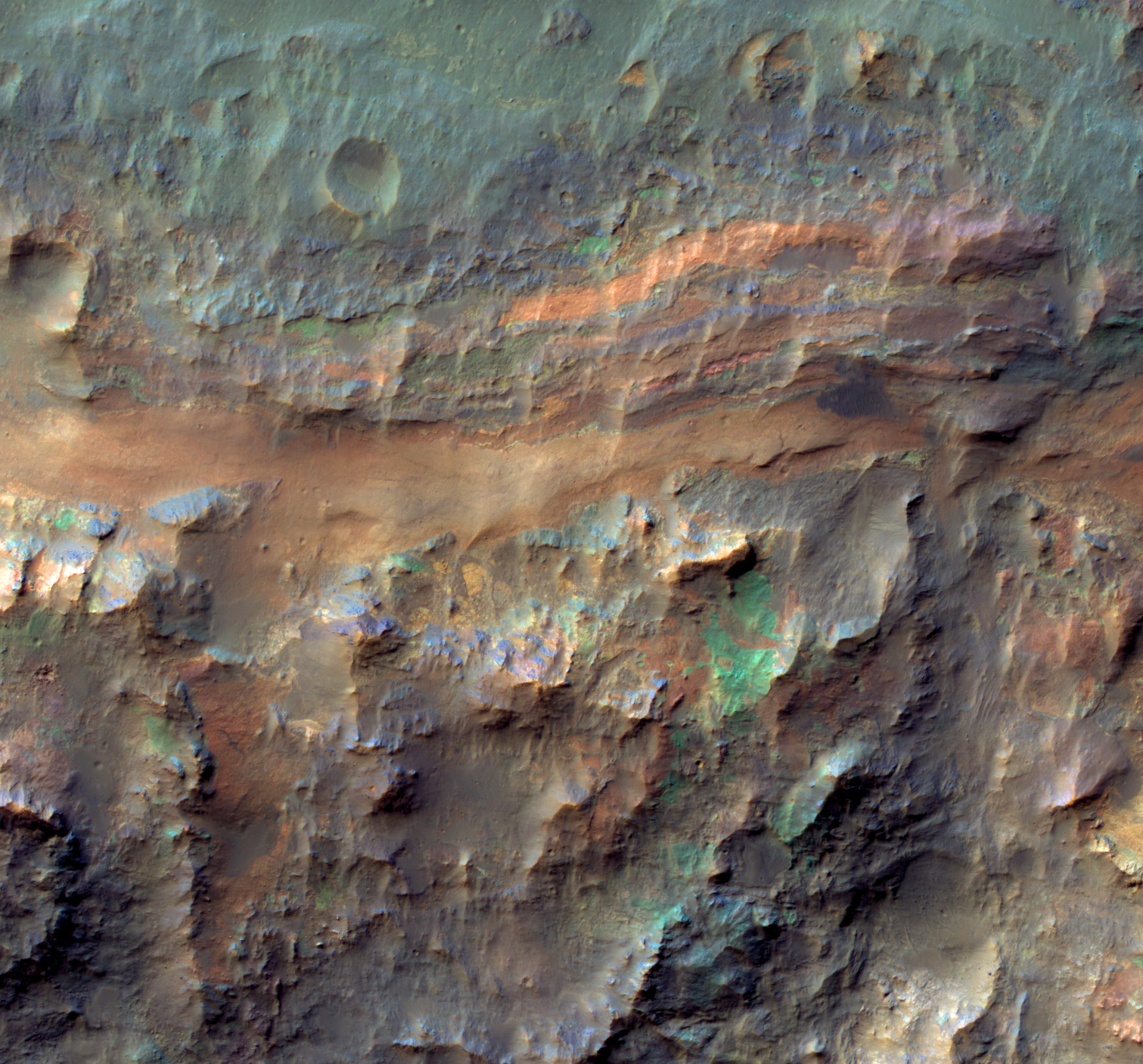
Sedimentary Deposits on the Floor of Ritchey Crater


Ritchey Crater exposes some of the most colorful rock outcrops on Mars in its central peak.

This image reveals comparable diversity in some of the layered sediments and jumbled deposits (megabreccia) on the crater floor. In general the blues and greens indicate unaltered minerals like olivine and pyroxene whereas the warmer colors indicate altered minerals such as clays.

Photo credit: NASA/JPL/University of Arizona

Friday, April 6, 2012

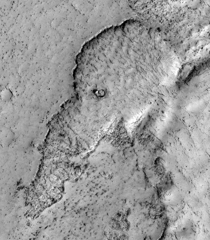
Elephantine Lava Flow in Elysium Planitia


This observation highlights terrain that looks like an elephant. This is a good example of the phenomena "pareidolia," where we see things (such as animals) that aren't really there.

Actually, this image covers the margin of a lava flow in Elysium Planitia, the youngest flood-lava province on Mars. Flood lavas cover extensive areas, and were once thought to be emplaced extremely rapidly, like a flood of water.

Most lava floods on Earth are emplaced over years to decades, and this is probably true for much of the lava on Mars as well. An elephant can walk away from the slowly advancing flow front. However, there is also evidence for much more rapidly flowing lava on Mars, a true flood of lava. In this instance, maybe this elephant couldn't run away fast enough.

Note: the subimage is not map-projected, so approximate North is down.

Photo credit: NASA/JPL/University of Arizona

Note: This site is located in Phlegra Dorsa; the closest named impact crater is Lockyer, which is some distance off to the west.

Monday, April 2, 2012

Cratered Dune Forms in Melas Chasma


One of the scientific goals for taking this observation is to create a stereo pair with another HiRISE image. From stereo pairs, which are pictures of the same area but at different angles, HiRISE creates 3D or anaglyph pictures.

Known since at least 2003, this is a wonderful case of aeolian sandstone that (a) preserves its original sand dune bedform shapes and (b) lies unconformably over a previously-eroded surface of layered sedimentary rock.

Photo credit: NASA/JPL/University of Arizona

Note: This site is located on the southern wall of Melas Chasma.

Sunday, April 1, 2012

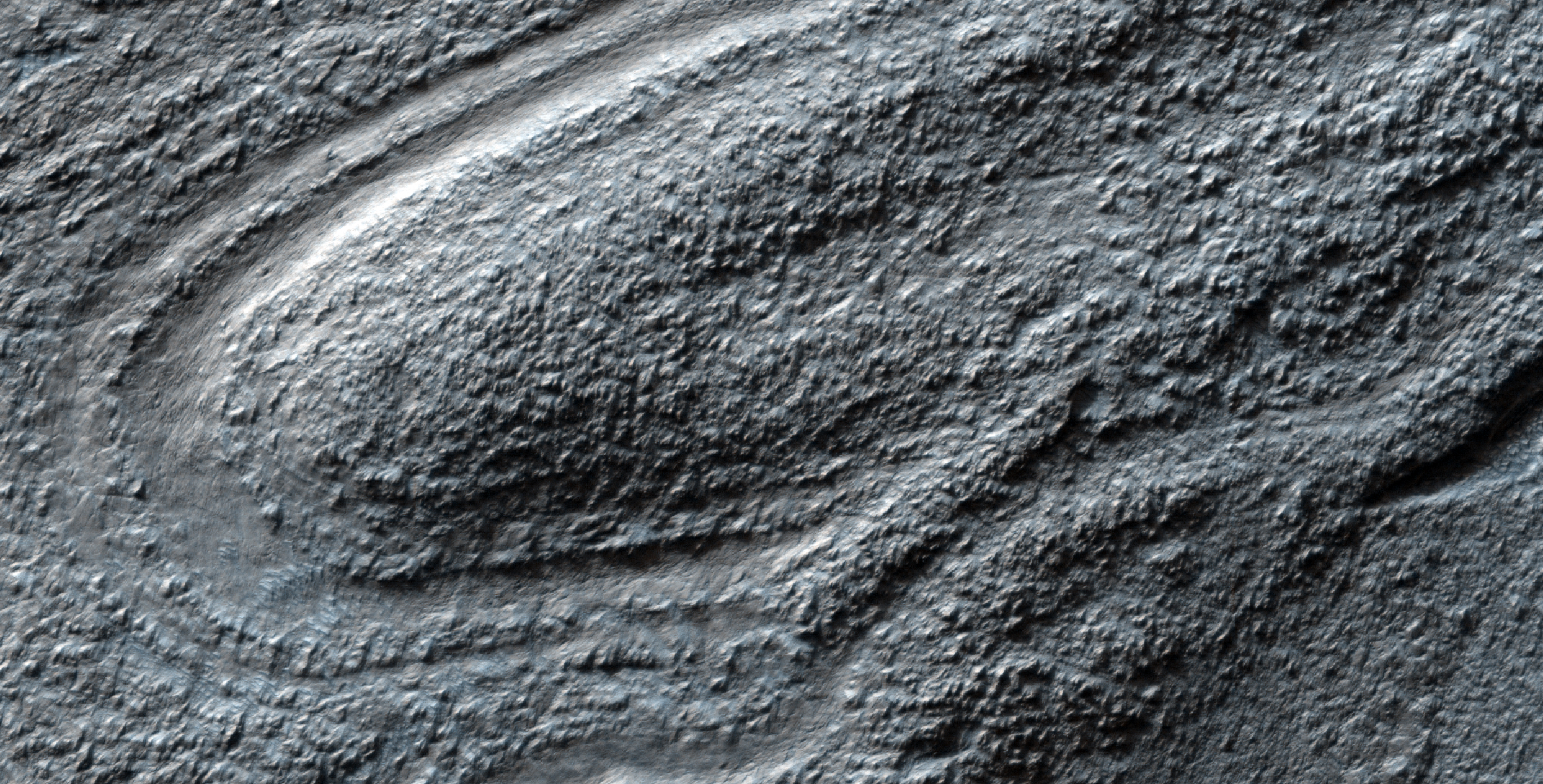
Lava Lamp Terrain on the Floor of Hellas Basin


Some of the weirdest and least-understood landscapes on Mars are on the floor of the deep Hellas impact basin. This image was acquired in northwest Hellas where depths are more than 6 kilometers below the reference (or roughly the average) altitude for Mars.

There are what look like impact craters but are elongated, as if stretched in a viscous manner (like in a lava lamp). Some of the flowing landforms are similar to those elsewhere in the middle latitudes of Mars, where the Shallow Radar (SHARAD) experiment on MRO has detected ice, but no ice detection has been reported here.

The floor of Hellas is relatively poorly mapped because it is often obscured by dust and haze in the atmosphere.

Photo credit: NASA/JPL/University of Arizona

Saturday, March 31, 2012

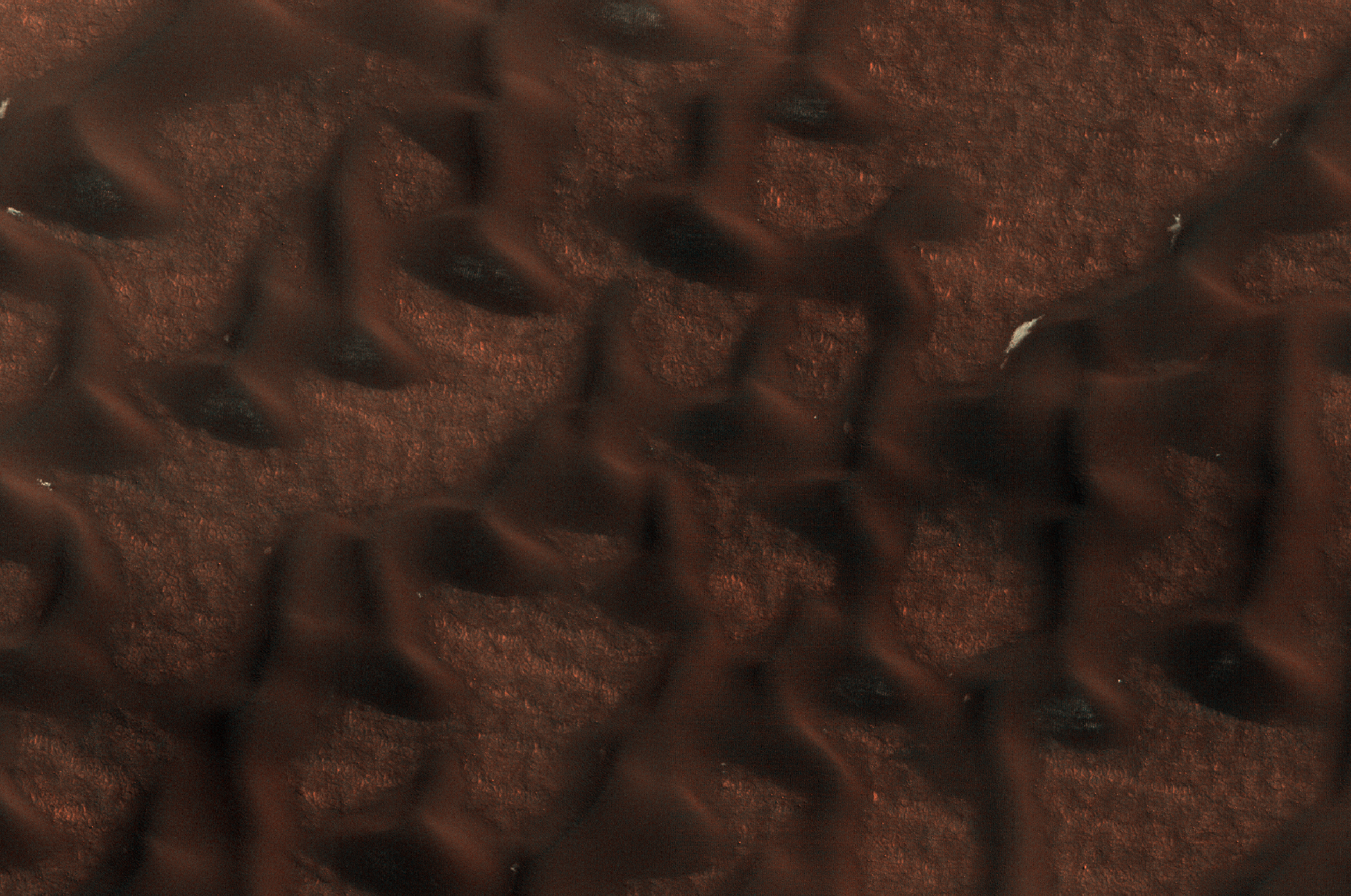
Late Spring in Vastitas Borealis


These dark sand dunes in the north polar region, basking in the sunshine of late spring, have shed most of their seasonal layer of winter ice.

A few bright ice deposits remain sequestered in "cold traps" shadowed from the Sun on the poleward-facing side of the dunes. Some bright patches of ice at the foot of the sunlit side of the dunes may be places where ice slumped to the foot of the dune creating a longer-lasting snow bank.

Photo credit: NASA/JPL/University of Arizona

Note: The closest named crater to this site is Escorial Crater, which is some distance off to the northeast; the closest named feature is Abalos Colles, which is also to the northeast, although not nearly as far away.

Friday, March 30, 2012

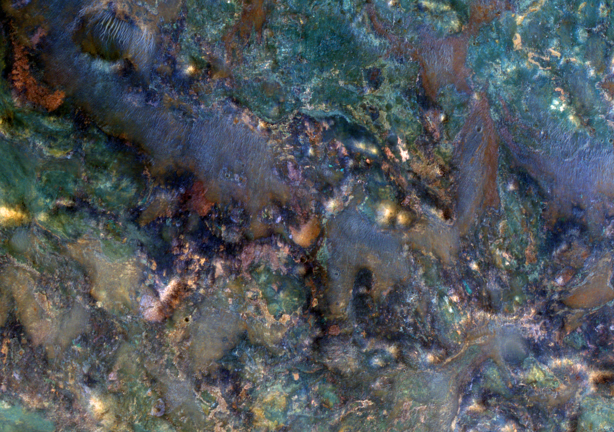
Jumbled Rocks Near Nili Fossae


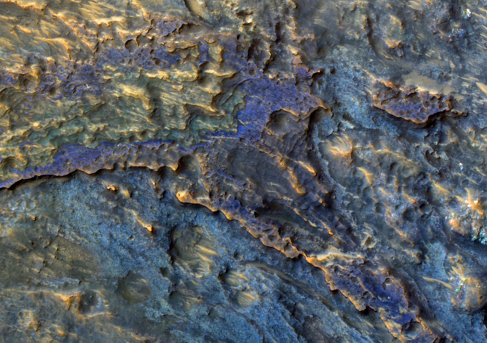
This image covers a region of Mars near Nili Fossae that contains some of the best exposures of ancient bedrock on Mars.

The enhanced-color subimage shows part of the ejecta from an impact crater. The impact broke up already diverse rocks types and mixed them together to create this wild jumble of colors, each representing a different type of rock.

Photo credit: NASA/JPL/University of Arizona

Note: The above image is slightly smaller in size (2048 x 1536 px) than what is normally posted on this blog (2560 x 1920 px) due to the fact that the larger image is over the allowable download size for photos onto Blogger.

Monday, March 26, 2012

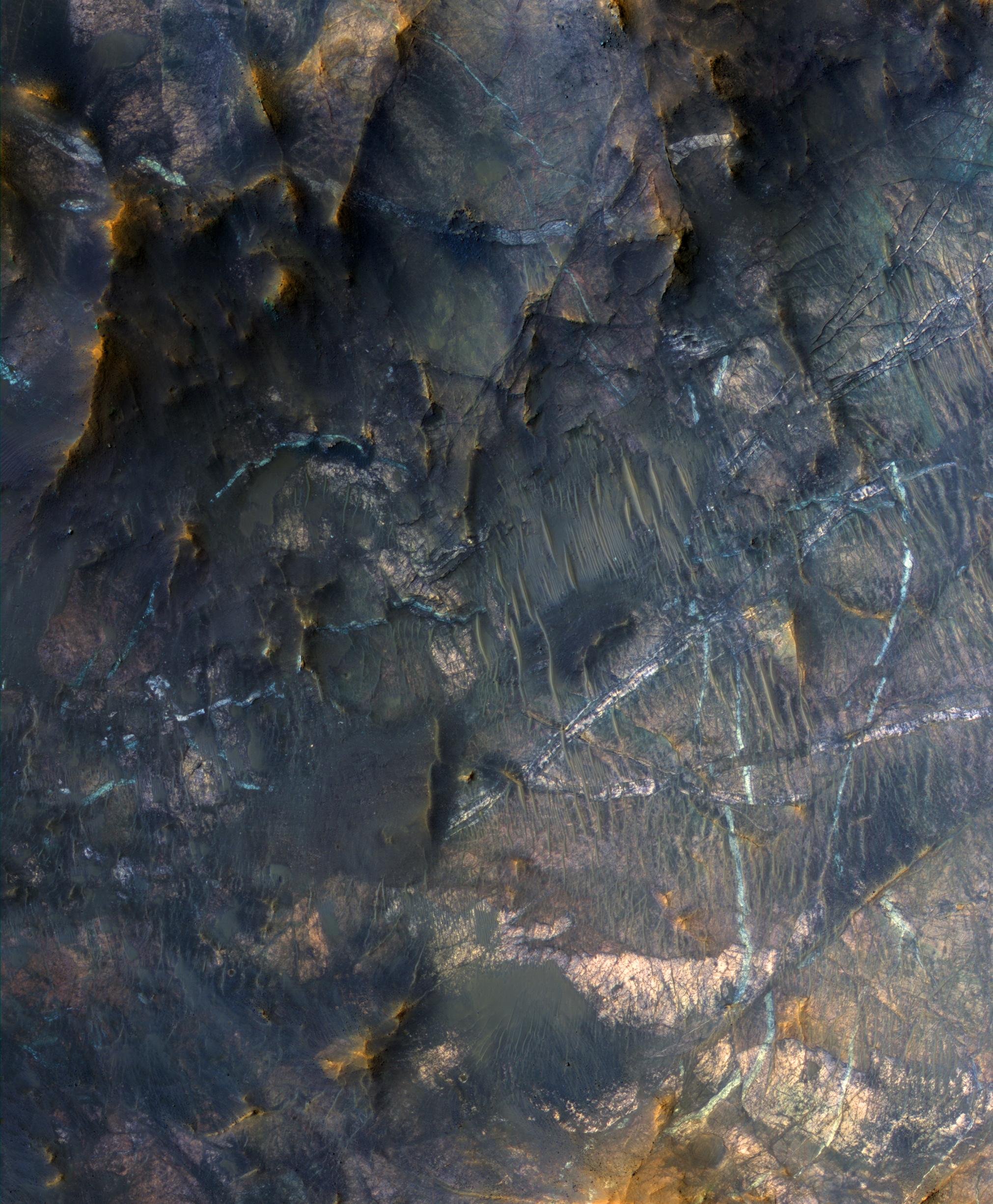
Mineral Veins in Terra Sabaea


The bright linear features cutting the bedrock in the center region of this image look like mineral veins.

Mineral veins are sheetlike bodies of minerals formed by water that flows through fractures. The setting of this image is the central uplift of a large (approximately 50-kilometer diameter) impact crater, where deep, ancient bedrock was uplifted about 5 kilometers and fractured. Heat from the impact melted ice in the Martian crust, creating a hydrothermal system. This could have been a habitable environment.

A small mineral vein was recently discovered by the Opportunity rover at Endeavour Crater.

This is a stereo pair with ESP_025766_2005.

Photo credit: NASA/JPL/University of Arizona

Note: This crater is located in northeast Terra Sabaea, in a complex of craters southeast of Baldet Crater.

Sunday, March 25, 2012

Boulders on the Floor of Hellas Planitia


This image reveals bouldery patches on the floor of the giant Hellas impact basin.

The boulders are often crudely aligned. Maybe these boulders were deposited or sculpted by flowing ice in the form of glaciers.

Photo credit: NASA/JPL/University of Arizona

Saturday, March 24, 2012

Magical Mystery Mound


How exactly these strange landforms came to be is a mystery. It probably isn't magical, but the catchy Beatles-era title did get you to read this caption.

The contorted material sits on the floor of a degraded impact crater. It has some bizarrely grooved textures that show up nicely with the low-sun illumination (with the Sun approximately 7 degrees above the horizon). We've seen this texture elsewhere on Mars, so a systematic study might lead to a good hypothesis about its origin.

The color data reveals some bluish material-- seasonal frost that is just starting to accumulate here in late fall.

Photo credit: NASA/JPL/University of Arizona

Note: The crater where this mound is located is in Noachis Terra, very close to Asimov Crater, to the northwest, and Maunder Crater, due west.

Friday, March 23, 2012

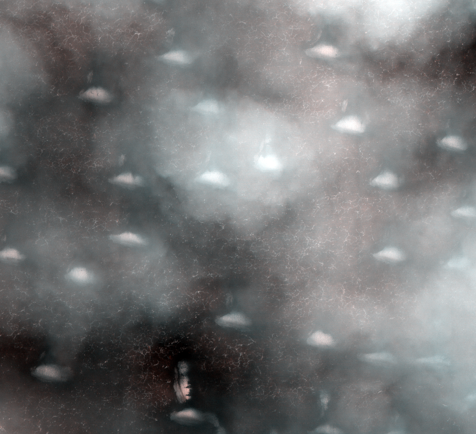
A Cloudy Day Over Vastitas Borealis


Mars occasionally has cloudy weather. We intended to take a picture of the bright ice-covered dunes that are faintly visible through these thin clouds, but weather forecasting on Mars is just as challenging as on Earth.

Where the clouds are thin, the remaining bright winter ice is visible, protected in shallow grooves on the ground, in addition to covering the dunes.

Photo credit: NASA/JPL/University of Arizona

Note: And, no, that is not the Face on Mars. ;) Although it does remind me more of those moai (statues) on Easter Island.

Monday, March 12, 2012

The Serpent Dust Devil of Mars


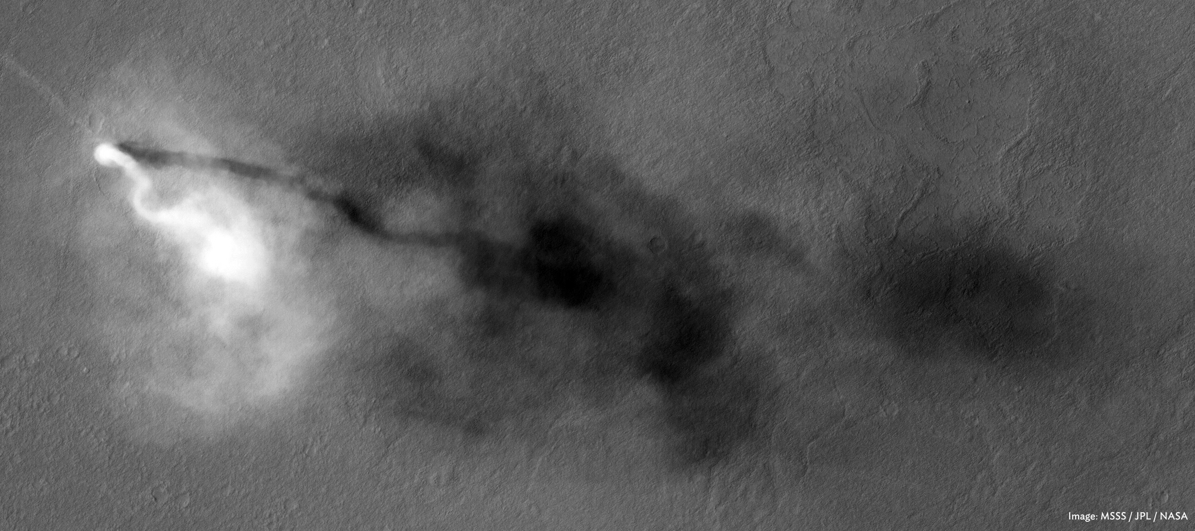
A towering dust devil casts a serpentine shadow over the Martian surface in this stunning, late springtime image of Amazonis Planitia.

The length of the shadow indicates that the dust plume reaches more than 800 meters, or half a mile, in height. The tail of the plume does not trace the path of the dust devil, which had been following a steady course towards the southeast and left a bright track behind it.

The delicate arc in the plume was produced by a westerly breeze at about a 250-meter height that blew the top of the plume towards the east. The westerly winds and the draw of warmth to the south combine to guide dust devils along southeast trending paths, as indicated by the tracks of many previous dust-devils. The dust plume itself is about 30 meters in diameter.

Numerous bright tracks trend from northwest to southeast. It is interesting to see that these tracks are bright, whereas dust-devil tracks elsewhere on Mars are usually dark. Dark tracks are believed to form where bright dust is lifted from the surface by dust devils, revealing a darker substrate.

Here in Amazonis, the dust cover is too thick to be penetrated by such scouring. A blanket of bright dust was deposited over this region recently, just before the arrival of MRO, so the surface dust here can still be moved. Perhaps the bright tracks form when the settled dust is stirred up by the strong winds generated by the dust devils (tangential wind speeds of up to 70 miles per hour have been recorded in HiRISE images of other dust devils).

It's also interesting that this image was taken during the time of year when Mars is farthest from the Sun. Just as on Earth, Martian winds are powered by solar heating. Exposure to the Sun's rays should be at a minimum during this season, yet even now, dust devils act relentlessly to clean the surface of freshly deposited dust, a little at a time.

This is a stereo pair with ESP_025985_2160.

Photo credit: NASA/JPL/University of Arizona

Note: For a short video showing how the dust devil would look like from the ground, see Storm Chaser on Mars.

Sunday, March 11, 2012

Icy Flows in Fitzroy Crater


This image shows flow features (tongue-shaped features in the depressions running down the slope) on the inner slope of an impact crater east of Hellas impact basin.

The time of year combined with MRO's orbit and the slope combine to provide the geometry for an image with almost glancing (very low sun) illumination. Such low-sun lighting enhances subtle topographic features and makes a dramatic image.

Other flows in this region of Mars, long thought to be due to flowing ice, have been confirmed to be icy by the Shallow Radar (SHARAD) experiment on MRO.

Photo credit: NASA/JPL/University of Arizona

Note: These ice flows are in Fitzroy crater.

Saturday, March 10, 2012

Layers of Water-Deposited Sediment


This image covers part of the floor of a large ancient impact crater, near the western rim.

The subimage shows layered deposits, many with distinct colors (the colors are enhanced or exaggerated). These layers have a morphology similar to that seen elsewhere on Mars in obvious alluvial fans where channels emerge into craters.

In this case the channels are not obvious, but we suspect that it is the same kind of deposit and the ancient channel is not well preserved due to subsequent modification.

Photo credit: NASA/JPL/University of Arizona

Note: This impact crater is located in Xanthe Terra just to the northeast of Mutch Crater.

Friday, March 9, 2012

Slope Streak Stripes on Crater Walls


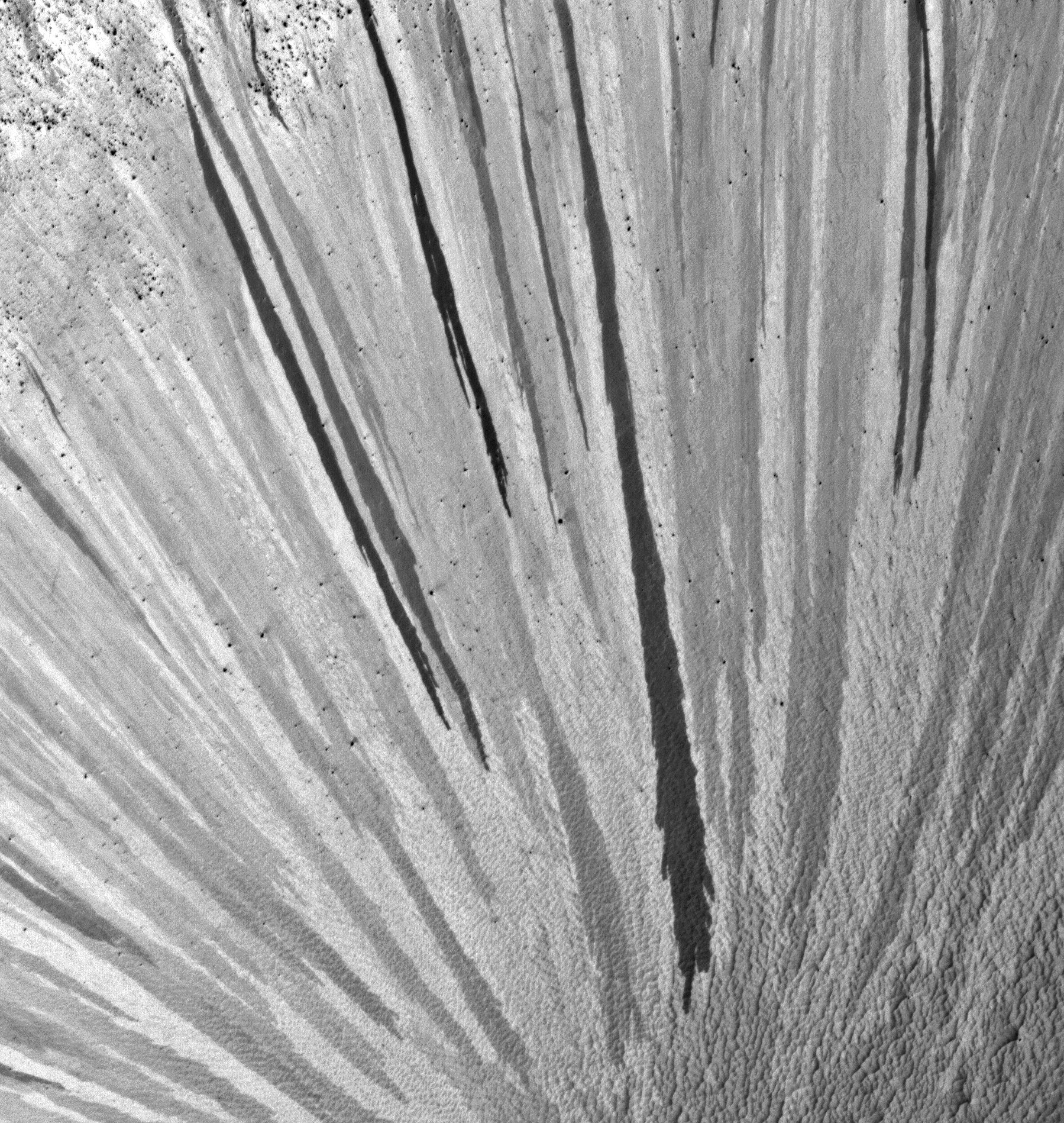
Radially-oriented slope streaks paint stripes on the sides of this crater in Arabia Terra. Slope streaks are common features on steep slopes in Mars' dusty terrain, but this crater is a particularly dramatic example.

Slope streaks, thought to be the result of shallow cascades of dust, are dark when fresh and fade as they age (see this highly stretched subimage that emphasizes the color difference between streaks). So it is clear that this crater experienced repeated episodes of streak formation, apparently around its entire circumference.

Other steep slopes nearby also show evidence of repeated slope streak activity - see ESP_024924_1945, PSP_009272_1955, and PSP_008705_1950 - but none are quite as photogenic as this one!

Photo credit: NASA/JPL/University of Arizona

Note: This crater is near the western border of Terra Sabaea, with Meridiani Planum lying to the southwest. The closest named feature is Gill Crater, to the west.

Wednesday, March 7, 2012

Syrtis Major


Syrtis Major, discovered in 1659 by Christaan Huygens, is a volcanic province on Mars. The image is centered on approximately 16°N/73°E. The High-Resolution Stereo Camera on ESA’s Mars Express collected the data for these images on 8 June 2011 during orbit 9487. The images have a ground resolution of approximately 19 m per pixel. This perspective view has been calculated from the Digital Terrain Model derived from the stereo channels. Some ancient lava flow fronts are seen in the foreground and a lighter-toned butte is emerging on the right.

Photo credit: ESA/DLR/FU Berlin (G. Neukum)

Note: For more information, see Mars Express Reveals Wind-Blown Deposits on Mars.

Tuesday, March 6, 2012

Phlegra Montes


Phlegra Montes is a range of gently curving mountains and ridges on Mars. They extend from the northeastern portion of the Elysium volcanic province to the northern lowlands. The High-Resolution Stereo Camera on ESA’s Mars Express collected the data for these images on 1 June 2011 during orbit 9465. The image combines data from the nadir channel and one stereo channel to produce this 3D image. Stereoscopic glasses are required to see the 3D effect.
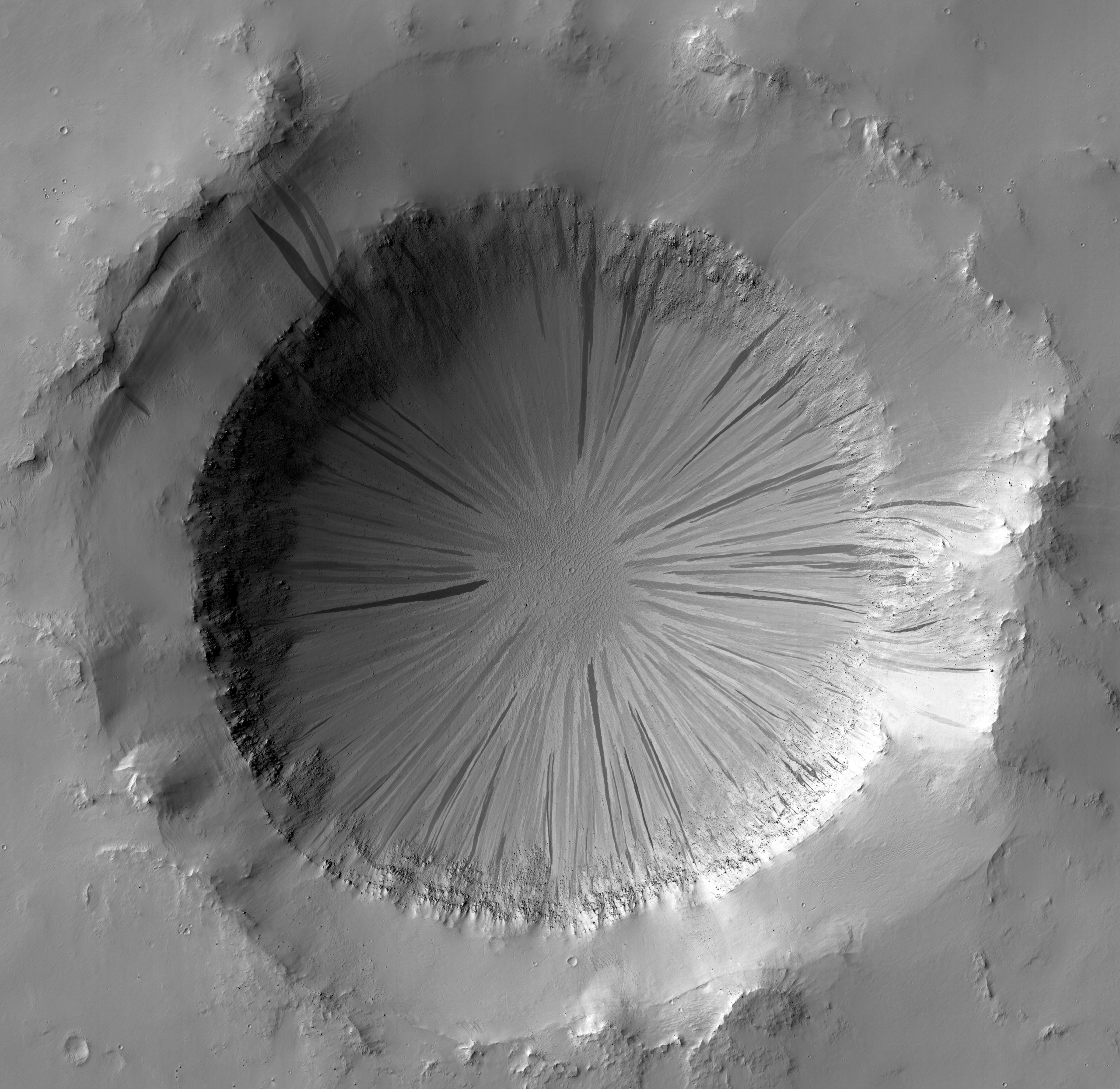
Photo credit: ESA/DLR/FU Berlin (G. Neukum)

Note: For more information, see Mountains and Buried Ice on Mars.

Friday, March 2, 2012

Tenth Anniversary Image from Themis


The Thermal Emission Imaging System (THEMIS) camera on NASA's Mars Odyssey spacecraft has completed an unprecedented full decade of observing Mars from orbit.

THEMIS captured this image on February 19, 2012, 10 years to the day after the camera recorded its first view of Mars. This image covers an area 11 by 32 miles (19 by 52 kilometers) in the Nepenthes Mensae region north of the Martian equator. The view depicts a knobby landscape where the southern highlands are breaking up as the terrain descends into the northern lowlands.

Odyssey, launched in 2001, has worked at Mars longer than any mission in history.

Photo credit: NASA/JPL-Caltech/ASU

Thursday, March 1, 2012

Comparison of Earth's Interior with Mars and the Moon


Mars has the same basic internal structure as the Earth and other terrestrial (rocky) planets. It is large enough to have pressures equivalent to those throughout the Earth's upper mantle, and it has a core with a similar fraction of its mass. This diagram shows the depths at which high pressures cause certain minerals to transform to higher-density crystal structures. In contrast, the pressure even near the center of the Moon barely reach that just below the Earth's crust and it has a tiny, almost negligible core. The size of Mars indicates that it must have undergone many of the same separation and crystallization processes that formed the Earth's crust and core during early planetary formation.

Illustration credit: JPL/NASA