Saturday, November 9, 2013

Gullies in Noachis Terra


Many gullies are located on the northern rim of this unnamed crater in Noachis Terra. Small dunes are located on the floor of the crater (lower left side of image).

Orbit Number: 52181 Latitude: -34.5275 Longitude: 37.2263 Instrument: VIS Captured: 2013-09-18 01:00

Photo credit: NASA/JPL-Caltech/Arizona State University


Cratered Cones in Tartarus Montes


Many types of craters exist on Mars. Most are generated by impacts of asteroids and comets.

In this area though, we think these craters may be due to steam explosions. This happens on the Earth when hot lava runs over icy ground.

Photo credit: NASA/JPL/University of Arizona

Note: For more information, see PIA17673: Cratered Cones in Tartarus Montes.

Friday, November 8, 2013

Arda Valles


The channels in this VIS image are a small portion of the channel complex called Arda Valles.

Orbit Number: 52171 Latitude: -20.3227 Longitude: 327.655 Instrument: VIS Captured: 2013-09-17 15:52

Photo credit: NASA/JPL-Caltech/Arizona State University

Dust Covered Channels on Tharsis Tholus


Tharsis Tholus is one of the smaller shield volcanoes on Mars' massive "Tharsis Rise." The main shield is covered by a very thick blanket (or "mantle") of loose material. This is likely to be the same dust that is found across all of Mars.

It accumulates on the tall volcanoes because the thin atmosphere at these elevations has a very hard time moving the dust after it is dropped out from the global dust storms. But another reason for the great thickness of the mantle here could be volcanic ash derived from the volcanoes themselves.

The flanks of Tharsis Tholus are cut by large channels, similar to those visible on other Martian shield volcanoes like Arsia Mons and Elysium Mons. Like the channels on those volcanoes, these channels probably formed by a combination of erosion by flowing lava, and the collapse of the volcano under its own weight. However, because of the thick covering, we cannot say this definitively.

A striking feature at the northern end of this image is the fact that the dust cover is much thinner on the lava flows that surround the shield. This indicates (1) the surrounding lavas are much younger than the shield and (2) the mantle on the volcanoes is old.

Photo credit: NASA/JPL/University of Arizona

Note: For more information, see PIA17670: Dust Covered Channels on Tharsis Tholus.

Thursday, November 7, 2013

Landslide in Hesperia Planum


A small landslide deposit is visible in this VIS image of an unnamed crater.

Orbit Number: 52166 Latitude: -7.06073 Longitude: 113.607 Instrument: VIS Captured: 2013-09-17 05:56

Photo credit: NASA/JPL-Caltech/Arizona State University

Note: This impact crater is located in northeastern Hesperia Planum.

Wednesday, November 6, 2013

Shalbatana Vallis


Today's VIS image shows several features in Shalbatana Vallis. There is a tributary channel that appears to have created a delta deposit in the upper half of the image, and several landslide deposits in the lower half of the image.

Orbit Number: 52158 Latitude: 2.906 Longitude: 316.768 Instrument: VIS Captured: 2013-09-16 16:03

Photo credit: NASA/JPL-Caltech/Arizona State University

Tuesday, November 5, 2013

Dark Slope Streaks in Terra Sabaea


Many dark slope streaks mark the rim of this unnamed crater in Terra Sabaea. There is a large group of streaks that are darker than the others streaks on the crater rim. It is likely that the formation of the darker set are more recent that the lighter set, as dust settling from the atmosphere brightens the surface over time.

Orbit Number: 52155 Latitude: 6.84297 Longitude: 43.8072 Instrument: VIS Captured: 2013-09-16 10:06

Photo credit: NASA/JPL-Caltech/Arizona State University

Monday, November 4, 2013

Layering in the Central Uplift of Mazamba Crater


This is only one of four impact craters known that possesses intact layers exposed in the central uplift.

Scientists believe this layered material originates from kilometers beneath the present surface and is raised up during the formation of the crater itself. These craters give us a window into these deep layers, which would otherwise remain hidden.

This is a stereo pair with PSP_007100_1520.

Photo credit: NASA/JPL/University of Arizona

Note: For more information, see PIA17624: Beautiful Layers in the Central Uplift of Mazamba Crater.

Sunday, November 3, 2013

Channels in Mangala Valles


This particular area, called Mangala Valles and located near the Tharsis region, may be an example of the action of liquid water in the ancient Martian past.

It's possible that the wide and short channels visible here may have formed by the motion of groundwater, similar to way channels like these form on Earth.

This is a stereo pair with ESP_033053_1640.

Photo credit: NASA/JPL/University of Arizona

Note: For more information, see PIA17625: Enigmatic Channels on the Floor of Mangala Valles.

Saturday, November 2, 2013

Daedalia Planum


This VIS image shows a small portion of the lava flows that make up Daedalia Planum.

Orbit Number: 52124 Latitude: -20.41 Longitude: 242.544 Instrument: VIS Captured: 2013-09-13 19:03

Photo credit: NASA/JPL-Caltech/Arizona State University

Martian Thunderbird in Terra Sabaea


This non-circular pit is due to a low angle impact from an asteroid or comet. The raised plateau west of the crater was where most of the impact debris landed.

This debris protected the material underneath, but else where this material was slowly removed by the wind and the debris-covered area was left behind as this high-standing and interestingly-shaped plateau.

(Note: the wallpaper images have been rotated 90 degrees counterclockwise for better effect.)

Photo credit: NASA/JPL/University of Arizona

Note: This crater is located in Terra Sabaea slightly to the southeast of Schiaparelli Crater and northeast of Pollack Crater.

Note: For more information, see PIA17626: Martian Thunderbird.

Friday, November 1, 2013

Ophir Chasma


This VIS image of Ophir Chasma shows part of a large landslide deposit.

Orbit Number: 52110 Latitude: -3.25696 Longitude: 288.504 Instrument: VIS Captured: 2013-09-12 15:19

Photo credit: NASA/JPL-Caltech/Arizona State University

Spring Avalanche in Planum Boreum


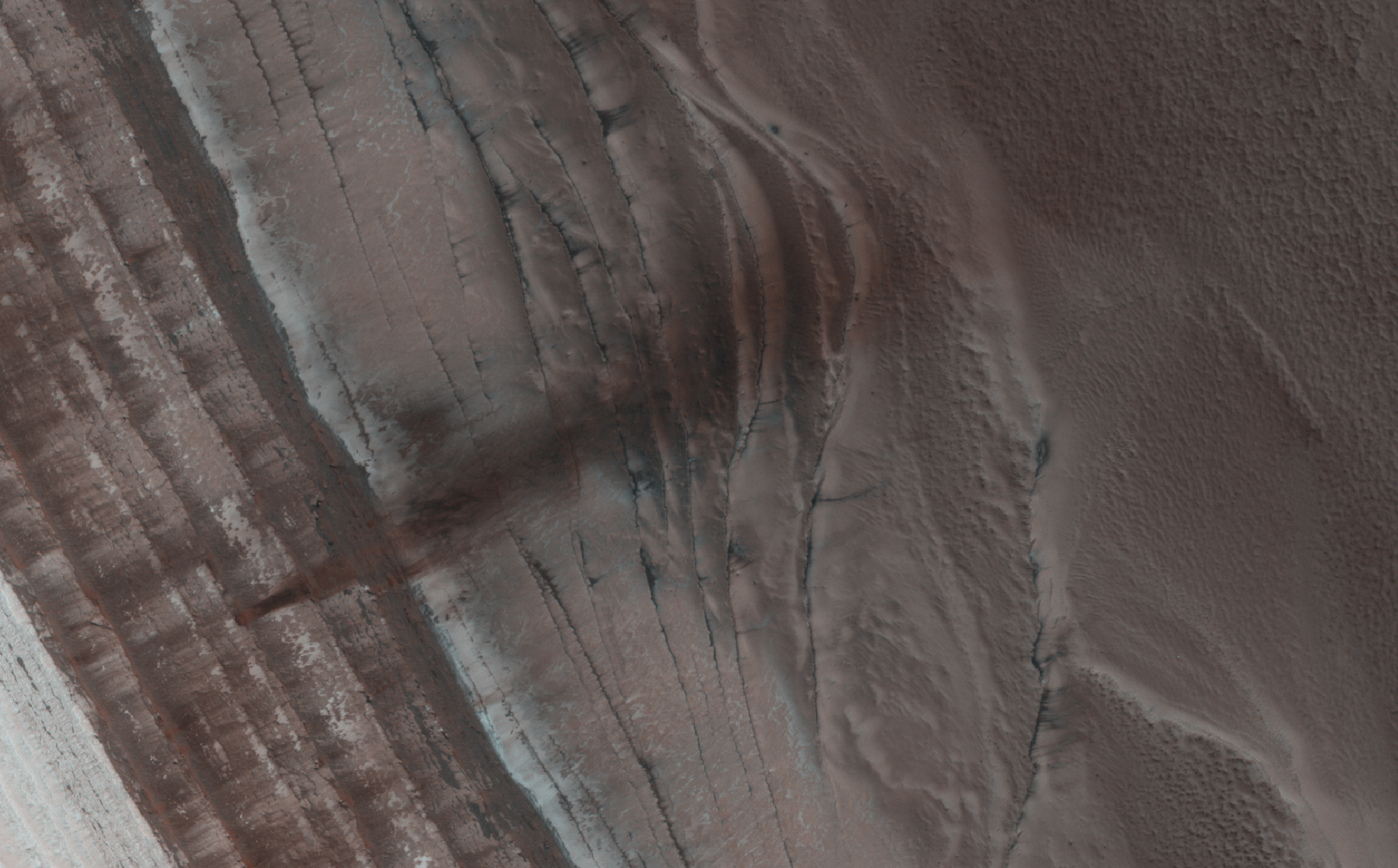
The North Polar region of Mars is capped with layers of water ice and dust, called the "polar layered deposits." This permanent polar cap is covered in the winter with a layer of seasonal carbon dioxide ice.

When the sun rises in the spring, the steep edges of the polar layered deposits are the first to warm up. The dry ice sublimes (going directly from a solid to a gas) and destabilizes loose chunks perched on the steep cliff. Material from the weaker layers gets dislodged and cascades down the steep slope.

Here, we can see a dark streak marking the path of that loose material, approximately 1 kilometer wide. HiRISE images often show avalanches in progress in the springtime along the edge of the polar layered deposits in this area.

Photo credit: NASA/JPL/University of Arizona

Note: For more information, see PIA17623: Spring Slide.

Thursday, October 31, 2013

Dark Slope Streaks in Amazonis Planitia


The small hill in this image of Amazonis Planitia has several dark slope streaks. These features are believed to form when down slope movement of rocks or other debris clear off some of the dust cover, revealing the darker rock material.

Orbit Number: 52100 Latitude: 13.5496 Longitude: 190.27 Instrument: VIS Captured: 2013-09-11 21:00

Photo credit: NASA/JPL-Caltech/Arizona State University

Wednesday, October 30, 2013

Daedalia Planum


Today's VIS image shows lava flows in Daedalia Planum.

Orbit Number: 52099 Latitude: -21.4867 Longitude: 243.094 Instrument: VIS Captured: 2013-09-11 17:41

Photo credit: NASA/JPL-Caltech/Arizona State University

Cooperstown Outcrop


The low ridge that appears as a dark band below the horizon in the center of this scene is a Martian outcrop called "Cooperstown," a possible site for contact inspection with tools on the robotic arm of NASA's Mars rover Curiosity. The ridge extends roughly 100 feet (about 30 meters) from left to right, and it is about 260 feet (about 80 meters) away from the location from which Curiosity captured this view.

The image combines portions of two frames taken by the Navigation Camera (Navcam) on Curiosity on the 437th Martian day, or sol, of the rover's mission inside Gale Crater on Mars (October 28, 2013).

Curiosity had just completed the mission's first use of two-sol autonomous driving. It resumed autonomous driving on Sol 437 where it had left off driving on Sol 436 (October 27, 2013). In autonomous driving, the rover itself chooses the best route to reach designated waypoints, using onboard analysis of stereo images that it takes during pauses in the drive. The combined two-sol drive that brought Curiosity to this vantage point, for seeing Cooperstown, covered about 410 feet (125 meters).

The left edge of the scene is toward south-southwest, with an edge of Mount Sharp on the horizon; the right edge is toward the west, with part of the rim of Gale Crater on the horizon.

Photo credit: NASA/JPL-Caltech

Note: For more information, see NASA's Curiosity Mars Rover Approaches 'Cooperstown'.

Tuesday, October 29, 2013

Ravi Vallis Crater


Today's VIS image shows another portion of Ravi Vallis (see PIA17545). In this image a small crater and the resistant material formed during the impact form a "donut" on the floor of the valley.

Orbit Number: 52058 Latitude: -0.104303 Longitude: 319.153 Instrument: VIS Captured: 2013-09-08 10:35

Photo credit: NASA/JPL-Caltech/Arizona State University

Ravi Vallis


The channels in this VIS image are part of Ravi Vallis.

Orbit Number: 52008 Latitude: -0.038353 Longitude: 320.536 Instrument: VIS Captured: 2013-09-04 07:50

Photo credit: NASA/JPL-Caltech/Arizona State University

Monday, October 28, 2013

Dark Dunes in Firsoff Crater


Dark dunes are located on the floor of an unnamed crater inside Firsoff Crater.

Orbit Number: 51982 Latitude: 2.88772 Longitude: 350.44 Instrument: VIS Captured: 2013-09-02 04:02

Photo credit: NASA/JPL-Caltech/Arizona State University

Solander Point


NASA's Mars Exploration Rover Opportunity captured this southward uphill view after beginning to ascend the northwestern slope of "Solander Point" on the western rim of Endeavour Crater.

The view combines five frames taken by Opportunity's navigation camera on the 3,463rd Martian day, or sol, of the rover's work on Mars (October 21, 2013). Opportunity had begun climbing the hill on Sol 3451 (October 8) and completed three additional uphill drives before reaching this point.

The rover team is using the rover to investigate outcrops on the slope. The northward-facing slope will tilt the rover's solar panels toward the sun in the southern-hemisphere winter sky, providing an important energy advantage for continuing mobile operations through the upcoming winter.

The scene extends from east-southeast on the left (with a glimpse across Endeavour Crater) to west-northwest on the right. It is presented as a seam-corrected cylindrical projection.

Image credit: NASA/JPL-Caltech

Note: For more information, see PIA17367: Mars Hill-Climbing Opportunity at 'Solander Point,' in Stereo and Mars Rover Opportunity Heads Uphill.

Sunday, October 27, 2013

Channel South of Arbor Tholus


The channel in this VIS image is part of a large system of depressions located on the eastern side of the Elysium Mons volcanic complex. The depression in this image is located just south of Albor Tholus.

Orbit Number: 51964 Latitude: 16.9564 Longitude: 151.246 Instrument: VIS Captured: 2013-08-31 16:51

Photo credit: NASA/JPL-Caltech/Arizona State University

Lava Channels Near Elysium Mons


This image shows several of the channels located in the Elysium Mons volcanic complex. It is likely that these channels were formed by lava flow rather than water.

Orbit Number: 51952 Latitude: 31.5629 Longitude: 139.321 Instrument: VIS Captured: 2013-08-30 17:04

Photo credit: NASA/JPL-Caltech/Arizona State University

Saturday, October 26, 2013

Landslide Deposits North of Ares Vallis


This VIS image shows one of the two landslide deposits within this unnamed crater north of Ares Vallis.

Orbit Number: 51920 Latitude: 12.4197 Longitude: 338.977 Instrument: VIS Captured: 2013-08-28 01:59

Photo credit: NASA/JPL-Caltech/Arizona State University

Landslide Deposits at Coprates Labes


Today's VIS image was collected at the same time as yesterday's IR image. The ridge at the top of this image was the source of some of the landslides in the IR image.

Orbit Number: 51935 Latitude: -12.5409 Longitude: 291.998 Instrument: VIS Captured: 2013-08-29 05:46

Photo credit: NASA/JPL-Caltech/Arizona State University

Friday, October 25, 2013

Landslide Deposits at Coprates Labes in Infrared


The landslide deposits in this IR image are located in Valles Marineris and are called Coprates Labes.

Orbit Number: 51935 Latitude: -12.6599 Longitude: 291.987 Instrument: IR Captured: 2013-08-29 05:45

Photo credit: NASA/JPL-Caltech/Arizona State University

Proctor Crater Dunes


Today's VIS image shows part of the dune field on the floor of Proctor Crater.

Orbit Number: 51794 Latitude: -47.4051 Longitude: 30.9037 Instrument: VIS Captured: 2013-08-17 15:31

Photo credit: NASA/JPL-Caltech/Arizona State University

Thursday, October 24, 2013

More Dark Slope Streaks in Lycus Sulci


Dark slope streaks are common in Lycus Sulci, the complex ridged terrain surrounding the north and west side of Olympus Mons.

Orbit Number: 51949 Latitude: 29.862 Longitude: 225.603 Instrument: VIS Captured: 2013-08-30 11:09

Photo credit: NASA/JPL-Caltech/Arizona State University

Dark Slope Streaks in Lycus Sulci


Dark slope streaks are common throughout Lycus Sulci.

Orbit Number: 51837 Latitude: 19.097 Longitude: 212.486 Instrument: VIS Captured: 2013-08-21 06:00

Photo credit: NASA/JPL-Caltech/Arizona State University

Wednesday, October 23, 2013

Wind Erosion South of Olympus Mons


Significant wind erosion has sculpted these materials located south of Olympus Mons.

Orbit Number: 51824 Latitude: 8.18554 Longitude: 225.7 Instrument: VIS Captured: 2013-08-20 04:26

Photo credit: NASA/JPL-Caltech/Arizona State University

Baltisk Crater


This VIS image of Baltisk Crater shows a sand sheet on the crater floor and channels dissecting the outer rim.

Orbit Number: 51797 Latitude: -41.8923 Longitude: 305.466 Instrument: VIS Captured: 2013-08-17 21:25

Photo credit: NASA/JPL-Caltech/Arizona State University

Tuesday, October 22, 2013

Olympus Mons


Part of the [north-eastern] summit caldera of Olympus Mons is visible at the bottom of this image.

Orbit Number: 51824 Latitude: 19.1853 Longitude: 227.243 Instrument: VIS Captured: 2013-08-20 04:22

Photo credit: NASA/JPL-Caltech/Arizona State University

Mojave Crater


This is a screen shot from a high-definition simulated movie of Mojave Crater on Mars, based on images taken by the High Resolution Imaging Science Experiment (HiRISE) camera on NASA's Mars Reconnaissance Orbiter. A 3-D surface model was created using stereo pairs from the HiRISE camera. Mojave Crater has a diameter of 60 kilometers (37 miles).

Image credit: NASA/JPL-Caltech/University of Arizona

Monday, October 21, 2013

Ascraeus Mons Collapse Pits


This VIS image shows part of the southern flank of Ascraeus Mons. Large collapse features are common in this area.

Orbit Number: 51823 Latitude: 7.0923 Longitude: 254.36 Instrument: VIS Captured: 2013-08-20 02:28

Photo credit: NASA/JPL-Caltech/Arizona State University

Possible Impacts from MSL Hardware


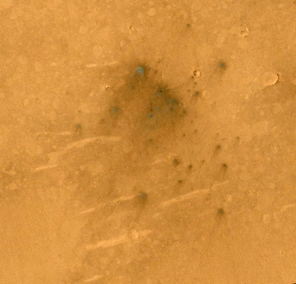
This cluster of small impact craters was spotted by the Context Camera on Mars Reconnaissance Orbiter in the region northwest of Gale Crater, the landing site of the Mars Science Laboratory (MSL) rover, Curiosity.

We had suspected that the cluster was produced by the impact of MSL's hardware onto the surface of Mars, because we could see it in CTX images after the landing, but it was not present in images prior to the arrival of MSL. Consistent with this interpretation is the fact that the cluster is located along a line between the Curiosity landing site and a strewn field of debris previously identified in HiRISE images as being caused by MSL hardware, in particular the cruise stage and/or tungsten weights used as cruise balance masses (see the caption for ESP_029245_1755 and associated links).

Over a year has passed since the landing, so this impact cluster is not as fresh as those imaged earlier and has been degraded somewhat by winds from the northeast. Nevertheless, the cluster shows some similarities to the impacts up-range, including asymmetric ejecta patterns that indicate an oblique impact (estimated to be only 9 to 10 degrees above horizontal). The cluster is located some 9 kilometers downrange of the impacts imaged earlier, about 70 kilometers away from the rover landing site.

With a closeup image, we see that it is was produced by a "shotgun blast" of at least 40 individual impacts that formed small craters no larger than 2 meters in diameter. In contrast, the up-range impacts included four craters that were 4 to 5 meters in diameter. Assigning each of the impacts to specific pieces of hardware is a challenging puzzle, but it is thought that the four large craters were produced by two large tungsten weights that broke in half to make these four craters, or by pieces of the cruise stage, which was designed to break up in the atmosphere for planetary protection purposes, to kill any Earthly microbes.

The cluster imaged here adds to the mystery, and may have been produced by a piece of the cruise stage that traveled farther through the Martian atmosphere and was therefore more thoroughly fragmented by the time it crashed onto the surface.

Photo credit: NASA/JPL/University of Arizona

Sunday, October 20, 2013

Proctor Crater Dunes


Today's VIS image shows part of the large sand sheet and sand dunes on the floor of Proctor Crater.

Orbit Number: 51819 Latitude: -47.6422 Longitude: 30.2201 Instrument: VIS Captured: 2013-08-19 16:53

Photo credit: NASA/JPL-Caltech/Arizona State University

Frosted Dunes in Richardson Crater


Richardson Crater is home to this sea of sand dunes. It was fall in the Southern hemisphere when this image was acquired and the dunes are frosted with the first bit of carbon dioxide ice condensed from the atmosphere.

As the season turns to winter ice will cover the entire dune field. At this moment however, it is patchy, and in the frost does not yet coat the ground beneath the dunes. The ground under the dunes appears to be cut by spidery troughs termed "araneiform terrain", carved by carbon dioxide sublimation (turning from solid to gas) in the spring.

Though Mars may appear to be a frozen wonderland it is not frozen in time: the spring will bring lots of activity to this region.

Photo credit: NASA/JPL/University of Arizona

Saturday, October 19, 2013

Daedalia Planum


This VIS image shows part of the extensive field of lava flows that make up Daedalia Planum.

Orbit Number: 51937 Latitude: -20.8833 Longitude: 233.201 Instrument: VIS Captured: 2013-08-29 09:46

Photo credit: NASA/JPL-Caltech/Arizona State University

Layered Bedrock in Candor Chasma


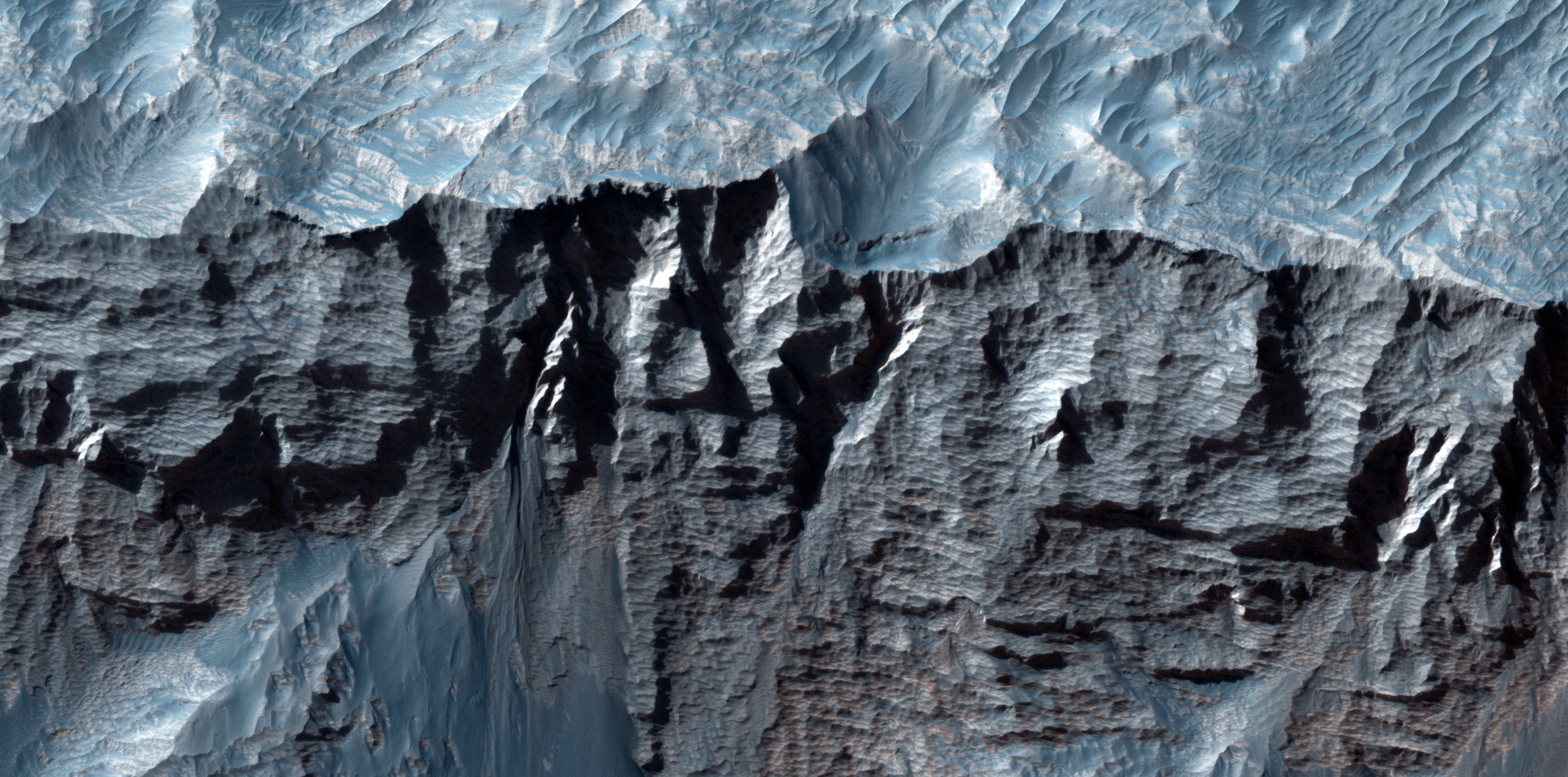
This beautiful image shows terrific layers and exposed bedrock along a cliff in west Candor Chasma, which is part of the extensive Valles Marineris canyon system.

A Context Camera (CTX) image of this area showed that the strata is not entirely horizontal, and that there may be crossed beds, or lenses pinching out, or some other texture/structure that might give a clue as to the depositional setting of the sediment that makes up these layers.

This image shows the area in greater detail and resolution, so we can compare what we have gleaned from CTX and MOC images to develop a better understanding of what we're looking at and how to interpret the past history of the region.

Photo credit: NASA/JPL/University of Arizona

Friday, October 18, 2013

Graben Near Sirenum Fossae


A graben is a downdropped block of material bounded on both sides by faults. The graben in this VIS image follows the trend of the nearby Sirenum Fossae graben.

Orbit Number: 51800 Latitude: -28.6362 Longitude: 221.182 Instrument: VIS Captured: 2013-08-18 03:16

Photo credit: NASA/JPL-Caltech/Arizona State University

Fretted Terrain in Promethei Terra


This observation shows an excellent example of what is called "fretted terrain," termed so because of the eroded appearance of the surface.

What causes this kind of terrain? One explanation is the sublimation of subsurface ground ice that goes directly from a solid state to a gaseous one. When that occurs, the material is removed and the ground can collapse in a jumbled pattern. The curving ridges and lineations could be indicative of slow movement of the ice-rich material, perhaps in a way that has similarities to rock glaciers on Earth.

Photo credit: NASA/JPL/University of Arizona

Note: This site is located in a crater within Promethei Terra, east of Hellas Planitia.

Sunday, October 13, 2013

Hebes Chasma Mesa


The details of the central mesa inside Hebes Chasma are seen in close-up detail in this perspective view. A horseshoe-shaped chunk has been taken out of one side of the mound (left in this image); the material has slumped down onto the floor of the valley below. A dark patch appears to pool like spilt ink across the debris. It is most likely loose material that has slid down the walls from an intermediate layer. Melted ice could have played a role by weakening the rocks to create its flow-like appearance.

Along the side of the mound fine horizontal layering is seen. The layers likely comprise a mix of wind-blown dust and ancient lake sediments, along with remnants of the older plateau.

Photo credit: ESA/DLR/FU Berlin (G. Neukum)

Saturday, October 12, 2013

Hebes Chasma Landslides


A flat-topped mesa is located in the center of Hebes Chasma and rises to a similar height as the surrounding plains. Exposed within the walls of the mesa are layers of sediments deposited by wind and water.

Numerous grooves are etched into the mountain, suggesting the material is weak and easily eroded. The walls of Hebes Chasma are also weak – a large landslide dominates the right side of this image.

Photo credit: ESA/DLR/FU Berlin (G. Neukum)

Friday, October 11, 2013

Hebes Chasma


This mosaic of Hebes Chasma is composed of eight single images taken with the High Resolution Stereo Camera on Mars Express, corresponding to orbits 360 (2 May 2004), 2149 (16 September 2005), 3217 (12 July 2006), 5142 (3 January 2008), 5160 (8 January 2008), 5178 (13 January 2008), 6241 (11 November 2008), and 7237 (24 August 2009). The image center lies at about 1°S / 284°E.

Hebes Chasma is an enclosed, almost 8 km-deep trough stretching 315 km in an east–west direction and 125 km from north to south at its widest point. It sits about 300 km north of the vast Valles Marineris canyon. A flat-topped mesa is located in the center of Hebes Chasma, which was likely shaped by the action of wind and water.

Image credit: ESA/DLR/FU Berlin (G. Neukum)

Note: For more information, see Hebes Chasma 3D and Hebes Chasma Topography.

Monday, October 7, 2013

Comet ISON by HiRise


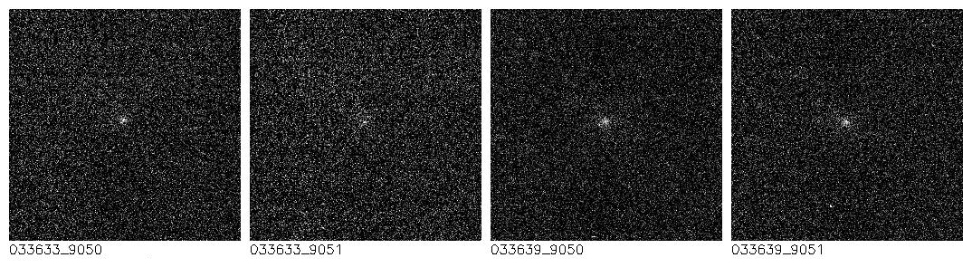
On 29 September 2013, the Mars Reconnaissance Orbiter (MRO) maneuvered to point its High Resolution Imaging Science Experiment (HiRISE) camera at ISON, a new comet passing by Mars on its way into the inner Solar System.

HiRISE saw a small spot at the position of ISON that is relatively bright, like a star, but moving relative to actual stars. The comet's coma is apparently very faint, so these data provide useful constraints on the size of the comet nucleus and its overall brightness, key measurements to understand its behavior and useful knowledge to subsequent observers.

These images show a 256 x 256 pixel patch of sky at the range to the comet of 8 million miles and when the solar phase angle is 47 degrees. Three more observations of ISON are planned for 1 and 2 October as the comet moves through closest approach to Mars at 7 million miles, but with less illumination as seen from Mars.

Based on preliminary analysis of the data, the comet appears to be at the low end of the range of brightness predictions for the observation. As a result, the image isn't visually pleasing but low coma activity is best for constraining the size of the nucleus. This image has a scale of approximately 8 miles (13.3 km) per pixel, larger than the comet, but the size of the nucleus can be estimated based on the typical brightness of other comet nuclei. The comet, like Mars, is currently 241 million kilometers from the Sun. As the comet gets closer to the sun, its brightness will increase to Earth-based observers and the comet may also become intrinsically brighter as the stronger sunlight volatilizes the comet's ices.

Comet ISON (officially known as C/2012 S1) is believed to be in its first pass through the inner solar system from the distant Oort Cloud, a roughly spherical collection of comets and comet-like structures that exists in a space between one-tenth light-year and 1 light-year from the sun. The comet will pass within 724,000 miles (1.16 million kilometers) of the Sun on 28 November 2013. It was discovered on 21 September 2012, roughly between Jupiter and Saturn, by Vitali Nevski and Artyom Novichonok at the International Scientific Optical Network (ISON) near Kislovodsk, Russia.

Image credit: NASA/JPL/University of Arizona

Sunday, October 6, 2013

Differential Compaction around a Crater Peak in Aeolis Mensae


This image shows a central peak that is surrounded by a ring-like graben feature and relatively flat terrain. Does the graben show evidence of what geologists call "differential compaction"?

Compaction refers to sediment that is originally porous and is covered up by other sediment (called "loading") that reduces that porousness. In other words, sand particles are pushed closer and closer together. Differential compaction is when there is variation in the thickness of a given area that creates uneven surface and has different degrees of porosity. The presence of the graben might be a clue to the formation of such unevenness.

This is a stereo pair with ESP_033253_1800.

Photo credit: NASA/JPL/University of Arizona

Note: This site is located in Aeolis Mensae, lying to the northeast of Gale Crater.

Saturday, October 5, 2013

Scalloped Terrain North of Protonilus Mensae


This observation shows what we call "scalloped terrain," that appears here to merge in a linear depression.

How do these scallops form? Possibly from the collapse of the terrain due to sublimation (when a solid transforms directly into a gaseous state) of subsurface ice. There is also a large number of rocks on the surface.

HiRISE resolution can help us examine the surface much more closely to see if there are any differences between the surrounding plains and the floor of these scalloped depressions.

Photo credit: NASA/JPL/University of Arizona

Note: This location is north of Protonilus Mensae in Vastitas Borealis. It is due east, at some distance, of Lyot Crater.

Friday, October 4, 2013

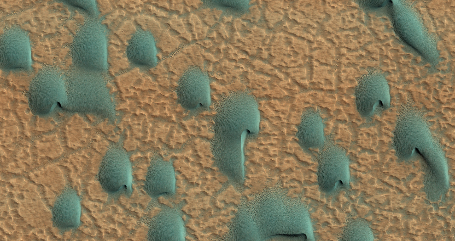
Barchan Dunes in Noachis Terra


This field of dunes lies on the floor of an old crater in Noachis Terra, one of the oldest places on Mars.

When there are perfect conditions for producing sand dunes--steady wind in one direction and just enough sand--barchan sand dunes form. The word "barchan" is a Russian term because this type of dune was first described in the desert regions of Turkistan.

Barchans have a gentle slope on the upwind side and a much steeper slope on the lee side where horns or a notch often forms. The wind in this case came from the southwest. Observing dunes on Mars can tell us how strong the winds are, as well as their direction. If pictures are taken at regular intervals, one may see changes in the dunes and in ripples on the dunes' surface.

The color in the photograph is not the same as we would see with our eyes because an extra color (infrared) is added. Our eyes cannot detect infrared, but it is used because it can give us clues to the composition of the surface. On Mars dunes are often dark in color because they were formed from the common, volcanic rock basalt. In the dry environment, dark minerals in basalt, like olivine and pyroxene, do not break down as quickly as they do on Earth. Although rare, some dark sand is found on Earth, for example in Hawaii which also has many volcanoes discharging basalt.

Photo credit: NASA/JPL/University of Arizona

Thursday, October 3, 2013

Coprates Chasma


This VIS image shows part of the floor of Coprates Chasma, including a large sand sheet and smaller dunes.

Orbit Number: 51735 Latitude: -13.9676 Longitude: 296.942 Instrument: VIS Captured: 2013-08-12 18:50

Photo credit: NASA/JPL-Caltech/Arizona State University

Wednesday, October 2, 2013

Slope Streaks East of Mangala Valles


Dark streaks mark the steep slopes of this ridge located east of Mangala Valles. One theory about the creation of this feature is that downslope movement of a rock "clears" the brighter dust revealing the darker surface below.

Orbit Number: 51688 Latitude: -17.0589 Longitude: 211.394 Instrument: VIS Captured: 2013-08-08 22:02

Photo credit: NASA/JPL-Caltech/Arizona State University

Tuesday, October 1, 2013

Landslides in Aurorae Chaos


Several landslides occurred on this steep cliff face.

Orbit Number: 51684 Latitude: -6.49984 Longitude: 328.126 Instrument: VIS Captured: 2013-08-08 14:05

Photo credit: NASA/JPL-Caltech/Arizona State University