Sunday, February 24, 2013

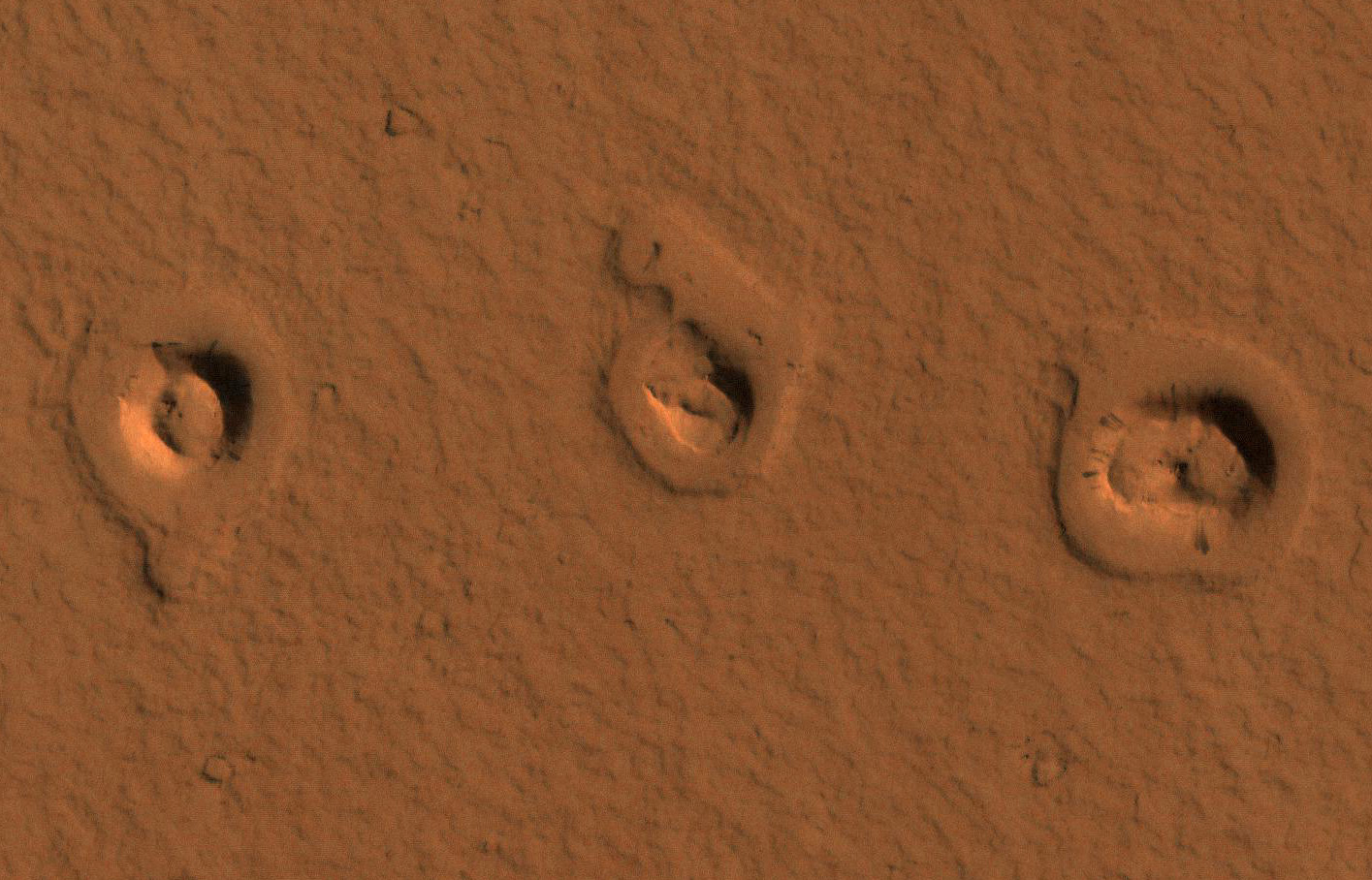
Rootless Cones and Inflated Lava Flows in Amazonis Planitia


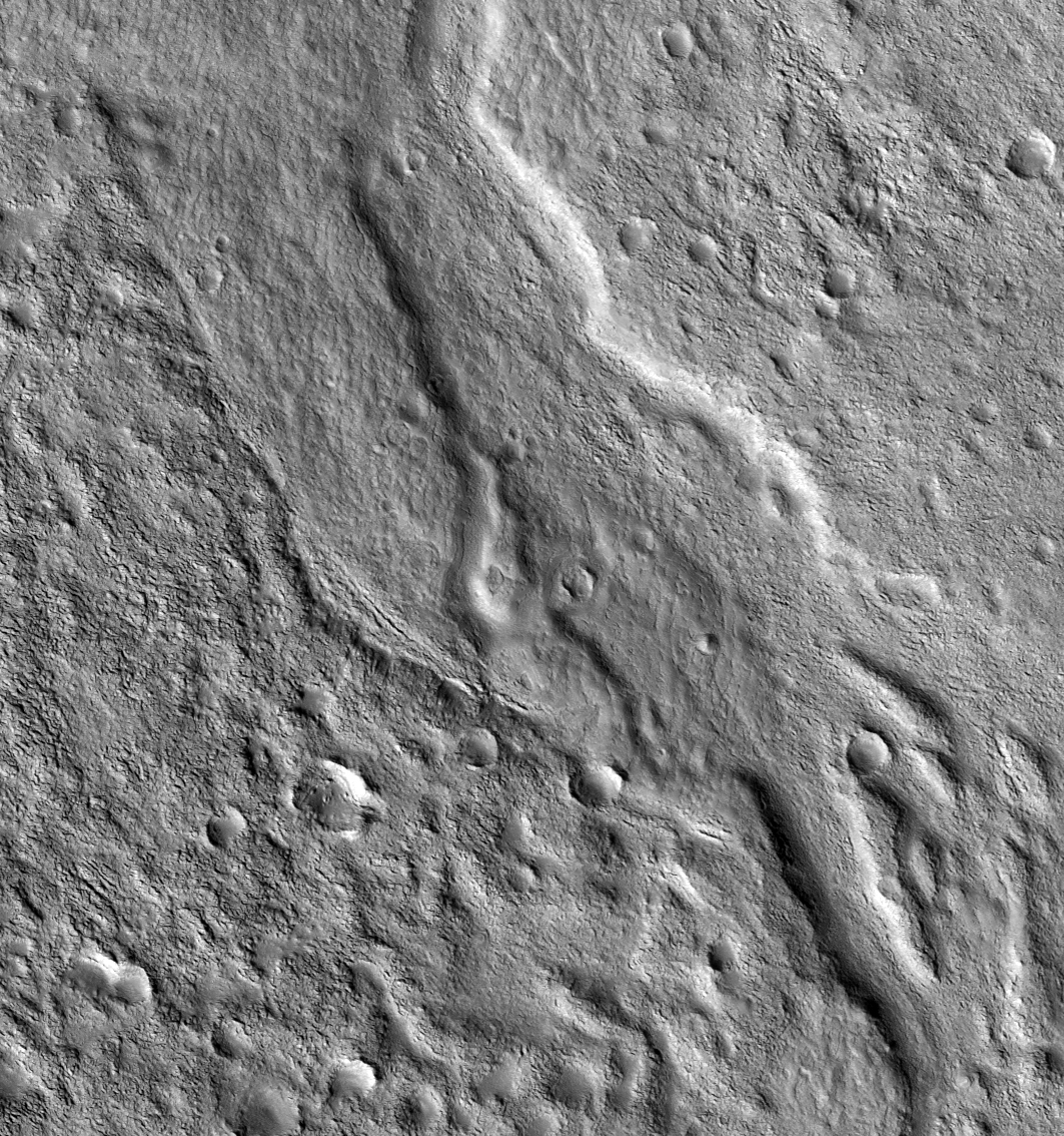
A CTX image shows topographic cones in local depressions here. What are these and how did they form?

This image reveals "rootless cones," which form on lava flows that interact with subsurface water. They are in depressions because subsequent lava flowed around the base of the cones, then "inflated." Lava inflation is a process where liquid is injected beneath the solid (thickening) crust and raises the whole surface, often raising it higher than the topography that controlled the initial lava emplacement.

This scene is in Amazonis Planitia, a vast region covered by flood lava. The surface is coated by a thin layer of reddish dust, which avalanches down steep slopes to make dark streaks.

Photo credit: NASA/JPL/University of Arizona

Saturday, February 23, 2013

Landslide Deposit in Ganges Chasma


Today's VIS image shows a landslide deposit which flowed towards the floor of Ganges Chasma.

Orbit Number: 49187 Latitude: -7.12336 Longitude: 315.372 Instrument: VIS Captured: 2013-01-15 02:33

Photo credit: NASA/JPL-Caltech/Arizona State University

Dark Deposits Around a Volcanic Fissure Adjacent to Tharsis Tholus


There have been a number of claims in recent years that there are small dark volcanic ash deposits on Mars, suggesting very recent volcanic eruptions. However, most of these claims have not stood up to scrutiny by HiRISE.

Dark wind blown sand, not volcanic ash, explains most examples of diffuse dark patches on Mars. This area is especially intriguing because the wind blown material in the region has a light, not dark, tone. Furthermore, there are fresh looking lava flows adjacent to the possible vent, lending additional weight to the idea of recent volcanism here.

The difference in the way small craters resist erosion within this dark deposit is also suggestive of coarser fallout from a lava fountain. Overall, this is a top contender for a recent volcanic vent on Mars.

Photo credit: NASA/JPL/University of Arizona

Friday, February 22, 2013

Crater Dunes in Terra Cimmeria


This VIS image shows a field of dunes on the floor of an unnamed crater in Terra Cimmeria.

Orbit Number: 49180 Latitude: -36.742 Longitude: 152.903 Instrument: VIS Captured: 2013-01-14 12:53

Photo credit: NASA/JPL-Caltech/Arizona State University

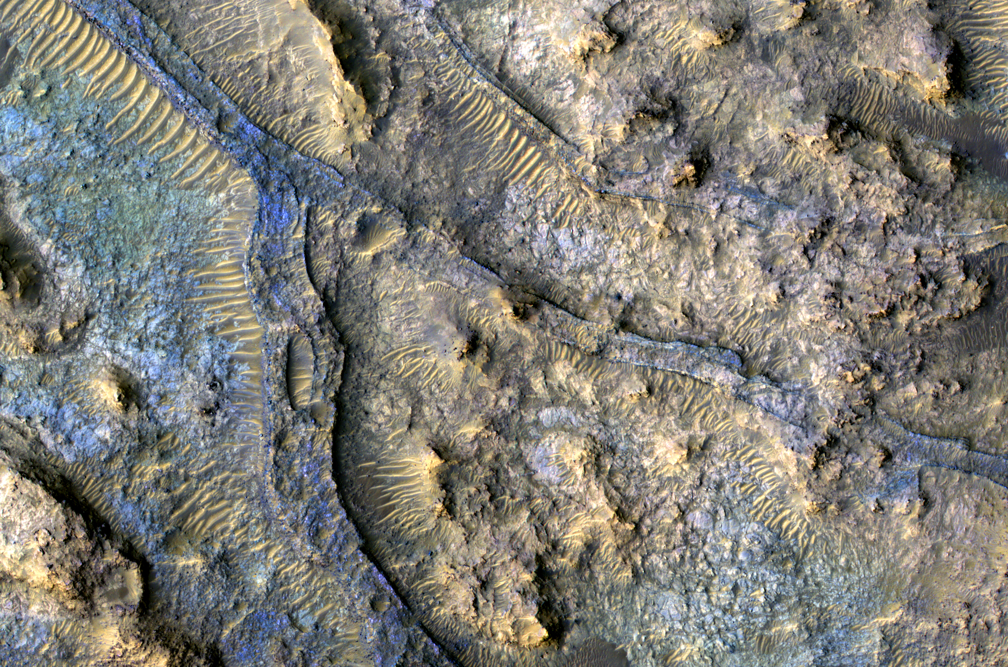
Inverted Channels in Kasimov Crater


Enhanced color images, such as this 1-kilometer wide (2/3 mile) sample, can help us distinguish between materials of different composition.

The image shows a bluish ridge that runs from bottom center to upper left. The ridge is joined by smaller one in the middle of the image like small tributary rivers join together with larger ones on Earth. Indeed, this is exactly what happened here on Mars billions of years ago.

These ridges are called "inverted channels" and mark the locations of ancient Martian river beds (in this case the river flowed towards the upper left of the image). They form because the bottoms of these rivers tend to be full of gravel-sized rocks, whereas the area around the river is made of fine clays. Long after the river stops flowing the wind slowly removes the clays, but can't blow away the gravel. After all the clays are gone, the old river bed gets left as a high-standing gravel ridge such as visible here.

This is a stereo pair with ESP_022829_1550.

Image credit: NASA/JPL/University of Arizona

Thursday, February 21, 2013

Ridges in Arsia Sulci


The parallel ridges in this VIS image are part of Arsia Sulci - a region west of Arsia Mons. How these features were formed is unknown.

Orbit Number: 49165 Latitude: -5.7405 Longitude: 229.9 Instrument: VIS Captured: 2013-01-13 07:05

Photo credit: NASA/JPL-Caltech/Arizona State University

Saturday, February 16, 2013

Daedalia Planum (Again)


Today's VIS image shows more of the extensive lava flows in Daedalia Planum.

Orbit Number: 49177 Latitude: -19.1646 Longitude: 242.039 Instrument: VIS Captured: 2013-01-14 06:05

Photo credit: NASA/JPL-Caltech/Arizona State University

Friday, February 15, 2013

Daedalia Planum


The volcanic flows in this VIS image are part of Daedalia Planum, an extensive flow field originating from Arsia Mons.

Orbit Number: 49152 Latitude: -18.8713 Longitude: 242.892 Instrument: VIS Captured: 2013-01-12 05:28

Photo credit: NASA/JPL-Caltech/Arizona State University

Thursday, February 14, 2013

Avernus Cavi Fractures


The arcuate fractures and depressions in this VIS image are part of Avernus Cavi.

Orbit Number: 49142 Latitude: -2.39672 Longitude: 173.492 Instrument: VIS Captured: 2013-01-11 09:38

Photo credit: NASA/JPL-Caltech/Arizona State University

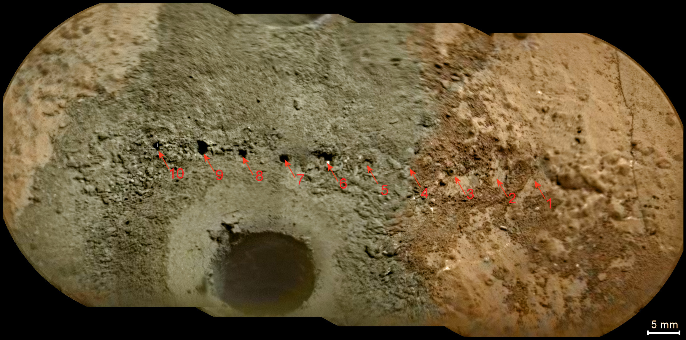
Laser Hits on Martian Drill Tailings


A day after NASA's Mars rover Curiosity drilled the first sample-collection hole into a rock on Mars, the rover's Chemistry and Camera (ChemCam) instrument shot laser pulses into the fresh rock powder that the drilling generated. This scene shows a line of pits left by laser hits on the drill tailings. The view is a mosaic of images taken by the remote micro-imager in ChemCam, with color information from Curiosity's MastCamera.

The drilled hole, at lower center, is about 0.6 inch (1.6 centimeters) in diameter. Curiosity drilled the hole 2.5 inches (6.4 centimeters) deep during the 182nd Martian day, or sol, of the rover's work on Mars (February 8, 2013). ChemCam repeatedly zapped several points near the hole on Sol 183 (February 9, 2013) to obtain spectra providing information about composition, and then on the same sol took the images that have been combined to create this view. Marks from the laser hits are visible along a line about halfway up the image. Arrows at 10 locations indicate the marks from the laser hits in the annotated version.

The site is on a patch of flat rock called "John Klein" in the "Yellowknife Bay" area of Mars' Gale Crater.

Photo credit: NASA/JPL-Caltech/LANL/IRAP/CNES/LPGNantes/IAS/CNRS/MSSS

Note: For an annotated version of the above photo, click here.

Wednesday, February 13, 2013

Gullies West of Bozkir Crater


Small gullies are located on the north and south sides of this hill. The hill is part of the mountainous region that borders the northeastern side of Argyre Planitia.

Orbit Number: 49124 Latitude: -44.1061 Longitude: 326.232 Instrument: VIS Captured: 2013-01-09 22:01

Photo credit: NASA/JPL-Caltech/Arizona State University

Note: This image is located just to the west of Bozkir Crater. The mountainous region mentioned above is known as Nereidum Montes.

Tuesday, February 12, 2013

Pavonis Mons


This VIS image shows the southern margin of Pavonis Mons.

Orbit Number: 49102 Latitude: -1.69816 Longitude: 246.882 Instrument: VIS Captured: 2013-01-08 02:37

Photo credit: NASA/JPL-Caltech/Arizona State University

Note: While collapse features may include pit craters, what we see in this photo are primarily collapsed lava tubes; see this post for a more detailed explanation of similar features on Pavonis Mons.

Hood Ornament on Mars


A shiny-looking Martian rock is visible in this image taken by NASA's Mars rover Curiosity's Mast Camera (Mastcam) during the mission's 173rd Martian day, or sol (January 30, 2013).

On Mars, as on Earth, sometimes things can take on an unusual appearance. A case in point is a shiny-looking rock seen in a recent image from NASA's Curiosity Mars rover.

Some casual observers might see a resemblance to a car door handle, hood ornament or some other type of metallic object. To Ronald Sletten of the University of Washington, Seattle, a collaborator on Curiosity's science team, the object is an interesting study in how wind and the natural elements cause erosion and other effects on various types of rocks.

Find out what likely caused the shiny appearance of the Martian rock, and see some examples of similar phenomena found on Earth. A PDF of the images and explanatory text is available at: http://www.jpl.nasa.gov/images/msl/20130211/ventifacts.pdf.

Photo credit: NASA/JPL-Caltech/Malin Space Science Systems

Monday, February 11, 2013

Landslide Deposits in Noctis Labyrinthus


Today's VIS image shows several small landslide deposits in Noctis Labyrinthus.

Orbit Number: 48989 Latitude: -13.2116 Longitude: 263.29 Instrument: VIS Captured: 2012-12-29 19:30

Photo credit: NASA/JPL-Caltech/Arizona State University

MSL Self-Portrait, Sol 177


This self-portrait of NASA's Mars rover Curiosity combines 66 exposures taken by the rover's Mars Hand Lens Imager (MAHLI) during the 177th Martian day, or sol, of Curiosity's work on Mars (February 3, 2013).

The rover is positioned at a patch of flat outcrop called "John Klein," which was selected as the site for the first rock-drilling activities by Curiosity. The self-portrait was acquired to document the drilling site.

The rover's robotic arm is not visible in the mosaic. MAHLI, which took the component images for this mosaic, is mounted on a turret at the end of the arm. Wrist motions and turret rotations on the arm allowed MAHLI to acquire the mosaic's component images. The arm was positioned out of the shot in the images or portions of images used in the mosaic.

Photo credit: NASA/JPL-Caltech/MSSS

Note: For more information, see PIA16764: Curiosity Rover's Self Portrait at 'John Klein' Drilling Site, Cropped. This is the same image as above, but is cropped into a nice, rectangular shape and is also at a higher resolution (6.678 MB).

Sunday, February 10, 2013

Dunes in Brashear Crater


Today's VIS image shows part of the dune field on the floor of Brashear Crater.

Orbit Number: 49052 Latitude: -53.4147 Longitude: 240.117 Instrument: VIS Captured: 2013-01-04 (All day)

Photo credit: NASA/JPL-Caltech/Arizona State University

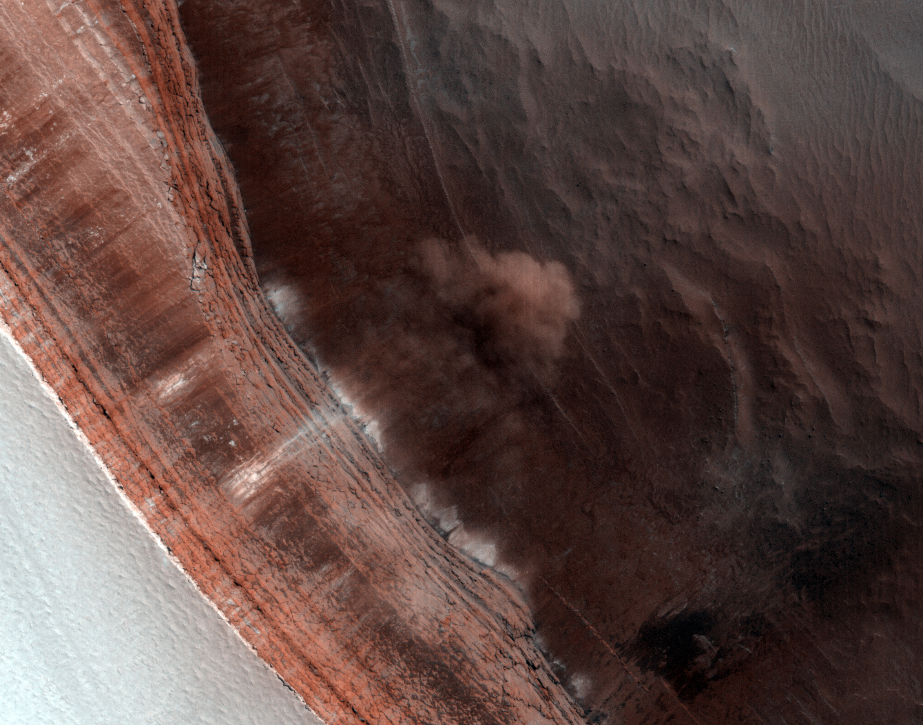
Frost Avalanches Along Olympia Rupes


This image was originally acquired in 2011 in order to monitor for frost avalanches that occurred the year prior.

HiRISE often re-images certain areas to track changes over time. In this case, we wanted to photograph the scarp near the onset of the Martian springtime, to get a better understanding of the frequency of these frost avalanches, what triggers them and any role they have in the evolution of the scarp's formation.

While HiRISE has captured other frost avalanches before, they never cease to amaze since it demonstrates that there are indeed active processes on the Red Planet.

Photo credit: NASA/JPL/University of Arizona

Saturday, February 9, 2013

Lava Flows in Daedalia Planum


Today's VIS image shows a small portion of the lava flows that make up Daedalia Planum.

Orbit Number: 48765 Latitude: -21.3017 Longitude: 240.492 Instrument: VIS Captured: 2012-12-11 09:06

Photo credit: NASA/JPL/Arizona State University

Layering in Central Candor Chasma


A Context Camera (CTX) image of this area shows faulted layered deposits near the contact between the layered deposits and wall rock.

At HiRISE resolution, we may be able to discern any structural relationships, which may yield insight into relative age of these layered deposits and faulting to basin formation. As part of a stereo pair (linked below), we can measure bedding and fault orientations.

This observation is in an area of high hematite abundance. On Earth, hematite is a mineral formed in an aqueous environment. Its presence on Mars can help us understand what the past environment was like that formed it.

This is a stereo pair with ESP_019732_1750.

Photo credit: NASA/JPL/University of Arizona

Friday, February 8, 2013

Meroe Patera Dunes


The dunes in this VIS image are located on the margin of Meroe Patera.

Orbit Number: 48870 Latitude: 6.65402 Longitude: 68.131 Instrument: VIS Captured: 2012-12-20 02:01

Photo credit: NASA/JPL-Caltech/Arizona State University

Layers in a Crater in Nilosyrtis


This impact crater in the Nilosyrtis region of Mars contains numerous layers exposed along its floor. These layers formed long after the impact event and are likely deposits of dust and ice.

Also present are dunes of dark sand that probably blew in from the surrounding terrain.

This is a stereo pair with ESP_025911_2255.

Photo credit: NASA/JPL/University of Arizona

Thursday, February 7, 2013

Channel in Tyrrhena Fossae


The channel feature in this VIS image is part of Tyrrhena Fossae, a large depression that dissects Tyrrhena Mons.

Orbit Number: 48882 Latitude: -20.2213 Longitude: 107.255 Instrument: VIS Captured: 2012-12-21 00:12

Photo credit: NASA/JPL-Caltech/Arizona State University

Conical Hill in Planum Australe


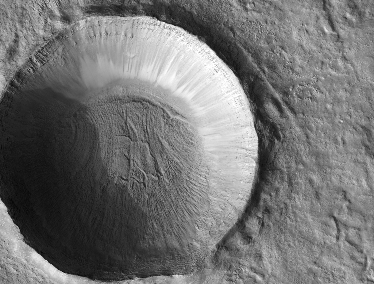
This image shows an odd pointy hill on the South Polar layered ice deposits.

The hill appears layered and may be an erosional remnant, in which most of the region been eroded to a depth of at least the height of this hill (about 20-30 meters), maybe more. The dark spots and streaks are due to defrosting of the seasonal cover of dry ice (carbon dioxide).

Photo credit: NASA/JPL/University of Arizona

Tuesday, February 5, 2013

Juventae Chasma Dunes


This VIS image shows the western margin of Juventae Chasma and the dunes that occur at the base of the chasma cliff.

Orbit Number: 48863 Latitude: -4.23348 Longitude: 297.286 Instrument: VIS Captured: 2012-12-19 10:35

Photo credit: NASA/JPL-Caltech/Arizona State University

Sunday, February 3, 2013

Textured Crater Floor in Arabia Terra


Surrounding the uplifted bedrock in the center of this large crater is mottled terrain. What possibly caused this?

The floor of the crater might be the result of icy flows. Perhaps an ancient aquifer system was exposed at the time of the impact resulting in the incredible mottled floor we see now, which appears different from the uplifted central peak.

Photo credit: NASA/JPL/University of Arizona

Note: This crater lies just to the north of Flammarion Crater in Arabia Terra.

Saturday, February 2, 2013

East Coprates Chasma Dune Fields and Wall Rock


One of the suggested goals for this observation was to investigate the relation of dune material with wall rock as a suspected sand source.

Outcrops emulating dark material are located upslope of the dune field. Adjacent HiRISE images (like PSP_007218_1660) show evidence that the dune material may be locally derived. Overlaps with other HiRISE images also help to monitor for change detection (dune slip faces and rock slides).

Coprates Chasma is part of the large Valles Marineris canyon, the largest one in the Solar System.

This is a stereo pair with ESP_025731_1655.

Photo credit: NASA/JPL/University of Arizona

Friday, February 1, 2013

Lucaya Crater Named

The USGS Astrogeology Science Center reports that:

The IAU Working Group for Planetary System Nomenclature has approved the name Lucaya for a crater on Mars. For more information, see the map of MC-21 in the Gazetteer of Planetary Nomenclature.

Note: Lucaya Crater is a small impact crater located on the northwestern rim of Huygens Crater, both of which are located in Terra Sabaea. It is named after a town in the Commonwealth of the Bahamas.


Diverse Mineral Compositions within Schaeberle Crater


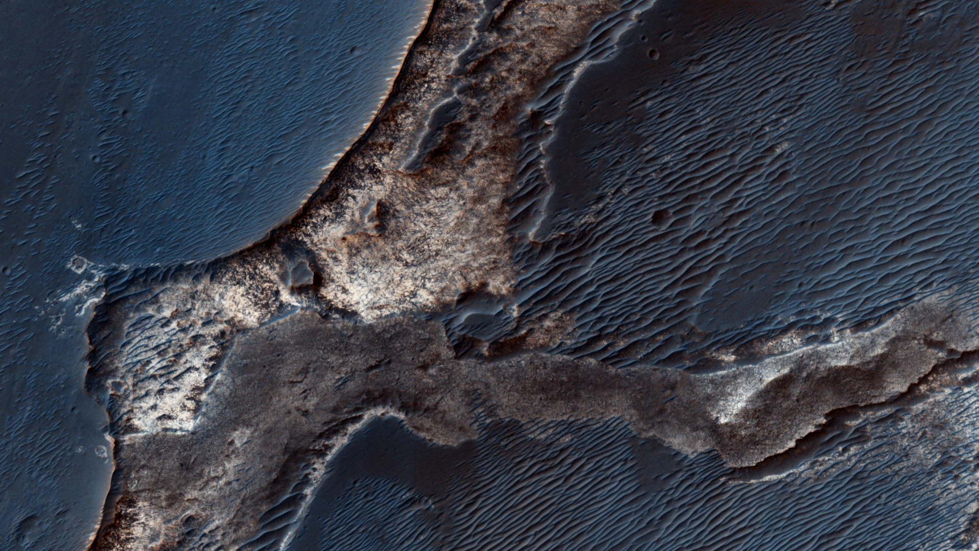
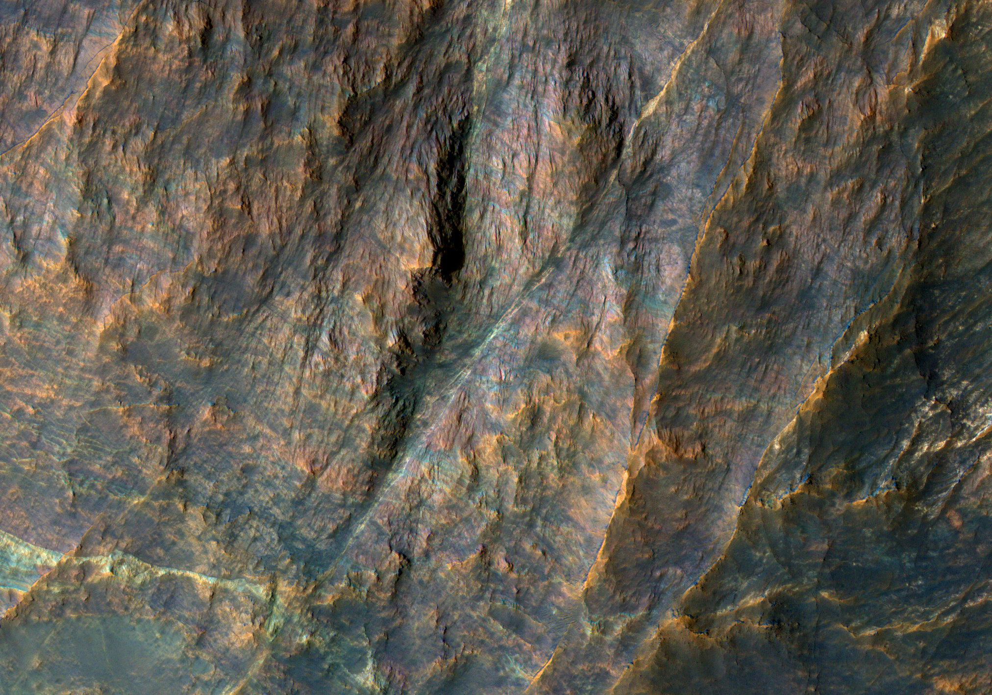
This image covers a well-preserved (relatively young) impact crater about 5 kilometers (3 miles) wide. The enhanced-color sample shows that the north-facing slope (on the south side of the crater) has a blue-green color but the south-facing slope has a yellowish color.

The blue-green (infrared-shifted) colors indicate minerals like olivine and pyroxene, common in lava or subsurface intrusions of magma. The yellowish color is typical of hydrous alteration or dust. This crater likely exposed diverse lithologies (rock types) that were present before the crater formed.

This is a stereo pair with ESP_030290_1550.

Photo credit: NASA/JPL/University of Arizona

Note: The location of this photo is within Schaeberle Crater, which lies to the northwest of Hellas Planitia in Terra Sabaea.

Thursday, January 31, 2013

Curiosity on Sol 157


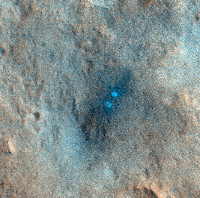
This HiRISE observation was performed in conjunction with a CRISM observation so that they could get good spectral data on the scour zone created by the MSL descent rockets.

Our higher resolution HiRISE image will allow the CRISM team to compare their data with ours. The scour zone is where MSL touched down. The pair of bright white spots in the HiRISE image show the area immediately below where sky crane's rockets were pointed. Those areas were "blasted clean" and therefore show brightest. The larger dark scour zone is dark because the fine dust has been blown away from the area leaving darker materials.

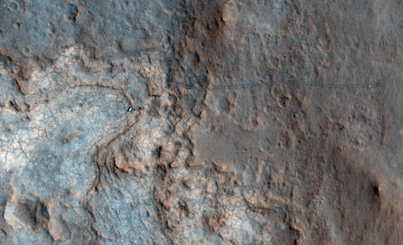
However, we also captured Curiosity on its 157th Sol as it was exploring Yellowknife Bay and about to drill its first rock.

This is the first time that we've captured the rover tracks in color, and they show up as a pair of dark lines moving across the landscape.

Note: the above image is non map-projected, so approximate north is down.

Photo credit: NASA/JPL/University of Arizona

Tuesday, January 29, 2013

Channel East of Baetis Chaos


This unnamed channel is located east of Baetis Chaos.

Orbit Number: 48738 Latitude: -0.645607 Longitude: 301.829 Instrument: VIS Captured: 2012-12-09 03:40

Photo credit: NASA/JPL/Arizona State University

Drilling John Klein


The percussion drill in the turret of tools at the end of the robotic arm of NASA's Mars rover Curiosity has been positioned in contact with the rock surface in this image from the rover's front Hazard-Avoidance Camera (Hazcam).

The drill was positioned for pre-load testing, and the Hazcam recorded this image during the 170th Martian day, or sol, of Curiosity's work on Mars (January 27, 2013). Other tests with the drill are planned before the first drilling into a rock on Mars to collect a sample of rock material for analysis.

In this view, the drill is positioned on a target on a patch of flat, veined rock called "John Klein." The site is within the "Yellowknife Bay" area of Gale Crater.

Photo credit: NASA/JPL-Caltech

Note: For more information, see Curiosity Maneuver Prepares for Drilling

Butterfly Crater in Syrtis Major Planum


Emily Lakdawalla of the Planetary Society wrote a nice blog entry about her HiWish image here.

She requested stereo coverage, which is also available, and here's a resulting anaglyph cutout.

If you're interested in suggesting a potential target for us to image, consider setting up a HiWish account here.

This is a stereo pair with ESP_029999_1890.

Photo credit: NASA/JPL/University of Arizona

Note: This crater is located between Nili Patera to the west and Isidis Planitia to the east, in Syrtis Major Planum.

Monday, January 28, 2013

Banded Bedrock in Terra Sabaea


Terra Sabaea is the region of ancient highlands north of the Hellas impact basin.

The enhanced color image shows bands of bedrock with different colors. Such colorful bedrock is typical of ancient Mars, when water played a more active role in altering minerals, and multiple geologic processes were very active (impact, volcanism, fluvial, tectonic).

The ridges or bright or dark lines that cut across the layers mark faults, places where the crust fractured and accommodated motions. A field geologist could spend years mapping the geology of the terrain covered by this image.

Photo credit: NASA/JPL/University of Arizona

Sunday, January 27, 2013

Spring Fans in Planum Australe


At high latitudes every winter carbon dioxide condenses from Mars' atmosphere onto the surface forming a seasonal polar cap. In the spring, the Sun shines through this semi-translucent layer of dry ice and heats the ground below.

The ice sublimates (goes directly from ice to gas) on the underside of the seasonal ice layer and the gas is trapped. When the pressure is high enough the ice cracks and ruptures allowing the gas to escape. When the conditions are optimal this gas may condense locally near the source, forming a bright fan.

The dark fans are fine bits of surface material that get carried along by the escaping gas up to above the surface ice. Fine particles are also carried downwind and deposited in dark fans on top of the ice, where they may slowly sink into the ice. The rows of dark fans outline the original crack in the ice that allowed the gas to escape.

Photo credit: NASA/JPL/University of Arizona

Saturday, January 26, 2013

Yardangs in Elysium Planitia


The small parallel ridges in this VIS image were created by the erosive power of wind blown particles.

Orbit Number: 48580 Latitude: -0.208654 Longitude: 148.683 Instrument: VIS Captured: 2012-11-26 05:33

Photo credit: NASA/JPL/Arizona State University

Note: These yardangs are located in Elysium Planitia, to the north of Aeolis Mensae.

Stone Circles in Promethei Terra


This image covers a region southeast of the giant Hellas impact basin, which has distinctive properties in THEMIS temperature images.

The daytime temperatures are relatively cold while nighttime temperatures are relatively warm. This tells us that the surface material conducts heat efficiently, like rocks rather than fine-grained materials.

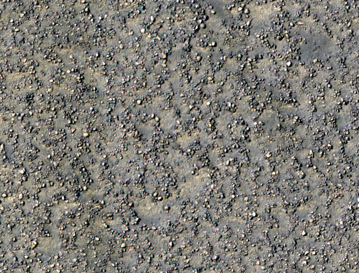
This image shows lots of boulders, and in places they form crude circular patterns. This could be due to the effects of many small impact craters (which we can no longer see, except perhaps for the boulder patterns). An alternative idea is that active processes on Mars can move large boulders (up to several meters in diameter) little by little over time.

There is almost certainly ice in the ground at this latitude (58 degrees south latitude), which expands and contracts with temperature changes. Those temperature stresses combined with the removal of fine-grained materials by the wind might be able to organize the boulders. Another idea is that in a recent past, climate the ice could seasonally melt, then re-freeze, which leads to stone circles in terrestrial permafrost (ground that is largely frozen throughout the year).

Photo credit: NASA/JPL/University of Arizona

Note: This image is located to the east of Secchi Crater in Promethei Terra.

Friday, January 25, 2013

Lava Flows from Pavonis Mons


The lava flows in this VIS image originated at Pavonis Mons.

Orbit Number: 48564 Latitude: -0.287967 Longitude: 250.006 Instrument: VIS Captured: 2012-11-24 21:57

Photo credit: NASA/JPL/Arizona State University

Sayunei at Night


This image of a Martian rock illuminated by white-light LEDs (light emitting diodes) is part of the first set of nighttime images taken by the Mars Hand Lens Imager (MAHLI) camera at the end of the robotic arm of NASA's Mars rover Curiosity. MAHLI took the images on January 22, 2012 (PST), after dark on the 165th Martian day, or sol, of the rover's work on Mars.

This rock target in the "Yellowknife Bay" area of Mars' Gale Crater is called "Sayunei." The image covers an area about 1.3 inches by 1 inch (3.4 by 2.5 centimeters). The illumination came from one of MAHLI's two groups of white LED pairs. This allowed surface features to cast shadows and provide textural detail.

Photo credit: NASA/JPL-Caltech/MSSS

Note: For more images in this series, see: PIA16712: MAHLI's First Night Imaging of Martian Rock Under Ultraviolet Lighting, PIA16713: First Night Image of MAHLI Calibration Target in White Lighting, and PIA16714: First Night Image of MAHLI Calibration Target Under Ultraviolet Lights. Also, Mars Rover Curiosity Uses Arm Camera at Night.

Sand Dunes in Olympia Undae Over Time


The High Resolution Imaging Science Experiment (HiRISE) camera on NASA's Mars Reconnaissance Orbiter snapped this series of false-color pictures of sand dunes in the north polar region of Mars. The area covered in each of the five panels is about 0.8 mile (1.3 kilometers) wide.

The progression begins at left (Panel A) in early spring, when the ground is covered by a seasonal layer of carbon dioxide ice (dry ice) about 2 feet thick. As spring progresses the ice cracks (Panel B), releasing dark sand from the dune below. When pressurized gas trapped below the ice layer is released, it carries along sand and dust to the top of the ice layer, where it is dropped in fan-shaped deposits downhill and downwind (panels C and D). The final panel shows more and more of the dark dunes as the overlying layer of seasonal ice evaporates back into the atmosphere.

The location in this series of images is at 80 degrees north latitude, 122.5 degrees east longitude.

Photo credit: NASA/JPL-Caltech/University of Arizona

Note: For more information, see Thawing 'Dry Ice' Drives Groovy Action on Mars.

Thursday, January 24, 2013

Mega Gully Near Echus Chasma


The mega gully in this VIS image empties into Echus Chasma.

Orbit Number: 48563 Latitude: 0.572332 Longitude: 278.937 Instrument: VIS Captured: 2012-11-24 19:58

Photo credit: NASA/JPL/Arizona State University

Wednesday, January 23, 2013

Channels and Fractures at Claritas Fossae


This VIS image of the Claritas Fossae region illustrates how fractures affect other features. In this instance, the fractures control the path of several channels (from upper right towards lower left). The channels follow the fractures and then follow the slope towards the bottom of the image.

Orbit Number: 48552 Latitude: -41.4612 Longitude: 258.678 Instrument: VIS Captured: 2012-11-23 20:30

Photo credit: NASA/JPL/Arizona State University

Matijevic Hill


As NASA's Mars Exploration Rover Opportunity neared the ninth anniversary of its landing on Mars, the rover was working in the 'Matijevic Hill' area seen in this view from Opportunity's panoramic camera (Pancam). Opportunity landed January 24, 2004, PST (January 25 UTC). The landing site was about 12 miles (19 kilometers), straight-line distance, or about 22 miles (35.5 kilometers) driving-route distance, from this location on the western rim of Endeavour Crater.

Matijevic Hill is an area within the "Cape York" segment of Endeavour's rim where clay minerals have been detected from orbit. This view is centered northwestward, toward the crest of Cape York. It extends more than 210 degrees from left to right. The field of view encompasses most of the terrain traversed by Opportunity during a "walkabout" in October and November 2012 to scout which features to spend time examining more intensely. Two of the features investigated at Matijevic Hill are "Copper Cliff," the dark outcrop in the left center of the image, and "Whitewater Lake," the bright outcrop on the far right.

Opportunity's Pancam took the component images for this mosaic during the period from the mission's 3,137th Martian day, or sol, (November 19, 2012) through Sol 3150 (December 3, 2012).

The image combines exposures taken through Pancam filters centered on wavelengths of 753 nanometers (near-infrared), 535 nanometers (green) and 432 nanometers (violet). The view is presented in approximate true color. This "natural color" is the rover team's best estimate of what the scene would look like if humans were there and able to see it with their own eyes.

Photo credit: NASA/JPL-Caltech/Cornell/Arizona State University

Note: For more information, see PIA16703: 'Matijevic Hill' Panorama for Rover's Ninth Anniversary (for the full-size natural color image), PIA16704: 'Matijevic Hill' Panorama for Rover's Ninth Anniversary (False Color) , PIA16709: 'Matijevic Hill' Panorama for Rover's Ninth Anniversary (Stereo) , and NASA's Veteran Mars Rover Ready to Start 10th Year.

Tuesday, January 22, 2013

Dittaino Valles


Today's VIS image shows a portion of Dittaino Valles.

Orbit Number: 48551 Latitude: -1.07402 Longitude: 293.526 Instrument: VIS Captured: 2012-11-23 18:18

Photo credit: NASA/JPL/Arizona State University

Monday, January 21, 2013

Carbonate Layering in McLaughlin Crater


This view of layered rocks on the floor of McLaughlin Crater shows sedimentary rocks that contain spectroscopic evidence for minerals formed through interaction with water. The High Resolution Imaging Science Experiment (HiRISE) camera on NASA's Mars Reconnaissance Orbiter recorded the image.

A combination of clues suggests this 1.4-mile-deep (2.2-kilometer-deep) crater once held a lake fed by groundwater. Part of the evidence is identification of clay and carbonate minerals within layers visible near the center of this image. The mineral identifications come from the Compact Reconnaissance Imaging Spectrometer for Mars (CRISM), also on the Mars Reconnaissance Orbiter.

The scene covers an area about one-third of a mile (about 550 meters) across, at 337.6 degrees east longitude, 21.9 degrees north latitude. North is up. Figure 1 [the second, annotated image above] indicates the location of layers bearing clay and carbonate minerals and includes a scale bar of 100 meters (328 feet).

Photo credit: NASA/JPL-Caltech/University of Arizona

Notes: For more information, see Layers with Carbonate Content Inside McLaughlin Crater on Mars. Unfortunately, these images are very low resolution, especially when compared to the very high resolution, very beautiful images the HiRISE team normally provides; however, this is the highest resolution NASA is releasing at this time.

Sunday, January 20, 2013

Dunes in a Noachis Terra Crater


Sand dunes on Mars are studied for many reasons. Recent investigations have focused on dune and ripples movement.

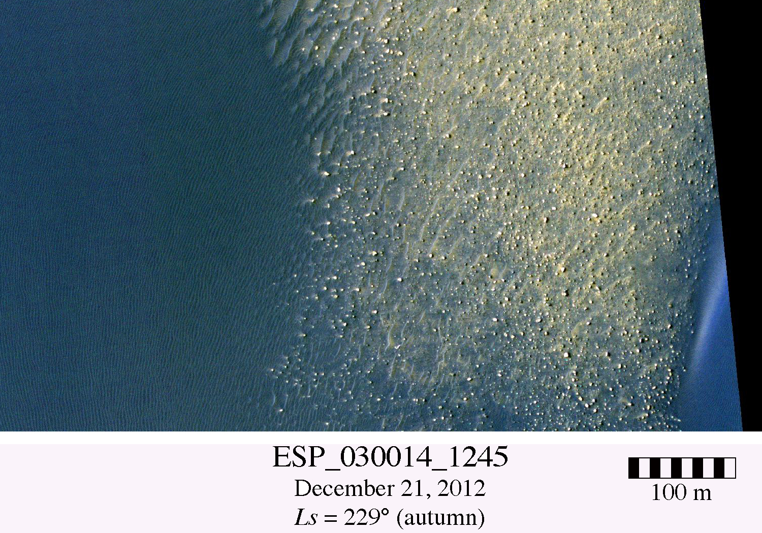
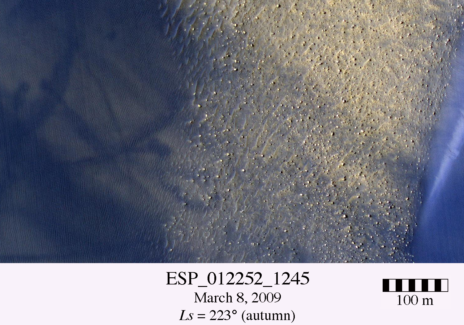
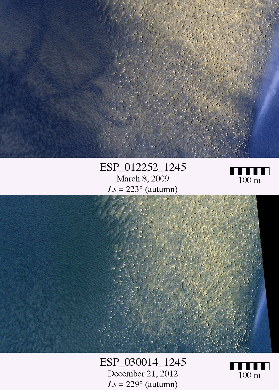
In this observation, we look at dunes within a crater in Noachis Terra. Zooming in to one of these areas (and here is the context image) we see the edges of two dunes separated by a field of ripples and rocks. We can compare this area to another image taken two Mars years ago. In the older image, there are many dark wispy features that cover the dunes. These are dust devil tracks, which formed when vortices removed a thin layer of dust off the surface, revealing a darker substrate.

In addition, there are dark sand streaks extending westward from the eastern dune. Blinking between these images shows that virtually all traces of the dust devil tracks and dark streaks have disappeared in the two Mars years. There is also little evidence for dune or ripple movement (however, these images have not yet been orthorectified for a detailed analysis).

In this region, it is likely that dust is periodically deposited and then removed off the dunes. The presence of dust may shield the dunes and ripples from significant movement, such that the observed changes are but thin layers of dust being removed and minor sand streaks that blow off the dunes.

This is a stereo pair with ESP_030080_1245.

Photo credit: NASA/JPL/University of Arizona

Note: The "blink" images, mentioned above, are well worth looking at. Here is the gif file below:

Saturday, January 19, 2013

Surface Textures at Planum Australe


Many different surface textures are found on the polar caps. This VIS images shows part of the surface of the south polar cap.

Orbit Number: 48511 Latitude: -86.8588 Longitude: 274.799 Instrument: VIS Captured: 2012-11-20 11:47

Photo credit: NASA/JPL/Arizona State University

John Klein Section of Gale Crater


This view shows the patch of veined, flat-lying rock selected as the first drilling site for NASA's Mars rover Curiosity. The rover's right Mast Camera (Mastcam), equipped with a telephoto lens, was about 16 feet (5 meters) away from the site when it recorded this mosaic's component images, between 3:10 and 3:33 in the afternoon of the 153rd Martian day, or sol, of Curiosity's work on Mars (January 10, 2013).

The area is shot full of fractures and veins, with the intervening rock also containing concretions, which are small spherical concentrations of minerals.The scale bar on the left image is 19.7 inches (50 centimeters) long. On the annotated version, three boxes, each about 4 inches (10 centimeters) across, designate enlargements on the right that illustrate attributes of the area.

Enlargement A shows a high concentration of ridge-like veins protruding above the surface. Some of the veins have two walls and an eroded interior. Enlargement B shows that in some portions of this feature, there is a horizontal discontinuity a few centimeters or inches beneath the surface. The discontinuity may be a bed, a fracture, or potentially a horizontal vein. Enlargement C shows a hole developed in the sand that overlies a fracture, implying infiltration of sand down into the fracture system.

The image has been white-balanced to show what the rocks would look like if they were on Earth.

Photo credit: NASA/JPL-Caltech/MSSS

Note: For more information, see PIA16568: Diversity in Vicinity of Curiosity's First Drilling Target and PIA16702: Neighborhood for Curiosity's First Drilling Campaign. Also, NASA Mars Rover Preparing to Drill Into First Martian Rock.

Channel and Crater Northeast of Hecates Tholus


The origins of channels on Mars is of great interest to understand the history of water.

There are several large (more than 30 kilometers wide) craters on Mars that appear to have spawned channels, perhaps draining from the fresh, hot impact ejecta.

Visible here is a well-preserved (meaning geologically young) crater that is about 3 kilometers wide, and a channel that appears from the margins of the ejecta and flows to the south. Did this small crater generate this relatively large channel?

Most likely the channel was there first, and the crater is younger. However, the channel might have been generated by a larger crater to the northwest.

Photo credit: NASA/JPL/University of Arizona

Note: This image is located west of Phlegra Montes and northeast of Hecates Tholus.

Friday, January 18, 2013

Ice Layering Near Chasma Australe


Today's VIS image shows the multitude of layers making up the South Polar cap.

Orbit Number: 48506 Latitude: -85.8144 Longitude: 95.4964 Instrument: VIS Captured: 2012-11-20 01:53

Photo credit: NASA/JPL/Arizona State University