Saturday, May 26, 2012

Expanded Craters on Icy Terrain in Tantalus Fossae


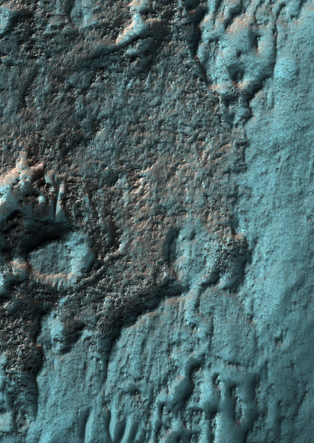
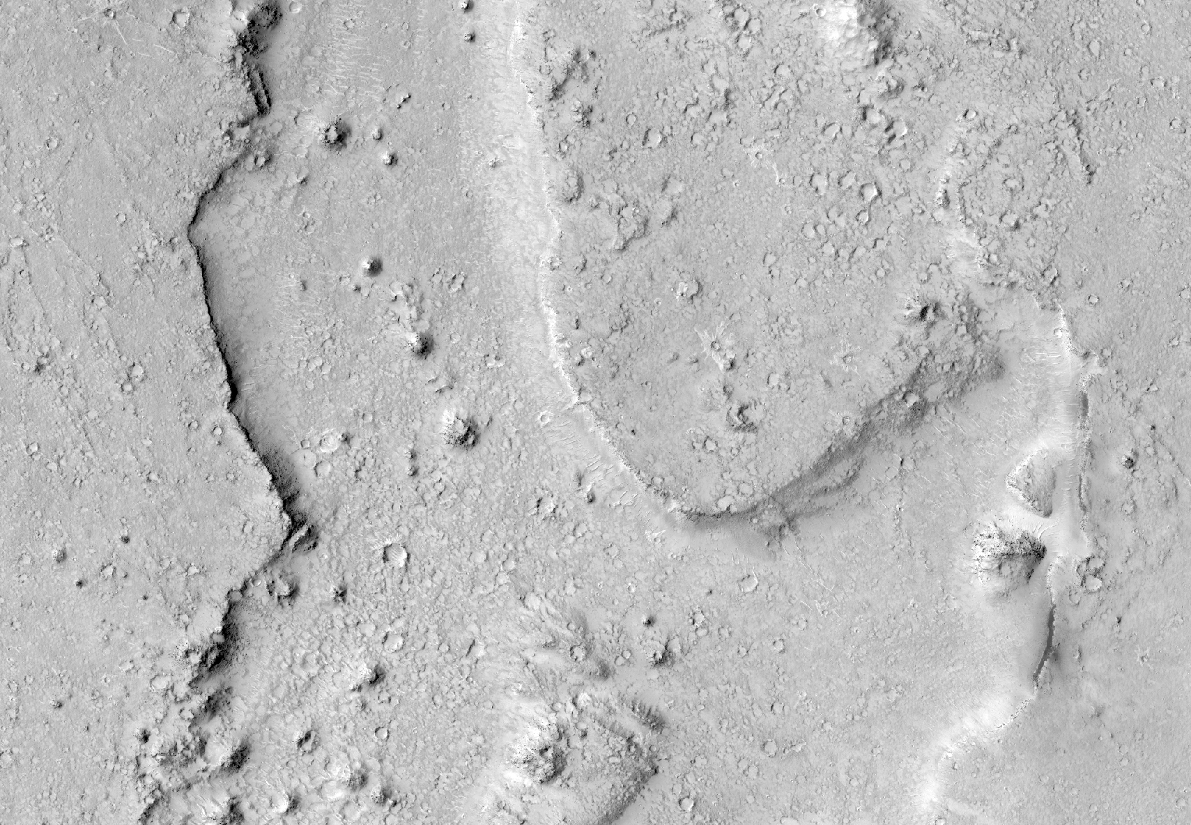
The middle of this image contains a cluster of depressions (craters) with two levels: a small inner crater, surrounded by a shallow depression extending outward from the inner crater.

This image is located at 50 degrees north latitude, where shallow ice has been mapped by the Mars Odyssey spacecraft. MRO has detected newly-formed impact craters in this broad region that exposed shallow ice, and also revealed that it is nearly pure ice.

One interpretation of the expanded craters visible here is that a group of small impacts, probably secondary craters from a much larger primary crater, exposed the clean, shallow ice in this region. Once exposed, the ice is unstable and sublimates (passes directly from ice to gas), and the shallow depressions could gradually expand.

Photo credit: NASA/JPL/University of Arizona

Note: This crater is located in eastern Tantalus Fossae to the northwest of Tempe Terra.

Friday, May 25, 2012

Late Afternoon Shadows at Endeavour Crater


NASA's Mars Rover Opportunity catches its own late-afternoon shadow in this dramatically lit view eastward across Endeavour Crater on Mars.

The rover used the panoramic camera (Pancam) between about 4:30 and 5:00 p.m. local Mars time to record images taken through different filters and combined into this mosaic view.

Most of the component images were recorded during the 2,888th Martian day, or sol, of Opportunity's work on Mars (March 9, 2012). At that time, Opportunity was spending low-solar-energy weeks of the Martian winter at the Greeley Haven outcrop on the Cape York segment of Endeavour's western rim. In order to give the mosaic a rectangular aspect, some small parts of the edges of the mosaic and sky were filled in with parts of an image acquired earlier as part of a 360-degree panorama from the same location.

Opportunity has been studying the western rim of Endeavour Crater since arriving there in August 2011. This crater spans 14 miles (22 kilometers) in diameter, or about the same area as the city of Seattle. This is more than 20 times wider than Victoria Crater, the largest impact crater that Opportunity had previously examined. The interior basin of Endeavour is in the upper half of this view.

The mosaic combines about a dozen images taken through Pancam filters centered on wavelengths of 753 nanometers (near infrared), 535 nanometers (green) and 432 nanometers (violet). The view is presented in false color to make some differences between materials easier to see, such as the dark sandy ripples and dunes on the crater's distant floor.

Photo credit: NASA/JPL-Caltech/Cornell/Arizona State University

Note: For more information, see Dark Shadows on Mars: Scene from Durable NASA Rover.

Friday, May 18, 2012

Monitoring Dune Gullies in Matara Crater


There are landforms called "gullies," consisting of an alcove, channel, and apron, on many large sand dunes on Mars.

Remarkably, we have learned that the gullies form primarily or entirely during seasons when there is carbon dioxide frost on the ground. To understand this better we image key locations multiple times throughout the Martian year.

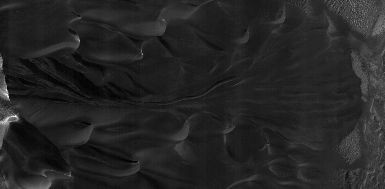
This image, at 49.5 S latitude, was acquired very near the winter solstice, when shadows are very long in the middle afternoon when MRO passes overhead. Dark sand inside shadows is a challenging scene to image while flying overhead at 3.4 km/sec, but the HiRISE camera has the sensitivity needed to acquire useful images even at the most challenging time of the year.

The subimage shows one of these gullies, hidden in the shadow. Vertical stripes in the image are from electronic noise that is usually hidden by the image signal, but in this case the signal is extremely low.

Photo credit: NASA/JPL/University of Arizona

Note: This image is located in Matara Crater, which is to the southwest of Hellas Planitia in Noachis Terra.

Thursday, May 17, 2012

A Youthful Crater in Cydonia Colles


This observation shows a youthful crater with sharp rim and gullied slopes.

Just what makes a Martian crater youthful, in a geologic sense? Very old craters tend to have eroded rims and can have plenty of material that's filled in the floor. Gale Crater, where the Mars Science Laboratory will land this summer, is an example of an ancient, highly eroded crater. By contrast, the crater in this image appears to have experienced much less erosion.

Note that even though a crater might be called "youthful," it can still mean that the crater formed tens of thousands of years ago, if not more. For an example of a truly recent crater, see the 7 meter (about 23 feet) diameter crater in ESP_015989_1835, which we know formed sometime between 2005 and 2010.

Note: the above image is not map-projected, so North is down.

Photo credit: NASA/JPL/University of Arizona

Note: This crater is located in Cydonia Colles, which is located in Acidalia Planitia to the north of Arabia Terra. This crater is an extremely short distance south of Apt Crater.

Wednesday, May 16, 2012

Advancing Dune in Nili Patera


Back-and-forth blinking of this two-image animation shows movement of a sand dune on Mars. The images are part of a study published by Nature on May 9, 2012, reporting movement of Martian sand dunes at about the same flux (volume per time) as movement of dunes in Antarctica on Earth.

The before-and-after images were taken nearly three Earth years apart by the High Resolution Imaging Science Experiment (HiRISE) camera on NASA's Mars Reconnaissance Orbiter. The scale bar is 50 meters (164 feet). The site is part of a dune field inside the summit caldera of Nili Patera, an ancient volcano, at 8.7 degrees north latitude, 67.3 degrees east longitude.

The images show a dark, rippled sand dune overlying bright-toned rock. They have been "orthorectified," that is, adjusted such that they appear as if viewed from directly overhead. They were then positionally tied together by registering fixed features on the bedrock seen in one image to the same features seen in the other. When the images are blinked back and forth, advance of the dune's lee (downwind) front over the time period of 941 days is clearly seen in the area indicated by the arrow near the lower-left corner. Other arrows indicate places where the margin of the dune has moved. In contrast, the ripples have changed so much that their migration cannot be tracked.

The first image, in which the main body of the dune looks darker due to lighting effects, was taken on October 13, 2007. It is one image product of HiRISE observation PSP_005684_1890. Other image products from the same observation are at http://hirise.lpl.arizona.edu/PSP_005684_1890. The "after" image was taken on May 11, 2010. Other image products from the same HiRISE observation are at http://hirise.lpl.arizona.edu/ESP_017762_1890.

Photo credit: NASA/JPL-Caltech/Univ. of Arizona/JHU-APL

Note: For a similar animation also located at Nili Patera see PIA15680: Ripple Movement on Sand Dune in Nili Patera, Mars. Also, see NASA Spacecraft Detects Changes in Martian Sand Dunes. For an abstract of the Nature article plus additional images, see Science in Motion.

Tuesday, May 15, 2012

Leaving Greeley Haven


NASA's Mars Exploration Rover Opportunity drove about 12 feet (3.67 meters) on May 8, 2012, after spending 19 weeks working in one place while solar power was too low for driving during the Martian winter. The winter worksite was on the north slope of an outcrop called Greeley Haven. The rover used its rear hazard-avoidance camera after nearly completing the May 8 drive, capturing this view looking back at the Greeley Haven. The dark shape in the foreground is the shadow of Opportunity's solar array. The view is toward the southeast.

Since landing in the Meridiani region of Mars on January 25, 2004, Universal Time and EST (January 24, PST), Opportunity has driven 21.4 miles (34.4 kilometers).

Opportunity and its rover twin, Spirit, completed their three-month prime missions on Mars in April 2004. Both rovers continued for years of bonus, extended missions. Both have made important discoveries about wet environments on ancient Mars that may have been favorable for supporting microbial life. Spirit stopped communicating in 2010.

Photo credit: NASA/JPL-Caltech

Note: For more information, see Opportunity Rolling Again After Fifth Mars Winter.

Monday, May 14, 2012

Naar Crater


This impressive crater, that stretches well across the width of the HiRISE camera's footprint, is notable for its sharp rim and steep walls.

There are also some interesting features on the crater floor, not to mention the ejecta blanket, the material surrounding the crater as a result of the original impact. In fact, when viewing this area with other images that have a wider range of view than HiRISE, the ejecta blankets for the craters located here take on the appearance of a flower.

This pattern of ejecta is common with Martian craters. The distinct sharp ends to the flower shaped ejected has led many scientists to suggest that water and ice were engulfed in the ejecta as it was thrown from the crater.

The crater is named after a town in Egypt.

Note: the above image is not map-projected, so North is down.

This is a stereo pair with PSP_007046_2030.

Photo credit: NASA/JPL/University of Arizona

Note: Naar Crater is located in Chryse Planitia.

Sunday, May 13, 2012

A Youthful Crater in Acidalia Planitia


In this image, we can clearly see the ejecta of this crater, and that tells us the crater appears young and well-preserved. "Ejecta" refers to the material that is excavated from an initial impact and settles back to the surface.

One way we describe a crater as being young is to observe the crater rim. If the rim of a crater doesn't appear that eroded, we often call it "sharp" and "young," even though the impact may have occurred an extremely long time ago.

Given the latitude and proximity to gullies on mesas and massifs in this region, there could also be mid-latitude-type gullies in this crater. At HiRISE resolution, we can get a better look at the ejecta, its distribution and possibly characterize any subsequent modifications we can see in the crater walls.

Photo credit: NASA/JPL/University of Arizona

Note: This crater is located in Acidalia Planitia; it is west of Acidalia Colles and almost due north of Bonestell Crater.

Saturday, May 12, 2012

Sculpting Dunes in Ganges Chasma


When dunes are located in a complex topographical area such a canyon, they become ideal candidates for detecting changes to their shapes and sizes over time.

The dunes here in Ganges Chasma--a canyon that's on the eastern end of Valles Marineris--could be strongly influenced by winds, and it's important not to underestimate the erosional power of wind. Because HiRISE has such good resolution, we can track these changes over time to tell us which way a dune is moving, how much, and in what direction. From these observations we can decipher present-day atmospheric processes.

Photo credit: NASA/JPL/University of Arizona

Friday, May 11, 2012

Frosted Ground in Noachis Terra in Late Autumn


This image was acquired within two weeks of the winter solstice, when the subsolar latitude is at its northernmost position.

At this location (latitude 52 S) and time the Sun barely peeks over the horizon in the mid-afternoon when MRO passes overhead, and carbon dioxide frost is building up on most of the surface.

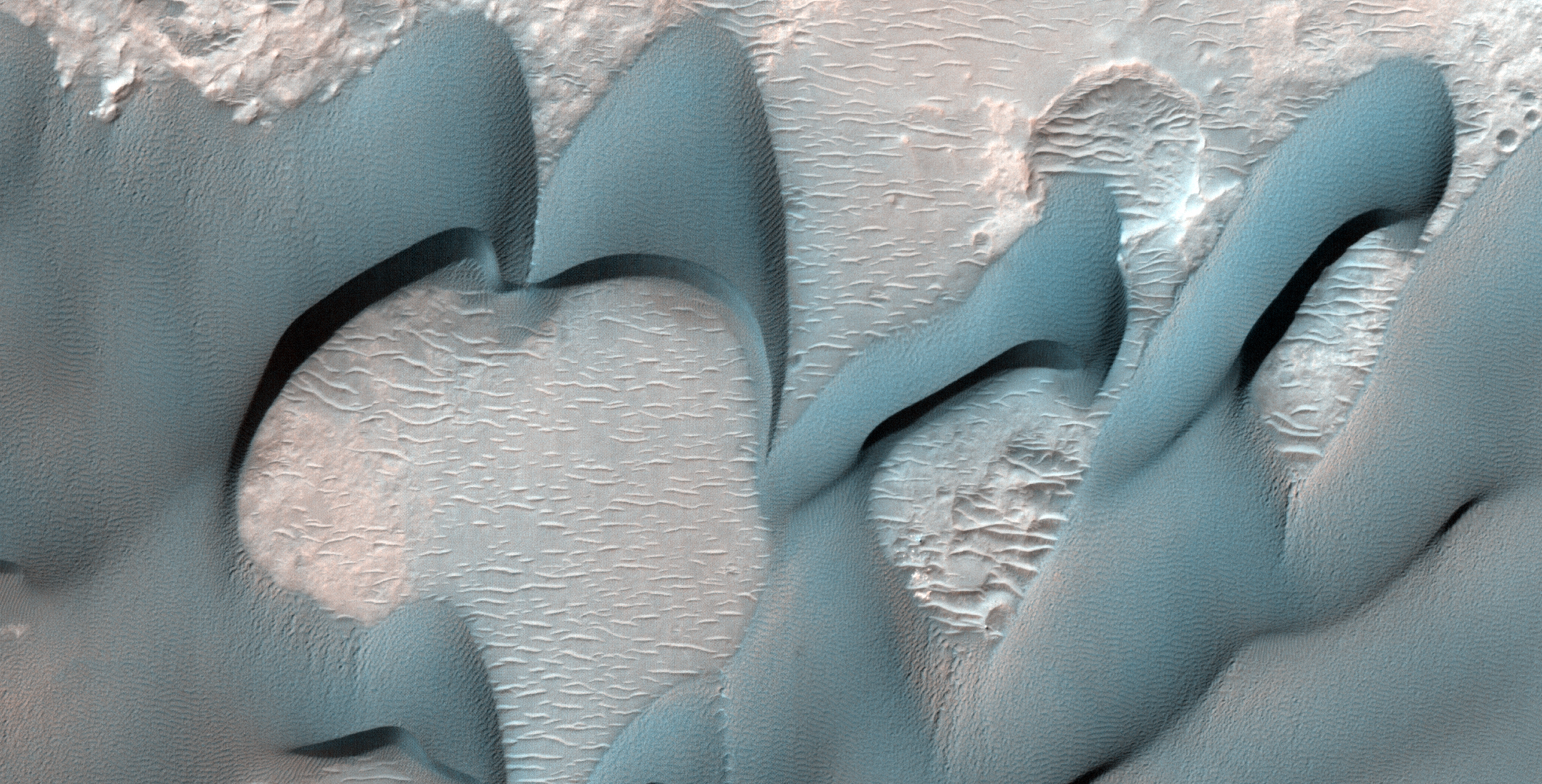
In enhanced color, the frost appears blue. Slopes that face north receive more heat from the Sun and appear reddish, indicating less frost is present. There may also be a small amount of water frost on the surface.

Mars is very different from Earth in that its main atmospheric component can condense onto the surface. The nitrogen that dominates Earth's atmosphere never condenses onto the surface, although nitrogen in the atmospheres of frigid Triton and Pluto do form surface frost and ice.

Photo credit: NASA/JPL/University of Arizona

Note: This image is located in Noachis Terra, roughly halfway between Hellas Planitia and Argyre Planitia; the closest named feature is Russell Crater, which lies to the southwest.

Tuesday, May 8, 2012

Acidalia Planitia and Tempe Terra


The transition between Acidalia Planitia and Tempe Terra is shown here in a computer-generated perspective view. The image was created using data obtained from the High-Resolution Stereo Camera (HRSC) on ESA’s Mars Express spacecraft. Centered at around 37°N and 306°E, this image has a ground resolution of about 15 m per pixel. The foreground craters are believed to come from a younger phase in Mars history, evidenced by a lack of erosion and infilling seen in the background craters, which are believed to have once held liquid water.

Image credit: ESA/DLR/FU Berlin (G. Neukum)

Note: Just to be clear, Tempe Terra is the higher ground on the left, and Acidalia Planitia is the lower ground to the right in the image.

Monday, May 7, 2012

Colorful Uplifted Rocks in Acidalia Planitia


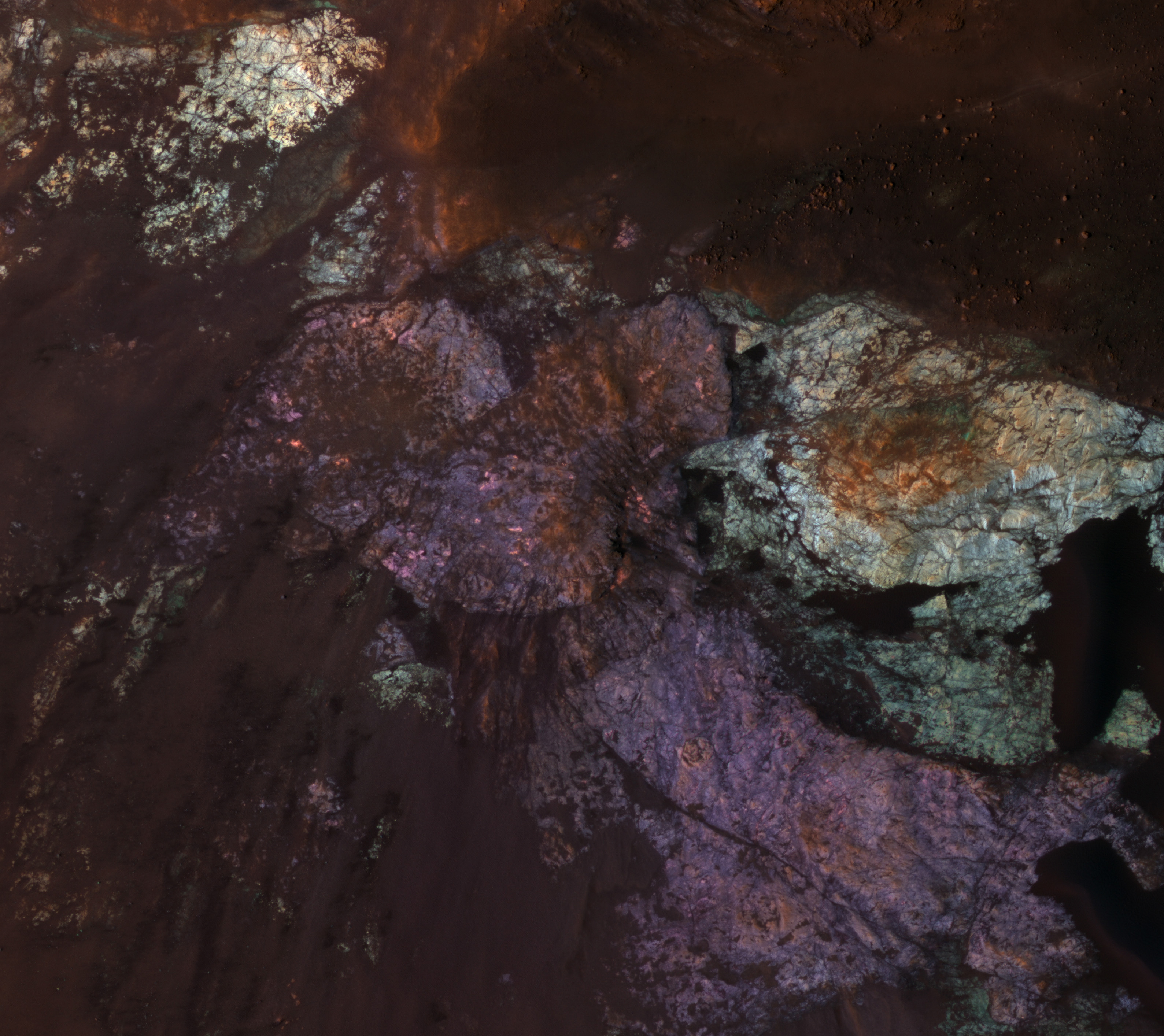
Large impact craters have central regions of uplifted bedrock, a rebound effect following the tremendous energy of a hypervelocity impact. This produces windows into the deep and more ancient geologic history.

Central peaks on Mars have some of the most diverse and distinctive rock types. In this enhanced-color subimage we see two distinctive bedrock colors--light blue and purple--plus reddish to black fine-grained materials covering some of the rock. These rocks are generally massive or jumbled, and do not show regular layers like lava flows or water-lain sediments. One possibility is that these are plutonic rocks, where molten rock solidified at depth rather than erupted onto the surface as lava flows or particles.

Analysis of the CRISM spectra here should provide further clues. This spot is in the vast northern plains, where some workers believe there was an ancient ocean. So far, the mineralogic signature of ocean-deposited sediments has not been reported.

Photo credit: NASA/JPL/University of Arizona

Note: This crater is located in Acidalia Planitia; the closest named feature is Davies Crater, which lies some distance to the southwest.

Sunday, May 6, 2012

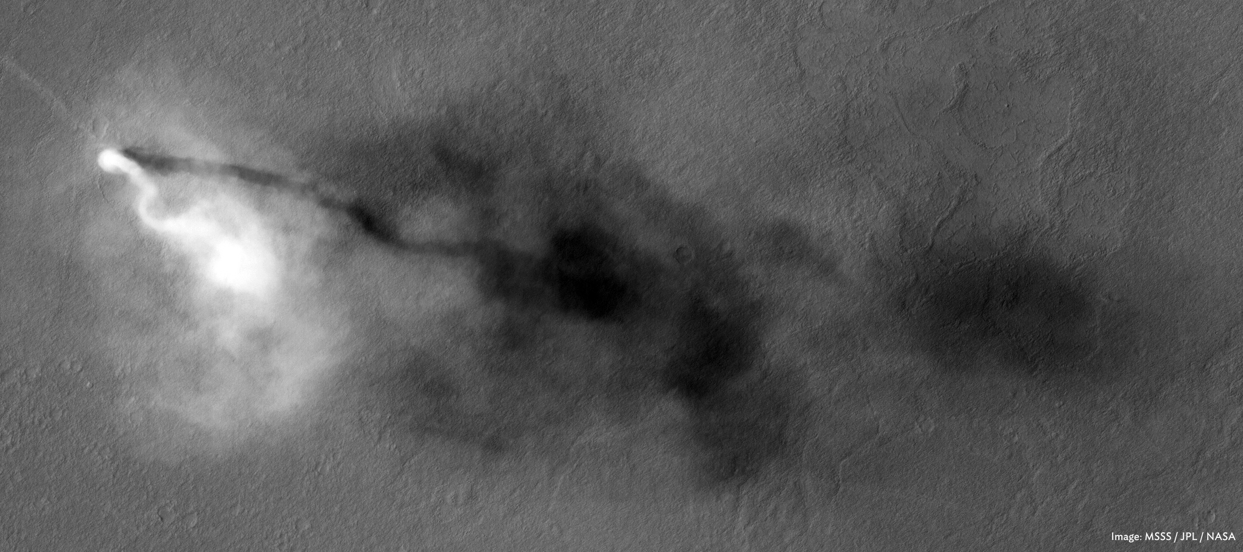
Dust Devil in Amazonis Planitia


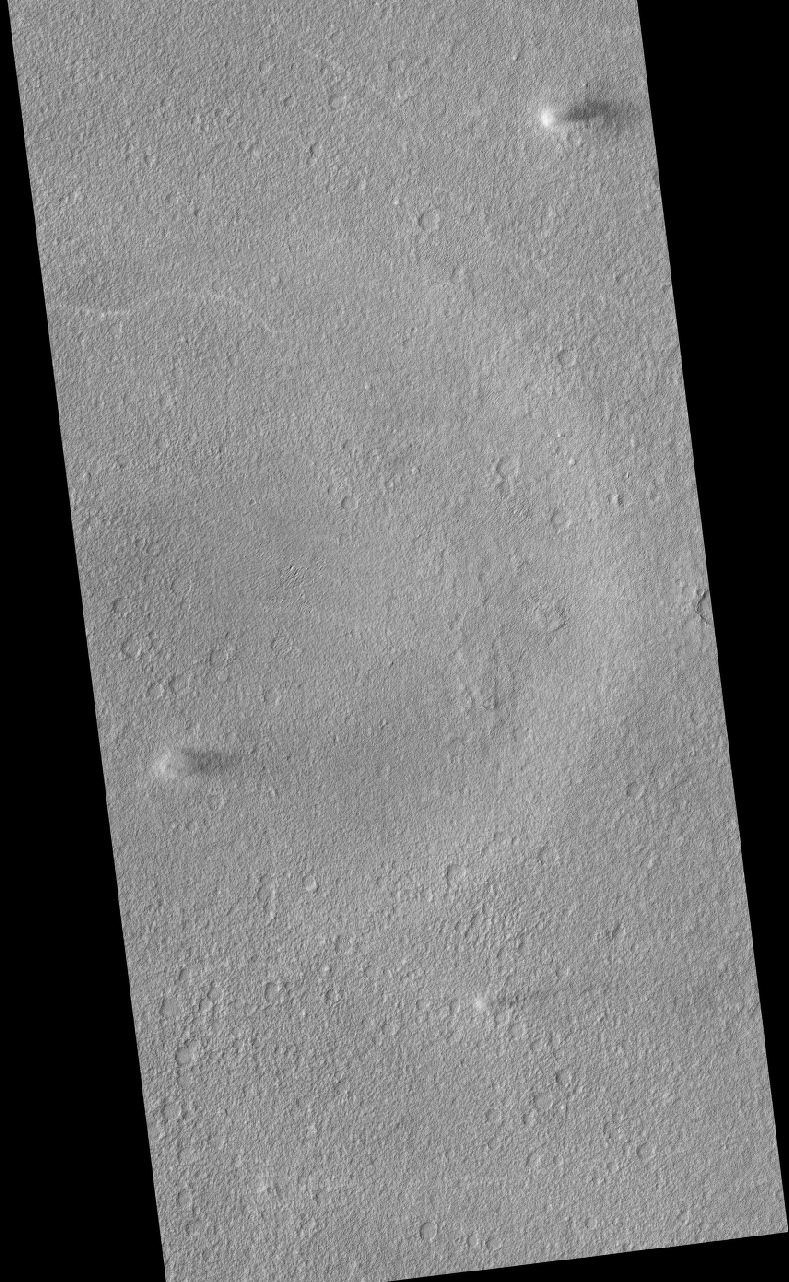
There are three active dust devils in this image, but they aren't monsters like this picture.

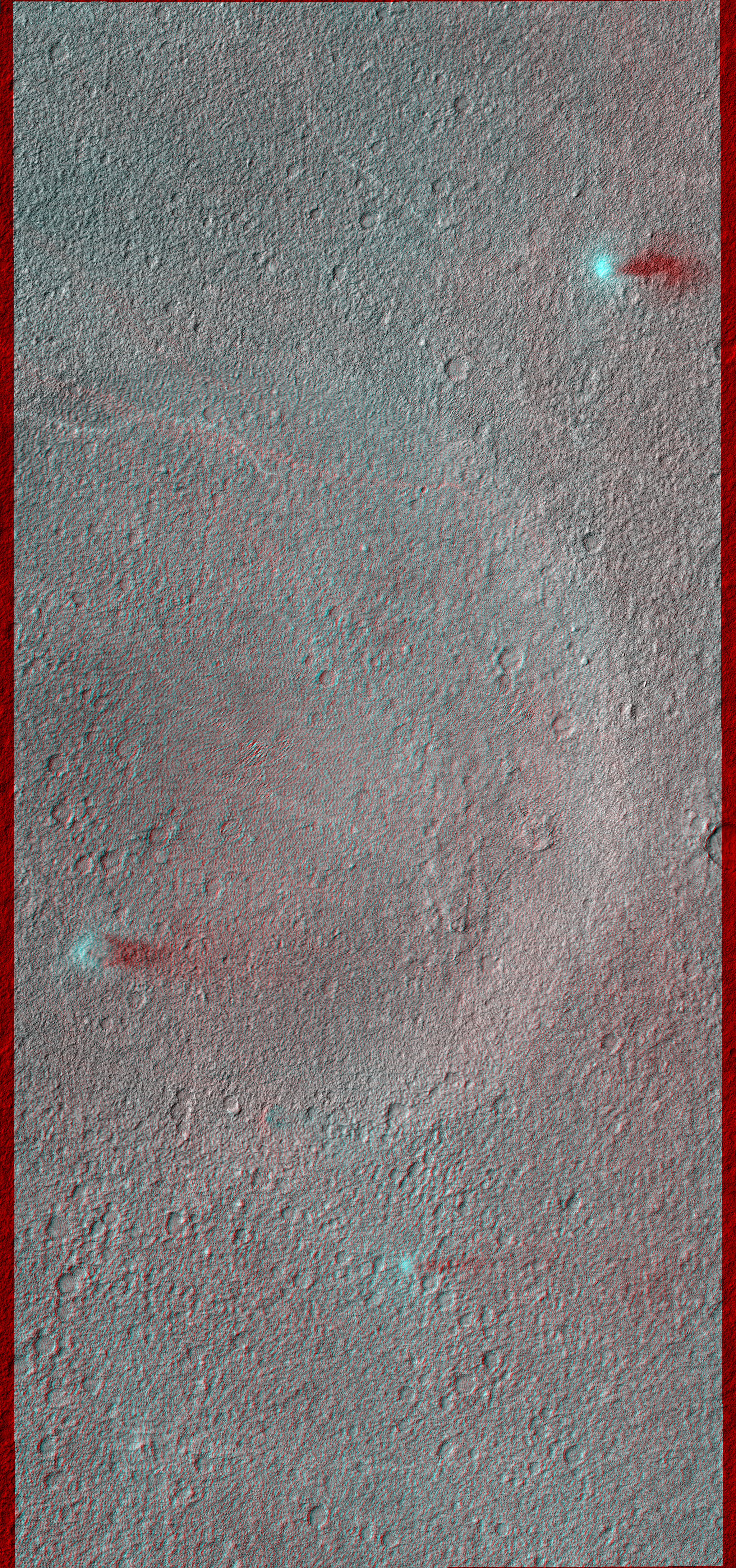
Especially interesting is the stereo anaglyph with ESP_026051_2160, acquired just two weeks after this one.

Viewed with red-green glasses, the active dust devils seem to float above the surface. There are also some bright lines present in only the later image--those are the tracks of dust devils that passed through this region in the prior two weeks.

This is a stereo pair with ESP_026051_2160.

Photo credit: NASA/JPL/University of Arizona

Saturday, May 5, 2012

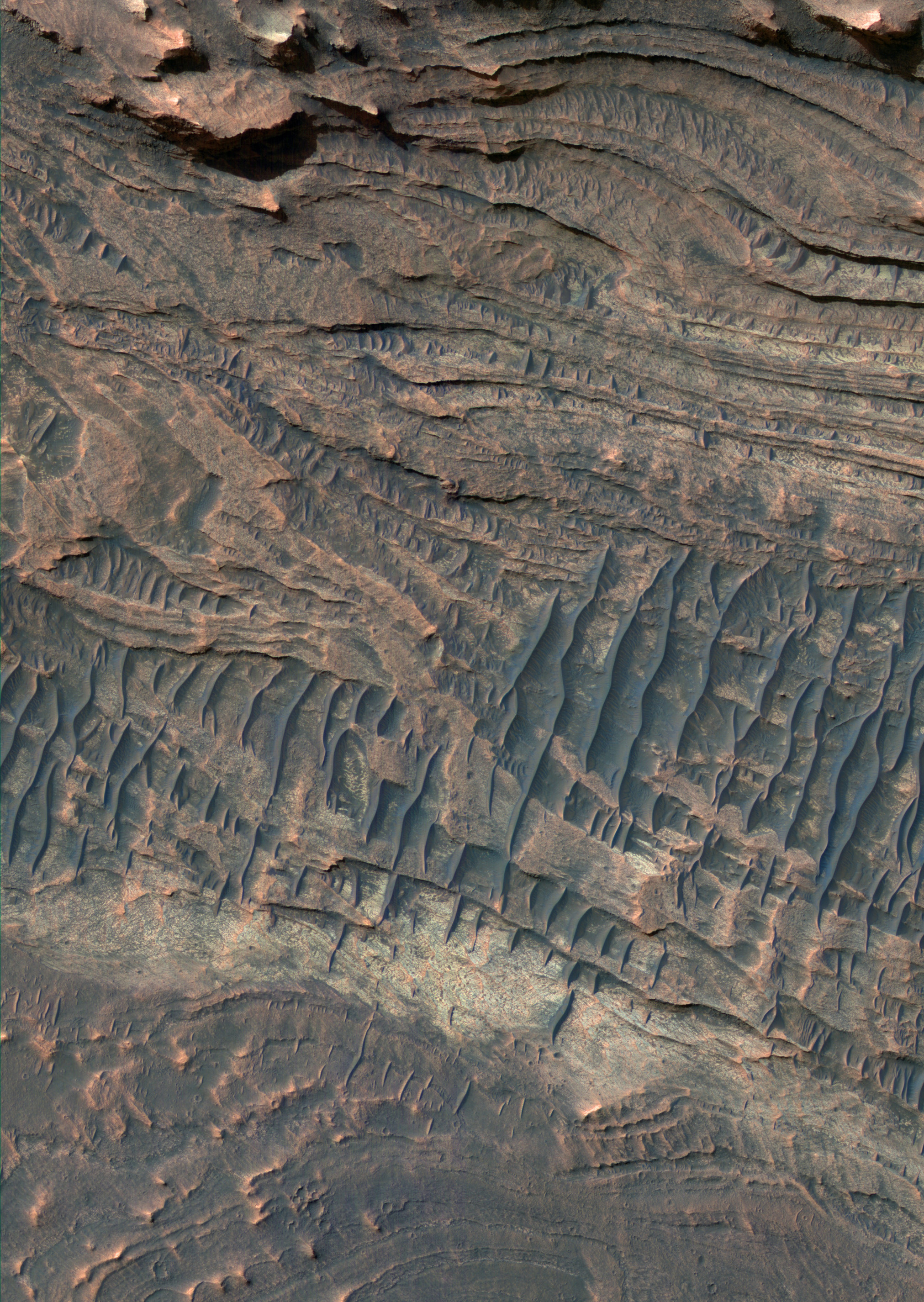
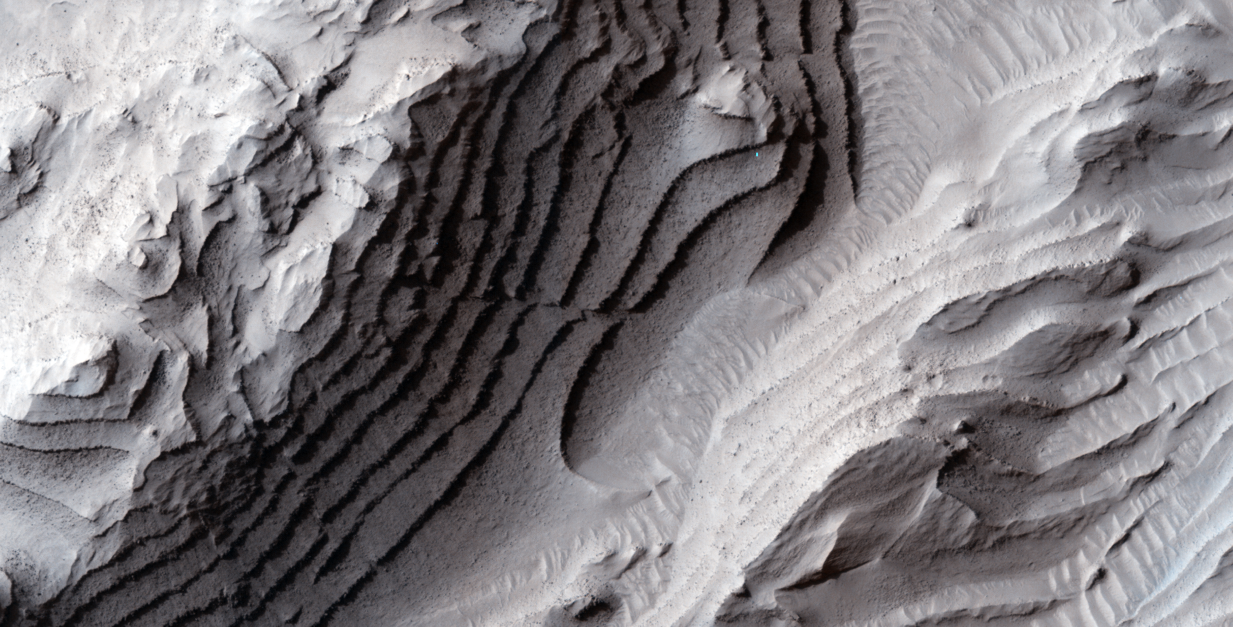
Layered Bedrock in Nili Fossae Region


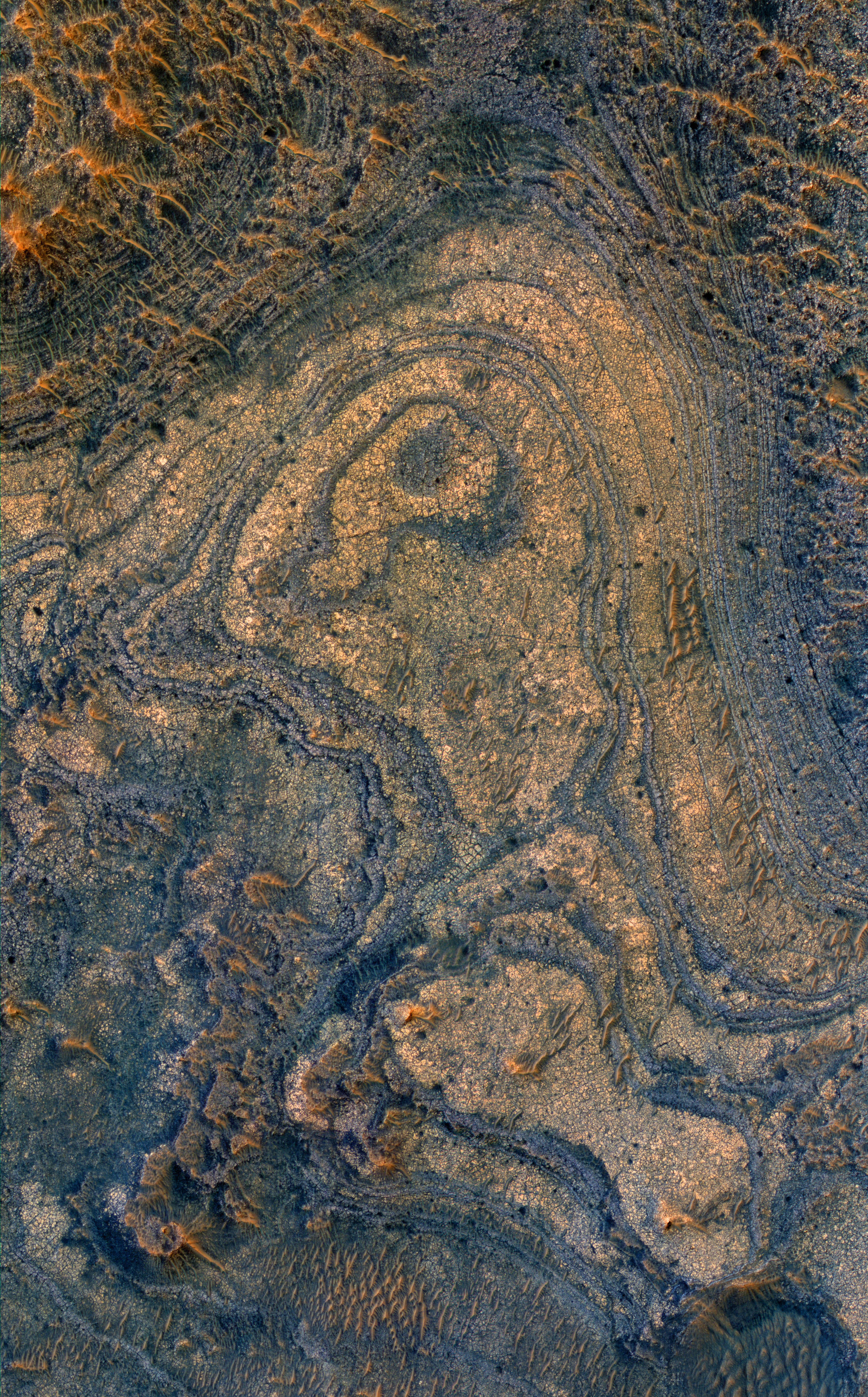
The Nili Fossae region contains some of the best exposures of ancient bedrock on Mars.

Ancient bedrock can be tilted, folded, and generally complicated and difficult to understand, but the center of this image shows a stack of nearly horizontal layers. These layers might record how the environment on ancient Mars changed over time, and would be a good site for future exploration by a rover.

The differing colors indicate different rock types of alteration. The darkest patches of ground probably consist of volcanic sand that is trapped in relative low areas. The reddest patches may be covered by dust.

Photo credit: NASA/JPL/University of Arizona

Friday, May 4, 2012

A Flow Margin in Phlegra Dorsa


These HiRISE images form a stereo pair to examine the topography of the margin of a flow.

The Phlegra Dorsa region consists of ancient hills that have been surrounded and partially buried by flows from the Cerberus Fossae to the south. These flows could have been mud-laden water floods or very large lava flows.

The margin visible here is similar to that on lava flows that have had a long history of liquid lava being injected underneath the solidified crust. Relatively fresh impact craters and recent dust devil tracks are also visible in this image.

The second half of this stereo pair has another well-known formation.

This is a stereo pair with ESP_026461_2080.

Photo credit: NASA/JPL/University of Arizona

Thursday, May 3, 2012

Tractus Catena


Tractus Catena was imaged during orbit 9538 of Mars Express by the HRSC camera. Centered at around 23°N and 103°W, this 3D image has a ground resolution of about 22 m per pixel.

Image credit: ESA/DLR/FU Berlin (G. Neukum)

Wednesday, May 2, 2012

How Did Valles Marineris Form?


This image (and its companion for stereo) crosses an impact crater about 50 kilometers (30 miles) wide. The crater was visible in Mariner 9 and Viking Orbiter images acquired decades ago, and was interpreted as evidence that the floor of Coprates Chasma was an old surface like that of the surrounding plateaus north and south of the canyon, and had dropped more than 10 kilometers (6 miles) as a huge intact block of crust.

However, this image and others acquired by MRO reveal a geologically young crater, with far fewer superimposed craters than the high plateaus, and well-preserved primary impact morphologies. This crater must have formed after the opening of Valles Marineris, and is not evidence, by itself, that this portion of the canyon system formed from simple downdrop of a giant intact block.

The opening of Valles Marineris did involve crustal spreading and faulting, but may have had a more complex history. Many of the large landslides in Valles Marineris could have been triggered by this impact event.

Photo credit: NASA/JPL/University of Arizona

Tuesday, May 1, 2012

Folded Layers in Melas Chasma


There are folded layered deposits in the southern half of this image. How did this folding occur? On Earth, rocks are commonly folded when deeply buried and subject to high heat and pressure, which can make any rock flow. Such deep burial (and re-exposure or exhumation) is unlikely at this location.

In general Mars has experienced much less vertical motion of geologic strata than on Earth. Another possibility is that these layers were soft and deformable near the surface, such as wet or icy sediments. There are other folded layers in the giant Hellas impact basin, such as ESP_025780_1415.

Please get out your 3D glasses for a look at the stereo anaglyph here.

This is a stereo pair with ESP_025811_1700.

Photo credit: NASA/JPL/University of Arizona

Monday, April 30, 2012

Sedimentary Layers in West Candor Chasma


West Candor Chasma in central Valles Marineris contains some of the thickest of the fine-grained layered deposits on Mars.

We can't see the grain sizes with HiRISE, but as the material erodes in the wind it disappears--apparently carried away by the wind--so the grains must be small. The layers may have been deposited from windblown materials, fall of volcanic sediments, or carried in by water, or all of the above.

Subsequently the layers may have been altered by groundwater, producing hydrated minerals such as sulfates. The enhanced colors in the sub image are related to the minerals or to overlying dust or sand. The dark blue sharp-crested ridges are sand dunes.

Photo credit: NASA/JPL/University of Arizona

Sunday, April 29, 2012

Tharsis Montes and Olympus Mons


Shaded relief image of Tharsis Montes and Olympus Mons derived from Mars Orbiter Altimeter data which flew on board NASA's Mars Global Surveyor. New data (see M. Beuthe et al., 2012) suggest that Tharsis Montes formed one by one, starting with Arsia Mons, possibly by the movement of a single mantle plume moving under the surface.

Photo credit: NASA; text credit: ESA

Note: For more information, see Mars Express Explores the Roots of Martian Volcanoes.

Saturday, April 28, 2012

Olympus Mons Topographical Map


Olympus Mons color-coded according to height from white (highest) to blue (lowest), based on images captured by the High Resolution Stereo Camera (HRSC) on board ESA's Mars Express. New data (see M. Beuthe et al., 2012) find that Olympus Mons is built on a rigid lithosphere whereas the nearby Tharsis Montes partially sank into a less rigid lithosphere, suggesting that there were large spatial variations in the heat flux from the mantle at the time of their formation.

Photo credit: ESA/DLR/FU Berlin (G. Neukum)

Note: For more information, see Mars Express Explores the Roots of Martian Volcanoes.

Friday, April 27, 2012

Terrain Near the MSL Landing Site


This image is of a region slightly to the southwest of where the MSL rover, called Curiosity, will land in August 2012.

It shows three distinct terrains: (a) older plains, (b) an overlying unit with a distinct margin, and (c) recent sand dunes. The dunes indicate that the strongest winds tend to blow from the southwest toward the northeast and, like many dune fields on Mars, are probably moving slowly.

The second unit has a margin that, at low resolution, is similar to a lava flow. It also has a hard surface that retains impact craters better than the older plains beneath it.

At full HiRISE resolution it is evident that this deposit is not lava. It has thin layers and a dense network of fractures across its surface. The tops of some lava flows and lava lakes are also fractured. However, HiRISE has confirmed that the size and other characteristics of lava fractures are quite different from the ones visible here. Hence, this is some kind of sedimentary deposit, possibly consisting of largely of hardened mud.

It is likely that Curiosity will have an opportunity to investigate terrain like this soon after landing as it drives to the layered mound to the south.

Photo credit: NASA/JPL/University of Arizona

Monday, April 23, 2012

Active Dune Gullies in Kaiser Crater


Gullies remain an interesting feature to study on Mars, especially because we are still learning about their formation and what processes still act on them.

In this observation, we see large gullies on a huge, barchan dune. We've observed these gullies before, seeing that they appear to be active at different times. When we say "active," we mean that we can see changes in their appearance between different HiRISE images of the same area.

The major objective of this and similar images is to better understand the mechanism for these changes. A specific hypothesis the HiRISE team is investigating is that the changes we see are associated with frost deposits. The frost may be thick and heavy enough to cause parts of the sand dune to collapse, especially if it is "lubricated" by a layer of gas at the base of the frost layer. The gas would form at the bottom of the frost if sunlight passes through the frost and heats the underlying dark sand, working like a greenhouse.

Photo credit: NASA/JPL/University of Arizona

Sunday, April 22, 2012

Disappearing Boulder Tracks


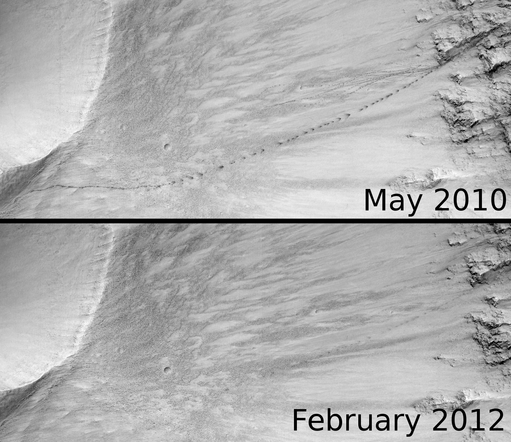
This image was taken in February 2012, in order to compare against image ESP_017985_1985, which was acquired in May 2010. These two images are separated by approximately one Mars year.

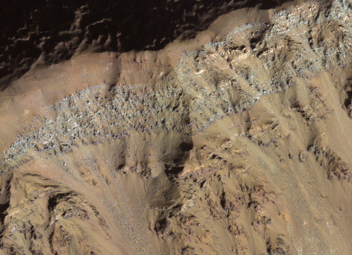
The original image showed a prominent series of dark markings that are the tracks left by boulders as they rolled and bounced down the slope. As they do this, they set off miniature dust avalanches. The bright, fine dust slides away, leaving a darker, larger grained dust underneath.

This follow-up image shows that the smaller dark tracks are gone, and the larger ones have faded considerably. This is most likely due to the fine bright dust that is transported in the atmosphere falling down and re-covering the dark markings.

Photo credit: NASA/JPL/University of Arizona

Note: This crater is located in southeastern "peninsula" of far northwestern Terra Cimmeria that borders northeastern Isidis Planitia.

Saturday, April 21, 2012

Late Springtime Defrosting of Northern Dunes


This observation shows dunes in the Martian north polar sand sea (commonly referred to as the "north polar erg") in the process of defrosting.

Every winter, dunes and other surfaces at these northern latitudes are coated with several tens of centimeters of carbon dioxide frost and ice, plus a minor amount of water frost. Details of this process are particularly visible this subimage. The white material is fine grained frost.

The dark, splotchy tones on the dunes may be deposits of particulates deposited from carbon dioxide "geysers" or relatively thick deposits of carbon dioxide ice. The more brownish colors represent defrosted areas. Polygonal patterns on the surface of the dunes are probably cracks in overlying carbon dioxide ice.

Landslides on the dunes' lee slopes are apparent, with a morphology consistent with fluidization from carbon dioxide frost. This and other areas of the north polar region are being investigated by HiRISE to compare to changes in past years.

Photo credit: NASA/JPL/University of Arizona

Friday, April 20, 2012

Landslides in a Terra Cimmeria Crater


The many large landslides inside Valles Marineris are well known, but there are also landslides elsewhere on Mars.

The southwest slope of this crater has at least three landslide lobes. What caused the landslides? They might have formed in the final stage of crater formation, but there are fewer subsequent craters on the lobes than elsewhere on the crater floor, so the landsliding occurred long after the crater's creation.

Perhaps the landslides were triggered by Marsquakes, either due to impact events or to faulting in the crust. Landslides are greatly facilitated by the presence of groundwater, which could have been present at the time these landslides happened, many millions of years ago.

Photo credit: NASA/JPL/University of Arizona

Note: This location is in Terra Cimmeria, to the southeast of Martz Crater.

Monday, April 16, 2012

A Volcanic Pit Chain and Dust Avalanches


This observation shows a volcanic pit chain in Amazonis Planitia.

Associated with two of the pits are meandering channels that splay into distributary patterns to the north. This suggests that the pits are eruptive centers, with the channels carved by lava.

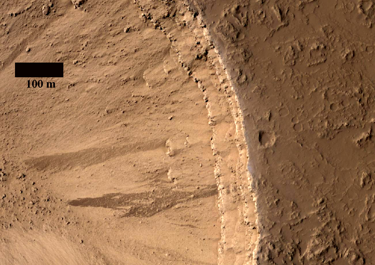
A close-up image shows the eastern wall of the westernmost pit. The fluid-like streaks are the products of dust avalanches, with the dark color resulting from a thin coating of dust that has been removed from the surface.

The upper wall of the pit shows at least four distinct layers, each representing a sequence of one or more lava flows. A hazy, blueish haze bounds the outer circumference of the pit, perhaps resulting from suspended dust. The plains near the pit appear heavily muted, indicating a thick dust cover.

Photo credit: NASA/JPL/University of Arizona

Sunday, April 15, 2012

Terraces or Strata on a Crater Slope


This observation shows an interesting layered rock outcrop in the southeast Hellas Region. One of the scientific goals is to look for bedding features that might give clues to what deposited the material: subaerial, subaqueous or polar-ice-like?

Structural features cut through the layered material and strata at this location. Could these features be faults or dikes? Additional images of this region may help us find out.

Photo credit: NASA/JPL/University of Arizona

Saturday, April 14, 2012

Eroded Terrain Near Volcanic Fissures


This observation was taken to investigate the topography near the source of fluids from the Cerberus Fossae fractures in the Elysium Planitia region of Mars.

There are distinct channels carved into the terrain here, presumably by floods of water. However, the terrain is coated with lava, and this situation--where flood-eroded channels are completely coated with lava--is seen in many parts of Mars.

This leads some researchers to suggest that the channels were actually carved by the flowing lava, and that there was no flood of water. Images like these are helping to test these ideas.

This is a stereo pair with ESP_026158_1945.

Photo credit: NASA/JPL/University of Arizona

Friday, April 13, 2012

Layered Sediments in Danielson Crater


This crater is named for G. Edward Danielson, Jr. (1939–2005), who was instrumental in the development of a series of Mars cameras, from Mariner 4 launched in 1964 to the Mars Global Surveyor launched in 1996.

These layered sediments are of great interest because they are very regular in thicknesses, suggesting some sort of periodic process such as climate change associated with Mars orbital variations.

Photo credit: NASA/JPL/University of Arizona

Wednesday, April 11, 2012

Tractus Catena


Tractus Catena is shown here in a computer-generated perspective view. The image was created using data obtained from the High-Resolution Stereo Camera (HRSC) on ESA’s Mars Express spacecraft. The pits seen in the background show hints of layered bedrock in the upper walls of each depression.

Photo credit: ESA/DLR/FU Berlin (G. Neukum)

Monday, April 9, 2012

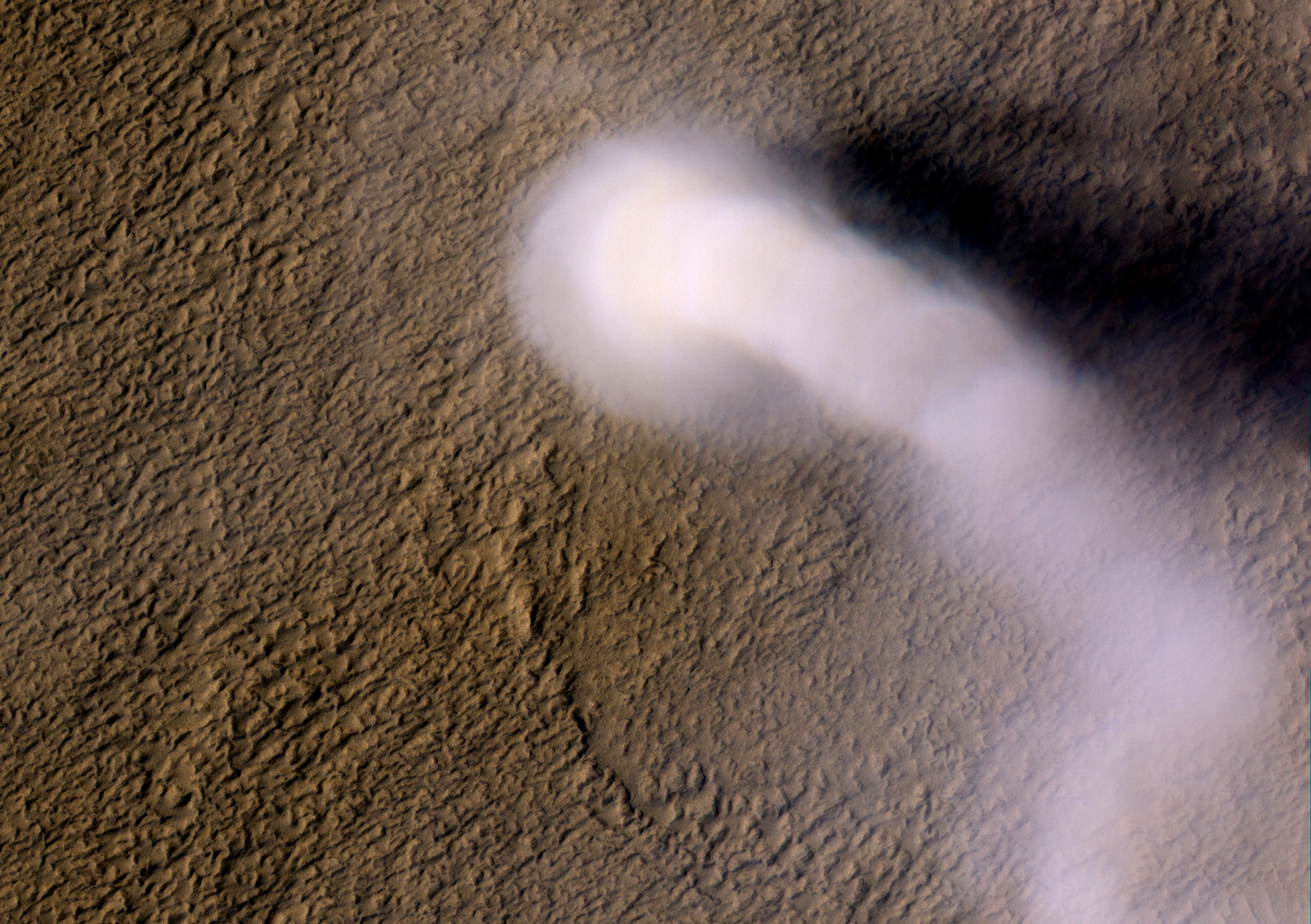
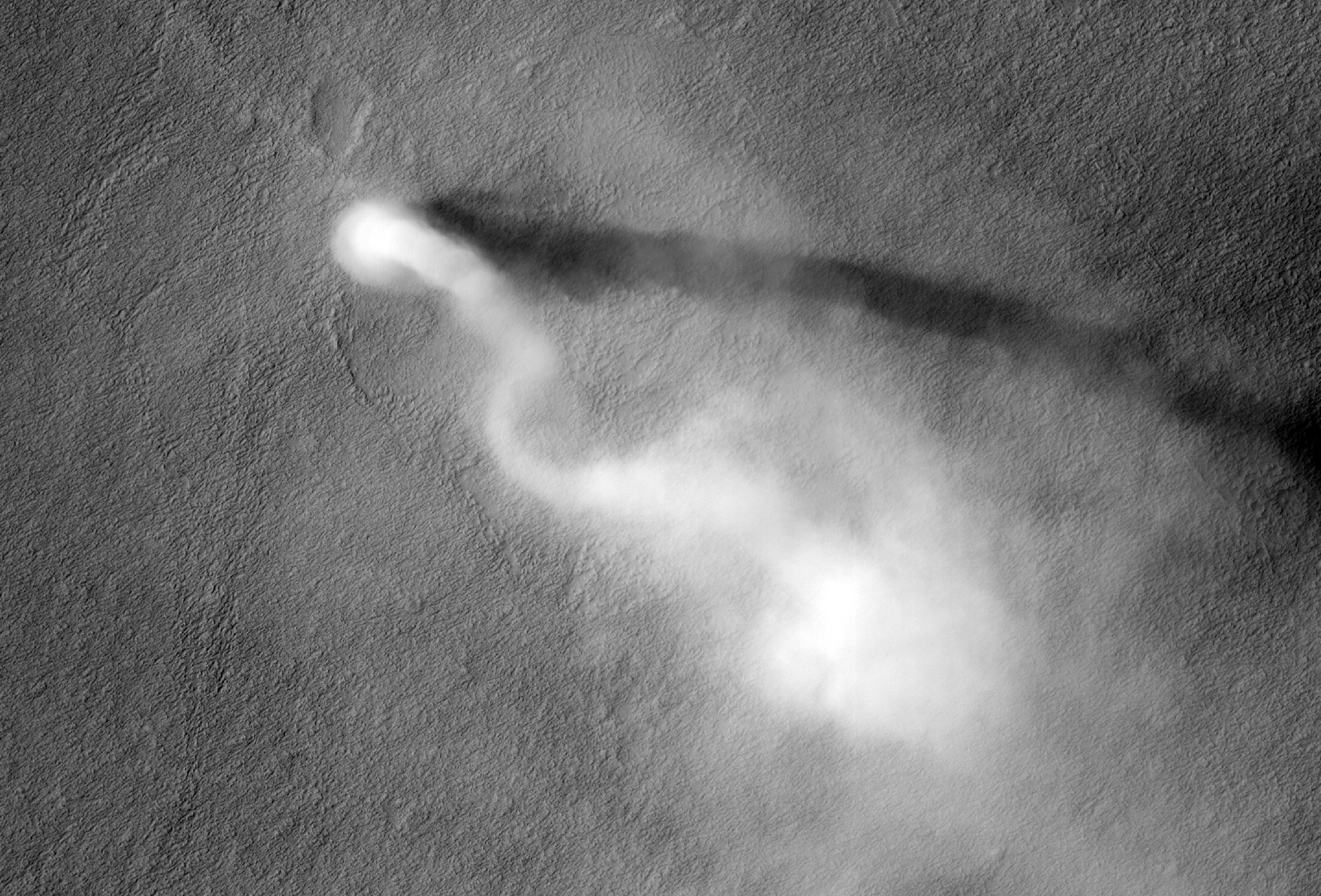
20 Kilometer Tall Dust Devil in Amazonis Planitia


A dust devil the size of a terrestrial tornado towers above the Martian surface in this late springtime afternoon image of Amazonis Planitia.

Also captured by the Context Camera on MRO, the length of the shadow indicates that the dust plume reached a height of 20 kilometers (12 miles) above the surface! Despite its gargantuan height, the plume is only 70 meters (70 yards) in diameter, giving it a snake-like appearance that is twisted by high altitude winds, similar to another dust devil spotted recently in this region.

Typical tornadoes on Earth are less than 10 miles tall, while dust devils on our planet seldom reach more than a few hundred yards in height. So, why do we classify this plume as a monster dust devil and not a Martian tornado? Dust devils differ from tornadoes in their energy sources. Dust devils are driven by the heat of the surface, absorbed from sunlight and re-radiated to warm the atmosphere. The warm air rises and spins as it contracts, much as a figure skater spins faster as she draws her arms to her sides.

Tornadoes have an additional energy source: the heat given off as water vapor condenses into liquid rain. The condensing water vapor produces the visible part of a tornado, called the condensation funnel, which is made up of water droplets. On Mars, there is too little water vapor in the atmosphere to contribute significantly to atmospheric convection on local scales. The cloud that we see in this image is produced by dust particles, not raindrops. The astounding heights of Martian dust devils are made possible because mass of an atmospheric column on Mars is less than 1 percent than that of a column on Earth. Transfer of heat from the surface into this less dense atmosphere can produce more vigorous convection, which will penetrate higher into the Martian atmosphere than its counterparts do on Earth.

Now, what would happen if you were caught in its path? Because the density of Mars' atmosphere is so low, even a high velocity dust devil is unlikely to knock you over. However, you might be blasted by any sand or dust particles carried along by the dust devil, which might scratch the visor of your space suit quickly if you were caught outside by this monster!

This vortex left behind a bright track as its winds disturbed the dust-covered surface, tracing the path of the dust devil from the northwest towards the southeast. A dust "skirt" twice as wide as the plume itself is seen near the base of the dust devil, but the bright track is the size of the plume and not the skirt. Dozens of smaller dust devils were also spotted in the same Context Camera scene, steadily vacuuming the surface and pumping dust up into the Martian atmosphere.

VIDEO
JPL has produced two excellent animations of this dust devil in action.
Clip 1
Clip 2

Photo credit: NASA/JPL/University of Arizona

Note: For more information, see 12-Mile-High Martian Dust Devil Caught In Act.

Sunday, April 8, 2012

Layers in a Crater Wall in Noachis Terra


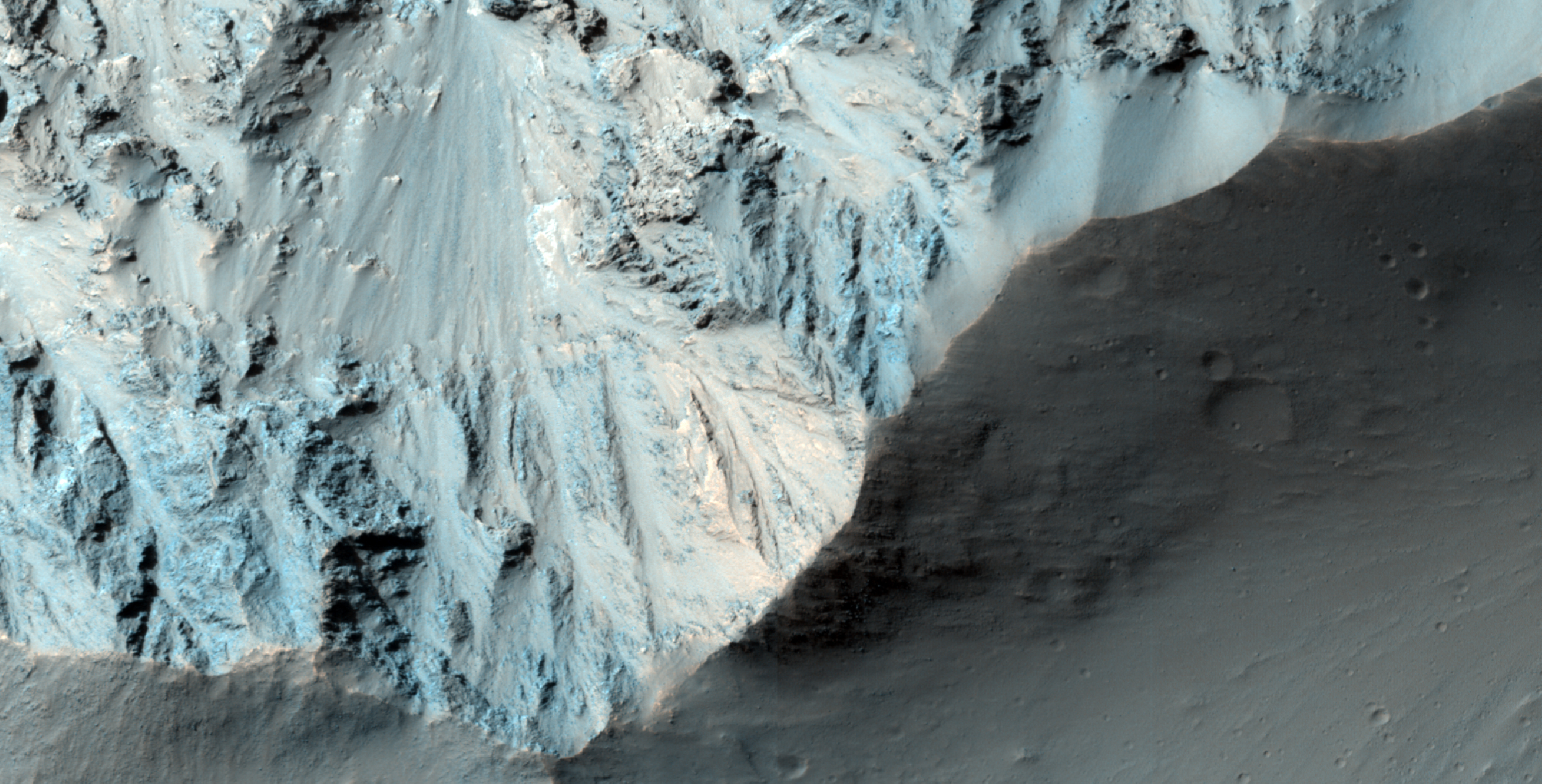
This image is of the rim of a crater. The Sun is low in the sky (only 15 degrees above the horizon) and shining full on this crater wall (you can see that the area beyond the rim has got long shadows).

The Sun is beautifully illuminating a series of layers exposed in the crater wall which have a variety of different colors.

Note: the subimage is non map-projected, so approximate North is down.

Photo credit: NASA/JPL/University of Arizona

Note: This crater is located in Noachis Terra to the northwest of Argyre Planitia. The closest named crater is Tábor, which is a very short distance to the northwest.

Saturday, April 7, 2012

Sedimentary Deposits on the Floor of Ritchey Crater


Ritchey Crater exposes some of the most colorful rock outcrops on Mars in its central peak.

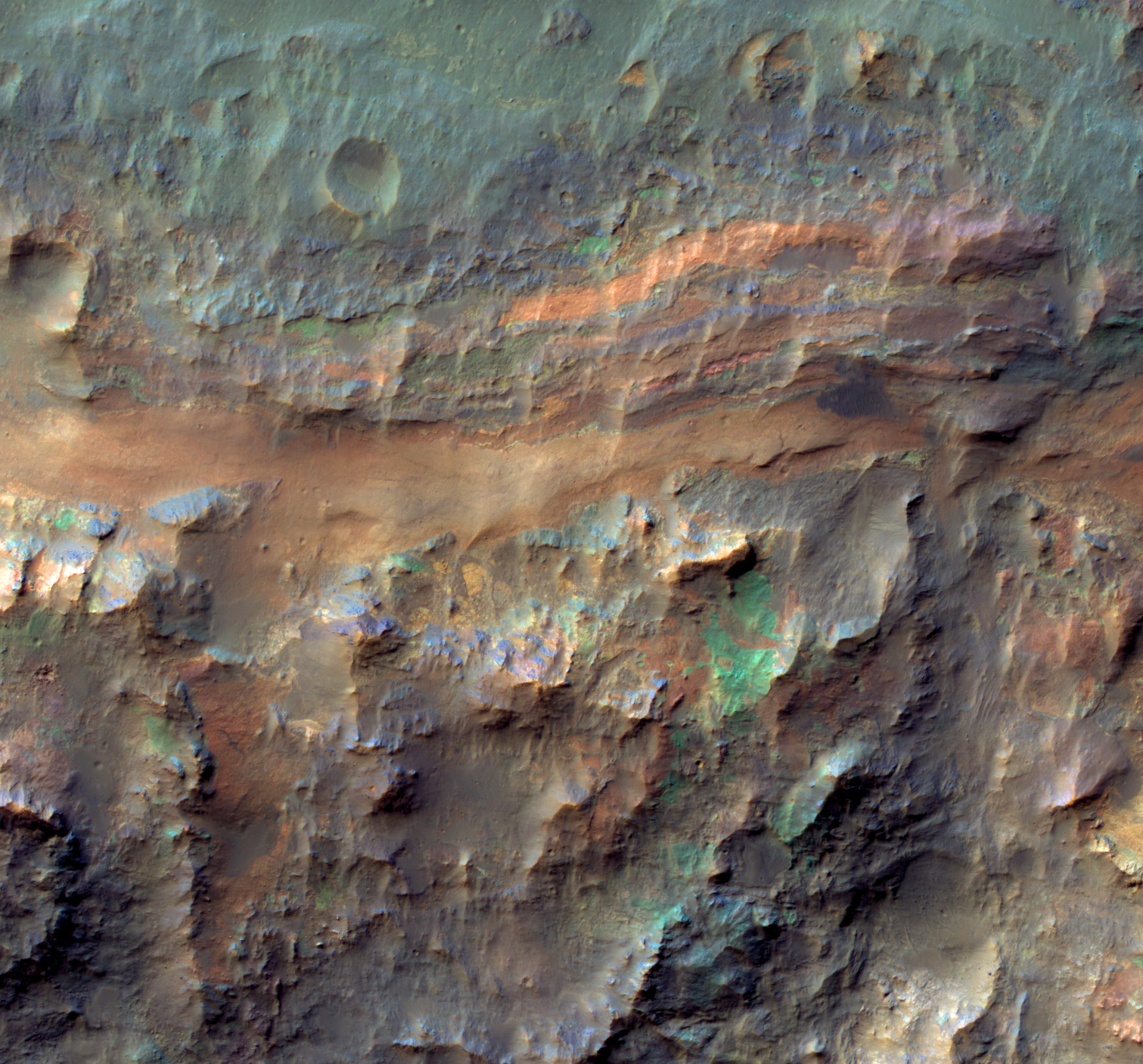
This image reveals comparable diversity in some of the layered sediments and jumbled deposits (megabreccia) on the crater floor. In general the blues and greens indicate unaltered minerals like olivine and pyroxene whereas the warmer colors indicate altered minerals such as clays.

Photo credit: NASA/JPL/University of Arizona

Friday, April 6, 2012

Elephantine Lava Flow in Elysium Planitia


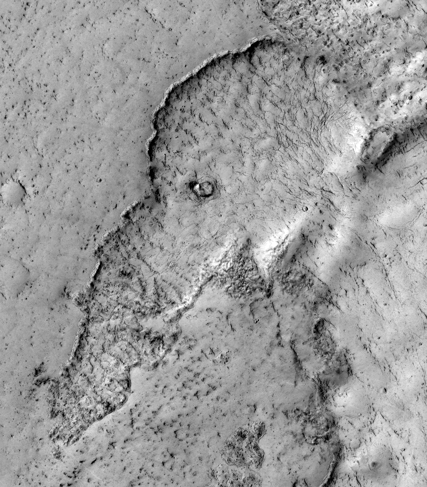
This observation highlights terrain that looks like an elephant. This is a good example of the phenomena "pareidolia," where we see things (such as animals) that aren't really there.

Actually, this image covers the margin of a lava flow in Elysium Planitia, the youngest flood-lava province on Mars. Flood lavas cover extensive areas, and were once thought to be emplaced extremely rapidly, like a flood of water.

Most lava floods on Earth are emplaced over years to decades, and this is probably true for much of the lava on Mars as well. An elephant can walk away from the slowly advancing flow front. However, there is also evidence for much more rapidly flowing lava on Mars, a true flood of lava. In this instance, maybe this elephant couldn't run away fast enough.

Note: the subimage is not map-projected, so approximate North is down.

Photo credit: NASA/JPL/University of Arizona

Note: This site is located in Phlegra Dorsa; the closest named impact crater is Lockyer, which is some distance off to the west.

Monday, April 2, 2012

Cratered Dune Forms in Melas Chasma


One of the scientific goals for taking this observation is to create a stereo pair with another HiRISE image. From stereo pairs, which are pictures of the same area but at different angles, HiRISE creates 3D or anaglyph pictures.

Known since at least 2003, this is a wonderful case of aeolian sandstone that (a) preserves its original sand dune bedform shapes and (b) lies unconformably over a previously-eroded surface of layered sedimentary rock.

Photo credit: NASA/JPL/University of Arizona

Note: This site is located on the southern wall of Melas Chasma.

Sunday, April 1, 2012

Lava Lamp Terrain on the Floor of Hellas Basin


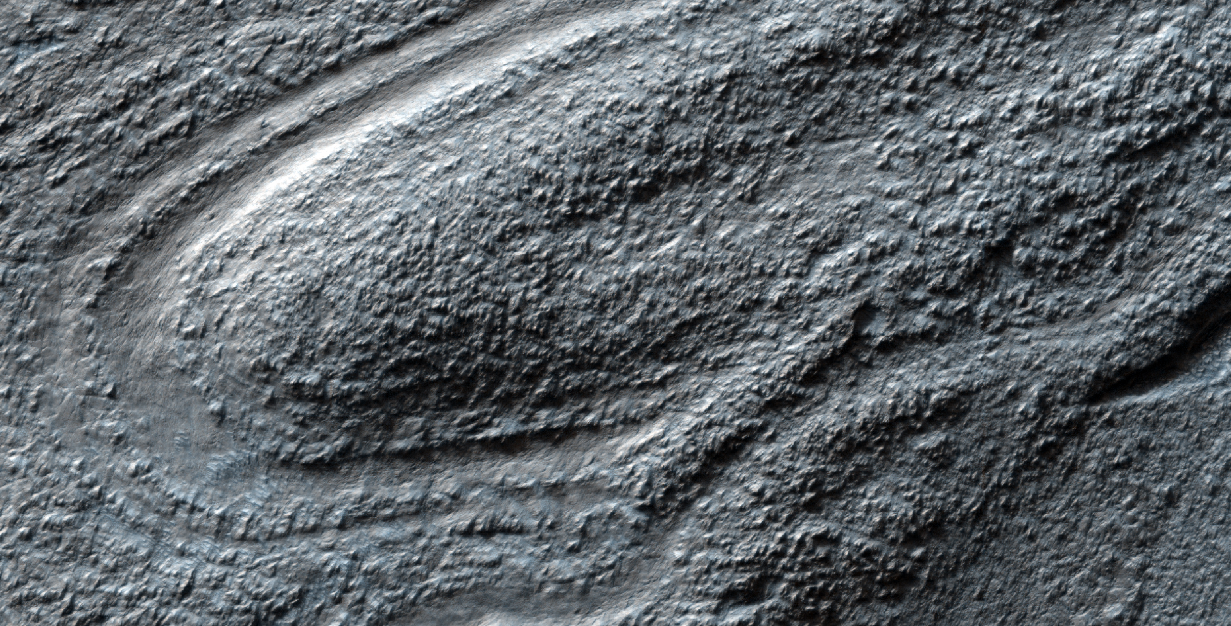
Some of the weirdest and least-understood landscapes on Mars are on the floor of the deep Hellas impact basin. This image was acquired in northwest Hellas where depths are more than 6 kilometers below the reference (or roughly the average) altitude for Mars.

There are what look like impact craters but are elongated, as if stretched in a viscous manner (like in a lava lamp). Some of the flowing landforms are similar to those elsewhere in the middle latitudes of Mars, where the Shallow Radar (SHARAD) experiment on MRO has detected ice, but no ice detection has been reported here.

The floor of Hellas is relatively poorly mapped because it is often obscured by dust and haze in the atmosphere.

Photo credit: NASA/JPL/University of Arizona