Friday, April 6, 2012

Elephantine Lava Flow in Elysium Planitia


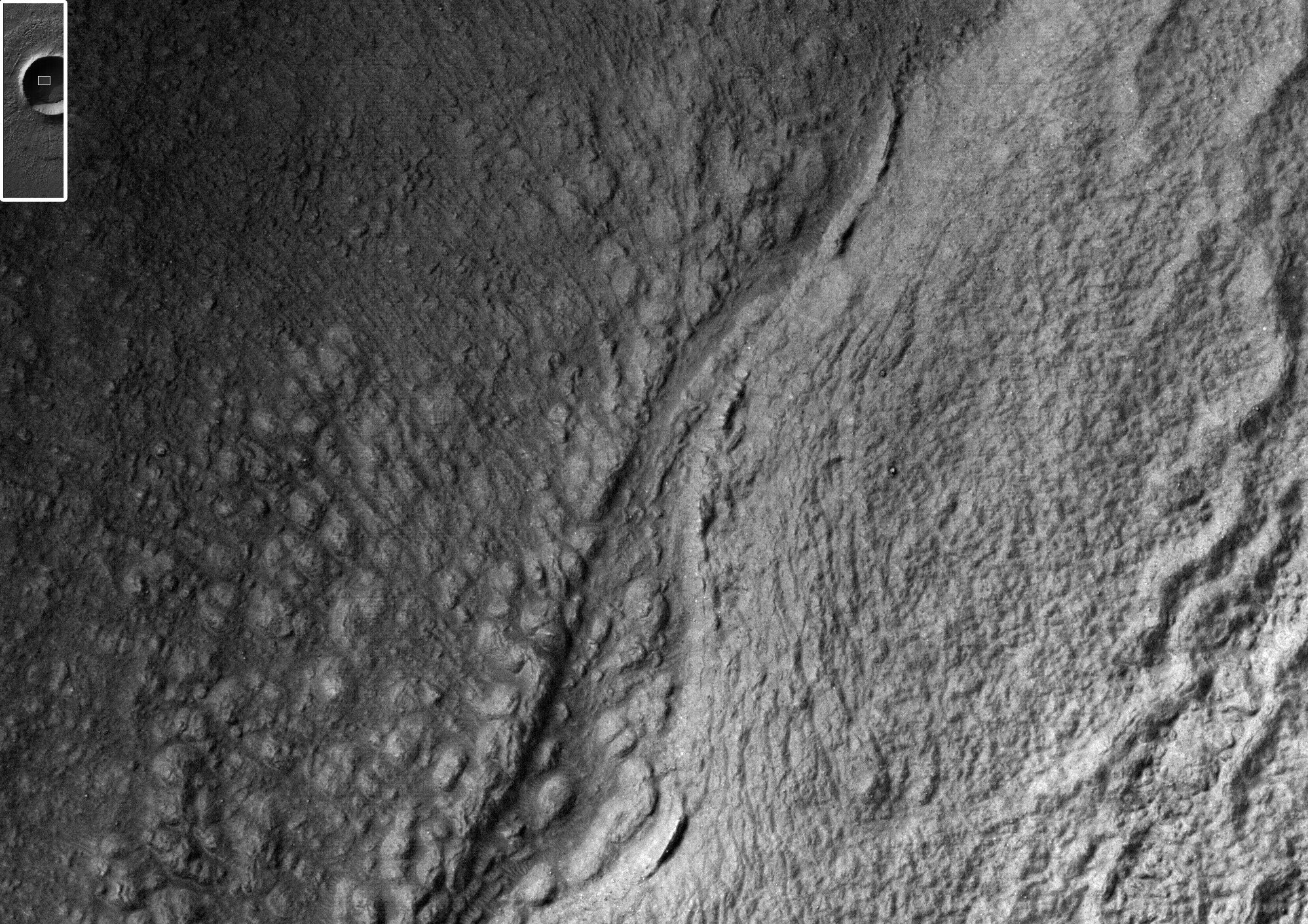
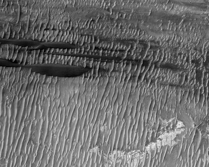
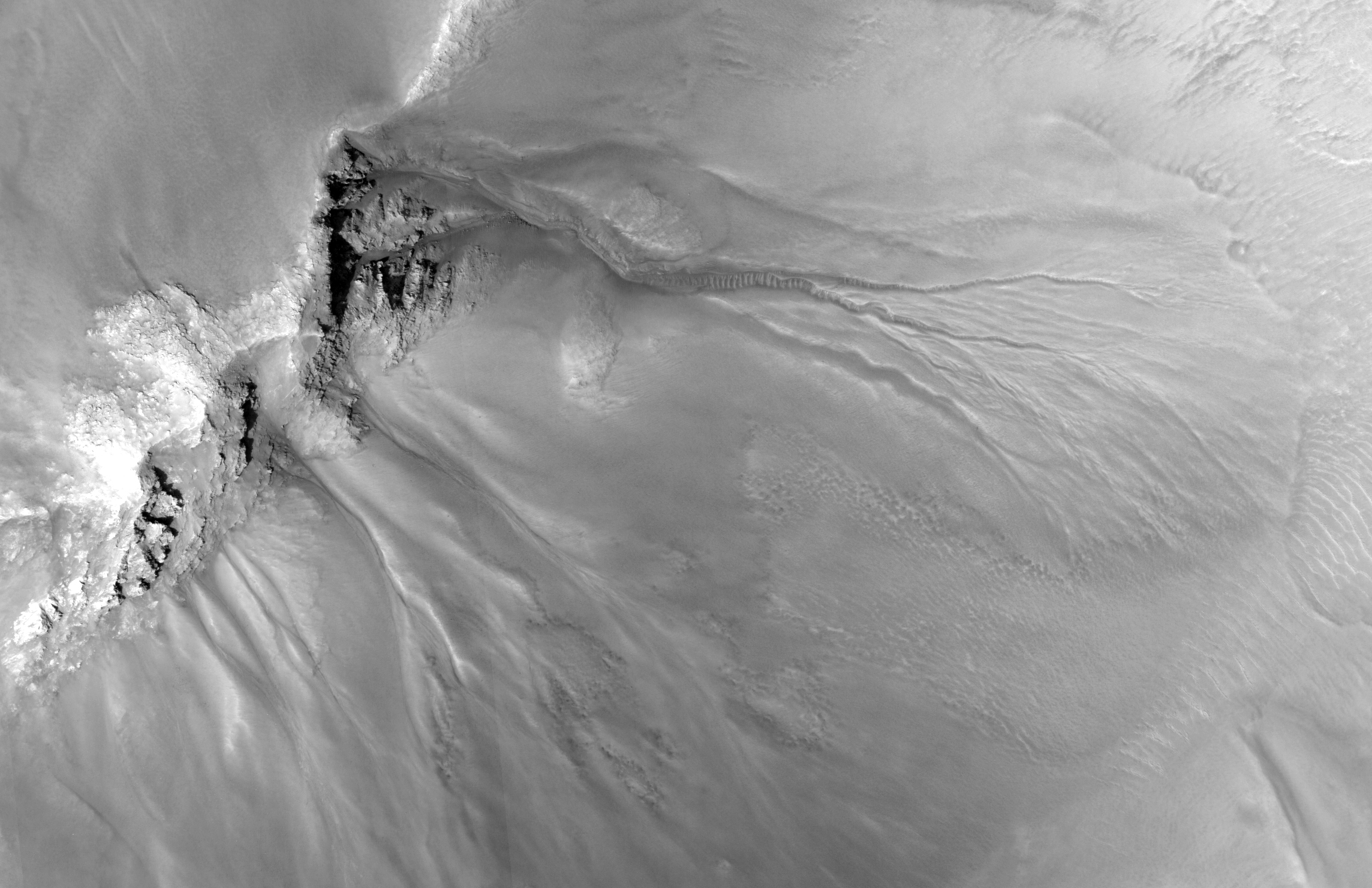
This observation highlights terrain that looks like an elephant. This is a good example of the phenomena "pareidolia," where we see things (such as animals) that aren't really there.

Actually, this image covers the margin of a lava flow in Elysium Planitia, the youngest flood-lava province on Mars. Flood lavas cover extensive areas, and were once thought to be emplaced extremely rapidly, like a flood of water.

Most lava floods on Earth are emplaced over years to decades, and this is probably true for much of the lava on Mars as well. An elephant can walk away from the slowly advancing flow front. However, there is also evidence for much more rapidly flowing lava on Mars, a true flood of lava. In this instance, maybe this elephant couldn't run away fast enough.

Note: the subimage is not map-projected, so approximate North is down.

Photo credit: NASA/JPL/University of Arizona

Note: This site is located in Phlegra Dorsa; the closest named impact crater is Lockyer, which is some distance off to the west.

Monday, April 2, 2012

Cratered Dune Forms in Melas Chasma


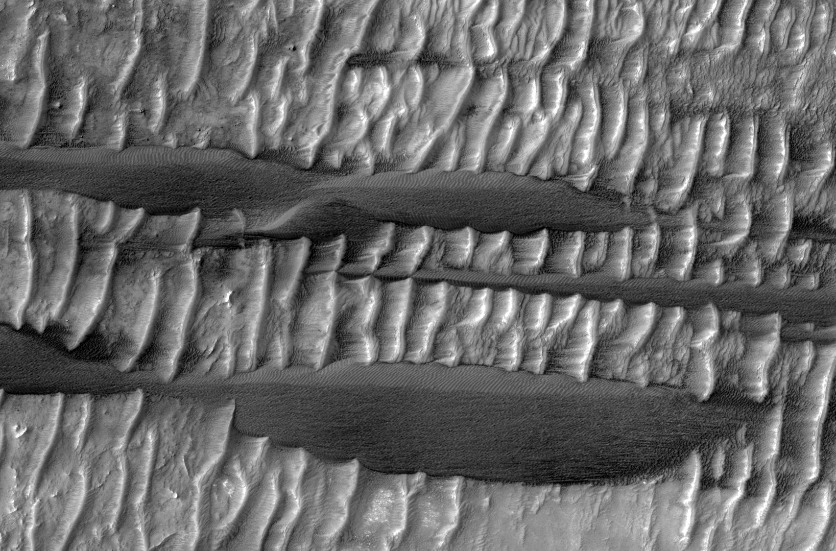
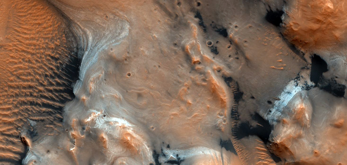
One of the scientific goals for taking this observation is to create a stereo pair with another HiRISE image. From stereo pairs, which are pictures of the same area but at different angles, HiRISE creates 3D or anaglyph pictures.

Known since at least 2003, this is a wonderful case of aeolian sandstone that (a) preserves its original sand dune bedform shapes and (b) lies unconformably over a previously-eroded surface of layered sedimentary rock.

Photo credit: NASA/JPL/University of Arizona

Note: This site is located on the southern wall of Melas Chasma.

Sunday, April 1, 2012

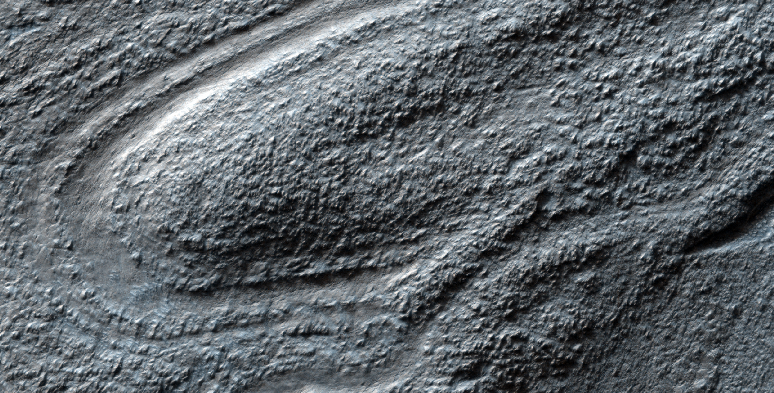
Lava Lamp Terrain on the Floor of Hellas Basin


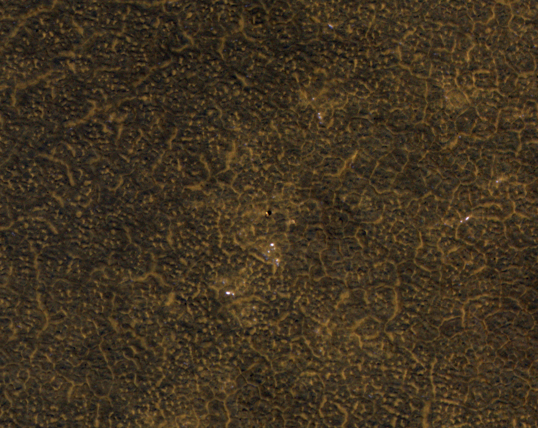
Some of the weirdest and least-understood landscapes on Mars are on the floor of the deep Hellas impact basin. This image was acquired in northwest Hellas where depths are more than 6 kilometers below the reference (or roughly the average) altitude for Mars.

There are what look like impact craters but are elongated, as if stretched in a viscous manner (like in a lava lamp). Some of the flowing landforms are similar to those elsewhere in the middle latitudes of Mars, where the Shallow Radar (SHARAD) experiment on MRO has detected ice, but no ice detection has been reported here.

The floor of Hellas is relatively poorly mapped because it is often obscured by dust and haze in the atmosphere.

Photo credit: NASA/JPL/University of Arizona

Saturday, March 31, 2012

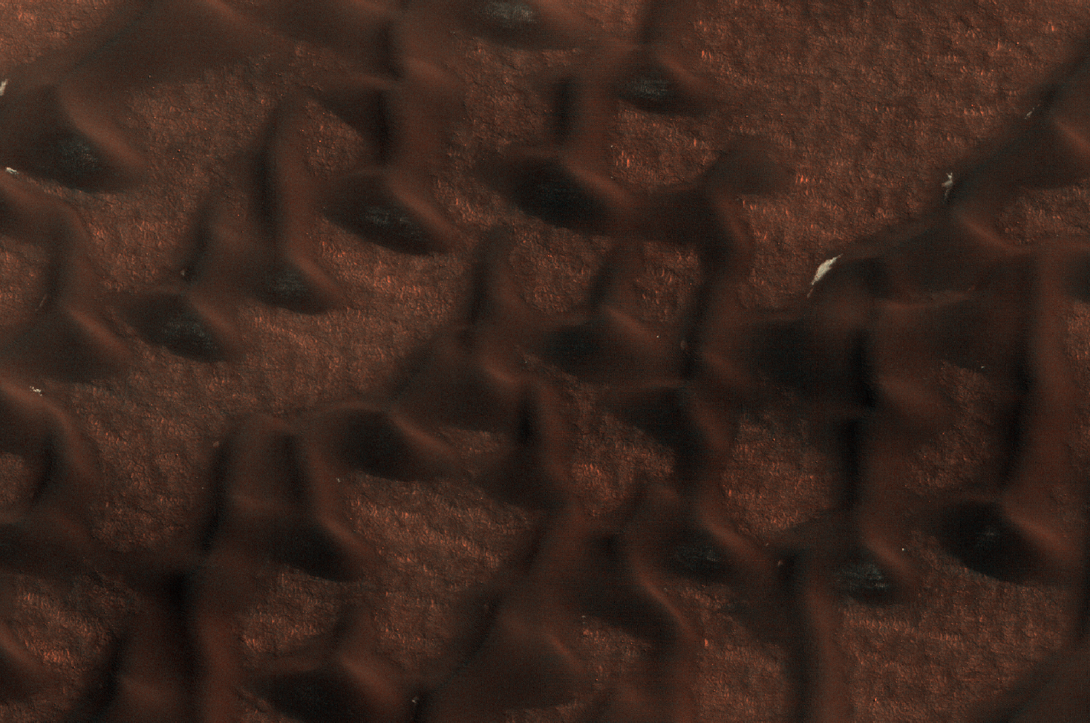
Late Spring in Vastitas Borealis


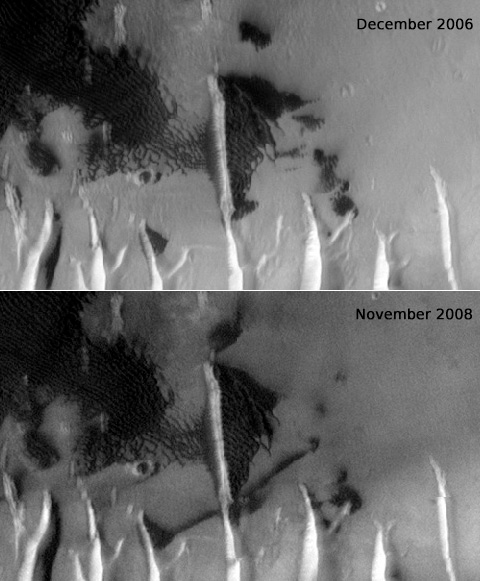
These dark sand dunes in the north polar region, basking in the sunshine of late spring, have shed most of their seasonal layer of winter ice.

A few bright ice deposits remain sequestered in "cold traps" shadowed from the Sun on the poleward-facing side of the dunes. Some bright patches of ice at the foot of the sunlit side of the dunes may be places where ice slumped to the foot of the dune creating a longer-lasting snow bank.

Photo credit: NASA/JPL/University of Arizona

Note: The closest named crater to this site is Escorial Crater, which is some distance off to the northeast; the closest named feature is Abalos Colles, which is also to the northeast, although not nearly as far away.

Friday, March 30, 2012

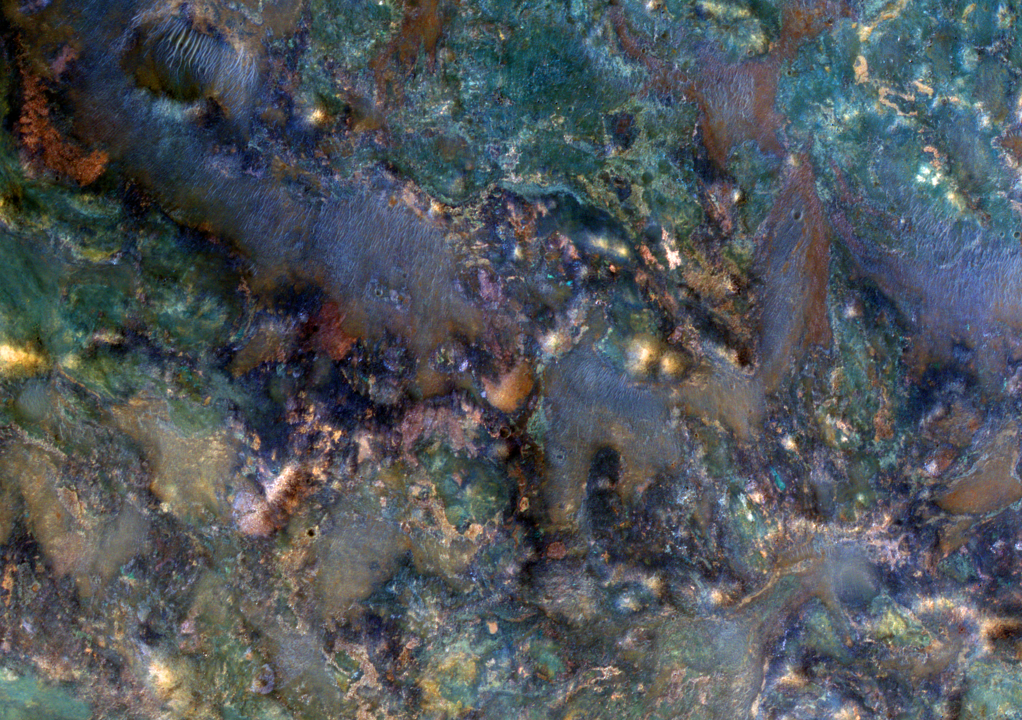
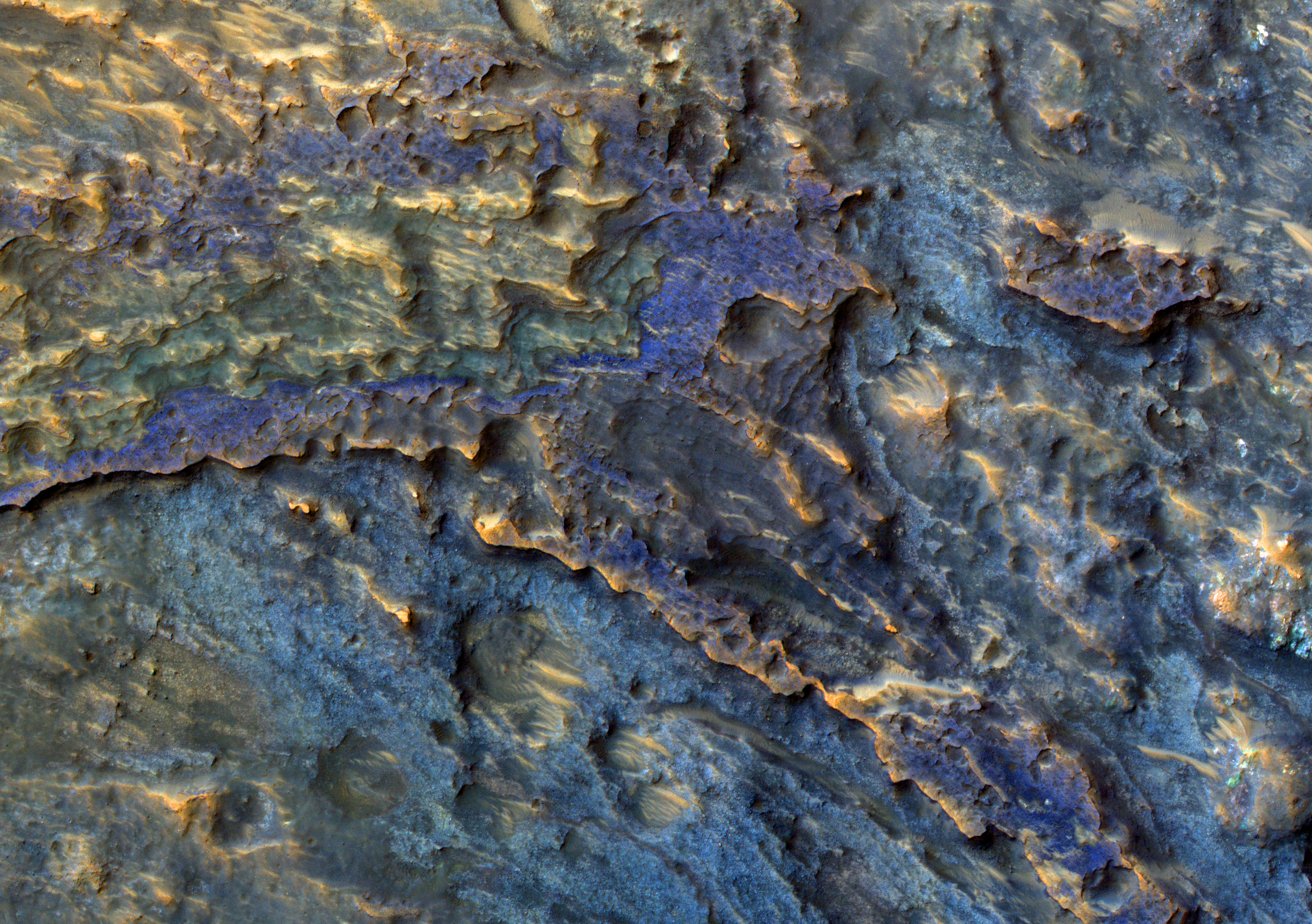
Jumbled Rocks Near Nili Fossae


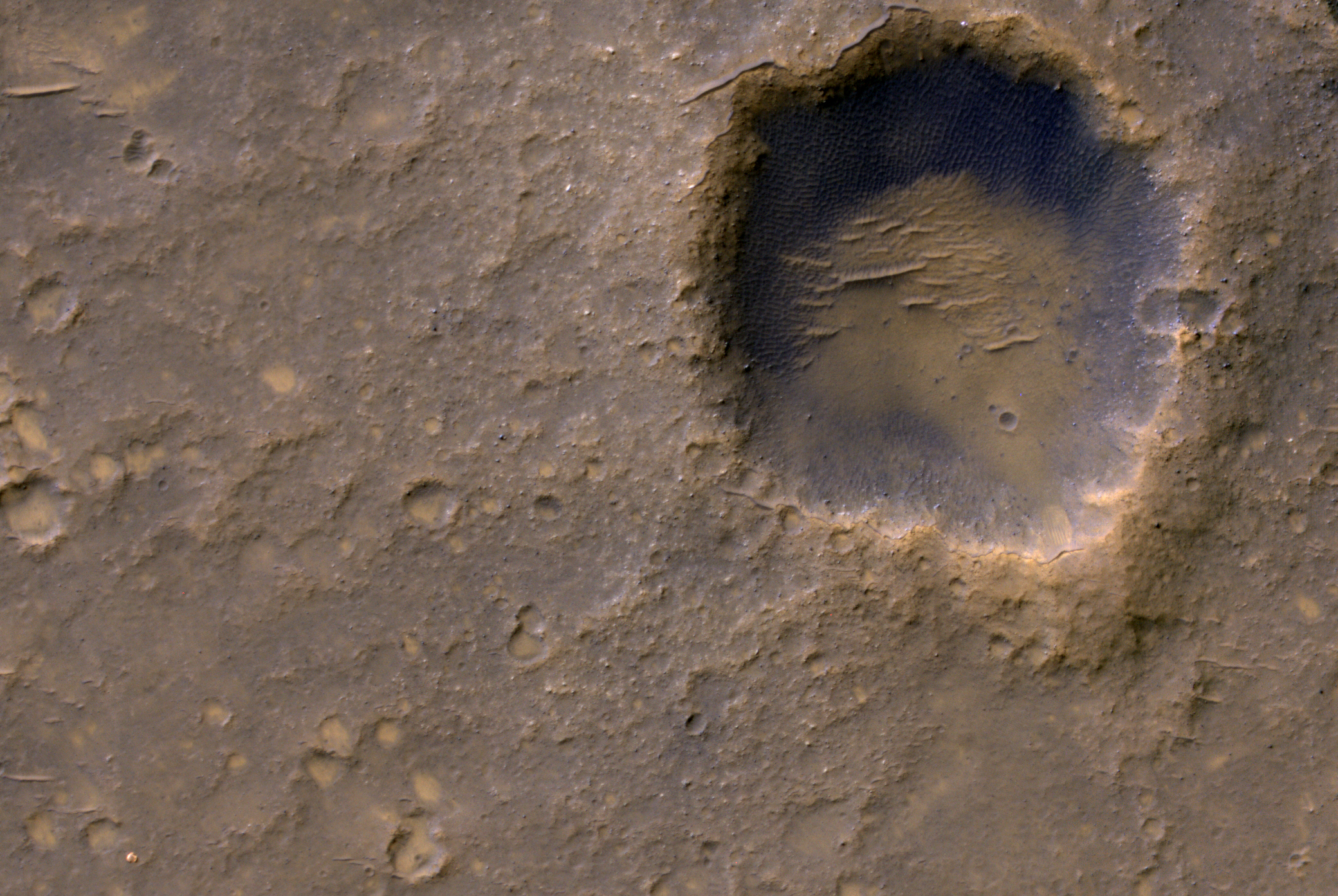
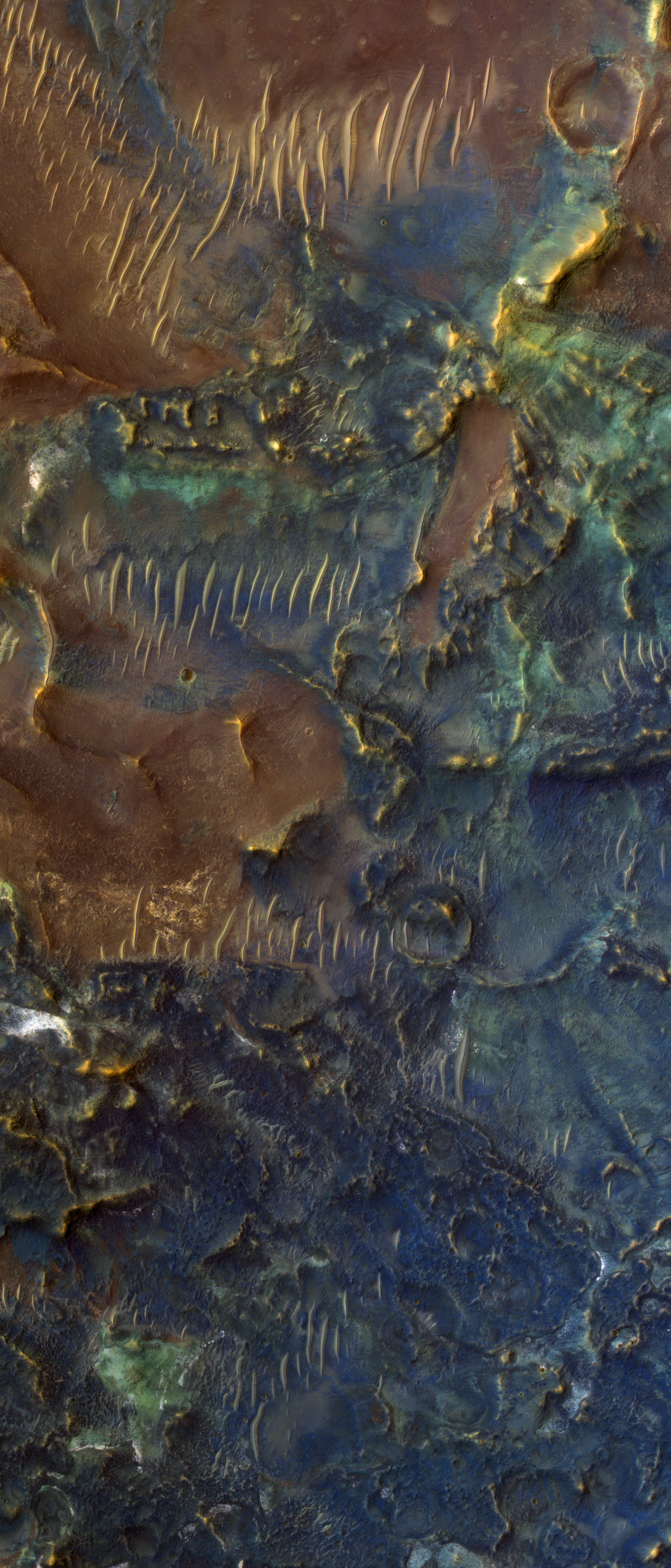
This image covers a region of Mars near Nili Fossae that contains some of the best exposures of ancient bedrock on Mars.

The enhanced-color subimage shows part of the ejecta from an impact crater. The impact broke up already diverse rocks types and mixed them together to create this wild jumble of colors, each representing a different type of rock.

Photo credit: NASA/JPL/University of Arizona

Note: The above image is slightly smaller in size (2048 x 1536 px) than what is normally posted on this blog (2560 x 1920 px) due to the fact that the larger image is over the allowable download size for photos onto Blogger.

Monday, March 26, 2012

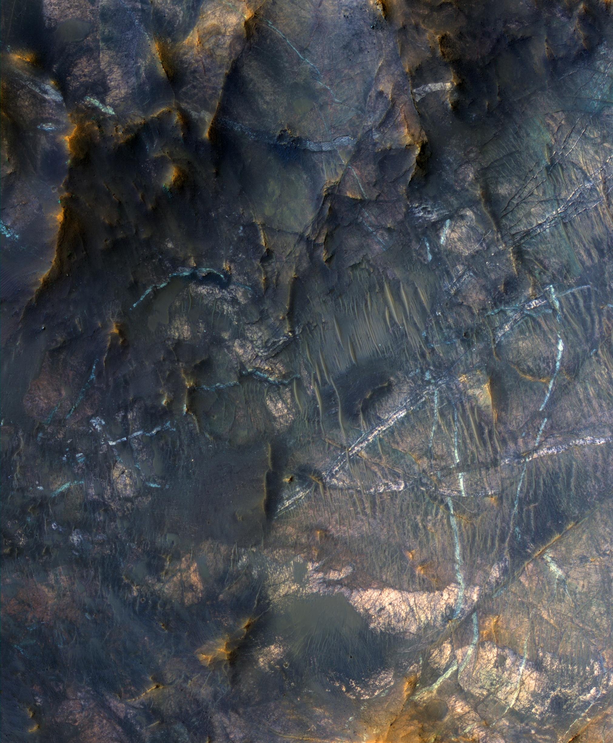
Mineral Veins in Terra Sabaea


The bright linear features cutting the bedrock in the center region of this image look like mineral veins.

Mineral veins are sheetlike bodies of minerals formed by water that flows through fractures. The setting of this image is the central uplift of a large (approximately 50-kilometer diameter) impact crater, where deep, ancient bedrock was uplifted about 5 kilometers and fractured. Heat from the impact melted ice in the Martian crust, creating a hydrothermal system. This could have been a habitable environment.

A small mineral vein was recently discovered by the Opportunity rover at Endeavour Crater.

This is a stereo pair with ESP_025766_2005.

Photo credit: NASA/JPL/University of Arizona

Note: This crater is located in northeast Terra Sabaea, in a complex of craters southeast of Baldet Crater.

Sunday, March 25, 2012

Boulders on the Floor of Hellas Planitia


This image reveals bouldery patches on the floor of the giant Hellas impact basin.

The boulders are often crudely aligned. Maybe these boulders were deposited or sculpted by flowing ice in the form of glaciers.

Photo credit: NASA/JPL/University of Arizona

Saturday, March 24, 2012

Magical Mystery Mound


How exactly these strange landforms came to be is a mystery. It probably isn't magical, but the catchy Beatles-era title did get you to read this caption.

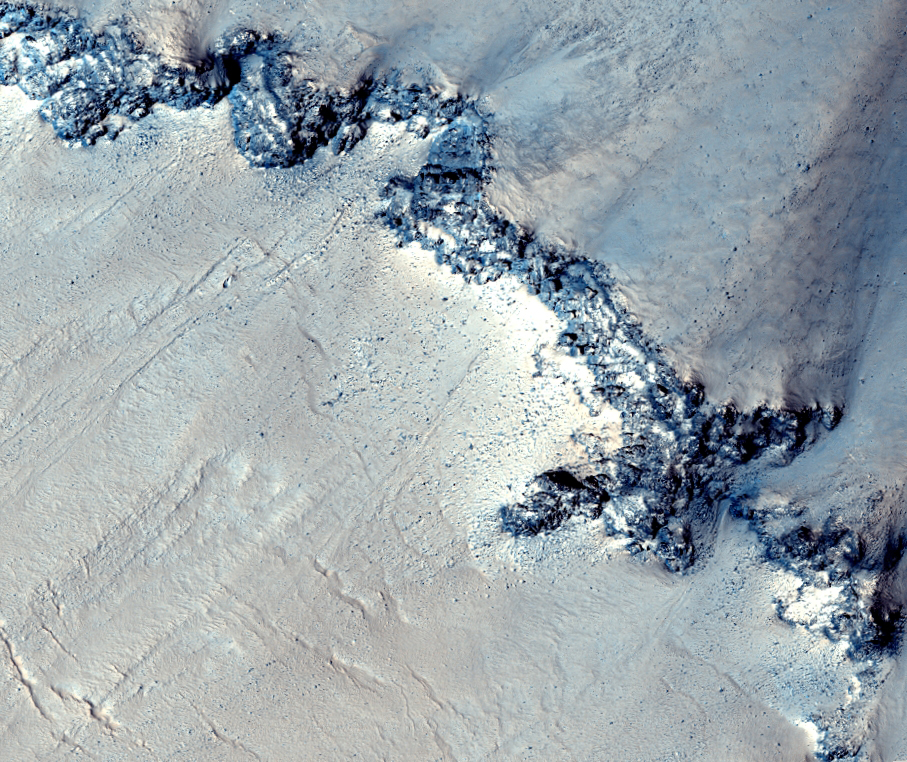
The contorted material sits on the floor of a degraded impact crater. It has some bizarrely grooved textures that show up nicely with the low-sun illumination (with the Sun approximately 7 degrees above the horizon). We've seen this texture elsewhere on Mars, so a systematic study might lead to a good hypothesis about its origin.

The color data reveals some bluish material-- seasonal frost that is just starting to accumulate here in late fall.

Photo credit: NASA/JPL/University of Arizona

Note: The crater where this mound is located is in Noachis Terra, very close to Asimov Crater, to the northwest, and Maunder Crater, due west.

Friday, March 23, 2012

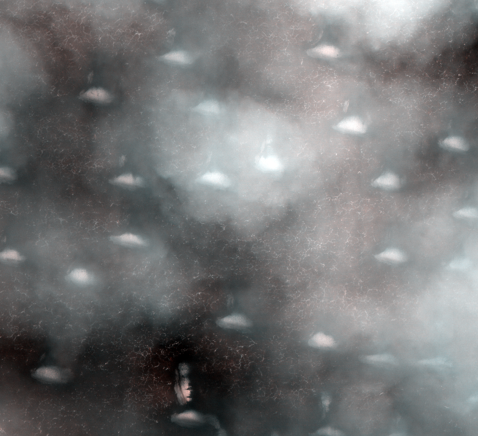
A Cloudy Day Over Vastitas Borealis


Mars occasionally has cloudy weather. We intended to take a picture of the bright ice-covered dunes that are faintly visible through these thin clouds, but weather forecasting on Mars is just as challenging as on Earth.

Where the clouds are thin, the remaining bright winter ice is visible, protected in shallow grooves on the ground, in addition to covering the dunes.

Photo credit: NASA/JPL/University of Arizona

Note: And, no, that is not the Face on Mars. ;) Although it does remind me more of those moai (statues) on Easter Island.

Monday, March 12, 2012

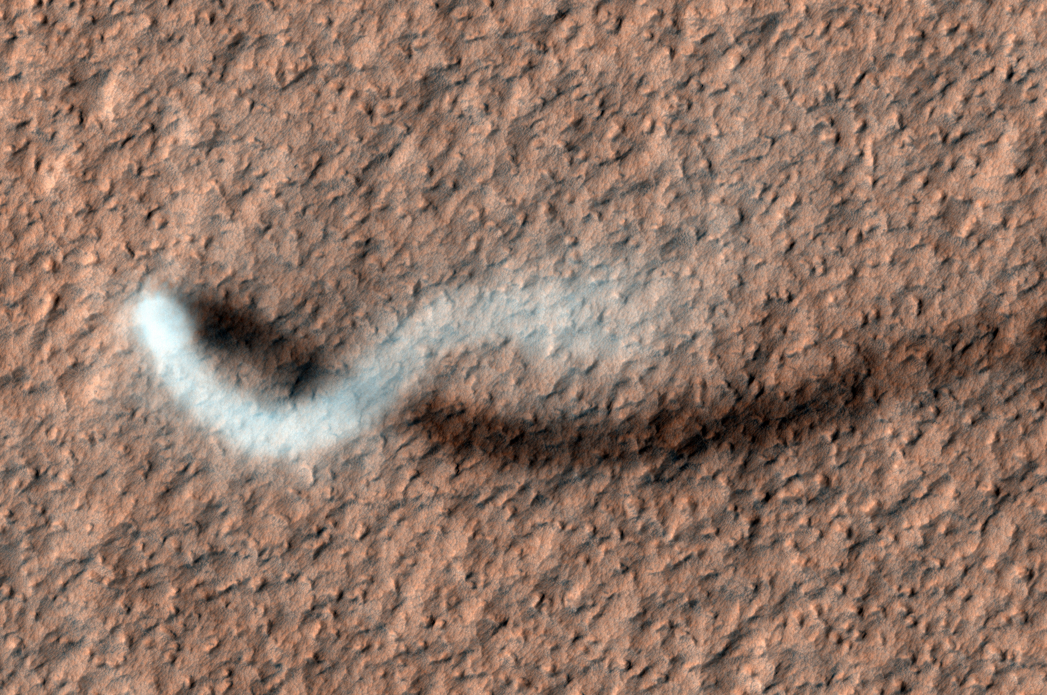
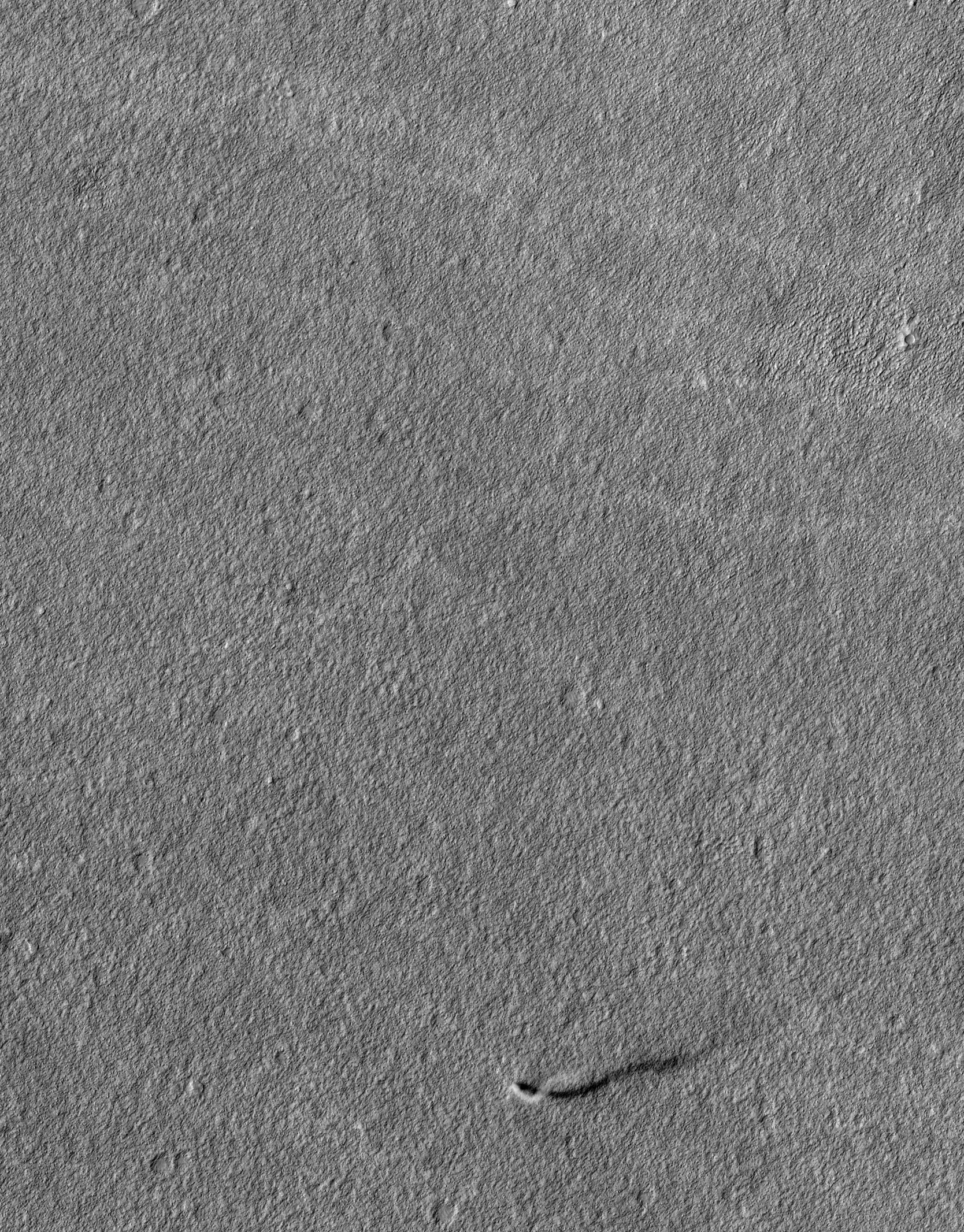
The Serpent Dust Devil of Mars


A towering dust devil casts a serpentine shadow over the Martian surface in this stunning, late springtime image of Amazonis Planitia.

The length of the shadow indicates that the dust plume reaches more than 800 meters, or half a mile, in height. The tail of the plume does not trace the path of the dust devil, which had been following a steady course towards the southeast and left a bright track behind it.

The delicate arc in the plume was produced by a westerly breeze at about a 250-meter height that blew the top of the plume towards the east. The westerly winds and the draw of warmth to the south combine to guide dust devils along southeast trending paths, as indicated by the tracks of many previous dust-devils. The dust plume itself is about 30 meters in diameter.

Numerous bright tracks trend from northwest to southeast. It is interesting to see that these tracks are bright, whereas dust-devil tracks elsewhere on Mars are usually dark. Dark tracks are believed to form where bright dust is lifted from the surface by dust devils, revealing a darker substrate.

Here in Amazonis, the dust cover is too thick to be penetrated by such scouring. A blanket of bright dust was deposited over this region recently, just before the arrival of MRO, so the surface dust here can still be moved. Perhaps the bright tracks form when the settled dust is stirred up by the strong winds generated by the dust devils (tangential wind speeds of up to 70 miles per hour have been recorded in HiRISE images of other dust devils).

It's also interesting that this image was taken during the time of year when Mars is farthest from the Sun. Just as on Earth, Martian winds are powered by solar heating. Exposure to the Sun's rays should be at a minimum during this season, yet even now, dust devils act relentlessly to clean the surface of freshly deposited dust, a little at a time.

This is a stereo pair with ESP_025985_2160.

Photo credit: NASA/JPL/University of Arizona

Note: For a short video showing how the dust devil would look like from the ground, see Storm Chaser on Mars.

Sunday, March 11, 2012

Icy Flows in Fitzroy Crater


This image shows flow features (tongue-shaped features in the depressions running down the slope) on the inner slope of an impact crater east of Hellas impact basin.

The time of year combined with MRO's orbit and the slope combine to provide the geometry for an image with almost glancing (very low sun) illumination. Such low-sun lighting enhances subtle topographic features and makes a dramatic image.

Other flows in this region of Mars, long thought to be due to flowing ice, have been confirmed to be icy by the Shallow Radar (SHARAD) experiment on MRO.

Photo credit: NASA/JPL/University of Arizona

Note: These ice flows are in Fitzroy crater.

Saturday, March 10, 2012

Layers of Water-Deposited Sediment


This image covers part of the floor of a large ancient impact crater, near the western rim.

The subimage shows layered deposits, many with distinct colors (the colors are enhanced or exaggerated). These layers have a morphology similar to that seen elsewhere on Mars in obvious alluvial fans where channels emerge into craters.

In this case the channels are not obvious, but we suspect that it is the same kind of deposit and the ancient channel is not well preserved due to subsequent modification.

Photo credit: NASA/JPL/University of Arizona

Note: This impact crater is located in Xanthe Terra just to the northeast of Mutch Crater.

Friday, March 9, 2012

Slope Streak Stripes on Crater Walls


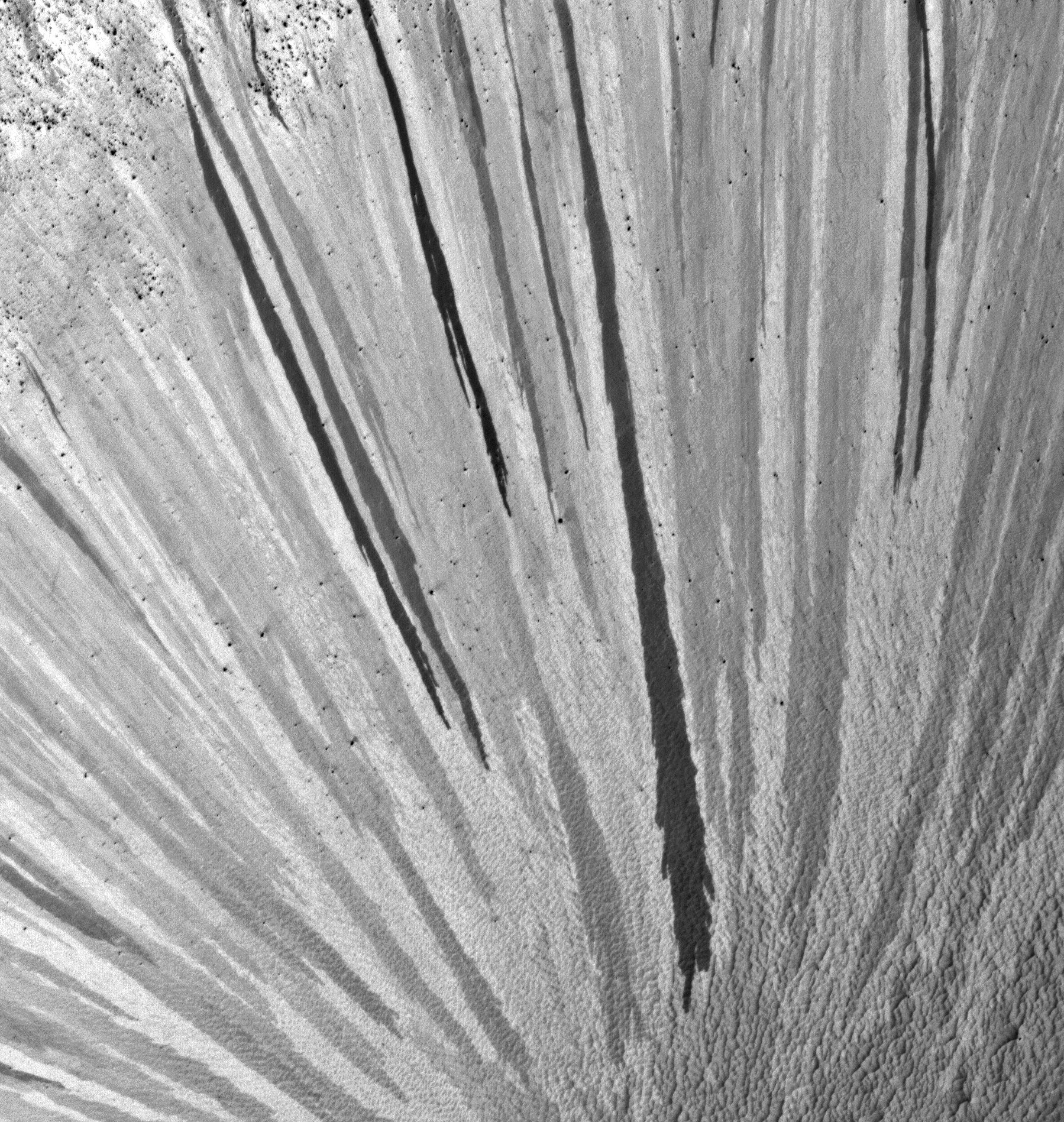
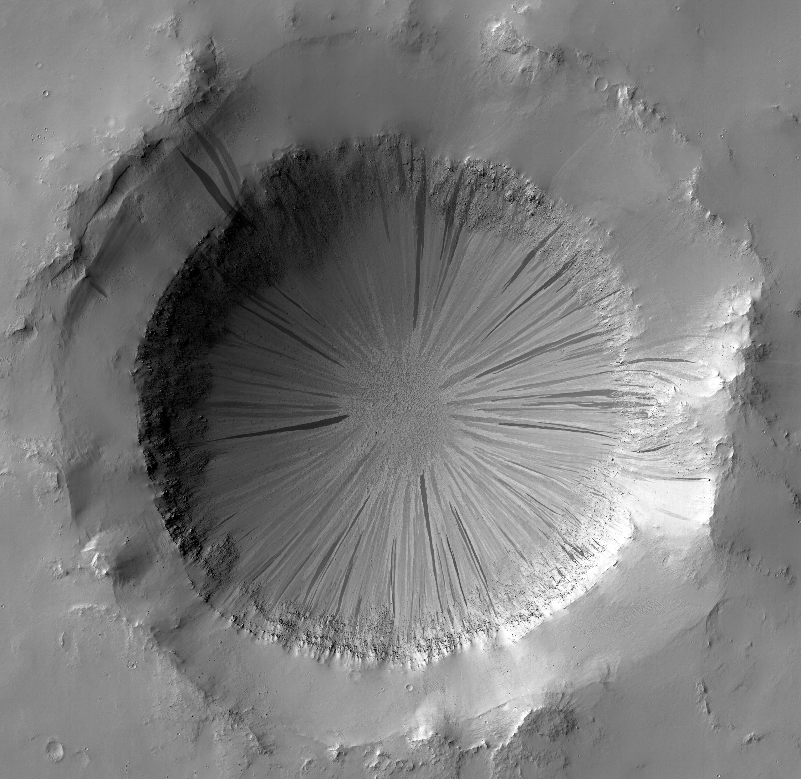
Radially-oriented slope streaks paint stripes on the sides of this crater in Arabia Terra. Slope streaks are common features on steep slopes in Mars' dusty terrain, but this crater is a particularly dramatic example.

Slope streaks, thought to be the result of shallow cascades of dust, are dark when fresh and fade as they age (see this highly stretched subimage that emphasizes the color difference between streaks). So it is clear that this crater experienced repeated episodes of streak formation, apparently around its entire circumference.

Other steep slopes nearby also show evidence of repeated slope streak activity - see ESP_024924_1945, PSP_009272_1955, and PSP_008705_1950 - but none are quite as photogenic as this one!

Photo credit: NASA/JPL/University of Arizona

Note: This crater is near the western border of Terra Sabaea, with Meridiani Planum lying to the southwest. The closest named feature is Gill Crater, to the west.

Wednesday, March 7, 2012

Syrtis Major


Syrtis Major, discovered in 1659 by Christaan Huygens, is a volcanic province on Mars. The image is centered on approximately 16°N/73°E. The High-Resolution Stereo Camera on ESA’s Mars Express collected the data for these images on 8 June 2011 during orbit 9487. The images have a ground resolution of approximately 19 m per pixel. This perspective view has been calculated from the Digital Terrain Model derived from the stereo channels. Some ancient lava flow fronts are seen in the foreground and a lighter-toned butte is emerging on the right.

Photo credit: ESA/DLR/FU Berlin (G. Neukum)

Note: For more information, see Mars Express Reveals Wind-Blown Deposits on Mars.

Tuesday, March 6, 2012

Phlegra Montes


Phlegra Montes is a range of gently curving mountains and ridges on Mars. They extend from the northeastern portion of the Elysium volcanic province to the northern lowlands. The High-Resolution Stereo Camera on ESA’s Mars Express collected the data for these images on 1 June 2011 during orbit 9465. The image combines data from the nadir channel and one stereo channel to produce this 3D image. Stereoscopic glasses are required to see the 3D effect.

Photo credit: ESA/DLR/FU Berlin (G. Neukum)

Note: For more information, see Mountains and Buried Ice on Mars.

Friday, March 2, 2012

Tenth Anniversary Image from Themis


The Thermal Emission Imaging System (THEMIS) camera on NASA's Mars Odyssey spacecraft has completed an unprecedented full decade of observing Mars from orbit.

THEMIS captured this image on February 19, 2012, 10 years to the day after the camera recorded its first view of Mars. This image covers an area 11 by 32 miles (19 by 52 kilometers) in the Nepenthes Mensae region north of the Martian equator. The view depicts a knobby landscape where the southern highlands are breaking up as the terrain descends into the northern lowlands.

Odyssey, launched in 2001, has worked at Mars longer than any mission in history.

Photo credit: NASA/JPL-Caltech/ASU

Thursday, March 1, 2012

Comparison of Earth's Interior with Mars and the Moon


Mars has the same basic internal structure as the Earth and other terrestrial (rocky) planets. It is large enough to have pressures equivalent to those throughout the Earth's upper mantle, and it has a core with a similar fraction of its mass. This diagram shows the depths at which high pressures cause certain minerals to transform to higher-density crystal structures. In contrast, the pressure even near the center of the Moon barely reach that just below the Earth's crust and it has a tiny, almost negligible core. The size of Mars indicates that it must have undergone many of the same separation and crystallization processes that formed the Earth's crust and core during early planetary formation.

Illustration credit: JPL/NASA

Monday, February 27, 2012

Well-Speckled Polar Dunes


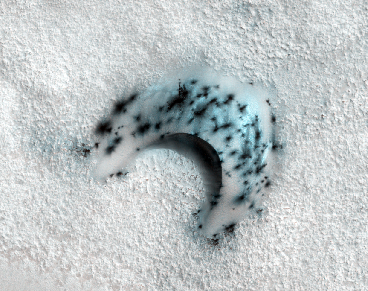
These barchan (crescent-shaped) sand dunes are found within the North Polar erg of Mars. This type of dune provides a great record of the wind environment when they formed and moved: barchan dunes' horns point downwind. Although the question of present-day sand motion is still open, it appears possible that these dunes are active (when not covered in frost) as their crestlines are very sharp and their slipfaces (the inner curved region between the horns/downwind surface) appears very smooth and steep.

In this image, taken during the northern spring season, the dunes and ground are still covered in seasonal frost. The speckled appearance is due to the warming of the area -- as the carbon dioxide frost and ice on the dunes warms, small areas warm and sublimate (turn from solid to gas) faster, creating small jets that expose/deposit dark sand and dust onto the surface. Notice that there are no spots on the ground between the dunes -- that is because the ground stays more uniformly cold, unlike the darker dune sand.

As spring continues, more spots will appear on the dunes until, suddenly, all of the frost on the dunes and ground will be gone and the dark dune sand will be exposed until next winter.

Photo credit: NASA/JPL/University of Arizona

Note: This image is located in Olympia Mensae.

Sunday, February 26, 2012

Utopia Planitia Scallops, Polygons, and Boulders


This terrain is covered by pits and scallops (pits open on one side), perhaps due to collapse after sublimation of subsurface ice.

This full-resolution anaglyph sample shows that the surface is cut into many polygons about 10 meters wide, that form as ice expands and contracts with temperature changes. There are also many meter-scale boulders on the surface, which must be rocks rather than blocks of ice, or they would not be stable on the surface.

More than 10 meters thickness of ice must have sublimated from some areas. (Sublimation is the process of going from a solid directly to a gas). How did the ice get deposited? One idea is that it's from snowfall (in a different climate), but then it is difficult to explain the presence of the boulders. The other possibility is transport through the shallow subsurface in very thin films of water over many years.

This is a stereo pair with ESP_025277_2275.

Photo credit: NASA/JPL/University of Arizona

Note: This image is located in northwestern Utopia Planitia; the closest named feature is Nier Crater, which is some distance off to the southeast.

Saturday, February 25, 2012

Dunes in Late Fall: Frost in the Ripples


These dunes in Aonia Terra are being monitored for changes such as gullies, which form over the winter from the action of carbon dioxide frost.
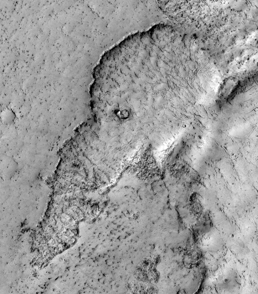
The season in which this image was acquired was late fall in the Southern hemisphere. Frost is just starting to accumulate here, and is concentrated on pole-facing slopes and in the troughs between the meter-scale ripples.

The colors have been enhanced in the subimage.

Photo credit: NASA/JPL/University of Arizona

Friday, February 24, 2012

Imaging in Deep Shadows


This image of an impact crater in Terra Cimmeria was acquired when the Sun was just 11 degrees above the horizon, so a long shadow extends over most of the crater interior.

However, there is still diffuse illumination from the sky and HiRISE has the ability to acquire sufficient signal over faint targets to make useful images. The subimage shows an area entirely in shadow, but with pixel values "stretched" to show the detail.

The crater interior shows a pattern of ridges and mounds suggestive of icy flow, which is common at this latitude on Mars.

Photo credit: NASA/JPL/University of Arizona

Tuesday, February 21, 2012

Search for the Mars 6 Lander


The Soviet Mars 6 lander arrived at Mars on 12 March 1974. The descent module entered the atmosphere and the parachute opened at 09:08:32 UT--the craft was collecting and returning data.

Contact with the descent module was lost at 09:11:05 UT, about when expected to encounter the surface.

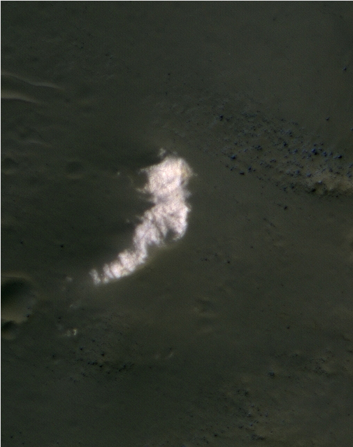
Because we know that the parachute opened and have some idea where it was headed, we have a chance of locating the hardware on the surface with HiRISE. In fact, an anomalous small bright patch was seen by MRO's Context Camera (CTX) team, which a CTX team member then suggested as a target for HiRISE.

The bright parachutes were the easiest thing to spot on the ground at 5 of the 6 past successful landing sites. In this subimage we see the bright spot at full HiRISE resolution, and it appears to be a patch of relatively bright bedrock, with a pattern of thin lines (fractures) typical of such outcrops.

We'll keep trying to find this and other failed landers, but there is a lot of surface area to cover on Mars and the hardware may be covered by dust and look much like natural features on Mars.

Photo credit: NASA/JPL/University of Arizona

Note: This location is on the border between southern Margaritifer Terra and northern Noachis Terra, to the northeast of Argyre Planitia.

Monday, February 20, 2012

Opportunity's Self-Portrait


This self portrait from NASA's Mars Exploration Rover Opportunity shows dust accumulation on the rover's solar panels as the mission approached its fifth Martian winter. The dust reduces the rover's power supply, and the rover's mobility is limited until the winter is over or wind cleans the panels.

This is a mosaic of images taken by Opportunity's panoramic camera (Pancam) during the 2,111th to 2,814th Martian days, or sols, of the rover's mission (December 21 to December 24, 2011). The downward-looking view omits the mast on which the camera is mounted.

The portrait combines exposures taken through Pancam filters centered on wavelengths of 601 nanometers, 535 nanometers and 482 nanometers. It is presented in approximate true color, the camera team's best estimate of what the scene would look like if humans were there and able to see it with their own eyes.

Earlier panoramas of Opportunity's deck provide comparison for the dust deposition: sols 322-323 PIA07372, sols 652-663 PIA03271 and sols 1282-1284 PIA15114.

Opportunity has worked through four Martian southern hemisphere winters since it landed in in January 2004 about 14 miles (23 kilometers) northwest of its current location. Closer to the equator than its twin rover, Spirit, Opportunity has not needed to stay on a Sun-facing slope during the previous winters. Now, however, Opportunity's solar panels carry a thicker coating of dust, and the team is using a strategy employed for three winters with Spirit: staying on a Sun-facing slope. The Sun will pass relatively low in the northern sky from the rover's perspective for several months of shortened daylight before and after the southern Mars winter solstice on March 30, 2012. Opportunity is conducting research while located on the north-facing slope of a site called "Greeley Haven."

Photo credit: NASA/JPL-Caltech/Cornell/Arizona State University

Sunday, February 19, 2012

Uplifted Jumble of Ancient Bedrock


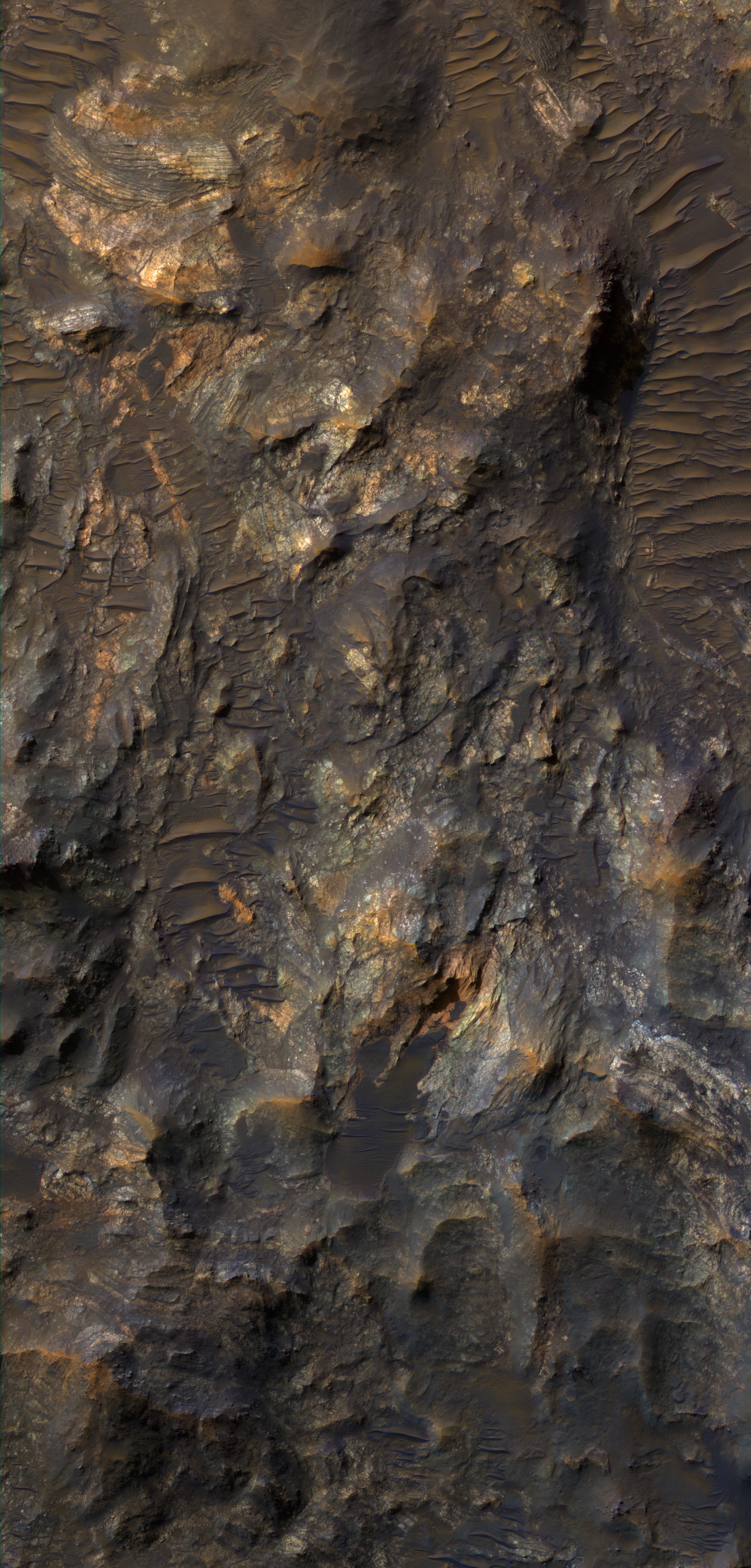
Impact craters larger than a certain size have complex forms, including central peaks or other structures that result from structural uplift of the target material. This provides a mechanism for exposing deep, ancient bedrock.

The enhanced-color subimage shows a great variety of colors and textures in the bedrock, where it is exposed from beneath a dark fine-grained mantle. The mantle is sometimes modified by the wind into dunes.

The bedrock here includes massive, layered, and broken-up (brecciated) areas. This crater is located in the volcanic plains between Argyre Planitia and Valles Marineris.

Photo credit: NASA/JPL/University of Arizona

Note: This crater is located in northwestern Noachis Terra, to the east of Nectaris Fossae. It is also located northwest of Ritchey Crater.

Saturday, February 18, 2012

Bedrock Exposures in an Acidalia Planitia Crater Wall


This mid-latitude (53 degrees North) crater appears well-preserved, with a clear ejecta blanket and well-defined rim. Bedrock exposures are visible near the top of the rim. Studying this site can yield information about the underlying terrain within this region.

Additionally, HiRISE images show small-scale features formed through modification and degradation processes; for example, few-meter-wide cracks that run perpendicular to the slope are likely formed through slumping and periglacial processes.

Gullies and flow features are also likely to be found along the crater wall -- possible shallow channels starting at the bedrock exposures are visible in along the rim in the upper/left portion of the image.

Photo credit: NASA/JPL/University of Arizona

Note: This crater is located in Acidalia Planitia, to the northwest of Lyot Crater.

Friday, February 17, 2012

Polar Layers in Gemini Scopuli


This is an especially pretty image due to the color variations and lighting geometry.

The color variations are due to mixtures of reddish dust with white frost and ice. The image was acquired as a "rider" with either a Context Camera or CRISM target.

One of these other MRO experiments chose this location to point at with the spacecraft, then the HiRISE science lead for this 2-week planning cycle decided to add a HiRISE image here for a high-resolution sample.

Photo credit: NASA/JPL/University of Arizona

Note: This image is located along one of the canyons in the Gemini Scopuli region of Planum Boreum.

Monday, February 13, 2012

Dunes and Ripples in Valles Marineris


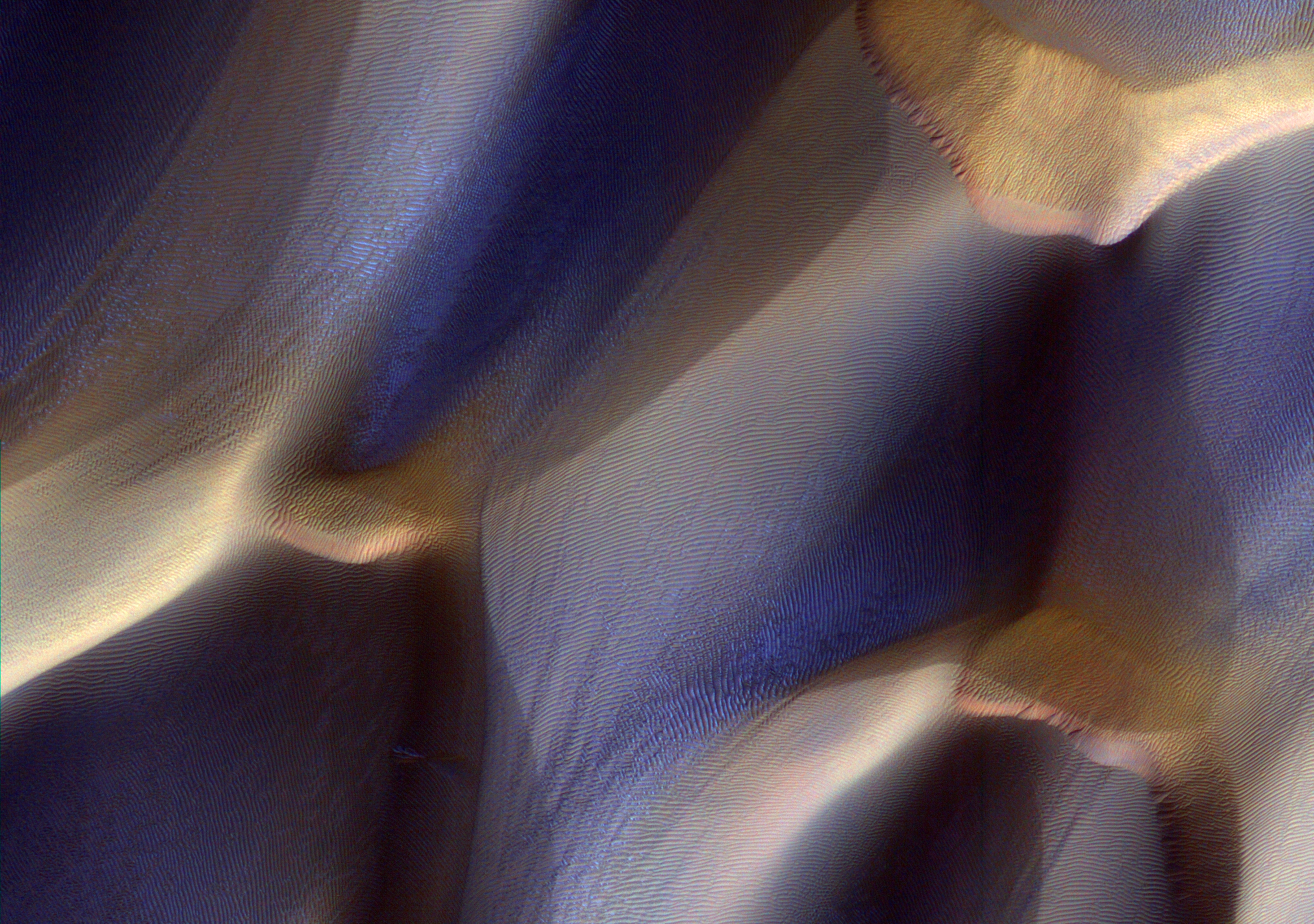
Two types of wind-blown sedimentary deposits are pictured in this scene of the floor of Ius Chasma in the Valles Marineris.

Smaller light toned ridge-like ripples draped over the bright bedrock are visible in this subimage. Long dark sand dunes superpose the small ridges, indicating that the sand dunes formed more recently than the ridges. Earlier observations have shown that the small ridges, known as "transverse aeolian ridges" or TARs, appear to be fixed in place. They are typically found near the equator of Mars, in places where the winds alternate in direction over daily or seasonal cycles.

Detailed investigations by the MER rovers revealed that the TARs were armored by a surface layer of coarse granules left behind after the smaller particles were winnowed away by the wind. These granules are too large to be lifted by the wind and preserve the TARs from further erosion. In contrast, recent HiRISE observations show that many of the dark sand dunes on Mars are actively on the move.

From these facts, we can hypothesize the recent history of the aeolian deposits here in Ius Chasma. Unconsolidated sediments were formed in the canyon by impact fragmentation and erosion of the steep canyon walls. These sediments were eroded and shaped into dunes by the winds that blow up and down the canyon, alternating direction between day and night. Eventually the tireless winds won the battle over sediment supply, and the remaining sediments were sifted into the TARs visible in the image, oriented perpendicular to the length of the canyon (transverse to the winds).

More recently, a fresh supply of sand was introduced into the canyon that the winds have not yet had time to tame. Instead of forming simple crescent dunes, the bidirectional winds have shaped the sand into long linear dunes punctuated by short slip faces. At high resolution, we see that the linear sand dunes are ruffled along their lengths by ripples transverse to the wind directions. Ultimately, most of this sand will be swept away, leaving the TARs trapped behind.

Photo credit: NASA/JPL/University of Arizona

Sunday, February 12, 2012

The Phoenix Lander After Two Mars Years


This is one of a series of images to monitor frost patterns at the Phoenix landing site.

The lander and backshell are visible, but not the parachute or the dark halo around the lander which is covered by dust. (Although the lander may appear strange, we have to remember that its solar arrays have collapsed.)

This is the same appearance to the hardware as 1 Mars years ago, in 2010. For views of the lander during the active mission in 2008, see our special releases page.

Photo credit: NASA/JPL/University of Arizona

Saturday, February 11, 2012

Looking for an Impact Crater on a Dune


This dune field image was requested since a prior lower-resolution (THEMIS VIS) image of this area had suggested the possible presence of an impact crater on the dunes. Finding an impact crater on a dune field would be quite important: as of 2011, no craters have been found on Martian dunes, which strongly supports the hypothesis that the dune fields are very young features and either formed or have actively evolved during the last tens of thousands of years.

No crater is visible in this dune field image, which is consistent with the "active" and "fresh" appearance of these dunes: (1) they have sharp crestlines and (2) slipfaces (the downwind slope; generally pointing towards the south-southwest in this field, although there are some signs of a reversing slipface, implying that some past winds have pushed sand towards the northeast-north northeast) are generally very smooth in appearance, except for some small avalanche features (which form as sand accumulating at the upper-portion of the slipface).

The search for a dune-field crater will need to continue...

Photo credit: NASA/JPL/University of Arizona

Note: This image is located in an unnamed crater in Bosporus Planum northwest of Argyre Planitia.

Friday, February 10, 2012

Spirit Lander and Bonneville Crater in Color


HiRISE has never before imaged the actual lander for the Spirit rover in color, on the west side of Bonneville Crater. The lander is still bright, but with a reddish color, probably due to a dust cover (lower left in the subimage).

A bright spot from a remnant of the heat shield is still visible on the north rim of Bonneville Crater. The backshell and parachute are still bright, but were not captured in the narrow color swath.

The rover itself can still be seen near "home plate" in the Columbia Hills, but there is no obvious sign of rover tracks--erased by the wind.

Photo credit: NASA/JPL/University of Arizona

Tuesday, February 7, 2012

Late Afternoon on Mars


NASA's Mars Exploration Rover Opportunity used its panoramic camera to capture this low-light raw image during the late afternoon of the rover's 2,847th Martian day, or sol, of work on Mars (January 27, 2012).

The rover is positioned for the Mars winter at "Greeley Haven," an outcrop located on the north end of Cape York on the rim of Endeavour Crater. This site provides an approximate 15-degree northerly tilt for favorable solar energy production.

Plans for research continuing through the winter months at Greeley Haven include a radio-science investigation of the interior of Mars, inspections of mineral compositions and textures on the outcrop, and assembly of a full-circle, color panorama of the surroundings.

Photo credit: NASA/JPL-Caltech/Cornell/Arizona State University

Monday, February 6, 2012

Crater with Gullies on a Central Structure


The 40-kilometer diameter unnamed crater (49 degrees North, 21 degrees East) in this image is located west of Lyot Crater and north of Deuteronilus Mensae in the Northern Plains of Mars.

As seen in the subimage, gully systems in the central structure have eroded underlying layers (undercutting) that are less resistant to erosion than the surface rock of the central structure. Previous channelized water flows likely transported the eroded sediments toward the southeast and deposited them forming the expansive debris aprons.

The formation of channels on the debris aprons supports the hypothesis that these sediments were transported down the gullies and then deposited onto the aprons by flowing water. In the larger, northernmost system, sediments have partially filled in the channel segments and winds have remobilized these sediments forming the dunes that line the gullies.

This is a stereo pair with PSP_009298_2295.

Photo credit: NASA/JPL/University of Arizona

Sunday, February 5, 2012

The Floor of Toro Crater


Toro Crater may have experienced hydrothermal alteration, producing diverse minerals. The mineral diversity leads to diverse color in HiRISE, especially when enhanced as in this subimage.

In general the blue and green colors indicate unaltered minerals like pyroxene and olivine, whereas the warmer colors indicate alteration into clays and other minerals. The linear north-south trending features are windblown dunes that are much younger than the bedrock.

This is a stereo pair with ESP_025344_1970.

Photo credit: NASA/JPL/University of Arizona

Saturday, February 4, 2012

Active Erosion in Pasteur Crater


This image shows knobs and bluffs that are being actively eroded by the Martian wind. Fine, light-toned sedimentary layering is exposed in the bedrock at the base of the cliffs.

Also in this scene are two types of unconsolidated aeolian sediments. The reddish ridges are relatively immobile, and are probably similar to granule ripples on Earth that are protected from the winds by a surface layer of coarse grains. The dark gray dunes are probably made up of fine (approximately 0.1 mm) basaltic sand. Previous HiRISE images (PSP_001756_1995, PSP_010643_1995) showed that the sand in Pasteur Crater is currently mobile.

This sand is thought to be locally derived, from dark deposits within a small crater called Euphrates that is located within Pasteur, upwind of the sand dunes. The movement of this sand contributes to the erosion of the ancient bedrock, sandblasting the formation into the knobs seen today and exposing layers that were deposited in ages past.

Photo credit: NASA/JPL/University of Arizona

Friday, February 3, 2012

Well-Preserved Crater in Terra Sabaea


Shown here is a stereo pair (see the anaglyph) of a well-preserved impact crater about 6 or 7 kilometers wide from rim to rim. By well-preserved we mean that the crater has a sharp rim, deep cavity, impact morphologies preserved down to scales of tens of meters, and little sign of infilling or degradation by a range of processes (other impacts, volcanism, tectonism, icy flow, aeolian erosion and infill, etc.).

When seen at full HiRISE resolution, almost all craters on Mars do show some modification such as subsequent smaller impacts, wind-blown deposition and/or erosion, and downslope movement of material on steep slopes.

We have imaged hundreds of well-preserved impact craters on Mars ranging from 1 meter to more than 100 kilometers wide. These targets are of great interest for multiple reasons: first, we want to better understand impact cratering, a fundamental surface process. Second, such craters often contain good exposures of bedrock in the steep walls and, if the crater is large enough, in the central uplift. Just like terrestrial geologists are attracted to good bedrock outcrops like road cuts, planetary geologists are attracted to well-preserved craters.

Third, the steep slopes often reveal active processes, such as formation of gullies, boulder falls, and slope streaks that could form in a variety of ways. Some of these active processes could be related to water, since the crater may expose lenses of ice or salty water, or create deep shadows that trap volatiles, or expose salts that can extract water from the air.

This is a stereo pair with ESP_024738_1595.

Photo credit: NASA/JPL/University of Arizona

Note: This crater is located on the border of Terra Sabaea, being to the northwest of Hellas Planitia. The closest named feature is Harris Crater.

Wednesday, February 1, 2012

Very Fresh Impact Crater Superposing a Wrinkle Ridge in Hesperia Planum


The ridge captured in this HiRISE image is called a wrinkle ridge. This wrinkle ridge is located in Hesperia Planum, a region of over two million square kilometers (over 770,000 square miles) in the southern highlands of Mars. It is located northwest of the Hellas basin and adjacent to Tyrrhena Patera and contains abundant orthogonal and intersecting wrinkle ridges.

Wrinkle ridges are long, winding topographic highs and are often characterized by a broad arch with superposed narrow asymmetric ridges. These features have also been identified on the Moon, Mercury, and Venus. Their origin is attributed to horizontal compression or shortening of the crust due to faulting and folding. They commonly have asymmetrical cross sectional profiles and an offset in elevation on either side of the ridge.

Superposing or located on top of the wrinkle ridge, is a very fresh impact crater. We can tell that this crater is fresh because of its relatively sharp or crisp rim and unmodified shape. If you look closely, you can see faint rays of relatively fine material, boulders, and smaller secondary craters radiating from the crater and superposing the wrinkle ridge and older surrounding craters.

Photo credit: NASA/JPL/University of Arizona

Note: For an mp4 video clip of this area, including additional photographs, click here.