Tuesday, April 20, 2010

Dark Slope Streaks in Terra Sabaea


Dark slope streaks, like the ones in this unnamed crater in Terra Sabaea, are believed to be formed when surface dust is displaced and the darker rock below is exposed. Rocks falling due to gravity likely formed these streaks.

Photo credit: NASA/JPL/Arizona State University

Note: The closest major landmark to the location in the above image is Tikhonravov Crater, which lies to the west.

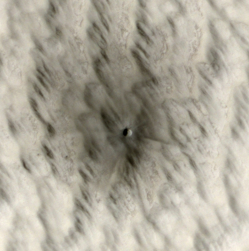
New Impact Crater


This small crater (approximately 7 meters, or 20 feet, in diameter) was created sometime within the last five years. We know this because we have enough images of Mars over the last decade that we can narrow down its formation date using "before" images where the crater did not appear.

We are able to discover these new craters because the dark area surrounding them is much larger than the crater itself. We can detect this larger dark spot with lower-resolution data sets from other instruments. Then when HiRISE follows up, the higher resolution image reveals the crater at the center of the dark spot, as well as details of the ejecta and surrounding area.

Studying new craters like these will tell us more about the current rate of impacts on Mars. A common technique for estimating the age of a given surface involves counting how many craters of each size are present on that surface. This will help us better understand results from that technique, and refine it to give more accurate ages.

Small impacts like these also represent a hazard to future exploration, both on Mars and the Moon. Imagine if one of the Martian rovers had been at this spot when this object blasted into the surface! This may be a very small crater on planetary scales, but it could still cause a lot of damage. On the Moon, where there is no atmosphere to provide protection from even the tiniest micrometeorite, the danger would be even higher. Knowing the rate of impacts like these will tell us how much shielding will be needed for future landers, rovers, and eventually human explorers.

Be sure to check out one of many more new craters HiRISE is discovering.

Photo credit: NASA/JPL/University of Arizona

Note: This crater is located on the northwestern flank of Biblis Patera, which is a volcano located on the Tharsis bulge, to the west of Pavonis Mons.

Monday, April 19, 2010

Coprates Chasma


This VIS image shows a portion of the floor of Coprates Chasma. Note the sand dune forms near the southern cliff face.

Photo credit: NASA/JPL/Arizona State University

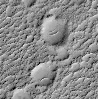
Comic and Tragic Craters


The subimage shows two craters on Mars that are reminiscent of the Greek muses of comedy and tragedy.

The muse of tragedy, Melpomene, wore the sad mask, and the muse of comedy, Thalia, wore the happy mask. Martians probably never enjoyed the theater, or were influenced by the Greeks.

A more likely explanation for the features seen here is that sand was blown into these craters and collected into dunes on their floors, where the winds are less intense.

Photo credit: NASA/JPL/University of Arizona

Note: These craters are located in a larger crater that is just south of de Vaucouleurs Crater, which itself is west of Gusev Crater, where the Mars Exploration Rover Spirit roamed.

Sunday, April 18, 2010

Slope Streaks in Tikhonravov Crater


Dark slope streaks mark this crater rim. This crater is located within the much larger Tikhonravov Crater in Arabia Terra.

Photo credit: NASA/JPL/Arizona State University

Gully Grab Bag in Crater Wall, Terra Sirenum Region


This observation shows the complex, gullied western wall of a kilometer-deep impact crater in the Terra Sirenum region. This is an interesting crater because it appears to be mantled by the fluidized ejecta blanket of a slightly smaller crater just to the west.

A diverse set of gullies originate at multiple elevations along the crater wall. Prominent gullies have incised through the overlying ejecta into the upper walls to reveal numerous resistant dark layers. The floors of these gullies display a host of interesting features, including braided middle reaches, cut banks, channel bars, and stream terracing. These are all features suggestive of water flow.

Miniature gully systems, less than a kilometer long, start much further downslope than the larger gullies yet display the usual gully attributes, including theater-headed alcove source regions, incised middle reaches, and overlapping alluvial fans at their lower reaches. Detailed studies of these and other gully systems should help to elucidate the gully formation mechanisms.

Photo credit: NASA/JPL/University of Arizona

Saturday, April 17, 2010

Hecates Tholus


This VIS image shows the southeastern flank of Hecates Tholus, the northernmost volcano of the Elysium Volcanic complex.

Photo credit: NASA/JPL/Arizona State University

Scalloped Topography in Peneus Patera Crater


This image, near the southeast rim of Peneus Patera crater, is marked by depressions in the mantle with scalloped edges. Several of the depressions have apparently coalesced together.

These features are most commonly found at approximately 55 degrees North and South latitude. Their presence has led to hypotheses of the removal of subsurface material, possibly interstitial ice by sublimation (evaporation).

Steep scarps consistently face the south pole while more gentle slopes face in the direction of the equator. This is most likely due to differences in solar heating.

A polygonal pattern of fractures, commonly associated with "scalloped terrain," can be found on the surface surrounding and within the depressions. The fractures indicate that the surface has undergone stress that may have been caused by subsidence, desiccation, or thermal contraction.

Scallop formation is believed to be an ongoing process at the present time.

Photo credit: NASA/JPL/University of Arizona

Note: Peneus Patera Crater is located just south of Hellas Planitia in the Noachis Quadrangle of Mars.

Friday, April 16, 2010

Terra Sabaea


The northern part of Terra Sabaea is heavily fractured and channeled, breaking up into a chaotic terrain as the elevation drops down to the northern plains. This VIS image shows just one of the many channels located in the region.

Photo credit: NASA/JPL/Arizona State University

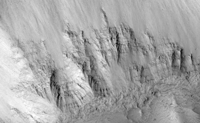
Layers Exposed on Slope in Echus Chasma Region


The layers seen in this HiRISE subimage of Echus Chasma are very different from the light-toned, thinly bedded layers HiRISE has observed in deposits seen elsewhere in Valles Marineris.

The view of these layers in Echus Chasma shows they are rough, with knobs of rock sticking out through the dust and talus (loose debris) on the slope. This indicates that perhaps these layers are made of different materials than the light-toned deposits, which appear more friable in nature.

These rough layers may be exposures of lavas, or they might just be more resistant forms of sedimentary rocks. The layers are typical of those seen in chasma slopes and crater rims elsewhere on the Martian surface.

Photo credit: NASA/JPL/University of Arizona

Thursday, April 15, 2010

Ganges Chasma


This VIS image of Ganges Chasma contains both landslide deposits and dunes.

Photo credit: NASA/JPL/Arizona State University

Small Shield Volcano in East Tharsis Region


This image shows a small shield volcano in the eastern Tharsis region of Mars. The Tharsis region is located on the Martian equator and contains some of the solar system's largest volcanoes.

The oval shaped depression in the center of the image is the summit pit of the volcano. Emanating from the summit crater, is a raised, leveed lava channel that branches downhill. Lava channels are narrow pathways through which lava flows on the volcano surface. The volume of lava in the channel can often fluctuate and sometimes lava will overflow the channel. When this happens, lava congeals and cools along the edges of the channel forming natural levees and building up the lava channel above the surrounding surface.

Shield volcanoes have shallow-sloping sides and get their name from their resemblance to a warrior's shield. They form from basaltic lava that flows easily, or has a low viscosity, and builds up over time to form a broad shield volcano profile.

Some of the largest volcanoes on Earth, such as Mauna Loa and Mauna Kea of Hawaii, are shield volcanoes.

Photo credit: NASA/JPL/University of Arizona

Note: This volcano lies just west of Noctis Labyrinthus.

Wednesday, April 14, 2010

Channels on Ceraunius Tholus


This VIS image shows the western edge of the summit caldera of Ceraunius Tholus, one of the smaller volcanic constructs of the Tharsis region. Several channels dissect the western flank of the volcano.

Photo credit: NASA/JPL/Arizona State University

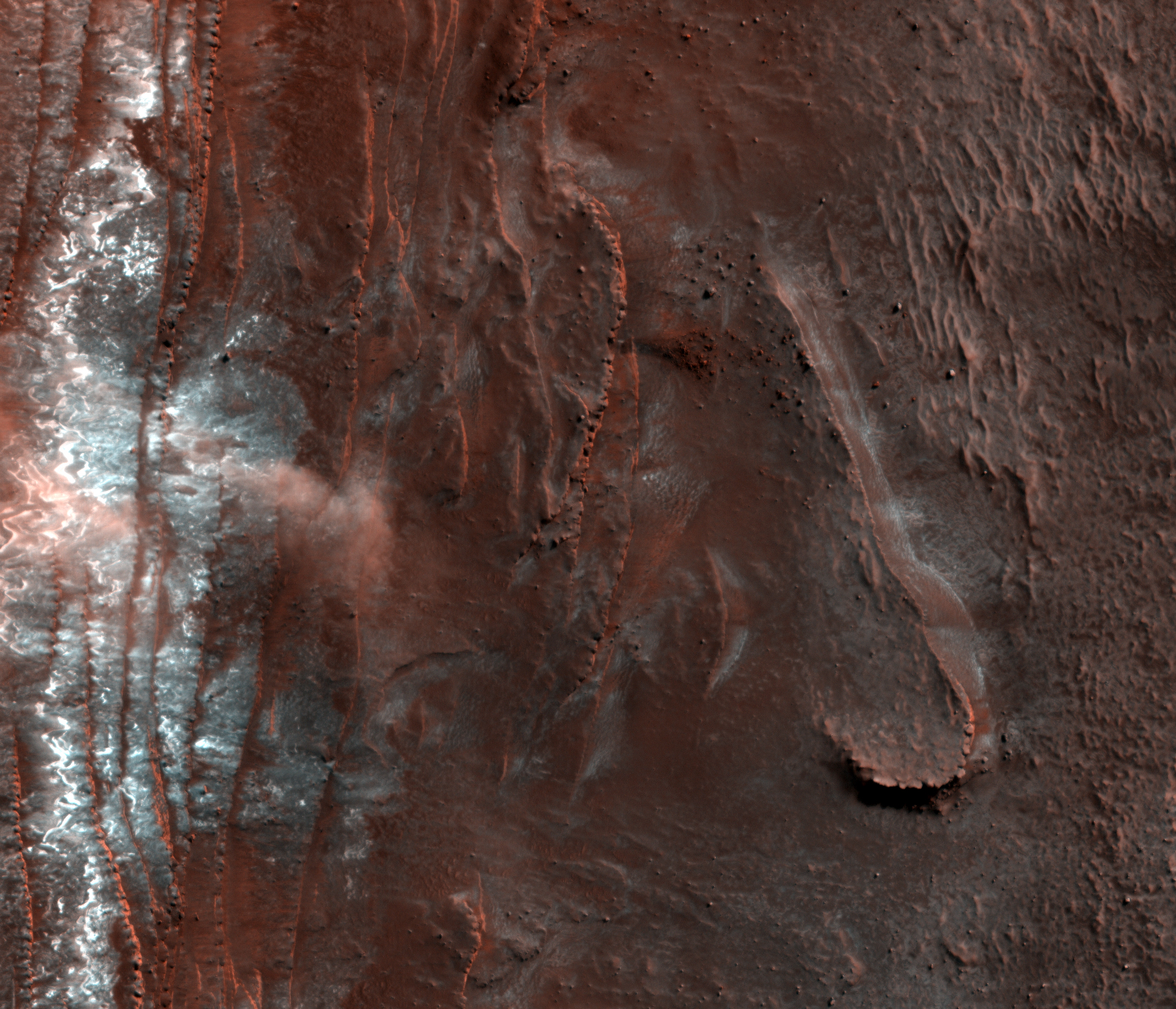
Avalanche Clouds


This HiRISE image shows at least three isolated clouds of particles near a steep cliff in the northern polar region of Mars.

These clouds, rolling or hovering close to the ground yet reaching up tens of meters high (up to 180 feet), are likely the result of an avalanche or fall of mostly carbon-dioxide frost. The frost clings to the scarp in the darkness of winter and may be disrupted by sunlight and thermal processes with the coming of spring. The cliff, approximately 700 meters (2000 feet) high is made up of layers of water ice with varying dust content, roughly similar to the polar ice caps on Earth.

On top is bright white carbon-dioxide ice and frost. Last year, HiRISE was monitoring this area for changes in frost patterns as spring progressed - it was quite surprising and very exciting to find an avalanche in progress (e.g. PSP_007338_2640)! This year, we were ready to capture more.

Targeting this scarp as well as others around the edge of the north polar icy layered deposits will help determine if this process is a characteristic one in Mars' cycle of seasons, including the period of year it is active and how wide-spread around the region it is. Several such events occurred earlier this year at this same scarp (e.g. ESP_016173_2640), and several more were also seen at a few other scarps (e.g. ESP_016228_2650) spread around about one-third of the circumference of the polar region.

Looking at all of the individual instances of avalanches from all of the images will also allow us to piece together a sequence of snaphots of the whole avalanche process, from beginning (a stream of material falling down the cliff face) to end (lingering puffy clouds). Based on this year's observations, these events happen mostly in the middle of spring, roughly equivalent to April to early May on Earth. And, they are indeed more widespread than just this one scarp. All together, it seems this is a regular spring process at Mars' north pole that may be expected every year - avalanche season! This information, in conjunction with the results of numerical modeling of the behavior of the materials involved, will help us find out what is causing these dramatic events.

Photo credit: NASA/JPL/University of Arizona

Tuesday, April 13, 2010

Candor Chasma


This VIS image of Candor Chasma contains eroded deposits of material and a large landslide deposit. Gravity, wind, and water all played a role in shaping the landforms we see in this image.

Photo credit: NASA/JPL/Arizona State University

Polygonal Patterned Ground


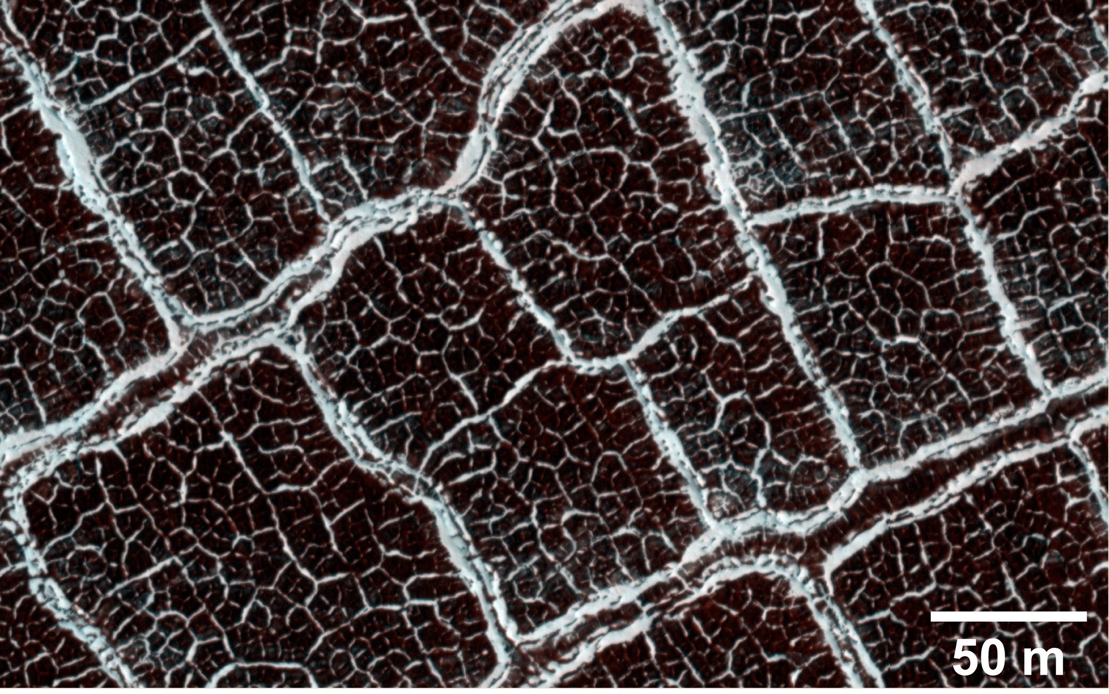
From a distance, the floor of this crater looks like a giant honeycomb or spider web. The intersecting shapes, or polygons, commonly occur in the northern lowlands of Mars.

The polygons in this "patterned ground" are easy to see because their edges are bound by troughs or ridges covered by bright frost relative to their darker, frost-free interiors. Patterned ground on Mars is thought to form as the result of cyclic thermal contraction cracking in the permanently frozen ground.

Scientists study polygonally-patterned ground on Mars because the occurrence and physical characteristics of the polygons helps us understand the recent and past distribution of ice (frozen water) in the shallow subsurface. These features also provide clues about climate conditions. The subimage shows smaller polygons within larger polygons.

Photo credit: NASA/JPL/University of Arizona

Note: The location of this crater is at 69.8° North, 64.9° East, in the Vastitas Borealis, and to the northwest of the Utopia Planitia.

Monday, April 12, 2010

Tithonium Chasma


This VIS image is part of Tithonium Chasma, part of the western side of Valles Marineris.

Photo credit: NASA/JPL/Arizona State University

Monitor Spirit Landing Site for Aeolian Changes


This observation covers the Columbia Hills and the surrounding plains of Gusev Crater, which the Mars Exploration Rover Spirit has been exploring since January 2004. Repeat images of this site have been acquired to study aeolian (wind-related) changes on the surface.

This image was acquired in February 2010, six months after the most recent prior image (ESP_014277_1650) and seven months after the most recent color image (ESP_013921_1650) of Spirit's location. During the intervening time, a significant regional dust storm blanketed Gusev crater, and bright Martian dust subsequently settled onto the surface. The surface around the Columbia Hills therefore appears brighter in this new image. However, numerous dark streaks are superposed on this surface; these are probably tracks left by dust devils migrating across the Gusev plains.

While driving around the "Home Plate" feature in the Columbia Hills, Spirit's wheels have excavated bright soils that were previously buried several centimeters beneath the Martian surface. These soils contain minerals such as sulfates and opaline silica that suggest past water activity at this location. The excavated soils are visible from orbit in previous HiRISE color images, where they appear as small, bright, blue-toned patches. These patches are all virtually invisible in the new HiRISE image, suggesting that the soils may have been buried by dust settling during the past few months.

Combining these orbital images with those taken by Spirit on the Martian surface provides a view of aeolian surface changes at a range of scales.

Photo credit: NASA/JPL/University of Arizona

Sunday, April 11, 2010

Eastern Coprates Chasma


This VIS image of the eastern end of Coprates Chasma contains a landslide deposit and sand dunes. Both features are typical for the chasmata that make up Valles Marineris.

Photo credit: NASA/JPL/Arizona State University

Fading Young Impact Crater


This image shows a new impact crater that formed on Mars between May 2002 and February 2004. It was discovered in data from the Mars Odyssey Mission THEMIS instrument and later confirmed to be an impact crater by the Context Camera on Mars Reconnaissance Orbiter. HiRISE is monitoring this site, at latitude 25.5 degrees and East longitude 221.8 degrees, to watch for changes brought about by the Martian winds.

Comparison of this image with an earlier HiRISE image (PSP_004175_2060) taken more than a Martian year earlier shows significant changes. The dark ejecta from the impact has faded considerably in the interval between June 2007 and February 2010. The fading is probably more significant than represented by these images, since the phase angle (the angle between the Sun, the surface, and the spacecraft) was much larger in the earlier image (72.2 degrees) than in the more recent picture (33.2 degrees). Images taken at higher phase angles tend to emphasize topography and make color and brightness differences less prominent.

The timing of the fading in not known, but the changes could have coincided with a global dust storm that took place in July 2007, shortly after the earlier image was acquired.

Photo credit:

Note: This crater is located just south of Lycus Sulci, which itself is on the Tharsis bulge to the northwest of Olympus Mons.

Saturday, April 10, 2010

Sabis Vallis


A section of Sabis Vallis is shown in today's VIS image.

Photo credit: NASA/JPL/Arizona State University

Note: Sabis Vallis is an ancient river valley in the Memnonia quadrangle of Mars, being located slightly to the northwest of Mangala Valles.

Faulted Layered Bedrock in Noctus Labyrinthus


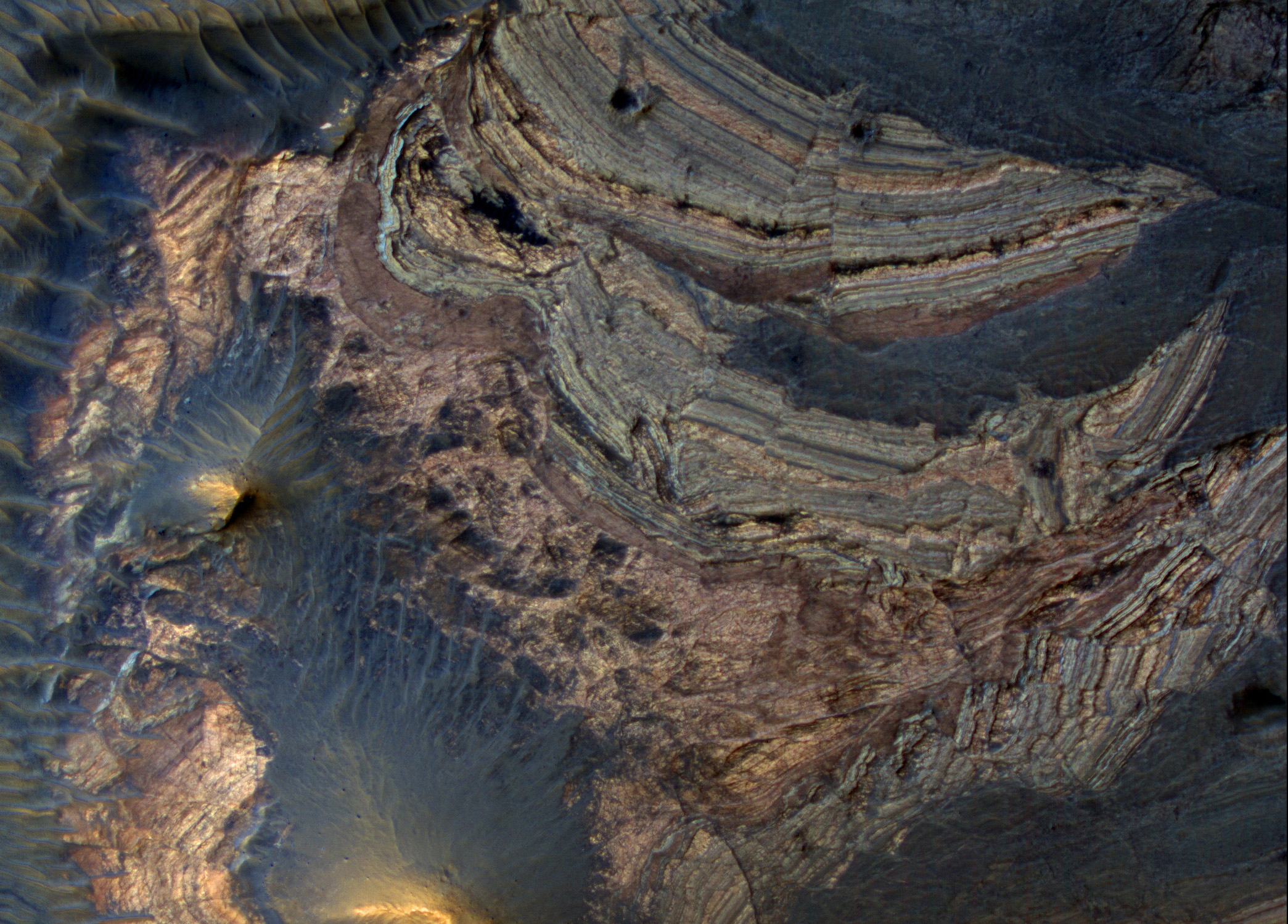
A portion of this observation shows layered bedrock that has been faulted and tilted.

These layers were likely horizontal when the materials were first deposited, but are now tilted to high angles, approaching 90 degrees, so we get a good cross-sectional view from a bird's-eye view.

The layers have distinctive colors, textures, and thicknesses, so it is easy to correlate layers from place to place. That makes it easy to measure the offset along the many faults breaking the layers.

Photo credit: NASA/JPL/University of Arizona

Note: The location of this image is Noctis Labyrinthus, which is located between Valles Marineris and the Tharsis bulge.

Friday, April 9, 2010

Wind Effects Near Zephyria Planum


This VIS image shows some of the effects that wind action has on the surface of Mars. This image is located near Zephyria Planum. Winds in the region have eroded and etched the surface materials.

Photo credit: NASA/JPL/Arizona State University

Note: Zephyria Planum is a region of Elysium Planitia, which is to the south-southeast of Elysium Mons. The region is centered at 0.99° South, 153.1° East.

Boulder Strewn Plain in Northern Utopia Planitia


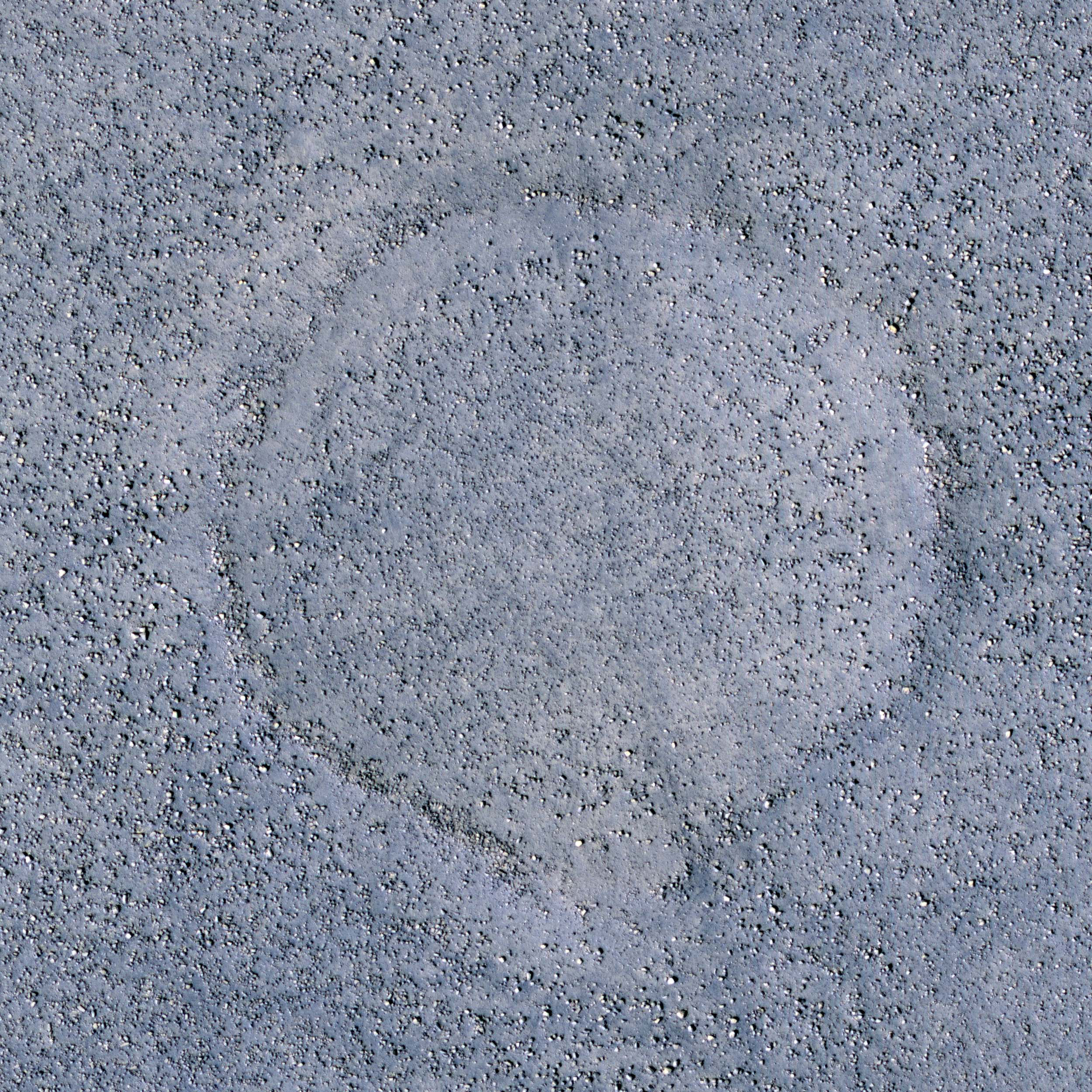
Common to the northern plains of Mars are rock and boulder strewn landscapes otherwise devoid of major features, short of a few impact craters. This image in the Cydnus Rupes region of northern Utopia Planitia is an excellent example of this sort of terrain.

Boulders up to several meters in size densely coat the landscape. The concentration of these boulders varies at several scales. In some areas only smaller rocks less than a meter across dominate the surface, while a couple hundred meters away may be a somewhat circular "blotch" of larger boulders. Often these blotches of boulders coincide with a faint circular ridge, the remnant of an impact crater now reduced by erosion and infilling to a a mere hint of a crater rim. The abundant boulders excavated by the impact, however, remain scattered over the surface to mark the past event.

Close examination of excavated large rocks and boulders may yield clues to the geologic processes that have shaped the regional landscape over Martian history. However, as a future landing site, these terrains are perilous. Large boulders can damage landing gear and puncture the underside of spacecraft. Rovers would find it extremely difficult to traverse through dense populations of large rocks and boulders.

Photo credit: NASA/JPL/University of Arizona

Notes: For a similar landscape, see Signs of Aeolian and Periglacial Activity at Vastitas Borealis. The Cydnus Rupes region is located in the northern half of Utopia Planitia. This particular location (55.5° North, 131.0° East) is northwest of Mie Crater.

Thursday, April 8, 2010

Barchan Dune Field in Arkhangelsky Crater


This VIS image shows part of the dune field located on the floor of Arkhangelsky Crater.

Note: The type of dunes present in this photo are known as barchan dunes, also known as crescent-shaped or transverse dunes. Barchans are generally wider than they are long. The slipfaces of the dune are on the concave side (the shorter, downward slope). These dunes form under winds that blow consistently from one direction (the side of the dune with the longer, upward slope; the "horns" of the dune are downwind, and point the general direction that the dune is moving).

Photo credit: NASA/JPL/Arizona State University

Mesas in Aureum Chaos


This image reveals the meter-scale surface textures of mesas and knobs in the Aureum Chaos region of Mars.

Aureum Chaos is a wide region of plateaus, mesas, and knobs. Most of the rocks in this area appear to have formed originally as laterally continuous layers through volcanic or sedimentary processes. Loss of groundwater or ground ice could have then caused the ground to collapse, forming the network of deep valleys and isolated hills we see today. Subtle layering of these rocks can be observed along many slope faces jutting out from under a mantle of surface sediments.

Also present along many slopes are dark-toned, discontinuous lineations. These are tracks left behind by boulders that rolled down the slopes. These boulders are often located at the down hill end of the tracks.

Photo credit: NASA/JPL/University of Arizona

Wednesday, April 7, 2010

Arsia Mons Lava Flows


The lava flows in this VIS image are part of the extensive flow field of Arsia Mons.

Photo credit: NASA/JPL/Arizona State University

Collapsing Volcano


This image covers the northern edge of the largest volcano in the solar system, Olympus Mons. The margin of Olympus Mons is defined by a massive, tall cliff. At this location, it is nearly 7 kilometers (23,000 ft) tall. The cliff exposes the guts of the volcano, revealing interbedded hard and soft layers. The hard layers are lava and the soft layers may be dust (from large dust storms) or volcanic ash.

This HiRISE image also shows a large tongue of material that has flowed over the giant cliff. While superficially similar to lava flows, this flow is actually a landslide. Most scientists think the the cliffs also formed by landslides, just much bigger ones. All this collapse is driven by the weight of the huge volcano exceeding the strength of the rocks of which it is composed.

Photo credit: NASA/JPL/University of Arizona

(Note: I wanted to explain my choice of link with respect to "weight of the huge volcano" in the second paragraph. As you can see, I chose to link to Kim Stanley Robinson's anthology, The Martians; the reason being, in his 1985 novella, Green Mars (not to be confused with the novel of the same name), Robinson devoted several pages (pp. 192-95) to this topic, explaining why the weight of Olympus Mons created such a towering escarpment that encircles the base of the volcano. This section of the novella is too long to include as part of this post, so I'll leave it to my readers to dig up the anthology to read for themselves.)

Tuesday, April 6, 2010

Coprates Catena


This VIS image shows a small portion of the floor of Coprates Catena. Coprates Catena is just south of the Valles Marineris canyon system. The catena is not as deep as the main canyon. The lighter toned materials in the center of the image are layered deposits.

Photo credit: NASA/JPL/Arizona State University

Samara Valles


Samara Valles is one of the longest ancient valley systems on Mars. This system traverses over 1000 kilometers towards the northwest across the heavily cratered Southern highlands eroding into the gentle slopes of Terra Meridiani. The valley terminates in the Northern lowlands within the Chryse Basin where both Viking Lander 1 and Pathfinder are located.

The full image is centered at 27 degrees South and 344 degrees West and transects a portion of the upper reach of Samara Valles. The valley is several hundred meters wide at this location and the surface is mantled with dust as evidenced by the system of dunes that line the valley floor. The surface is heavily cratered by ancient impacts whose ejecta blankets have long ago been eroded and subsequently buried by dust which mantles the entire region.

Photo credit: NASA/JPL/University of Arizona

Monday, April 5, 2010

Landslide in Aurorae Chaos


The landslide deposit in this VIS image is located in Aurorae Chaos. Several regions of chaotic terrain are located on the eastern end of the Valles Marineris system.

Photo credit: NASA/JPL/Arizona State University

Deposits on the Floor of Palos Crater


This image shows a portion of the floor in Palos Crater. The floor appears bumpy with high-standing layered knobs. Most of the terrain on the floor is weathering into meter-size polygonal blocks. The circular structures in the image, many of which are filled with darker aeolian material, are eroded impact craters.

Palos Crater is breached in the south by the 180 kilometers-long Tinto Vallis. Water transported along Tinto Vallis could have could have collected into Palos Crater to form a lake that later drained to the north. Sediments carried by Tinto Vallis would have also been deposited within Palos Crater so the layered unit we see along the floor today could represent these fluvial sediments.

Photo credit: NASA/JPL/University of Arizona

Note: Palos Crater and Tinto Vallis are located in the Mare Tyrrhenum Quadrangle of Mars. This area lies southeast of Isidis Planitia.

Sunday, April 4, 2010

Icy Layers and Climate Fluctuations at the Martian North Pole


Sometimes icy layers can be ablated away during warm climates. Later the ice sheet can be buried by new ice layers and grow in size again; it's likely that many of these cycles have occurred over the ice sheet's history.

The Martian north polar layered deposits are an ice sheet much like the Greenland ice sheet on the Earth. Just as with the ice sheet in Greenland, this Martian ice sheet contains many layers that record variations in the Martian climate.

These sorts of fluctuations in the thickness of the ice sheet are most pronounced at the edges of the sheet where this HiRISE image was taken. The ice sheet ends here in a gentle scarp that slopes about eight degrees downhill from bottom to top in this image. The layering within the ice is exposed on this sloping surface; the thickness of the ice here is about 1 kilometer (about 3300 feet). Scientists are analyzing these layers to see what information they might hold regarding previous Martian climates.

Most of the layers are parallel to each other. However, if you look more closely at the layers near the base of the slope then you can see that they are orientated at odd angles to each other. This happens when the ice sheet undergoes the fluctuations in thickness described above. Ice is ablated away and the new ice sheet surface cuts at an angle through several layers. When ice starts being laid down here again, it is in layers parallel to the surface and so at an angle to the older layers. Much later this sloping surface was created by erosion and gives us a cross-sectional view of all the layers and the angles they make with each other. When sloping layers are truncated by flat ones like this geologists call it an angular unconformity.

This location is especially interesting because the ice sheet partly covers an impact crater that is about 17 kilometers (about 10 miles) in diameter. You can see the rim of this crater on the flat terrain in the top quarter of the image. The curving crater rim is partly buried by the ice sheet here. The slopes within the crater caused the lowest elevation ice layers to be tilted and probably led to the abundance of angular unconformities at this location.

Photo credit: NASA/JPL/University of Arizona

Note: This photo was taken at the southern edge of the north polar ice cap, Planum Boreum, at 79.3° North, 351.5° East.

Saturday, April 3, 2010

Dust-Mantled Topography Near Zephyria Tholus


This image covers some high-standing topography just outside the rim of an approximately 30 kilometer diameter impact crater. What formed this hill? Could it be a volcano? That was hypothesized to be the case in a paper published in 2001, and this suggestion was entered to test that idea, perhaps from seeing internal layering exposed by the crater.

This is an example of what we regard as an excellent science justification—following up on a testable hypothesis with specific observational goals. It was entered by blogospherian Emily Lakdawalla of the Planetary Society. If you're thinking we chose to acquire this image early because we want her to blog nice things about HiRISE and HiWiSH, you're right! But it's also a good suggestion.

So what does the HiRISE image show us? Mostly it shows a dust mantle, hiding the bedrock it was intended to study. The dustiness is especially apparent from the uniformity of the color data. Much of Mars is covered by dust, so we often favor the relatively dust-free patches for HiRISE imaging. (You can usually tell whether a surface is dusty by looking at dust index maps and the THEMIS nighttime IR mosaic.) We hope to get the nighttime IR map entered as a layer of HiWISH to help image suggesters.

The night-IR bright (warm) stuff is rocky or sandy, and dark (cool) stuff is probably dusty. Dust cools off rapidly at night while rocks store and slowly release heat. If the dust is thin, HiRISE images can still show the underlying meter-scale morphology. Maybe someone will want to study the dust-related processes on Mars, which are actually not well understood. Additionally, dusty surfaces are where we can find new impact craters that disturb the dust and make easy-to-see dark spots. We'll see if Emily finds something interesting in this image.

Photo credit: NASA/JPL/University of Arizona

Note: This photo was taken near the small dome-shaped mountain, Zephyria Tholus, which is located in Terra Cimmeria. The closest major feature to this location is Ma'adim Vallis, which is to the east.

Friday, April 2, 2010

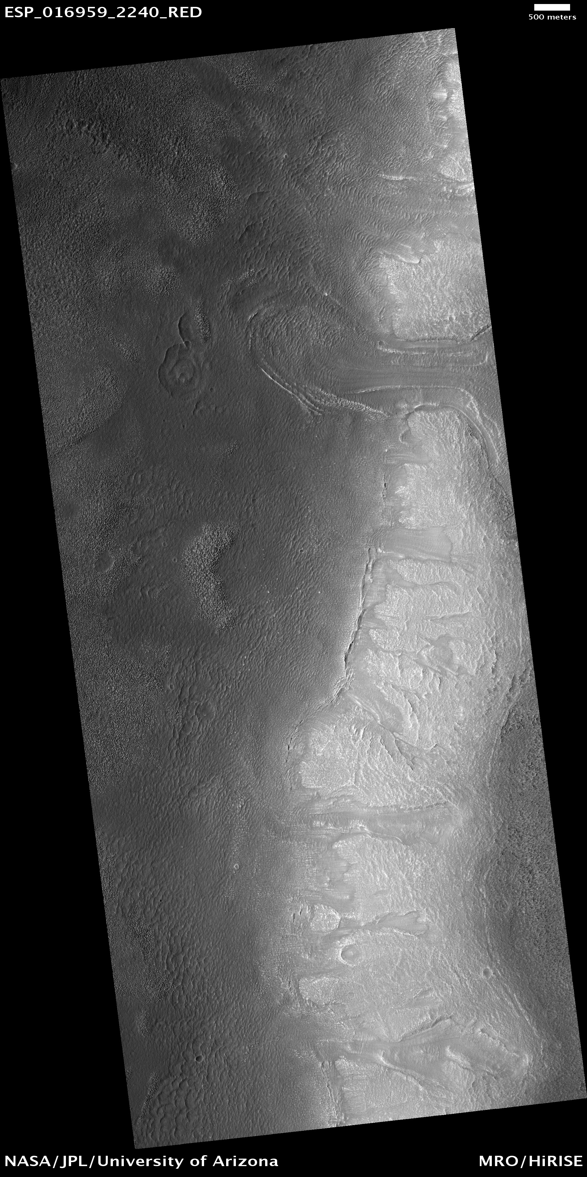
Lobate Debris Apron in Deuteronilus Mensae

 (ESP_016959_2240)

This observation is located in the Deuteronilus Mensae region along the highland/lowland dichotomy boundary in the Northern hemisphere of Mars.

This region contains many mesas surrounded by lobate debris aprons that are thought to be ice-rich. These aprons have been interpreted as a variety of possible features including rock glaciers, ice-rich mass movements, or debris-covered glacial flows. Recent radar data from the MRO SHARAD instrument has shown them to be composed of nearly pure ice.

The full image shows the edge of one of these mesas with a lobate debris apron extending from its base. Both the mesa top and the surface of the debris apron appear covered with ice-rich mantling materials characteristic of the Martian mid-latitudes and thought to have been deposited around 10 million years ago during a period of high obliquity. Ice-rich flows also extend down the side of the mesa onto the surface of the apron, as evidenced by the lobate flow near the top of the image. Several alcoves can also be seen along the mesa wall that appear to be filled with "pasted-on" mantling deposits. Similar features have been observed along the walls of Dao Vallis east of the Hellas Basin, a mid-latitude region that also contains lobate debris aprons.

Photo credit: NASA/JPL/University of Arizona

Note: Deuteronilus Mensae is an "archipelago" of flat-topped knobby terrain located between Lyot Crater to the north and Arabia Terra to the south.

Thursday, April 1, 2010

Signs of Aeolian and Periglacial Activity at Vastitas Borealis


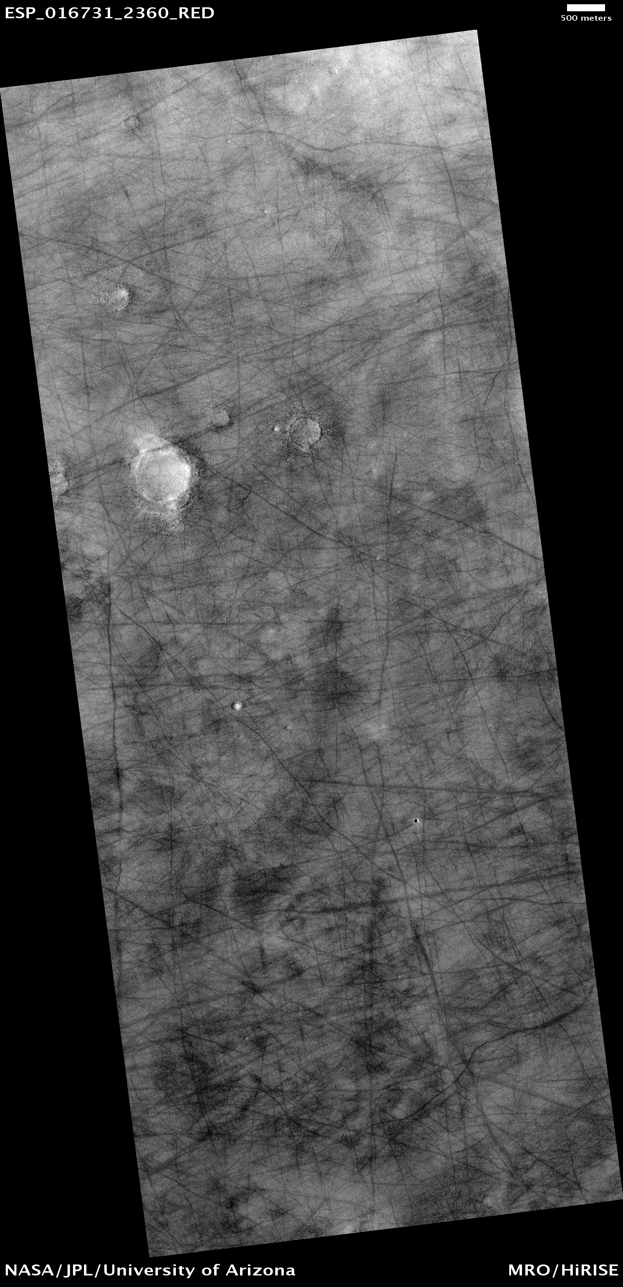
This observation shows a region of approximately 7 x 7 kilometer (4.4 x 4.4 miles) located in Vastitas Borealis, part of the Northern Plains.

The surface imaged is relatively young, as indicated by the lack of recent impact craters. Aeolian and periglacial activity seem to be the dominant geological processes at work, as shown by numerous crisscrossing dust devil tracks and ubiquitous polygonal features, respectively.

Dust devils form when the sun warms up the air near a flat, dry surface. Warm air then rises quickly through the cooler air above and starts spinning, causing a forward motion. The spinning, forward-moving cell may pick up dust and sand as it advances, thus leaving behind a "clean" track. We infer from this image that a thin veneer of light-colored particles of dust and/or fine-grained sand cover relatively darker materials, apparent in the dust devil tracks.

The tracks pictured in this image are in many cases more than 30 meters (27 yards) wide and over 4 kilometers (2.5 miles) long, surpassing the dimensions of average terrestrial dust devil tracks.

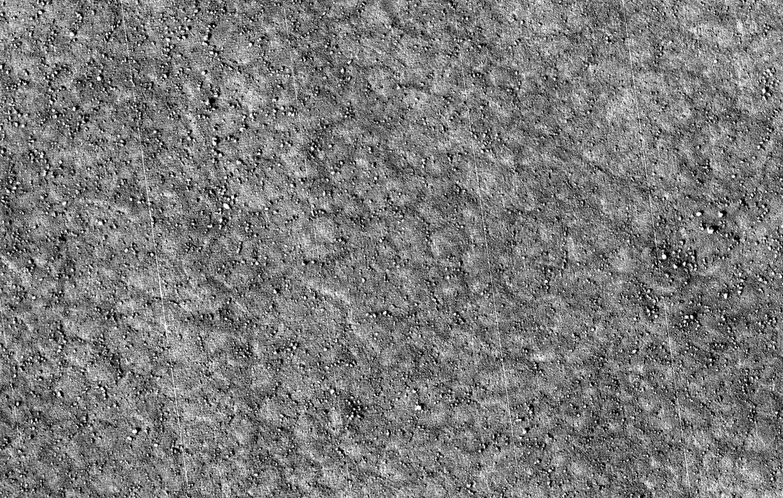
The polygons visible in the subimage, which covers approximately 400 x 250 meters (350 x 225 yards), are in the order of 10 meters (0.9 yards) across; in some cases they are delimited by aligned rocks. Similar features in both shape and scale are found in terrestrial periglacial regions such as Antarctica, where ice is present at or near the surface.

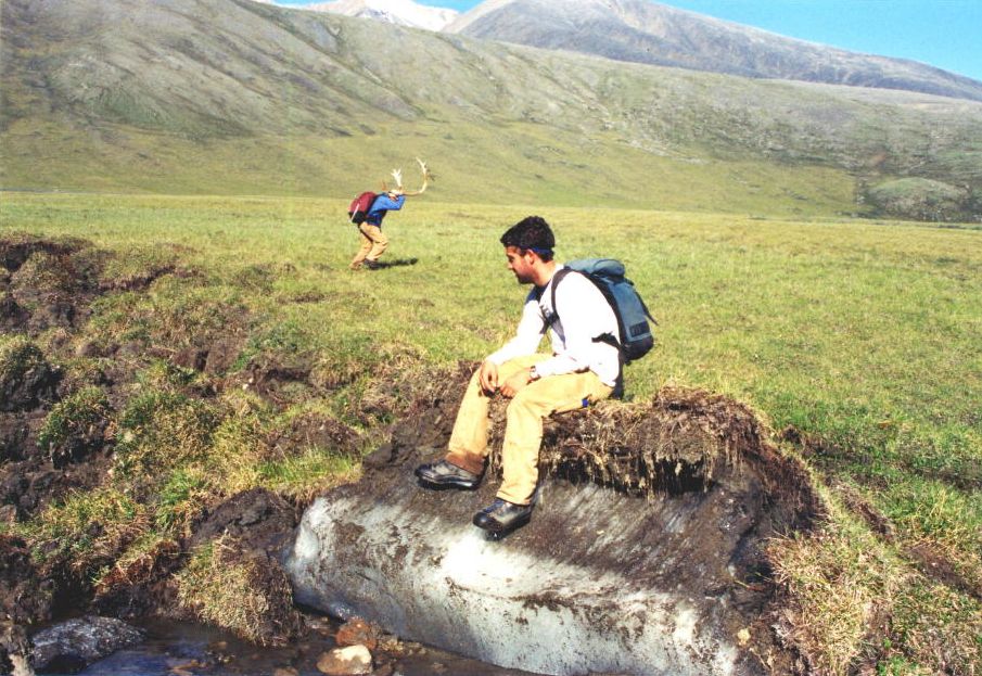
Antarctica's polygons and rock alignments are produced by repeated expansion and contraction of the soil-ice mixture due to seasonal temperature oscillations; dry soil falling into the cracks form sand wedges and amplify this effect. This results in polygonal networks of stress fractures and in the resurfacing and sorting of rocks along these fractures.

(Thin diagonal lines are artifacts in the image).

Photo credit: NASA/JPL/University of Arizona

Wednesday, March 31, 2010

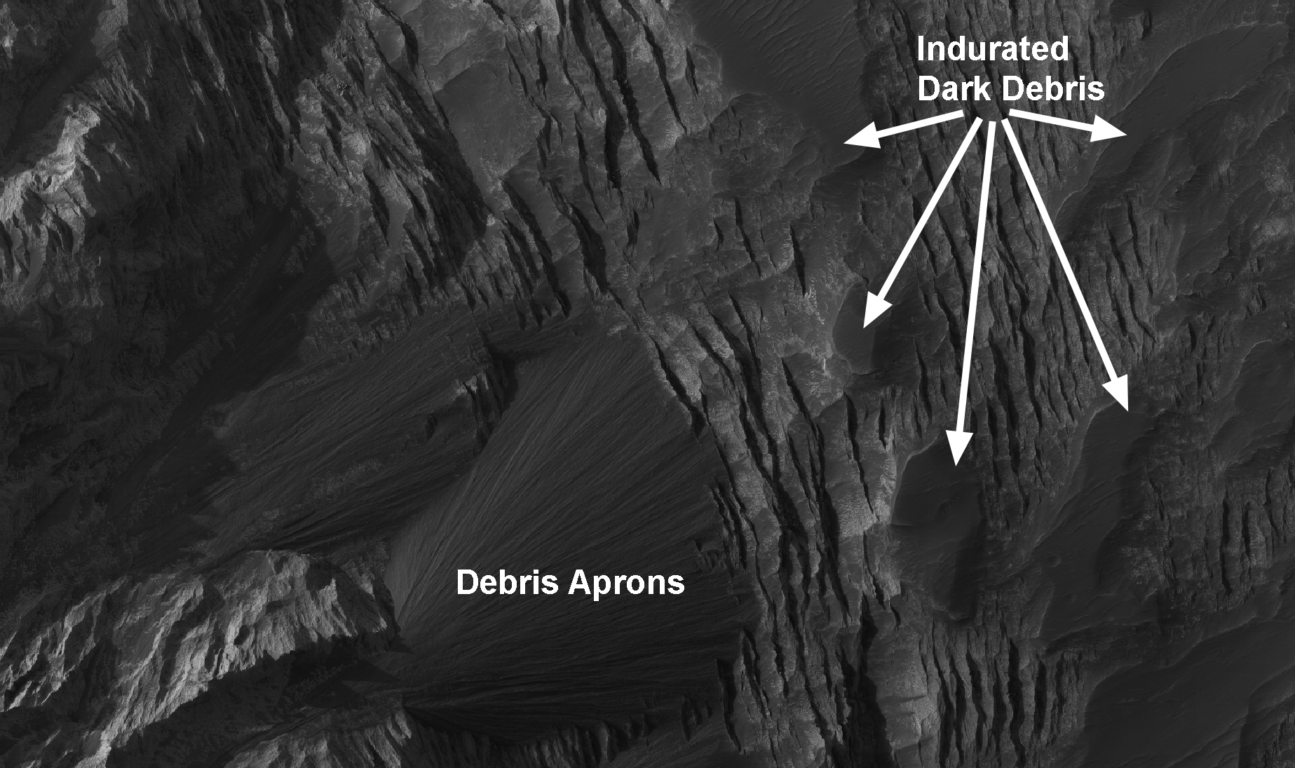
Layers and Dark Debris in Melas Chasma


This subimage shows layering in a light-toned deposit in Melas Chasma.

The layers are sedimentary in origin, but there are many processes that could have deposited them, such as volcanic airfall from explosive eruptions, or dust-size particles settling out of the atmosphere due to cyclic changes, and deposition in standing bodies of water.

By looking at the slopes in the layers and how the layers intersect each other, scientists can rule out various origins. A darker material can be seen covering much of the layered deposit. Some of this dark material is loose and can be seen accumulating as debris aprons at the base of steep slopes. Other dark material appears indurated and has been eroded by the wind to form etched edges with topographic expressions.

The lack of impact craters on the layered deposit indicates that it is a relatively young deposit, or the craters have been removed by the wind, or the deposit was quickly buried and is now being exhumed.

Photo credit: NASA/JPL/University of Arizona

Tuesday, March 30, 2010

Opportunity at the Edge of Concepción Crater


This image shows the Mars Exploration Rover Opportunity perched on the [southwestern] edge of Concepción Crater in Meridiani Planum, Mars.

Concepción Crater is a fresh, 10 meter-diameter crater with dark rays that clearly overprint the north trending aeolian ripples. The dark rays are produced by shadows cast by blocky ejecta and the presence of the rays and similar relationships with other fresh craters in Meridiani Planum indicate that this is likely the youngest crater visited by either rover on Mars (estimated to have impacted thousands to tens of thousands of years ago).

This image was acquired by HiRISE on 13 February 2010, on sol 2153 of Opportunity’s mission on Mars. Note the rover tracks in the ripples to the north and northwest of the rover. Scientists use these high-resolution images (about 25 cm/pixel) to help navigate the rover. In addition, rover exploration of areas covered by such high-resolution images provides “ground truth” for the orbital data.

Photo credit: NASA/JPL/University of Arizona

Monday, March 29, 2010

Rotational Landslides or Slumps Along Walls of Bahram Vallis


Bahram Vallis is a narrow-winding valley (20-22 North, 301-304 East) that terminates at the circum-Chyrse Basin on Mars.

The valley has numerous circular to sub-circular alcoves along its slopes, some with large deposits directly below on the valley floor. These features are evident from earlier image datasets of Mars including THEMIS, MOC, and HRSC, and are indicative of mass-wasting processes that have occurred along the valley walls.

A portion of the valley was imaged by the HiRISE camera at approximately 30 centimeters/pixel resolution in a location with both alcoves and valley floor deposits. Several features are apparent: a well-defined circular crown and main scarp, tensional cracks along the crown margins, and a well-defined accumulation zone with slump deposits.

The general appearance of these landslides is similar to terrestrial rock and/or loose earth rotational landslides. The Bahram landslides are also different from other well-documented landslides on Mars, such as those in the Valles Marineris canyon system that have lobate forms and longitudinal and/or transverse ridges on their surfaces. Future study of these landslide deposits will incorporate elevation data from the digital topographic model to assess the stability of valley walls using standard earth geotechnical models.

Credit: NASA/JPL/University of Arizona/USGS

Note: While doing research for the various links in this post, I came across this short flyby animation of the Bahram Vallis that uses HiRISE data. Enjoy!

Sunday, March 28, 2010

Deformed Layered Sediments in Western Hellas Planitia


The western margin of Alpheus Colles (the large plateau in Hellas Planitia) is bound by a large depression that is the deepest point in the Hellas basin and also the lowest terrain on Mars.

This region is characterized by highly deformed layered sediment nicknamed "honeycomb" or "taffy pull" terrain. The origin of this unusual layered sediment is unknown, but it may be related to an ancient lake or ocean in Hellas.

Photo credit: NASA/JPL/University of Arizona