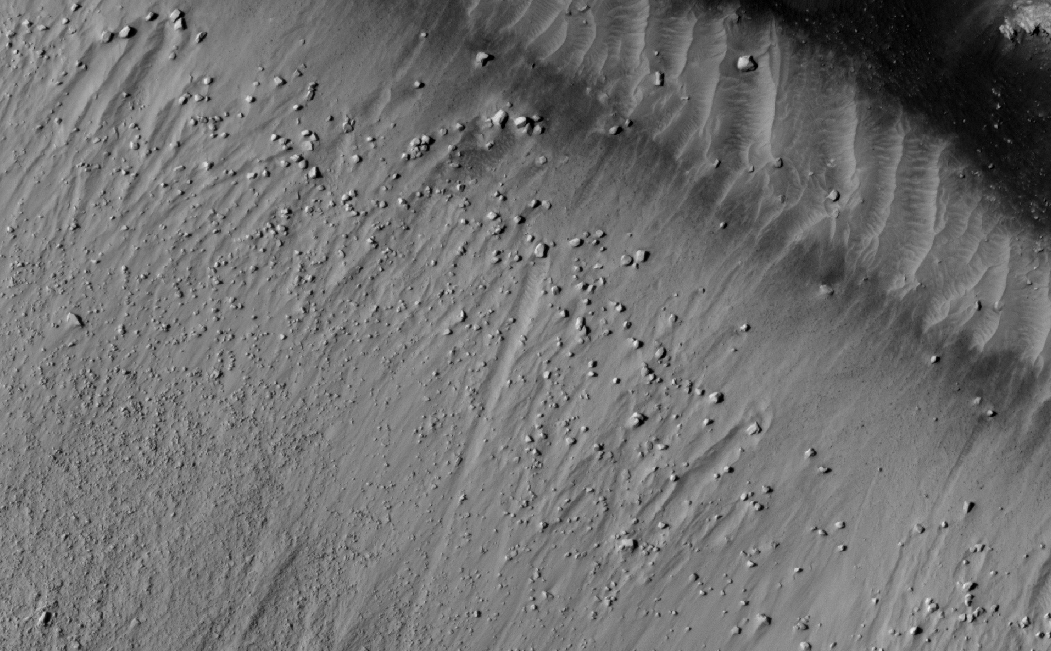
The dunes here are linear, thought to be due to shifting wind directions. In places, each dune is remarkably similar to adjacent dunes, including a reddish (or dust colored) band on northeast-facing slopes. Large angular boulders litter the floor between dunes.
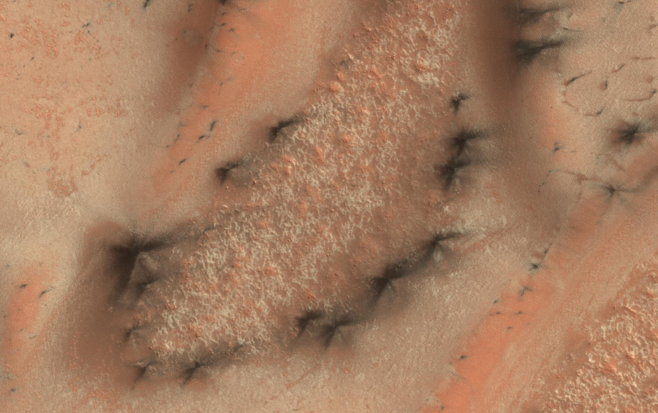
Dunes are often found on crater floors. In the winter time at high northern latitudes the terrain is covered by carbon dioxide ice (dry ice). In the spring as this seasonal ice evaporates many unusual features unique to Mars are visible.
On the floor of this crater where there are no dunes, the ice forms an uninterrupted layer. On the dunes however, dark streaks form as surface material from below the ice is mobilized and deposited on top of the ice. In some cases this mobile material probably slides down the steep face of the dune, while in other cases it may be literally blown out in a process of gas release similar to removing a cork from a champagne bottle.
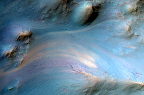
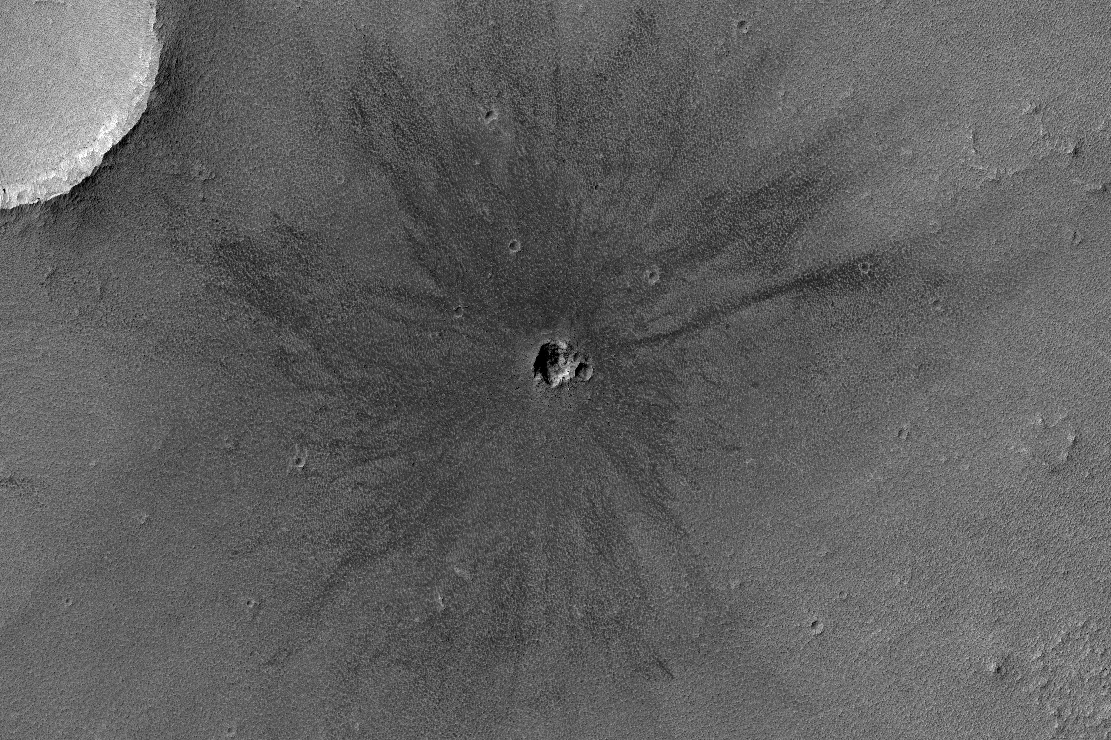
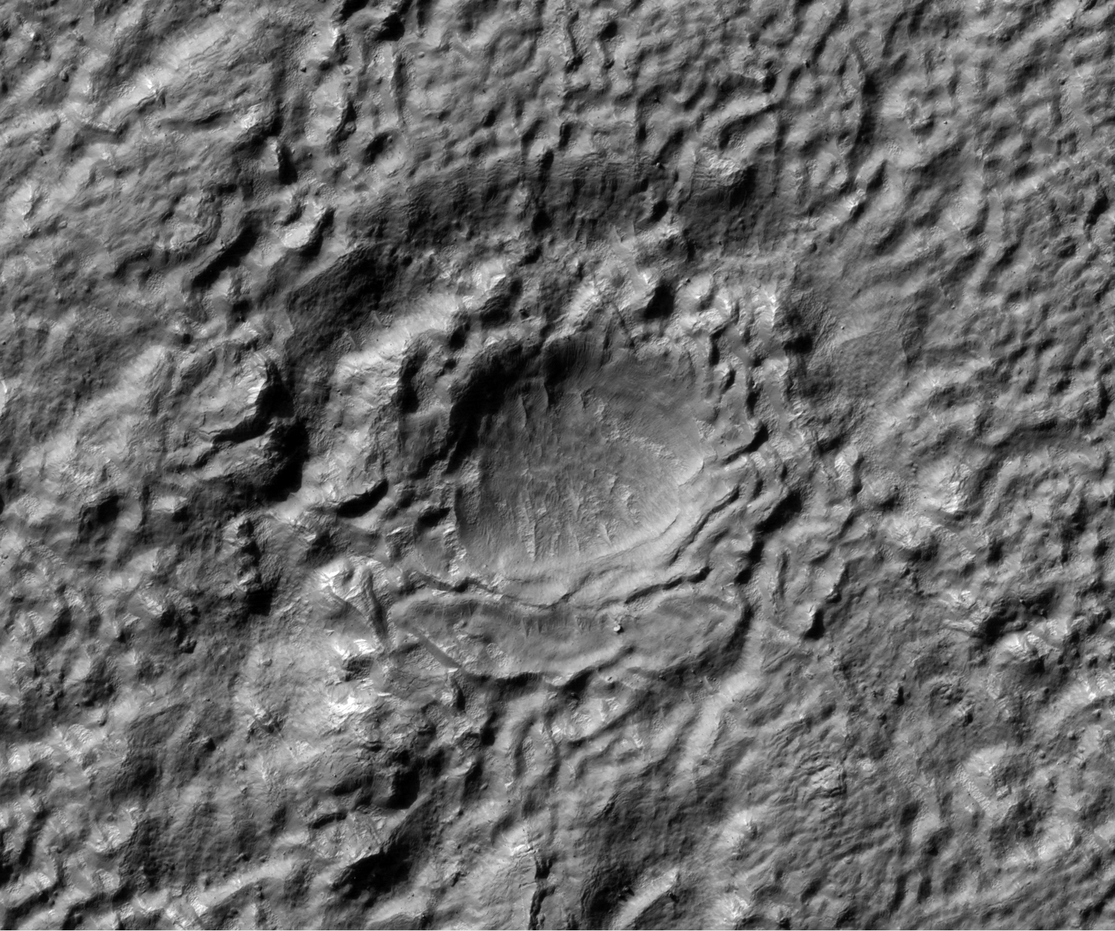
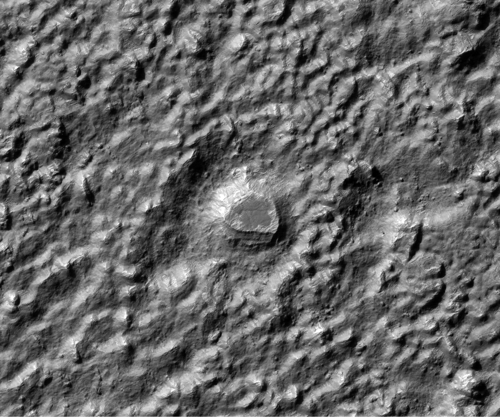
This is an image of the central pit of an impact crater in the ancient highlands.
The central uplifts of large impact craters often collapse to form pits on Mars, but they are still structural uplifts and often expose deep bedrock with diverse rock types which have a variety of colors.
Note: This crater is located in the Memnonia Quadrangle; the closest significant crater to this location is Magelhaens Crater, which is named after the Portuguese explorer, Fernão de Magalhães (1480-1521), better known in the English language as Ferdinand Magellan. Magelhaens Crater is to the southeast of this image.
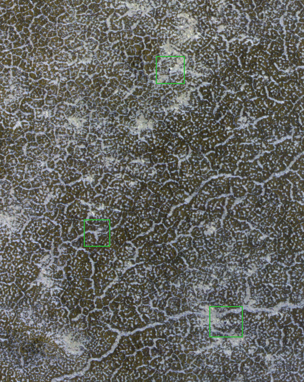
During the long polar-winter night atmospheric carbon dioxide freezes onto the surface building up a layer of frost roughly 30 centimeters (about one foot) thick. In the spring this frost returns to atmosphere gas (sublimates) over the course of several months. This image, part of a seasonal frost monitoring sequence, shows some areas of bare ground are beginning to be exposed. However, extensive frost patches remain in the topographic lows, such as the troughs of the local polygonally patterned surface.
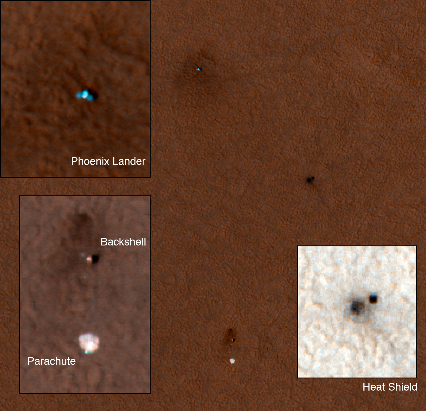
The solar arrays on the lander were clearly discernible from their distinctive bluish color in HiRISE images acquired last Martian northern summer. The enhanced color subimage [the image above] has green boxes around the backshell (top), heat shield, and lander (bottom). They are not discernible in this new image, probably because the patchy frost effectively camouflages them. (For a comparison, see PSP_008855_2485, particularly the subimage there.)
Even when the frost has completely sublimated, dust deposited during the winter may obscure them. The parachute attached to the backshell is also not apparent in this image, and we'll see if it reappears in later images. Also gone are the darkhalos around the lander, backshell, and heat shield, again due to seasonal frost and/or dust. This and future images will help calibrate expectations for finding the Mars Polar Lander hardware which encountered Mars in 1999.
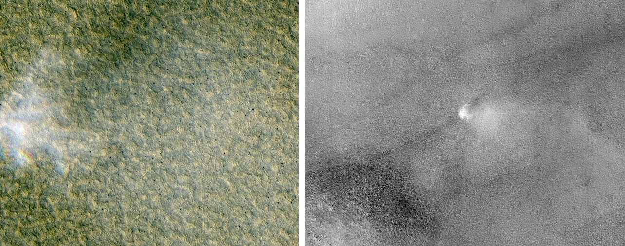
This image was targeted to study knobs in Mars' northern plains, just north of Scandia Crater. The knobs are clearly imaged, but what surprised scientists was a dust devil visible in the south-central part of the image.
As on Earth, dust devils form when ground heated by sunlight warms the air above it. The hot air rises, forming an updraft accompanied by vortical motions. Because warm ground is a requirement, dust devils on Mars generally form in late spring to summer, especially at high latitudes.
This image was taken in early spring (2010), at a latitude of 61 degrees North. No dust devil has been seen this far from the equator at such an early season before.
Note: The location of this dust devil and Scandia Crater are both in the Scandia Colles region of the Vastitas Borealis, and is located in the Diacria Quadrangle. Scandia Crater is located almost due north of Milankovic Crater, which is the most prominent crater in that region.
It has unusual thermal properties and distinctive morphologies, but lacks spectral absorption bands. All of these characteristics and the geologic settings are consistent with salt deposits. These deposits are often associated with clay minerals that do have distinctive absorption bands.
This particular location has been selected as a candidate landing site for the Mars Science Laboratory or another future rover. Hopefully the HiRISE images won't reveal too many boulders or steep slopes that would be hazardous. A stereo anaglyph is also available.
Images from the recent flyby of Phobos, on 7 March 2010, were released on March 15th. The images show Mars' rocky moon in exquisite detail, with a resolution of just 4.4 meters per pixel. They show the proposed landing sites for the forthcoming Phobos-Grunt mission.
ESA's Mars Express spacecraft orbits the Red Planet in a highly elliptical, polar orbit that brings it close to Phobos every five months. It is the only spacecraft currently in orbit around Mars whose orbit reaches far enough from the planet to provide a close-up view of Phobos.
Like our Moon, Phobos always shows the same side to the planet, so it is only by flying outside the orbit that it becomes possible to observe the far side. Mars Express did just this on 7, 10 and 13 March 2010. Mars Express also collected data with other instruments.
Phobos is an irregular body measuring some 27 × 22 × 19 km. Its origin is debated. It appears to share many surface characteristics with the class of 'carbonaceousC-type'asteroids, which suggests it might have been captured from this population. However, it is difficult to explain either the capture mechanism or the subsequent evolution of the orbit into the equatorial plane of Mars. An alternative hypothesis is that it formed around Mars, and is therefore a remnant from the planetary formation period.
In 2011 Russia will send a mission called Phobos–Grunt (meaning "Phobos-Soil") to land on the Martian moon, collect a soil sample and return it to Earth for analysis.
For operational and landing safety reasons, the proposed landing sites were selected on the far side of Phobos within the area 5°S-5°N, 230-235°E. This region was imaged by the HRSC high-resolution camera of Mars Express during the July-August 2008 flybys of Phobos. But new HRSC images showing the vicinity of the landing area under different conditions, such as better illumination from the Sun, remain highly valuable for mission planners.
It is expected that Earth-based ESA stations will take part in controlling Phobos-Grunt, receiving telemetry and making trajectory measurements, including implementation of very long-baseline interferometry (VLBI). This cooperation is realized on the basis of the agreement on collaboration of the Russian Federal Space Agency and ESA in the framework of the 'Phobos-Grunt' and 'ExoMars' projects.
Mars Express will continue to encounter Phobos until the end of March, when the moon will pass out of range. During the remaining flybys, HRSC and other instruments will continue to collect data.
This HiRISE image shows a part of Nanedi Vallis, one of the Martian valley networks. The valley networks are thought to have formed by flowing water in the distant past when the climate on Mars was warmer and wetter than it is today.
Some scientists have suggested that the valley networks could have been produced in a climate like the dry, cold one of Mars today if the liquid water was protected by an overlying ice layer. Others think that glacial activity may be responsible for them, but the majority believe that the valley networks are evidence of ancient flowing water.
Valley networks are characterized by their blunt, theater-shaped heads and their approximately constant width along their reaches. They often have tributaries, as seen in this image, that connect with the main trunk of the valley.
This image shows a part of the western flank of Ascraeus Mons. Ascraeus Mons is one of the giant volcanoes of the Tharsis volcanic region of Mars.
It is a shield volcano, so named because of the gently-sloped round shape. Terrestrial examples, like Mauna Loa and Kilauea on Hawaii, are formed mostly by repeated eruptions of fluid (basaltic) lava. Martian volcanoes can attain much larger sizes partially because Mars lacks plate tectonics, allowing eruptions to persist at the same site for a long time.
In this HiRISE image, the surface is covered by a mantle of dusty material which obscured the underlying surface. This has been sculpted into regular textures, probably by aeolian (wind) erosion. It appears that there are multiple layers, as the southeast portion of the image shows textured knobs standing above a similarly patterned surface. The origin of the dusty mantle is unclear. It could be wind-blown dust, but it is also possible that some of it is volcanic ash erupted from Ascraeus Mons.
This image captures a tongue-shaped lobate flow feature along a interior crater wall located in eastern Hellas Planitia.
The flow feature is approximately 5 kilometers long and 1 kilometer wide with a partial double inner ridge and raised outer margin. The flow feature's surface is generally devoid of impact craters and parts of its outer margin have deflected around obstacles.
Similar flow features, though not as distinctively tongue-shaped as this one, are found in many other craters throughout the southern mid-latitudes of Mars.
Recent studies of these flow features have determined a latitudinal dependence to which side of the crater interior these features are formed upon. For this particular flow feature, it has formed on the pole-facing slope. This polar or equatorial-facing preference has implications for the amount of solar insolation these slopes are receiving, which may be a result of recent climate change due to shifts from low to high obliquity.
Although there are a few truly giant shield volcanoes on Mars, there are also many smaller shield volcanoes. We are interested in imaging the vent regions of volcanoes to understand volcanic processes, and also to search for any signs of especially recent activity.
The floor of Hellas Basin is often obscured by atmospheric haze and dust, but it tends to be quite clear this time of year (northern spring and southern fall).
HiRISE images are revealing some very strange landforms on the floor of Hellas. Materials appear to have flowed in a viscous manner, like ice. Viscous flow features are common over the middle latitudes of Mars, but those in Hellas are often distinctive for unknown reasons.
The subimage shows an interesting area in color (reddish areas are dustier).
The crater was first seen in an image acquired with MRO's Context Camera (CTX). The best image of this region prior to CTX was from one of the VikingOrbiters, and the crater isn't apparent in that image. This could mean that the crater formed sometime between 1976 and 1999, or there may have been more dust on the surface in 1976 or the air may have been hazy, obscuring the crater.
Based on the HiRISE image, we suspect that the crater is more than several decades old, because at full resolution we see a textured surface that is common in dust-mantled regions of Mars, but absent in the youngest craters.
In this subimage streaks of dark basaltic sand have been carried from below the ice layer to form fan-shaped deposits on top of the seasonal ice. The similarity in the directions of the fans suggests that they formed at the same time, when the wind direction and speed was the same. They often form along the boundary between the dune and the surface below the dunes.
Large boulders that have been dislodged from the graben walls are visible on the floor of Cerberus Fossae. The first subimage shows an example of an approximately 6 meter (20 feet) boulder that left a distinct track as it moved downhill. Although this track is quite clear, ripples inside the track are discernible, indicating that enough time has passed for wind activity to rework loose material into the form of ripples. With close examination of this observation, one can see many boulder tracks, some with ripples and some without ripples.
Wind streaks emanating from impact craters are visible on the plains surrounding Cerberus Fossae. The second subimage shows a false color image of an approximately 33 meters (108 feet) impact crater. Material on the crater floor (blue in the color image) is being moved by the wind out of the crater and across the plains. The wind streaks in this observation indicate that the predominant wind direction in this region is from East to West.
This image covers part of a candidate landing site that appears to be a shallow depression with a deposit perhaps consisting of chlorides, like table salt.
The relatively bright material broken up into polygons or other patterns is possibly chloride. Such deposits occur in playas on Earth, and imply the past presence of water and a habitable (but not necessarily inhabited) environment. The HiRISE images will help to interpret the geology and to determine if this spot is a sufficiently safe landing site—not too many boulders or steep slopes. If it is safe enough, this site will be considered further as a landing site for the 2011 Mars Science Laboratory or for a European or NASA rover to be launched in 2018 according to current plans.
Be sure also to look at the stereo anaglyph for more detail.
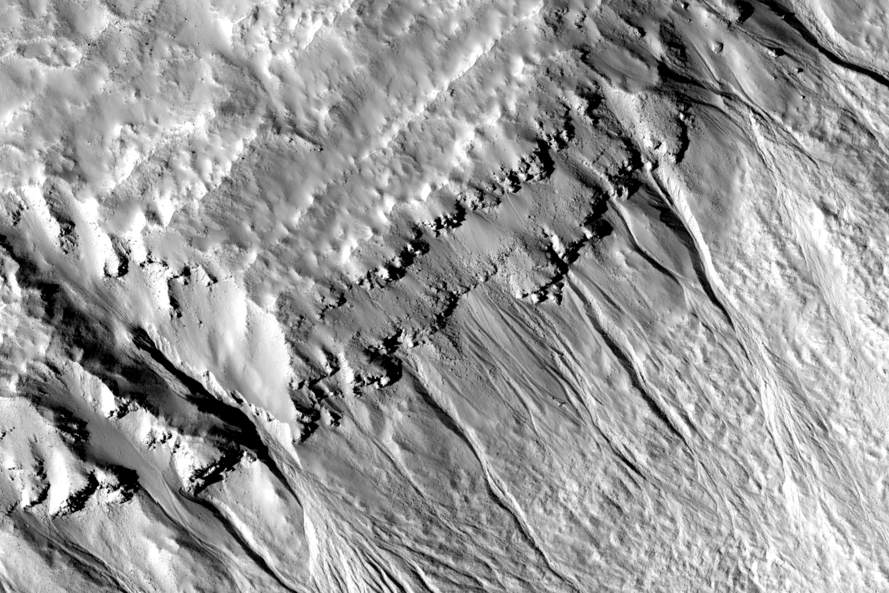
This observation shows northern hemisphere gullies on a layered crater wall.
Many channels are visible emanating from beneath layers suggesting that the layers are permeable and carried water to the slope face via the subsurface. It is also possible that the source of water came from the surface. The gullies that do not originate at a layer likely did at one time and have subsequently experienced headward erosion, eroding the layers upslope of their original location.
A mantled unit (smooth terrain) is visible the sources of and within many of the gullies in this image. The mantled unit has been proposed to be remnant snowpack that melts at its bottom to carve gullies. The mantled unit is less abundant in locations where the gullies are most deeply incised, which supports the melting snowpack theory.
Deeper incision typically involves more water and/or more flow events. If the mantled unit is the source of the liquid for the gullies, then it is expected that locations with evidence of larger or more frequent flows would be associated with regions of less mantled unit. It is unknown whether the mantled unit can insulate the surface sufficiently to allow temperatures and pressures appropriate for liquid water formation. An answer to this awaits future modeling of snowpack under Martian conditions.
Within the subimage, channels can clearly be seen to originate at a variety of layers. Also noticeable is the smooth, mantled material located between layers above these gullies.
Calderas form when magma (molten rock) is removed from the magma chamber in the volcano, and the roof of the magma chamber collapses into the resulting void. In the case of Arsia Mons, there are relatively young lava flows that overtop the northeast rim of the caldera.
This HiRISE image samples some of these lava flows. The long elliptical depression is the summit crater of a small shield volcano that fed some of these lava flows. At HiRISE resolution, we see that even these younger lavas are covered by a thick layer of dust. The small dark-rayedcrater in the southwest edge of the image shows that the rock under the dust is dark, as expected of lava.
This HiRISE image shows the scarp that demarcates the boundary between layered deposits covering the north polar region and the lower surrounding terrain, which includes sand dunes.
This image was taken in the northern hemisphere Martian spring, where it is still cold enough that white carbon dioxide frost covers most of the area. At about the same time in the previous Martian spring (February 2008), HiRISEcaught four avalanches at this location.
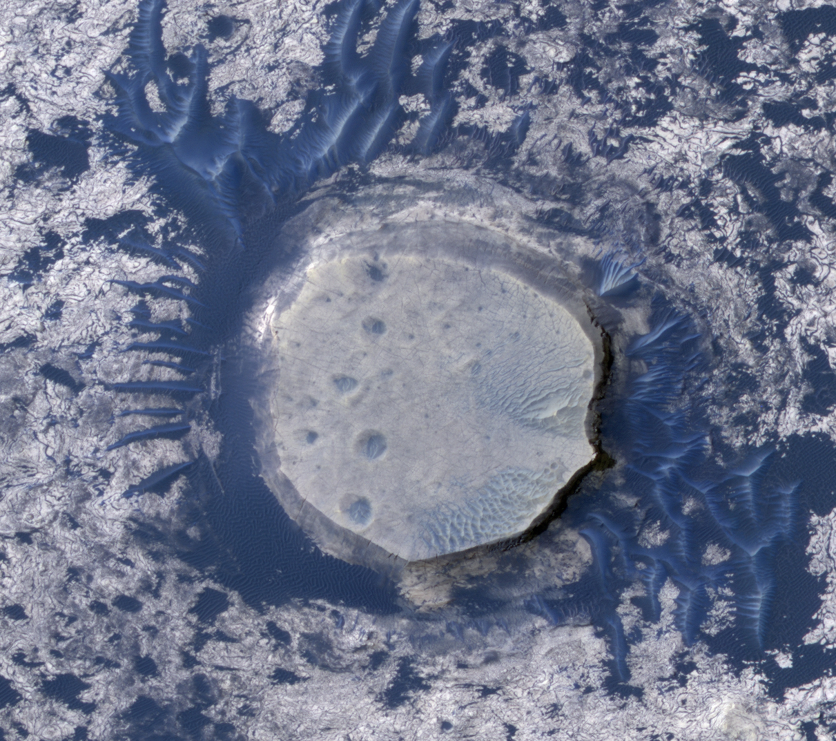
This image shows dark sand dunes and inverted craters in the Arabia Terra region of Mars.
The sand is dark because it was probably derived from basalt, a black volcanic rock that is common on Mars. Unlike traditional craters that are depressions, those here stick up above the surrounding plains. Such "inverted topography" is found on Mars and Earth where erosion has stripped away surrounding topography.
In this case, the craters were filled with sediment. Subsequent erosion stripped away the terrain around the filled craters, leaving the inverted topography visible here. The enlarged color view shows one of the inverted craters surrounded by the dark dunes.
This observation shows part of an unnamed crater, itself located inside the much larger Newton Crater, in Terra Sirenum. This unnamed crater is approximately 7 kilometers in diameter (over 4 miles) and some 700 meters (760 yards) deep.
Numerous gully systems are visible on the east- and south-facing walls of the crater; their characteristics are astonishingly diverse.
The subimage [the light-colored photo above] covers an area of nearly 610 x 740 meters (670 x 800 yards). Downhill is toward the bottom of the image, north is up; illumination is from the northwest. This subimage depicts several gullies or troughs carved in the southwest-facing wall of the crater.
These troughs are extremely rectilinear, lack tributaries, and do not seem to have terminal fan deposits: they terminate rather abruptly, some of them in a spatula-like shape. Their characteristics contrast sharply with those of gully systems elsewhere in this same crater, which are sinuous, have numerous tributaries, and show distinct fan deposits.
HiRISE is unveiling the large diversity exhibited by Martian gully systems, thanks to its high-resolution, stereo, and color capabilities. The diverse types of gullies observed may have been produced by different mechanisms. Current leading hypotheses explaining the origin of gullies include erosion from seepage or eruption of water from a subsurface aquifer, melting of ground ice, or surface snow; and dry landslides.
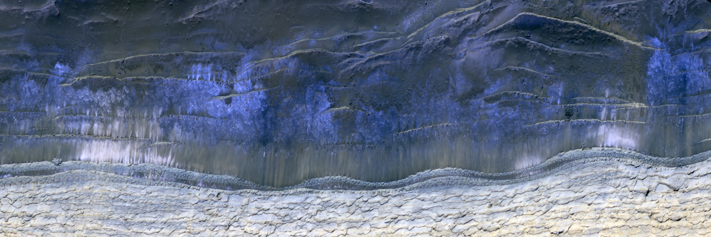
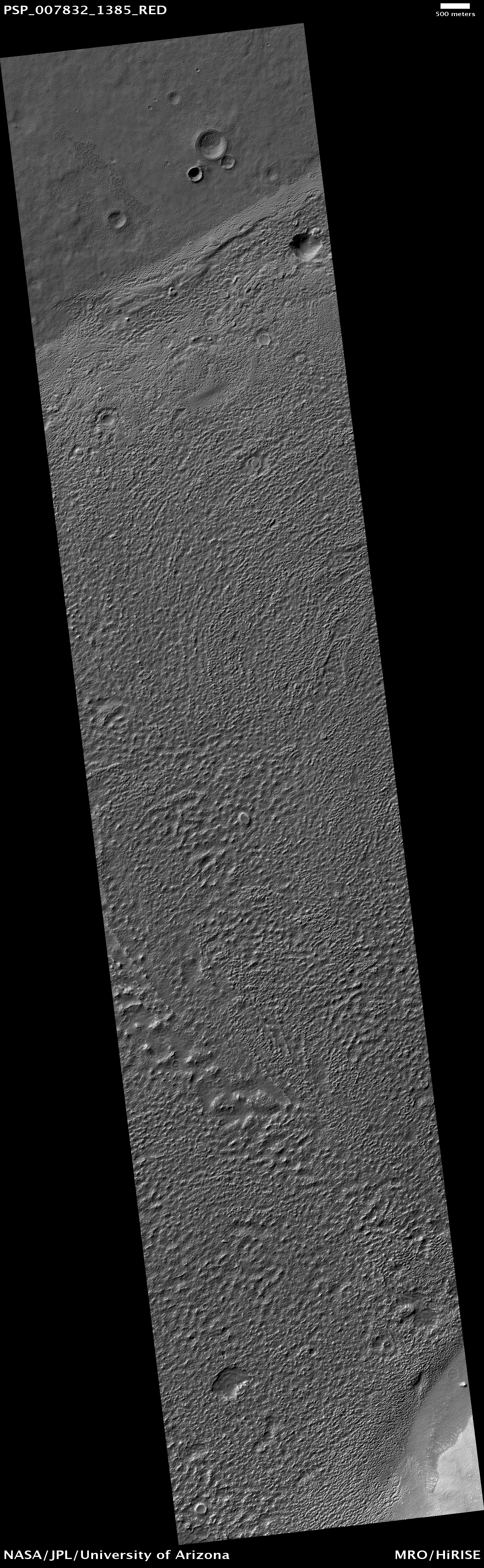
The etched terrain in this image is split into two units. The darker unit at the top of the image is filling in an approximately 120 kilometer NW-SE trending valley, while the brighter etched terrain in the middle of the image is stratigraphically and topographically higher than the lower etched terrain in the valley. This upper etched terrain is a plateau-forming unit with a geomorphic pattern that ranges from relatively flat plains to dissected plateaus and mesas. The lower etched terrain is flat with low albedo, and covered in dunes.
It is in these etched terrains that CRISM, and previously OMEGA, have detected hydratedsulfates, which makes a sedimentary origin seems most likely for these layered deposits of etched terrain found in Meridiani.
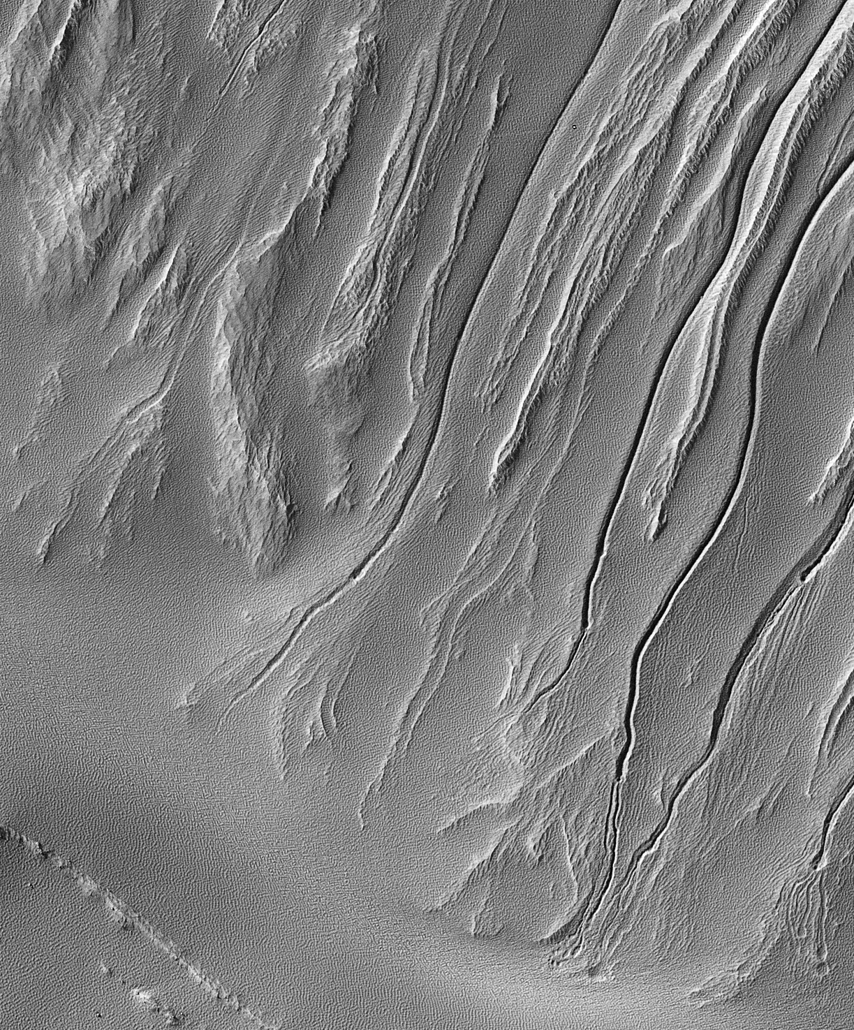
This observation shows a swath of a debris apron east of Hellas Basin. Features like this are often found surrounding isolated mountains in this area. Material flowed down off of the top of the mountain and settled in an area around its base. The bottom of the image (to the south) shows the base of the mountain, where material is sliding off and piling up into ridges. The top of the image (to the north) shows the lobate edge of the apron, where it stopped flowing.
Recently, the SHARAD (Shallow Ground-Penetrating Radar) instrument (also on board the Mars Reconnaissance Orbiter with HiRISE) measured large amounts of water ice mixed into this and other debris aprons. The water ice is what gives the apron its unique texture, which is especially clear at HiRISE's high resolution. Parallel ridges and grooves indicate material has moved slowly while remaining solid - a process called "creep." Pits and buttes may have formed when the dust- and debris-covered ice cracked and sublimated (went directly from a solid to a gas phase).
We can also use this HiRISE image to study the small impact craters found in these areas. Débris aprons like this one have fewer craters than their surroundings. Because impacts generally occur indiscriminately over all of Mars, this means that either the débris apron is younger than its surroundings, or some process is erasing craters on the apron - a process which is not occurring as rapidly on the surrounding plains.
The fact that this apron is rich in water ice is a clue to what is happening. Another clue is the craters on the apron themselves: they have a different appearance than most craters. Some of these degraded craters are "inverted" (higher in the middle than at the edges, which is the opposite of normal craters).
Craters like this have been modified, so we can tell the surface has been active at some time since the impact that formed the crater. For this reason we can't estimate the age of the flow by counting craters, like we are be able to do on some surfaces. However, we can use these craters to study the processes that are actively modifying the apron material.
This region exposes Early Noachian bedrock, more than 4 billion years old, and contains a diversity of hydrated minerals. This would be an excellent place to explore early Mars, when the environment may have been conducive to life.
HiRISE images will aid geologic interpretations and help determine if this spot is sufficiently safe for landing--not too many boulders or steep slopes. If it is sufficiently safe, it may be considered for the 2011 Mars Science Laboratory or the 2018 rovers from Europe and the USA [ESA-NASA ExoMars Program].
Such beautifully preserved layered rocks, although rare, are no surprise to planetary scientists. First, layered rocks exposed in the central uplifts are common in terrestrial impact structures. Secondly, there is abundant layering exposed in the nearby Valles Marineris canyon system — a gash that exposes layering down to 7 kilometers beneath the mean surface. This suggests that layered materials exist to great depths in the subsurface, which is supported by the Oudemans central uplift observation.
Based on estimates of the depth of excavation for a crater the size of Oudemans, these layers originated from just as deep as those exposed in Valles Marineris and possibly deeper. A comparison of the layers in Valles Marineris and in the Oudemans central uplift may prove that they are similar rock types that share the same mode of origin. The fact that these layers are so well intact gives planetary scientists specific clues regarding the subsurface and history of the general area.
Additionally, three other craters, Martin (21.2 degrees South, 290.7 degree East), Mazamba (27.3 degrees South, 290.2 degrees East) and a yet unnamed crater (28.4 degrees South, 305 degrees Eeast) also possess finely layered materials in their central uplift features and lie within the circum-Tharsis region. The preservation of the layering and geographical occurrence of these four craters suggests that they could be ash layers deposited from numerous episodes from the Tharsis volcanoes. Voluminous volcanic episodes could have produced large volumes of layered rock that could have been rapidly buried and protected from cratering.
This observation shows a portion of the wall (light-toned material) and floor of a trough in the Acheron Fossae region of Mars.
Many dark and light-toned slope streaks are visible on the wall of the trough surrounded by dunes. Slope streak formation is among the few known processes currently active on Mars. While the mechanism of formation and triggering is debated, they are most commonly believed to form by downslope movement of extremely dry sand or very fine-grained dust in an almost fluidlike manner (analogous to a terrestrial snow avalanche) exposing darker underlying material.
Some of the slope streaks show evidence that downslope movement is being diverted around obstacles, such as large boulders, and a few appear to originate at boulders or clumps of rocky material. These slope streaks, as well as others on the planet, do not have deposits of displaced material at their downslope ends. The darkest slope streaks are youngest and can be seen to cross cut and lie on top of the older and lighter-toned streaks. The lighter-toned streaks are believed to be dark streaks that are lightening with time as new dust is deposited on their surface.
Update:Astronomy Picture of the Day has highlighted the above photo, and included two interesting links with respect to this photo that I've included below. The first is a wide-angle, black-and-white photo by HiRise that is directly overhead of the slope streaks in Acheron Fossae:
The second link goes to a very short Youtube video, embedded below, in which someone playing with a pile of sand demonstrates the way in which the sands on Mars have created these slope streaks.
On 3 March 2010 Mars Express will make its closest ever approach to Phobos, the larger of the two Martian moons. During a series of flybys, spanning six weeks, all seven instruments onboard Mars Express will be utilised to study Phobos. The close approach provides a first opportunity to perform a unique gravity experiment that may reveal the distribution of mass within this intriguing moon.
ESA's Mars Express spacecraft orbits the Red Planet in a highly elliptical, polar orbit that brings it close to Phobos every five months. It is the only spacecraft, currently in orbit around Mars, whose orbit reaches far enough away from the planet to provide a close-up view of Phobos. Over the course of twelve flybys, taking place between 16 February and 26 March 2010, Mars Express will pass within 1400 km of the surface of Phobos. The Mars orbiter will make its closest ever approach to Phobos- just 50 km above the surface - on 3 March 2010.
The suite of seven experiments onboard Mars Express are primarily used to study the atmosphere, surface and subsurface of the Red Planet. These science instruments can also be used to investigate Phobos. During this current series of flybys all Mars Express instruments will be used to study Phobos, taking advantage of not only the close approach to the moon but also, for the gravity experiment during the closest flyby, the proximity of Mars to the Earth.
Phobos – a moon of unknown origin
Phobos, the larger of the two Martian moons, remains one of the few objects in the Solar System whose location cannot be easily explained. By studying Phobos with the Mars Express instruments scientists are hoping to contribute to the understanding of the moon's nature and origin. Phobos (and Deimos) could be captured asteroids – early measurements of the composition of both moons were compatible with this idea – or they could have formed from material that was ejected following a large collision with Mars. Additional theories are that the moons could be survival planetisimals, or formed from the break-up of a moon that was created early in the formation of the Solar System. Knowing how the mass is distributed within Phobos is an important step in understanding the interior of the moon and this in turn will provide crucial insight into the moon’s origin.
Studying Phobos close-up – unique science
At a distance of just 50 km above the surface of Phobos Mars Express will make the most precise measurements to date of the moon's gravity field using the X-band (8.4 GigaHertz) channel of the Mars Radio Science (MaRS) instrument. This instrument relies on the observation of the phase, amplitude, polarisation and propagation times of radio signals transmitted from the spacecraft and received at ground station antennas on Earth. The radio signals are affected by the medium through which the signals propagate, by the gravitational influence of Mars on the spacecraft and finally by the performance of the various systems involved both on the spacecraft and on ground. In addition, during this series of close flybys, the gravitational attraction of Phobos will slightly disturb the trajectory of the spacecraft. The difference between predicted trajectory (without Phobos) and the actually observed trajectory will lead to the determination of the forces acting on the spacecraft and from them the gravity field of the moon. To make these measurements, the spacecraft operates in two-way link mode with an X-band uplink and downlink.
This current series of flybys happen to occur when the orbits of Earth and Mars bring them close together which means that Mars Express will be ideally positioned to maximize the signal-to-noise ratio of the two-way X-band radio-link. NASA’s Deep Space Network (DSN) 70 metre radio station at Robledo, Spain, will track the radio signal from Mars Express and will pick up the subtle changes in the signal due to the doppler effect as the gravity of Phobos affects the spacecraft's velocity. In addition, the ESACebreros station will also be listening to the signal.
Mapping the mass distribution of Phobos
Analysis of Mars Express data will provide key coefficients of the gravity field. The most important coefficient, the mass of Phobos, has been determined from previous flybys at higher altitudes, but it does not provide any information about how the mass is distributed. Calculation of the density of Phobos, using the mass and volume, gives a value too low to be consistent with a solid, non-porous body, which has led to speculation about the composition of the moon and about how its mass is distributed.
Measurement of the gravity field coefficients from a lower altitude, as will be achieved during this series of flybys, will provide increased accuracy of the mass and allow the subsequent, smaller coefficients, such as the J2 coefficient, to be determined for the first time. To determine the mass distribution of Phobos these coefficients are required along with the libration, a measure of how Phobos rotates – this has already been determined from Mars Express HRSC images. Knowledge of these various parameters allows the three principle moments of inertia to be derived - these in turn describe the mass distribution of Phobos. Models of Phobos' interior are being developed and will be tested against the findings of the current and future close flybys.
Studying Phobos close-up – continuing investigation
In addition to the new science performed during the gravity experiment, this series of flybys will see Mars Express build on knowledge gained from previous flybys. HRSC data obtained during previous flybys has led to the development of a new topographical atlas of Phobos (see M. Wählisch et al. (2009) for further details and the Phobos atlas website). On-going investigations include: improving the accuracy of the location of Phobos (see J. Oberst et al. (2006), V. Lainey et al. (2007), K. Willner et al. (2008), P. Rosenblatt et al. (2008)) and therefore knowledge of its constantly changing orbit as it spirals slowly towards Mars; measurements of the surface to determine its composition (see B. Gondet et al. (2008), S. Perrier et al. (2004)), study of the origin of grooves [pdf] (see J. Murray et al. (2006)), shape (see K. Willner et al. (2010)) and sub-surface properties; as well as studying how the surface interacts with the solar wind.
Mars Express data will provide an important contribution to understanding the nature and origin of Phobos but this alone will not provide a definitive answer. Further exploration is required, and in 2011 the Russian Phobos-Grunt (Phobos-Soil) mission is scheduled to launch to retrieve a sample from Phobos to return for study on Earth. Images taken by the Mars Express HRSC instrument during this series of flybys will be used to support the final selection of the Phobos-Grunt landing site.
Credits: Digital terrain model of Phobos derived from HRSC data (top), M. Wählisch et al. (2009) Orbits of Phobos and Mars Express (bottom), ESA
For a very nice animation of Phobos (that, unfortunately, I'm not able to upload for this blog post), see A Complete View of Phobos.
The deposits in this image [are] now being eroded into knobs and ridges. The erosion is probably dominated by wind, as most of the ridges are parallel. This is common in wind-eroded features, with the ridges generally aligned with the prevailing wind.
At high resolution, layering is revealed in many of the knobs and outcrops. The horizontal layers indicate that the material was deposited uniformly over a broad area. Possible origins include volcanic airfall or lacustrine (lake) deposits. After deposition, the rock in this area has been fractured and faulted, forming a diverse array of cracks.
The mottled appearance of much of the image is caused by dark, featureless patches which may be wind-blown dust. These have interacted with lighter-toned ridges and ripples which are probably also formed by aeolian (wind) processes. In places, the dark patches partially cover the ripples, indicating that they have moved more recently, but they must be thin because the ripples frequently stand above surrounding dark material.
The ripples exhibit multiple interacting orientations in some places, producing networks of small ridges which reflect movement in winds from several directions.
This observation shows a secondary crater field, which form when material ejected from a larger impact event impacts the Martian surface. One impact event, depending on the size of the impactor, can form hundreds of millions of secondary craters at essentially the same time.
Primary craters (those created directly from an impactor from space) can be the same size as secondary craters, which makes dating surfaces based on the number of accumulated craters difficult to near-impossible. Secondary craters are distinguished from primaries based on their morphologies. They are sometimes irregularly shaped, as seen in this image, because they form at relatively low velocities. The velocity of the impactor determines a crater’s size, shape, and depth, with lower energy impacts forming shallow, less-developed craters and higher energy impacts forming deeper, more regular craters.
Secondary craters often occur in clusters, as seen here, as a piece of ejecta breaks up before hitting the surface. Primary craters form at random locations globally. Secondary clusters are more likely to be found in groups because of their formation mechanism.
Note: The craters in this photo are located in the southwestern rim of Utopia Planitia (31.1° North, 89.7° East), in the Casius Quadrangle.