
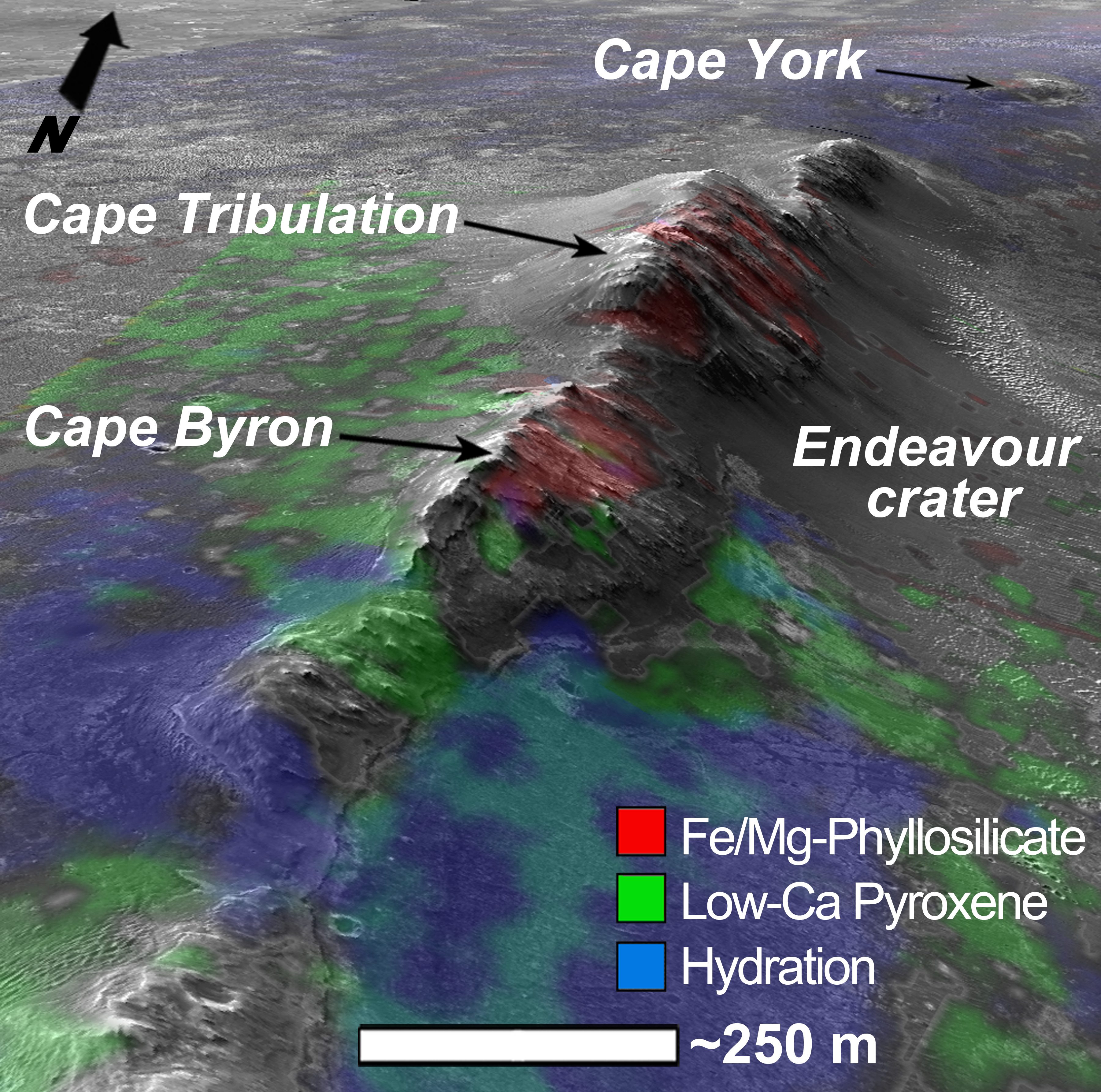
This digital terrain model covers the western rim of Endeavour Crater where the Mars Exploration Rover Opportunity has been investigating since 2011. It provides valuable topographic data that have been very useful in Opportunity mission planning.
For example, this subimage shows a northward perspective view of HiRISE and compositional data from the Compact Reconnaissance Imaging Spectrometer for Mars (CRISM) overlaid over the DTM of Endeavour Crater. This image shows where orbital data indicate possible clay (red), sulfate (green), and volcanic (blue) minerals are located, where the former two attest to the regions aqueous ancient past.
Ongoing surface operations by Opportunity are attempting to reveal the geologic history at Endeavour crater.
Opportunity is currently (2013) at Cape York heading south.
Image credit: NASA/JPL/University of Arizona/USGS
No comments:
Post a Comment