Monday, September 30, 2013

Ozone Production Over the Southern Winter Pole on Mars


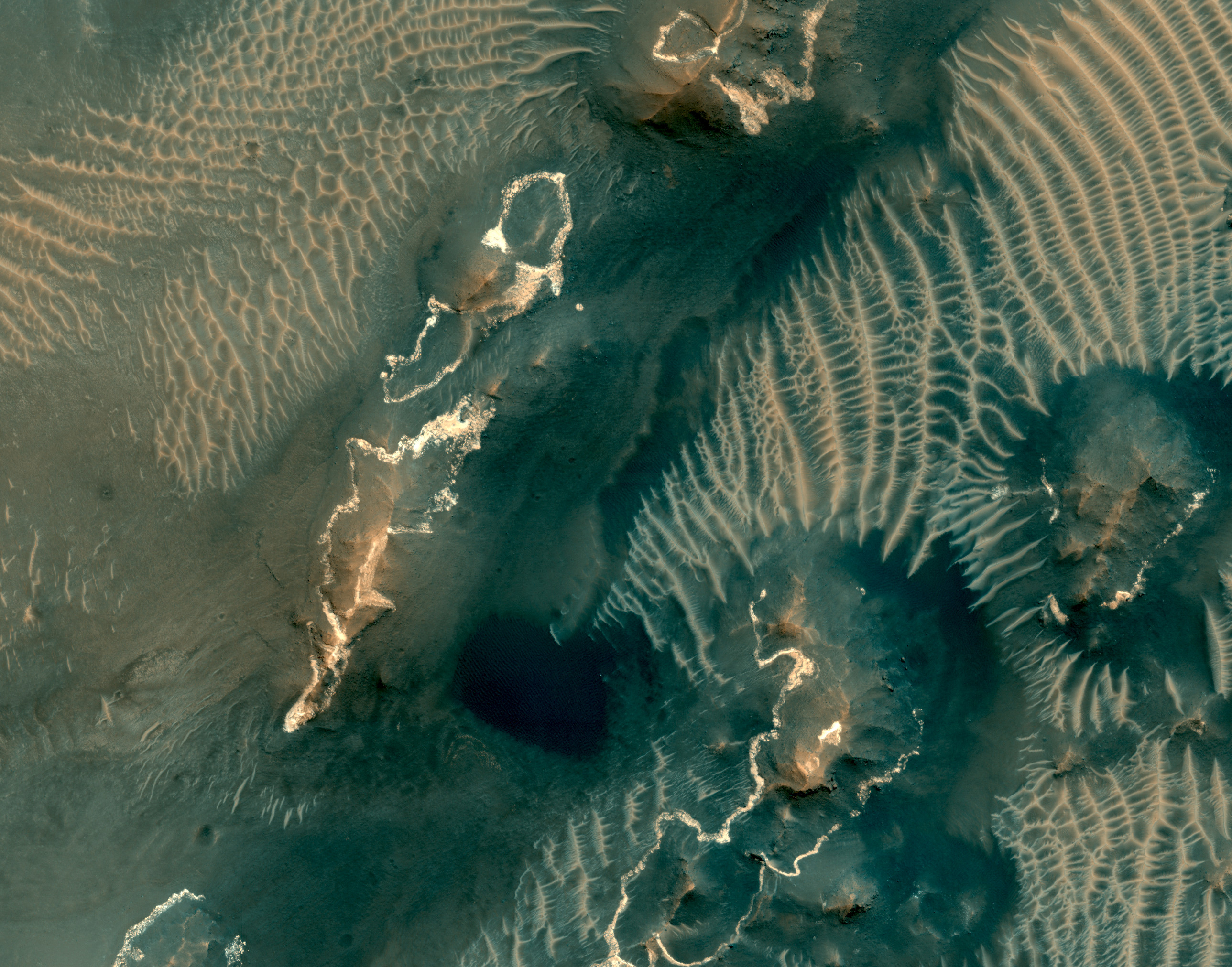
Three separate ozone layers, each with their own characteristics, have been detected in the Martian atmosphere, by Mars Express. By comparing spacecraft data with computer models, scientists have found an explanation for how the layer that appears over the southern winter pole occurs.

It seems that the observed polar ozone layers are the result of the same atmospheric circulation pattern that creates a distinct oxygen emission identified in the Martian polar night. This circulation takes the form of a huge Hadley cell in which warmer air rises and travels poleward before cooling and sinking at higher latitudes. (Earth's atmosphere has two Hadley cells between the equator and the subtropics.)

Oxygen atoms produced by the ultraviolet photolysis (splitting) of CO2 (shown in blue [carbon] and red [oxygen] in this image) in the upper branch of the Hadley cell eventually recombine in the polar night to form molecular oxygen (O2) and ozone (O3). The concentration of ozone gas at night is dependent upon the supply of oxygen and the rate of destruction due to hydrogen radicals.

Hydrogen radicals can only be created by photolysis of water vapor above 25 km. During the northern summer, which takes place when Mars is near aphelion and consequently is further from the Sun than during southern summer, the conditions are such that water vapor is confined below 15 km, with the result that very few radicals are produced there and transported south, where they would destroy the ozone in the atmosphere. In contrast, during the southern summer the upper atmosphere is warmer and the altitude at which the atmosphere becomes saturated with water is above 40 km. The production of hydrogen radicals is increased and more of them flow to the northern winter poles resulting in a rate of ozone destruction about 100 times greater than above the southern pole.

No evidence for a comparable layer of ozone has been found above the northern pole of Mars. This dichotomy is confirmed by the Global Climate Model (developed at the Laboratoire de Météorologie Dynamique (LMD) and LATMOS, France), which predicts no high-altitude ozone layer in the northern polar night region.

For further details, read about A Seasonal Ozone Layer Over the Martian South Pole.

Illustration credit: ESA/ATG medialab

Saturday, September 28, 2013

Unnamed Channel in Tyrrhena Terra


This small unnamed channel is located in southern Tyrrhena Terra.

Orbit Number: 51680 Latitude: -28.5234 Longitude: 80.2749 Instrument: VIS Captured: 2013-08-08 06:18

Photo credit: NASA/JPL-Caltech/Arizona State University

Koshoba Crater

From the USGS Astrogeology Science Center:

The IAU Working Group for Planetary System Nomenclature has approved the name Koshoba for a crater on Mars. For more information, see the map of MC-13 in the Gazetteer of Planetary Nomenclature.

Friday, September 27, 2013

Rabe Crater Dunes


This VIS image shows part of the dune field located on the floor of Rabe Crater. Compare this image with the IR image from earlier this week.

Orbit Number: 51669 Latitude: -43.6701 Longitude: 34.893 Instrument: VIS Captured: 2013-08-07 08:39

Photo credit: NASA/JPL-Caltech/Arizona State University

Thursday, September 26, 2013

White Rock In Pollack Crater


This IR image shows the feature called "White Rock." In vis images, the feature is brighter in color that the surroundings. In this IR image the feature is dark, indicating that it is cooler than the surroundings.

Orbit Number: 51707 Latitude: -9.99112 Longitude: 24.6573 Instrument: IR Captured: 2013-08-10 11:29

Image credit: NASA/JPL-Caltech/Arizona State University

Wednesday, September 25, 2013

Rabe Crater Dunes in Infrared


This IR image shows part of the dune field on the floor of Rabe Crater. The dunes are "brighter" than the surrounding material, indicating that they are warmer. In visible wavelength images the dunes are dark, because they are comprised of basaltic sand.

Orbit Number: 51694 Latitude: -41.6772 Longitude: 34.5902 Instrument: IR Captured: 2013-08-09 10:00

Image credit: NASA/JPL-Caltech/Arizona State University

Tuesday, September 24, 2013

Daedalia Planum


Today's VIS image shows part of the extensive lava flows that comprise Daedalia Planum.

Orbit Number: 51637 Latitude: -20.9792 Longitude: 240.989 Instrument: VIS Captured: 2013-08-04 17:20

Photo credit: NASA/JPL-Caltech/Arizona State University

Small Ridge at Darwin Outcrop


This mosaic of four images taken by the Mars Hand Lens Imager (MAHLI) camera on NASA's Mars rover Curiosity shows detailed texture in a ridge that stands higher than surrounding rock. The rock is at a location called "Darwin," inside Gale Crater. Exposed outcrop at this location, visible in images from the High Resolution Imaging Science Experment (HiRISE) camera on NASA's Mars Reconnaissance Orbiter, prompted Curiosity's science team to select it as the mission's first waypoint for several days during the mission's long trek from the "Glenelg" area to Mount Sharp.

MAHLI took the component images shortly before sunset on the 400th Martian day, or sol, of Curiosity's work on Mars (September 21, 2013). The camera was positioned about 10 inches (25 centimeters) from the rock. Scale is indicated by the Lincoln penny from the MAHLI calibration target, shown beside the mosaic.

The ridge resulted from a crack or vein in the surrounding rock becoming filled with material that was subsequently more resistant to erosion than the material of the surrounding rock. Researchers are investigating the textures and composition of ridges and the surrounding rock, which is a pebbly sandstone conglomerate. Reddish dust coats the surfaces seen in this image. The underlying rocks are gray, varying from nearly white to nearly black. The host rock in which the crack or vein formed is obscured in this image by the coating of dust and a thin layer of the rock's own debris -- loose pebbles and sand.

Researchers also examined ridges at Waypoint 1 with Curiosity's Alpha Particle X-ray Spectrometer (APXS), Chemistry and Camera (ChemCam) instrument and Mast Camera (Mastcam).

Image credit: NASA/JPL-Caltech/MSSS

Note: For more information, see PIA17362: Pebbly Sandstone Conglomerate Rock at Curiosity's 'Waypoint 1', PIA17363: Curiosity Uses X-ray Instrument's Data for Proximity Placement and NASA Rover Inspects Pebbly Rocks at Martian Waypoint.

Monday, September 23, 2013

Tunable Laser Spectrometer Mockup for Curiosity


This picture shows a lab demonstration of the measurement chamber inside the Tunable Laser Spectrometer, an instrument that is part of the Sample Analysis at Mars investigation on NASA's Curiosity rover. This demonstration uses visible lasers -- rather than the infrared ones on the actual spectrometer -- to show how the lasers bounce between the mirrors in the measurement chamber.

The TLS shoots laser beams into a type of measurement chamber that can be filled with Mars air. By measuring the absorption of light at specific wavelengths, the tool can measure concentrations of methane, carbon dioxide and water vapor in the Martian atmosphere and different isotopes of those gases.

Researchers are using Curiosity's 10 instruments to investigate whether areas in Gale Crater ever offered environmental conditions favorable for microbial life.

Photo credit: NASA/JPL-Caltech

Note: For more information, see NASA Curiosity Rover Detects No Methane on Mars.

Sunday, September 22, 2013

Sand Dunes and Transverse Ridges in Noctis Labyrinthus


This colorful scene is situated in the Noctis Labyrinthus, perched high on the Tharsis rise in the upper reaches of the Valles Marineris canyon system.

Targeting the bright rimmed bedrock knobs, the image also captures the interaction of two distinct types of windblown sediments. Surrounding the bedrock knobs is a network of pale reddish ridges with a complex interlinked morphology. These pale ridges resemble the simpler “transverse aeolian ridges” (called TARs) that are common in the equatorial regions of Mars.

The TARs are still poorly understood, and are variously ascribed to dunes produced by reversing winds, coarse grained ripples, or indurated dust deposits. HiRISE observations of TARs have so far shown that these bedforms are stable over time, suggesting either that they form slowly over much longer time scales than the duration of MRO's mission, or that they formed in the past during periods of very different atmospheric conditions than the present.

Dark sand dunes comprise the second type of windblown sediment visible in this image. The dark sand dune seen just below the center of the cutout displays features that are common to active sand dunes observed by HiRISE elsewhere on Mars, including sets of small ripples crisscrossing the top of the dune. In many cases, it is the motion of these smaller ripples that drives the advance of Martian sand dunes. The dark dunes are made up of grains composed of iron-rich minerals derived from volcanic rocks on Mars, unlike the pale quartz-rich dunes typical of Earth.

This image clearly shows the dark sand situated on top of the pale TAR network, indicating that the sand dunes are younger than the TARs. Moreover, the fresh appearance of the sand dunes suggest that they are currently active, and may help shape the unusual TAR morphology by sandblasting the TARs in the present day environment.

Photo credit: NASA/JPL/University of Arizona

Saturday, September 21, 2013

Dunes in Herschel Crater


This VIS image shows dunes in and around a crater located on the floor of the much larger Herschel Crater.

Orbit Number: 51566 Latitude: -14.3607 Longitude: 128.67 Instrument: VIS Captured: 2013-07-29 21:05

Photo credit: NASA/JPL-Caltech/Arizona State University

Brain Terrain in Deuteronilus Mensae


Scientists now know that Mars has a lot more ice than once thought. Many lobate features are now known to be almost pure ice, like glaciers on the Earth.

We still don't know for sure if these Martian ice deposits flow like Earth's glaciers. Knowing how fast they flow (if at all!) would help us understand more about the climate of Mars and how it has changed over time.

This image shows one of these icy lobate features wrapping around a small hill. There is an unusual texture on the ice at the base of this hill that people have called “brain terrain.” This strange-looking surface might be related to flow of the ice, but we still don't have a definite explanation for this mystery.

This is a stereo pair with ESP_032875_2195.

Photo credit: NASA/JPL/University of Arizona

Note: This location is on the edge between Arabia Terra to the south and Deuteronilus Mensae to the north.

Friday, September 20, 2013

Dunes in Bogia Crater


This VIS image shows the dunes on the floor of Bogia Crater, a crater in Hellas Planitia.

Orbit Number: 51480 Latitude: -44.3424 Longitude: 83.1185 Instrument: VIS Captured: 2013-07-22 19:25

Photo credit: NASA/JPL-Caltech/Arizona State University

Sinuous Ridge in Medusae Fossae


At this location is an exceptionally long sinuous ridge, possibly an inverted fluvial feature, that cuts across newly mapped geologic units of the Medusae Fossae Formation.

In the eastern part of the image, the sinuous ridge appears in a manner that suggests erosion of the surrounding landscape. Interestingly, this fluvial feature has no elevation within and to the west location, indicating that fluvial activity may have occurred within this material before widespread erosion.

With HiRISE resolution, we might be able to have more information on the timing of fluvial activity and its relationship to the history of the Medusa Fossae formation.

Photo credit: NASA/JPL/University of Arizona

Note: For more information, see PIA17574: Sinuous Ridge Cutting Across Geologic Units of the Medusae Fossae Formation.

Thursday, September 19, 2013

Candor Chasma


This VIS image shows a portion of Candor Chasma.

Orbit Number: 51473 Latitude: -6.36614 Longitude: 290.738 Instrument: VIS Captured: 2013-07-22 05:23

Photo credit: NASA/JPL-Caltech/Arizona State University

Wednesday, September 18, 2013

Darwin Outcrop at Waypoint 1


For at least a couple of days, the science team of NASA's Mars rover Curiosity is focused on a full-bore science campaign at a tantalizing, rocky site informally called "Darwin."

Curiosity arrived in the vicinity of Darwin last week after its longest drive yet. The rover rolled closer to Darwin in recent days to lay its "contact science" instruments on the bedrock itself for in-depth mineral and chemical composition analysis.

Darwin and other rocks in the area first were seen in images taken from an orbiting spacecraft. The region was chosen as "Waypoint 1" because it appears to expose layers of rock that could reveal the inner makeup and history of the plains on the floor of Gale Crater, including any flows of water that laid these materials down in the past. Analysis of Darwin may provide evidence of whether and how water played a role in the layering of rocks in this region.

This view of Darwin was taken with the left eye of the Mast Camera (Mastcam) on Curiosity during the 390th Martian day, or sol, of the rover's work on Mars (Sept. 10, 2013).

Photo credit: NASA/JPL-Caltech/Malin Space Science Systems

Coprates Chasma


Today's VIS image is further west from yesterday's image. This image is near the margin between Coprates Chasma and Melas Chasma.

Orbit Number: 51423 Latitude: -12.124 Longitude: 291.311 Instrument: VIS Captured: 2013-07-18 02:40

Photo credit: NASA/JPL-Caltech/Arizona State University

Tuesday, September 17, 2013

Coprates Chasma


This VIS image shows part of Coprates Chasma, which is just one part of the extensive Valles Marineris canyon system.

Orbit Number: 51348 Latitude: -12.7902 Longitude: 293.216 Instrument: VIS Captured: 2013-07-11 22:34

Photo credit: NASA/JPL-Caltech/Arizona State University

Gullied Massif in the Nereidum Montes


This observation shows a beautiful example of gullies in a massif in Nereidum Montes, located in Argyre Planitia, one of the largest impact basins on Mars.

The purpose of acquiring this full-resolution image of these gullies was to take a closer look at where they are originating from in the massif wall. If we can answer that, we might be able to learn what were the processes that actually formed these gullies. In this particular region, there might be indications of a glacial past.

Nereidum Montes extends approximately 1150 kilometers, and was named by the noted Greek astronomer Eugène Michel Antoniadi (1870-1944).

Photo credit: NASA/JPL/University of Arizona

Monday, September 16, 2013

Slope Lineae along Coprates Chasma Ridge


The formation of "recurring slope lineae" is a fascinating process on Mars that we're just beginning to investigate, and one that we've imaged before in Palikir Crater.

These RSLs show up in the spring and fade in the winter. Their presence might be due to briny water, and it opens up the door to taking a fresh look at other possible RSL candidates. This observation was done to accomplish just that: to re-image a previously photographed area that might confirm if this a candidate for RSL.

When HiRISE re-images an area, we try to match the exact lighting as before, in order to see any differences. Along with a stereo pair and resulting anaglyph, our understanding of the terrain is more complete.

Photo credit: NASA/JPL/University of Arizona

Sunday, September 15, 2013

Layers and Bedrock Ridges within Schiaparelli Crater


Like any diverse group of explorers, scientists on the HiRISE team and the general public who submit target suggestions have different goals and interests for the Mars images they hope to get. More often than not, an image intended for one particular science investigation ends up having many other applications, answering and raising new questions.

This image was targeted to look at potential changes in the distribution of dark sand compared to earlier pictures (PSP_005897_1790 three Mars years ago and ESP_016406_1790/ESP_017118_1790, approximately 1.5 Mars years ago). In a preliminary investigation, no such changes have been found, although we will keep looking.

Originally, this area — a crater within the larger Schiaparelli Crater — was targeted to investigate the circumferential layers that fill the crater, evidence for possible past deposition from airfall dust or even water. In this image, we note something that becomes apparent if we zoom in to many of the areas containing dark sand. Here, the sand is on top of periodic bedrock edges oriented semi-radially from the crater and approximately perpendicular to the layers. How did these ridges form, and what is the relationship to the sand?

The ridge origin is a mystery, but the sand may simply be nucleating on the ridges. This suggests that some apparent large ripples on Mars are sand nucleation sites on pre-existing topography. The extent of such ridges, and their relationship to sand elsewhere on the planet, can be further understood with future HiRISE images in other areas.

Photo credit: NASA/JPL/University of Arizona

Saturday, September 14, 2013

Windstreaks in Meridiani Planum


Windstreaks in this VIS image indicate winds from the east to west in this region of Meridiani Planum.

Orbit Number: 51332 Latitude: 4.18759 Longitude: 7.94561 Instrument: VIS Captured: 2013-07-10 16:51

Photo credit: NASA/JPL-Caltech/Arizona State University

Terraced Crater in Arcadia Planitia


Small impact craters usually have simple bowl shapes; however, when the target material has different layers of different strength, then more complicated crater shapes can emerge.

The most common situation is a weaker layer overlying a stronger one. In that case, these craters usually have a terrace on their inner walls where the crater abruptly becomes smaller at the depth where this change in material occurs.

In this image of Arcadia Planitia, we can see one of these terraced craters. In fact, there are two distinct terraces implying at least three distinct layers in this target. Images like this help scientists probe the near subsurface of Mars. In this case, the different material strengths are probably caused by layers of ice (weak) and rock (strong).

Photo credit: NASA/JPL/University of Arizona

Friday, September 13, 2013

Crater Rim Channels in Noachis Terra


Multiple channels dissect the rim of this unnamed crater in Noachis Terra.

Orbit Number: 51309 Latitude: -29.7655 Longitude: 335.027 Instrument: VIS Captured: 2013-07-08 17:03

Photo credit: NASA/JPL-Caltech/Arizona State University

Wednesday, September 11, 2013

Darwin Outcrop at Waypoint 1


An outcrop visible as light-toned streaks in the lower center of this image has been chosen as a place for NASA's Mars rover Curiosity to study for a few days in September 2013. The pause for observations at this area, called "Waypoint 1," is the first during the rover's trek of many months from the "Glenelg" area where it worked for the first half of 2013 to an entry point to the lower layers of Mount Sharp. This pale outcrop is informally named "Darwin."

The view is a mosaic of images taken by the telephoto-lens camera of the Mast Camera (Mastcam) on Curiosity during the 387th Martian day, or sol, of Curiosity's work on Mars (September 7, 2013). The rover's position was on a rise called "Panorama Point," and the view looks southwestward. The Sol 387 position was at the endpoint of the mission's longest-yet drive, 464 feet or 141.5 meters on Sol 385, and before a Sol 388 drive to the top of the rise.

Colors in the image have been white-balanced, showing what the rocks would look like if they were under Earth's sky. Figure 1 includes a 4-meter scale bar (13 feet) to indicate the size of features in the Darwin area.

Waypoint 1 is the first of a few waypoint stops planned along the route to the Mount Sharp entry point. Studies at these waypoints are intended to help researchers trace how the rocks at Glenelg, where the mission found evidence of an ancient habitable environment, are related to the lower layers of Mount Sharp, where scientists hope to learn more about habitable environments and major changes in environmental conditions.

Curiosity finished more than six months of investigations in the Glenelg area in early July 2013 and began the drive of about 5.3 miles (8.6 kilometers) from Glenelg to the Mount Sharp entry point. Waypoint 1 is about one-fifth of the way along the route plotted with the use of images taken from orbit.

Image credit: NASA/JPL-Caltech/MSSS

Note: For more information, see PIA17359: Curiosity's View from 'Panorama Point' to 'Waypoint 1' and Outcrop 'Darwin' and Long Drive Puts NASA Mars Rover Near Planned Waypoint.

Friday, September 6, 2013

Becquerel Crater Wind-Blown Sediments


Prominent patches of wind-blown dust, possibly mixed with volcanic ash, radiate from Becquerel crater and into a neighboring crater. The streak of dust following a radial path likely traces out a gentle topographic depression, beyond the eroded rim of the neighboring old crater.

The prevailing wind direction is towards the bottom right of the image in this orientation, in the direction of the tail-like features emanating from the tiny craters. Although small, the crater rims influence wind flow over the crater such that the material immediately downwind of the crater remains undisturbed in comparison to the surrounding plains.

Becquerel crater and its immediate surrounds were imaged during four orbits of Mars Express around the Red Planet: on 22 July 2006 (orbit 3253), and 26 February, 2 and 7 March 2008, corresponding to orbits 5332, 5350 and 5368, respectively. Becquerel Crater lies within Arabia Terra, at about 22°N/352°E.

Photo credit: ESA/DLR/FU Berlin (G. Neukum)

Thursday, September 5, 2013


Today's VIS image shows Tinto Vallis (middle of image) and Palos Crater (top of image).

Orbit Number: 51217 Latitude: -3.24903 Longitude: 110.809 Instrument: VIS Captured: 2013-07-01 03:49

Photo credit: NASA/JPL-Caltech/Arizona State University

Proposed InSight Landing Sites


The process of selecting a site for NASA's next landing on Mars, planned for September 2016, has narrowed to four semifinalist sites located close together in the Elysium Planitia region of Mars. The mission known by the acronym InSight will study the Red Planet's interior, rather than surface features, to advance understanding of the processes that formed and shaped the rocky planets of the inner solar system, including Earth. The location of the cluster of semifinalist landing sites for InSight is indicated on this near-global topographic map of Mars, which also indicates landing sites of current and past NASA missions to the surface of Mars. The mission's full name is Interior Exploration Using Seismic Investigations, Geodesy and Heat Transport.

The location of Elysium Planitia close to the Martian equator meets an engineering requirement for the stationary InSight lander to receive adequate solar irradiation year-round on its photovoltaic array. The location also meets an engineering constraint for low elevation, optimizing the amount of atmosphere the spacecraft can use for deceleration during its descent to the surface. The number of candidate landing sites for InSight was trimmed from 22 down to four in August 2013. This down-selection facilitates focusing the efforts to further evaluate the four sites. Cameras on NASA's Mars Reconnaissance Orbiter will be used to gather more information about them before the final selection.

The topographic map uses data from the Mars Orbiter Laser Altimeter on NASA's Mars Global Surveyor spacecraft. The color coding on this map indicates elevation relative to a reference datum, since Mars has no "sea level." The lowest elevations are presented as dark blue; the highest as white. The difference between green and orange in the color coding is about 2.5 miles (4 kilometers) vertically.

InSight will deploy a heat-flow probe designed to hammer itself 3 to 5 yards (or meters) deep and monitor heat coming from the planet's interior. The mission will also use a seismometer and radio science. The French space agency Centre National d'Etudes Spatiales, or CNES, and the German Aerospace Center, or DLR, are contributing instruments to the mission. Lockheed Martin Space Systems, Denver, is building the spacecraft.

Map credit: NASA/JPL-Caltech

Note: For more information, see PIA17358: Artist's Concept of InSight Lander on Mars and NASA Evaluates Four Candidate Sites for 2016 Mars Mission.

Wednesday, September 4, 2013

Nanedi Vallis


Today's daytime IR image shows part of Nanedi Vallis.

Orbit Number: 51284 Latitude: 7.72187 Longitude: 312.091 Instrument: IR Captured: 2013-07-06 18:02

Photo credit: NASA/JPL-Caltech/ASrizona State University

Tuesday, September 3, 2013

Proctor Crater Dunes


The dunes in this daytime IR image appear bright because they are warmer than the surrounding crater materials. These dunes are located on the floor of Proctor Crater.

Orbit Number: 51282 Latitude: -48.8558 Longitude: 29.9853 Instrument: IR Captured: 2013-07-06 12:25

Photo credit: NASA/JPL-Caltech/ASrizona State University

Monday, September 2, 2013

Migrating Sand Ripples in an Aonia Terra Crater


Having operated at Mars for more than seven years, MRO and the HiRISE camera continue to make new discoveries. One of these is that many sand dunes and ripples are moving, some at rates of several meters per year.

In this observation, a dune field in a Southern hemisphere crater was observed approximately one Mars year apart, first on 2 September 2011 and then again on 11 July 2013 (a year on Mars is 687 Earth days). By taking images at the same time of year, solar illumination angles are the same, so that subtle apparent changes can be linked to true displacement on the surface and not artifacts.

In these two images, there is little distortion (a digital elevation model would remove more distortion). Here, we focus on the southern and northern part of two adjacent dunes. With an animated image, the displacement of ripples on the dunes relative to nearby rocks and dark ripples are clearly visible. It seems that the ripples on the southern dune are moving northeast, while those on the northern dune are moving west, indicating complex winds in this area. The static dark ripples may be composed of larger grains than those in the dunes and are therefore harder to move.

In most areas of Mars, darker-toned ripples are more mobile than lighter ones. This area is different, demonstrating that continued imaging of the Martian surface results in new findings and revisions of ideas.

This is a stereo pair with ESP_032748_1275.

Photo credit: NASA/JPL/University of Arizona

Note: This impact crater is due west of Lowell Crater in Aonia Terra.

Sunday, September 1, 2013

Layered Deposits in Ceti Mensa


This basin in Ceti Mensa exposes concentric rings in the sedimentary layers. Dark sand ripples and textures in the bedrock suggesting wind scouring are also apparent.

Wind is a powerful, erosive force, transporting fine-grain sediments that can shape topography and expose darker material underneath the surface. One such feature of wind-scour on Mars is in Gale Crater, where scouring has created a stair-step pattern.

This is a stereo pair with PSP_009460_1745.

Photo credit: NASA/JPL/University of Arizona