Wednesday, April 30, 2014

Two Channels Near the Origin of Mamers Valles


Two channels are visible in today's image. The smaller one near the bottom of the image did not carve as deeply as the larger channel at the top of the image. The channel near the top of the image is near the origin of Mamers Valles.

Orbit Number: 54129 Latitude: 30.7146 Longitude: 19.1717 Instrument: VIS Captured: 2014-02-25 20:00

Photo credit: NASA/JPL-Caltech/Arizona State University

Tuesday, April 29, 2014

Channels in Granicus Valles


The channels in this VIS image are part of Granicus Valles, located west of the Elysium volcanic complex.

Orbit Number: 54125 Latitude: 27.5359 Longitude: 133.989 Instrument: VIS Captured: 2014-02-25 12:37

Photo credit: NASA/JPL-Caltech/Arizona State University

Saturday, April 26, 2014

Kasei Valles


The channels, both large and small, in this image captured by NASA's 2001 Mars Odyssey spacecraft are part of Kasei Valles near its terminus in Chryse Planitia.

Orbit Number: 54094 Latitude: 25.2367 Longitude: 307.42 Instrument: VIS Captured: 2014-02-22 23:24

Photo credit: NASA/JPL-Caltech/Arizona State University

Windjana Rock


NASA's Curiosity Mars rover has driven within robotic-arm's reach of the sandstone slab at the center of this view from the rover's Mast Camera (Mastcam). The rover team plans to have Curiosity examine a target patch on the rock, called "Windjana," with tools on the rover's arm and mast to aid a decision on whether to use Curiosity's drill at this site.

The rock is about 2 feet (about 60 centimeters) across, left-to-right in this image. The informal name for the target comes from Windjana Gorge in Western Australia.

This Martian rock is in a waypoint location called "the Kimberley," where sandstone outcrops with differing resistance to wind erosion result in a stair-step pattern of layers. Windjana is within what the team calls the area's "middle unit," because it is intermediate between rocks that form buttes in the area and lower-lying rocks that show a pattern of striations.

If this target meets criteria set by engineers and scientists, it could become the mission's third drilled rock and the first that is not mudstone.

This view combines several exposures taken by the Mastcam's left-eye camera during the 609th Martian day, or sol, of the rover's work on Mars (April 23, 2014). The component images have been calibrated, linearly scaled and brightened, which results in colors that resemble those that would be seen under daytime lighting conditions on Earth. A version with raw color, as recorded by the camera under Martian lighting conditions, is available as Figure A.

Image credit: NASA/JPL-Caltech/MSSS

Note: For more information, see PIA18085: Location of Mars Sandstone Target 'Windjana', PIA18086: Curiosity Mars Rover Beside Sandstone Target 'Windjana', and Drill Here? NASA's Curiosity Mars Rover Inspects Site.

Friday, April 25, 2014

Channels Northeast of Olympus Mons


Given their location in the Tharsis volcanic complex, these channels were likely formed by the flow of lava rather than water.

Orbit Number: 54084 Latitude: 20.4294 Longitude: 235.074 Instrument: VIS Captured: 2014-02-22 03:41

Photo credit: NASA/JPL-Caltech/Arizona State University

Thursday, April 24, 2014

Cyane Fossae


The graben in this VIS image is Cyane Fossae. The lava flows are part of the extensive Tharsis volcanic flows.

Orbit Number: 54084 Latitude: 23.9838 Longitude: 235.597 Instrument: VIS Captured: 2014-02-22 03:39

Photo credit: NASA/JPL-Caltech/Arizona State University

Wednesday, April 23, 2014

Lava Flows Southeast of Adams Crater


The lava flows in this VIS image are located SE of Adams Crater.

Orbit Number: 54074 Latitude: 29.8362 Longitude: 164.73 Instrument: VIS Captured: 2014-02-21 07:52

Photo credit: NASA/JPL-Caltech/Arizona State University

Tuesday, April 22, 2014

Ceraunius Fossae


This complexly faulted region is part of Ceraunius Fossae, located south of Alba Mons.

Orbit Number: 54071 Latitude: 30.7824 Longitude: 251.441 Instrument: VIS Captured: 2014-02-21 01:57

Photo credit: NASA/JPL-Caltech/Arizona State University

Crater Gullies in Tyrrhena Terra Northeast of Briault Crater


Although gullies are most common in the middle latitudes of Mars, they are also found in equatorial regions. This image shows a 3-kilometer-wide impact crater with gullies all along the steep inner slopes.

An enhanced-color cutout better distinguishes the gully deposits from the surrounding boulder fields. These slopes are very steep, so a fluid like water is not required to explain gully formation.

Photo credit: NASA/JPL/University of Arizona

Note: This impact crater is located in Tyrrhena Terra to the northeast of Briault Crater. For more information, see PIA18225: Equatorial Gullies on Mars.

Monday, April 21, 2014

Slope Streak in Melas Chasma


HiRISE has been monitoring the recurring slope lineae (RSL) over the mid-latitude and equatorial regions of Mars. One of these sites is a crater on the floor of Melas Chasma; and an animation shows how the RSL follow the sun, changing slope aspect with the seasons.

In one of our most recent images of this site, there was a surprise: a new dark streak just down slope from the RSL. This new streak is about 18 meters wide, whereas most RSL flows (see closer to the crater rim) are less than 5 meters wide. Closer inspection shows that the dark streak corresponds to a topographic slump, similar to several others visible on this slope.

This is one of the largest topographic changes we've seen in equatorial regions of Mars. We are continuing to monitor this location to see if this streak fades in the same manner as RSL, and to understand its relationship, if any, to the RSL activity. If the RSL are due to seeping water, then saturation of a layer downslope could destabilize the slope and lead to such slumps. We continue to be surprised by new discoveries from the Mars Reconnaissance Orbiter after 8 years in orbit.

Photo credit: NASA/JPL/University of Arizona

Note: For more information, see PIA18224: A Surprise Landslump in Melas Chasma.

Sunday, April 20, 2014

Red Bedrock in an Impact Crater Northeast of Hellas Planitia


This image covers a 26-kilometer-wide impact crater northeast of the Hellas impact basin. The crater exposes large blocks of bedrock (called "megabreccia") in both the central uplift and in the walls of the crater.

The enhanced-color subimage from the wall shows a large, approximately 250-meter-wide reddish block, although actually "red" in the infrared-shifted color of HiRISE. These blocks could be ejecta from the ancient Hellas impact or other large impacts from billions of years ago.

Image credit: NASA/JPL/University of Arizona

Note: For more information, see PIA18226: A Big Block of Red Bedrock.

Saturday, April 19, 2014

Channels in Arabia Terra


Many small channels are visible in this VIS image of Arabia Terra.

Orbit Number: 54067 Latitude: 35.1164 Longitude: 7.39422 Instrument: VIS Captured: 2014-02-20 18:01

Photo credit: NASA/JPL-Caltech/Arizona State University

Opportunity Self-Portrait, March 2014


This self-portrait of NASA's Mars Exploration Rover Opportunity shows effects of wind events that had cleaned much of the accumulated dust off the rover's solar panels. It combines multiple frames taken by Opportunity's panoramic camera (Pancam) through three different color filters from March 22 to March 24, 2014, the 3,611th through 3,613th Martian days, or sols, of Opportunity's work on Mars.

For a comparison to what the rover looked like before a series of cleaning events in March, see a similar self-portrait taken January 3 through January 6, 2014, at PIA17759.

With the cleaner arrays and lengthening winter days, Opportunity's solar arrays were generating more than 620 watt-hours per day in mid-April 2014, compared to less than 375 watt-hours per day in January 2014.

This image is presented as a vertical projection in approximately true color. The mast on which the Pancam is mounted does not appear in the image, though its shadow does.

Image credit: NASA/JPL-Caltech/Cornell University/Arizona State University

Note: For more information, see PIA18080: Self-Portrait by Freshly Cleaned Opportunity Mars Rover, False Color and NASA Rover Opportunity's Selfie Shows Clean Machine.

Friday, April 18, 2014

Channels at Semeykin Crater


This VIS image shows several channels dissecting the rim of Semeykin Crater.

Orbit Number: 54067 Latitude: 40.9448 Longitude: 8.39087 Instrument: VIS Captured: 2014-02-20 17:59

Photo credit: NASA/JPL-Caltech/Arizona State University

Mount Remarkable At The Kimberley


NASA's Curiosity Mars rover used its Navigation Camera (Navcam) to record this scene of a butte called "Mount Remarkable" and surrounding outcrops at a waypoint called "the Kimberley" inside Gale Crater. The butte stands about 16 feet (5 meters) high. Its informal name comes from a mountain and national park in Australia. The rover team plans to drive Curiosity to the flatter outcrop at the base of the Martian Mount Remarkable for a close-up inspection that might include drilling into the rock.

This mosaic view combines multiple images taken during the 597th Martian day, or sol, of Curiosity's work on Mars (April 11, 2014). That same day, the rover had driven 90.2 feet (27.5 meters) and NASA's Mars Reconnaissance Orbiter observed Curiosity at the location from which the rover captured this panorama. The resulting image from the orbiter's High Resolution Imaging Science Experiment (HiRISE) camera is online at PIA18081. A map showing Curiosity's route from the August 2012 landing site to the Kimberley is online at http://mars.jpl.nasa.gov/msl/multimedia/images/?ImageID=6153.

Curiosity's science team chose the Kimberley in 2013 as a waypoint for science investigations along the route to the mission's long-term destinations on the lower slopes of Mount Sharp, in the middle of Gale Crater. This waypoint offers set of outcrops of different types of rock layers exposed close together, so that their relationship to each other can be studied. The team refers to the rock layer surrounding the base of Mount Remarkable as the "middle unit" because it is intermediate in location between rocks that form buttes in the area and lower-lying rocks that show a pattern of striations.

Image credit: NASA/JPL-Caltech

Note: For more information, see PIA18084: Stereo View of 'Mount Remarkable' and Surrounding Outcrops at Mars Rover's Waypoint.

Thursday, April 17, 2014

Labeatis Fossae


This complex graben is part of Labeatis Fossae.

Orbit Number: 54045 Latitude: 30.2428 Longitude: 280.922 Instrument: VIS Captured: 2014-02-18 22:36

Photo credit: NASA/JPL-Caltech/Arizona State University

Curisosity at The Kimberley


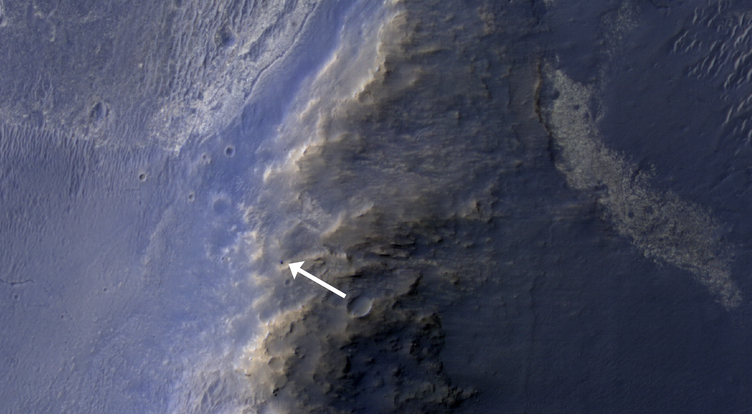
NASA's Curiosity Mars rover and tracks from its driving are visible in this view from orbit, acquired on April 11, 2014, by the High Resolution Imaging Science Experiment (HiRISE) camera on NASA's Mars Reconnaissance Orbiter.

The rover is near the largest butte in the lower left quadrant of the image, at about a two o'clock position relative to the butte. It appears bright blue in the exaggerated color of this image.

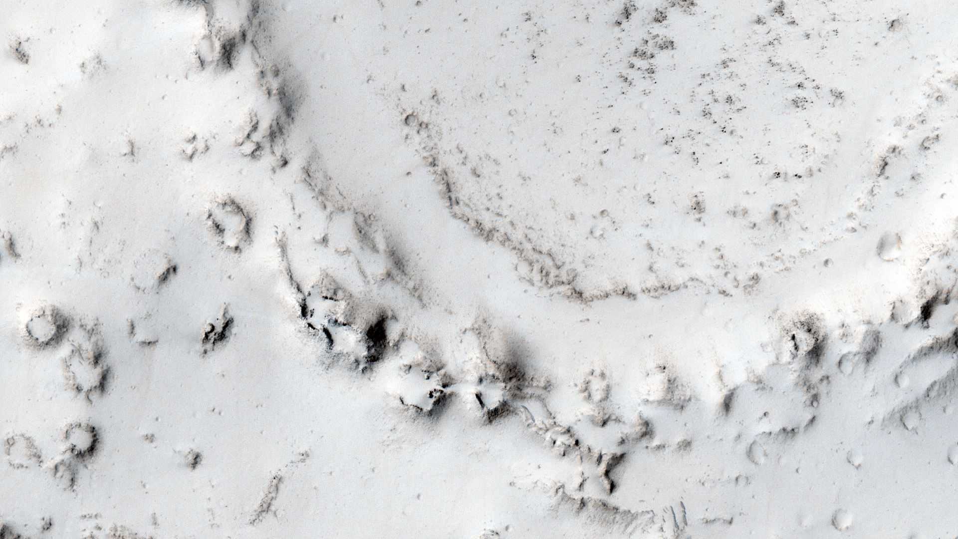
The multi-layered location filling much of the left half of this image is called "the Kimberley." Curiosity's science team chose it, based on other HiRISE images, as a potential gold mine for the rover mission. Black gold, that is, as organic material that, if found at the Kimberley could be a biomarker (sign of past life) -- the holy grail of Mars exploration.

In December 2013, at the fall meeting of the American Geophysical Union in San Francisco, Curiosity Project Scientist John Grotzinger talked about what the mission had learned that year in a location called "Yellowknife Bay," and why the team was planning to stop Curiosity and drill again at the Kimberley. Mudstones that Curiosity drilled and analyzed at Yellowknife Bay had been exposed at the Martian surface for less than 100 million years, which is relatively recent, geologically speaking. Scientists deduced that this was due to erosion of overlying layers by the wind, and that even younger exposure ages should be possible closer to an eroding scarp. This matters because Mars doesn't have a magnetosphere and thick atmosphere like Earth's, which protect us from energetic particles from space that break down organic material. Thus, rocks that have been near the surface of Mars longer (on geological time scales) are less likely to contain complex organic material. Complex organic material might be the remains of past life, or at least inform us about past habitability. Habitability is the potential to support life, whether or not life ever actually existed there.

By late 2013, Curiosity had left Yellowknife Bay and wasn't going to turn around, but similar scarps lay ahead, on the way to the mission's long-term destinations on lower slopes of Mount Sharp (also known as Aeolis Mons). The team had already chosen Curiosity's next major target: the Kimberley. This location, where Curiosity arrived in early April 2014, has what appear to be geologically young scarps. This HiRISE image shows the rover close to one of the scarps.

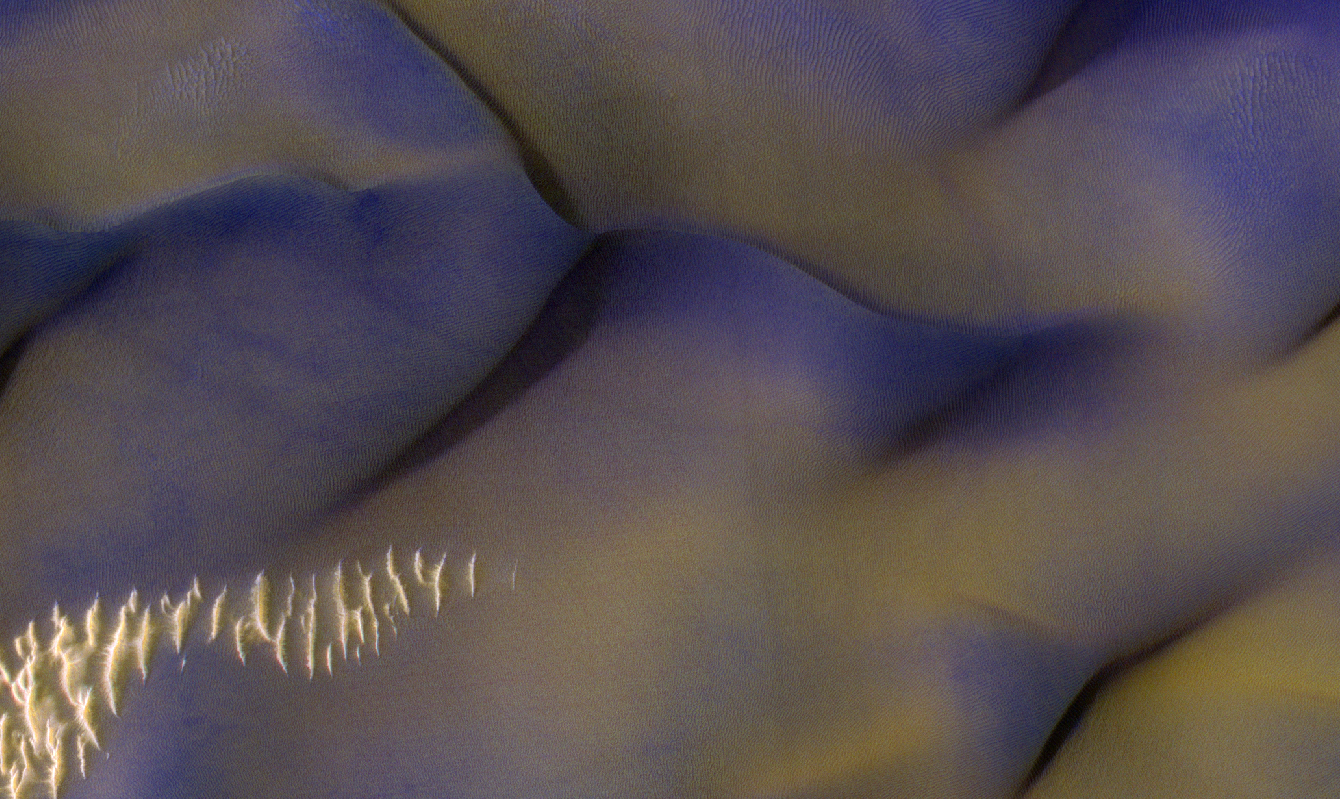
Curiosity entered the area included in this image on March 12, along the tracks visible near the upper left corner. The distance between parallel wheel tracks is about 9 feet (2.7 meters). The area included in the image is about 1,200 feet (about 365 meters) wide. This view is an enhanced-color product from HiRISE observation ESP_036128_1755, available at the HiRISE website at http://uahirise.org/releases/msl-kimberley.php. The exaggerated color, to make differences in Mars surface materials more apparent, makes Curiosity appear bluer than the rover really looks. A stereo view combining information from this observation with topography derived from earlier HiRISE observations, for a three-dimensional appearance, is at PIA18082.

A rover's-eye view taken by Curiosity from the location where the rover is seen in this image is online at PIA18083.

Image credit: NASA/JPL-Caltech/University of Arizona

Note: For more information, see NASA Mars Orbiter Spies Rover Near Martian Butte, Curiosity Ready to Drill for Gold at the Kimberley, and PIA18227: Curiosity Ready to Drill for Gold at the Kimberley.

Wednesday, April 16, 2014

Streamlined Island in Lobo Vallis


Today's VIS image shows a streamlined island in a broad channel in Chryse Planitia. The channel is part of the outflow region of Lobo Vallis, a northern branch of Kasei Valles.

Orbit Number: 54044 Latitude: 31.689 Longitude: 309.953 Instrument: VIS Captured: 2014-02-18 20:37

Photo credit: NASA/JPL-Caltech/Arizona State University

Tuesday, April 15, 2014

Buvinda Vallis


Today's VIS image shows part of Buvinda Vallis, located just outside the northeastern flank of Hecates Tholus.

Orbit Number: 54037 Latitude: 33.2014 Longitude: 151.998 Instrument: VIS Captured: 2014-02-18 06:47

Photo credit: NASA/JPL-Caltech/Arizona State University

Two-Color Dunes in Meridiani Terra


Why are these dunes different colors? Sand on Mars is typically dark in tone, as it commonly derived from volcanic rocks like lava flows. In HiRISE enhanced color, which operates in long infrared wavelengths (beyond what the human eye can detect), surfaces like these dune crests are dark blue to purple. Sand comes in sizes that are ideal for surface transport by the wind, where sand “hops” along forming bedforms, like these dunes after large amounts of time.

The lighter toned “tan” or “reddish” surfaces are indeed composed of a different material, but not as sand sized particle that makes up the bulk of these dunes. Rather, the light-toned smooth surfaces that dominate the lower, flatter areas of the dunes are a thin coating of global dust. Dust on Mars is composed of a variety of materials, including oxidized iron, like rust.

For a given wind gust, speeds are not constant at different heights. Rather, wind speeds are greater with height above the ground and wind energy drops to nearly zero at the surface. Dust persists on flatter dune areas, because wind energy there has not been sufficient to remove it, whereas “dust free” higher-lying dune crests are subject to more intense winds, which ultimately conspire to make the appearance of two-color dunes.

Photo credit: NASA/JPL/University of Arizona

Monday, April 14, 2014

Terraced Crater Northwest of Alba Mons


This image shows the western rim of a well-preserved 8.5-kilometer (about 5 miles) diameter impact crater.

The wall features a slumped terrace that extends all the way around the crater diameter (the adjacent image show the rest of the terrace). This slumped terrace, a result of the crater formation process, gives the crater a concentric ringed appearance.

Terraces are an expected feature in Martian craters of this size or larger, as the material strength of the surface is overcome by the force of all-of-the-sudden-missing mass. Blocks of rock slump down the steep crater walls and slide inward (by contrast, terraces in smaller craters are often the product of an impact of an object into a surface with layers of differing material strength).

Photo credit: NASA/JPL/University of Arizona

Note: This impact crater is located to the northwest of Alba Mons and its lava flows.

Sunday, April 13, 2014

Butte Remaining at Possible Fissure Vent South of Ascraeus Mons


What is this strange-looking feature? HiRISE scientists first noticed it in images from the Context Camera and acquired this picture to investigate more closely.

The feature indeed does look like a heart. It is located south of Ascraeus Mons, which is a large volcano within the Tharsis volcanic plateau, so it is extremely likely that this feature was formed by a volcanic process. The feature rises above the surrounding terrain and we can see concentric ridges on its top. Perhaps this feature is an ancient vent structure (an opening in the ground from which volcanic lava emerges) that has been more resistant to erosion than the surrounding area, so that it resembles “inverted” terrains.

Topographic inversion or inverted terrain often occurs when low areas of a landscape become filled with lava or sediments that harden into materials which are more resistant to erosion than the materials that surround them. Differential erosion then removes the less resistant surrounding material, leaving behind the younger resistant material which may then appear as a ridge where previously there was a valley, or in our case, a butte, where there was once a pit or depression.

Additional imaging of the feature to create a stereo and a digital terrain model may help in further assessing the structure by making accurate measurement of its height and the steepness of its slopes.

Photo credit: NASA/JPL/University of Arizona

Saturday, April 12, 2014

Channel in Nili Fossae


This complex channel is located in the Nili Fossae region.

Orbit Number: 54027 Latitude: 22.7189 Longitude: 78.748 Instrument: VIS Captured: 2014-02-17 11:05

Photo credit: NASA/JPL-Caltech/Arizona State University

Osuga Valles


The central portion of Osuga Valles, which has a total length of 164 km. In some places, it is 20 km wide and plunges to a depth of 900 m. It is located approximately 170 km south of Eos Chaos, which is located at the periphery in the far eastern portion of the vast Valles Marineris canyon system.

Catastrophic flooding is thought to have created the heavily eroded Osuga Valles, which displays streamlined islands and a grooved floor carved by fast-flowing water. The water flowed in a northeasterly direction (towards the bottom right in this image) and eventually drained into another region of chaotic terrain, just seen at the bottom of the image.

Several large impact craters are also seen in this scene, including the ghostly outline of an ancient, partially buried crater in the bottom center of the image.

The image was created using data acquired with the High Resolution Stereo Camera on Mars Express on 7 December 2013 during orbit 12,624. The image resolution is about 17 m per pixel and the image center is at about 15ºS / 322ºE.

Image credit: ESA/DLR/FU Berlin

Note: For more information, see Osuga Valles in Context, Osuga Valles in 3D, Perspective View of Osuga Valles, and Osuga Valles Topography.

Friday, April 11, 2014

Olympia Undae


The sand dunes in this VIS image are part of Olympia Undae, a huge sand sea located near the north polar cap.

Orbit Number: 54011 Latitude: 78.4383 Longitude: 198.938 Instrument: VIS Captured: 2014-02-16 03:10

Photo credit: NASA/JPL-Caltech/Arizona State University

Opportunity at Murray Ridge


This HiRISE image of the Opportunity rover was acquired as a coordinated “ride-along” observation with the CRISM instrument, also onboard the Mars Reconnaissance Orbiter. The CRISM instrument is a spectrometer that views the surface in many wavelengths beyond what the human eye can detect, allowing for mineral identification of the Martian surface.

HiRISE images can be used to construct digital terrain models (or DTM), like the one of Endeavour Crater’s western rim, which provides high-resolution topography for landing site support. This southward prospective view was built using that DTM.

The use of CRISM mineralogy, along with topography and fine-scale images from HiRISE will aid in Opportunity's investigation into the geologic history of the Murray Ridge of Endeavour Crater.

Photo credit: NASA/JPL/University of Arizona

Thursday, April 10, 2014

Wind Streak East of Olympus Mons


The windstreak in this VIS image is located on Tharsis volcanic lava flows east of Olympus Mons.

Orbit Number: 54009 Latitude: 20.7725 Longitude: 237.425 Instrument: VIS Captured: 2014-02-15 23:33

Photo credit: NASA/JPL-Caltech/Arizona State University

Wednesday, April 9, 2014

Patapsco Vallis


Today's VIS image shows a portion of Patapsco Vallis, located on the eastern margin of the Elysium volcanic complex.

Orbit Number: 53987 Latitude: 23.4305 Longitude: 152.015 Instrument: VIS Captured: 2014-02-14 04:05

Photo credit: NASA/JPL-Caltech/Arizona State University

Bright Spot in the Distance at Gale Crater


This image from the Navigation Camera (Navcam) on NASA's Curiosity Mars rover includes a bright spot near the upper left corner. The sun is in the same direction, west-northwest, above the frame. Bright spots appear in images from the rover nearly every week. Typical explanations for them are cosmic rays hitting the light detector or sunlight glinting from rocks.

The right-eye camera of the stereo Navcam recorded this frame during the afternoon of the 589th Martian day, or sol, of Curiosity's work on Mars (April 3, 2014), from the site where the rover reached a waypoint called "the Kimberley" by that sol's drive. An image taken by the Navcam's left-eye camera within one second of the same time (http://mars.jpl.nasa.gov/msl/multimedia/raw/?rawid=NLB_449790582EDR_F0310000NCAM00262M_&s=589) does not include a bright spot of this type. A pair of Navcam images in the same direction from the previous afternoon has a bright spot similarly located in the right-eye image (http://mars.jpl.nasa.gov/msl/multimedia/raw/?rawid=NRB_449700848EDR_F0301254NCAM00252M_&s=588) but not in the left-eye image (http://mars.jpl.nasa.gov/msl/multimedia/raw/?rawid=NLB_449700848EDR_F0301254NCAM00252M_&s=588).

One possible explanation for the bright spot in this image is a glint from a rock surface reflecting the sun. Another is a cosmic ray hitting the camera's light detector, a CCD (charge-coupled device). Cosmic ray patterns in Mars rover images vary from a dot to a long line depending on the angle at which the ray strikes the detector.

Photo credit: NASA/JPL-Caltech

Note: For more information, see Images From NASA Mars Rover Include Bright Spots.

Tuesday, April 8, 2014

Graben in Labeatis Fossae


The depressions in this VIS image are graben that make up part of Labeatis Fossae. Graben are tectonic features comprised of a fault bounded depression where the central block of material has been downdropped between the two faults.

Orbit Number: 53970 Latitude: 27.2178 Longitude: 282.723 Instrument: VIS Captured: 2014-02-12 18:29

Photo credit: NASA/JPL-Caltech/Arizona State University

Ring of Rootless Cones in Elysium Planitia


In the center of this observation, we see a ring of cones that have developed over a crater rim. Lava appears to have deflated around and within the ring.

Interestingly, the area around the ring has few cones: did water or steam flow to the crater and make that zone less fertile? These cones are likely "rootless cones," so named because they do not form as a result of direct magma supply, but from the interaction of lava and water or ice in the substrate. The rootless cones in this image may have formed around the crater rim because the lava was thin there.

This is a stereo pair with ESP_034808_2065.

Photo credit: NASA/JPL/University of Arizona

Note: These rootless cones are located in northeastern Elysium Planitia to the southeast of Lockyer Crater.

Monday, April 7, 2014

Candidate Landing Site in Gusev Crater for Mars 2020 Rover


As we did for Phoenix in 2008 and the Mars Science Laboratory in 2012, HiRISE has been imaging landing sites for a potential rover mission in 2020.

With HiRISE resolution, mission teams can examine what areas of Mars are flat enough to touchdown safely and also investigate the terrain to satisfy scientific research goals. Gusev Crater, a massive and ancient impact crater, was also the landing site for the rover Spirit in January 2004.

With this image, the science rationale was to investigate nearby opaline silica, carbonates and other aqueous phases.

Photo credit: NASA/JPL/University of Arizona

Sunday, April 6, 2014

The Kimberley


NASA's Curiosity Mars rover recorded this view of various rock types at a waypoint called "the Kimberley" shortly after arriving at the location during the 589th Martian day, or sol, of the rover's work on Mars (April 2, 2014). The Kimberley was selected in 2013 as a major waypoint for the mission because of the diversity of rock types distinguishable in orbital images, exposed close together at this location in a decipherable geological relationship to each other.

The outcrop at the center of the image is a category that the rover team scientists call "striated," from its appearance in images taken from orbit before the rover reached this area. Farther in the distance, the striated type is overlain by other types. On the horizon, slopes of Mount Sharp -- the mission's long-term destination -- are on the left and the rim of Gale Crater is on the right.

Curiosity's Navigation Camera (Navcam) took the component images of this mosaic. The scene spans from south-southwest at left to west-northwest at the right. It is presented here as a cylindrical projection.

Image credit: NASA/JPL-Caltech

Note: For more information, see PIA18072: Curiosity's View From Before Final Approach to 'The Kimberley' Waypoint, PIA18074: Curiosity's View From Arrival Point at 'The Kimberley' Waypoint (Stereo), PIA18075: Map of Curiosity Mars Rover's Drives to 'the Kimberley' Waypoint, PIA18076: Curiosity Mars Rover's Route from Landing to 'The Kimberley' Waypoint, and NASA Mars Rover Curiosity Scoping Out Next Study Area.

Saturday, April 5, 2014

Lava Flows from Ascraeus Mons


The lava flows in this VIS image most likely originated from Ascraeus Mons, one of the large Tharsis volcanos.

Orbit Number: 53958 Latitude: 15.8753 Longitude: 267.009 Instrument: VIS Captured: 2014-02-11 18:51

Photo credit: NASA/JPL-Caltech/Arizona State University

An Irregular Crater-Intersecting Graben in Tractus Albus


This crater, of which only a small portion is visible in the full HiRISE image, is very irregularly shaped and might suggest that some underlying liquid was present that made it so elongated after the initial impact.

Another reason for the crater’s shape might be that it was caused by a binary asteroid pair or a meteorite that broke into multiple fragments just before hitting the ground leading to the formation of a number of superimposed craters that produced this odd-shaped depression. Such craters have been previously observed by HiRISE (https://hirise.lpl.arizona.edu/PSP_009619_1630)

The crater itself intersects a graben, which is a depressed stretch of land typically bordered by parallel faults. Note the dark streak on the crater’s eastern wall.

Photo credit: NASA/JPL/University of Arizona

Friday, April 4, 2014

Streamlined Island in Kasei Valles


Today's VIS image shows a streamlined island in Kasei Valles. The teardrop shape indicates that flow was from the bottom to the top of the image. Kasei Valles is one of the largest channel system on Mars, starting in Echus Chasma and emptying into Chryse Planitia.

Orbit Number: 53895 Latitude: 18.9361 Longitude: 283.703 Instrument: VIS Captured: 2014-02-06 14:24

Photo credit: NASA/JPL-Caltech/Arizona State University

Probable Caldera Near Apollinaris Mons


Impact craters are very common on the surface of Mars. However, when a circular depression is visible on the summit of a mound or an elevated landform in general, careful analysis is needed to identify whether the crater is created by an impact or by volcanic activity.

This issue becomes even more problematic when the crater is located in a area known for its volcanic history such as the Apollinaris region where this image was taken and is very close to the prominent volcano Apollinaris Mons.

In fact, this classical problem has been encountered before here on Earth in the case of the famous Meteor Crater in Arizona just outside of the city of Flagstaff. Back in the late 19th century, many people believed that Meteor Crater was a volcanic crater because of its proximity to the San Francisco volcanic field and the rarity of impact craters on Earth.

Meteor Crater remained controversial until the 1960s when scientists were finally able to confirm that the crater was indeed an impact crater by identifying minerals in the crater site that can only form in extremely high pressures, which are usually associated with violent impact events.

In the absence of such “ground truth” or lab analysis, how can planetary scientists differentiate between impact and volcanic craters? There are a number of ways. For example, impact craters usually exhibit raised rims and distinctive ejecta patterns around the crater, formed by materials ejected during the impact event. Large craters (more than 7 kilometers-wide in general for Mars) exhibit central peaks that form due the rebound of the ground right after impact. All these features are not usually observed in volcanic craters. In this observation, none of these features is visible. Nonetheless, this region is old and heavily dusted so all the above-mentioned features may have been eroded away or are covered by other materials.

However, we can see in this image that the crater is on the summit of a mountain- or hill-like elevated land form. In addition, some of the materials at the base of this elevated land form exhibit a rough texture that may resemble volcanic flows. If we add to that that the region is within a volcanic area, it becomes highly likely that this crater in particular is, in fact a volcanic crater.

Photo credit: NASA/JPL/University of Arizona

Thursday, April 3, 2014

Layering in Planum Boreum


With summer fast approaching, the frost has sublimated away and the layers that make up the north polar cap are easily discernible.

Orbit Number: 53890 Latitude: 82.8252 Longitude: 98.7289 Instrument: VIS Captured: 2014-02-06 04:10

Photo credit: NASA/JPL-Caltech/Arizona State University

Wednesday, April 2, 2014

Channel in Arabia Terra


Today's VIS image shows an unnamed channel that dissects the rim of a large crater in Arabia Terra.

Orbit Number: 53879 Latitude: 31.2164 Longitude: 26.7961 Instrument: VIS Captured: 2014-02-05 06:44

Photo credit: NASA/JPL-Caltech/Arizona State University

Tuesday, April 1, 2014

Dust Devil Tracks in Utopia Planitia


A multitude of dust devil tracks mark the surface in this region of Utopia Planitia.

Orbit Number: 53877 Latitude: 55.7328 Longitude: 89.2858 Instrument: VIS Captured: 2014-02-05 02:39

Photo credit: NASA/JPL-Caltech/Arizona State University

Opportunity's Shadow


NASA's Mars Exploration Rover Opportunity caught its own silhouette in this late-afternoon image taken by the rover's rear hazard avoidance camera. This camera is mounted low on the rover and has a wide-angle lens.

The image was taken looking eastward shortly before sunset on the 3,609th Martian day, or sol, of Opportunity's work on Mars (March 20, 2014). The rover's shadow falls across a slope called the McClure-Beverlin Escarpment on the western rim of Endeavour Crater, where Opportunity is investigating rock layers for evidence about ancient environments. The scene includes a glimpse into the distance across the 14-mile-wide (22-kilometer-wide) crater.

Photo credit: NASA/JPL-Caltech

Note: For more information, see Cleaner NASA Rover Sees Its Shadow in Martian Spring.