Friday, January 31, 2014

Ascraeus Mons


Today's image shows a different portion of the collapse features located on the northern flank of Ascraeus Mons.

Orbit Number: 53309 Latitude: 13.6999 Longitude: 256.956 Instrument: VIS Captured: 2013-12-20 09:06

Photo credit: NASA/JPL-Caltech/Arizona State University

Dingo Gap


This scene combines images taken by the left-eye camera of the Mast Camera (Mastcam) instrument on NASA's Curiosity Mars rover during the mid-afternoon, local Mars solar time, of the mission's 526th Martian day, or sol (January 28, 2014). The sand dune in the upper center of the image spans a gap, called "Dingo Gap," between two short scarps. The dune is about 3 feet (1 meter) high. The nearer edge of it is about 115 feet (35 meters) away from the rover's position when the component images were taken, just after a Sol 526 drive of 49 feet (15 meters).

The image has been white-balanced to show what the rocks would look like if they were on Earth. A version with 200-centimeter (79-inch) scale bars is available as Figure A. A version with raw color, as recorded by the camera under Martian lighting conditions, is available as Figure B.

Image credit: NASA/JPL-Caltech/MSSS

Note: For more information, see PIA17763: Full-Circle Vista During Curiosity's Approach to 'Dingo Gap', PIA17764: Full-Circle Vista During Curiosity's Approach to 'Dingo Gap' (Stereo), PIA17765: Traverse Map for Mars Rover Curiosity as of January 26, 2014, PIA17767: Crystal-Laden Martian Rock Examined by Curiosity's Laser Instrument and Curiosity Mars Rover Checking Possible Smoother Route.

Thursday, January 30, 2014

Ascraeus Mons


The pits, fractures and channel-like features in this image are located on the northern flank of Ascraeus Mons. Most of these features were created by collapse into lava tubes that existed below the surface.

Orbit Number: 53284 Latitude: 13.1863 Longitude: 257.591 Instrument: VIS Captured: 2013-12-18 07:44

Photo credit: NASA/JPL-Caltech/Arizona State University

Opportunity Traverse Map for Cape York


A region known as "Cape York" on the western rim of Endeavour Crater, where NASA's Mars Exploration Rover Opportunity worked for 20 months, is highlighted in these images.

The inset at upper left is a portion of a false-color image taken by the High Resolution Imaging Science Experiment (HiRISE) camera on NASA's Mars Reconnaissance Orbiter. The black outline shows the "Matijevic Hill" region, enlarged in the central image. Initial traverses accomplished by Opportunity to evaluate the geologic setting of the region are noted. The Opportunity team was interested in this region because the Compact Reconnaissance Spectrometer for Mars (CRISM) on NASA's Mars Reconnaissance Orbiter showed a specific type of clay mineral called a ferric smectite. This type of clay mineral originally formed in groundwater along fractures in which the water was only mildly acidic.

The lower left inset shows a portion of CRISM data centered on Cape York. The red region delineates where CRISM spectra show features diagnostic of the smectite clay mineral.

This image is from a portion of a HiRISE observation cataloged as ESP_032573_1775 . Other products from the same observation are available at http://hirise.lpl.arizona.edu/ESP_032573_1775.

Image credit: NASA/JPL-Caltech/University of Arizona

Wednesday, January 29, 2014

Alba Fossae


Today's VIS image shows a portion of Alba Fossae, located on the northwestern margin of Alba Mons. Small channels are also visible.

Orbit Number: 53322 Latitude: 45.2895 Longitude: 247.241 Instrument: VIS Captured: 2013-12-21 10:36

Photo credit: NASA/JPL-Caltech/Arizona State University

Montmorillonite Deposit in Rock at Cape York


Researchers used NASA's Mars Exploration Rover Opportunity to find a water-related mineral [Montmorillonite] on the ground that had been detected from orbit, and found it in the dark veneer of rocks on the rim of Endeavour Crater.

This false-color view from the panoramic camera (Pancam) on Opportunity shows a dark veneer, exposed after brushing with the rover's rock abrasion tool. These finely layered rocks with dark veneers are in the "Whitewater Lake" outcrop on "Matijevic Hill" on the western rim of Endeavour. The deposits are part of the ancient Matijevic formation, which predates the Endeavour impact event. The brushed area is about 1.5 inches (3.8 centimeters) wide. This image was taken on the 3,098th Martian day, or sol, of Opportunity's mission (October 11, 2012).


Photo credit: NASA/JPL-Caltech/Cornell University/Arizona State University

Note: For more information, see PIA17756: 'Esperance6' and 'Lihir' Rover Targets and PIA17757: Mineral Plot from 'Esperance' Target.

Tuesday, January 28, 2014

Labeatis Fossae


The fractures in this VIS image are part of Labeatis Fossae. The large impact crater was formed after the fractures.

Orbit Number: 53283 Latitude: 32.1022 Longitude: 289.185 Instrument: VIS Captured: 2013-12-18 05:39

Photo credit: NASA/JPL-Caltech/Arizona State University

Frost and Geyser Marks on a Dune South of Planum Boreum


This image shows numerous dark shapes and bright spots on a sand dune in the Northern polar regions of Mars.

The bright spots are carbon dioxide frost. On Mars, the main atmospheric component is carbon dioxide, which circulates seasonally between the atmosphere and the polar regions. One of the reasons that permit this process is the fact that temperatures on Mars are much colder than on Earth, which allows carbon dioxide frost to condense on the surface in winter.

When spring comes however, the surface heats up and the carbon dioxide frost eventually sublimates (turns directly from the solid to the vapor state), and forms jets of carbon dioxide mixed with dust, leading to the formation of the dark features we see in the image.

Such processes occur seasonally on Mars, and therefore are continuously being monitored by the HiRISE scientists to assess the differences from one year to the next.

Photo credit: NASA/JPL/University of Arizona

Note: This dune is located in Vastitas Borealis just south of Planum Boreum.

Monday, January 27, 2014

Light-Toned Deposits in Coprates Chasma


Valles Marineris contains kilometers-thick light-toned layered sedimentary deposits along many of its floors. In this image, similar light-toned layered deposits are observed, except these are found along steeper wallrock slopes in Coprates Chasma.

Compositional data from CRISM and also stereo images—which we use to create 3D images—can help scientists determine how these sediments were deposited and if they are the same as the thicker deposits seen along the chasma floors.

Photo credit: NASA/JPL/University of Arizona

Sunday, January 26, 2014

Oxus Patera Collapse Feature


Oxus Patera is an ancient, eroded depression in northern Arabia Terra. It is not known how Oxus Patera formed, though it has been suggested that the feature represents an ancient caldera formed through collapse and explosive volcanism.

Other possibilities include formation by impact and erosion, or collapse due to removal of subsurface volatiles. Regardless of how the massive depression originally formed, there is little doubt that the feature has been modified by younger ice-related processes.

This image shows an unusual landform on the floor of Oxus Patera. Notice an irregular, scalloped contact trending diagonally from southwest to northeast near the center of the image. The terrain in the upper left is likely composed of fine-grained, weakly consolidated materials because it does not form many topographic features within the unit (few mesas, buttes, mountains, etc.). Where it is eroded, it does not form boulders: it appears to be an easily crumbled, blanketing deposit. The terrain in the lower right is very unusual. It contains smooth surfaces marked by small, irregularly shaped cones and fractures that are bounded by upturned ridges. The boundary between the two terrains consists of scalloped fractures that appear to have formed where the terrain in the lower right has detached from the terrain in the upper left, and partially collapsed.

Photo credit: NASA/JPL/University of Arizona

Saturday, January 25, 2014

Cerberus Fossae and Athabasca Valles


The fractures in this VIS image are part of a large system of fractures called Cerberus Fossae. Athabasca Valles is visible in the lower right corner of the image.

Orbit Number: 53141 Latitude: 19.8044 Longitude: 61.0929 Instrument: VIS Captured: 2013-12-06 13:16

Photo credit: NASA/JPL-Caltech/Arizona State University

Giant Gullies North of Argyre Planitia


This image shows gullies that are large even by Mars standards, and much larger than the terrestrial landforms we call gullies. The length of some of these is over 6 kilometers (3.6 miles).

They are located on large mountains located north of the Argyre impact basin. An enhanced color view (reduced scale) shows only subtle color differences.

Photo credit: NASA/JPL/University of Arizona

Friday, January 24, 2014

Dust Devil Tracks in Antoniadi Crater


This VIS image shows a portion of the floor of Antoniadi Crater. The faint, dark marks may be dust devil tracks.

Orbit Number: 53141 Latitude: 19.8044 Longitude: 61.0929 Instrument: VIS Captured: 2013-12-06 13:16

Photo credit: NASA/JPL-Caltech/Arizona State University

Opportunity's January 2014 Self-Portrait


NASA's Mars Exploration Rover Opportunity recorded the component images for this self-portrait about three weeks before completing a decade of work on Mars. The rover's panoramic camera (Pancam) took the images during the interval January 3, 2014, to January 6, 2014, a few days after winds removed some of the dust that had been accumulating on the rover's solar panels.

Opportunity landed on Mars on January 25, 2004, Universal Time (January 24, 2004, PST) for a mission that was planned to last three months. It is still active 10 Earth years later.

This image is presented as a vertical projection. The mast on which the Pancam is mounted does not appear in the image, though its shadow does.

Image credit: NASA/JPL-Caltech/Cornell University/Arizona State University

Note: For more information, see PIA17758: Opportunity's First Decade of Driving on Mars and NASA's Opportunity at 10: New Findings from Old Rover.

Wednesday, January 22, 2014

Labeatis Fossae


The fractures in this VIS image are part of Labeatis Fossae.

Orbit Number: 53096 Latitude: 25.6028 Longitude: 279.278 Instrument: VIS Captured: 2013-12-02 20:22

Photo credit: NASA/JPL-Caltech/Arizona State University

Pinnacle Island


This before-and-after pair of images of the same patch of ground in front of NASA's Mars Exploration Rover Opportunity 13 days apart documents the arrival of a bright rock onto the scene. The rover had completed a short drive just before taking the second image, and one of its wheels likely knocked the rock -- dubbed "Pinnacle Island" -- to this position. The rock is about the size of a doughnut.

The images are from Opportunity's panoramic camera (Pancam). The one on the left is from 3,528th Martian day, or sol, of the rover's work on Mars (December 26, 2013). The one on the right, with the newly arrived rock, is from Sol 3540 (January 8, 2014). Much of the rock is bright-toned, nearly white. A portion is deep red in color. Pinnacle Island may have been flipped upside down when a wheel dislodged it, providing an unusual circumstance for examining the underside of a Martian rock.

The site is on "Murray Ridge," a section of the rim of Endeavour Crater where Opportunity is working on north-facing slopes during the rover's sixth Martian winter.

Image credit: NASA/JPL-Caltech/Cornell University/Arizona State University

Tuesday, January 21, 2014

Olympia Undae


This VIS image shows a portion of the north polar dune field where there has been more frost lost from the dunes, so they appear darker than the dunes in PIA17865.

Orbit Number: 53077 Latitude: 79.9901 Longitude: 128.365 Instrument: VIS Captured: 2013-12-01 06:32

Photo credit: NASA/JPL-Caltech/Arizona State University

Note: This image is located in Olympia Undae.

Sunday, January 19, 2014

Dunes on the Western Rim of the Hellas Planitia


Sand dunes like these seen in this image have been observed to creep slowly across the surface of Mars through the action of the wind. These are a particular type of dune called a “barchan”, which forms when the wind blows in one direction (here, east to west) for long periods of time. Barchan dunes are common on Mars and in the desert regions of the Earth.

These barchan dunes are located on the western rim of the Hellas impact basin, in the Southern Hemisphere of Mars. This area is covered by extensive deposits of layered rocks that were initially deposited as loose sediments and over time formed these rock layers. Portions of these layered rocks were subsequently eroded away and the remaining layers now form numerous flat-topped hills called “mesas”. The barchan dunes are forming in the lee (or downwind) of the mesas.

This area was previously image by HiRISE in 2008 and was retargeted here through a public request via HiWish. Careful comparison of repeat images such as these can reveal the speed and manner by which dunes move across the Martian surface. This information can be used to study the current atmosphere of Mars, the age and mobility of sand deposits on the planet’s surface, and the hazards that sand dunes may pose to landed vehicles such as rovers.

Over the course of its mission, the science instruments on board the Mars Reconnaissance Orbiter (MRO) have returned over 200 terabits of data back to Earth. This image was taken on November 4, 2013, the same day that MRO’s 200-terabit mark was surpassed.

Photo credit: NASA/JPL/University of Arizona

Note: For more information, see PIA17873: Dunes on the Rim of the Hellas Impact Basin.

Saturday, January 18, 2014

Olympia Undae


This VIS image shows dunes near the north polar cap of Mars. It is springtime at the north pole and the dunes are starting to lose their frost cover. As the season continues towards summer the dunes will appear darker and darker as the frost sublimates.

Orbit Number: 53076 Latitude: 80.2675 Longitude: 157.439 Instrument: VIS Captured: 2013-12-01 04:34

Photo credit: NASA/JPL-Caltech/Arizona State University

Note: This image is located in Olympia Undae.

Salt Deposits in Terra Cimmeria


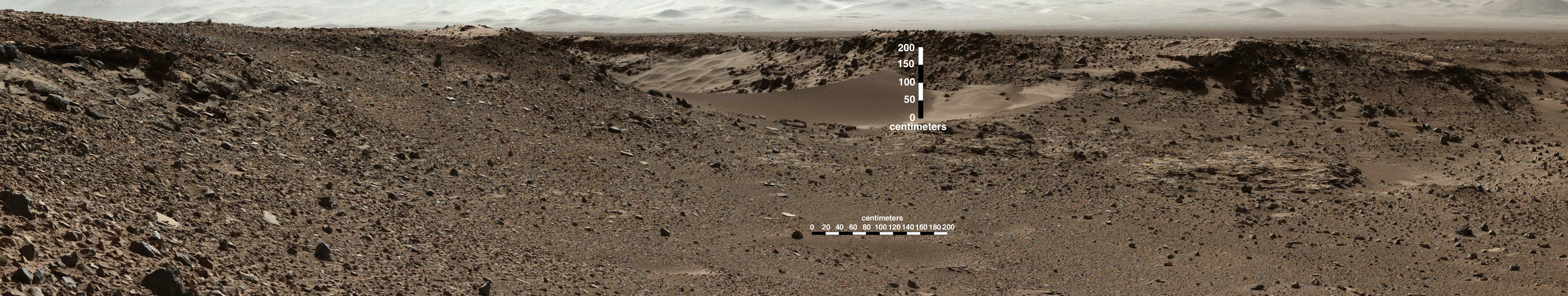
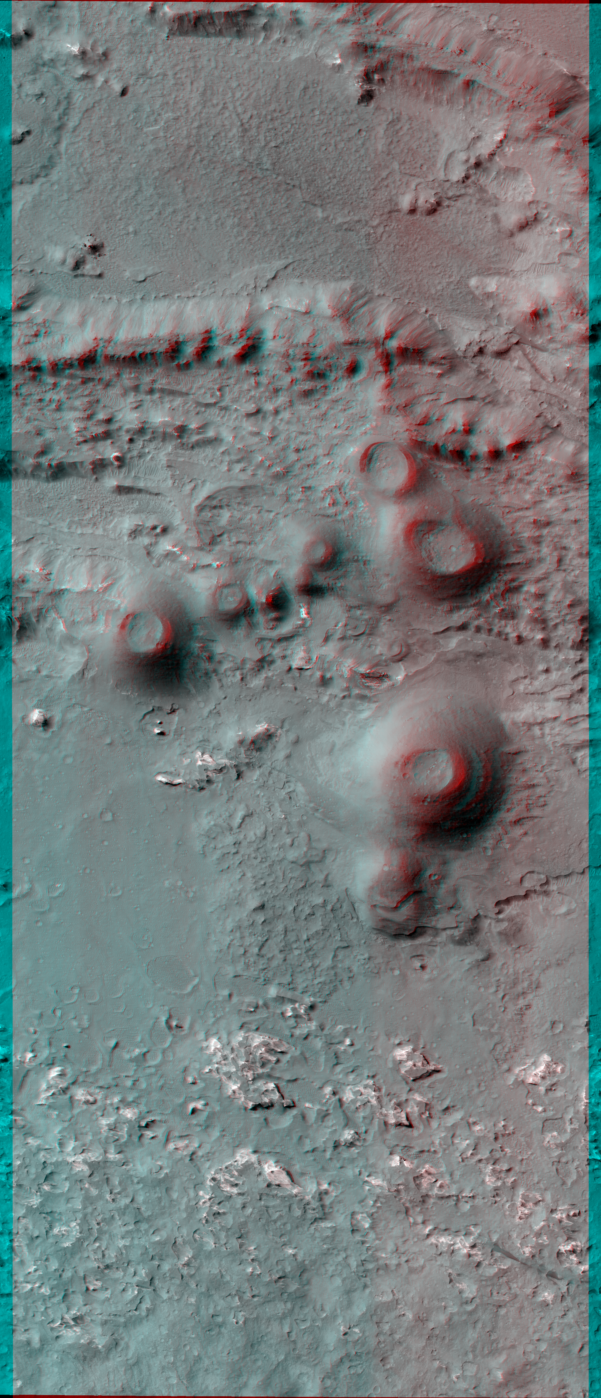
Why are scientists interested in areas that contain salts on Mars? Simply put, salts usually form by evaporation of liquid water. Most salts can easily dissolve in water, and if that water evaporates away completely, the salt is left behind as a deposit or residue. The larger the amount of salts initially dissolved, the larger the salt deposit left behind when the water evaporates. So when scientists look for regions on Mars that have noticeable salt deposits, they are effectively looking for areas that may have contained liquid water in the past.

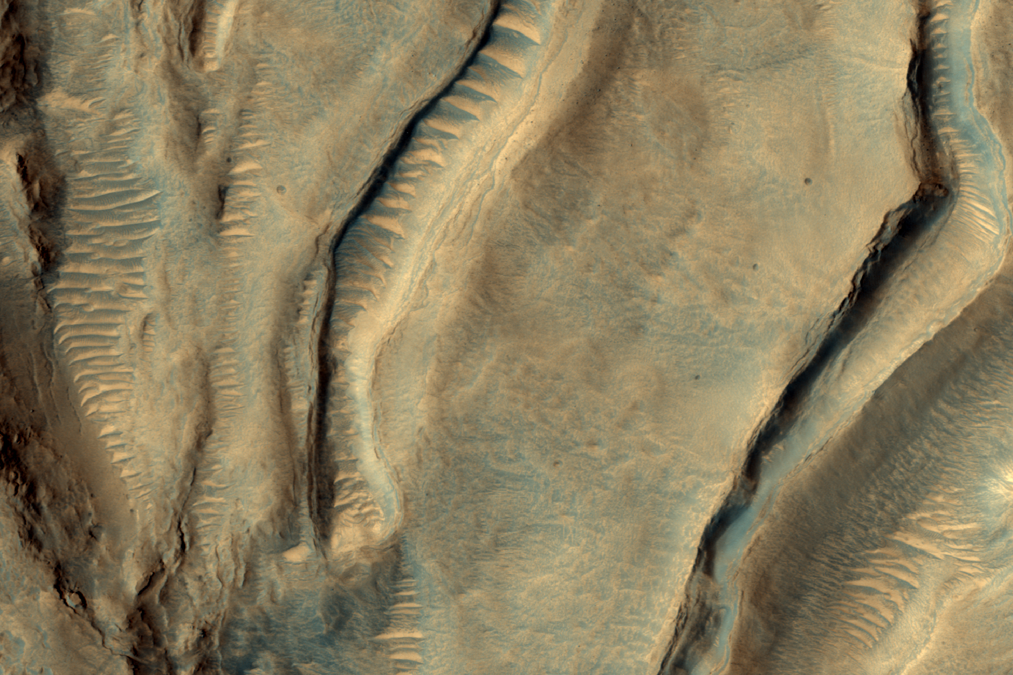
A few years ago, a group of scientists found more than 600 locations on Mars that may contain chloride salts, which could be very similar to common table salt. Since then, scientists have been using the HiRISE camera to look at these locations more closely and they have found out that many of these locations are very similar to dried lakes on Earth, which are sometimes called “playas” or “salt pans.” Many such playas can be visited in California and Arizona such as the Racetrack playa and the Death Valley National Park.

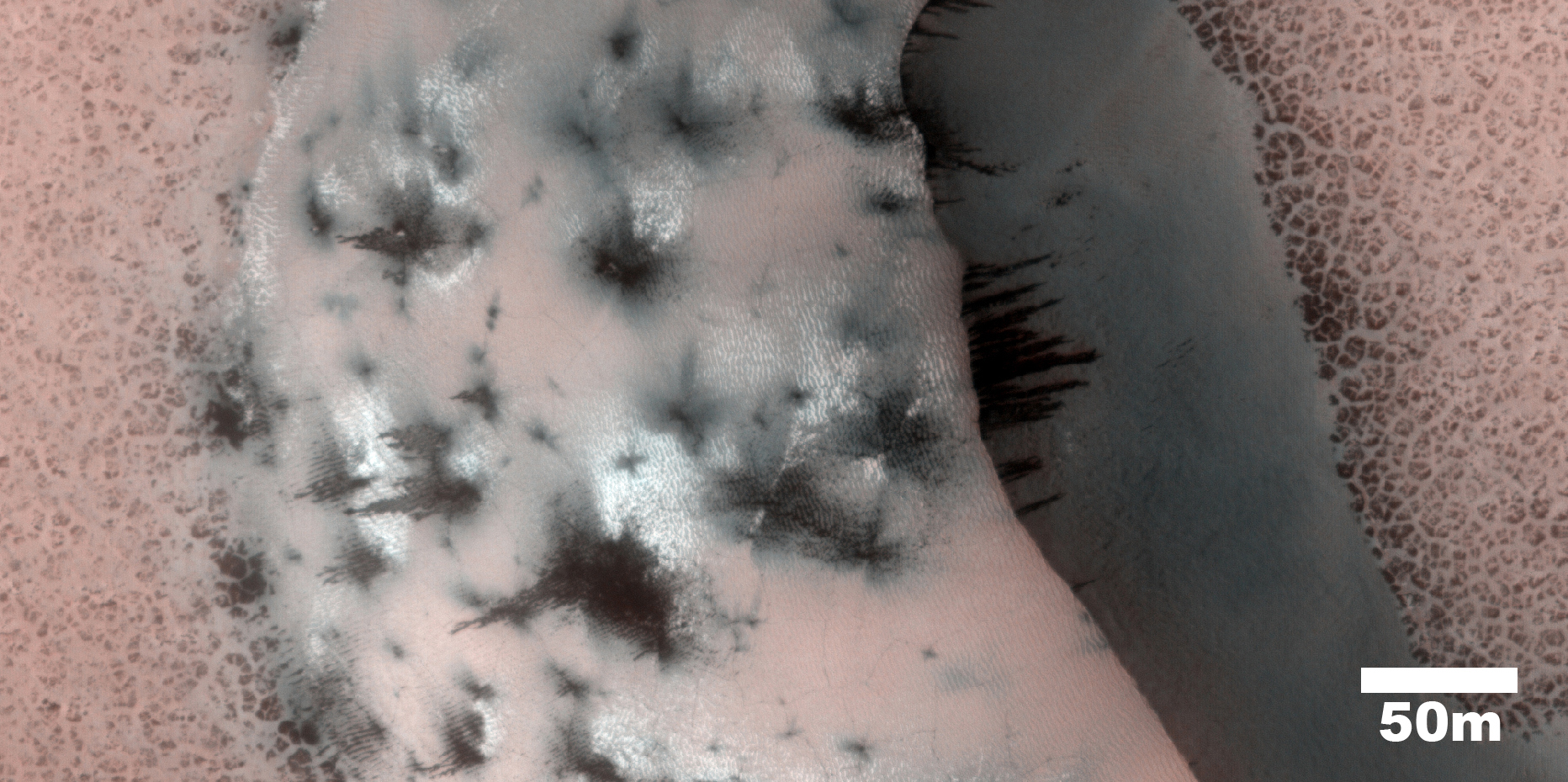
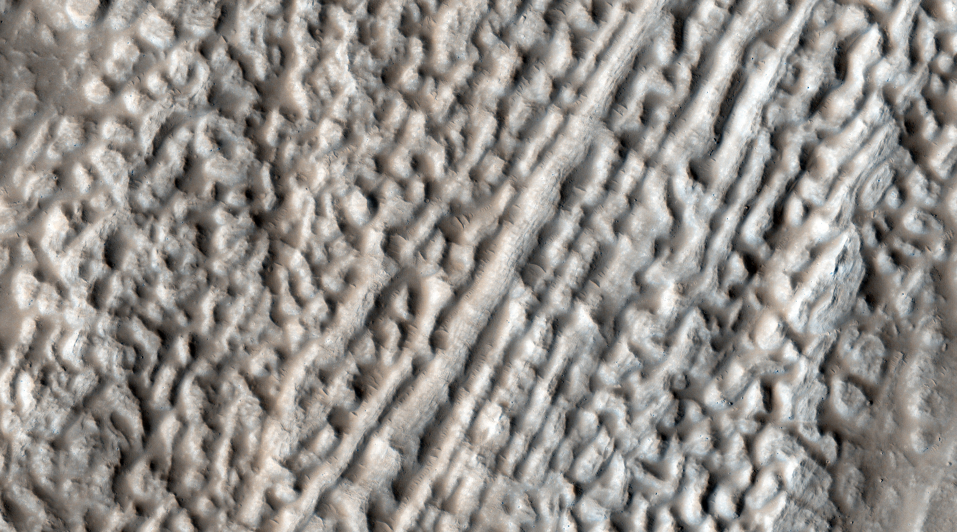
In this image, the chlorides have a bright appearance and are covered by other dark materials. Interestingly, the bright deposits also display cracks that form polygonal patterns very similar to common mud cracks, which may be another indication that these deposits formed when salty waters evaporated away. Studying these regions in detail can help scientists understand when and how the weather conditions on Mars may have changed.

Photo credit: NASA/JPL/University of Arizona

Note: These salt deposits are located in Terra Cimmeria, northwest of Morpheos Rupes. For more information, see PIA17875: Looking for Salts on Mars.

Friday, January 17, 2014

Olympus Mons - End of the Lava Flows


This VIS image located southwest of Olympus Mons, shows the end of a lava flow that has flowed between the hills at the upper left portion of the image.

Orbit Number: 53048 Latitude: 12.8907 Longitude: 221.307 Instrument: VIS Captured: 2013-11-28 21:38

Photo credit: NASA/JPL-Caltech/Arizona State University

Cinder Cones in Valles Marineris


The possibility of recent volcanism inside Valles Marineris was first proposed decades ago based on Viking orbiter images, but the candidate volcanoes proved to be other features such as complex sand dunes when we studied them with higher-resolution images.

However, this image shows cones with summit pits that are very similar to cinder cones on Earth. They are also very well-preserved, peppered by only small impact craters, so they must be geologically young (perhaps less than a few hundred million years).

These features were first seen in Context Camera image D01_027538_1674_XN_12S062W and a HiRISE target was suggested by a member of that team using HiWish. The cones might look like craters in single images, but if you look at the stereo anaglyph, you’ll see the cones stick up and are clearly not the same shape as impact craters.

This is a stereo pair with ESP_033986_1670.

Photo credit: NASA/JPL/University of Arizona

Note: For more information, see PIA17874: Recent Volcanism in Valles Marineris.

Thursday, January 16, 2014

Ceraunius Fossae


The complex fracture system in this VIS image is part of Ceraunius Fossae, one of the fracture systems that surround Alba Mons.

Orbit Number: 53047 Latitude: 21.418 Longitude: 251.344 Instrument: VIS Captured: 2013-11-28 19:37

Photo credit: NASA/JPL-Caltech/Arizona State University

Linear Fissure Vent Near Cerberus Fossae


The linearity of the volcanic vent shown in this HiRISE image, in conjunction with evidence of lava flow from the vent, suggests control by combined volcano-tectonic processes. The details of this vent gained by HiRISE should provide insight into those volcano-tectonic processes along Cerberus Fossae fissures in two ways.

The nature of both the volcanic products along this fissure, and the geometries of the linear vent, will permit comparison with similar, non-volcanic fissures at Cerberus. And results from these comparisons will provide insight into the orientation of the underlying dike system that may have controlled the ascent of water to the surface in the Cerberus region.

Future topographic analysis with a second image in order to create a 3D picture will enable us to measure the heights of the associated flows and better understand their volcanic history.

Photo credit: NASA/JPL/University of Arizona

Note: For more information, see PIA17876: Fissure near Cerberus Fossae with Tectonic Morphologies.

Wednesday, January 15, 2014

Olympia Undae


This VIS image shows a small portion of Olympia Undae, the vast dune field near the north pole.

Orbit Number: 53013 Latitude: 81.1248 Longitude: 175.596 Instrument: VIS Captured: 2013-11-26 00:08

Photo credit: NASA/JPL-Caltech/Arizona State University

Kasei Valles - The Floodwaters of Mars


Ten years ago, on 14 January 2004, Mars Express took its very first images of Mars in color and in 3D.

To mark the occasion, the team produced a fly-through movie of the ancient flood plain Kasei Valles. The movie is based on the 67-image mosaic released as part of the ten-years-since-launch celebrations in June 2013.

The scene spans 987 km in the north–south direction, 19–36°N, and 1550 km in the east–west direction (280–310°E). It covers 1.55 million square kilometers, an area equivalent to the size of Mongolia.

Kasei Valles is one of the largest outflow channel systems on Mars, created during dramatic flood events. From source to sink, it extends some 3000 km and descends 3 km.

Kasei Valles splits into two main branches that hug a broad island of fractured terrain – Sacra Mensa – rising 2 km above the channels that swerve around it. While weaker materials succumbed to the erosive power of the fast-flowing water, this hardier outcrop has stood the test of time.

Slightly further downstream, the flood waters did their best to erase the 100 km-wide Sharonov crater, crumpling its walls to the south. Around Sharonov many small streamlined islands form teardrop shapes rising from the riverbed as water swept around these natural obstacles.

Video credit: ESA/DLR/FU Berlin (G. Neukum)

Tuesday, January 14, 2014

Cyane Fossae


The complex fracture in this VIS image is one of the many graben that surround Alba Mons.

Orbit Number: 52960 Latitude: 36.0631 Longitude: 241.734 Instrument: VIS Captured: 2013-11-21 15:43

Photo credit: NASA/JPL-Caltech/Arizona State University

Monday, January 13, 2014

Curiosity's Tracks in Gale Crater


Two parallel tracks left by the wheels of NASA's Curiosity Mars rover cross rugged ground in this portion of a December 11, 2013, observation by the High Resolution Imaging Science Experiment (HiRISE) camera on NASA's Mars Reconnaissance Orbiter. The rover itself does not appear in this part of the HiRISE observation.

Curiosity has been on the move. By the time this image was taken, it had driven about 2.86 miles (4.61 kilometers) since its August 2012 landing in Gale Crater. This enhanced color image shows where the rover zigzagged to avoid steep slopes and other obstacles on its route toward its long-term destination on the lower slopes of Mount Sharp. Curiosity is progressing from a bright dust-covered area to a region with a darker surface, where windblown sand scours the surface relatively free of dust. For scale, the two parallel lines of the wheel tracks are about 10 feet (3 meters) apart.

The image is one product from HiRISE observation ESP_034572_1755. Other image products from this observation are available at http://uahirise.org/ESP_034572_1755.

Photo credit: NASA/JPL-Caltech/University of Arizona

Note: For more information, see PIA17755: Curiosity Trekking, Viewed from Orbit in December 2013 and Mars Orbiter Images Rover and Tracks in Gale Crater.

Sunday, January 12, 2014

Periodic Bedding in Tithonium Chasma


Earth's seasons are caused by the tilt of our planet's rotational axis to the orbital plane or obliquity. Mars' obliquity is currently about 25 degrees, which is not much different from Earth's 23 degrees. However, numerical calculations by scientists at the Paris Observatory and Massachusetts Institute of Technology suggest that this near-agreement is a coincidence.

Under the influence of gravitational torques from other planets, Mars' obliquity varies chaotically, probably reaching values greater than 60 degrees and lower than 10 degrees. By contrast, Earth's obliquity appears to have been limited to small variations from its current value because of the stabilizing gravitational influence of the Moon. If the calculations are correct, then for most of the Solar System's history, the obliquity of Mars was greater than 25 degrees. This would produce warmer summers and colder winters than on present-day Mars. On Earth, a recent 1 degree rise in obliquity is believed to have triggered ice sheet retreat from the current location of New York City to Greenland. The climatic consequences of 50 degree changes in obliquity on Mars remain unknown.

It is possible, though unproven, that higher obliquity triggered partial melting of some of Mars' water ice. Our best chance at understanding this is to find piles of ice, dust, silt or sand that accumulated over many cycles of obliquity change. Chemical, mineralogical and isotopic variations within those piles could then offer clues to about past climate changes. On Mars, sediment layers of near-uniform thickness visible from orbit are a fingerprint of deposits that record many cycles of obliquity change.

This HiRISE image of an east-facing slope in Tithonium Chasma was taken to follow up an earlier Context Camera image that seemed to show sediment layers of near-uniform thickness. These sediment layers are the dark and light stripes that run diagonally across the center of the observation. In this top-down view, afternoon sunlight picks out subtle east-west trending ridges in the east-facing slope. The dark and light stripes appear to deflect to the east (downslope) across the ridges. To a geologist, this outcrop pattern shows that the dip of the ancient sediment layers is gentler than the slope of the modern hillside. Further analysis of the image may determine whether these layers do record ancient obliquity-driven climate change on Mars.

Photo credit: NASA/JPL/University of Arizona

Saturday, January 11, 2014

Lyot Crater Dunes


The dunes in this VIS image are located on the floor of Lyot Crater.

Orbit Number: 52955 Latitude: 50.411 Longitude: 28.5003 Instrument: VIS Captured: 2013-11-21 05:45

Photo credit: NASA/JPL-Caltech/Arizona State University

Banded Ridges in Hellas Planitia


Low lying areas in the Hellas region -- which is the largest impact basin on Mars -- often show complex groups of banded ridges, furrows, and pits. These sorts of bands suggest that the surface material has flowed and twisted viscously like taffy. The orientation of the ridges and groups of ridges would then point in the direction of the flow, called stream lines.

Making this landscape even more complex is when we see that the ridges are sometimes disconnected. They stop abruptly, break up into blocky segments that sometimes appear offset. Such mixed up fragments give an initial sense that parts of the flow have been rafted apart from one another. Alternatively, the entire region may be substantially eroded since the time when the taffy-like ridges actually formed. In that case, the flow may have been far more complex and three dimensional, such that the disconnected portions are actually areas where the flow transitioned up and down relative to the current plane of the eroded surface. In this way we only see a slice through a far more complex series of twists and bends, some of which is still buried beneath the ground.

What this taffy-like material is made of is currently unknown. Hard and soft rocks, as well as ice and ice-rich rocky debris, can deform and flow given time under the force of gravity and the pressures found deep beneath the surface. Afterwards, differential erosion of hard and soft rock or icy materials mixed in bands and layers might give rise to the ridges, furrows and pits which we observe today.

Photo credit: NASA/JPL-Caltech/University of Arizona

Friday, January 10, 2014

Resistant Ejecta in Amazonis Planitia


This VIS image of southern Amazonis Planitia shows two craters with ejecta that stand out above the surrounding surface. The ejecta has remained in place while the surrounding material was removed. Extensive wind erosion is common in this region.

Orbit Number: 52949 Latitude: 6.13179 Longitude: 194.416 Instrument: VIS Captured: 2013-11-20 18:09

Photo credit: NASA/JPL-Caltech/Arizona State University

Chevron Ripples on a Slope in Coloe Fossae


This observation shows us a set of landforms that appears to form a nested "chevron" pattern on a slope in Coloe Fossae. Interestingly, nearby surfaces on the same slope are all parallel.

How do these form? Are they bedforms created by the wind? Why do some slopes have these features and others do not?

Further down the image, we see fretted terrain that's mostly likely the result of glacial processes. The valley floor offers a stark contrast to the upper slopes and its delicate rippled landforms.

Photo credit: NASA/JPL/University of Arizona

Thursday, January 9, 2014

Patapsco Vallis Entering Elysium Fossae


This VIS image shows where Patapsco Vallis enters the largest depression of Elysium Fossae. Patapsco Vallis, as other valley systems on the Elysium Mons volcanic complex, was likely formed by the flow of lava rather than water.

Orbit Number: 52938 Latitude: 23.8099 Longitude: 153.968 Instrument: VIS: Captured: 2013-11-19 20:20

Photo credit: NASA/JPL-Caltech/Arizona State University

Wednesday, January 8, 2014

Slope Streaks in Terra Sabaea


Numerous dark slope streaks mark the complex inner rim of this unnamed crater in Terra Sabaea.

Orbit Number: 52905 Latitude: 0.327992 Longitude: 22.046 Instrument: VIS Captured: 2013-11-17 03:17

Photo credit: NASA/JPL-Caltech/Arizona State University

Tuesday, January 7, 2014

Slope Streaks in Lycus Sulci


Dark slope streaks mark the hill sides in Lycus Sulci. These features are thought to be formed when a rock fall or other material slides down the steep face, removing the dust and revealing the darker surface below.

Orbit Number: 52873 Latitude: 26.3584 Longitude: 228.223 Instrument: VIS Captured: 2013-11-14 11:57

Photo credit: NASA/JPL-Caltech/Arizona State University

Saturday, January 4, 2014

Ascraeus Mons


The fractures, collapse features and lava flows in this VIS image are all located on the northern flank of Ascraeus Mons.

Orbit Number: 52872 Latitude: 14.8313 Longitude: 255.366 Instrument: VIS Captured: 2013-11-14 10:02

Photo credit: NASA/JPL-Caltech/Arizona State University

Murray Ridge Outcrop (False Color)


NASA's Mars Exploration Rover Opportunity observed this outcrop on the "Murray Ridge" portion of the rim of Endeavour Crater as the rover approached the 10th anniversary of its landing on Mars.

Opportunity used its Panoramic Camera (Pancam) during the 3,494th to 3,496th Martian days, or sols, of its work on Mars (November 21 to November 23, 2013) to take the images combined into this view. The scene includes an outcrop called "Moreton Island," which the rover imaged to help researchers choose a target for contact investigation with tools on the rover's robotic arm.

The view merges exposures taken through three of the Pancam's color filters, centered on wavelengths of 753 nanometers (near-infrared), 535 nanometers (green) and 432 nanometers (violet). It is presented in false color to emphasize subtle color differences among the materials on the Martian surface.

Opportunity landed on Mars on January 25, 2004, Universal Time (January 24, 2004, PST). Spirit, the other twin rover sent by NASA's Mars Exploration Rover Project, landed on January 4, 2004, UT (January 3, 2004, PST). Both missions were planned for durations of three months on Mars. Spirit worked for six years and Opportunity is still exploring in January 2014.

Image credit: NASA/JPL-Caltech/Cornell University/Arizona State University

Note: For more information, see PIA17752: Outcrop on 'Murray Ridge' Section of Martian Crater Rim and Decade-Old Rover Adventure Continues on Mars and Earth.

Friday, January 3, 2014

Nanedi Valles


Today's VIS image shows a portion of Nanedi Valles.

Orbit Number: 52870 Latitude: 6.3594 Longitude: 311.818 Instrument: VIS Captured: 2013-11-14 06:08

Photo credit: NASA/JPL-Caltech/Arizona State University

Thursday, January 2, 2014

Wind Erosion South of Olympus Mons


Winds have scoured this region south of Olympus Mons.

Orbit Number: 52848 Latitude: 8.2951 Longitude: 226.333 Instrument: VIS Captured: 2013-11-12 10:41

Photo credit: NASA/JPL-Caltech/Arizona State University

Wednesday, January 1, 2014

Ascraeus Mons


This VIS image shows part of the summit caldera of Ascraeus Mons.

Orbit Number: 52847 Latitude: 11.2919 Longitude: 255.561 Instrument: VIS Captured: 2013-11-12 08:41

Photo credit: NASA/JPL-Caltech/Arizona State University