
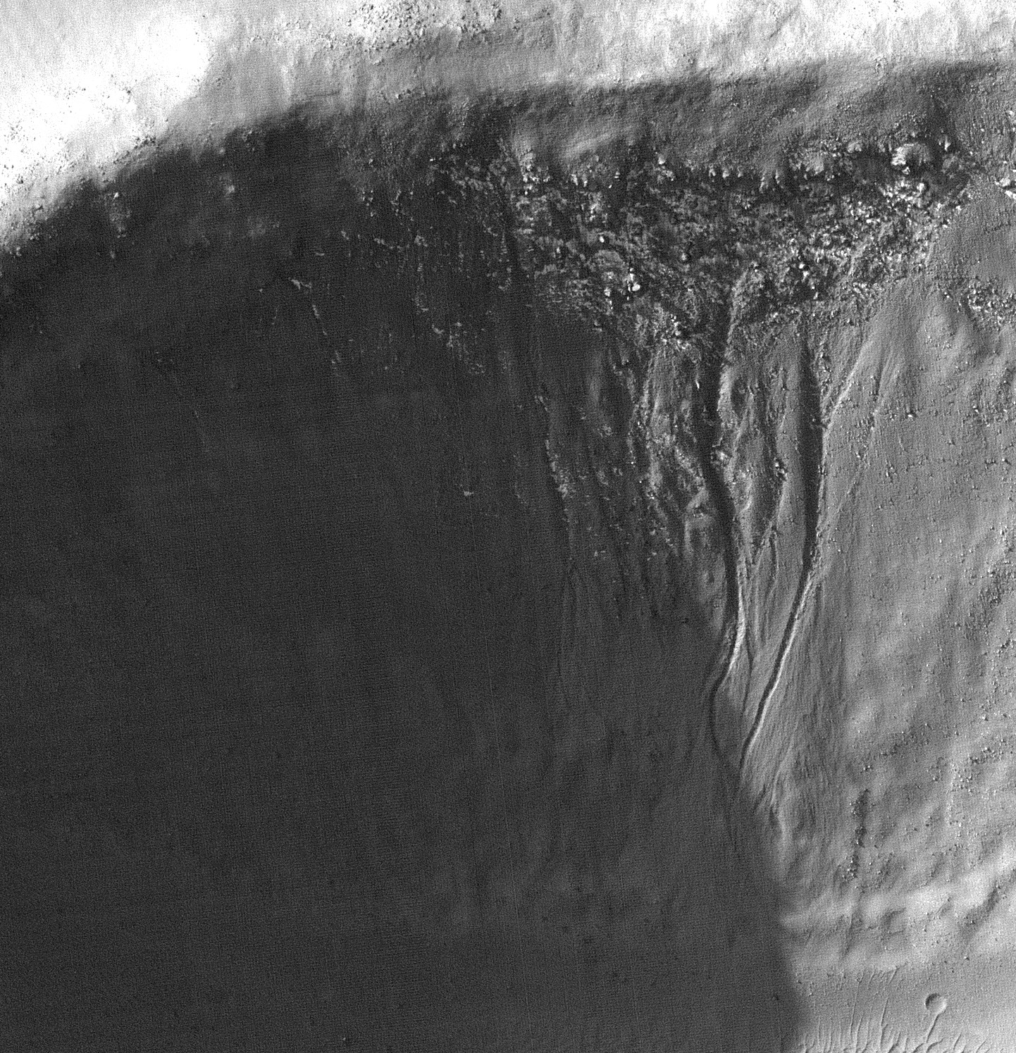
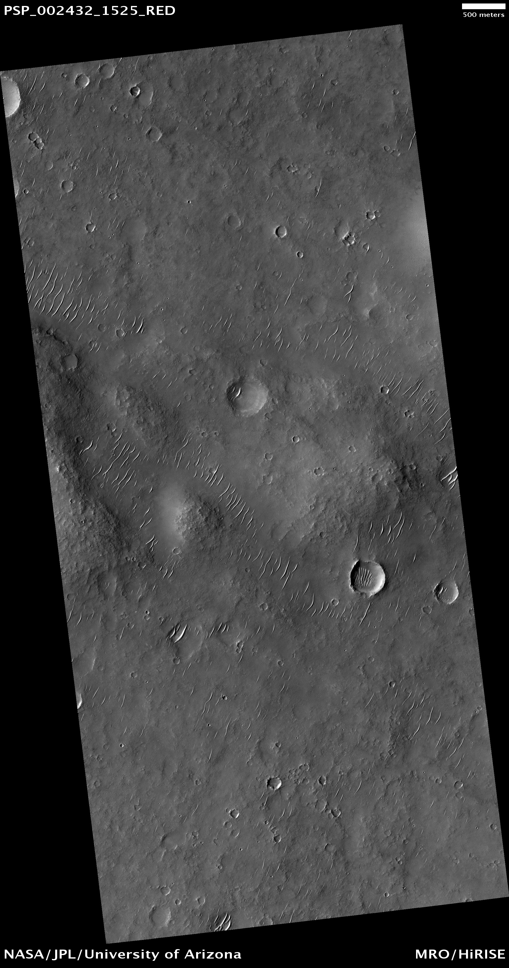
Today's VIS image shows a small portion of the southern flank of Alba Mons.
Photo credit: NASA/JPL/Arizona State University
Today's VIS image shows a small portion of the southern flank of Alba Mons.

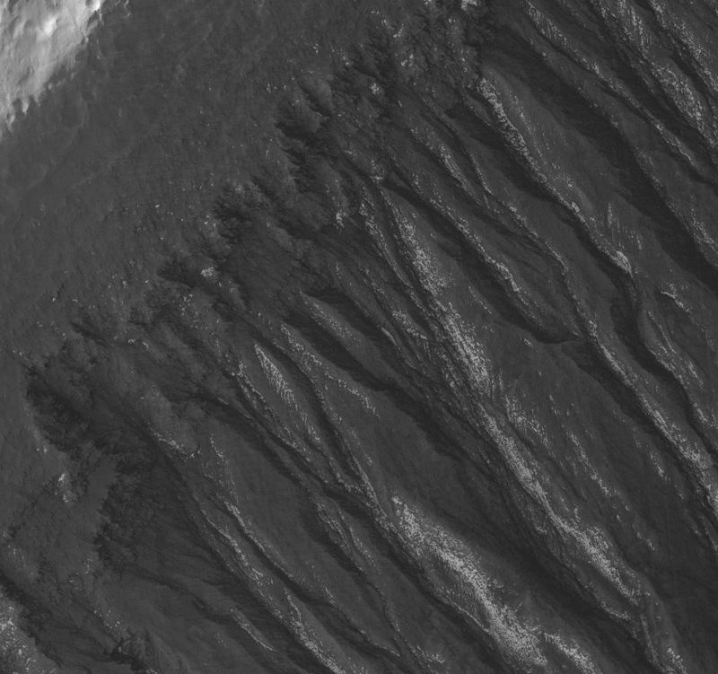
This observation shows gullies and arcuate ridges in a crater in the southern hemisphere of Mars. Arcuate ridges and gullies are found together at many places on Mars, leading some researchers to suggest that their coexistence may be a result of a single process.
Conversely, there are many locations on Mars where gullies and arcuate ridges are found alone, causing the debate about the relationship, or lack thereof, between their origins to continue. The bright regions in this image are frost, probably water frost, that is deposited and removed seasonally.
The arcuate ridges are the wavy features on the crater floor. They appear to parallel the alcove heads (upslope end) of the gullies. Arcuate ridges resemble protalus ramparts that are found on Earth. Protalus ramparts form at the bottom of snow-covered slopes when rock debris becomes separated from the slope face and accumulates downslope.
There is a mantled unit that covers the majority of the mid-latitudes of Mars that is thought to be ice-rich. This mantled unit drapes over topography and likely contains large amounts of dust, creating a dusty "snowpack." It is unknown how arcuate ridges form on Mars, but they are thought to be a result of mass wasting of ice-rich materials, possibly sections of the mantled unit.
The gullies seen in this image exhibit a range of morphologies. The large gully in the center of the image is deeply incised with a wide alcove. The gullies on the west (left) rim of the crater have small alcoves and tiny channels. Many of the channels appear to start at one of the fine layers that can be seen along this wall (see subimage). It is possible that water came from underground along these layers to form the gullies. The gully on the far left of the image extends all the way to the top of the slope. It is likely that the water that fed this gully came from one of the layers and then the slope experienced headward (upslope) erosion and collapse to extend the alcove to the crater rim.

This VIS image shows dunes on the floor of Nili Patera, one of the two volcanic calderas of Syrtis Major.

The flanks of Olympus Mons are covered with lava flow after lava flow. Most of these flows are relatively narrow flows with a channel running down the middle. They appear similar to the lava flows found on Mt. Etna in Sicily.
However, in this image, we see these typical lavas partially covered by another, more recent flow. This flow also has a central channel, but is about 10 times wider than the more typical flows.
At the center of the HiRISE image the channel disappears. This is probably because the channel was blocked here and lava spilled out of the channel and covered a broad, fan-shaped, area. The eruption that produced this unusual flow was probably more vigorous and perhaps lasted longer than the more common ones.

This VIS image of Candor Chasma shows a complex region of eroded layered deposits.

This observation is a candidate landing site for the Mars Science Laboratory (MSL) rover — named Curiosity — to be launched in 2011.
One of the main science objectives for MSL at this location is to examine deposits containing different types of clay minerals along the banks of Mawrth Vallis.

The complex region of channels at the top of this VIS image are lava channels. These channels are called Olymipca Fossae.

This image, of the northern plains of Mars, is marked by depressions in a layer of material that covers the region. The depressions, several of which have coalesced together, have scalloped edges and layers in their walls.
Features such as these are most commonly found at approximately 55 degrees North and South latitude. Their presence has led to hypotheses of the removal of subsurface material, possibly ground ice, by sublimation (evaporation). This process is believed to be ongoing today.
In this image, steeper scarps with layers consistently face the north pole while more gentle slopes without layers face in the direction of the equator. This is most likely due to differences in solar heating.
Large boulders, some several meters in length, are scattered within the depressions and on the surrounding surface. Also on the surface surrounding the scalloped depressions is a polygonal pattern of fractures. This is commonly associated with "scalloped terrain," and indicates that the surface has undergone stress potentially caused by subsidence, desiccation, or thermal contraction.

This VIS image shows the northern wall of Ganges Chasma. Dunes and a landslide deposit are visible at the bottom of the image.

This observation shows an outcrop of bright material in Melas Chasma, part of the giant Valles Marineris trough system.
These troughs contain many bright deposits, often layered. The origin of these materials is still not known, but is the subject of much study because answering this question will provide important information regarding the geologic history of Mars.
In this image, some layers are visible, but much of the surface has a strange scalloped texture. The cause of this texture is unclear, but it is likely related to the mechanism of erosion of these deposits as well as their physical nature.
These materials are being eroded by winds, forming elongated ridges called yardangs. These winds may also be responsible for the small-scale scalloped texture. Also, landslides have produced some talus cones, composed of piles of loose debris; these are visible in places, mostly near the base of the mound, as wedge-shaped features containing many boulders.

This VIS image shows dunes on the floor [and one of the ridges] of Juventae Chasma.

Aram Chaos appears to be a former impact crater. The terrain is disrupted, giving it a chaotic appearance (hence the name "chaos"). Scientists have postulated that a lake may have once existed inside the crater and sediments were laid down within the lake.
The mineral hematite (rich in iron) has been detected by orbiting spacecraft within Aram Chaos. Hematite has been identified in several other locations on Mars, including at the Mars Exploration Rover [Opportunity] landing site in Meridiani Planum. The hematite at both Meridiani and Aram Chaos most likely formed by precipitation in water.
This HiRISE image shows the light-toned sediments inside Aram Chaos that could have formed in a former lake. Unfortunately, dark debris now obscures much of this sediment, making it difficult to view and interpret the rocks. The light-toned layered deposit in the south (bottom) of the image is higher standing and has a pitted surface.
Circular structures with dark centers are likely to be impact craters that have been partly filled with dark debris, including sand. More irregular depressions appear to result from erosion of layered beds within the sediments. Wind could erode materials that are slightly weaker more quickly and produce the irregular topography seen along the surface of the deposit.

This image shows a portion of the floor of Ganges Chasma. Eroded deposits and sand dune forms are common features of Ganges Chasma.

Mars’ carbon dioxide atmosphere partially condenses every winter to form polar caps of dry ice. In the spring, the evaporation of the ice is a dynamic process and carves channels into the ground as it escapes back into the atmosphere.
Often these channels are radial in nature, and are colloquially referred to as “spiders,” although the preferred term for these radially-organized channels is “araneiform” which means spider-like.
In this subimage all the seasonal frost is gone, and we can use stereo images or shadow measurements to measure the depth of the channels carved into the ground, typically 1 - 2 meters deep.

Dark slope streaks are visible on the rim of this crater in Terra Sabaea.

Somewhere in this patterned landscape less than 1,000 kilometers (about 600 miles) from the south pole of Mars, a treasure may be hiding.
In January 1999, NASA launched a rocket containing the Mars Polar Lander (MPL), an exploration vehicle with a weather station and a subsurface probe designed to search for water ice, towards the layered terrain near the Martian south pole. The layers are thought to be a sequence of alternating dust-rich and dust-poor ice deposited by the seasonal advance and retreat of the south polar ice cap and could be an important record of climate on the Red Planet.
On 3 December 1999, just before the lander entered the Martian atmosphere, MPL went silent. Investigations propose the most likely cause of the mission failure is that the spacecraft’s computers misinterpreted the release of the lander’s legs in preparation for descent as touch-down on the Martian surface, causing descent engines to shut off when the lander was still 40 meters (130 feet) above ground. However, no one knows for sure.
An immediate search began for the remains of the MPL using images from Mars Global Surveyor. HiRISE is continuing the search with high resolution images of the area in which MPL is most likely to have landed.

The windstreak in this image is located on lava flows from Arsia Mons.

Slope streaks, commonly seen in dust-rich equatorial regions of Mars, have been observed in all spacecraft images from the early Mariner missions to the most recent Mars Reconnaissance Orbiter (MRO) mission.
Recently formed slope streaks are typically darker than their surroundings and appear to fade (i.e., brighten) over time. Typical characteristics of slope streaks are initiation at a point source, one streak splitting into two, deflection around or over obstacles such as small boulders or crater rims, widening below the source area up to a few hundred meters, and lengths of up to a few kilometers.
Numerous models have been proposed for their formation, both dry- and wet-based. Although there is not one universally accepted model, one key observation up to now was that streaks do not appear to have topographic relief. However, HiRISE images from the first seven months of MRO showed that slope streaks do indeed have topographic relief: the streak interior is lower than its surroundings. There are also many Martian slope streaks that do not appear to have relief; this does not necessarily mean they lack relief, but rather, the relief is below the capability of HiRISE to detect.
The discovery of topographic relief provides an important clue in that sediment had to be removed for the relief to be present. There are several processes, both wet and dry, that can remove material. A small stream of liquid water running over the surface could carve out the streak area, but liquid water exposed at the surface is not stable under current Martian conditions. Water flowing below the surface, covered by an insulating layer of materials is also possible.
Other evidence that would favor a wet process are detection of salts, alcoves or channels above the point source, or streaks forming at the intersection of two different geologic layers (i.e., permeable and non-permeable layers). However, there are no documented cases of these thus far. Thus, a dry process is appealing and one of these are dry dust avalanches.
Further analyses of the slope streaks have documented features related to modification of the streaks. These include ridge-like structures, which have been interpreted to be aeolian ripples. These ripples indicate that saltation of grains within streak beds are occurring on Mars today, and have likely occurred in the recent past.

Numerous dark slope streaks are visible in this small unnamed crater in Zephyria Planum.

This image reveals an interesting coincidence of two important planetary processes: impact cratering and tectonism.
Here we have an impact crater (the large round feature, approximately 6.2 kilometers, or 3.9 miles, across) that intersects a series of faults (the linear features). The faults are seen to cut the circular rim of the impact crater. Also, the impact did not destroy the adjacent faults. These observations tell us that the fault was active after the impact occurred.
In addition, by measuring the distance of offset of the different pieces of the crater rim separated by the fault line (assuming that when the crater formed, the rim was continuous around its circumference), the amount of movement along the fault can be estimated, laterally and vertically. Faults like these cause troughs to form, called graben, of which the heavily shadowed one is a good example. The center (shadowed) section has been dropped downwards relative to the surrounding terrain, forming the trough.
It is also clear that parts of the crater rim are lower than others where the graben intersects the crater. The sides of the graben (the faults forming the walls of the trough) are sloped, so that the dropped-down part of the crater rim has also moved horizontally away from the higher part of the rim. The combined down-dropping and moving apart indicates that the land here is being stretched and pulled apart, called extension. By measuring the amount of offset on all the faults, we can estimate how much extension has occurred in this part of the planet.
This location is especially helpful because, as mentioned above, we have a good knowledge of the “before-faulting” configuration of the land, in which the crater rim was continuous. Finally, it is interesting that there is no sign of the fault on the floor of the crater – the floor has not been faulted and no part is down-dropped and stretched apart as the crater rim has been. This indicates that some infilling of the crater (perhaps by lava or airborne sediment) has likely occurred since the fault was active, burying the trace of the fault and representing a third stage of geologic history in this area.

The dunes in this VIS image are located on the floor of an unnamed crater in Tyrrhena Terra.

This observation shows dark dunes and light polygonal terrain in Olympia Undae, also known as the North Polar Erg.
Two sets of dunes are obvious. The major set trends North-South, indicating winds from the East or West. Between the crests of these dunes is a second set oriented mostly East-West.
Zooming in on the dunes, a rippled texture is apparent, probably due to redistribution of sand at the scale of meters and less. Near the crests of some dunes are channel-like features, with some branching downslope. The origin of these channels is unknown, but they may result from the flow and displacement of sand that was fluidized by sublimating carbon dioxide or water frost.
Bright patches of ground are found in some inter-dune areas, with many having a polygonal texture. Polygons on Earth form from contraction induced by stresses from dehydration, cooling, and other processes, so these features may have a similar origin. The CRISM instrument on MRO and OMEGA on Mars Express indicates that many dunes in Olympia Undae are rich in the mineral gypsum.

This VIS image shows a portion of the northeastern flank of Ascraeus Mons.

Ascreaus Mons is one of the giant shield volcanoes in the Tharsis region of Mars. Based on earlier lower resolution images, this location seemed to be ideal for examining how different types of lava flows interacted.
The smoother ground on the northwest side of the image is probably a lava flow with a relatively smooth crust much like "pahoehoe" lava flows in Hawaii.
The rugged terrain in the southwestern part of the image is indicative of a highly disrupted crust, possibly like what Hawaiians call an "aa" flow. Instead of confirming these hypotheses, HiRISE shows that the lava flow details are obscured by dust. The dust is carved into a curious network of scallops that are too small to have been seen by previous cameras.

This observation shows the interior of Gale Crater, a region being considered as a landing site for the 2011 Mars Science Laboratory.
Gale is distinguished from many other craters on Mars by a large interior layered mound that extends to the height of the crater rim. The top part of this image contains portions of the southeast part of the mound, with the bottom part showing details of the crater floor.
The mound material here is exposed as several distinct smaller hills. Close up, the hills show abundant rocks and debris aprons on their flanks, lacking distinct bedrock layers seen elsewhere on Mars. This suggests that the mound material is friable and easily eroded by the wind over time.
Other evidence of wind activity includes bright bedforms near the top of the image and dark bedforms and sand sheets at bottom. Between the hills and dark sand are a series of stacked stratigraphic units. Polygons are visible in some of the units, indicating contraction due to water loss, cooling, or some other process. Many of the polygons appear highly fractured.
Possible crossbeds are seen in some of the rock exposures near the bottom of the image. This and other images of Gale will be studied over the coming months and years in order to better understand the geology and further assess the potential as a future landing site.

Dark slope streaks, like the ones on the rim of a unnamed crater in Terra Sabaea, are thought to have been formed by material moving down slope due to gravity. As the lighter toned fine materials are removed, the darker toned underlying materials are exposed.

As on Earth, the seasonal frost caps of Mars grow and recede each year. But seasonal frost on Mars is composed of carbon dioxide ice (also known as dry ice), not water ice as on our planet.
Near the south pole of Mars, the seasonal carbon dioxide frost never completely disappears, leaving a residual ice cap of carbon dioxide ice throughout the summer. This HiRISE image shows part of the south polar residual cap, with many shallow pits dubbed "Swiss cheese" terrain. Because the sun is always low in the sky at this latitude, the steep walls of the pits receive more solar energy than the high-standing, flat areas between the pits. This causes the walls of the pits to retreat several meters per year as sunlight causes the carbon dioxide ice to evaporate directly to gas, a process called "sublimation."
In some depressions, ridges or blocks of material a couple of meters (several feet) across are visible at the base of the depression walls, likely fallen from the walls during the sublimation and retreat process. At this rate, the layer of carbon dioxide ice could completely disappear in about 100 years if not replenished.

This region of Mars has been eroded by the wind. Linear hills called yardangs indicate the wind direction, which varies in this area of Medusae Fossae.

This observation shows the intersection of several geologic features at the edge of the huge Valles Marineris system of canyons on Mars.
The circular feature is an impact crater, roughly 4 kilometers (2.5 miles) across. To the south, terrain slopes downward over 4,000 meters (13,000 feet). Thinking of the crater like a huge drill hole and the canyon wall like a towering road-cut, both features provide a glimpse into the subsurface of the surrounding terrain.
In the curved north wall of the impact crater, and in the East-West trending, upper walls of the canyon (center of the scene), individual layers of rock can be traced laterally over hundreds to thousands of meters (thousands to tens-of-thousands of feet). The layers appear prominently in the wall because they are stronger, steeper, and more resistant to erosion than materials above and below, which form more gradual slopes.
In this scene, darker shadows help to distinguish the steeper, rock layers from lighter, gentler slopes, which are covered with broken rocks and dust. Such layers on Mars may have been deposited by the wind, in water, or by volcanic lava flows or ash falls. Thicknesses and sequences of layering can yield information about how many different events were responsible for their formation, the relative volumes of material involved in each event, and whether a repeating pattern of events of similar type and/or size exists.
The interaction of crater materials and the canyon adds an additional level of interest and complexity to the scene. Normally, when an impact into a layered planetary surface occurs, materials from the center of the crater are pushed downward or blown upward and outward (forming the hole in the ground), while the terrain immediately ringing the crater is tilted upwards to form a relatively narrow, sharp rim as exemplified along the north and southeast edge of this crater. However, the southwest rim of this crater is wider, extends further away from the crater center, is not as circular, and contains several discontinuous pieces of ridges. Either this wall of the crater was pushed further outwards and stretched because the impact occurred near the edge of the canyon (basically allowing the impact to push the wall part-ways over the edge of the canyon), or erosion and expansion of the canyon after formation of the crater has partially undercut the crater wall, causing the wall to slump downwards and outwards.
In either case, it may be possible to learn something about the impact-induced damage and disruption caused in the ground below the rim of a crater; about the strength and structure of post-impact materials in the crater wall; about the effects of impacts on layers farther away or below the crater, and about processes of erosion, canyon growth, and crater formation.


This observation shows two southern hemisphere craters. These craters are about the same size, approximately 800 - 900 meters in diameter, and appear to have experienced parallel histories. Both craters show dunes and gullies with similar orientations.
Several generations of dunes can be seen in the interior of these craters. The largest barchan dunes trend northwest-southeast with their slip faces facing the southeast, indicating that the winds forming them came from the northwest.
There are smaller dunes that superpose the large dunes with a different orientation. Different dune orientations are a sign of a changing dominant wind direction. Both craters have similar dune orientations, which is expected because of their proximity.
The two craters also both have gullies originating at layers on their south-facing walls. The gullies are mostly in shadow, but adjusting the brightness and contrast of the image allows them to be seen. The subimage is approximately 300 meters across and shows the gullies in the crater on the right. Gullies are thought to form by liquid water flowing down slopes, but the source of the water and how it is involved in gully erosion is often debated.
One theory proposes that near-surface ground ice melts to form the gullies. An important part of this theory is the direction and amount of insolation (sunlight) a slope receives. Since these craters are close to each other, they receive similar insolation, which could explain why the gullies are in the same location in them.
Another theory suggests that subsurface water from an aquifer forms the gullies. If an extensive aquifer existed, it would flow downslope. If the regional slope trends towards the south, that could explain why the gullies are where they are (the water would come from behind the slope to form the gullies).
HiRISE is showing us unprecedented details of the gullies and will no doubt bring us closer to understanding how these mysterious features form.

This VIS image shows a small portion of the floor of Capri Chasma. Bright layered deposits and dunes are visible in this image.

This observation covers a small part of the plains surrounding the volcano Tyrrhena Patera.
Most of this area is covered by a thick layer of "mantling" material which hides the underlying rocks. Infrared data from the Mars Odyssey spacecraft suggested that this area is rockier than most of the region.
The center of the image is at full resolution, but the outer edges have averaged each group of 4 x 4 pixels. This reduces the amount of data that needs to be returned to Earth and helps ascertain how much resolution is actually needed to study this kind of terrain.
This observation confirms that the area is unusually rocky, with some bare patches of ancient shattered rock exposed at the surface. This image is also a good example of how the HiRISE team samples unknown terrain.

Two landslide deposits are visible in this image of Tithonium Chasma.

Previous images of this area by other space missions indicate that this is a shield volcano with very shallow slopes. What HiRISE reveals is that it is completely covered by a blanket of dust.
While volcanic features remain obscure, the dust does exhibit some very strange patterns. As you zoom into the middle of the image, the ground appears covered with a fine network of light and dark polygons. But at full resolution, it can be seen that these polygons are actually the edges of small scallops.
The dust is apparently held together by some unknown means, giving it sufficient strength to be carved into this strange pattern.

This VIS image shows a complex tributary channel and its entry to the main channel of Shalbatana Vallis.

This image captures one of the cleaner portions of the interior wall of the caldera at the top of Tharsis Tholus.
Tharsis Tholus is an intermediate sized shield volcano, much smaller than giants such as Olympus Mons, but still large by terrestrial standards. While relatively dust-free, this section of the caldera wall is still extensively covered by dust that is being sculpted into curious shapes by the wind and by gravity.

This small channel is located on the northern margin of Arabia Terra.

This observation samples part of an ancient lava plain in Thaumasia Planum. The stack of lava flows has been folded into dunes the size of a chain of hills, as is visible in the center of the image.
The lava and the dunes has been degraded by erosion. The numerous craters and dunes attest to two of the erosional processes—meteorite impacts and the wind.

This VIS image shows a landslide deposit in Ophir Chasma.

Impact craters on Mars are kind of neat: many of them look very different than impact craters seen on the Moon or Mercury.
Fresh lunar and Mercurian craters have ejecta blankets that look a bit rough near the crater rims; around larger craters, long rays or chains of secondary craters radiate away from the crater rims. Some Martian craters are similar to these craters, but Mars also has a high proportion of craters with forms not found on the Moon or Mercury: rampart craters.
Rampart craters, also called fluidized-ejecta craters, have ejecta blankets that appear lobate, or rounded, and end in low ridges or ramparts, such as the ridge in this HiRISE image. Here you see the rampart at the edge of the ejecta blanket that comes from an approximately 16 kilometer (10 mile)-diameter crater, about 16 km (10 mi) to the east.
For years there has been a debate about whether these lobes and ramparts were formed by ejecta interacting with the thin Martian atmosphere, or whether they formed because volatiles (such as water or ice) in the subsurface were incorporated into the ejecta material excavated by the impact. The common consensus is now in favor of the volatile hypothesis. Because of this, rampart craters can be used to indicate the past presence of water or ice in the Martian crust.

At the eastern end of Valles Marineris is Eos Chasma. In Eos the canyon system transitions into a region of chaos and then into major outflow channels. This image shows the transition into chaos.

Lengthy detective work with data NASA's Mars Exploration Rover Spirit collected in late 2005 has confirmed that an outcrop called "Comanche" contains a mineral indicating that a past environment was wet and non-acidic, possibly favorable to life.
Spirit used its panoramic camera to capture this view of the Comanche outcrop during the 689th Martian day, or sol, of the rover's mission on Mars (December 11, 2005). The rover's Moessbauer spectrometer, miniature thermal emission spectrometer and alpha particle X-ray spectrometer each examined targets on Comanche that month. On June 3, 2010, scientists using data from all three spectrometers reported that about one-fourth of the composition of Comanche is magnesium iron carbonate. That concentration is 10 times higher than for any previously identified carbonate in a Martian rock.
Carbonates originate in wet, near-neutral conditions but dissolve in acid. The find at Comanche is the first unambiguous evidence from either Spirit or its twin, Opportunity, for a past Martian environment that may have been more favorable to life than the wet but acidic conditions indicated by the rovers' earlier finds.
In this image, Comanche is the dark reddish mound above the center of the view. The image is presented in false color, which makes some differences between materials easier to see. It combines three separate exposures taken through filters admitting wavelengths of 750 nanometers, 530 nanometers and 430 nanometers. The main Comanche outcrop is about 5 meters (16 feet) from left to right from this perspective. The paler material visible at bottom right is part of another outcrop, "Algonquin."

