
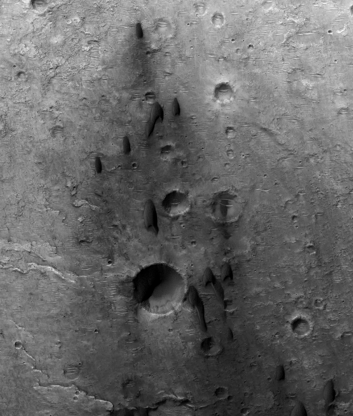
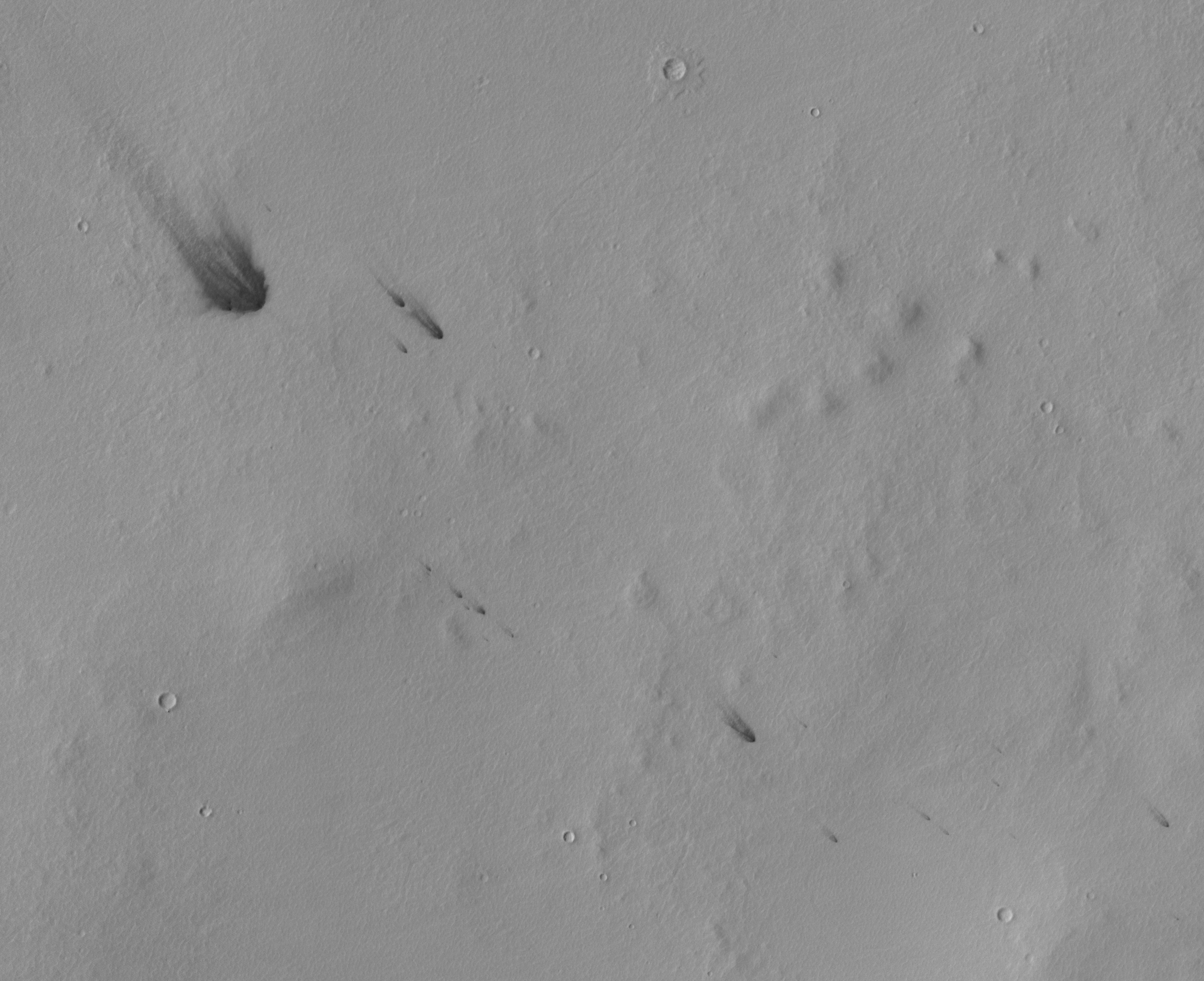
Dark slope streaks mark the rim of this unnamed crater in Terra Sabaea.
Orbit Number: 54715 Latitude: 13.3858 Longitude: 41.7134 Instrument: VIS Captured: 2014-04-15 02:01
Photo credit: NASA/JPL-Caltech/Arizona State University
Dark slope streaks mark the rim of this unnamed crater in Terra Sabaea.
Orbit Number: 54715 Latitude: 13.3858 Longitude: 41.7134 Instrument: VIS Captured: 2014-04-15 02:01

Today's VIS image of the northern plains show hundreds of dust devil tracks.
Orbit Number: 54706 Latitude: 62.5081 Longitude: 310.578 Instrument: VIS Captured: 2014-04-14 07:58

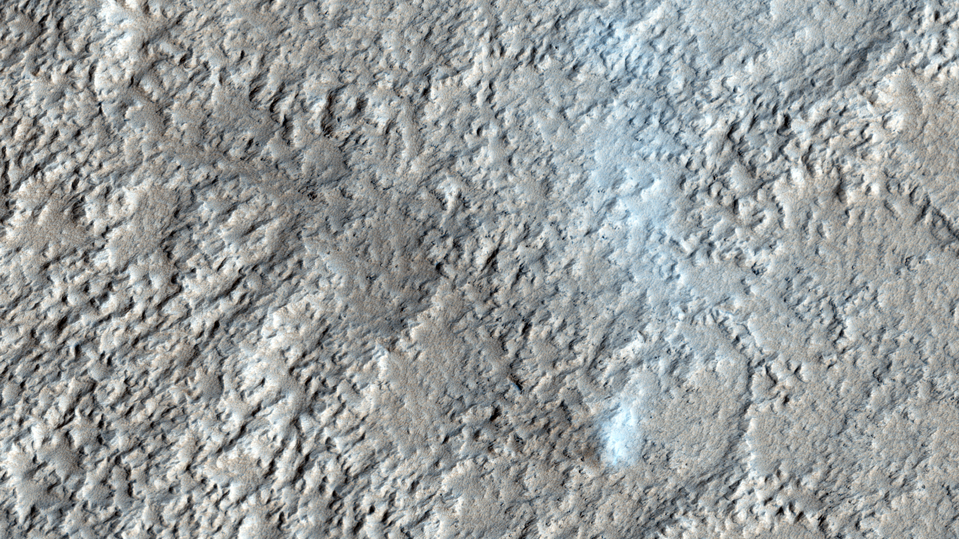
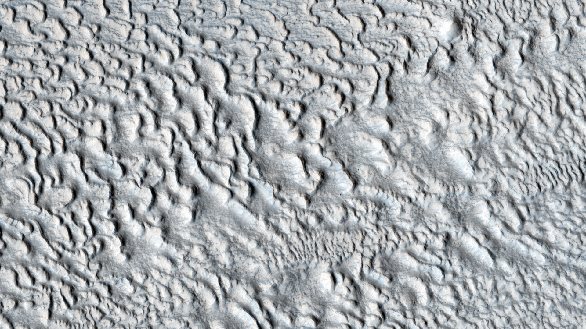
This unnamed crater in this VIS image is located on the margin between Terra Sabaea and Utopia Planitia and is filled with material with a grooved surface. The grooves parallel the crater rim and may indicate that the material is flowing away from the rim. The flow is probably supported by volatiles (like ice) within the fill material.
Orbit Number: 54664 Latitude: 37.9717 Longitude: 75.8752 Instrument: VIS Captured: 2014-04-10 21:09

The channel at the very top of this VIS image is Olympica Fossae. That and the rest of the channels in this image are likely lava channels.
Orbit Number: 54658 Latitude: 24.5997 Longitude: 246.738 Instrument: VIS Captured: 2014-04-10 09:22

This scene from the panoramic camera (Pancam) of NASA's Mars Exploration Rover Opportunity catches "Pillinger Point," on the western rim of Endeavour Crater, in the foreground. The eastern rim of the crater is on the distant horizon. Endeavour Crater is 14 miles (22 kilometers) in diameter.
The vista spans from north-northwest, at the left, to south-southwest, at the right. It merges several Pancam exposures taken on the 3,663rd Martian day, or sol, of Opportunity's work on Mars (May 14, 2014). The scene is presented in approximate true color by combing exposures taken through three of the Pancam's color filters, centered on wavelengths of 753 nanometers (near-infrared), 535 nanometers (green) and 432 nanometers (violet).
Opportunity's international science team chose Pillinger Point as the informal name for this ridge as a tribute to Colin Pillinger (1943-2014). Pillinger was the British principal investigator for the Beagle 2 project, which attempted to set a lander on Mars a few weeks before Opportunity's January 2004 landing.
The site became a destination for Opportunity to examine because observations from orbit indicated the presence of a clay mineral named montmorillonite, which forms under wet conditions.

A sand sheet with surface dune forms covers part of the floor of this unnamed crater. This crater is located in Acidalia Planitia.
Orbit Number: 54656 Latitude: 61.3669 Longitude: 311.752 Instrument: VIS Captured: 2014-04-10 05:13

Sand dunes on Mars are frequently found within craters, raising the question: do they form from sandy materials within the craters, or are they simply traps for dunes traveling in their path?
This image shows dozens of dark-toned dunes in and around several craters within the rugged terrain of Terra Cimmeria. Based on the positions of the dune avalanche slopes, called "slip faces", the migration direction is toward the bottom of the image (to the south).
This direction relative to the local terrain indicates that the dunes here have been transported in and out of the craters on their path southward. Smaller sand patches appear anchored in the depressions where wind cannot effectively initiate sand motion, trapping sand indefinitely.
Here, HiRISE has revealed sand dunes can be both be caught and released by craters on Mars.

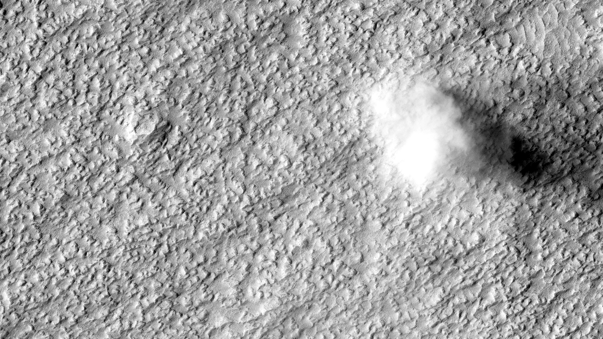
HiRISE has captured some stunning images of dust devils in action, but the overall sample remains fairly limited. Both Mars Orbiter Camera and HiRISE images in this general region have a fairly high rate of capturing dust devils (sometimes several in one image), so acquiring images here in the right season has a good chance to help us obtain better measurements of these features.
This image has been fairly successful, showing one well-defined, large dust devil in the north and two less well formed ones in the center. Dust devils are identified in images both by their cloudy form and the shadow their cloud casts on the surface, from which the height of the dust devil can be determined.
Dust devils on Mars form the same way they do in deserts on Earth: strong heating of the surface by the sun, rising of heated, less-dense air that swirls upwards in a column, some wind to move it along a path over the ground, and entrainment, or picking up, of surface particles such as dust.
Preliminary results have shown that the along-ground movement and the circulating winds of a dust devil can be estimated using the HiRISE color frames if the dust devils happen to be imaged in the HiRISE color swath (down the center of the image).

The dark dunes in this VIS image are located in a depression bounded by ice. The polar ice is the bright material at the top and bottom parts of this image.
Orbit Number: 54643 Latitude: 83.1846 Longitude: 115.71 Instrument: VIS Captured: 2014-04-09 03:02

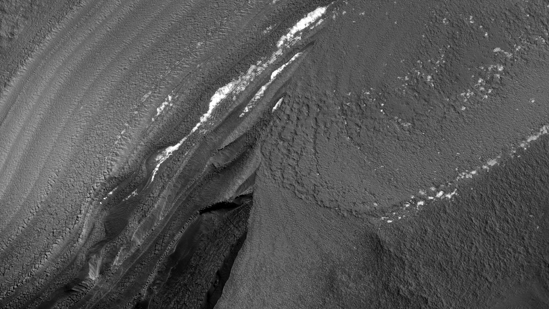
The North Polar layered deposits (NPLD) are a stack of layers of ice and dust at the North Pole of Mars. The layers are thought to have been deposited over millions of years, as the atmosphere changed in response to the varying tilt of the planet’s axis. Learning to read this record could tell us much about recent conditions on Mars, but we first need to understand the processes that have shaped the NPLD.
Comparing this HiRISE image with an observation from the previous Martian year reveals an example of one of these processes: block falls. The slope is steep and fractured here, and a large chunk of dusty ice has tumbled down the slope and broken apart. Scientists on the HiRISE team are studying this process at many locations in order to measure how quickly the NPLD is changing.
Other changes are visible on the slope as well: sand patches have shifted, and in some places on the slope they have been eroded into grooves or troughs, most likely by the carbon dioxide frost (dry ice) that covers the North Pole in the winter.

The channels in this VIS image are part of a complex valley system called Mamers Valles. Mamers Valles is located on the northern margin of Arabia Terra.
Orbit Number: 54641 Latitude: 32.8488 Longitude: 18.0953 Instrument: VIS Captured: 2014-04-08 23:45

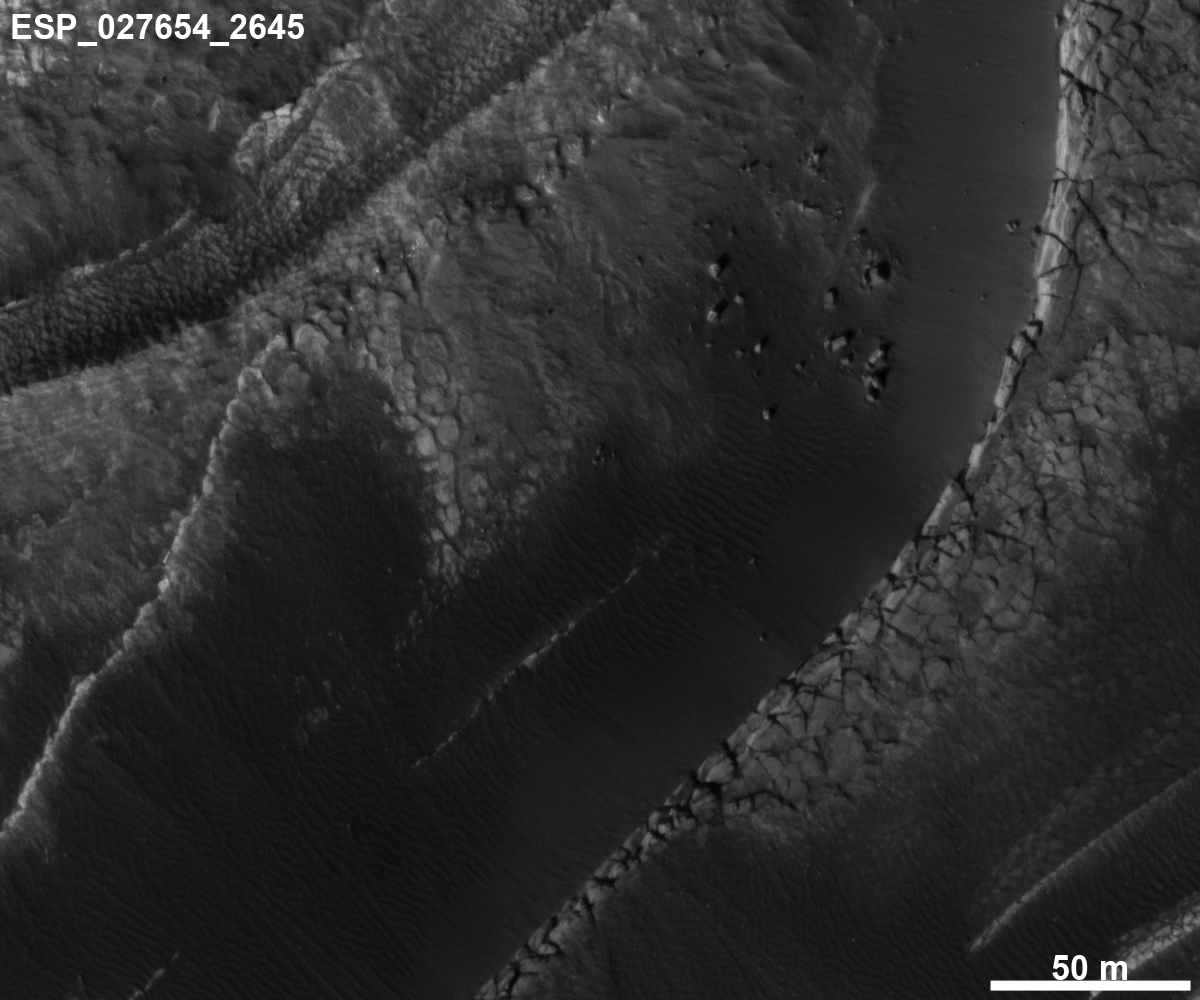
This image appears to show some type of mass movement of material down the wall of a mesa in Deuteronilus Mensae. Also visible is an arc-shaped ridge at the end of the valley.
The ridge may be a moraine from a glacier. HiRISE may be able to see that the surface of the moraine is coarser than the material in front of the ridge.

The dark lobed material in this VIS image is a lava flow located northwest of the Elysium Volcanic Complex. The channel on the dark material was likely formed by the flow of lava rather than water.
Orbit Number: 54637 Latitude: 33.1545 Longitude: 133.458 Instrument: VIS Captured: 2014-04-08 15:51

A large sand sheet with surface dune forms covers the floor of this unnamed northern crater.
Orbit Number: 54631 Latitude: 74.2979 Longitude: 319.195 Instrument: VIS Captured: 2014-04-08 03:46

Like the previous VIS image, this one shows one of the many unnamed channels on the northern margin of Arabia Terra.
Orbit Number: 54617 Latitude: 32.8763 Longitude: 350.048 Instrument: VIS Captured: 2014-04-07 00:21

Today's VIS image shows part of one of the numerous unnamed channels that dissect the northern margin of Arabia Terra.
Orbit Number: 54578 Latitude: 39.37 Longitude: 35.6148 Instrument: VIS Captured: 2014-04-03 19:17

This VIS image shows part of the northern flank of Hecates Tholus, which is located on the northern part of the Elysium Volcanic Complex.
Orbit Number: 54574 Latitude: 33.2631 Longitude: 149.882 Instrument: VIS Captured: 2014-04-03 11:25

The channels in this VIS image are part of Granicus Valles. Granicus Valles is located just west of the Elysium Mons Volcanic Complex and was liked formed by the flow of lava rather than water.
Orbit Number: 54562 Latitude: 28.0545 Longitude: 135.055 Instrument: VIS Captured: 2014-04-02 11:04

The lava flows and depressions in this VIS image are located south of Alba Mons.
Orbit Number: 54558 Latitude: 27.878 Longitude: 250.422 Instrument: VIS Captured: 2014-04-02 03:50

This VIS image shows the layering of the north polar cap. Such layering is visible on the sides of troughs carved into the ice.
Orbit Number: 54558 Latitude: 81.4902 Longitude: 51.9188 Instrument: VIS Captured: 2014-04-02 03:27

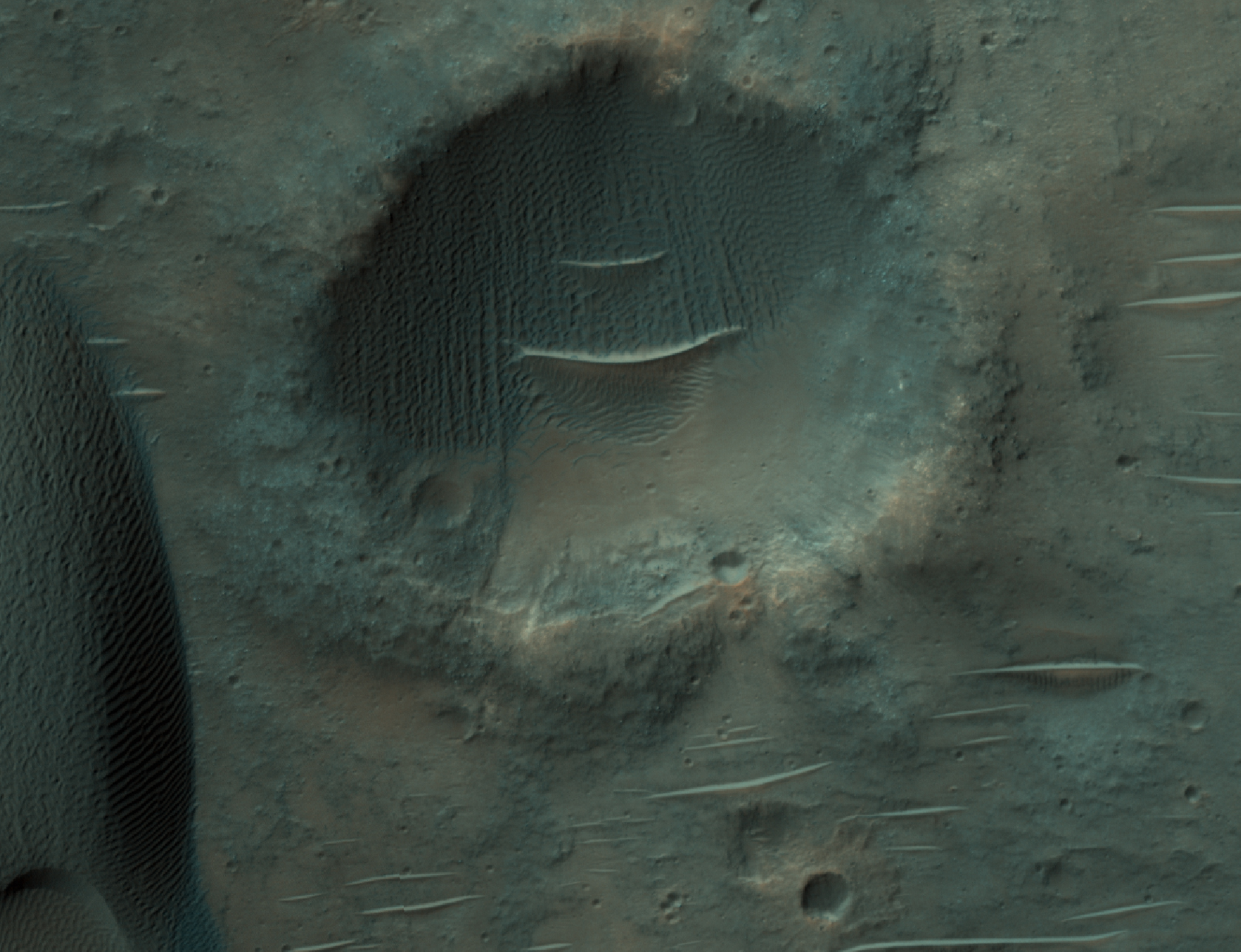
Dusty regions on Mars are often considered to look boring in HiRISE images because the dust obscures surface features. However, new meteor impacts are found most easily in dusty regions such as the one in this image because the new impacts blast away the dust at the surface, leaving obvious dark spots that can be seen in images from the Mars Reconnaissance Orbiter Context Camera (CTX). HiRISE will then take a close up image of the dark spots to image any new craters that have formed as a result of the impact.
As well as confirming a new impact, this image also showed other features commonly found in dusty areas: slope streaks and bed-forms. A close-up picture of the roughly 2.5-kilometer-diameter crater at the bottom of the main image shows ridges on the crater floor where dust has become trapped, and bright and dark streaks down the crater walls where dust has cascaded down the slope.

On Earth, alluvial fans form in desert regions when heavy but sporadic rainfall washes debris from upslope and deposits it in a wedge-shaped fan on the lower slopes below.
On Mars, alluvial fans are sometimes visible in impact crater basins, as material from the steep rims is transported radially inward to the relatively flat floor. Because this is a water-driven process on Earth, and therefore might work the same way on Mars, scientists study Martian alluvial fans order to try to better understand the climate history and possible warmer, wetter past of Mars.
This image, along with its stereo companion, displays an alluvial fan on the floor of a large, 60-kilometer (38 mile) diameter equatorial crater. It is one of several present in the crater (see ESP_017340_1565). This one looks particularly nice in the anaglyph, as there are well-delineated ridges in the fan that stand above the crater floor. These ridges are inverted channels, which form when the floor of a channel is more resistant to erosion than the surrounding surface. This can happen if the floor of the channel is cemented by minerals deposited from water, filled by lava, or simply covered by larger rocks which are hard for the wind to sweep away.
This is a stereo pair with ESP_029221_1565.

There are several streamlined islands in this VIS image of Kasei Valles. This image is located near the region where Kasei Valles empties into Chryse Planitia.
Orbit Number: 54556 Latitude: 25.0252 Longitude: 307.603 Instrument: VIS Captured: 2014-04-01 23:54

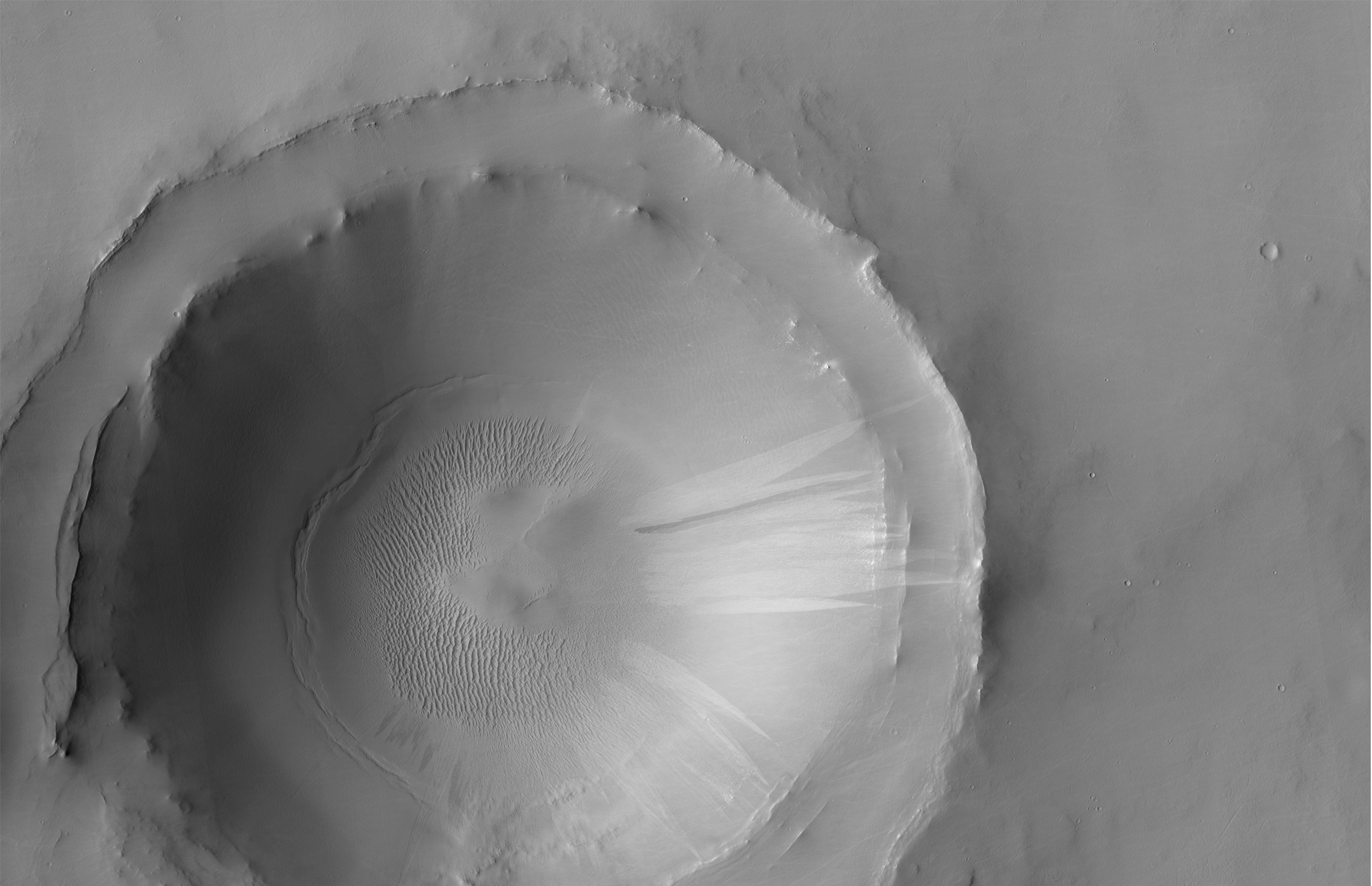
This crater is located in Meridiani Planum, about 20-kilometers northwest of where the Opportunity rover landed in 2004 (and about 42-kilometers northwest of Endeavour Crater’s rim, where the rover has been busy the past few years). Although it’s in the opposite direction from where the rover went, this crater is still an interesting place.
With a diameter of 4-kilometers, it’s the largest crater in the region other than Endeavour Crater (22 kilometers). It’s also a little more than 5 times larger than Victoria Crater (0.75 km), which Opportunity spent nearly 2 years investigating from 2006-2008 (compare with TRA_000873_1780).
What makes it worth checking out? This crater is much older than Victoria Crater. Compare the smooth, rounded rim of this crater to the jagged edge of Victoria's actively-eroding rim. In comparison with Victoria, this crater is much more filled in by sediments, and its rim is more planed off by erosion. Despite the difference in age and scale, these two craters, and most such craters in Meridiani Planum, have much in common. Both craters have exposed bedrock layers along the rim, a field of bright ripples on the crater floor, and dark sand that has piled up along the north inner crater rim and that extends to the northwest on the plains beyond the crater.

Now that summer has arrived in the northern hemisphere of Mars, the dunes near the polar cap have shed all their winter frost.
Orbit Number: 54555 Latitude: 81.1207 Longitude: 140.061 Instrument: VIS Captured: 2014-04-01 21:03

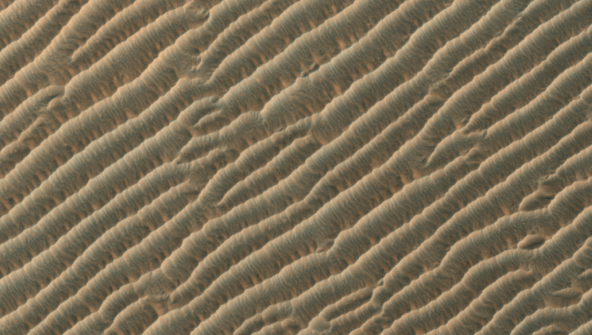
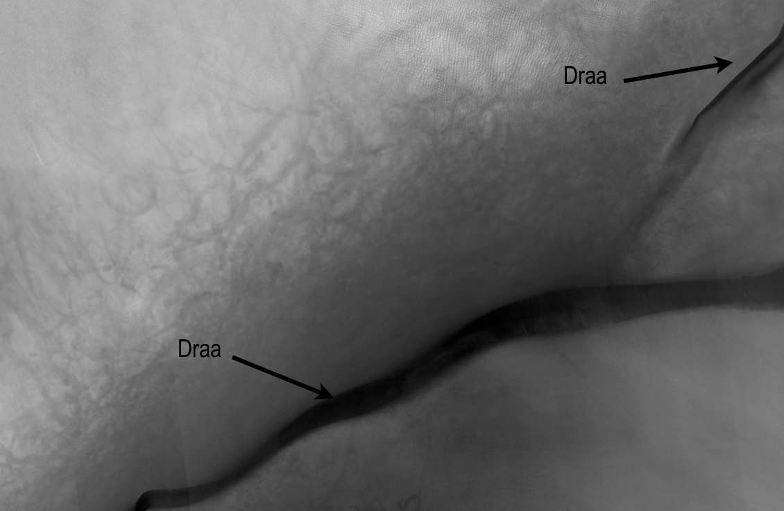
Sandy landforms formed by the wind or aeolian bedforms are classified by the wavelength--or length--between crests. On Mars we can observe four classes of bedforms (in order of increasing wavelengths): ripples, transverse aeolian ridges (known as TARs), dunes, and what are called “draa.” All of these are visible in this Juventae Chasma image.
Ripples are the smallest bed forms (less than 20 meters) and can only be observed in high-resolution images acquired by HiRISE commonly superposed on many surfaces. TARs are slightly larger bedforms (wavelengths approximately 20 to 70 meters), which are often light in tone relative to their surroundings. Dark-toned dunes (wavelengths 100 meters to 1 kilometer) are a common landform and many are active today. What geologists call “draa” is the highest-order bedform with largest wavelengths ( greater than 1 kilometer), and is relatively uncommon on Mars.
Here, this giant draa possess steep faces or slip faces several hundreds of meters tall and has lower-order superposed bedforms, such as ripples and dunes. A bedform this size likely formed over thousands of Mars years, probably longer.

Today's VIS image shows the same crater as yesterday's IR image.
Orbit Number: 21257 Latitude: 72.3992 Longitude: 125.999 Instrument: VIS Captured: 2006-09-29 14:49

The ejecta pattern around this northern plains crater is termed "butterfly" for its similarity to butterfly wings. This type of ejecta pattern is common for oblique impacts. In this IR image the ejecta appears bright. This is because the rock ejecta is warmer than the surrounding dust covered plains.
Orbit Number: 54313 Latitude: 73.298 Longitude: 126.752 Instrument: IR Captured: 2014-03-12 23:41

A delta deposit sits on the floor of this unnamed crater in Arabia Terra. The channel that created the delta dissects the crater rim.
Orbit Number: 54354 Latitude: 31.1307 Longitude: 12.3785 Instrument: VIS Captured: 2014-03-16 08:54