
Today's VIS image shows layering in the south polar cap.
Orbit Number: 56263 Latitude: -82.7003 Longitude: 274.05 Instrument: VIS Captured: 2014-08-20 10:21
Photo credit: NASA/JPL-Caltech/Arizona State University
Today's VIS image shows layering in the south polar cap.
Orbit Number: 56263 Latitude: -82.7003 Longitude: 274.05 Instrument: VIS Captured: 2014-08-20 10:21

This VIS image spans Candor Chasma.
Orbit Number: 56411 Latitude: -7.43707 Longitude: 293.113 Instrument: VIS Captured: 2014-09-01 15:12

The ridge in today's VIS image is the rim of a crater near the south polar cap.
Orbit Number: 56402 Latitude: -78.815 Longitude: 214.37 Instrument: VIS Captured: 2014-08-31 21:02

This southeastward-looking vista from the Mast Camera (Mastcam) on NASA's Curiosity Mars rover shows the "Pahrump Hills" outcrop and surrounding terrain seen from a position about 70 feet (20 meters) northwest of the outcrop.
The component images were acquired on September 17, 2014, during the 751st Martian day, or sol, of Curiosity's work on Mars. The rover team used these images to select a first drilling site on Pahrump Hills, which is part of the base layer of Mount Sharp. The selected drilling location is in the near portion of the pale outcrop to the right of the sand ripples.
The scene includes four distinct features:
1. Sand ripples in foreground, typical of those along the floors of valleys in this area within Gale Crater
2. The Pahrump Hills section of the Murray formation, where approximately 60 vertical feet (18 meters) of rock layers are exposed
3. A darker ridge off in the distance toward the left
4. Northwestern slopes of Mount Sharp in the background, where an abrupt transition is apparent between the buttes and valleys in the lower part and the tilted and carved beds of the upper part
This view combines several exposures taken by the Mastcam's left-eye camera. The color has been approximately white-balanced to resemble how the scene would appear under daytime lighting conditions on Earth.

Located on the floor of an unnamed crater in Terra Sirenum, the crater in the center of the VIS image has numerous gullies on the inner rim. An ejecta deposit from a near by crater is visible at the bottom on this image.
Orbit Number: 56451 Latitude: -38.1315 Longitude: 224.023 Instrument: VIS Captured: 2014-09-04 22:05

The unnamed channels in this VIS image are located in Terra Cimmeria.
Orbit Number: 56453 Latitude: -40.8943 Longitude: 166.72 Instrument: VIS Captured: 2014-09-05 02:01

Today's VIS image shows a portion of Labou Vallis.
Orbit Number: 56464 Latitude: -7.59742 Longitude: 204.493 Instrument: VIS Captured: 2014-09-05 23:56

This image shows an artist concept of NASA's Mars Atmosphere and Volatile Evolution (MAVEN) mission.
NASA's Mars Atmosphere and Volatile Evolution (MAVEN) spacecraft successfully entered Mars' orbit at 7:24 p.m. PDT (10:24 p.m. EDT) Sunday, September 21, where it now will prepare to study the Red Planet's upper atmosphere as never done before. MAVEN is the first spacecraft dedicated to exploring the tenuous upper atmosphere of Mars.
"As the first orbiter dedicated to studying Mars' upper atmosphere, MAVEN will greatly improve our understanding of the history of the Martian atmosphere, how the climate has changed over time, and how that has influenced the evolution of the surface and the potential habitability of the planet," said NASA Administrator Charles Bolden. "It also will better inform a future mission to send humans to the Red Planet in the 2030s."
After a 10-month journey, confirmation of successful orbit insertion was received from MAVEN data observed at the Lockheed Martin operations center in Littleton, Colorado, as well as from tracking data monitored at NASA's Jet Propulsion Laboratory navigation facility in Pasadena, California. The telemetry and tracking data were received by NASA's Deep Space Network antenna station in Canberra, Australia.
"NASA has a long history of scientific discovery at Mars and the safe arrival of MAVEN opens another chapter," said John Grunsfeld, astronaut and associate administrator of the NASA Science Mission Directorate at the agency's Headquarters in Washington. "Maven will complement NASA's other Martian robotic explorers-and those of our partners around the globe-to answer some fundamental questions about Mars and life beyond Earth."
Following orbit insertion, MAVEN will begin a six-week commissioning phase that includes maneuvering into its final science orbit and testing the instruments and science-mapping commands. MAVEN then will begin its one Earth-year primary mission, taking measurements of the composition, structure and escape of gases in Mars' upper atmosphere and its interaction with the sun and solar wind.
"It's taken 11 years from the original concept for MAVEN to now having a spacecraft in orbit at Mars," said Bruce Jakosky, MAVEN principal investigator with the Laboratory for Atmospheric and Space Physics at the University of Colorado, Boulder (CU/LASP). "I'm delighted to be here safely and successfully, and looking forward to starting our science mission."
The primary mission includes five "deep-dip" campaigns, in which MAVEN's periapsis, or lowest orbit altitude, will be lowered from 93 miles (150 kilometers) to about 77 miles (125 kilometers). These measurements will provide information down to where the upper and lower atmospheres meet, giving scientists a full profile of the upper tier.
"This was a very big day for MAVEN," said David Mitchell, MAVEN project manager from NASA's Goddard Space Flight Center, Greenbelt, Maryland. "We're very excited to join the constellation of spacecraft in orbit at Mars and on the surface of the Red Planet. The commissioning phase will keep the operations team busy for the next six weeks, and then we'll begin, at last, the science phase of the mission. Congratulations to the team for a job well done today."
MAVEN launched November 18, 2013, from Cape Canaveral Air Force Station in Florida, carrying three instrument packages. The Particles and Fields Package, built by the University of California at Berkeley with support from CU/LASP and Goddard, contains six instruments that will characterize the solar wind and the ionosphere of the planet. The Remote Sensing Package, built by CU/LASP, will identify characteristics present throughout the upper atmosphere and ionosphere. The Neutral Gas and Ion Mass Spectrometer, provided by Goddard, will measure the composition and isotopes of atomic particles.
The spacecraft's principal investigator is based at CU/LASP. The university provided two science instruments and leads science operations, as well as education and public outreach, for the mission.
NASA Goddard Space Flight Center manages the project and also provided two science instruments for the mission. Lockheed Martin built the spacecraft and is responsible for mission operations. The Space Sciences Laboratory at the University of California at Berkeley provided four science instruments for MAVEN. JPL provides navigation and Deep Space Network support, and Electra telecommunications relay hardware and operations. JPL, a division of the California Institute of Technology in Pasadena, manages the Mars Exploration Program for NASA.

Today's polar image shows an unusual surface texture. The circular depressions look like Swiss cheese.
Orbit Number: 56475 Latitude: -86.65 Longitude: 355.117 Instrument: VIS Captured: 2014-09-06 21:13

Today's VIS image shows a small part of the south polar cap.
Orbit Number: 56419 Latitude: -86.7159 Longitude: 160.247 Instrument: VIS Captured: 2014-09-02 06:34

Color-coded topography map of a region of the Argyre basin, featuring Hooke crater and part of the floor of the basin known as Argyre Planitia. White and red show the highest terrains, while blue and purple show the deepest. The image is based on a digital terrain model of the region, from which the topography of the landscape can be derived. The region clearly slopes to the south (left).
The image was acquired by the High Resolution Stereo Camera on Mars Express on 20 April 2014 during orbit 13,082. The ground resolution is about 63 m per pixel. Hooke crater is located at about 46°S / 316°E. North is right and East is down.

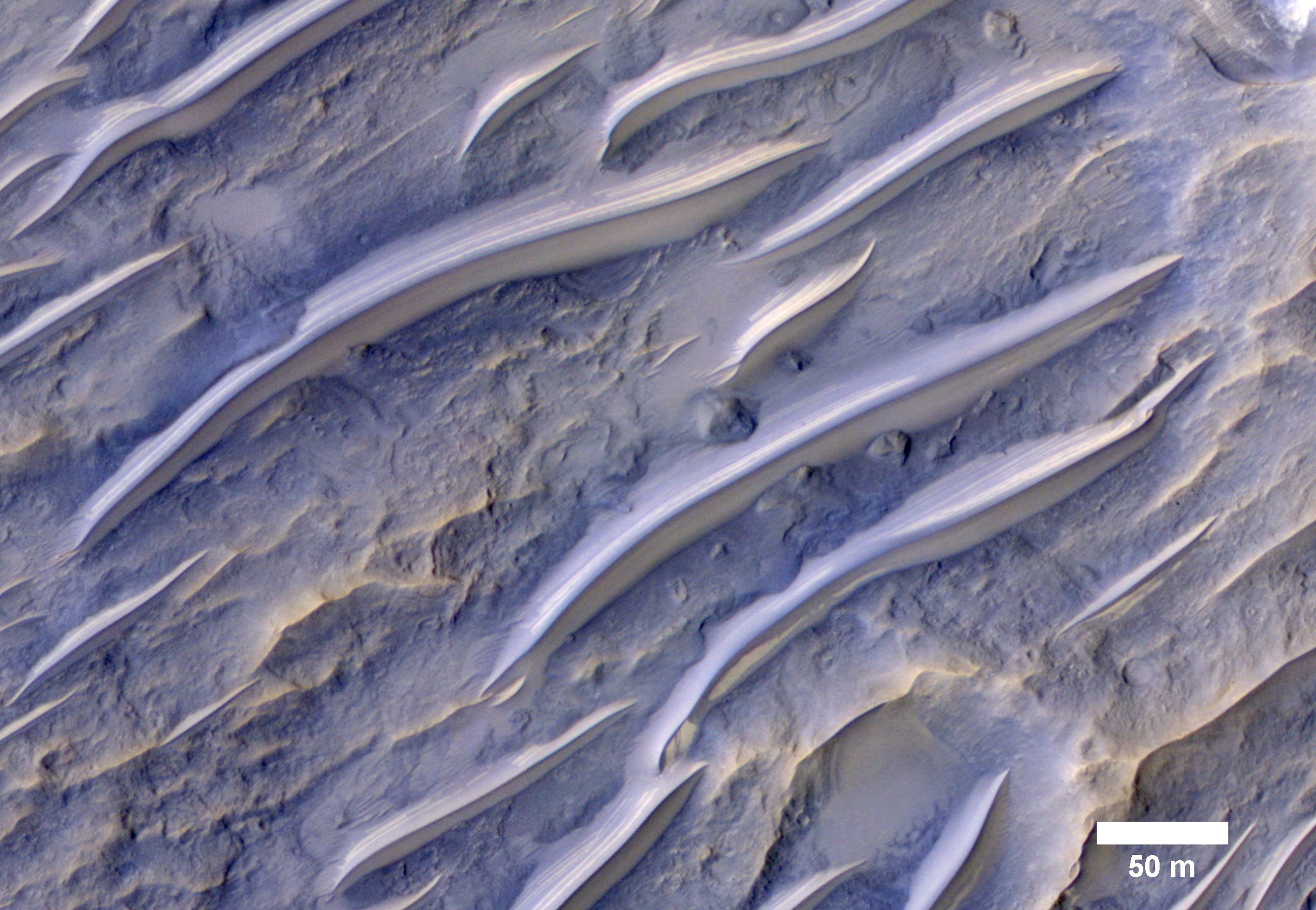
Spring has arrived at the south pole of Mars. The multitude of layers that make up the cap are readily visible in today's THEMIS VIS image.
Orbit Number: 56290 Latitude: -84.0207 Longitude: 220.827 Instrument: VIS Captured: 2014-08-22 15:42

Lava flows south of Arsia Mons in Daedalia Planum transition from younger flows with elongated, sinuous morphologies to the northeast, to older, broader lobes and sheet flows to the southwest. (The time scale we’re talking about is approximately 100 million to 1 billion years.) At the southern margin of the Tharsis region, older, probably 3-billion year old volcanic plains have been identified where Tharsis flows contact the ancient highlands.
The high-resolution of HiRISE images allows for reconstruction of complex volcanic surfaces, including delineation of individual flow lobes and superposition relationships within a flow field. This image shows a contact between two of the younger, elongate flows to the northeast. Populations of small, superposed impact craters can be used to derive relative and absolute age constraints for individual flows and flow sequences.

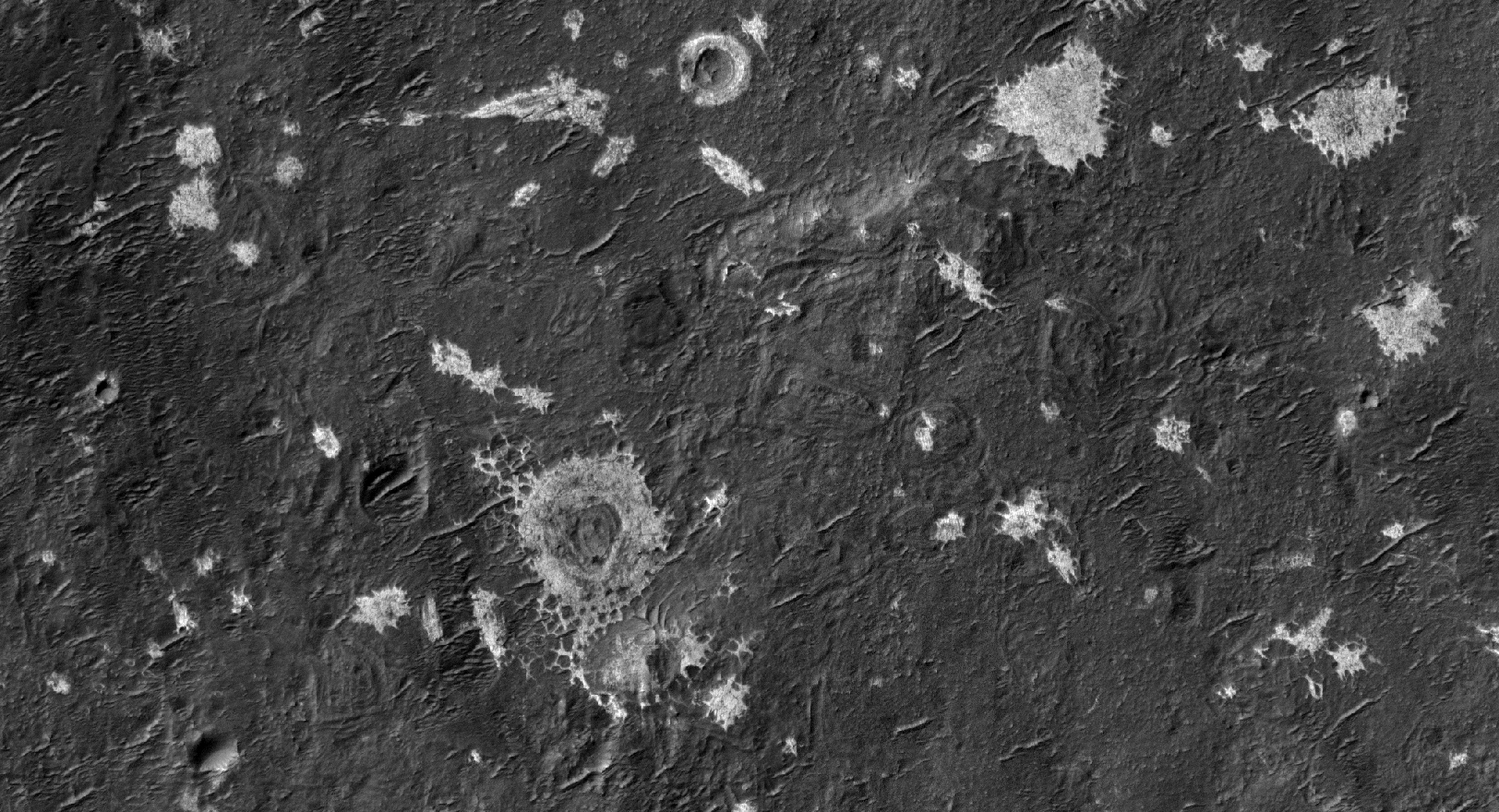
The region shown in this VIS image is part of Gigas Sulci.
Orbit Number: 56151 Latitude: 8.50082 Longitude: 230.099 Instrument: VIS Captured: 2014-08-11 05:33

The tropics of Mars are commonly littered with small bright ripples that were somehow shaped by the wind. Called "transverse aeolian ridges", or TARs, the features stand up to 6 meters tall and are spaced a few tens of meters apart. They are typically oriented transverse to modern day wind directions, and often found in channels and crater interiors. The physical process that produces these features is still mysterious. Most TARs display no evidence of internal structure, so it is difficult to discern exactly how they were formed.
While validating a HiRISE digital terrain model of the area, Sarah Mattson of the University of Arizona discovered these rare banded TARs in Iapygia, south of Syrtis Major. These features resemble TARs elsewhere on Mars, except that they show bands or layers on their northwest faces but fewer or none on the southeast sides.
One possible interpretation of this strange layering is that these particular TARs are made up of wedge-shaped layers, as shown in the schematic cross-section illustrating the inferred structure of the TARs. If this hypothesis is correct, it implies that the ripples grew vertically over time, as material accreted at the crests of the ridges. It also suggests that the banded slopes faced upwind.
This observation might provide a valuable clue to the formation of TARs elsewhere on Mars, if they have a similar internal structure but that structure cannot be seen because they are made up of homogeneous materials that are uniform in color.
This is a stereo pair with ESP_021639_1610.

Today's VIS image shows part of Melas Chasma.
Orbit Number: 56149 Latitude: -10.2791 Longitude: 290.34 Instrument: VIS Captured: 2014-08-11 01:30

Vinogradov is an old, 224-kilometer diameter, heavily degraded impact crater in southern Margaritifer Terra.
The southeastern floor of Vinogradov is covered with several mysterious light-toned, sub-meter scale “blobs” that lack obvious layering. In some places the light-toned material appears to have filled pre-existing craters giving them a circular appearance.
The light-toned material has a northwest-southeast orientation and tends to be associated with a smooth, darker-toned deposit. This material may be related to ejecta from a nearby crater, eroded from the rim of Vinogradov or emplaced by some other process.
This is a stereo pair with ESP_037519_1590.

Eridania is the name of topographically enclosed basin located in the southern highlands of Mars that has been suggested to be the site of a large ancient lake or inland sea.
A chaotic jumble of relatively bright blocks sits on the lowest floor regions of the basin, sampled in this image. These blocks contain a variety of hydrated minerals that could have formed in the water, perhaps preserving information about an ancient habitable environment.
This lake or sea partially drained to form the Ma'adim Vallis, a large channel that itself drained into Gusev Crater to the north. The Spirit rover landed in Gusev Crater in 2004 to study the expected lake deposits, but found that the floor of the crater had been covered by lava that was younger than the fluvial activity.
Eridania is a better place to find lake sediments, but is too rough and dangerous for the landing systems sent to Mars in the past.

This image, taken with the High Resolution Imaging Science Experiment (HiRISE) camera, shows a mesa within the "Murray Buttes" area on Mars showing a complex fracture pattern (black arrow) protruding from the eroding rock. This mesa, which likely represents a remnant of crater floor sediments, lies on top of the sedimentary rocks of the Murray Formation. NASA's Curiosity rover will be exploring this formation.

The region of this VIS image shows several different flow surfaces, including platy and lobate. These flows are part of Daedalia Planum.
Orbit Number: 56139 Latitude: -20.1869 Longitude: 220.191 Instrument: VIS Captured: 2014-08-10 05:41

This portion of a color mosaic taken by NASA's Mars Curiosity rover shows strata exposed along the margins of the valleys in the "Pahrump Hills" region on Mars. The scale of layering increases upward, providing what's called a "thickening upward" trend. This is consistent with a variety of ancient environments, in particular those that involved water.
This image was taken by the rover's Mast Camera (Mastcam). It has been white-balanced to show how the scene would appear under Earth's lighting conditions.

Today's VIS image shows part of the western flank of Pavonis Mons.
Orbit Number: 56138 Latitude: 1.02298 Longitude: 246.073 Instrument: VIS Captured: 2014-08-10 03:49

This image from NASA's Mars Curiosity rover shows the "Amargosa Valley," on the slopes leading up to Mount Sharp on Mars. The rover is headed toward the "Pahrump Hills" outcrop, seen above the scale bar. This area represents a boundary between the plains of Gale Crater, named Aeolis Palus, and the layered slopes of Mount Sharp, or Aeolis Mons. Curiosity has recently crossed into this terrain and now is on the Mount Sharp side of the transition zone.
This image was taken by the rover's Mast Camera (Mastcam). It has been white-balanced to show how the scene would appear under Earth's lighting conditions.

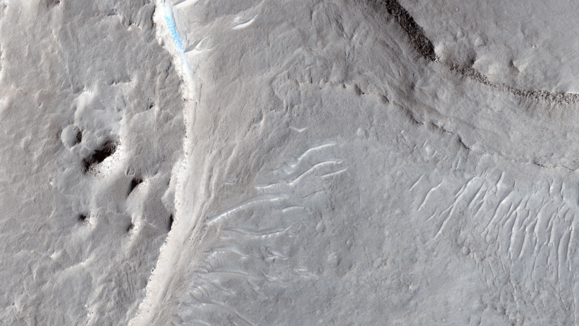
This VIS image shows a small portion of Aeolis Mensae, a complex region of hills, plateaus and graben. The prominent channel in the lower half of the image is a fault bounded graben.
Orbit Number: 56129 Latitude: -6.33435 Longitude: 146.63 Instrument: VIS Captured: 2014-08-09 10:00

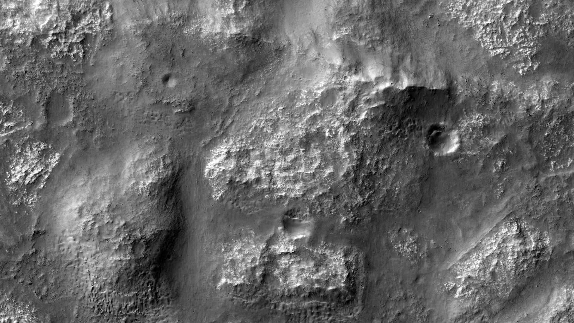
The hills in this VIS image are part of Avernus Colles.
Orbit Number: 56128 Latitude: -1.54092 Longitude: 174.827 Instrument: VIS Captured: 2014-08-09 08:03

This scene from the panoramic camera (Pancam) on NASA's Mars Exploration Rover Opportunity looks back toward part of the west rim of Endeavour Crater that the rover drove along, heading southward, during the summer of 2014.
The vista merges multiple Pancam exposures taken on August 15, 2014, during the 3,754th Martian day, or sol, of Opportunity's work on Mars.
The high point on the rim in the left half of the scene is the southern end of "Murray Ridge." Tracks from drives from mid-July 2014 are faintly visible near there, and tracks from subsequent drives advance to the foreground. For scale, the distance between Opportunity's parallel wheel tracks is about 3.3 feet (1 meter).
The most distant visible tracks are from nearly half a mile (more than 700 meters) prior to Opportunity's arrival at the viewpoint from which this scene was recorded.
This version of the image is presented in approximate true color by combing exposures taken through three of the Pancam's color filters, centered on wavelengths of 753 nanometers (near-infrared), 535 nanometers (green) and 432 nanometers (violet).
A false-color version, at http://photojournal.jpl.nasa.gov/catalog/PIA18605, makes the tracks more visible. A video at http://www.jpl.nasa.gov/video/?id=1325 places the scene into context of the rover's entire route of more than 25 miles (40 kilometers) since its 2004 landing. A map indicating the rover's Sol 3754 location (as the location reached by a Sol 3752 drive) is online at http://mars.nasa.gov/mer/mission/tm-opportunity/opportunity-sol3757.html.

This VIS image shows a portion of Ma'adim Vallis, which is a large channel that enters Gusev Crater from the south. Gusev Crater is the "home" of the MER rover named Spirit.
Orbit Number: 56128 Latitude: -18.5885 Longitude: 177.177 Instrument: VIS Captured: 2014-08-09 07:57

The lava flows in this VIS image are located on the eastern flank of Olympus Mons.
Orbit Number: 56126 Latitude: 16.5299 Longitude: 230.021 Instrument: VIS Captured: 2014-08-09 04:12

The hills and ridges at the top of this VIS image are part of Nilus Mensae, which is part of the complex Kasei Valles channels.
Orbit Number: 56124 Latitude: 21.5934 Longitude: 286.954 Instrument: VIS Captured: 2014-08-09 00:17

Today's VIS image shows sand dunes on the floor of an unnamed crater in Arabia Terra.
Orbit Number: 56122 Latitude: 12.6451 Longitude: 345.967 Instrument: VIS Captured: 2014-08-08 20:16

This VIS image shows the summit caldera of Pavonis Mons.
Orbit Number: 56113 Latitude: 0.510887 Longitude: 247.192 Instrument: VIS Captured: 2014-08-08 02:25

The lava flows and channel in this VIS image are located on the eastern margin of Olympus Mons.
Orbit Number: 56051 Latitude: 20.1784 Longitude: 232.331 Instrument: VIS Captured: 2014-08-03 00:03

One of the important roles of HiRISE is to take high resolution images of potential landing sites for future landing missions.
This image is of an area called Aram Dorsum (also known by its old name, Oxia Palus) that has been suggested for the 2018/2020 ExoMars Rover, because it contains an ancient, exhumed alluvial system.
Imaging is needed both to check for boulder fields and other obstacles, as well as checking the scientific justification for choosing a site. This image is one part of what we call a stereo observation, where taking a view at a different angle from another orbit of the same areas will allow a 3D model (a digital terrain model) to be prepared. With this model, accurate measurements of slopes can then be made. Although it won't show the exhumed alluvial system, images of the area are needed to characterize the landing site.
The main image of the Aram Dorsum site contains a relatively fresh, 150-meter diameter impact crater with associated boulders. This small (1 kilometer square) part also shows signs of erosion into an overlying plateau, plus recent formation of some transverse aeolian ridges (called TARs) within the resulting valley. Overall, however, the site has relatively few obstacles for a lander.
This is a stereo pair with ESP_036740_1880.

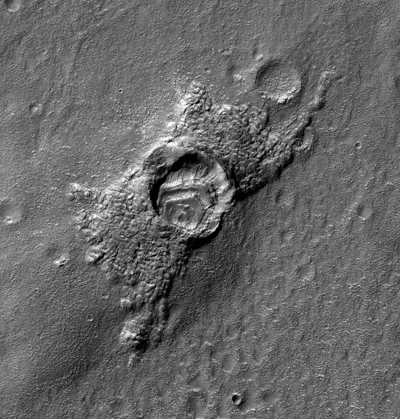
This feature has a strange appearance, as if the crater has feet with toes sticking out of two sides. Let’s try to explain this.
First, there was a highly oblique impact event, with the bolide (or meteorite) striking the ground while flying almost horizontally over the surface. Such oblique impacts tend to send ejecta in two directions to the sides of the bolide trajectory, rather than in all directions around the crater. However, there was ice near the surface, covered and protected by the ejecta, and the unprotected ice sublimated at some later time, so the ejecta now appears especially thick.
Also, there were layers of dust (maybe along with ice) deposited inside the crater. Or maybe something else happened, but likely involving the ice that comes and goes in the middle latitude regions of Mars.