Tuesday, October 25, 2011

Oraibi Crater


Oraibi crater is about 32 km across and situated in Ares Vallis on Mars. The crater is filled with sediments and its southern rim has been eroded by water. The image was acquired by the HRSC instrument on Mars Express at about 16°N/327°E during orbit 9393 on 11 May 2011. The images have a ground resolution of 15 m per pixel. North is to the right in this image and south to the left.

Photo credit: ESA/DLR/FU Berlin (G. Neukum)

Monday, October 24, 2011

Four New Names Approved for use on Mars

From the USGS Astrogeology Science Center:

The names Corozal, Palikir, Raga, and Tivat have been approved for use on Mars. For more information, see the maps of Mars in the Gazetteer of Planetary Nomenclature.

Note: Corozal is a small crater located within a much larger unnamed crater in Terra Cimmeria, and is named for the town of Corozal, Belize. Palikir Crater is also a small crater, but located in the southern half of Newton Crater; it is named for the capital of the Federated States of Micronesia. Raga Crater is located in western Aonia Terra, to the southwest of Icaria Planum, and is named for a town in South Sudan. Tivat Crater is located in Noachis Terra, and is northeast of Asimov Crater. It is named for a town in Montenegro.

Mysterious Color-Changing Dust Devil Track


Dust devils leave tracks behind them that create the beautiful swirling patterns visible here (approximately 0.5 kilometers, or 0.3 miles across) and in many other images of dust-covered terrain. Suction created by the air rotating in a whirlwind removes a thin layer of light-colored dust from the Martian surface, leaving behind dark lines in the dust devil's path.

That's what usually happens. In this case, however, there is an unusual streak that appears brighter at one end (approximately 0.6 kilometers or 0.4 miles across, and north is roughly upwards).

The bright streak could be a deposit of light-colored material that the dust devil dropped for some reason: maybe the dust devil died out right at this spot. Or it could be that at this particular location, the underlying dune is brighter than the dust on top of it, so when the dust devil removed the surface layer, a brighter layer below was revealed. Or there could be some other explanation we haven't even thought of yet!

Numerous small slope streaks are also visible in this image; for example, on the left side of the subimage, white arrow. These are thought to occur when a thin layer of dust avalanches downhill, revealing darker material beneath. Over time, these streaks, like dust devil tracks, slowly brighten to match their surroundings, as dust is deposited from the atmosphere to cover them.

Photo credit: NASA/JPL/University of Arizona

Note: This image is located in an impact crater northwest of Antoniadi Crater.

Sunday, October 23, 2011

Possible Newest Segment of Cerberus Fossae


This small fossa segment cuts the channel of Athabasca Valles, and post-dates the youngest of Mars' outflow channels. A "fossa" is a cavity or depression.

Floods of water and lava are thought to have emanated from the larger fossae nearby, perhaps forming the Athabasca channel and later filling it with lava. Comparison with the larger fossa segments at the Athabasca Valles head may reveal whether this will be a source of a future flood.

Photo credit: NASA/JPL/University of Arizona

Saturday, October 22, 2011

The Millipedes of Mars?


HiRISE observations like this one are used to aid in classification and volume estimates of dunes in the USGS global dune database.

Sand dunes are among the most widespread aeolian features present on Mars. Their spatial distribution and morphology are sensitive to subtle shifts in wind circulation patterns and wind strengths. These provide clues to the sedimentary history of the surrounding terrain.

What's fascinating about this image is the ridges running the length of the dunes here, creating the spectacular illusion that we're looking at millipedes. This is a good example of what's called "pareidolia," where we see things that really are not there.

Luckily, the power of HiRISE helps us see formations in greater detail to know we're seeing impressive dune ridge formations and not insects!

Photo credit: NASA/JPL/University of Arizona

Note: The location of these dunes is in the region west of the Hellespontus Montes, southeast of Rabe Crater.

Friday, October 21, 2011

Lobate Flow Features in the Northwest Hellas Rim


This image, taken by HiRISE, shows a lobate tongue on the northwest Hellas rim.

Lobate features such as these are located in the mid-latitudes (30-60 degrees), indicative of viscous flow, are reminiscent of terrestrial glaciers and have long-been interpreted as evidence for subsurface ice.

Recent ground-penetrating radar observations by SHARAD of other lobate features in this latitude belt also support the notion that these features have cores with ice.

Photo credit: NASA/JPL/University of Arizona

Note: This landscape is located somewhat to the northeast of Hellespontus Montes.

Monday, October 17, 2011

Sinuous Ridge in Malea Planum


This area of Malea Planum is covered by bright dust and dark lines. These lines formed by swirling winds known as dust devils that move across the surface removing the dust cover and revealing the darker rock materials beneath.

In the lower half of this image there is a faint sinuous, broad bouldery unit. Although largely dust covered, this sinuous unit may mark the location of a stream that once flowed across the plains. The stream may have later been filled by a lava flow or other bouldery material that was more resistant to erosion than the surrounding terrains forming what is known as an inverted stream. Since this time dust has largely filled in this terrain.

Photo credit: NASA/JPL/University of Arizona

Sunday, October 16, 2011

Artynia Catena


This observation shows an impressive chain of pits along the southernmost tip of the chain in Artynia Catena, located on the northwestern flank of the volcano, Alba Patera.

These pits form in fracture along its southern most extent. The fracture is part of a larger fracture system that is radial to the volcano and suggests that it is related to the formation of the volcano. Therefore, this chain of pits may have formed from the withdrawal of subsurface magma and subsequent partial collapse of the overlying material into the fracture.

Another explanation may be that subsurface water/ice may have preferentially formed along these fractures and subsequent removal of ice-rich material by sublimation resulted in partial collapse of surface materials forming the pit chain.

Photo credit: NASA/JPL/University of Arizona

Saturday, October 15, 2011

Scarp in Aurorae Chaos


Aurorae Chaos is a large irregular depression consisting of jumbled uplifted blocks, knobs, mounds and isolated mesas known as chaotic terrains.

These areas of chaos are the source regions for the catastrophic releases of ground water thought to have formed the outflow channels. Aurorae Chaos extends to Eos, Capri and Gangis Chasma to the south and east and to Simud and Tiu Vallis to the north as well as to other chaotic terrains west of Margaritifer Chaos.

Along the southeastern part of the image is a prominent scarp. The elevated region to the right is likely a remnant mesa of original terrain. The lower elevation region to the west and north are areas where ground water was likely released and forming conduits flowed out of the chaotic terrain towards Simud and Tiu Valles.

Photo credit: NASA/JPL/University of Arizona

Friday, October 14, 2011

Changes to Sand Dunes in Syrtis Major


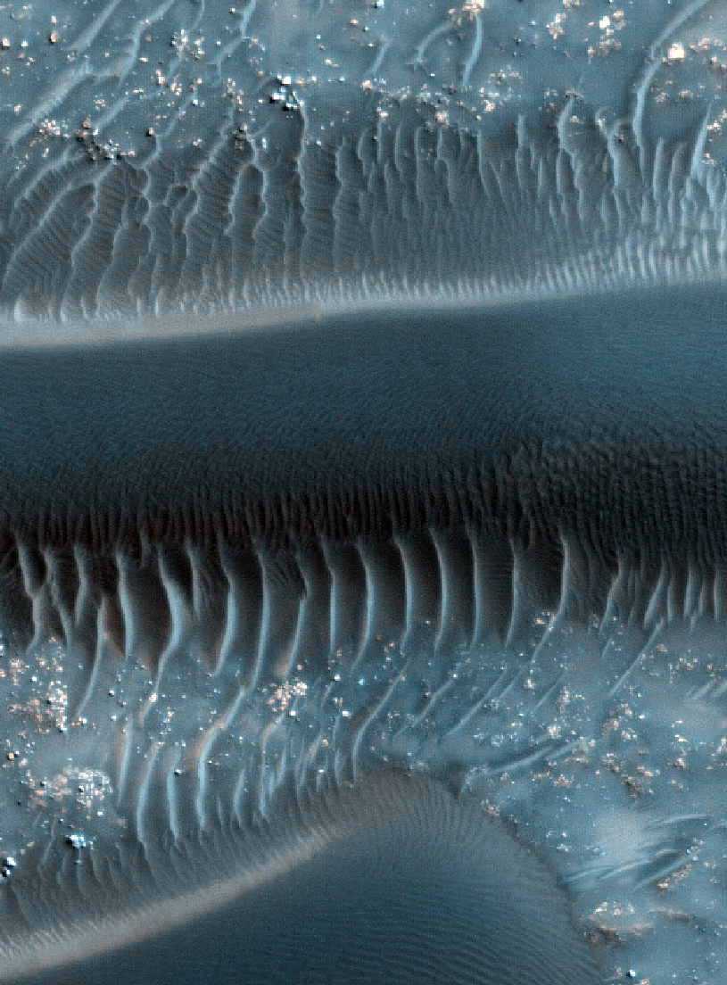
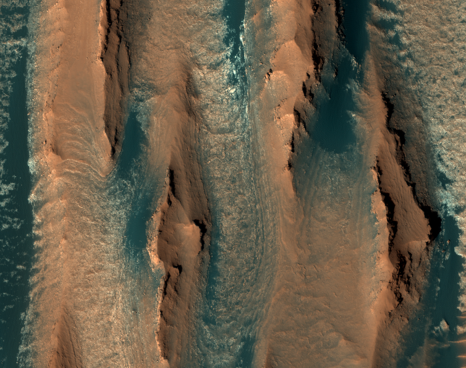
Now that HiRISE has been returning data from its primary science orbit at Mars since 2006, it has been able to document changes in the position of sand dunes and ripples on the surface.

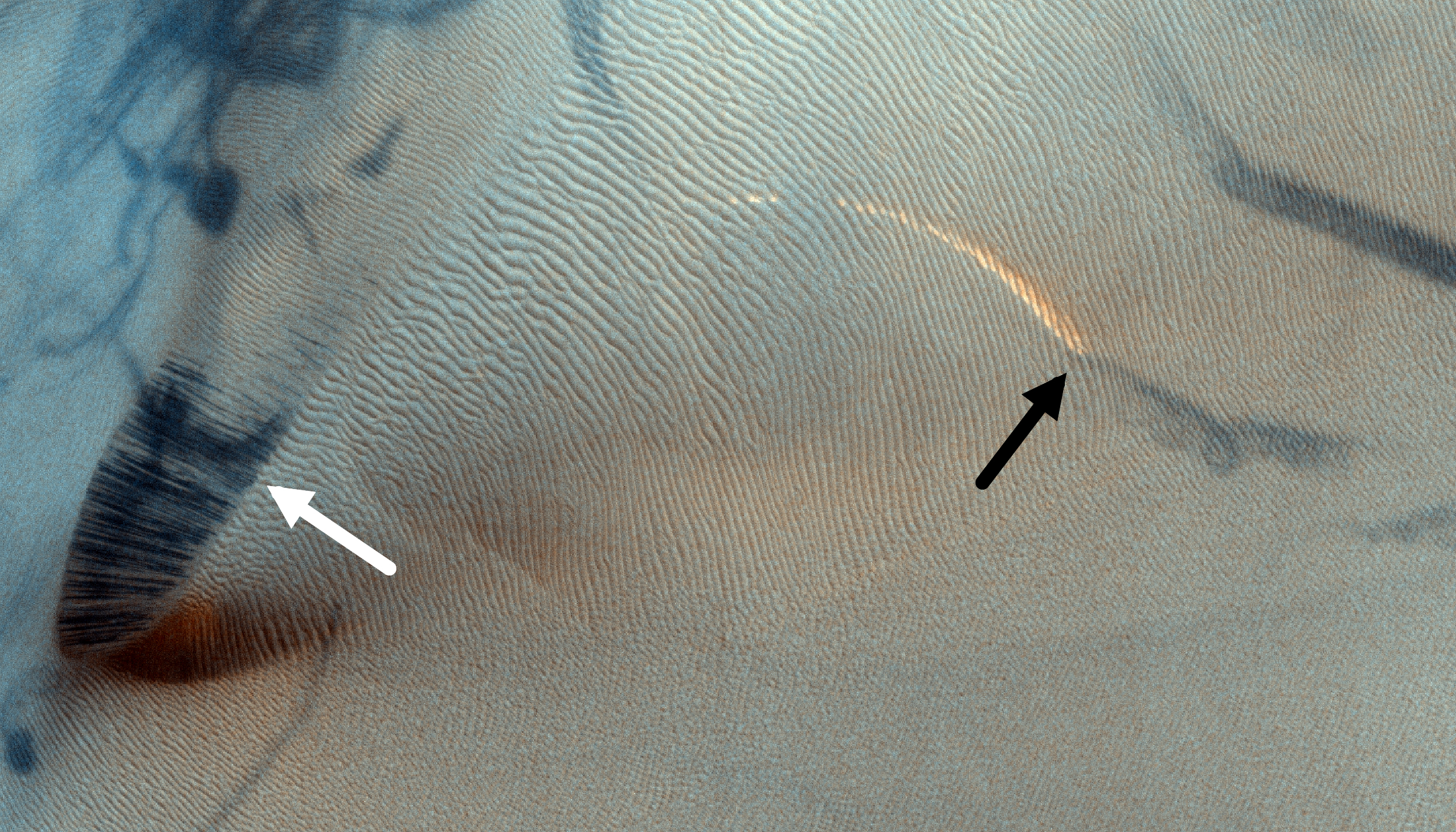
Shown here is one example, illustrating changes in sand dunes, located within a crater in Syrtis Major, from December 16, 2007 (HiRISE image PSP_006501_2005) to September 11, 2011 (ESP_024025_2005, this image).

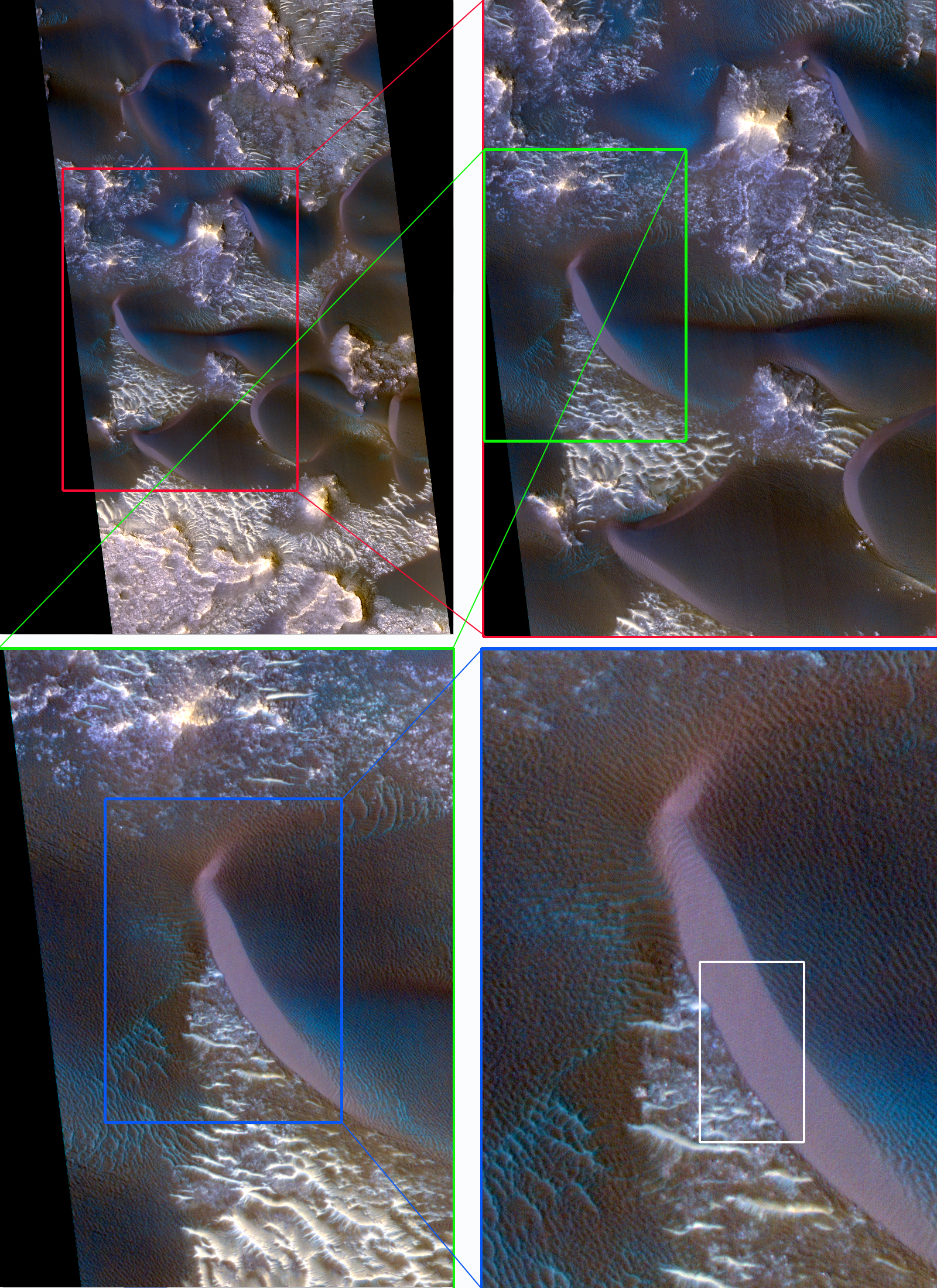
The time interval is approximately two Mars years, such that lighting geometry is very similar in the two images. In addition, the MRO spacecraft took both images at nearly the same roll angle. With the similar lighting and viewing geometry, changes can be readily seen. Subimage 1 shows a series of zoomed views, starting from part of the dune field and then zeroing in on the slip face of one dune. Subimage 2, an animated GIF, shows how the dune slip face, and ripples on dune surface, have changed over two Mars years.

The dune appears to have moved a couple of meters. This demonstrates that this region of Mars has winds strong enough to move significant volumes of sand.

Photo credit: NASA/JPL/University of Arizona

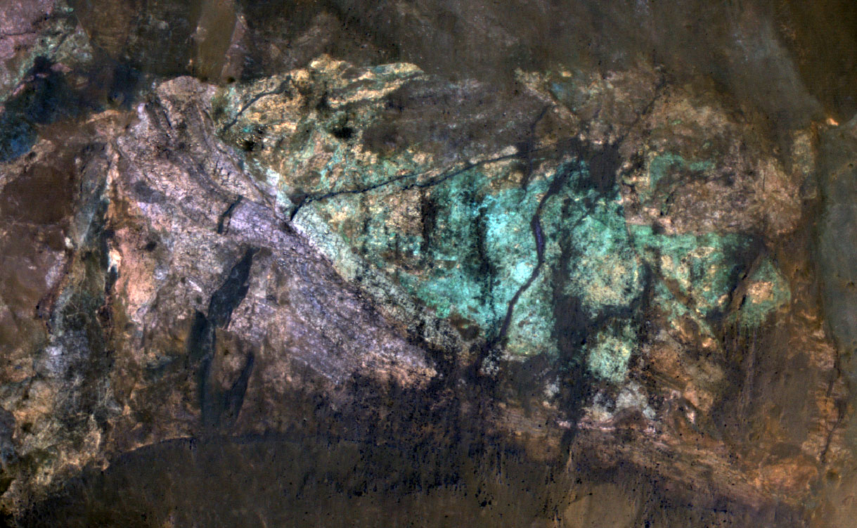
Note: This large crater is located on the northwestern "shore" of Isidis Planitia; the closest named feature is Jezero Crater, which lies to the southwest.

Thursday, October 13, 2011

Approaching Endeavour Crater, Sol 2,680


This image from the navigation camera on NASA's Mars Exploration Rover Opportunity shows the view ahead on the day before the rover reached the rim of Endeavour crater. It was taken during the 2,680th Martian day, or sol, of the rover's work on Mars.

It is one of 309 images included in a video record of Opportunity's three-year journey of more than 13 miles (21 kilometers) to reach Endeavour from its last previous major destination, Victoria crater.

Photo credit: NASA/JPL-Caltech

Monday, October 10, 2011

Crater with Surrounding Bench in Sinus Meridiani


This image is located within Northern Sinus Meridiani, a region of ridged terrains and extensive stratigraphic layering.

Originally identified in a Mars Orbiter Camera image (MOC), this 10-kilometer (approximately 6 miles) diameter crater is surrounded by a prominent bench. As this HiRISE image shows, there is extensive layering in the upper cap units.

The bench formed because these layered surface units are eroding at a faster rate than the more resistant underlying materials that comprise the rest of the crater.

This is a stereo pair with ESP_023593_1845.

Photo credit: NASA/JPL/University of Arizona

Sunday, October 9, 2011

Light-Toned Layered Rock Outcrop in Ladon Valles


Ladon Vallis, an approximately 600 kilometer (370 mile) long outflow channel, is part of a larger system that begins in Argyre basin to the south and extends northwards across the Southern Highlands towards the larger Ares Vallis outflow system. This image shows part of Ladon Vallis that is located within Ladon basin.

Here the extensive laterally continuous outcrops of layered light-tone units and deposits contrasts sharply with the darker-toned materials that cover the channel floor. Dark-toned dunes partly infill fractures and impact craters.

These extensive layers may have resulted from ponding of water and sediments that flowed into the basin from Ladon Vallis. Subsequent episodic flood events out of the basin to the north may have eroded and exposed the pre-existing sedimentary layers.

Photo credit: NASA/JPL/University of Arizona

Saturday, October 8, 2011

Colorful Central Peak in Noachis Terra


Small impact craters retain their original bowl shape, but once a crater is large enough that the force of gravity on the slopes of the crater wall is greater than the strength of the target material, the wall collapses inward to form a central peak.

On Mars, the transition between simple (bowl-shaped) and complex craters is observed to occur at about 7-kilometer diameter. The formation of central peaks in complex craters brings up material from deep beneath the Martian surface. Therefore, central peaks of complex craters are good places to look for ancient rocks.

The colorful rocks exposed in the central peak visible in this image probably reflect variations in mineral content that were caused by water activity early in Mars' history. The CRISM hyperspectral image that was taken at the same time as this HiRISE image may show evidence for the various types of minerals that presumably are responsible for the colors visible here.

Photo credit: NASA/JPL/University of Arizona

Note: This crater is located in northwestern Noachis Terra, east of Nectaris Fossae and south of Saravan Crater.

Friday, October 7, 2011

Dunes in Richardson Crater


Richardson Crater is well-known among Mars scientists for its spectacular dunes.

These dunes are located around -72 degrees in latitude; if they were on Earth they'd be well south of the Antarctic Circle! Because of their extreme southern positioning, they endure dramatic temperature changes over the course of the Martian year. The HiRISE team attempts to monitor this area as these dunes get covered by seasonal frost in the fall and defrost in the spring, taking multiple images over the same locations in order to better understand the structure and evolution of these beautiful landforms.

This image was taken close to the Southern hemisphere autumnal equinox, the end of Southern Hemisphere summer and beginning of autumn. Unlike that observed on Earth, the frost seen on the Richardson Crater dunes is composed of carbon dioxide, and sublimates (goes directly from a solid to a gas) rather than melts. At the time of this image, the frost has likely disappeared to its greatest extent and will begin to re-accumulate soon.

Wide, dark streaks are visible extending from the crests of the dunes, likely due to movement of material as the dunes defrosted or to wind transportation of surface particles. Numerous dust devil tracks are still visible as thin, dark, criss-crossing marks, although these will gradually be covered by carbon dioxide frost as Southern hemisphere winter sets in.

The subimage is approximately 1 kilometer (about 0.62 miles) across.

To see the previous image taken at this same location, taken in early Southern Hemisphere spring as the dunes were thawing, see ESP_011785_1075.

To take a look at other impressive dunes from various locations within Richardson Crater, see ESP_012774_1080, PSP_004230_1080, and ESP_012985_1075.

Photo credit: NASA/JPL/University of Arizona

Note: Here is the Italian translation of the above caption (Spettacolari Dune Nel Cratere Richardson), the Spanish translation (Espectaculares Dunas en el Cráter Richardson), and the Portuguese translation (Dunas Espetaculares na Cratera Richardson).

Tuesday, October 4, 2011

Phobos


Mars Express obtained these views of Phobos, the largest of the Martian moons, when it flew by on 9 January 2011, passing at a distance of 100 km.

This sequence shows 5 HRSC-channels, orbit 8974: (left to right) stereo S1 (4.1 m/pixel), photometric P1 (8.1 m/pixel), nadir ND (3.9 m/pixel), photometric p2 (8.2 m/pixel), stereo S2 (4.3 m/pixel).

Photo credit: ESA/DLR/FU Berlin (G. Neukum)

Monday, October 3, 2011

Tithonium Chasma


This complicated landscape of craters, slopes, and boulders is in an area called Tithonium Chasma, a large trough that is itself a part of the more well-known canyon system Valles Marineris.

Scientists are interested in imaging canyons such as these because they provide a view "under" the surrounding Martian surface to potentially older material beneath (similar to the Grand Canyon on Earth). This image shows the floor of the trough, although the walls of this canyon have also been imaged previously (see PSP_007562_1745 for one example of the walls of Tithonium Chasma).

Evidence from the CRISM instrument, a spectrometer also aboard Mars Reconnaissance Orbiter, suggests sulfates and iron oxides exist in this general region, in the form of layered deposits. (Murchie, S. et al. 2009. A synthesis of Martian aqueous mineralogy after 1 Mars year of observations from the Mars Reconnaissance Orbiter. Journal of Geophysical Research: 114.) It is unknown how far these deposits may extend beneath the surface.

Photo credit: NASA/JPL/University of Arizona

Sunday, October 2, 2011

Layered Yardangs


This observation shows terrain on the floor of a large, degraded crater. Many sharp ridges are visible across the image, all of them aligned in a similar direction. There are patches of dark sand in the low areas between the ridges and on the ridge slopes.

What creates these sharp ridges? This layered terrain has been sculpted by the wind. The aligned ridges are called yardangs, which are formed in areas where the dominant erosional force is the wind. Yardangs are also found on Earth, usually in very dry areas.

The subimage shows a closeup of some yardangs.

This is a stereo pair with ESP_023051_1865.

Photo credit: NASA/JPL/University of Arizona

Note: This crater is located south of Tikhonravov Crater in Terra Sabaea.

Saturday, October 1, 2011

Gullies and Curved Ridges at the Base of Crater Walls


This southern mid-latitude crater is typical of other small craters in this latitude band, containing both gullies on its walls and arcuate ridges at the base of the walls.

These features appear inter-related and their orientation on the crater wall can be associated with the latitude of the crater. Craters at latitudes between about -30 and -44 degrees (in the Southern hemisphere) typically have pole-facing gullies and curved ridges. Craters at latitudes between -44 degrees and -60 degrees (as is this one at -47 degrees) typically have these features on equator-facing walls, or on the east and west walls. This is thought to relate to changes in the obliquity of Mars.

These features likely formed during a period of high obliquity (tens of millions of years ago). During this time, it is thought that snowfall was deposited in these mid-latitude regions, and the high tilt of the planet led to higher degrees of solar insolation on the different crater walls, causing the snow to melt and form gullies. The arcuate ridges are thought to be moraines, or remnants of snowpacked ice flowing down the crater wall and onto the crater floor.

Photo credit: NASA/JPL/University of Arizona

Note: This crater is located slightly to the southwest of Hellas Planitia; the closest named crater to this site is Matara Crater.