Sunday, October 31, 2010

Gullies in Matara Crater


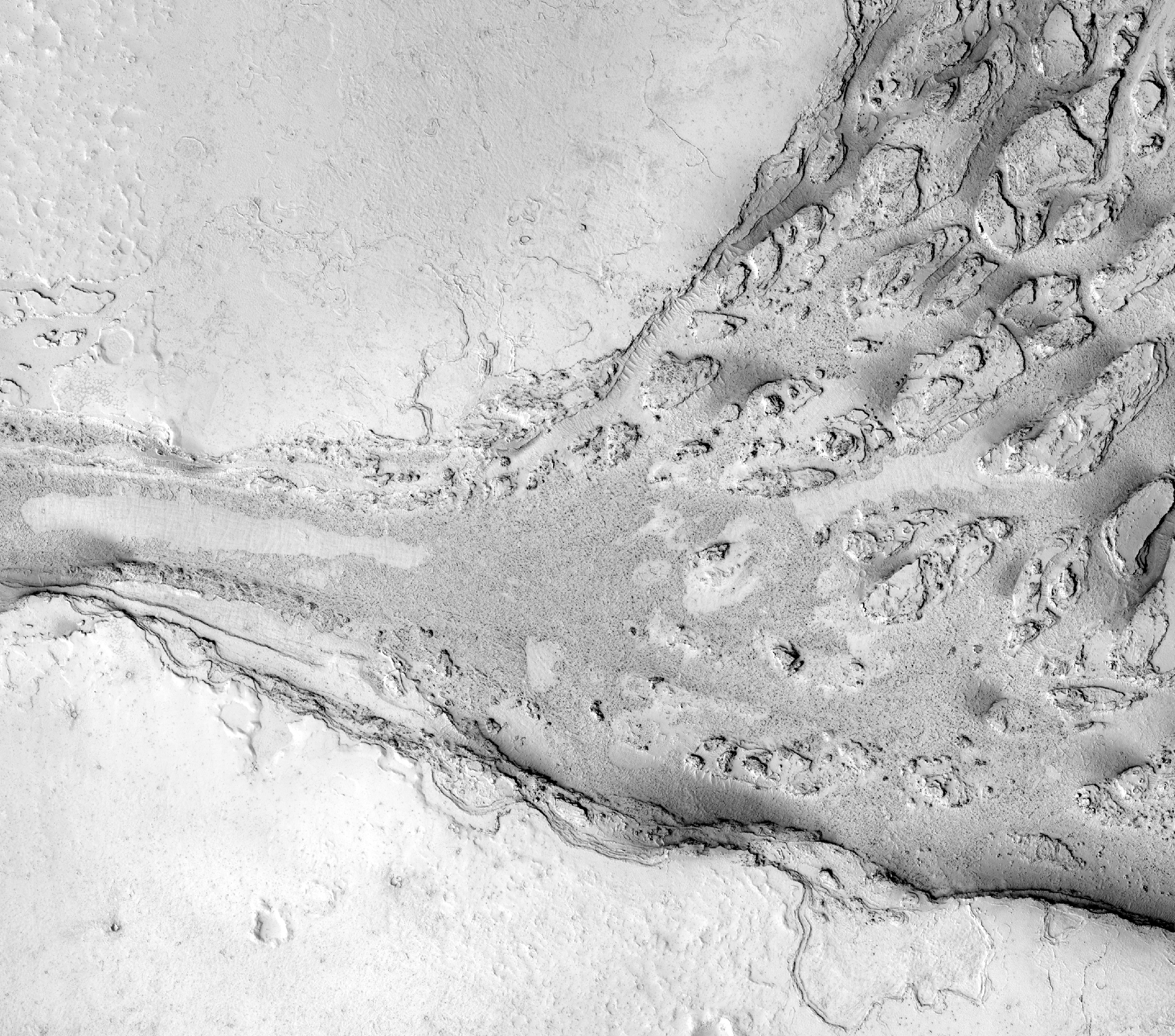
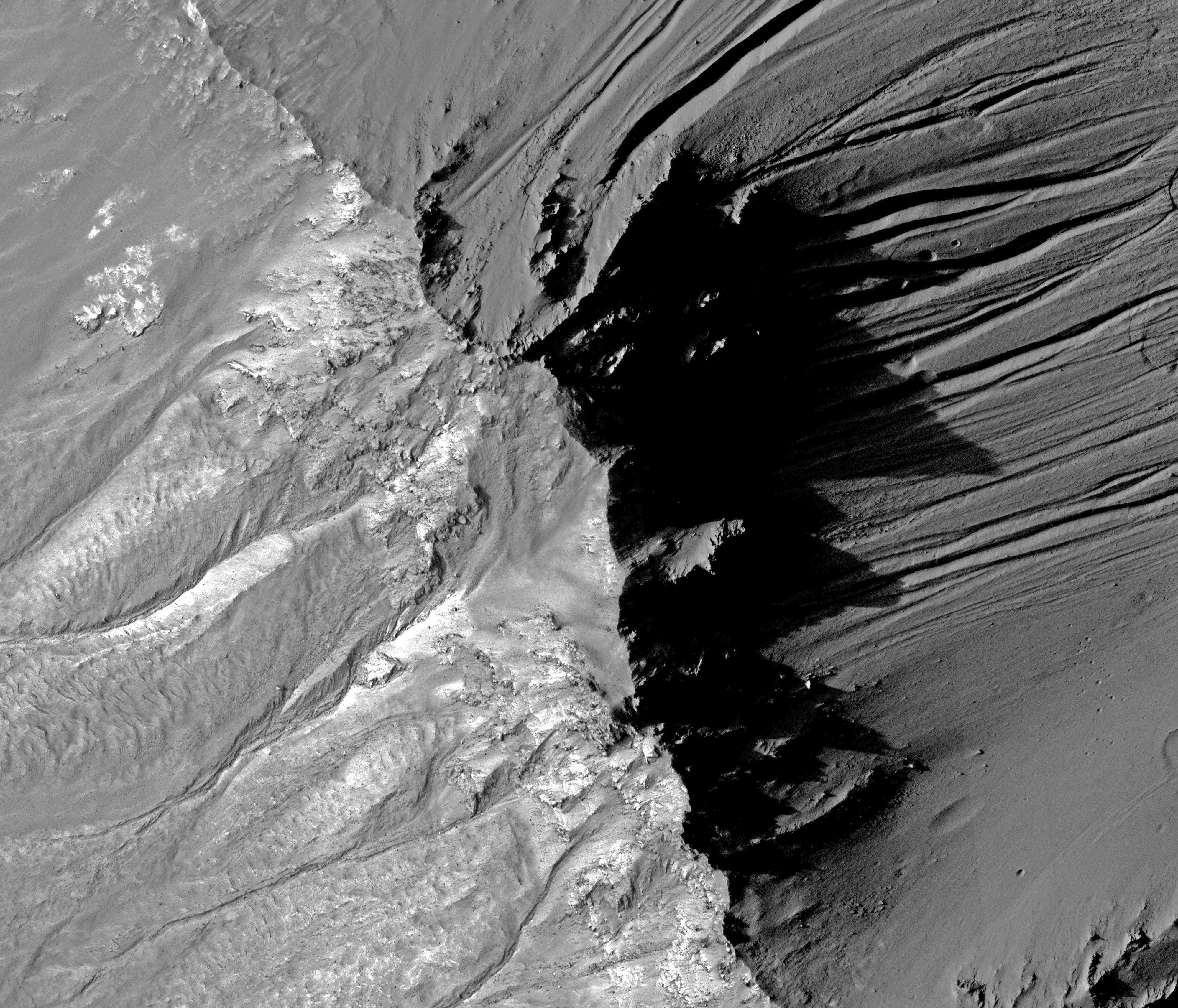
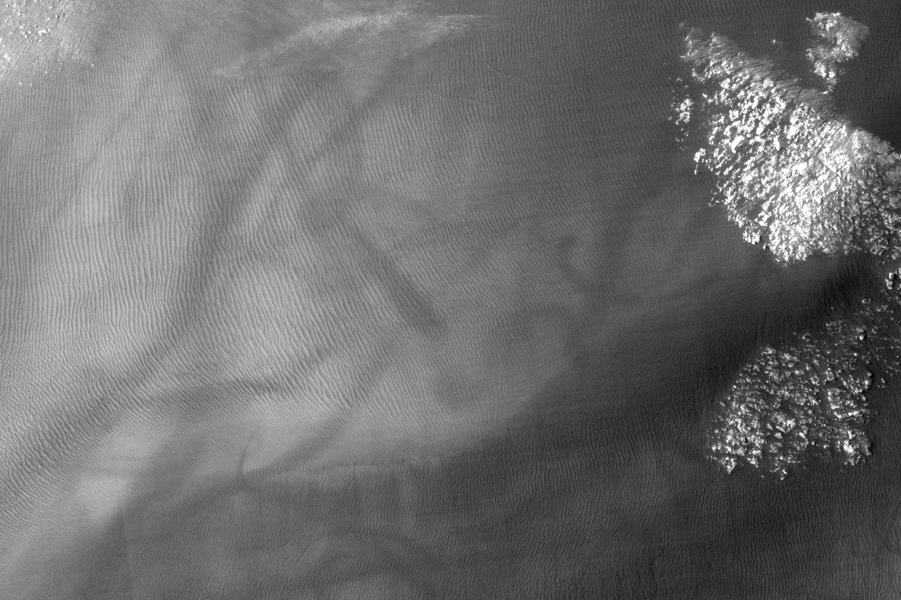
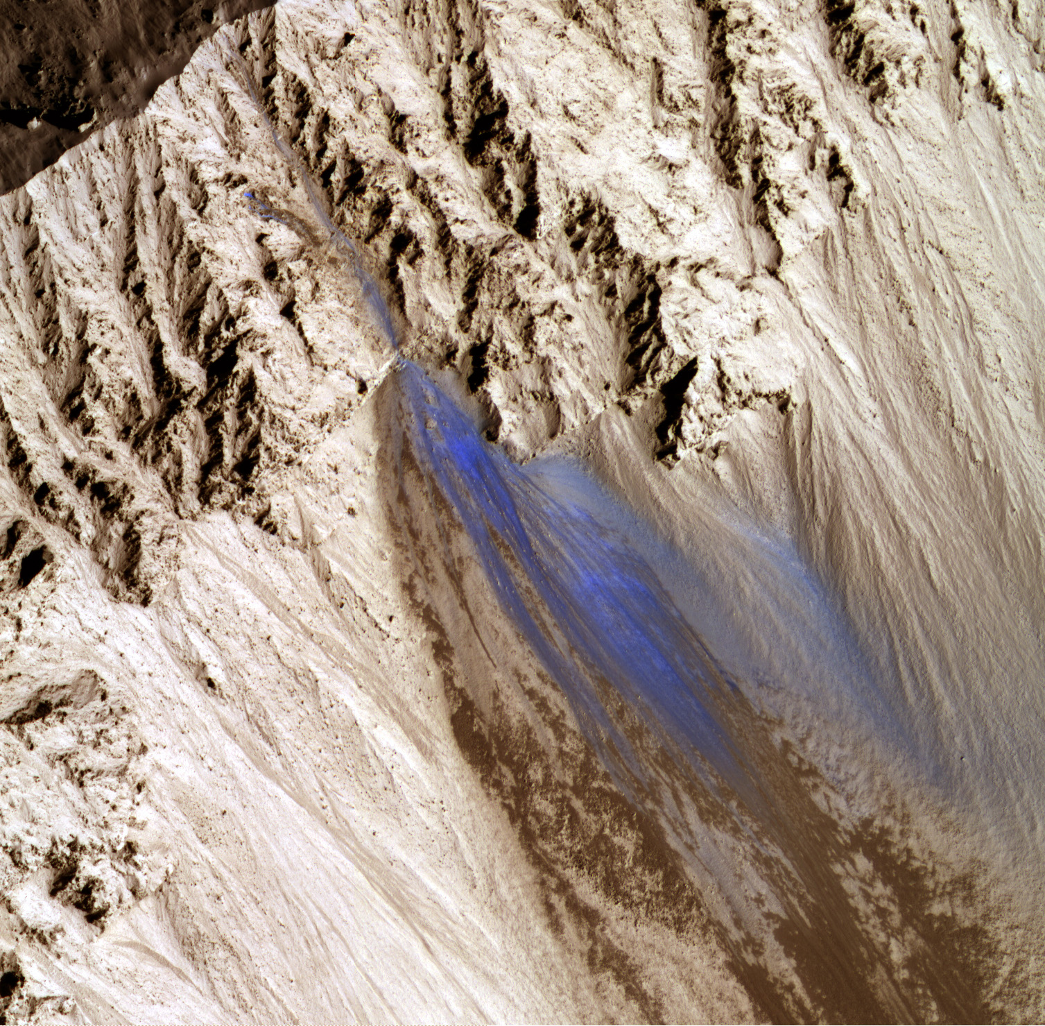
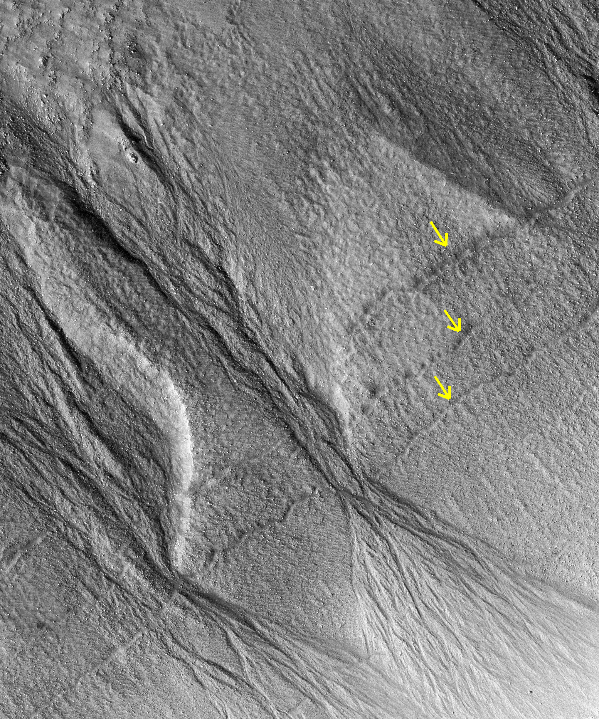
The gullies on a Martian sand dune in this trio of images from NASA's Mars Reconnaissance Orbiter deceptively resemble features on Earth that are carved by streams of water. However, these gullies likely owe their existence to entirely different geological processes apparently related to the winter buildup of carbon-dioxide frost.

Scientists at the University of Arizona, Tucson, and at Johns Hopkins University Applied Physics Laboratory, Laurel, Maryland, compared pairs of images from before and after changes in such dune gullies. They determined that the changes occur in Martian winter, during periods of carbon-dioxide frost, rather than during warmer seasons when frozen water, if present, might somehow melt and flow.

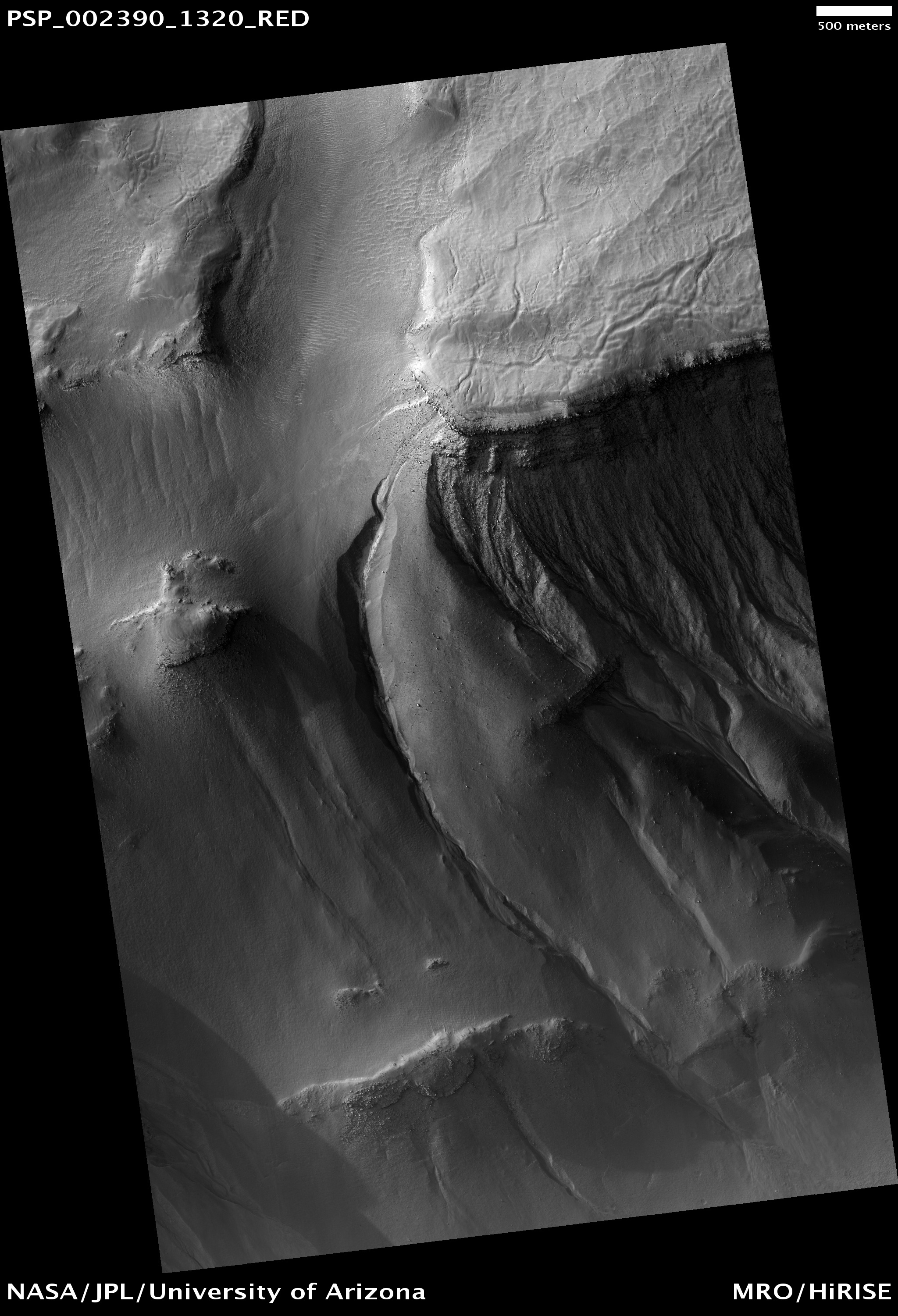
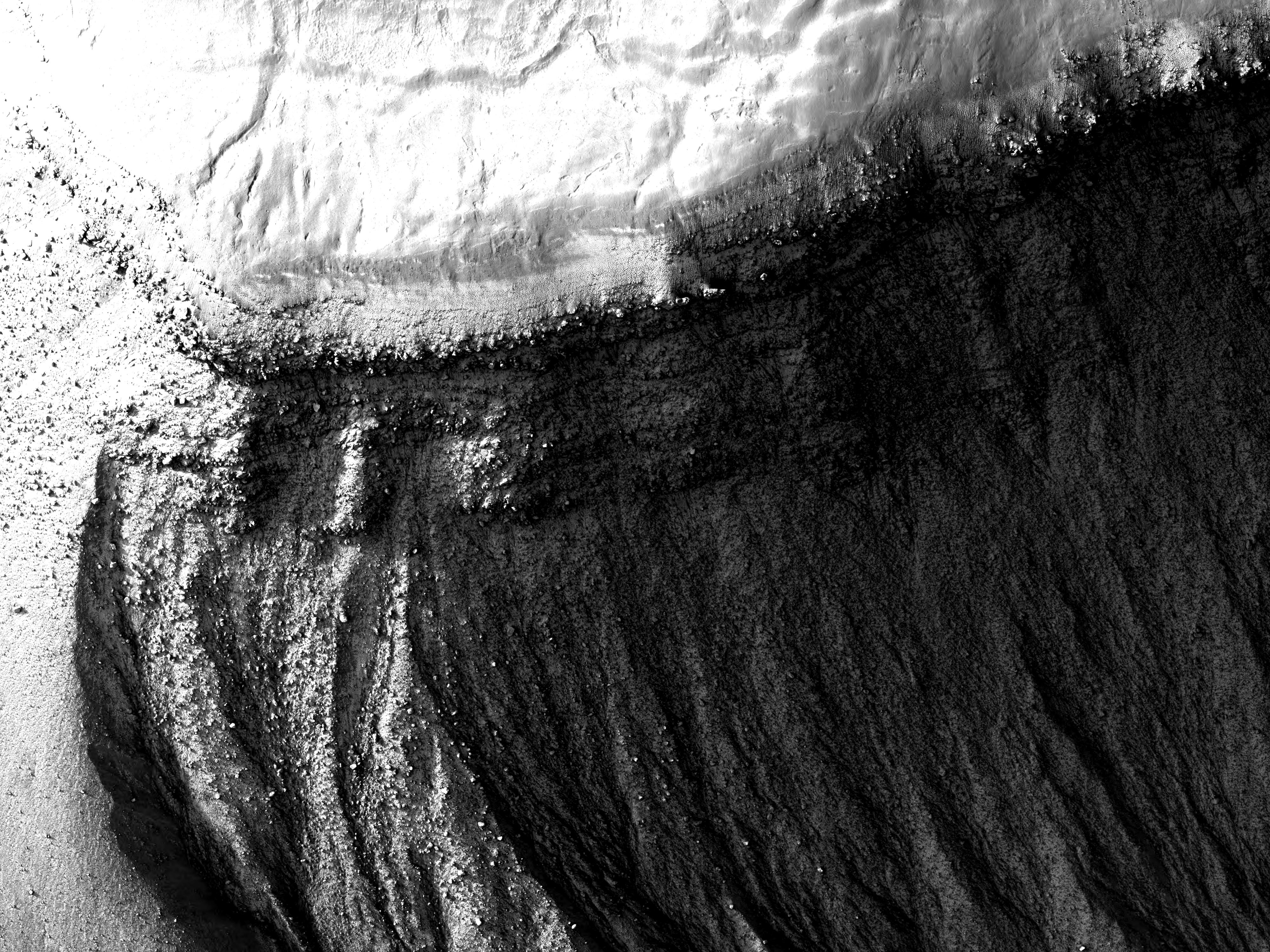
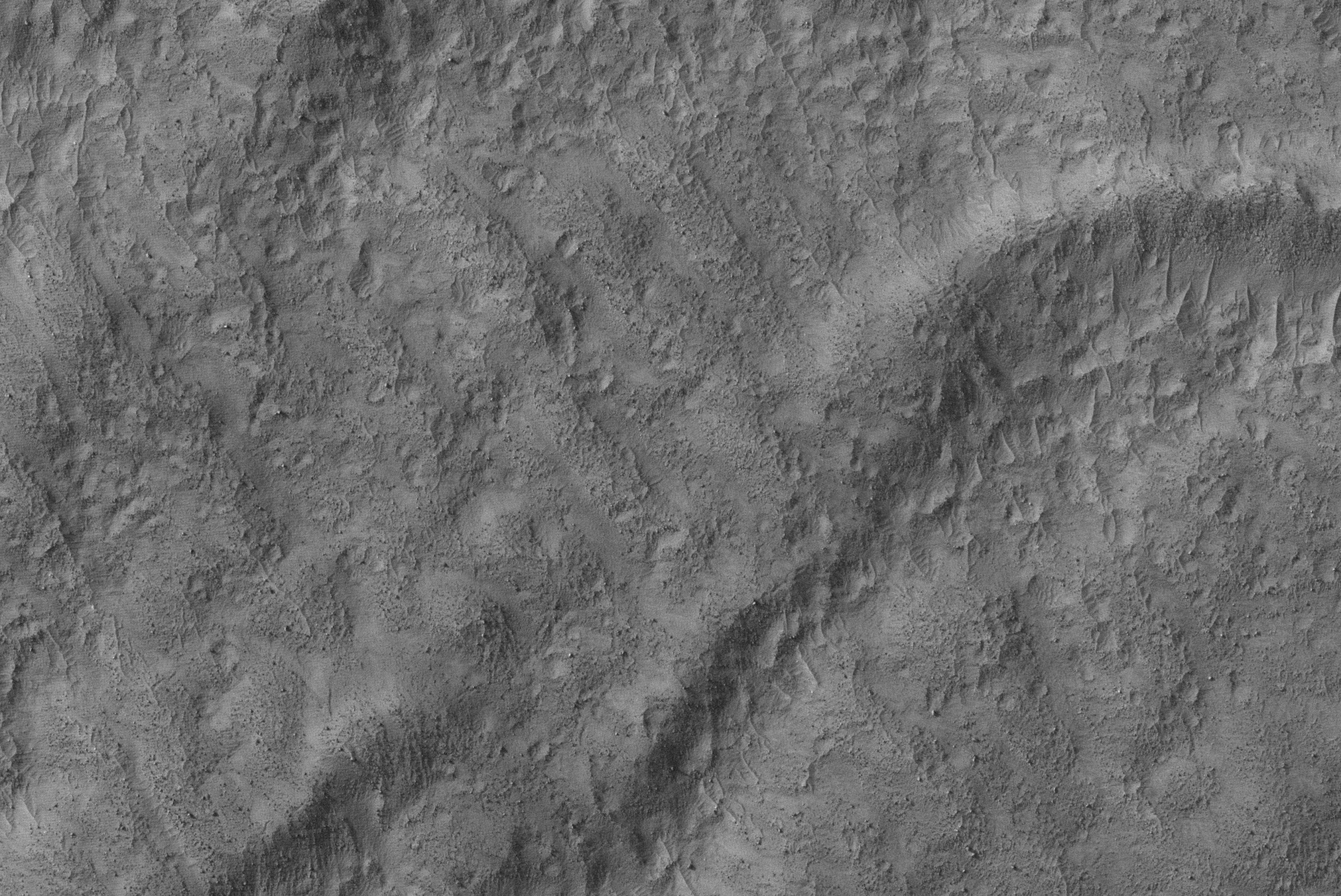
Each of the three images here shows an area about 1.2 kilometers (three-fourths of a mile) across. The dunes lie inside Matara Crater, at 49.4 degrees south latitude, 34.7 degrees east longitude. The images are portions of observations by the High Resolution Imaging Science Experiment (HiRISE) camera on the Mars Reconnaissance Orbiter. HiRISE took the top one on March 14, 2008, which was mid-autumn in Mars' southern hemisphere, the middle one on July 9, 2009, in the first half of the next southern-Mars summer, and the bottom one on October 4, 2010, in the late part of the following (and most recent) winter season.

Illumination is from the upper left. Gullies run leftward downhill from a dune crest in the upper right corner.

Arrows indicate places where changes appeared between observations. Each year, the alcoves at the dune's crest and the channel beds widened during the Martian winter as material moved down slope and lengthened the apron at the bottom. Very new deposits (formed sometime in September 2010) are visible in the bottom image as the darker material extending from the channels and obscuring the pre-existing ripples on the dune's surface. Additionally, on the upper gully, material first filled-in part of the channel (between 2008 and 2009) and then re-incised the channel into the apron (between 2009 and 2010).

The upper image is part of HiRISE observation PSP_007650_1300; the middle image part of ESP_013834_1300; the lower image part of ESP_019636_1300. Other image products from those observations are at http://hirise.lpl.arizona.edu/PSP_007650_1300 and http://hirise.lpl.arizona.edu/ESP_013834_1300.

Photo credit: NASA/JPL-Caltech/University of Arizona

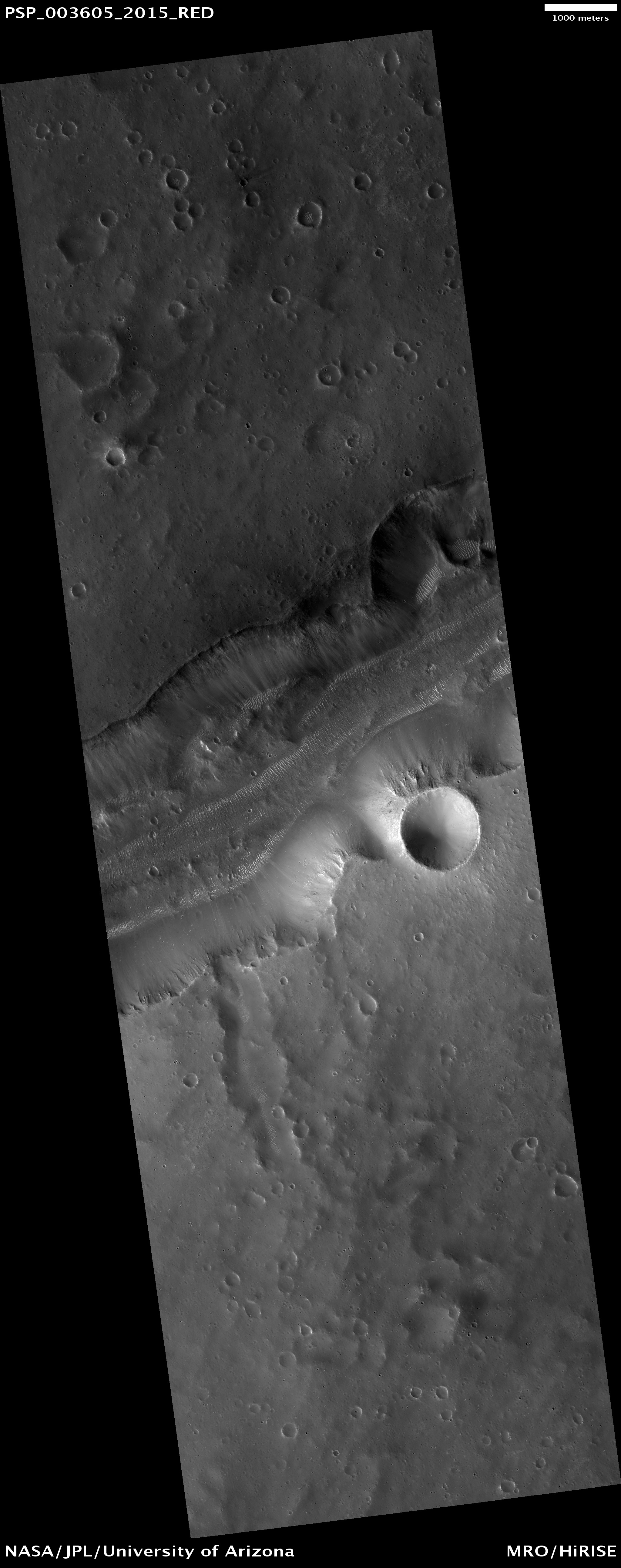
Note: Matara Crater is a small impact crater southeast of Proctor Crater and southwest of Hellas Planitia.

End of Lethe Vallis


This image hows the funnel-shaped terminus of Lethe Vallis, a winding channel in the Elysium Planitia region of Mars.

Lethe Vallis flows from southwest to northeast between two basins, Cerberus Palus and eastern Elysium Planitia. Where it empties into the latter, the channel abruptly widens. On the west side of this HiRISE image, Lethe Vallis is approximately 800 meters (0.5 miles) wide; on the east side, it is more than 7 kilometers (4.3 miles) in width. As the fluid that carved the channel spread out, its erosive power diminished. Thus, where the channel is wider, it contains numerous high-standing mesas that are primarily composed of pre-existing material that was not fully eroded away.

The floor of Lethe Vallis is covered in solidified lava and blanketed by a thin layer of light-toned dust. The lava has a rough, ridged appearance where its surface buckled as it cooled, and a smoother polygonal texture where it was not significantly deformed. Interestingly, lava textures are visible high on the banks and terraces of the Lethe Vallis. Farther away from the channel, the terrain is older and more heavily cratered.

Photo credit: NASA/JPL/University of Arizona

Saturday, October 30, 2010

Dark Slope Streaks Near Tikhonravov Crater


Dark streaks mark the slope of this crater rim south of Tikhonravov Crater.

Photo credit: NASA/JPL/Arizona State University

Note: Tikhonravov Crater actually cannot be seen in this image, as it lies just to the north of the photo.

Friday, October 29, 2010

Proctor Crater Dune Field


This observation shows the edge of a dark dune field on the floor of Proctor Crater, a 150-kilometer diameter crater in the southern highlands of Mars.

The dark dunes are composed of basaltic sand that has collected on the bottom of the crater. Dark dune slip faces (the steeper sides of the dunes) are located on the east side of the dunes and are believed to have formed in response to fall and winter westerly winds caused by geostrophic forces (winds balanced by Coriolis and pressure gradient forces). Superimposed on their surface are smaller secondary dunes that are commonly seen on terrestrial dunes of this size.

Many smaller and brighter bedforms, most likely small dunes or granule ripples, cover the substrate between the larger dark dunes as well as most of the floor of Proctor Crater. The dark dunes overlie the small bright bedforms indicating that they formed more recently. In several areas, however, the dark dunes appear to influence the orientation of the small bright dunes, possibly by wind flowing around the larger ones, suggesting that both dark and bright bedforms are coeval. The dunes in Proctor Crater may be active today, moving in response to Martian winds.

Photo credit: NASA/JPL/University of Arizona

Northern Dunes


Dunes cover the floor of this unnamed crater in the northern lowlands.

Photo credit: NASA/JPL/Arizona State University

Note: This crater is almost due north of Lomonosov Crater, which lies about 5 degrees south. The surprise is that this unnamed crater doesn't have a name yet, as it's both a medium-sized crater and fairly prominent for the region (i.e., there is no other major crater in its vicinity other than Lomonosov).

Lava Flows at the Base of Olympus Mons


Olympus Mons is the largest volcano in the Solar System and is thought to be quite young (compared to other features on Mars). So, what happens to all those lava flows running off of Olympus Mons?

This observation shows that they are buried by yet younger "flood" lavas that lap up against the side of Olympus Mons. In this image we see two very different types of Olympus Mons lava flows. On the west, there is a thick flow with a rough surface texture. This is almost assuredly similar to lava flows in Hawaii that are called "aa." The lava is quite sticky as it flows and thus is ripped into chunks when it tries to move. Next to the aa flow is a long trough or channel. If you look closely, you can see tongues of lava flowing to either side of the channel. This looks like the product of a long eruption with lots of pulses.

The channel eventually disappears and an irregular set of pits is visible at its extension. This is probably because the channel had developed a solid roof (becoming a lava tube) and then lava burst out of the tube. This kind of complex evolution of a lava flow can be seen on Kilauea Volcano, in Hawaii, today. But, happily, it is happening at a much smaller scale than these ancient lava flows on Mars.

Photo credit: NASA/JPL/University of Arizona

Thursday, October 28, 2010

Fractures near Kasei Valles


The fracture system shown in today's VIS image is on the northern margin of the Kasei Valles lowland. Fractures like this can become chaos with continued downdropping of blocks and widening fractures.

Photo credit: NASA/JPL/Arizona State University

Dunes in Mars' Polar Erg


Near the north pole of Mars, the landscape is dominated by sand dunes forming a massive erg (sand sea), much like parts of the Sahara Desert on Earth. In parts of the erg, sand is abundant and covers the entire surface. Here near the edge, sand is in shorter supply and the dunes are separated by areas of lighter-toned soil.

Many dunes on Mars are simple crescent-shaped dunes called barchans, which commonly form in sand-starved areas. A very long ridge oriented at a right angle to the wind is called a transverse dune. Here many of the dunes are barchan-like, but they have partially coalesced and deformed into longer, straighter ridges and other, more complex forms. This suggests a more complex interaction between wind and sand.

Photo credit: NASA/JPL/University of Arizona

Note: This location of this photo is just north of Siton Undae, southwest of Escorial Crater, both of which are in the northern reaches of Vastitas Borealis.

Wednesday, October 27, 2010

Naktong Vallis


Today's VIS image shows a short section of Naktong Vallis.

Photo credit: NASA/JPL/Arizona State University

Light-Toned Gully Materials on Hale Crater Wall


This observation shows the southern latitude Hale Crater, a rather large, pristine elliptical crater approximately 125 x 150 kilometer in diameter.

Hale Crater possesses sharp features, impact melt bodies ponded through out the structure and few overprinting impact craters. These attributes indicate that it is relatively young and certainly well-preserved -- likely the youngest crater of this size on Mars!

Present on the crater walls are a large number of gullies, some with light-toned deposits. The gullies visible here are very well developed, and many are cut deeply into the crater walls. Several have braided channels suggestive of repeated flow. Some of the gullies have boulders littered throughout their channels. This could be a result of a fluid preferentially transporting smaller particles and leaving larger rubble behind. The composition of the light-toned deposits are currently unknown. The CRISM visible-infrared spectrometer, HiRISE's sister instrument on MRO, may be able to shed some light on the composition of these materials.

In one place along the crater rim gullies are visible on both sides of the rim. This has only been seen in a few locations on Mars.

Photo credit: NASA/JPL/University of Arizona

Tuesday, October 26, 2010

Channels in Gale Crater's Rim


Small channels dissect the northwestern rim of Gale Crater.

Photo credit: NASA/JPL/Arizona State University

Strengths of Materials in Ganges Mensa


The amount of time that a geologic deposit is exposed at the surface can be measured by counting the number of impact craters that is contains in a given area. The longer a deposit is exposed at the surface the more impact events that it endures.

In this image, there are at least two distinct geologic units, a light–toned bedrock and a surface veneer of dark–toned material that contains sand dunes. The light–toned bedrock must be older that the dark–toned veneer of sand; the bedrock must have been present first in order to be covered by the sand. The dark–toned sand however, contains many more impact craters than the light–toned bedrock. This suggests that the surface of the bedrock is younger than the veneer of sand.

This can be explained by the bedrock being more easily eroded by the wind than the veneer of sand. The surface of the bedrock is rapidly refreshed (craters smoothed away), while the sand veneer retains impact craters for a longer period of time. This indicates that the bedrock is very friable (weak and easily eroded, in this case by the wind) and the sand veneer is less friable.

Photo credit: NASA/JPL/University of Arizona

Note: The location of this photo is the south face of Ganges Mensa, the central mesa that lies in the middle of Ganges Chasma (the eye of the eagle's head).

Monday, October 25, 2010

Hephaestus Fossae


The channels in this VIS image are called Hephaestus Fossae and were most likely formed by lava flow and erosion rather than being eroded by water.

Photo credit: NASA/JPL/Arizona State University

Southern Hemisphere Crater with Dune Field


This observation shows a southern hemisphere crater with gullies, dunes, periglacial modification, bright rock deposits, and dust devil tracks. Although these features are all common on Mars, there are not many places that have all of them together as viewed here.

The gullies seen at the top of the image are likely caused by wet debris flows. They have deposits of multiple ages. The gully on the left has bright deposits that have been modified by periglacial processes overlain by slightly darker deposits that have not been modified. Periglacial processes, such as seasonal freezing and thawing, are responsible for the polygonal fractures seen near the gullies and around the image.

The dark material in the center of the image is a dune field. There are several different sizes and orientations of dunes — these different orientations indicate that the dominant winds in the area have changed throughout time.

The dark streaks that criss-cross on the outskirts of the dune field are dust devil tracks. Dust devils are spinning cells of dust that travel across the Martian surface. As they move, they pick up and redeposit particles, as well as disturbing dust on the surface. They are responsible elsewhere on Mars for removing dust from the solar panels of the Mars Exploration Rovers Spirit and Opportunity, which has helped to extend their missions way beyond the 90-day primary mission.

The subimage, 750 meters across, shows dust devil tracks near the southwest edge of the dune field. The bright protruding rocks to the right of the image are either being exposed or being buried as the dunes migrate.

Note that the black rectangular feature near the top right of the full image is a data gap resulting from data transmission problems; it is not a real feature.

Photo credit: NASA/JPL/University of Arizona

Note: This small crater is located east of Russell Crater in the Chalcoporos Rupes region.

Special Note:  This is Areology's 500th post!

Sunday, October 24, 2010

Dark Slope Streaks


Numerous dark slope streaks mark the rim of this unnamed crater located on the rim of Henry Crater.

Photo credit: NASA/JPL/Arizona State University

Flood-Emplaced Blocks in Holden Crater


This image shows blocks of bright, layered rock embedded in darker material that are thought to have been deposited by a giant flood that occurred when Uzboi Valles breached the rim of Holden Crater (Grant et al., 2008, Geology v. 36, p. 195-198).

The magnitude of this ancient flood is indicated by the large size of the blocks (up to 100 meters across). The blocks do not appear to have been moved very far by the flood, as they are not rounded.

Holden Crater is one of the four potential landing sites for the Mars Science Laboratory rover, to be launched in November 2011. The bright layered rock in this image probably contain a record of a wetter, warmer period early in Martian history, and are therefore a prime target for exploration.

Photo credit: NASA/JPL/University of Arizona

Saturday, October 23, 2010

Ascraeus Mons


This VIS image shows lava channels and collapse features on the southwestern flank of Ascraeus Mons.

Photo credit: NASA/JPL/Arizona State University

Russell Crater Dunes, Defrosted


The Russell Crater dune field is covered seasonally by carbon dioxide frost, and this image shows the dune field after the frost has sublimated (evaporated directly from solid to gas). There are just a few patches left of the bright seasonal frost.

Numerous dark dust devil tracks can be seen meandering across the dunes. The face of the largest dune is lined with gullies. The source of the gullies is unclear but could involve erosion by the seasonal carbon dioxide ice.

Photo credit: NASA/JPL/University of Arizona

Note: Don't the dust devil tracks in the above picture remind you of Schiaparelli's canals?

Friday, October 22, 2010

Elysium Chasma


This fracture system, located southwest of Elysium Mons, is called Elysium Chasma.

Photo credit: NASA/JPL/Arizona State University

Layers in Arsia Mons


This image covers a pit in the lower west flank of Arsia Mons, one of the four giant volcanoes of the Tharsis region.

Many layers are exposed in the pit, probably marking individual lava flows, and provide information about the nature of the volcanic eruptions. This image was acquired in the middle of large regional dust storms on Mars, but the atmosphere over this image is only moderately dusty because the altitude is 6.5 kilometers higher than the planetary mean, so the air is quite thin and cannot hold as much dust.

Although the atmosphere is not too dusty, the surface is buried by a dust layer meters thick. These high-altitude locations on Mars have thick dust deposits because the thin air cannot blow away the dust, or at least not as fast as it accumulates. On Earth the oceans serve as dust traps, but on Mars, it is the high volcanoes.

Photo credit: NASA/JPL/University of Arizona

Thursday, October 21, 2010

Dunes in Nili Patera


The individual dunes in this image are moving along a hard surface in Nili Patera.

Photo credit: NASA/JPL/Arizona State University

Small-Scale Volcanic Activity on Tharsis


This image shows detail of a small volcanic complex in the region of Mars called Tharsis.

Tharsis, a high volcanic region thousands of kilometers wide, hosts some of the largest known volcanoes in the Solar System. The volcanic crater seen here, however, is only about 1 kilometer (0.6 miles) across. This means that Tharsis was covered with volcanic activity at a wide range of scales. The wavy ridges of material seen here are solidified lava flows.

On some flows, a set of narrow parallel ridges, or levees, illustrate how the flowing lava created its own path as it flowed along. Measuring the height and width of these levees and the flows themselves can yield information on the lava's rheology, or how it flowed and moved. In turn, rheology depends on the composition of the lava, among other factors. Knowing how lava moved across the surface of Mars and what it was made of can help scientists determine how similar Mars' volcanic processes were to those on Earth.

In order to facilitate vertical measurements from images, such as the height of these levees, the MRO spacecraft has the ability to roll to its side, allowing the HiRISE camera to take images of a spot on the surface, like these lava flows, from two different angles (on two different orbits). From these two images a stereo image and digital terrain model of topography can be created, much as the separation between your two eyes allows you to view objects in three dimensions. (The stereo pair for this image consists of this image and ESP_018468_1950.)

One factor that will complicate the study of these lava flows is that they are quite old, and thus have been damaged and covered by impact cratering and deposition and removal of material by the wind.

Photo credit: NASA/JPL/University of Arizona

Note: This particular volcano is located about halfway between Sulci Gordii and Gigas Sulci, southeast of Olympus Mons.

Wednesday, October 20, 2010

Platy Flows in Elysium Planitia


These lava flows in Elysium Planitia are called platy flows. The surface of the lava flow cooled and solidified, while liquid lava beneath kept flowing. The continued flow broke apart the solid surface and moved the pieces like rafts. This VIS image shows a channel of such movement.

Photo credit: NASA/JPL/Arizona State University

Alpine Glacier in Protonilus Mensae


On Earth, glaciers are common at high elevations where snow accumulates each year in mountain valleys. Once the snow pack becomes thick enough and compressed to solid ice it will start to flow down hill and becomes a glacier. At lower latitudes these “alpine glaciers” more often occur on poleward facing slopes where sunlight is limited and snow melt is slow.

On Mars, landforms resembling alpine glaciers are now found to be common at middle latitudes.

This image shows an example of such a landform at 41 degrees North latitude. Snow and ice accumulated in the mountain valley in the southern areas of this image, where the rounded valley headwalls (called "cirques") were gradually carved out by the slowly flowing ice. This flow of ice is indicated by long stream lines, called "lateral moraines," ridges of rafted soil and rock debris from the cirque regions.

An interesting aspect of this image is that the flow from these cirques appears to have overtopped the south rim of a large crater at the north end of the image, filling the crater with ice. Once filled the ice flow breached the north rim of this crater and flowed out onto the adjacent plain. Such rapid drops in elevation for a glacier are call "ice falls," analogous to a water fall. Fresh ice falls often exhibit fractured and broken surfaces as the ice flow breaks into crevasses. High resolution images such as this can help scientists to understand the rate and thickness of the flow by examining such characteristics.

Today Mars is cold, with a global average temperature of about -68 Celsius (-90 Fahrenheit). Mars is also a very dry place and surface ice is unstable everywhere on except for on the polar caps. Any ice left on the surface would evaporate without ever melting, called "sublimation." However, past climate changes have periodically allowed snow and ice to be stable on the Martian surface and even to build into glacial masses, hundreds of meters (yards) or more thick. In this image, the visible surface is made up of regolith (rock and soil debris) and no ice is visible. Subsurface ice may still be present and protected by this soil cover.

Photo credit: NASA/JPL/University of Arizona

Notes: This glacier is located on the southern edge of Protonilus Mensae, just north of Rudaux Crater and east of Moreux Crater. The above image forms a stereo pair with Debris Flow (ESP_019503_2210).

Tuesday, October 19, 2010

Elysium Fossae and Patapsco Vallis


This VIS image shows two different types of linear depressions. The wide depression at the top of the frame is Elysium Fossae, which most likely formed due to tectonic activity. The fossae is probably bounded on both sides by faults. The narrow depression at the bottom of the frame is a lava channel called Patapsco Vallis. This channel has lava flows on both sides which were probably formed by over spilling of lava as it flowed down the channel. Both these features are located east of Elysium Mons.

Photo credit: NASA/JPL/Arizona State University

Landslide in Zunil Crater


This color image shows a portion of the southeast inner wall of Zunil, a geologically recent (less than about 10 million years old) well-preserved 10-kilometer impact crater.

The color and albedo patterns indicate that a landslide occurred here very recently -- too recently to have been re-covered by dust. The landslide could have been triggered by a Marsquake or a small impact event.

Monitoring Mars for changes such as this will help us to better understand active processes. The color image has north down, which also places downhill down and helps us to interpret the topography. However, we are in fact looking down from directly above the crater.

Photo credit: NASA/JPL/University of Arizona

Monday, October 18, 2010

Gullies and Layers in Noachis Terra


This observation shows gullies in a trough in Noachis Terra.

The trough is actually one section of a "trough crater." Here the term "trough crater" refers to a roughly circular trough that appears to follow the wall of a crater. A great deal of geologic activity is needed to transform an impact crater into a trough crater. First, the crater must have been filled in with some type of sediment. Second, the outer edge of the filling must have been scooped out by an unknown process, leaving a trough in the form of a ring inside the crater.

The trough in this observation is located on the north wall of the southern end of the trough crater. Gullies can be seen to start at multiple levels on this wall. The Martian gullies are thought to require some amount of liquid water to form, although carbon dioxide and dry debris flows have also been suggested as erosional materials. The start of gullies across Mars are often correlated with layers as seen here. What is particularly interesting about these gullies is that the heads (tops) of the gullies are located at many elevations along the same slope, and that each elevation with gullies has an associated set of layers.

One thing to notice is that often a layer correlated with a gully is most eroded where the gully occurs. (See, for example, the gullies located in the bottom center of the image and the subimage). At the bottom center, there are two gullies present, and the layer where they appear to originate is most eroded where the gullies exist. In the subimage, the deeper gully channels correspond to locations where the layers have been more eroded. This suggests that undermining may be occurring. Undermining often happens when water from the subsurface reaches the surface and destabilizes nearby material. The water erodes material in its way, which can create an overhang. Once this overhang becomes unstable, it will collapse.

This might be the reason that the layers are the most eroded near the gullies. It would support a subsurface origin for the water that formed these gullies. Undermining can also be generated by surface water if a weak, easily erodible layer lies beneath a stronger layer.

Photo credit: NASA/JPL/University of Arizona

Sunday, October 17, 2010

Olympus Mons


This VIS image shows the southeast flank of Olympus Mons. This huge volcano is surrounded by an escarpment, a large cliff at the volcano margin. This image has a landslide along this escarpment.

Photo credit: NASA/JPL/Arizona State University

Landslides along the Walls of Bahram Vallis


Landslides are one of the most spectacular mass wasting features on Mars in terms of their areal extent and volume. Some of the best preserved landslides are in the Valles Marineris canyon system, but that's not the only place we see evidence for landslides.

This image of Bahram Vallis, a valley along the edges of the circum-Chyrse Basin, has large mounds of material at the base of the valley floor. These deposits of material are different from those deposits seen at Valles Marineris. They do not have a "ribbed" surface of transverse ridges. They also do not have a semi-circular distal margin giving it a lobate appearance and they have not traveled for many kilometers away from their source region like most Valles Marineris landslides do.

These particular deposits have the characteristic shape of rotational landslides or slumps on Earth where material along the entire wall slumps down and piles debris at the base of the slope, much like a person who slumps down the back of a chair. Right at the cliff edge at the top of the slope, the shape of the area where the valley wall gave way to a landslide is not straight, but rather curved or semi-circular. This is typical of large landslides where the failure area has an arcuate "crown" shape. The fact that landslides have occurred here indicates that the valley walls are not stable and the materials respond to Martian gravity with mass movements.

Scientists studying landslides can use these images along with topographic data to model how the wall failed, which can give clues to the nature of the materials (type, strength, etc.) in this region. Another consequence of landslide activity in Bahram Vallis is that the overall width of the valley will increase over time.

Photo credit: NASA/JPL/University of Arizona

Saturday, October 16, 2010

Friday, October 15, 2010

Spring Colors on the Southern Polar Cap


Mars has a seasonal southern polar cap composed of carbon dioxide (commonly known as dry ice), that overlies a permanent polar cap which is a mixture of carbon dioxide ice, water ice and dust. As the carbon dioxide evaporates in the spring the escaping gas carves channels in the permanent cap below. Often these channels radiate outward (or converge inward), giving them a spider-like appearance [araneiform].

In this false color image the seasonal frost is whitish-lavender. The tan areas starting to show through are where the frost has already evaporated (sublimated is actually the correct term, when ice changes directly to a gas). Tan-colored dust blows around and accumulates in the bottom of some of the channels.

This is truly other-worldly terrain, with exotic landforms with no earthly analogs.

Photo credit: NASA/JPL/University of Arizona

Note: The location of this photo is on the Planum Australe ice cap, south of Promethei Planum and west of Chasma Australe.

Thursday, October 14, 2010

Dark-Toned Unit Exposed atop Crater Ejecta in Meridiani Planum


This image shows the contact between two geologic units: a cratered plains unit and an etched terrain unit.

The cratered plains are relatively smooth and dark, while the brighter etched terrain consists of smooth plains and dune fields.

The etched terrain occupies the lowest portions of an approximately 120 kilometer NW-SE trending valley with a wide variety of landforms suggestive of wind erosion. Both units partially cover the ejecta from an approximately 20 kilometer crater directly to the northeast of the image.

Photo credit: NASA/JPL/University of Arizona

Notes: For a similar photograph and caption, see Northern Meridiani Etched Terrain and Hematite Plains Contact. This location is in Meridiani Planum, extremely close to the point where the Martian equator and prime meridian intersect.

Moreux Crater Dunes and Central Peaks


Today's VIS image shows some of the dunes of the floor of Moreux Crater.

Photo credit: NASA/JPL/Arizona State University

Note: The "hills" in the upper left corner of the image are actually the central peaks that were formed by the impact that created this complex crater.

Frosted Gullies in the Northern Summer


Many images show that Martian gullies have formed on impact crater walls in both the northern and southern hemispheres. Gullies such as the ones shown here have an alcove at the top of the crater wall and channels leading downhill to debris aprons that run out over the crater floor.

Some of these gullies show activity today with new material appearing on top of the debris aprons. Many scientists believe that these gullies have been carved by liquid water so this present-day activity is of immense interest. Recently however, an alternate theory has been gaining ground.

An analysis of gully activity in craters and on sand dunes shows that activity seems to only occur in the winter at the coldest time of year. The alternate suggestion for gully activity is that accumulations of frost in the gully alcoves starts an avalanche of loose material that does not involve liquid water.

This HiRISE image shows shows gullies on a crater wall in the north polar region. Although it is late summer, you can see frost within the gully alcoves. These alcoves are on the poleward facing crater wall and so spend much of the time in shadow. This allows the frost to survive. The full-image [see also here and here] shows that the opposite (south-facing) wall has similar gullies, but no frost during this season. Scientists are analyzing many images like this in order to try and answer the broader question of whether liquid water is responsible for the these gullies or not.

Photo credit: NASA/JPL/University of Arizona

Note: The unnamed crater in which these gullies appear lies in Vastitas Borealis to the northwest of Tantalus Fossae.

Wednesday, October 13, 2010

Juventae Chasma


The amount of sand in this region of Juventae Chasma has coalesced into a sand sheet, rather than individual dune forms. Wind continues to sculpt the sand around high standing hills.

Photo credit: NASA/JPL/Arizona State University

Signs of Fluids and Ice in Acidalia Planitia


This observation shows a crater approximately 11 kilometers (7 miles) in diameter, located in Acidalia Planitia, part of the northern plains. Several features in and around this crater are suggestive of fluids and ice at and near the surface.

The south-looking (or equator facing) walls of this crater are cut by numerous gullies such as the ones shown in this subimage with well developed alcoves, sinuous channels, and terminal fan deposits. These gullies seem to originate at the same height, suggesting that the carving agent may have emanated from one single layer exposed in the crater's wall.

Contrastingly, no gullies are observed in the north-looking (or pole facing) wall of this crater. Terrestrial gullies very similar to the ones shown in this image are produced by surface water. The arrows in the cutout show fissures that may indicate detachment of surficial materials possibly held together by subsurface ice, sliding en masse down the crater's wall.

The muted topography of the crater and its surroundings, the relatively shallow floor (300 meters or 330 yards), the convex slope of its walls — all are consistent with ice being present under the surface, mixed with rocks and soil. Ice would have acted as a lubricant, facilitating the flow of rocks and soils and hence smoothing landscape's features such as ridges and craters' rims.

The concentric and radial fissures in the crater's floor may indicate decrease of volume due to loss of underground ice. Piles of rocks aligned along these fissures and arranged forming polygons are similar to features observed in terrestrial periglacial regions such as Antarctica. Antarctica's features are produced by repeated expansion and contraction of subsurface soil and ice, due to seasonal temperature oscillations. The funnel-shaped depressions visible in the crater's floor could be collapse pits, further evidence of ice decay; alternatively, they could be smoothed-out impact craters.

Photo credit: NASA/JPL/University of Arizona

Tuesday, October 12, 2010

Gullies and Ice-Rich Material


This observation shows gullies in a crater in the southern hemisphere.

Gullies typically form when flowing water has sufficient energy to erode soil and soft rock in a channelized flow. The gullies in this image have narrow, overlapping channels and are deeply incised into the slope. Overlapping channels may suggest multiple flow events on this slope wall.

It is unknown what happened to the water that flowed in these gullies. Some of the water may have evaporated or gradually sublimated into the atmosphere or became incorporated as ice in the gully debris aprons located downslope at their termini.

Sublimation is a process similar to evaporation except that solid ice (instead of liquid water) returns to the atmosphere as a gas. Sublimation is common on Mars because the temperature and pressure are so low on Mars today that liquid water is only rarely stable.

The crater floor is covered in boulders (see subimage), dunes, and textured material. The boulders are likely a “sublimation lag” that provides evidence that material on the crater floor is, or once was, ice-rich. A sublimation lag forms when ice-rich material sublimates leaving the boulders and rocks behind. It is possible that the boulders on this crater floor represent such a process. The pitted texture around boulders may also be an indicator of ice sublimation.

Photo credit: NASA/JPL/University of Arizona

Note: This crater is located in Terra Sirenum northeast of Newton Crater.

Tharsis Lava


Volcanic flows cover the majority of the surface of Mars. In some regions, like around Arsia Mons, the flows are readily identifiable. As time passes, the flow features are covered or eroded away by other processes. This region of Tharsis near Olympus Mons contains subtle features showing its lava flow origin. Note the "softened" flow fronts and lava channels.

Photo credit: NASA/JPL/Arizona State University

Note: This location of this photo is just southeast of Olympus Mons and northwest of Gigas Sulci.