Sunday, December 23, 2012

On the Edge of Yellowknife Bay


In a shallow depression called "Yellowknife Bay," the NASA Mars rover Curiosity drove to an edge of the feature during the 130th Martian day, or sol, of the mission (December 17, 2012) and used its Navigation Camera to record this view of the ledge at the margin and a view across the "bay."

Photo credit: NASA/JPL-Caltech

Note: For more information, see Curiosity Rover Explores 'Yellowknife Bay'.

Saturday, December 22, 2012

Copper Cliff by Opportunity


This 180-degree mosaic of images from the navigation camera on the NASA Mars Exploration Rover Opportunity shows terrain near the rover during the 3,153rd Martian day, or sol, of the rover's work on Mars (December 6, 2012). West is at the center, south at the left edge, north at the right edge.

Opportunity had driven about 7 feet (2.2 meters) westward earlier on Sol 3153 to get close to the outcrop called "Copper Cliff," which is in the center of this scene. The location is on the east-central portion of "Matijevic Hill" on the "Cape York" segment of the western rim of Endeavour Crater.

The view is presented as a cylindrical projection.

Photo credit: NASA/JPL-Caltech

Note: For the anaglyph image, see PIA16561: Opportunity at 'Copper Cliff,' Sol 3153.

Friday, December 21, 2012

Matijevic Hill by Opportunity


This full-circle panorama shows the terrain around the NASA Mars Exploration Rover Opportunity during the 3,105th Martian day, or sol, of the rover's work on Mars (October 18, 2012). It was assembled from images taken by the rover's navigation camera. South is at the center. North is on both ends.

Opportunity had driven about 61 feet (18.5 meters) westward earlier on Sol 3105 to reach this location, which is on the northern portion of "Matijevic Hill" on the "Cape York" segment of the western rim of Endeavour Crater. The wheel tracks created by the drive are visible. For scale, the distance between the two parallel tracks is about 3.3 feet (1 meter).

The basin of Endeavour Crater is in the left half of the image. Opportunity has been working on the western rim of Endeavour since mid-2011.

The panorama is presented as a cylindrical projection.

Photo credit: NASA/JPL-Caltech

Note: For the anaglyph image, see PIA16559: Opportunity's Surroundings on Sol 3105, Stereo View.

Thursday, December 20, 2012

Opportunity at Whitewater Lake Outcrop


This full-circle panorama shows the terrain around the NASA Mars Exploration Rover Opportunity during the 3,071st Martian day, or sol, of the rover's work on Mars (September 13, 2012). It was assembled from images taken by the rover's navigation camera. South is at the center. North is on both ends.

Opportunity had driven about 34 feet (10.3 meters) the preceding sol to reach this location, which is on part of a relatively flat, light-toned outcrop called "Whitewater Lake." A darker, adjacent outcrop, called "Kirkwood," lies just east of the rover's location and cuts a band through the middle of this view.

The basin of Endeavour Crater is in the left half of the image. Opportunity has been working on the western rim of Endeavour since mid-2011.

The panorama is presented as a cylindrical projection.

Photo credit: NASA/JPL-Caltech

Note: For the anaglyph image, see PIA16557: Opportunity's Surroundings on Sol 3071, Stereo View.

Monday, December 17, 2012

A Circular Crack in Lucus Planum


This circular crack is very odd-looking. When you zoom in to HiRISE scale, the crack looks a lot like a graben.

Canyonlands, Utah is a great place to see grabens on Earth. Grabens form when solid rock is pulled apart. Two cracks form at distinctive angles, and the material between the cracks collapses downward, forming a straight-walled canyon. Well, they're usually straight-walled, but this one is circular, which is unusual.

The first thing anyone thinks of when they see circular features on Mars is a crater. So one hypothesis about how this formed is that an ancient crater was buried by some material, maybe lava or even multiple layers of wet sediments. Because the center of the crater was deeper, more material settled there, and the high-standing rim was only thinly covered. The mantling material solidified and shrank, creating extensional forces.

The heavy central fill pulled downward, cracking the material at the rim where it was thinnest. That's just one guess, though - what else do you think it could be?

References
Buczkowski, D. L. and M. L. Cooke, 2004. Formation of double-ring circular grabens due to volumetric compaction over buried impact craters: Implications for thickness and nature of cover material in Utopia Planitia, Mars, J. Geophys. Res., 109, E02006, doi:10.1029/2003JE002144.

McGill, G. E., 1986. The giant polygons of Utopia, Northern Martian Plains GeoRL 13, 705-708. DOI:10.1029/GL013i008p00705

This is a stereo pair with ESP_029217_1795.

Photo credit: NASA/JPL/University of Arizona

Sunday, December 16, 2012

New Impact Site in Fortuna Fossae


This impact site is located on the floor of a large fracture within Fortuna Fossae. This site formed sometime between September 2005 and May 2008 and consists of five distinct craters each displaying individual dark-toned ejecta patterns.

The resulting craters indicate that the impactor broke up into five parts prior to its collision with the surface. Craters continue to form on Mars today and repeat imaging of these recent impacts--especially in the color portion--provides information about how impact features change with time.

Photo credit: NASA/JPL/University of Arizona

Saturday, December 15, 2012

Defrosting Landscape Inside Jeans Crater


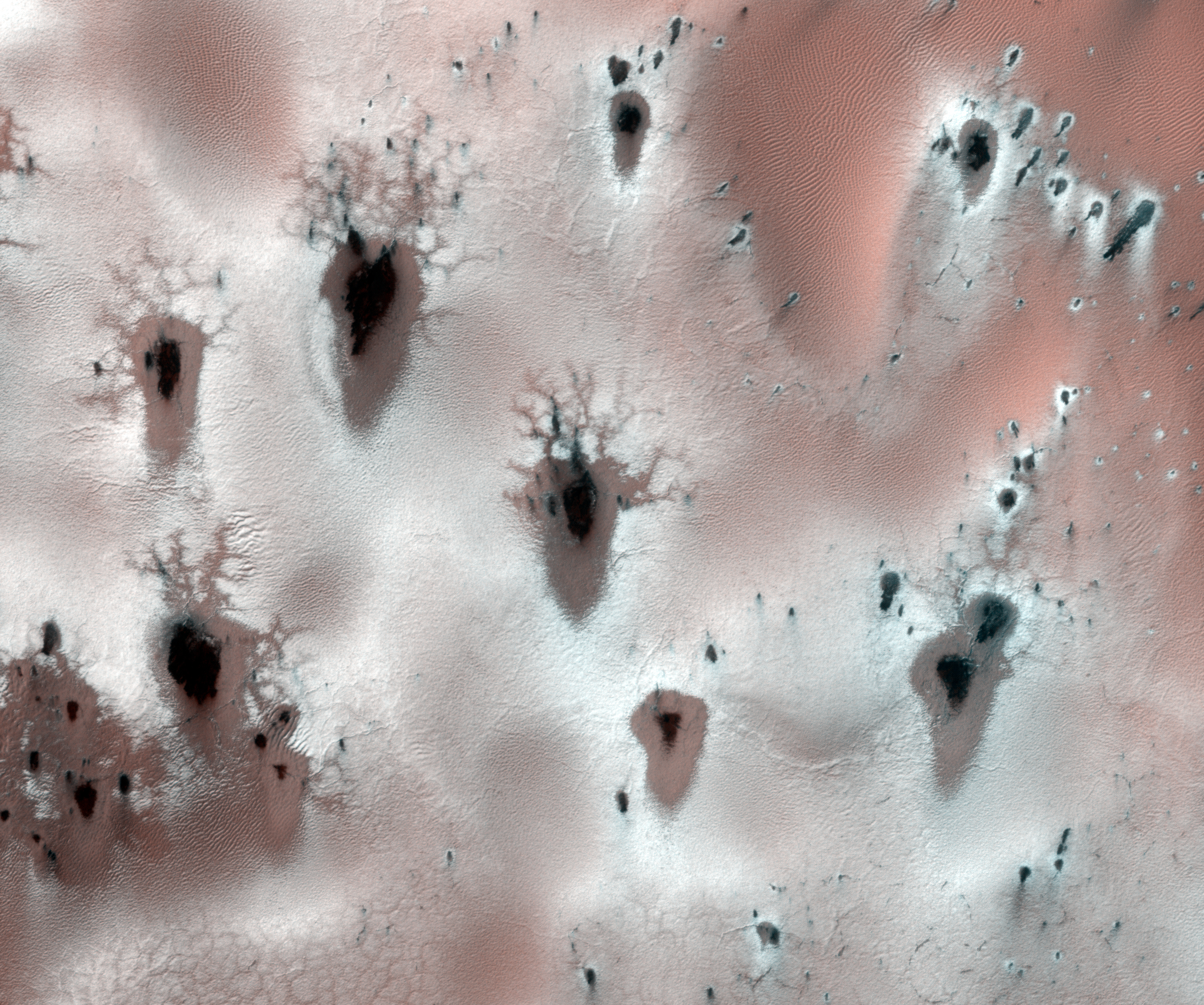
This image is from the high latitudes in the Southern hemisphere, about half-way through southern spring.

Just like on the Earth, the frost layer that accumulates over the winter will disappear as summer approaches and Mars heats up. However, most of this frost is not made of water ice and snow -- on Mars, most of the frost/ice is made of carbon dioxide (also known as "dry ice").

This material will not melt, but instead will go directly from solid into vapor (a process called sublimation) as it heats up (above approximately 147 K, which is -195 F, or -126 C). In doing so, it'll create all sorts of interesting landforms.

In this image, we can see sublimation spots (small spots where the frost/ice has sublimated away, exposing the darker ground). We also see small fans, which form when jets of gaseous carbon dioxide erupt through a weak spot in the surface ice, ejecting dark surface material that then gets smeared across the surface by the wind (so the different directions of the fans show us how the wind varies across this landscape).

Large darker "flows" are also visible; these are avalanches of material that extend downslope (and scientists are still debating if flows are dry or wet features). In the next few weeks, more of these features will appear and grow, until Mars heats up enough for all of the frost and ice (and sublimation features) to disappear.

References:
Gardin, E., et al. (2010). Defrosting, dark flow features, and dune activity on Mars: Example in Russell crater. J. Geophys. Res. 115, E06016.

Hansen, C.J., et al. (2010). HiRISE observations of gas sublimation-driven activity in Mars' southern polar regions: I. Erosion of the surface. Icarus 205, 283-295.

Kereszturi, A., et al. (2009). Recent rheologic processes on dark polar dunes of Mars: Driven by interfacial water? Icarus 201, 492-503.

Photo credit: NASA/JPL/University of Arizona

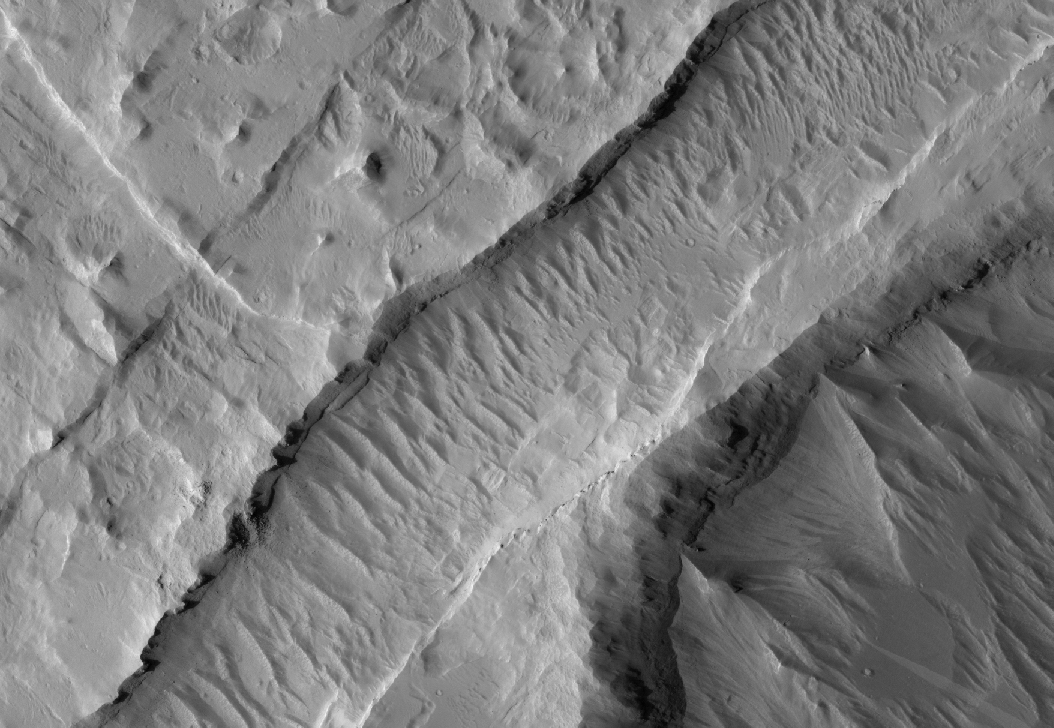
Note: This image is located inside Jeans Crater, which itself is located in Terra Cimmeria.

Friday, December 14, 2012

Layers, Dunes and Cliffs in Hydrae Chasma


Hydrae Chasma is a deep, circular depression approximately 50 kilometers across, situated between Juventae Chasma to the north and the large canyon system Valles Marineris to the south. The Chasma has steep walls flanked by numerous landslides and a massive scarp along its southern boundary where the surface has collapsed into this depression.

This closeup is of an isolated flat-topped mountain (known as a mesa) rising out of a sea of dunes located in the center of Hydrae Chasma. Darker-toned dunes, likely composed of basaltic sands, form an apron along the base of the mesa's northern margin. The western side of the mesa is gently sloping and is composed of a highly fractured light-toned rubbly base. It is overlaid by alternating light and dark layered cliff-forming units and is covered by a sediment cap containing still more dunes.

The layered sequences are present only in the interior deposits and not in the walls of the Chasma. Similar deposits are located on the floors of Valles Marineris and other chasmata and may be the sediment remnants of ancient lakes formed within these canyon systems.

Photo credit: NASA/JPL/University of Arizona

Saturday, December 8, 2012

Charitum Montes Topographical Map


This color-coded overhead view is based on an ESA Mars Express HRSC digital terrain model of the region, from which the topography of the landscape can be derived. The color coding shows the very edge of the Charitum Montes mountain region at the top of the image, with the highest elevation, while the subtle pedestal craters that dot the image almost fade away with just a small amount of relief difference between the elevated ejecta and the surrounding area. Centered at around 53°S and 334°E, the image has a ground resolution of about 20 m per pixel. The image was taken during revolution 10778 on 18 June 2012.

Image credit: ESA/DLR/FU Berlin (G. Neukum)

Friday, December 7, 2012

Charitum Montes Anaglyph


Charitum Montes imaged during revolution 10778 on 18 June 2012 by ESA’s Mars Express using the High-Resolution Stereo Camera (HRSC). Data from HRSC’s nadir channel and one stereo channel have been combined to produce this anaglyph 3D image that can be viewed using stereoscopic glasses with red–green or red–blue filters. Centered at around 53°S and 334°E, the image has a ground resolution of about 20 m per pixel.

Photo credit: ESA/DLR/FU Berlin (G. Neukum)