
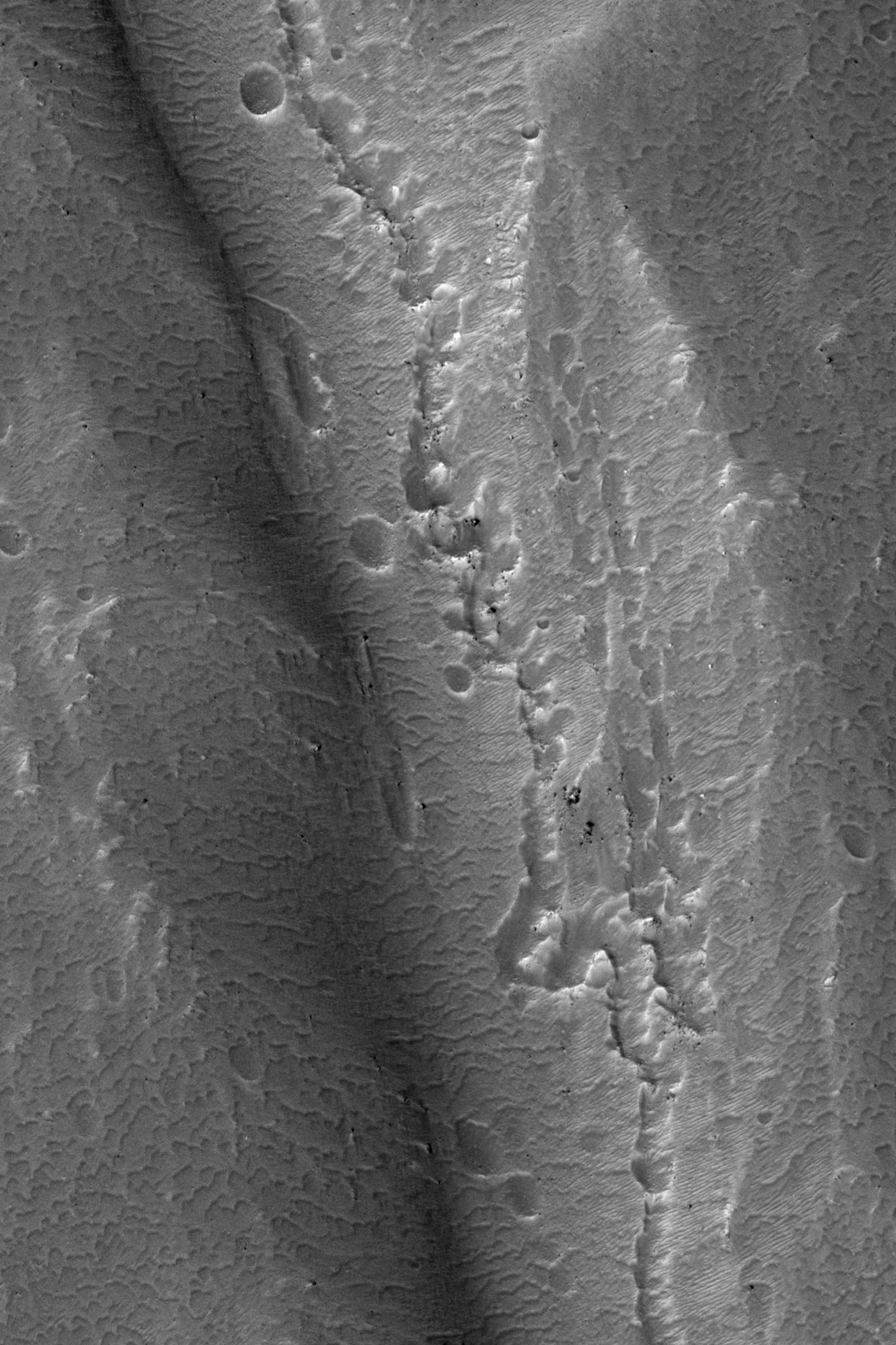
This observation shows a central peak of a large, degraded impact crater in the Terra Sirenum region of the southern hemisphere. Central peaks form during crater formation when a particularly large impactor hits the surface.
The central peak visible here (about 2/3 of the way down the full image) is interesting because it has some fluvial-like features on its south side. At lower resolution, these features appear to be channels with some connecting pits. At higher resolution (see subimage), the features appear to be troughs that are filled with dunes.
What is most interesting is the chain of pits that extends down the center of some of the troughs as seen in the subimage. It is possible that these pits are evidence of subsurface piping or hydrothermal activity. Piping occurs when subsurface water flows through soil, takes some soil with it, and causes the overlying ground to collapse. These fluvial-like features and the connected pits may have formed during a late stage of crater formation when temperatures were suitable for liquid water.
Photo credit: NASA/JPL/University of Arizona
No comments:
Post a Comment