Wednesday, October 20, 2010

Alpine Glacier in Protonilus Mensae


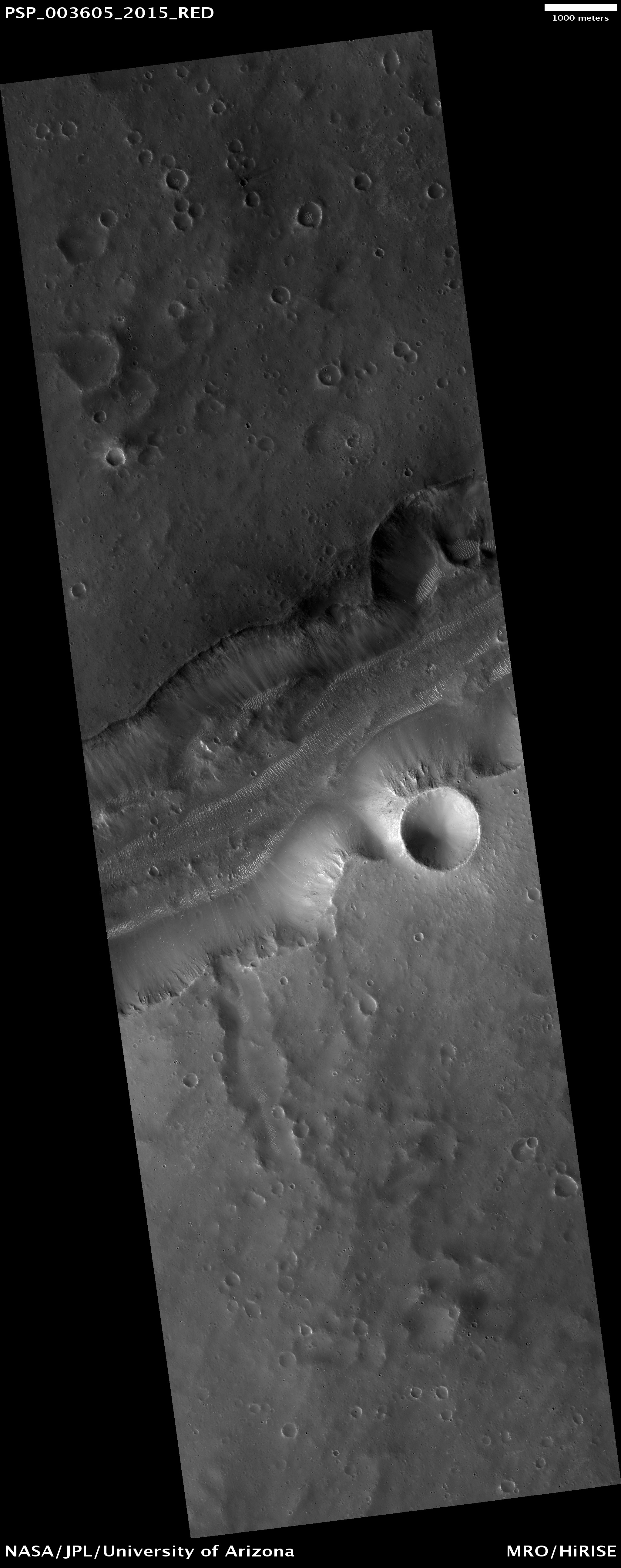
On Earth, glaciers are common at high elevations where snow accumulates each year in mountain valleys. Once the snow pack becomes thick enough and compressed to solid ice it will start to flow down hill and becomes a glacier. At lower latitudes these “alpine glaciers” more often occur on poleward facing slopes where sunlight is limited and snow melt is slow.

On Mars, landforms resembling alpine glaciers are now found to be common at middle latitudes.

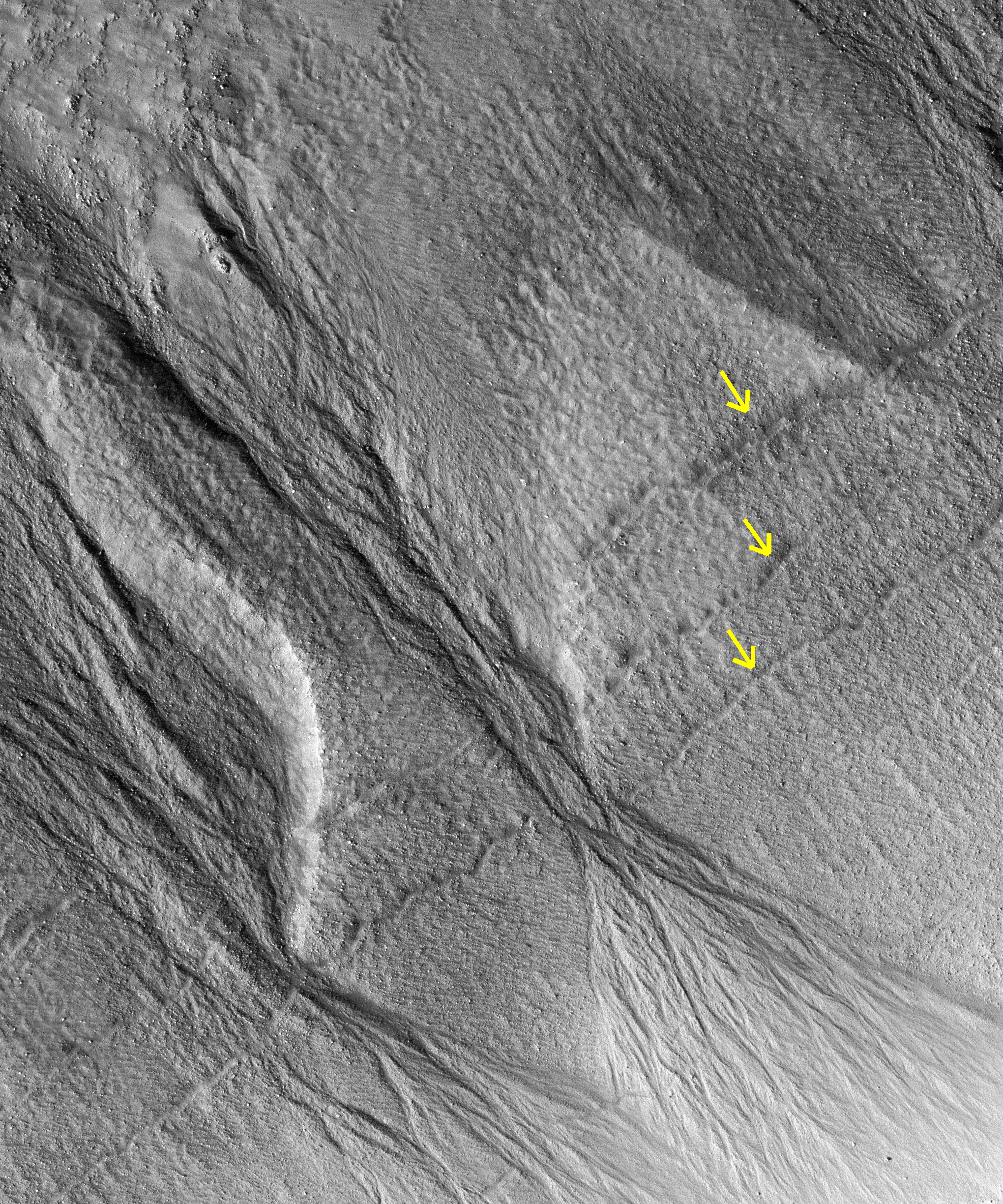
This image shows an example of such a landform at 41 degrees North latitude. Snow and ice accumulated in the mountain valley in the southern areas of this image, where the rounded valley headwalls (called "cirques") were gradually carved out by the slowly flowing ice. This flow of ice is indicated by long stream lines, called "lateral moraines," ridges of rafted soil and rock debris from the cirque regions.

An interesting aspect of this image is that the flow from these cirques appears to have overtopped the south rim of a large crater at the north end of the image, filling the crater with ice. Once filled the ice flow breached the north rim of this crater and flowed out onto the adjacent plain. Such rapid drops in elevation for a glacier are call "ice falls," analogous to a water fall. Fresh ice falls often exhibit fractured and broken surfaces as the ice flow breaks into crevasses. High resolution images such as this can help scientists to understand the rate and thickness of the flow by examining such characteristics.

Today Mars is cold, with a global average temperature of about -68 Celsius (-90 Fahrenheit). Mars is also a very dry place and surface ice is unstable everywhere on except for on the polar caps. Any ice left on the surface would evaporate without ever melting, called "sublimation." However, past climate changes have periodically allowed snow and ice to be stable on the Martian surface and even to build into glacial masses, hundreds of meters (yards) or more thick. In this image, the visible surface is made up of regolith (rock and soil debris) and no ice is visible. Subsurface ice may still be present and protected by this soil cover.

Photo credit: NASA/JPL/University of Arizona

Notes: This glacier is located on the southern edge of Protonilus Mensae, just north of Rudaux Crater and east of Moreux Crater. The above image forms a stereo pair with Debris Flow (ESP_019503_2210).

Tuesday, October 19, 2010

Elysium Fossae and Patapsco Vallis


This VIS image shows two different types of linear depressions. The wide depression at the top of the frame is Elysium Fossae, which most likely formed due to tectonic activity. The fossae is probably bounded on both sides by faults. The narrow depression at the bottom of the frame is a lava channel called Patapsco Vallis. This channel has lava flows on both sides which were probably formed by over spilling of lava as it flowed down the channel. Both these features are located east of Elysium Mons.

Photo credit: NASA/JPL/Arizona State University

Landslide in Zunil Crater


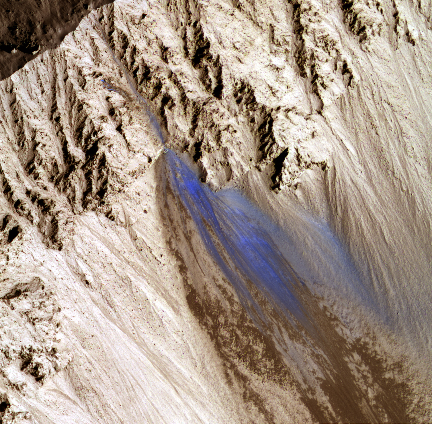
This color image shows a portion of the southeast inner wall of Zunil, a geologically recent (less than about 10 million years old) well-preserved 10-kilometer impact crater.

The color and albedo patterns indicate that a landslide occurred here very recently -- too recently to have been re-covered by dust. The landslide could have been triggered by a Marsquake or a small impact event.

Monitoring Mars for changes such as this will help us to better understand active processes. The color image has north down, which also places downhill down and helps us to interpret the topography. However, we are in fact looking down from directly above the crater.

Photo credit: NASA/JPL/University of Arizona

Monday, October 18, 2010

Gullies and Layers in Noachis Terra


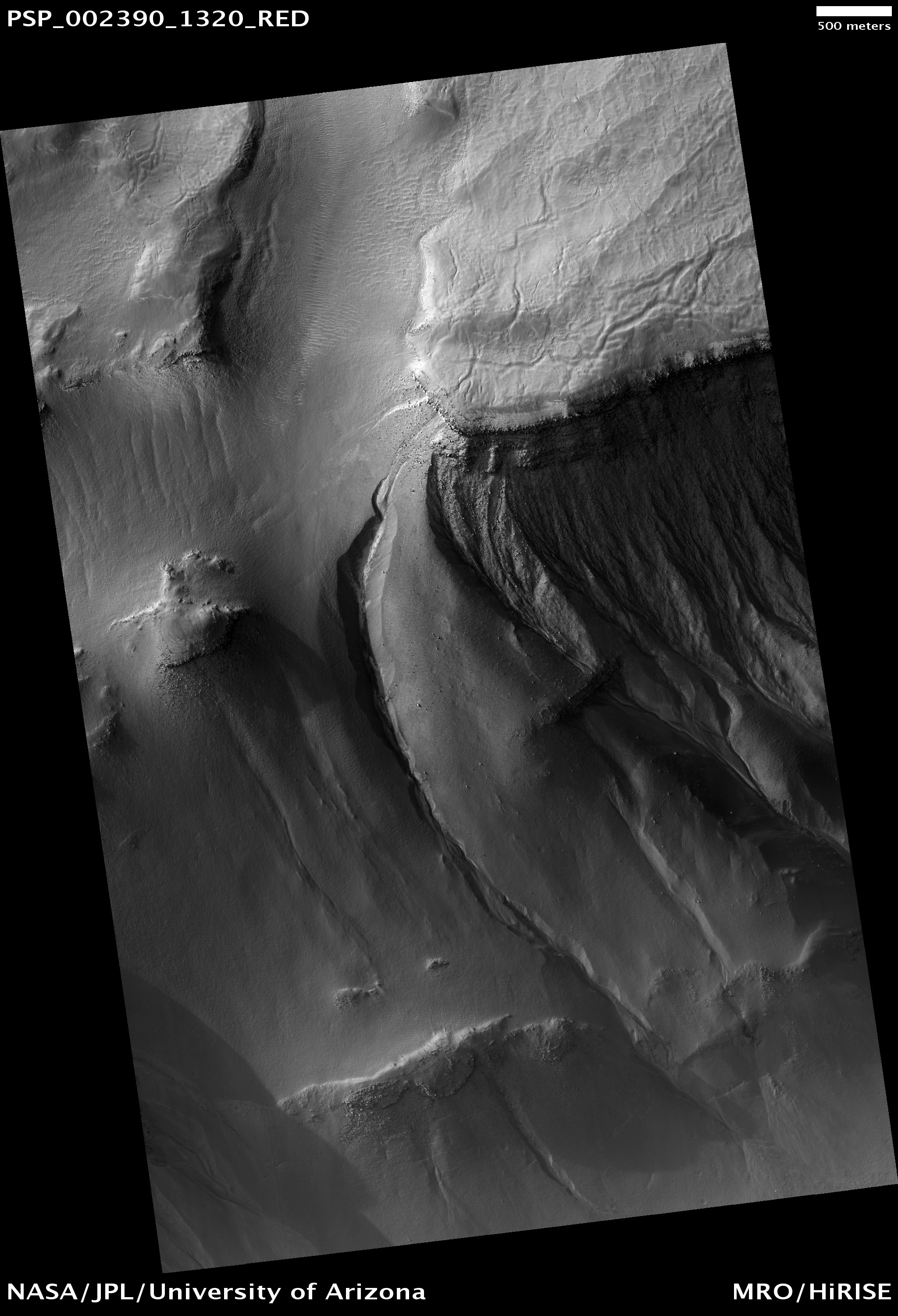
This observation shows gullies in a trough in Noachis Terra.

The trough is actually one section of a "trough crater." Here the term "trough crater" refers to a roughly circular trough that appears to follow the wall of a crater. A great deal of geologic activity is needed to transform an impact crater into a trough crater. First, the crater must have been filled in with some type of sediment. Second, the outer edge of the filling must have been scooped out by an unknown process, leaving a trough in the form of a ring inside the crater.

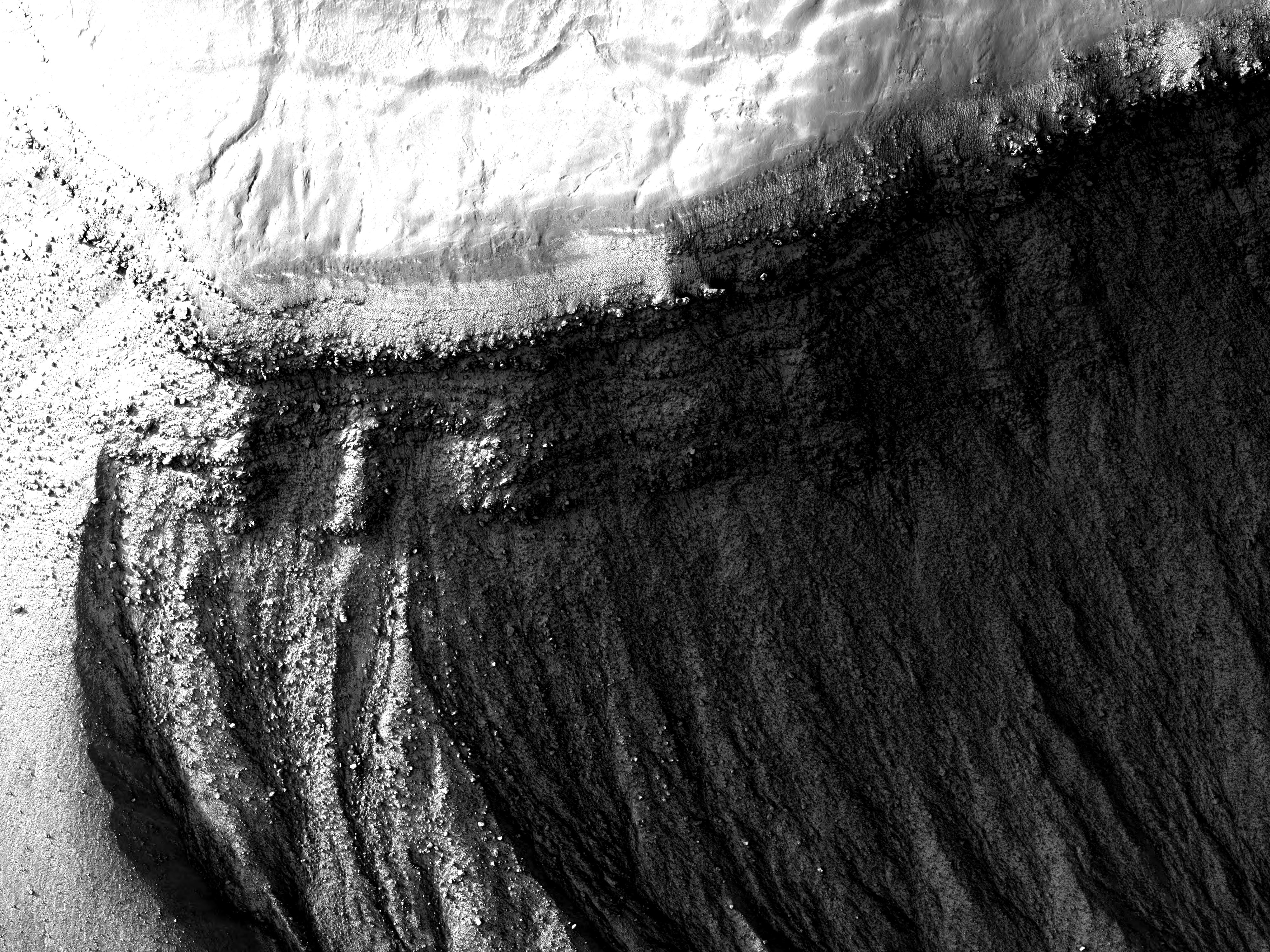
The trough in this observation is located on the north wall of the southern end of the trough crater. Gullies can be seen to start at multiple levels on this wall. The Martian gullies are thought to require some amount of liquid water to form, although carbon dioxide and dry debris flows have also been suggested as erosional materials. The start of gullies across Mars are often correlated with layers as seen here. What is particularly interesting about these gullies is that the heads (tops) of the gullies are located at many elevations along the same slope, and that each elevation with gullies has an associated set of layers.

One thing to notice is that often a layer correlated with a gully is most eroded where the gully occurs. (See, for example, the gullies located in the bottom center of the image and the subimage). At the bottom center, there are two gullies present, and the layer where they appear to originate is most eroded where the gullies exist. In the subimage, the deeper gully channels correspond to locations where the layers have been more eroded. This suggests that undermining may be occurring. Undermining often happens when water from the subsurface reaches the surface and destabilizes nearby material. The water erodes material in its way, which can create an overhang. Once this overhang becomes unstable, it will collapse.

This might be the reason that the layers are the most eroded near the gullies. It would support a subsurface origin for the water that formed these gullies. Undermining can also be generated by surface water if a weak, easily erodible layer lies beneath a stronger layer.

Photo credit: NASA/JPL/University of Arizona

Sunday, October 17, 2010

Olympus Mons


This VIS image shows the southeast flank of Olympus Mons. This huge volcano is surrounded by an escarpment, a large cliff at the volcano margin. This image has a landslide along this escarpment.

Photo credit: NASA/JPL/Arizona State University

Landslides along the Walls of Bahram Vallis


Landslides are one of the most spectacular mass wasting features on Mars in terms of their areal extent and volume. Some of the best preserved landslides are in the Valles Marineris canyon system, but that's not the only place we see evidence for landslides.

This image of Bahram Vallis, a valley along the edges of the circum-Chyrse Basin, has large mounds of material at the base of the valley floor. These deposits of material are different from those deposits seen at Valles Marineris. They do not have a "ribbed" surface of transverse ridges. They also do not have a semi-circular distal margin giving it a lobate appearance and they have not traveled for many kilometers away from their source region like most Valles Marineris landslides do.

These particular deposits have the characteristic shape of rotational landslides or slumps on Earth where material along the entire wall slumps down and piles debris at the base of the slope, much like a person who slumps down the back of a chair. Right at the cliff edge at the top of the slope, the shape of the area where the valley wall gave way to a landslide is not straight, but rather curved or semi-circular. This is typical of large landslides where the failure area has an arcuate "crown" shape. The fact that landslides have occurred here indicates that the valley walls are not stable and the materials respond to Martian gravity with mass movements.

Scientists studying landslides can use these images along with topographic data to model how the wall failed, which can give clues to the nature of the materials (type, strength, etc.) in this region. Another consequence of landslide activity in Bahram Vallis is that the overall width of the valley will increase over time.

Photo credit: NASA/JPL/University of Arizona

Saturday, October 16, 2010

Friday, October 15, 2010

Spring Colors on the Southern Polar Cap


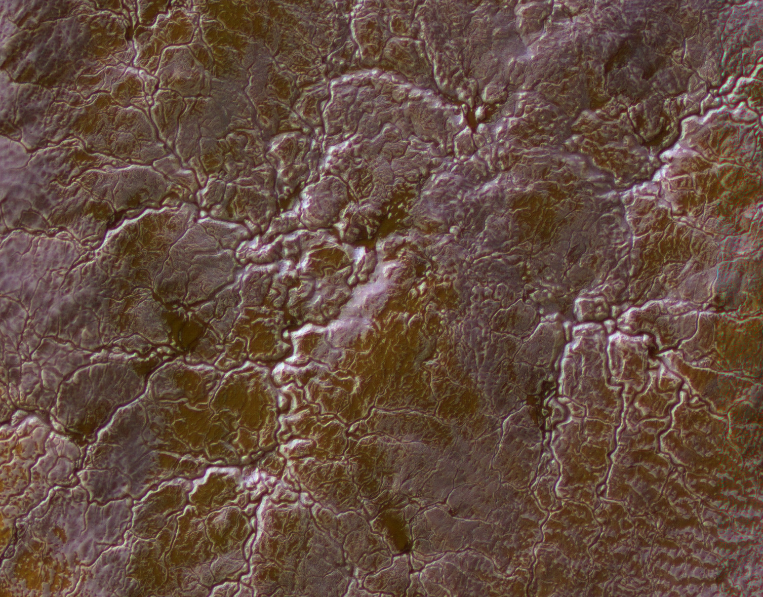
Mars has a seasonal southern polar cap composed of carbon dioxide (commonly known as dry ice), that overlies a permanent polar cap which is a mixture of carbon dioxide ice, water ice and dust. As the carbon dioxide evaporates in the spring the escaping gas carves channels in the permanent cap below. Often these channels radiate outward (or converge inward), giving them a spider-like appearance [araneiform].

In this false color image the seasonal frost is whitish-lavender. The tan areas starting to show through are where the frost has already evaporated (sublimated is actually the correct term, when ice changes directly to a gas). Tan-colored dust blows around and accumulates in the bottom of some of the channels.

This is truly other-worldly terrain, with exotic landforms with no earthly analogs.

Photo credit: NASA/JPL/University of Arizona

Note: The location of this photo is on the Planum Australe ice cap, south of Promethei Planum and west of Chasma Australe.

Thursday, October 14, 2010

Dark-Toned Unit Exposed atop Crater Ejecta in Meridiani Planum


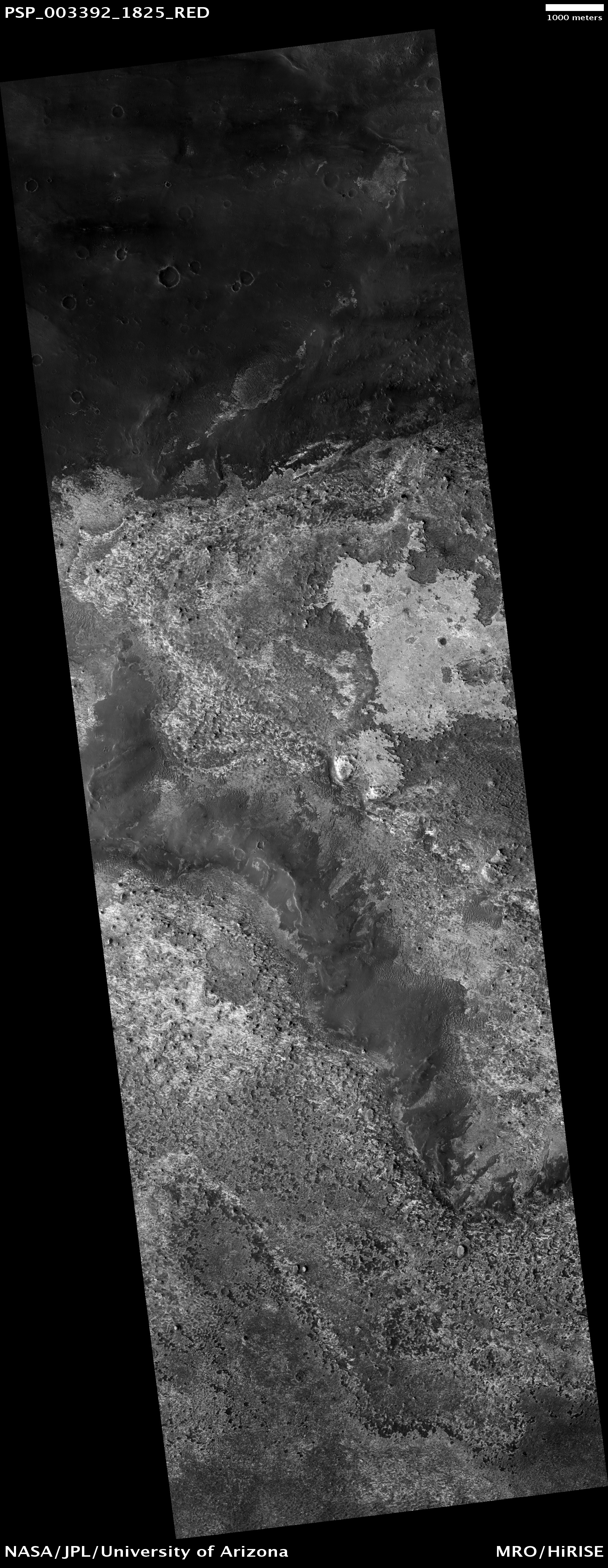
This image shows the contact between two geologic units: a cratered plains unit and an etched terrain unit.

The cratered plains are relatively smooth and dark, while the brighter etched terrain consists of smooth plains and dune fields.

The etched terrain occupies the lowest portions of an approximately 120 kilometer NW-SE trending valley with a wide variety of landforms suggestive of wind erosion. Both units partially cover the ejecta from an approximately 20 kilometer crater directly to the northeast of the image.

Photo credit: NASA/JPL/University of Arizona

Notes: For a similar photograph and caption, see Northern Meridiani Etched Terrain and Hematite Plains Contact. This location is in Meridiani Planum, extremely close to the point where the Martian equator and prime meridian intersect.

Moreux Crater Dunes and Central Peaks


Today's VIS image shows some of the dunes of the floor of Moreux Crater.

Photo credit: NASA/JPL/Arizona State University

Note: The "hills" in the upper left corner of the image are actually the central peaks that were formed by the impact that created this complex crater.

Frosted Gullies in the Northern Summer


Many images show that Martian gullies have formed on impact crater walls in both the northern and southern hemispheres. Gullies such as the ones shown here have an alcove at the top of the crater wall and channels leading downhill to debris aprons that run out over the crater floor.

Some of these gullies show activity today with new material appearing on top of the debris aprons. Many scientists believe that these gullies have been carved by liquid water so this present-day activity is of immense interest. Recently however, an alternate theory has been gaining ground.

An analysis of gully activity in craters and on sand dunes shows that activity seems to only occur in the winter at the coldest time of year. The alternate suggestion for gully activity is that accumulations of frost in the gully alcoves starts an avalanche of loose material that does not involve liquid water.

This HiRISE image shows shows gullies on a crater wall in the north polar region. Although it is late summer, you can see frost within the gully alcoves. These alcoves are on the poleward facing crater wall and so spend much of the time in shadow. This allows the frost to survive. The full-image [see also here and here] shows that the opposite (south-facing) wall has similar gullies, but no frost during this season. Scientists are analyzing many images like this in order to try and answer the broader question of whether liquid water is responsible for the these gullies or not.

Photo credit: NASA/JPL/University of Arizona

Note: The unnamed crater in which these gullies appear lies in Vastitas Borealis to the northwest of Tantalus Fossae.

Wednesday, October 13, 2010

Juventae Chasma


The amount of sand in this region of Juventae Chasma has coalesced into a sand sheet, rather than individual dune forms. Wind continues to sculpt the sand around high standing hills.

Photo credit: NASA/JPL/Arizona State University

Signs of Fluids and Ice in Acidalia Planitia


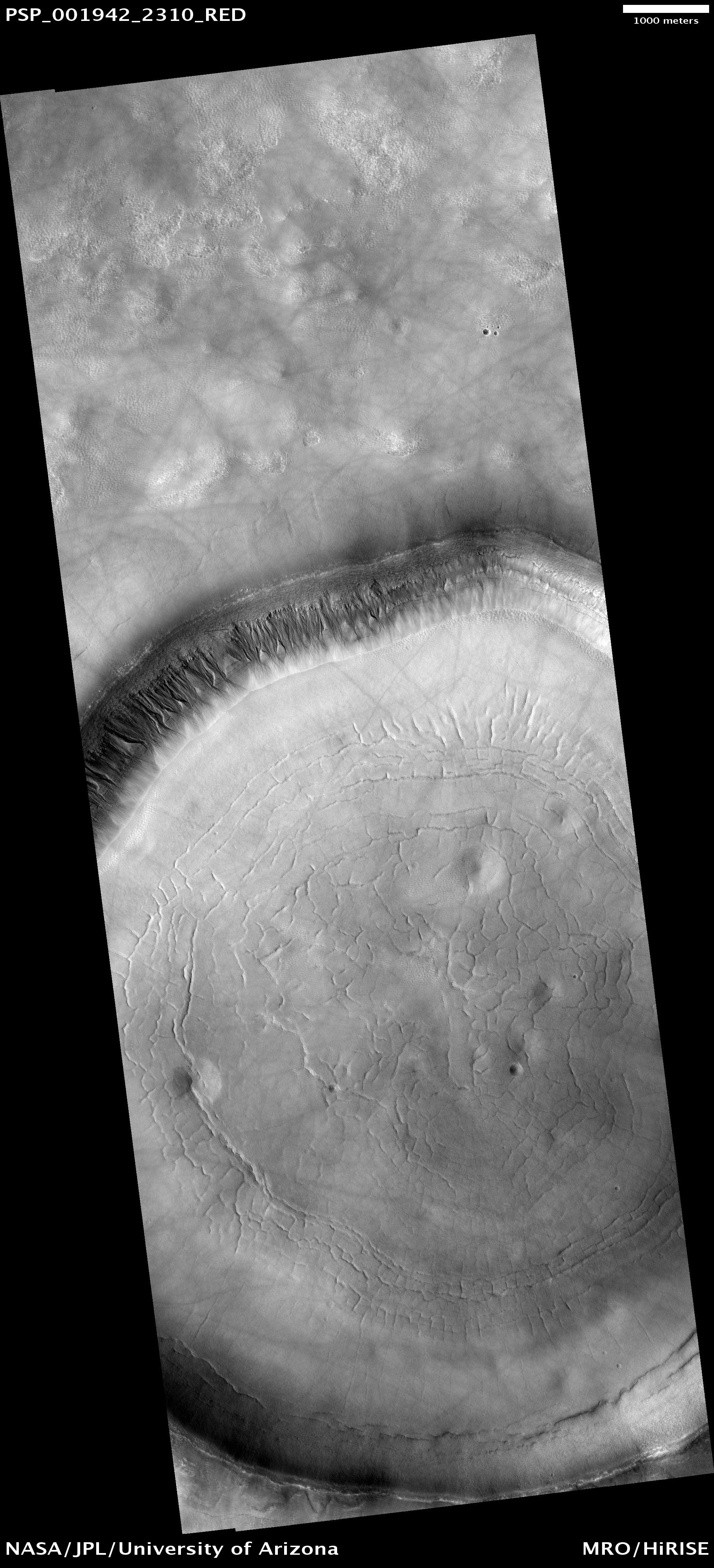
This observation shows a crater approximately 11 kilometers (7 miles) in diameter, located in Acidalia Planitia, part of the northern plains. Several features in and around this crater are suggestive of fluids and ice at and near the surface.

The south-looking (or equator facing) walls of this crater are cut by numerous gullies such as the ones shown in this subimage with well developed alcoves, sinuous channels, and terminal fan deposits. These gullies seem to originate at the same height, suggesting that the carving agent may have emanated from one single layer exposed in the crater's wall.

Contrastingly, no gullies are observed in the north-looking (or pole facing) wall of this crater. Terrestrial gullies very similar to the ones shown in this image are produced by surface water. The arrows in the cutout show fissures that may indicate detachment of surficial materials possibly held together by subsurface ice, sliding en masse down the crater's wall.

The muted topography of the crater and its surroundings, the relatively shallow floor (300 meters or 330 yards), the convex slope of its walls — all are consistent with ice being present under the surface, mixed with rocks and soil. Ice would have acted as a lubricant, facilitating the flow of rocks and soils and hence smoothing landscape's features such as ridges and craters' rims.

The concentric and radial fissures in the crater's floor may indicate decrease of volume due to loss of underground ice. Piles of rocks aligned along these fissures and arranged forming polygons are similar to features observed in terrestrial periglacial regions such as Antarctica. Antarctica's features are produced by repeated expansion and contraction of subsurface soil and ice, due to seasonal temperature oscillations. The funnel-shaped depressions visible in the crater's floor could be collapse pits, further evidence of ice decay; alternatively, they could be smoothed-out impact craters.

Photo credit: NASA/JPL/University of Arizona

Tuesday, October 12, 2010

Gullies and Ice-Rich Material


This observation shows gullies in a crater in the southern hemisphere.

Gullies typically form when flowing water has sufficient energy to erode soil and soft rock in a channelized flow. The gullies in this image have narrow, overlapping channels and are deeply incised into the slope. Overlapping channels may suggest multiple flow events on this slope wall.

It is unknown what happened to the water that flowed in these gullies. Some of the water may have evaporated or gradually sublimated into the atmosphere or became incorporated as ice in the gully debris aprons located downslope at their termini.

Sublimation is a process similar to evaporation except that solid ice (instead of liquid water) returns to the atmosphere as a gas. Sublimation is common on Mars because the temperature and pressure are so low on Mars today that liquid water is only rarely stable.

The crater floor is covered in boulders (see subimage), dunes, and textured material. The boulders are likely a “sublimation lag” that provides evidence that material on the crater floor is, or once was, ice-rich. A sublimation lag forms when ice-rich material sublimates leaving the boulders and rocks behind. It is possible that the boulders on this crater floor represent such a process. The pitted texture around boulders may also be an indicator of ice sublimation.

Photo credit: NASA/JPL/University of Arizona

Note: This crater is located in Terra Sirenum northeast of Newton Crater.

Tharsis Lava


Volcanic flows cover the majority of the surface of Mars. In some regions, like around Arsia Mons, the flows are readily identifiable. As time passes, the flow features are covered or eroded away by other processes. This region of Tharsis near Olympus Mons contains subtle features showing its lava flow origin. Note the "softened" flow fronts and lava channels.

Photo credit: NASA/JPL/Arizona State University

Note: This location of this photo is just southeast of Olympus Mons and northwest of Gigas Sulci.

Possible Cinder Cone on the Southern Flank of Pavonis Mons


This image is centered on a small cone on the side of one of Mars' giant shield volcanoes [Pavonis Mons]. The cone shows some layers of hard rock but most of it is made of relatively soft material. This appears to be an example of a "cinder" cone composed of pieces of lava thrown into the air during a small volcanic eruption.

Typically, such eruptions produce fountains of molten lava. Most of the lava would have cooled in this fountain, producing a loose pile of lava rocks. However, it appears that some pulses of the eruption allowed the lava to land without cooling much. These pieces were hot enough to weld together to make the hard layers we see today. The cone is 700 x 1,100 meters (2,300 x 3,600 feet) in size, similar to many cinder cones on Earth.

In other parts of the image, we see channels carved by lava. It is sometimes difficult to tell if a channel was formed by flowing water or lava; in this case, it is possible to see that lava flows feed out of these channels.

Photo credit: NASA/JPL/University of Arizona

Monday, October 11, 2010

New Impact Crater in Arcadia Planitia


The MRO Context camera team noticed a dark spot in an image taken in August 2010 that was not present in a Mars Odyssey THEMIS image taken in December 2007.

The team therefore requested a full-resolution HiRISE image of the dark spot to determine whether it was caused by an impact. Indeed, the HiRISE image shows an approximately 7 meter-diameter fresh crater and dark ejecta blanket at this location. These small impact craters continue to form on Mars, and are most easily recognized in areas covered by bright dust.

Photo credit: NASA/JPL/University of Arizona

Note: This unnamed crater is located in Arcadia Planitia to the northwest of Erebus Montes.

Sunday, October 10, 2010

Dunes in Herschel Crater


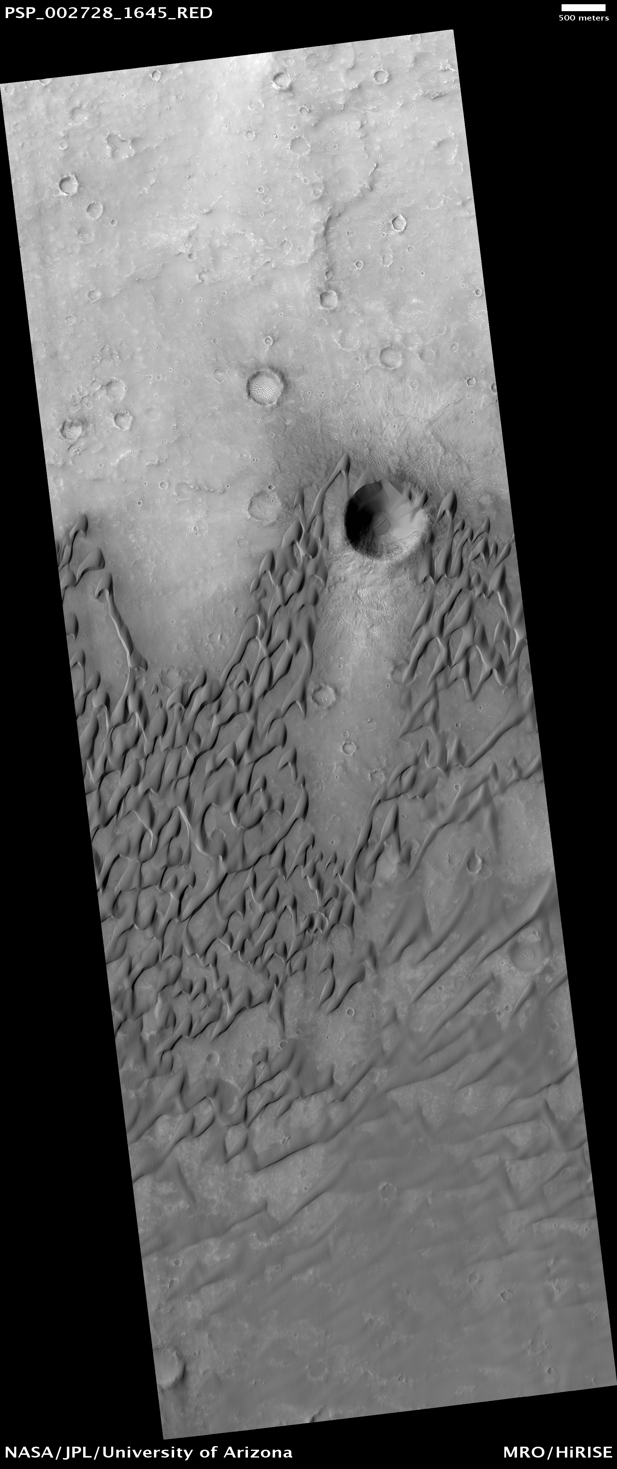
This image shows dunes on the floor of Herschel Crater. The steep faces ("slipfaces") are oriented downwind, in the direction of motion of the dunes. One feature of particular interest is the dune-free area downwind of the crater at the image center. Some sand has been trapped in the crater, but the crater prevents the dunes from migrating directly downwind.

Sand dunes form naturally as a result of the transport of sand by the wind. The dunes in this image are somewhat crescent-shaped, but are being extended and distorted downwind and merging with nearby dunes; this complex behavior is common in dune fields on Earth.

In the southern part of the image the sand lies in sheets rather than well-defined dunes. At high resolution, the dune surfaces are covered in small ripples and scallops, also shaped by the wind.

Photo credit: NASA/JPL/University of Arizona

Saturday, October 9, 2010

Alba Mons Grabens


Termed both "catena" and "fossae," long linear depressions are a dominate surface feature of Alba Mons. Created by tectonic forces, these depressions are fault bounded downdropped blocks of material called grabens on Earth. Today's VIS image shows two graben.


Photo credit: NASA/JPL/Arizona State University

Fractured Mounds in Elysium Planitia


This observation shows fractured mounds on the southern edge of Elysium Planitia.

The mounds are typically a few kilometers in diameter and about 200 feet tall. The fractures that crisscross their surfaces are dilational (extensional) in nature, suggesting that the mounds formed by localized uplift (i.e., they were pushed up from below).

The mounds are probably composed of solidified lava. They are contiguous with, and texturally similar to, the flood lavas that blanket much of Elysium Planitia, and, where dilation cracks provide cross-sectional exposure, the uplifted material is rocky.

Patches of mechanically weak and disrupted material overlie the rocky mound material. This is particularly conspicuous in the northeast corner of the HiRISE image. These patches may be remnants of a layer that was once more continuous but has been extensively eroded. Smooth lava plains fill the low-lying areas between the mounds. They are riddled with sinuous pressure ridges. The entire area is covered by a relatively thin layer of dust and sand.


Photo credit: NASA/JPL/University of Arizona

Friday, October 8, 2010

Layering in Becquerel Crater


Becquerel Crater is one of several impact craters in Arabia Terra that have light-toned layered deposits along the crater floor. The light-toned deposits are particularly striking to look at in this HiRISE image because they are stacked together to produce a thick sequence of layered beds. The layers appear to be only a few meters thick and show little variations in thickness.

On Earth, layered beds with these characteristics are typically formed in water environments, although aeolian (wind blown) deposition on Mars through a cyclic process is also possible. Volcanic eruptions would not be expected to produce ash or volcanic flows of such regular thickness, and there are no nearby volcanic vents.

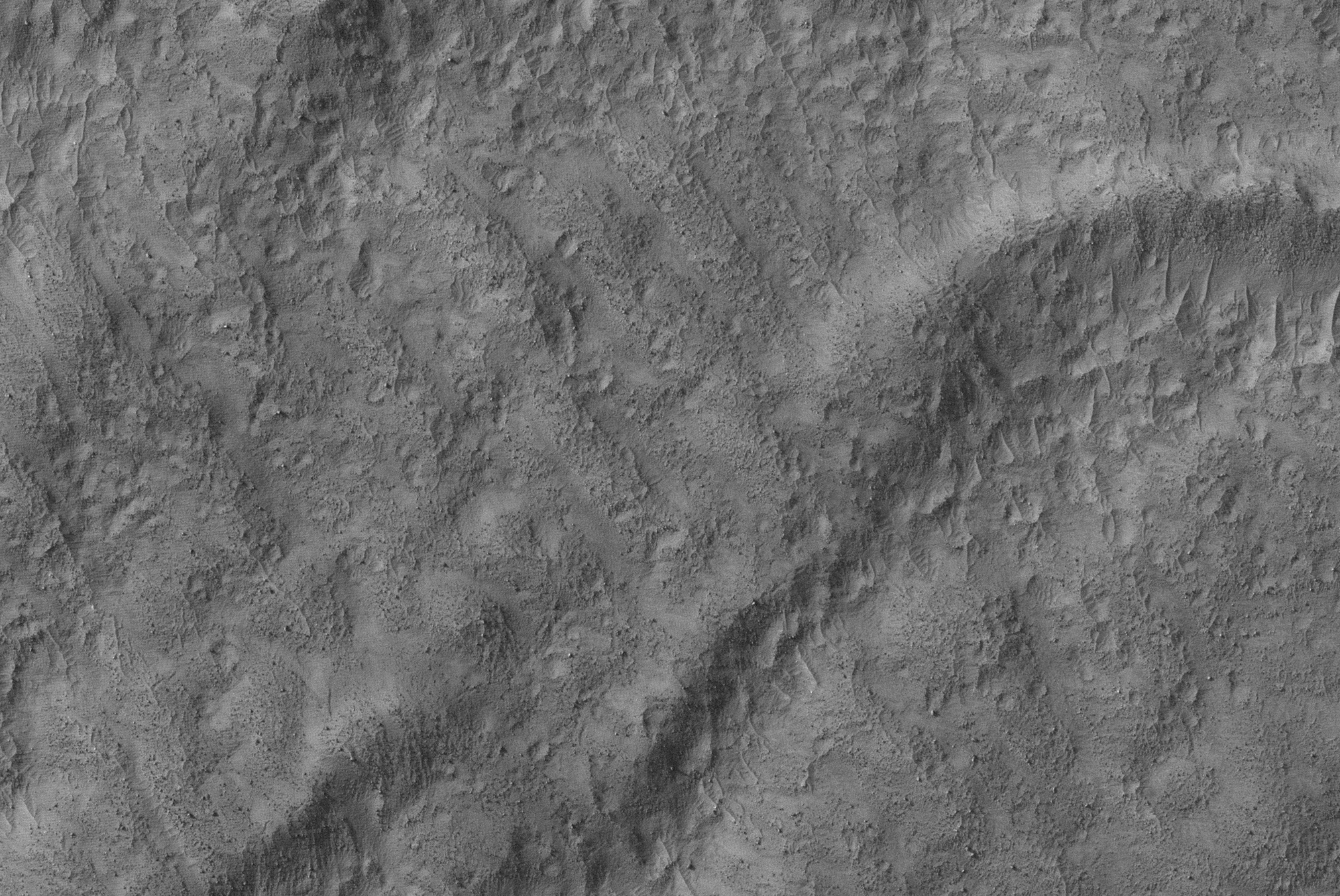
Some of the layering in the image appears dark, probably due to deposition of basalt sand along flatter surfaces rather than any compositional variations in the layer beds themselves. Faults can also be seen displacing portions of the layered beds. The surface of the light-toned deposit is not smooth but instead appears disrupted into polygonal cracks and blocks.

Relative to most surfaces on Mars, there are almost no impact craters seen in this image. This is not due to a young age but rather to the friable (easily eroded) nature of the light-toned layered deposits that enable wind easily to erode the unit, thereby removing any impact craters. Evidence of erosion by the wind is most apparent in the bottom of the image where linear ridges most likely formed by wind scouring away material in a North-South direction and creating the ridges.


Photo credit: NASA/JPL/University of Arizona

Central Peak Crater


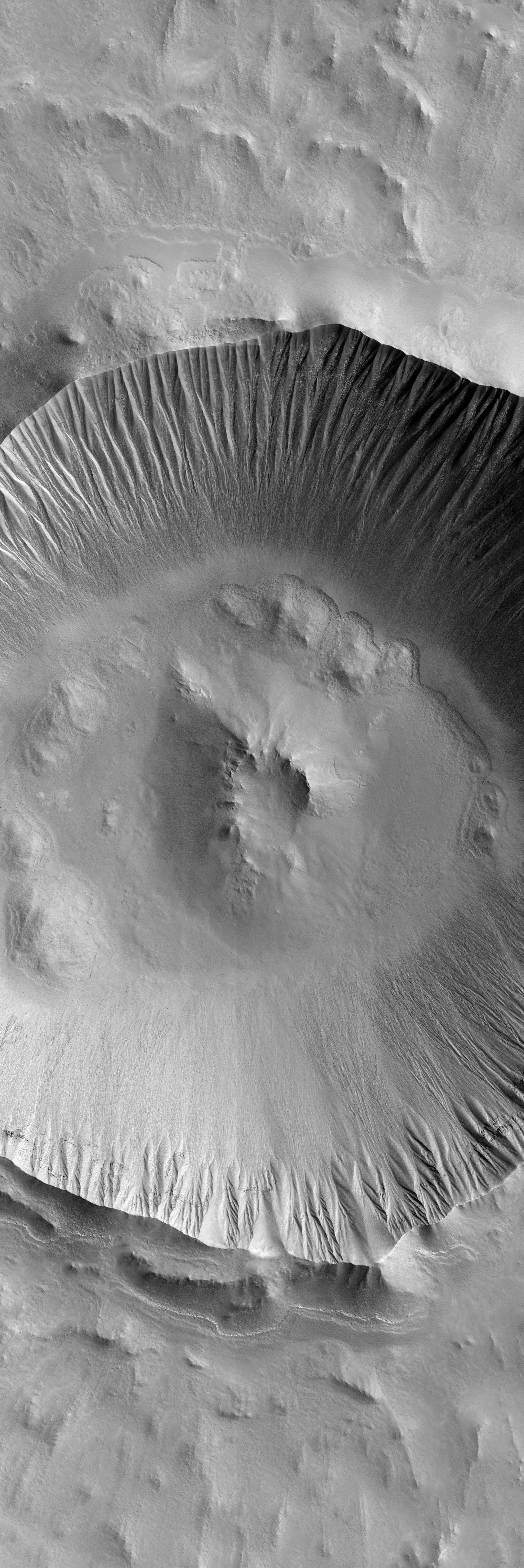
As crater size increases, craters become more complex. This moderate size crater contains a central peak, created by rebound of molten material just following the impact.


Photo credit: NASA/JPL/Arizona State University

Note: This crater is located on the northeastern "cape" between Isidis Planitia and Utopia Planitia; it is directly north of the Amenthes Fossae region.

Flow Obstructions and Wakes Southeast of Elysium


This observation covers a portion of the Martian equatorial plains called Elysium Planitia. In this location, lava that was once flowing across the surface interacted with multiple obstructions.

The image is near the southern margin of where these flows occurred, and it is likely that the obstructions are small hills in the underlying surface that poked up through the flow. As the flowing material moved past the obstructions, piles of rocky debris banked up on the northwestern or upstream sides while long trails or "wakes" were left on the southeastern or downstream side. Changes in the direction of the "wakes" indicate that the direction of flow altered somewhat over time, and fractures across the surface show the top of the flow was carried along as a brittle "skin."

The rough and blocky nature of the material where it piles along obstructions and other attributes suggest the flowing material was lava and was part of a much larger and relatively young (by geologic standards) flow that occurred in this part of Mars.

Photo credit: NASA/JPL/University of Arizona

Thursday, October 7, 2010

Wind Erosion in Gordii Dorsum


This region on the north end of Gordii Dorsum has an odd texture. Wind the the main source of erosion in this region, so the unusual texture may indicate that the surface material in this region is different from nearby regions.

Photo credit: NASA/JPL/Arizona State University

Oileán Ruaidh Meteorite in True and False Colors


This is an image of the meteorite that NASA's Mars Exploration Rover Opportunity found and examined in September 2010.

Opportunity's cameras first revealed the meteorite in images taken on Sol 2363 (September 16, 2010), the 2,363rd Martian day of the rover's mission on Mars. This view was taken with the panoramic camera on Sol 2371 (September 24, 2010).

The science team used two tools on Opportunity's arm -- the microscopic imager and the alpha particle X-ray spectrometer -- to inspect the rock's texture and composition. Information from the spectrometer confirmed that the rock is a nickel-iron meteorite. The team informally named the rock "Oileán Ruaidh" (pronounced ay-lan ruah), which is the Gaelic name for an island off the coast of northwestern Ireland.

Opportunity departed Oileán Ruaidh and resumed its journey toward the mission's long-term destination, Endeavour Crater, on Sol 2374 (September 28, 2010) with a drive of about 100 meters (328 feet).

This view, presented in approximately true color, combines component images taken through three Pancam filters admitting wavelengths of 601 nanometers, 535 nanometers and 482 nanometers.

Photo credit: NASA/JPL-Caltech/Cornell University


The component images were taken through three Pancam filters admitting wavelengths of 753 nanometers, 535 nanometers and 432 nanometers. This view is presented in false color to make some differences between materials easier to see.

Photo credit: NASA/JPL-Caltech/Cornell University

Note: Click here for another story on the Oilean Ruaidh meteorite.

Wednesday, October 6, 2010

Pavonis Mons


Pavonis Mons, one of the three huge Tharsis volcanoes, is encircled on the west side by a series of arcuate ridges. How these features were formed is still unknown.

Photo credit: NASA/JPL/Arizona State University

Linear Dunes and Sand Sheets in Herschel Crater


This image shows sand dunes and sheets in the central part of Herschel Crater.

In the northern (top) part of the image, the dunes grade between two morphologies, "barchan" and "linear." Barchans are crescent-shaped, with the horns of the crescents pointing downwind. One barchan is visible in the upper part of the image, with the southeast (lower right) horns longer than the other (see subimage, red box). This trend, along with the position of the steep face of the dune on the south side, indicates that the predominant winds which formed the dunes came from the north.

Southward of the barchan, the dunes grade into long streamers, called "linear dunes." On Earth, barchans form in areas of limited sand supply and linear dunes require two dominant wind directions that meet at an acute angle (i.e., less than 90 degrees). South of the linear dunes the sand covers the terrain in a vast sand sheet (see subimage, blue box). Together, these observations suggest that this part of Mars contains a limited supply of sand that has been subjected to high speed winds coming from two northerly directions.

The surface texture on the upper surface of the barchan dune and sand sheet exhibits corrugated patterns not seen on other dune surfaces. This may be caused by induration and subsequent erosion of some of the sand. Such a hypothesis was proposed by earlier investigators using lower resolution data from the Mars Orbiter Camera.

Photo credit: NASA/JPL/University of Arizona

Tuesday, October 5, 2010

Wind Erosion in Lucus Planum


The action of the wind continues to shape the surface of Mars. This region has been eroded by the wind into parallel hills.

Photo credit: NASA/JPL/Arizona State University

Note: This location is in northern Lucus Planum.

Very Fine Layers in Juventae Chasma


This image shows a portion of the light-toned layered deposits in Juventae Chasma.

Juventae Chasma is a large trough just north of the main part of Valles Marineris, and may have been the source region for giant floods long ago. There are currently several large hills of layered rock on the chasma floor, likely remnants of a deposit which was once more extensive. Among the possible origins of the layered deposits are lake sediments, volcanic material of various origins (possibly erupted under ice), or deposits of aeolian sand and dust.

The subimage shows some extremely thin beds within one of the mounds. These are probably sheets of material lying nearly flat, and are some of the finest-scale layers observed on Mars. It is possible that in places layer boundaries are accentuated by variable amounts of dark wind-blown dust, which buries the layers in some parts of the image; nevertheless, some of the layering must be extremely thin.

The layers are actually even more thin than they appear, since the slope of the mound makes them appear wider. The occurrence of many thin layers indicates many events or variations in deposition while this material was forming.

Photo credit: NASA/JPL/University of Arizona

Monday, October 4, 2010

Slope Streaks in Terra Sabaea


Many dark slope streaks are visible in this VIS image of an unnamed crater in Terra Sabaea.

Photo credit: NASA/JPL/Arizona State University

Kaiser Crater Dune Field


This observation shows a sand dune field in Kaiser Crater, a 210 kilometer (130 mile) wide impact basin in the Hellespontus region of Mars.

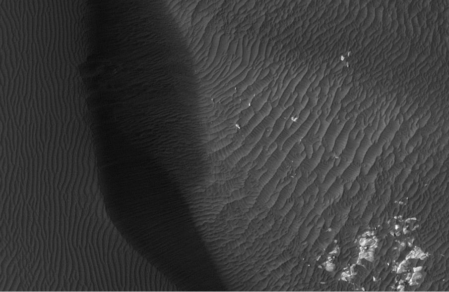
Winds have trapped massive quantities of sand on the floors of broad craters in this region. The steepest slopes on each dune, the slip faces, point to the East indicating that the dominant wind direction in this part of the dune field is from West to East. Patches of seasonal frost can be seen in the low areas between the dunes.

The subimage reveals smaller secondary dunes superimposed on the surface of the large dunes and even smaller ripples that appear between and perpendicular to the secondary dunes. Avalanching or mass movement of sand has left deep scars on the slip face of the large dune in the upper left portion of the subimage. This may indicate that the sand is not loose but is weakly cemented.

Photo credit: NASA/JPL/University of Arizona

Sunday, October 3, 2010

Dune Field near Proctor Crater


The dune field in today's VIS image is located on the floor of an unnamed crater east of Proctor Crater.

Photo credit: NASA/JPL/Arizona State University

Pedestal Crater in the Medusa Fossae Formation


This image shows a pedestal crater located in a geologic unit on Mars called the Medusa Fossae Formation.

Pedestal craters are produced by differential erosion around impact craters. If the ejecta (material thrown out of the crater) is more resistant to erosion, then the crater and surrounding ejecta will be preserved while the surface is eroded nearby. This causes the ejecta blanket surrounding the crater to form a "pedestal," standing out in relief rather than gradually merging into its surroundings.

There appear to be at least two resistant layers in the material around this pedestal crater, as there are two "steps" in the topography of the pedestal. The subimage, from the long ridge near the top center of the image, shows these steps as well as possible smaller-scale layering.

Despite the detail resolved by HiRISE, it is not clear why the step-forming layers are more resistant. Much of the scene is coated with a mantle of dust which obscures details. Dark slope streaks, likely produced by small avalanches in the dust, are common here. Dust deposition and erosion are also likely the reason for the scalloped texture of mantling material in the crater.

Photo credit: NASA/JPL/University of Arizona

Daedalia Planum Lava Flows


Daedalia Planum was created by extensive lava flows from Arsia Mons. Today's VIS image shows a small portion of those flows.

Photo credit: NASA/JPL/Arizona State University

Ares Vallis Cataract


This observation shows a dry cataract within Ares Vallis. A cataract is a large waterfall where there is a high, steep drop. The presence of this large cataract in Ares Vallis confirms that this channel was carved by water, probably in one or many large catastrophic flooding events.

This feature has many of the same characteristics as the cataracts on Earth associated with the flood that carved the Channelled Scablands in Washington state, including horseshoe-shaped headcuts and longitudinal grooves. These grooves in the lower portion of the image lead up to the cataract, with the water flowing from the south to the north in this image. It then flowed down the cataract into the smaller incised channel.

The horseshoe-shaped headcut here is only part of a larger cataract system, and probably formed during the last stage of flooding. The inner channels are now filled with dunes formed by wind blowing along the channel floor.

Photo credit: NASA/JPL/University of Arizona

Saturday, October 2, 2010

Ceraunius Tholus Caldera


This VIS image shows part of the summit of Ceraunius Tholus.

Photo credit: NASA/JPL/Arizona State University

Note: For an almost identical picture of this same landscape, see Channels on Ceraunius Tholus.

Opportunity on Sol 2,363


This mosaic of images from the navigation camera on NASA's Mars Exploration Rover Opportunity shows surroundings of the rover's location following an 81-meter (266-foot) drive during the 2,363rd Martian day, or sol, of Opportunity's mission on Mars (September 16, 2010).

The camera took the component images for this 360-degree panorama during sols 2363 to 2365. The terrain includes light-toned bedrock and darker ripples of wind-blown sand. For scale, the distance between the parallel wheel tracks in the right half of the image is about 1 meter (about 40 inches).

This view is presented as a cylindrical projection.

Photo credit: NASA/JPL-Caltech

Note: For other photos in this series, see PIA13413: Opportunity's Surroundings After Sol 2363 Drive (Vertical), PIA13414: Opportunity's Surroundings After Sol 2363 Drive (Polar), and PIA13415: Opportunity's Surroundings After Sol 2363 Drive (Stereo).

Balvicar Crater


A small channel enters the south side of Balvicar Crater.

Photo credit: NASA/JPL/Arizona State University

Note: Balvicar Crater is located along the Xanthe Montes mountain range near Chryse Planitia. The Viking 1 landing site is located some distance to the northeast of this crater.